Table of Contents
Advertisement
Advertisement
Table of Contents

Related Manuals for Magellan 330 Series


Summary of Contents for Magellan 330 Series
-
Page 3: User Manual
MAP 330/MAP 330M This User Manual provides the instructions for using the Magellan MAP 330 and the Magellan MAP 330M GPS receivers. Any reference to the MAP 330 in this User Manual applies to both receivers. Those areas that apply only to the MAP 330M will be noted. - Page 4 LICENSE AGREEMENT Magellan grants you, the purchaser, the right to use the software supplied in and with MAGELLAN GPS products (the "SOFTWARE") in the normal operation of the equipment. You may make copies only for your own personal use and for use within your organization.
- Page 5 THIS WARRANTY APPLIES ONLY TO THE ORIGINAL PURCHASER OF THIS PRODUCT. In the event of a defect, Magellan Corpora- tion will, at its option, repair or replace the product with no charge to the purchaser for parts or labor.
- Page 6 MODIFICATIONS TO THE RECEIVER WHICH MAY BE REQUIRED DUE TO ANY CHANGE IN THE GLOBAL POSITIONING SYSTEM (GPS). (Note: All Magellan GPS receivers use GPS to obtain position, velocity and time information. GPS is operated by the U.S. Government, which is solely responsible for its accuracy and maintenance.
-
Page 7: Table Of Contents
Large Data Screen ... 13 Position Screens ... 13 Accessing the Navigation Screens ... 14 Saving a Waypoint ... 15 Using GOTO Routes ... 18 Creating a GOTO Route ... 18 Navigating on a GOTO Route ... 21 Magellan MAP 330 GPS Receiver... - Page 8 Large Data Screen ... 34 Customizing the Data Fields ... 35 Position Screen ... 35 Selecting the Position Screen ... 35 Resetting the Trip Odometer ... 35 Customizing the Data Fields ... 37 GPS Status Messages ... 37 Magellan MAP 330 GPS Receiver...
- Page 9 Appending a Newly Created Waypoint to a Route ... 50 Reversing a Route ... 50 Deleting a Route ... 50 Viewing a Route on the Map Screen ... 51 Creating a Route using Track History ... 51 Magellan MAP 330 GPS Receiver...
- Page 10 Changing the Fish/Hunt Position ... 58 MAP 330 Alarms ... 59 Setting the Arrival Alarm ... 59 Setting the Anchor Alarm ... 59 Setting the XTE Alarm ... 59 Setting the GPS Fix Alarm ... 59 Magellan MAP 330 GPS Receiver...
- Page 11 Waypoint Icons ... 67 Features of the MAP 330M ... 68 Contacting Magellan ... 69 Specifications ... 70 Accessories ... 71 MapSend Streets™ ... 72 Connecting to External Devices ... 73 Glossary ... 75 Index ... 78 Magellan MAP 330 GPS Receiver...
- Page 12 Magellan MAP 330 GPS Receiver...
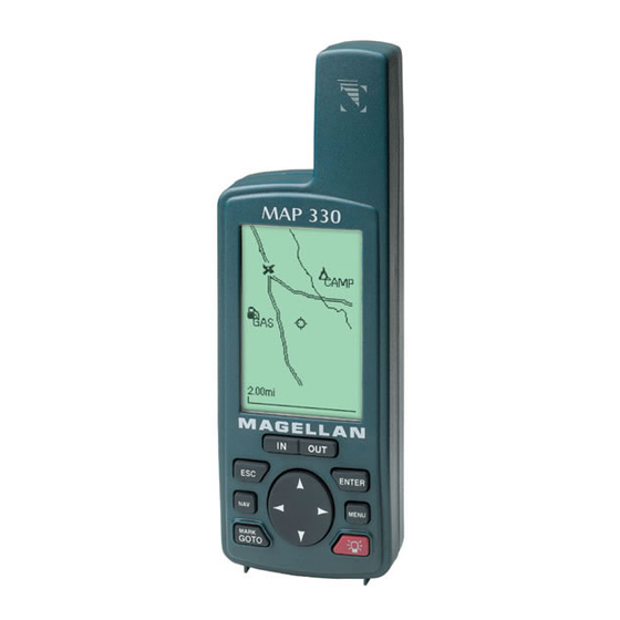
- Page 13 Magellan GPS receiver. In addition to these features, the MAP 330 offers the ability to display your location on detailed city maps providing you with a complete navigation tool that will last you for years to come.
- Page 14 The most important thing to us is to be sure that you are completely satisfied with your MAP 330 and the accompanying documentation. If you have any ideas, suggestions or even a complaint, please pass them along to us through our web site (www.magellangps.com) or by mail. Magellan MAP 330 GPS Receiver...
-
Page 15: Setting Up The Map 330
Always turn the MAP 330 off before removing the batteries or turning off external power. Failure to do so can cause loss or corruption of data. Magellan MAP 330 GPS Receiver Setting Up the MAP 330 Setting Up the MAP 330... -
Page 16: Connecting The Wrist Strap
Setting Up the MAP 330 Setting Up the MAP 330 The wrist strap attaches to the ring on the screw for the battery door cover. The picture below shows how the wrist strap should be attached. Magellan MAP 330 GPS Receiver... -
Page 17: Initialization For First Time Use
The MAP 330 turns on and displays the start-up screen and a warning screen. Start-up Screen Press (You have 10 seconds to press ENTER or the MAP 330 will shut off.) Magellan MAP 330 GPS Receiver Setting Up the MAP 330 Setting Up the MAP 330 Warning Screen... -
Page 18: Enter Your Approximate Position
Be sure that you set the AM/PM indicator. Note: After the MAP 330 starts to pick up signals from any satellite, it will automatically update the time using the satellite’s atomic clock. Magellan MAP 330 GPS Receiver... - Page 19 Done button is highlighted. To complete the initialization process, press Magellan MAP 330 GPS Receiver Setting Up the MAP 330 Setting Up the MAP 330 results in:...
- Page 20 At this point you can begin using the MAP 330 beginning with the Basic Operation described in the next chapter or you can turn the MAP 330 off. To turn the MAP 330 off, press Magellan MAP 330 GPS Receiver...
-
Page 21: Basic Operation
For many of you this will be your first introduction into using a GPS receiver as a navigational tool. With all of the features and functions provided with the MAP 330, it may seem a bit intimidating at first. Don’t worry. There are only a few things you need to know to use the MAP 330. -
Page 22: Turning Power On/Off
MAP 330. See the section on Accessories for description of available cables. Press [You have 10 seconds to press ENTER accepting the displayed warning or the MAP 330 will shut off.] Warning Screen displayed Magellan MAP 330 GPS Receiver... -
Page 23: Turning The Backlight On/Off
The menu display Contrast may differ slightly depending upon which screen it was accessed from. Magellan MAP 330 GPS Receiver Basic Operation Basic Operation Pressing the ON/OFF button again will turn off the MAP 330 immediately. Pressing ESC... -
Page 24: Getting A Position Fix
Holding the MAP 330. The receiver is designed to fit comfortably in your hand. Hold the MAP 330 in the palm of your hand with the antenna pointing towards the sky. Magellan MAP 330 GPS Receiver... -
Page 25: Compass Screen
Setup. This screen shows all of the basic position, time and satellite information. In addition current navigation information is shown on the bottom half of the screen. Magellan MAP 330 GPS Receiver Basic Operation Basic Operation . The cursor... -
Page 26: Accessing The Navigation Screens
While viewing any navigation screen, you can maneuver through the other screens following the sequence below. Map Screen (Position Mode) Compass Screen Lg. Data Screen Position 1 Screen Sat Status Screen returns you to the Map Screen (Cursor Mode) Position 2 Screen Magellan MAP 330 GPS Receiver... -
Page 27: Saving A Waypoint
Use the UP/DOWN arrows and notice that the highlight moves from field to field and then back to “Save.” Highlight the Icon field using the UP/DOWN arrows. Press Magellan MAP 330 GPS Receiver Basic Operation Basic Operation for 2 for 2... - Page 28 Highlighting “Clear” and pressing clears the entire name. Highlighting the space bar and pressing adds a space. Highlighting “Shift” and pressing displays the lower case letters and some additional punctuation marks. Magellan MAP 330 GPS Receiver...
- Page 29 However, the MAP 330 will only allow messages to be created for 200 waypoints. If you should ever get that many and need to input more, you will have to delete ones that you no longer need to make room. Magellan MAP 330 GPS Receiver Basic Operation Basic Operation .
-
Page 30: Using Goto Routes
Use the UP/DOWN arrows to highlight the category that your destination waypoint is in. Use the LEFT/RIGHT arrows to select how the waypoints are displayed, Alphabetical, Near Position or Near Cursor. In this case, you will be using “Near Position”. Magellan MAP 330 GPS Receiver... - Page 31 Basic Operation The example shown here is a sample of a City Waypoint List. This is a sample of a Nearest City Waypoint list for Magellan. Your screen will look different. Use the UP/DOWN arrows to highlight your choice of waypoint to be your destination and press The GOTO route is now active and you are returned to the last viewed navigation screen.
- Page 32 Press the RIGHT arrow again and use the UP arrow to select “S” in the cursor. Now you have gotten to a point on the list where you can see the city waypoint name for Los Angeles. Magellan MAP 330 GPS Receiver...
-
Page 33: Navigating On A Goto Route
You’ll find very quickly that you can easily use the roads and highways displayed on the Map screen and compare them to the displayed route and get to your destination simply. Magellan MAP 330 GPS Receiver Basic Operation Basic Operation... - Page 34 All of these and other features can be found in the Reference chapter of this manual. Just refer to it as you need. Again, thank you for joining the family of Magellan users and be sure to visit us on the web at www.magellangps.com for any software updates, MAP 330 information and a host of other items that you may find useful.
-
Page 35: Power/Backlight/Contrast
An automatic timer will turn the backlight off when a button has not been pressed for a selected duration (see Setup). Press and hold for 2 seconds Magellan MAP 330 GPS Receiver Reference Reference Button Sequence 1st Press Light On (low) -
Page 36: Adjusting The Display Contrast
If you require to see more of the map you can also turn off these data fields. Information as to how to customize this screen follows this brief description of the Map screen. Highlight Contrast Adjust Contrast Level Magellan MAP 330 GPS Receiver... - Page 37 Track History Track History Dotted line on the map displays the history of where you have travelled since the last time you Position Mode Magellan MAP 330 GPS Receiver Reference Reference Track History Data Fields cleared the Track History (see Clear Memory in the Reference Chapter.)
- Page 38 “cursor” appears. The data shown in the information block is the heading and distance from your present position to the cursor. Cursor Mode Magellan MAP 330 GPS Receiver...
-
Page 39: Setting The Map Detail
Oceans State Lines Rivers Lakes Swamps Railroads Interstate Roads U.S. Routes Roads National Parks Magellan MAP 330 GPS Receiver Reference Reference Use arrows to highlight the “Detail” field (Pointer ) (Crosshair ) (Hourglass) Displayed with the icon selected for that waypoint. -
Page 40: Turning On/Off Display Waypoints
Highlight Use arrows to highlight the “Display Waypoints” field Icon Population ≥ 500,000 ≥ 100,000 ≥ 10,000 < 10,000 Highlight Hide Nav Info Show Nav Info Magellan MAP 330 GPS Receiver... -
Page 41: Selecting Street Information Or Data Fields For Nav Information
From Highlight the MAP Customize Screen Use L/R arrows to highlight the title for the data field to be changed Magellan MAP 330 GPS Receiver Reference Reference Highlight Street info Two nav fields Highlight Two nav fields Use arrows to... -
Page 42: Data Field Options Definitions
This is the direction you need to turn to put you on the shortest distance to your destination from your present position. Elevation This is the distance above sea level that you are presently at. Time Local time. Date Current date. Magellan MAP 330 GPS Receiver... -
Page 43: Changing The Map Orientation
MAP 330 stores more points on or near turns and less points on straight stretches of the map. You also have the option of selecting fixed intervals for track point storage. Magellan MAP 330 GPS Receiver Reference Reference Use arrows to highlight the “Orientation”... -
Page 44: Clearing Track
The selection of land or marine use can be found in the Map Setup option. From the MAP Screen Use U/D arrows to select Marine or Land. Highlight Confirm Clear Track Highlight Highlight Map Setup Primary Usage Magellan MAP 330 GPS Receiver... - Page 45 13 different options. Customizing is accessed through the MENU button. Some of the data displayed requires you to be moving to be computed, invalid data is indicated by dashes. Magellan MAP 330 GPS Receiver Reference Reference Heading Marker Sun/Moon Position...
-
Page 46: Compass Screen
13 different options. Customizing is accessed through the MENU button. Some of the data displayed requires you to be moving to be computed, invalid data is indicated by dashes. Magellan MAP 330 GPS Receiver... -
Page 47: Customizing The Data Fields
Setup - Selecting the Coordinate System. Resetting the Trip Odometer — Resets the trip odometer to 0000.00. From the Highlight Position Reset Trip Screen Magellan MAP 330 GPS Receiver Reference Reference Use arrows to highlight the title for the data field to be changed... - Page 48 Trip Odometer Trip Odometer Trip Odometer Trip Odometer Trip Odometer The odometer performs like the odometer in your car. It can be reset through the MENU button. Magellan MAP 330 GPS Receiver...
-
Page 49: Customizing The Data Fields
Screen Use arrows to select new data type GPS Status Messages — Messages indicating the status of the GPS receiver section of the MAP 330 are displayed on the Position screen. Message Searching - 1st sat Searching for 1st satellite. -
Page 50: Satellite Status Screen
2-dimensional (elevation is not being computed). Blank - MAP 330 is not computing a position fix. Satellite Position Satellite Position Satellite Position Satellite Position Satellite Position Where the satellite is located relative to your position. Magellan MAP 330 GPS Receiver... -
Page 51: Waypoints / Database
Cursor Mode. Note: When selecting the User category, the MAP 330 does not use the list with the “Quick-Find” box. Magellan MAP 330 GPS Receiver Reference Use up/down arrows to select... -
Page 52: Selecting Waypoints Nearest To The Cursor
Note: The “Find By” option Near Cursor is only available when the Map screen is in the Cursor Mode. As discussed in the Map Magellan MAP 330 GPS Receiver... -
Page 53: Saving Present Position As A Waypoint
Creating New Waypoint with Map Cursor — Provides a method of creating a new waypoint with coordinates other than your present position. The new coordinates are computed automatically based on the location of the map cursor. Magellan MAP 330 GPS Receiver Modify (see Note) -
Page 54: Deleting A User Waypoint
Modify (see Hold down Note) for 2-3 seconds Highlight left/right arrows select User “Find By” Highlight Delete WPT Highlight left/right arrows select User “Find By” Select Field Edit to be Edited Field Highlight “Save” button Magellan MAP 330 GPS Receiver... -
Page 55: Viewing A Map Object On The Map
Follow the instructions above for Viewing a Map Object on a Map. Press and hold MARK for 2-3 seconds. Edit any field of the waypoint that you want and when you are done, highlight “Save” and press ENTER. Magellan MAP 330 GPS Receiver Reference Select... -
Page 56: Searching For A Street Address
(MARK) or view it on the Map Screen. NOTE: The option is available ONLY if you have uploaded one or more detailed maps from the Magellan MapSend Streets CD-ROM. From Highlight Database... -
Page 57: Routes
All you need do is follow the instructions below and let the MAP 330 take you there. From Highlight Routes Screen Highlight Activate Backtrk Magellan MAP 330 GPS Receiver Reference Select Use L/R arrows Waypoint to select Category “Find By”... -
Page 58: Creating A Multileg Route
(Note: these routes have been termed “multileg” in an effort to make the understanding of them a little clearer, however you could create a 1-leg route and save it in the MAP 330’s memory.) Magellan MAP 330 GPS Receiver... - Page 59 Repeat Step 2 for all additional legs in the route. Step 3: Use up/down Save the arrows to highlight route “Save Route” button Sample Route List (Bold route indicates “Active” route) Magellan MAP 330 GPS Receiver Reference Select an “Empty” Route Select Use L/R arrows Waypoint to select Category “Find By”...
-
Page 60: Activating/Deactivating A Route
Viewing a Route and then use the instructions for inserting, deleting, replacing or appending a leg as appropriate. When you are done with editing the route, use the Up/Down arrows to highlight the “Save Route” button and press ENTER. Select Route Highlight Select Route Routes Magellan MAP 330 GPS Receiver... -
Page 61: Inserting A Leg
Select route to be edited. See Instructions for Viewing a Route Highlight Replace WPT Select Waypoint Magellan MAP 330 GPS Receiver Highlight destination waypoint for leg that will have a leg inserted. Select Database Highlight destination waypoint for leg that will be deleted. -
Page 62: Appending A Leg
“EMPTY” routes are available. From Screen Highlight Delete Route Highlight next available leg. (Indicated by dashes) Select Waypoint Highlight Select “Routes” Route Button Highlight Select Route Routes Highlight Select Route Routes Magellan MAP 330 GPS Receiver... -
Page 63: Viewing A Route On The Map Screen
Two such instances would be travelling over 500 miles with your MAP 330 turned off or complete loss of memory. From Highlight Setup Screen Highlight Region Input Date Magellan MAP 330 GPS Receiver Reference Select Route Highlight Initialize Input Highlight Time Area... -
Page 64: Turning The Nav Screens On/Off
The coordinate system you select may require additional information. Default: Primary - Lat/Lon Secondary - UTM Highlight Highlight Setup Nav Screens Compass Large Font On/Off On/Off Highlight Highlight Setup Coord System Select Coordinate System DEG.MIN.MMM Magellan MAP 330 GPS Receiver... -
Page 65: Selecting A Map Datum
Selecting the Time Format — Enables you to choose from three different time formats: Local 24 Hr (military time), Local AM/PM or UTC. From Highlight Setup Screen Select Format Default: Local AM/PM Magellan MAP 330 GPS Receiver Reference Highlight Map Datum Select Datum Secondary - WGS84 Highlight Elev Mode... -
Page 66: Selecting Nav Units
30 seconds, 1 Minute, 2 Minutes, 4 Minutes, 10 Minutes or Timer Off. From Screen Select Timer Duration Default: 4 Minutes Highlight Highlight Setup Nav Units Highlight North Reference Highlight Highlight Setup Light Timer Magellan MAP 330 GPS Receiver... -
Page 67: Turning The Beeper On/Off
You can choose from 1200 baud, 4800 baud, 9600 baud or 19200 baud. From Highlight Setup Screen Select Baud Rate Default: 4800 Baud Magellan MAP 330 GPS Receiver Reference Highlight Beeper Highlight NMEA Highlight Baud Rate... -
Page 68: Clearing Memory
The next time it is turned on, it will prompt you that it needs to be initialized. From Highlight Screen Highlight Highlight Setup Clear Memory Confirm? Yes/No Highlight Setup Clear Memory Confirm? MAP 330 Yes/No will shut Magellan MAP 330 GPS Receiver... -
Page 69: Sun/Moon Display
The default is “Position” which is your present position. From Highlight Sun/Moon Screen Use left/right arrows to select “Find By” Magellan MAP 330 GPS Receiver Reference Highlight Date Field Highlight At Field Highlight Waypoint... -
Page 70: Fish/Hunt Times Display
The default is “Position” which is your present position. From Fish/Hunt Screen Use left/right arrows to select “Find By” Highlight Highlight Highlight Date Field Highlight Highlight At Field Highlight Waypoint Magellan MAP 330 GPS Receiver... -
Page 71: Map 330 Alarms
This is handy in that it alerts you that you may need to move to an area that has a clearer view of the sky. Magellan MAP 330 GPS Receiver Reference Highlight... -
Page 72: Using The Simulator
Turning the Simulator Off — Turns the simulator off and returns the MAP 330 to normal operation. From Screen Highlight Highlight Setup Simulate Confirm Clearing of Track Highlight Setup Simulate Enter Heading Confirm and Speed Clearing of Data Track Highlight Highlight Setup Simulate Magellan MAP 330 GPS Receiver... -
Page 73: Help
MapSend Streets™, and how much free memory is available. From Highlight About... Screen Magellan MAP 330 GPS Receiver Reference Select Topic... -
Page 74: Frequently Asked Questions
No. The time transmitted by the satellites atomic clock are UTC (Universal Time Coordinated) and provides no correction for daylight savings. When daylight savings time changes (or when you move to a new time zone), you need to go into Setup — Magellan MAP 330 GPS Receiver... -
Page 75: Waypoints/Database
MAP 330. Waypoints/Database What waypoints come preloaded on my MAP 330’s database? The Database contains cities, highways, airports, waterways and national parks. Magellan MAP 330 GPS Receiver Frequently Asked Questions Frequently Asked Questions... -
Page 76: Navigation Screens
Why does my MAP 330 not make an audible beep when I have an alarm active? Check your setup settings for the Beeper. If the selection is Off or Keys Only, the beeper will not sound for alarms. Magellan MAP 330 GPS Receiver... -
Page 77: Output Data
MAP 330’s baud rate (See Setup - Changing the Baud Rate.) Can I interface my MAP 330 with a Macintosh computer? Magellan does not supply cabling or software for the Macintosh line of computers. For information on a cable or software that may meet your requirements, visit GPSy at www.gpsy.com on... -
Page 78: Troubleshooting
Use map data for reference and do not rely completely on it. Data was not saved or was corrupted. This can be caused because you removed the batteries or removed external power with the MAP 330 turned on. Magellan MAP 330 GPS Receiver... -
Page 79: Waypoint Icons
Default House Aerial Airport Amusement Auto Repair Boating Camping Exit Ramp First Aid Fixed Nav Aid Floating Buoy Magellan MAP 330 GPS Receiver Fuel Restaurant Garden Rock Golf Scuba Hotel RV Service Hunt/Fish Shooting Large City Sight Seeing... -
Page 80: Features Of The Map 330M
• You may want to customize the Navigation screens to give you marine-related parameters, such as XTE, CTS (course to steer), VMG, etc. Magellan MAP 330 GPS Receiver... -
Page 81: Contacting Magellan
Representatives are available Monday through Friday from 7 AM to 5 PM, PST. Faxes can be sent to Customer Service at (909) 394-7070. If necessary, you can also return your receiver to Magellan for repair. Before returning the receiver you must get a Return Materials Authorization (RMA) from Magellan Corporation. -
Page 82: Specifications
Operating 14˚F to 140˚F to (-10˚C to 60˚C) Storage -4˚F to 158˚F (-20˚C to 70˚C) Power: Source 2 AA alkaline batteries or 9-35 VDC with power cable Battery Life Up to 10 hours approximately 15 seconds approximately 1 minute 1 second continuous Magellan MAP 330 GPS Receiver... -
Page 83: Accessories
Accessories for your receiver are available from your Magellan dealer or you can order directly from Magellan at (800) 669-4477 (press 3 to place an order). Swivel Mounting Bracket: Mounts the receiver on a surface, allowing for hands- free operation. -
Page 84: Mapsend Streets
Recommended Requirements • IBM PC AT-Pentium/300 or compatible • 64 MB RAM • True Color Video with 800x600 resolution • 60 MB Hard Drive Space • 32x CD-ROM drive • MS Windows 95/98/NT 4.0 (or higher) Magellan MAP 330 GPS Receiver... -
Page 85: Connecting To External Devices
Available as accessories for your GPS receiver are the following cables: External Power Cable with Cigarette Lighter Adapter, Power/Data Cable, Data Cable and PC Cable with Cigarette Lighter Adapter. The instructions given below apply to all cables, unless otherwise stated. - Page 86 Pin 5: Ground Cable Wiring Color Code Power Red: Power + Black: GND Data (Power/Data, PC cable & Data cable only) Yellow: Data In Orange: Data Out Black: GND Cigarette Lighter Adapter Cut Here Power Supply Box Magellan MAP 330 GPS Receiver...
-
Page 87: Glossary
The value or setting automatically chosen by the unit unless otherwise directed. Can be changed in Setup. Distance. Distance from position to destination. Estimated Time of Arrival. The estimated time of day the leg’s destination waypoint will be reached. Magellan MAP 330 GPS Receiver Appendix Appendix... - Page 88 A coordinate system describing only Great Britain, similar to UTMs. Used with GRB36 datum. Position fix Position coordinates as computed by the MAP 330. Speed Over Ground. The speed at which the receiver is moving. Temperature. Magellan MAP 330 GPS Receiver...
- Page 89 Used to create routes. Cross Track Error. The perpendicular distance between the present position and the courseline. Given as a distance, right or left, of course when facing the destination. Magellan MAP 330 GPS Receiver Appendix Appendix...
-
Page 90: Index
Elevation, selecting 53; fluctuations 62 External Connection 10, 65, 73; power source 74 Fish/Hunt screen, accessing 58; date changing 58; position changing 58 GPS Status Messages 36 GOTO 18; creating 18, 45; navigating on 21 Magellan MAP 330 GPS Receiver... - Page 91 Power On 5, 10, 23; not working 66 Power Source 38 Routes, active 64; activating/deactivating 48; backtrack 45; clearing all 56; creating GOTO 18, 45; creating multileg 44; deleting 50; editing 48; reversing 50; viewing 48, 50; track history 51 Magellan MAP 330 GPS Receiver Appendix Appendix...
- Page 92 Trip Odometer 36; resetting 35 Waypoints, accessing 39; creating manually 41; creating with cursor 41; deleting 45; editing 42; icons 67; preloaded 63; saving 15, 41; number of 17; appending to route 50 Wrist strap 4 Magellan MAP 330 GPS Receiver...
- Page 94 960 Overland Court, San Dimas, CA 91773 (909) 394-5000 630800 A...