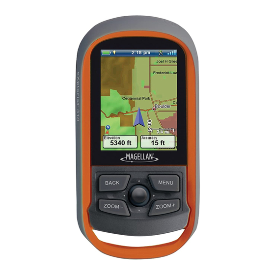
Magellan eXplorist 310 User Manual
Hide thumbs
Also See for eXplorist 310:
- User manual (86 pages) ,
- User manual (39 pages) ,
- User manual (29 pages)
Table of Contents
Advertisement
Quick Links
Download this manual
See also:
User Manual
Advertisement
Table of Contents

Related Manuals for Magellan eXplorist 310


Summary of Contents for Magellan eXplorist 310
-
Page 1: User Manual
Magellan eXplorist User Manual ® ® Mio Technology UK Ltd. Spectrum House, Beehive Ring Road, London Gatwick Airport, RH6 0LG, UNITED KINGDOM www.magellangps.com/europe... - Page 2 Revision: A (June, 2011)
-
Page 3: Safety Warnings
VEHICLE. Please do not try to change any settings on the Magellan eXplorist while driving. Come to a complete stop or ask a passenger make any changes. Taking your eyes off the road is dangerous and can result in an accident in which you or others could be injured. - Page 4 Maximum normal use temperature is 66°C. © 2011 MiTAC International Corporation. The Magellan logo, Magellan and eXplorist are registered trademarks of MiTAC International Corporation and are used under license by MiTAC Digital Corp. All rights reserved. All other trademarks and registered trademarks are property of their respective owners.
-
Page 5: Table Of Contents
Using the Magellan eXplorist ............1 Installing the Batteries ..................1 Replacing the Batteries ........................1 Setting the Battery Type ........................1 Powering the Magellan eXplorist ..............2 Turning the Receiver On ........................2 Turning the Receiver Off ........................2 Conserving Power ..................... 2 Setting the Active Suspend Timer .................... - Page 6 Navigation Lines ....................6 Hiding/Showing an Active Track ..................... 6 Clearing an Active Track ........................6 Starting a New Track ........................6 Viewing the Track Summary ......................6 Viewing an Overview of the Active Track ..................6 Backtrack ......................6 Creating a Backtrack Route ......................
- Page 7 Installing Geocaches with ‘Send to GPS’ (Detail Page) .............. 14 The Magellan Communicator ................15 Direct installation of the Magellan Communicator from www.magellangps.com ....15 Installing Geocaches (Drag n Drop) ..................... 15 Installing Geocaches with Drag ‘n Drop ..................15 Geocache List ....................
- Page 8 Going to a Geocache from the Geocache Description ............... 17 Viewing the Geocache on the Map ....................17 Going to a Geocache While Viewing on the Map ................ 17 Marking a Geocache as a Favourite ..................... 17 Adding a Geocache ..................17 Saving Your Current Location as a Geocache Waypoint ............
- Page 9 Sun & Moon Rising and Setting Times ................... 20 Using Sun & Moon Times ......................20 Area Calculation ..........................20 Walking around the Perimeter....................... 20 Selecting Points of an Area ......................20 Help ..............................20 Accessing Help Files ........................20 Play Product Demo ........................... 20 Accessing the Product Demo .......................
- Page 10 Selecting the Calendar Format ..................... 23 Selecting the Time Zone (Auto or Manual) ................... 23 Maps ..............................23 Setting Map .............................23 Map Options ............................23 Setting the Map View (2D or 3D) ....................23 Setting the Map Orientation ......................23 Setting the Number of Map Fields ....................23 Defining Quick Info Details ......................
- Page 11 Night Mode ............................25 Setting the Use of Night Mode ...................... 25 Joystick Functions ........................... 25 Assigning Joystick Functions ...................... 25 Compass ............................25 Assigning the Compass Graphic ....................26 Background ............................26 Satellite ..............................26 Viewing the Satellite Status Screen ....................26 GPS ..............................26 Turning the GPS Receiver On/Off ....................
- Page 12 Selecting the Language ......................... 27 Product Information ......................... 27 Viewing the Receiver Serial Number .................... 27 Viewing the SW Version, EULA or Copyright Information ............27...
-
Page 13: Using The Magellan Explorist
Using the Magellan eXplorist The Magellan eXplorist GPS receiver is designed to be easy enough for the casual ‘explorer’ as well as having all of the advance features the ‘enthusiast’ requires. This chapter provides information on the basics of using the Magellan eXplorist GPS receiver. -
Page 14: Powering The Magellan Explorist
Using the Magellan eXplorist Conserving Power Use BACK button to return to the Menu screen. The Magellan eXplorist can be customised to extend Select the Map icon to return to the Map the battery life of the AA batteries installed. There are screen. -
Page 15: Setting The Backlight Brightness
Accessing the Dashboard With the receiver on and the Map screen displayed, press the BACK button. Select the Dashboard icon. To change the dashboard display, press the Menu button and select Switch Dashboard. Magellan eXplorist 310 User Manual... -
Page 16: The Back Button
Entering a space is done using the space bar key. To backspace, select the backspace key. To save the text entered, select the green accept button. To cancel and return to the previous screen, press the BACK button. Magellan eXplorist 310 User Manual... -
Page 17: Map Screen
The Map screen will be the screen you most commonly use and a good understanding of its workings will enhance your experience with the Magellan eXplorist. The Map screen can be displayed in two modes, Navigate and Pan. In Navigate Mode your current location is displayed along with a graphical indication of where you’ve travelled (track) and information about where you are going (route). -
Page 18: Displaying A Compass On The Map Screen
Select Clear Active Track. Starting a New Track Press the BACK button while viewing the Map screen. Select Start. (If a track is already being saved, you will need to select the Save icon first.) Magellan eXplorist 310 User Manual... -
Page 19: Pan Mode
Pan Mode Maps Additional maps for the eXplorist may be available Accessing Pan Mode from the Magellan Store at www.magellangpseurope. Use the joystick to move the cursor while com. Once the map has been purchased and viewing the Map screen. -
Page 20: Dashboard Screens
The orange arrows under the strip compass will show which way to turn to head towards your destination. The data fields at the top of the display are customisable (see Customising the Data Fields). Magellan eXplorist 310 User Manual... -
Page 21: Satellite Status Screen
Also a line can be moved along the graph to pinpoint an exact point on the graph and display detailed information on that point. Magellan eXplorist 310 User Manual... -
Page 22: Customising Data Fields
Press MENU. Select Edit Nav Fields. (Not available on the Satellite Status screen.) Select the type of data to be displayed from the displayed list. The Dashboard screen is displayed with the data selected displayed. Magellan eXplorist 310 User Manual... -
Page 23: Waypoints
Location: Select Location. Select the Press MENU. Primary or Secondary coordinates fields. Select the coordinated to be changed and use Select Sort & Search. the keyboard to enter the new values. Select Search by Name. Magellan eXplorist 310 User Manual... -
Page 24: Going To A Waypoint From The Waypoint Description
When you can see the point on the map you The Waypoint Description page is displayed. want to create a waypoint for, press the MENU Make the necessary edits and select the Disk button. icon at the bottom to save. Select Add Waypoint. Magellan eXplorist 310 User Manual... -
Page 25: Geocaches
A typical cache is a small, waterproof container containing a logbook and “treasure.” The Magellan eXplorist receiver is designed to connect with millions of passionate adventure seekers at www. geocaching.com. Geocaching.com is the premier website for organising the world’s geocaches. Whether you want to learn about geocaching, hide or seek a cache, log your experiences, or find out about a localgeocaching event, Geocaching.com is your one-stop shop for all things geocaching! No need to worry about clumsy data... -
Page 26: Installing Geocaches With 'Send To Gps' (Detail Page)
The “GPX eXchange File” button is greyed out for non-premium users. Select the “Send to GPS” button. Select the Magellan tab in the “Send to GPS” window. The Send to GPS function first detects if you have the Magellan Communicator installed. If not, the message “Magellan Communicator... -
Page 27: The Magellan Communicator
Magellan GPS set up to save files.) receiver. You can install the plug-in by using the steps above or by going to the Magellan web site as Turn your receiver on and connect it to your explained here. -
Page 28: Geocache List
ID. If you are deleting a field note, you will need toconfirm the deletion Select the green checkmark. The Geocache List is displayed with the results of the search. Magellan eXplorist 310 User Manual... -
Page 29: Going To A Geocache From The Geocache Description
Accessing the Geocache Summary with a yellow star added to the icon in the Access the Geocache list. upper left corner indicating that this geocache is part of your favourites. Press MENU. Select Geocache Summary. Magellan eXplorist 310 User Manual... -
Page 30: Accessing Pois
Points of Interest (POIs) The Magellan eXplorist has preloaded points of interest waypoints that provide a wide array of locations that you may seek. These POIs are waypoints for many commonly needed destinations. The POIs are installed along with the maps used in the eXplorist. The basemap contains some basic POIs and turning on a detailed map will provide a robust source of POIs. -
Page 31: The Tools Menu
Tools The Magellan eXplorist has a Tools Menu that gives you access to tools that you may find useful while using thereceiver. Additionally, the Tools Menu provides access to the Settings Menu (see the chapter on Settings for details) which gives you the means to customise the eXplorist for your navigation requirements. -
Page 32: Best Fishing & Hunting Times
Access the Tools Menu. Repeat the steps to select another two points. At least three points are required for area Select Screen Capture. calculation. Select the Screen Capture button to toggle Press MENU. screen capture on or off. Magellan eXplorist 310 User Manual... -
Page 33: Owner Information
Select View Saved Screen Captures to view all screen captures currently stored in the receiver. Owner Information Setting Owner Information Access the Tools Menu. Select Owner Information. Select any of the four fields and use thekeyboard to enter the information. Magellan eXplorist 310 User Manual... -
Page 34: The Settings Menu
Settings The Magellan eXplorist has a Settings Menu that allows you to customise how the eXplorist displays information, run diagnostic tests and other useful functions that will enhance your navigating experience. The Settings Menu Adjusting the Volume Access the Settings Menu. -
Page 35: Selecting The Battery Type
You can toggle the map on or off by selecting on the check mark box to the left of Magellan eXplorist 310 User Manual... -
Page 36: Toggling Origin Destination Lines (On/Off)
Select Units. geocache waypoints will be displayed on the map. Select the Distance drop-down menu and select the desired units of measure. Setting the Waypoint Display Style Access the Settings Menu. Select Map Options. Magellan eXplorist 310 User Manual... -
Page 37: Setting Speed Units Of Measure
Compass Select the Off Course drop-down menu and define the distance that when of course that an This defines what graphic will be used to display the alarm will sound. compass on the Map screen. Magellan eXplorist 310 User Manual... -
Page 38: Assigning The Compass Graphic
Select Navigation. Access the Settings Menu. Select the Primary Coordinate System drop- down menu and select the desired coordinate Select Navigation. system. Select the Secondary Coordinate Datum drop- down menu and select the desired datum. Magellan eXplorist 310 User Manual... -
Page 39: Selecting The North Reference
Setting Receiver Connectivity Select Versions, EULA or Copyright Info. Access the Settings Menu. Select Connectivity. Select the Mode drop-down menu and select the desired connectivity mode. Diagnostics Running the Audio Test Access the Settings Menu. Select Diagnostics. Magellan eXplorist 310 User Manual...