Table of Contents
Advertisement
User Manual
User Manual
User Manual
User Manual
User Manual
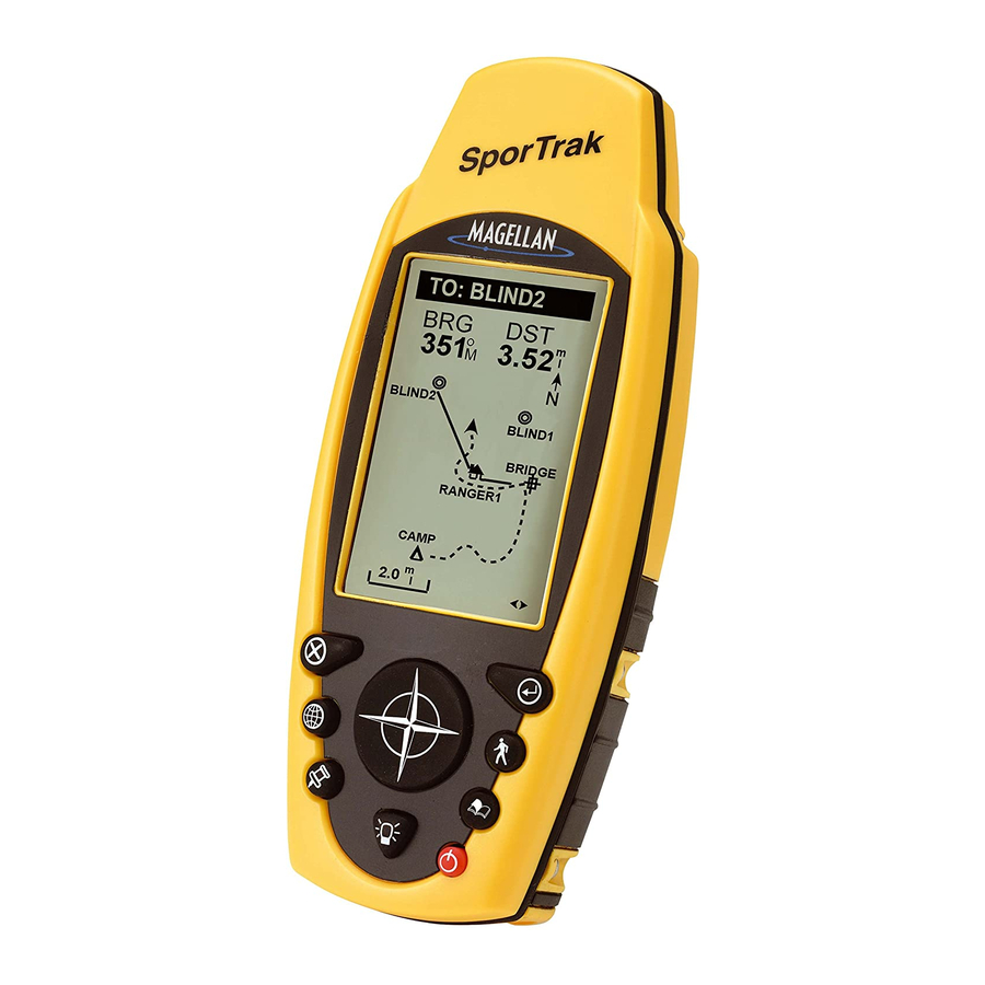
SporTrak Series of GPS
SporTrak Series of GPS
SporTrak Series of GPS
SporTrak Series of GPS
SporTrak Series of GPS
Mapping
Mapping
Mapping
Mapping
Mapping
Receivers
Receivers
Receivers
Receivers
Receivers
.
This manual covers both the SporTrak™ Map and the
SporTrak™ Pro GPS receivers. All of the functions
described in this manual apply to both receivers.
The SporTrak Map has a 2MB basemap with an addi-
tional 4MB for data downloaded from MapSend™
products. The SporTrak Pro has a 9MB basemap and
23MB for data downloaded from MapSend products.
Advertisement
Table of Contents

Related Manuals for Magellan 310


Summary of Contents for Magellan 310
- Page 1 User Manual User Manual User Manual User Manual User Manual SporTrak Series of GPS SporTrak Series of GPS SporTrak Series of GPS SporTrak Series of GPS SporTrak Series of GPS Mapping Mapping Mapping Mapping Mapping Receivers Receivers Receivers Receivers Receivers This manual covers both the SporTrak™...
-
Page 2: License Agreement
Department of Defense civil GPS user policy and the Federal Radionavigation Plan. Accuracy can also be affected by poor satellite geometry. Use only Magellan cables and antennas; the use of non-Magellan cables and antennas may severely degrade performance or damage the receiver, and will Thales Navigation grants you, the purchaser, the right to use the software supplied in and with Thales Navigation GPS products (the "SOFTWARE") in the... - Page 3 All Magellan GPS receivers are navigation aids, and are not intended to replace other methods of navigation. Purchaser is advised to perform careful position charting and use good judgment. READ THE USER GUIDE CAREFULLY BEFORE USING THE PRODUCT. THALES NAVIGATION’S WARRANTY...
- Page 4 MODIFICATIONS TO THE RECEIVER WHICH MAY BE REQUIRED DUE TO ANY CHANGE IN THE GLOBAL POSITIONING SYSTEM (GPS). (Note: All Magellan GPS receivers use GPS to obtain position, velocity and time information. GPS is operated by the U.S. Government, which is solely responsible for its accuracy and maintenance.
-
Page 5: Table Of Contents
Satellite Status Screen ... 11 Accessing the Navigation Screens ... 11 Saving a Waypoint ... 12 Using GOTO Routes ... 14 Creating a GOTO Route ... 14 Navigating on a GOTO Route ... 16 Summary ... 17 Magellan SporTrak GPS Receiver... - Page 6 Auto vs. Auto Detailed ... 28 Using Vertical Profile ... 28 Selecting Vertical Profile ... 29 Track History Description ... 29 Highlighted Road Vertical Profile Description ... 29 Route Vertical Profile Description ... 29 Path Check Description ... 29 Magellan SporTrak GPS Receiver...
- Page 7 Routes ... 43 Creating a GOTO Route ... 43 Creating a Backtrack Route ... 43 Creating a Multileg Route ... 43 Activating/Deactivating a Route ... 45 Viewing a Route ... 45 Editing a Route ... 46 Magellan SporTrak GPS Receiver...
- Page 8 Clearing All Memory in the SporTrak ... 55 Changing Languages ... 56 Sun/Moon Display ... 56 Accessing the Sun/Moon Screen ... 56 Changing the Sun/Moon Date ... 56 Changing the Sun/Moon Position ... 57 Fish/Hunt Times Display ... 57 Magellan SporTrak GPS Receiver...
- Page 9 Alarms ... 63 Output Data ... 63 Appendix Troubleshooting ... 65 Waypoint Icons ... 66 Contacting Magellan ... 67 Specifications ... 68 Accessories ... 69 MapSend™ Streets ... 70 Connecting to External Devices ... 71 Connecting to External Power Source ... 72 WAAS ...
- Page 10 Magellan SporTrak GPS Receiver...
- Page 11 GPS mapping receivers. The SporTrak has all the features that a sailor, fisherman, hiker, hunter, or any person involved with outdoor recreational activities has come to expect from a Magellan GPS receiver. In addition to these features, the SporTrak offers the ability to display your location on detailed city maps providing you with a complete navigation tool that will last you for years to come.
- Page 12 The most important thing to us is to be sure that you are completely satisfied with your SporTrak and the accompanying documentation. If you have any ideas, suggestions or even a complaint, please pass them along to us through our web site (www.magellangps.com) or by mail. Magellan SporTrak GPS Receiver...
-
Page 13: Installing The Batteries
Setting up the SporTrak is a simple three-step process: installing the batteries, selecting the language to be used and initializing the SporTrak. The Magellan SporTrak uses two AA batteries that are installed from the back through the battery cover. You can expect to get up to 15 hours of usage on two AA batteries with the backlight turned off. -
Page 14: Selecting Language
Follow these instructions to initialize the SporTrak. Turning the SporTrak On Press [PWR] The SporTrak turns on and displays the start-up screen and a warning screen. Magellan SporTrak GPS Receiver... -
Page 15: Enter Your Approximate Position
Be sure that you set the AM/PM indicator. Note: After the SporTrak starts to pick up signals from any satellite, it will automatically update the time using the satellite’s atomic clock. Magellan SporTrak GPS Receiver [ENTER]... - Page 16 SporTrak off. If you turn the SporTrak off, all of the information you just entered will be saved. To turn the SporTrak off, press Pressing right arrow results in: Pressing up arrow results in: [ENTER]. [PWR]. Magellan SporTrak GPS Receiver...
-
Page 17: Sportrak Gps Receiver
GOTO is used to create a direct route to any waypoint stored in memory. This key is also used to MARK a position. Magellan SporTrak GPS Receiver IN - Zooms in display of the Map screen. (Press once to zoom one... -
Page 18: Turning Power On/Off
2 seconds Display backlight backlight illuminates illuminates (low) You have 10 seconds to press ENTER accepting the warning or the SporTrak will shut off. Press and hold for 2 seconds Display Display backlight turns off (high) Magellan SporTrak GPS Receiver... -
Page 19: Adjusting The Contrast
Large Data screen, two Position screens, Road screen, and Sat Status screen. They will be described briefly here. More detailed information on the different screens can be found in the Reference chapter of the User Manual. Magellan SporTrak GPS Receiver The menu display may differ slightly... -
Page 20: Map Screen
Even from a distance the information can be read with ease. [ESC]. The This is a handy screen to have at your The Large Data screen is similar to Magellan SporTrak GPS Receiver... -
Page 21: Position Screens
Note that if you are inputting data, pressing screen but your inputs will not be saved. Magellan SporTrak GPS Receiver The Position screens 1 and 2 display [NAV] will return you to the last navigation... -
Page 22: Saving A Waypoint
[MENU]. Use the arrows to highlight [ENTER]. [MENU]. Use the arrows to highlight [ENTER].. Use the UP/DOWN arrows and [ENTER]. Magellan SporTrak GPS Receiver... - Page 23 When you have the name the way you want it, highlight “OK” and press [ENTER]. You are returned to the Mark screen with the new name displayed. Magellan SporTrak GPS Receiver [ENTER] and the [ENTER] erases the last [ENTER] clears the entire [ENTER] adds a space.
-
Page 24: Using Goto Routes
Use the LEFT/RIGHT arrows to select how the waypoints are displayed, Alphabetical, Near Position, Near City or Near Cursor. In this case, you will be using “Near Position”. [GOTO] key and hold it down for 2-3 Magellan SporTrak GPS Receiver... - Page 25 The example shown here is a sample of a City Waypoint List. This is a sample of a Nearest City Waypoint list for Magellan. Your screen will look different. Use the UP/DOWN arrows to highlight your choice of waypoint to be your destination and press The GOTO route is now active and you are returned to the last viewed navigation screen.
-
Page 26: Navigating On A Goto Route
SporTrak off, you will need to restart the GOTO. Routes, however, are stored in memory. If you need to make a GOTO but expect to turn the SporTrak off before arriving, you might consider making a 1-leg route using the route menu. [ENTER]. Magellan SporTrak GPS Receiver... -
Page 27: Summary
An ideal way to get used to using the Magellan SporTrak is to go outside your house and obtain a position fix. (An easy way to see that you are computing a position fix is to view the Sat Status screen. -
Page 28: Power/Backlight/Contrast
(See “Setup” to change the settings for the automaic timer). Press and hold for 2 seconds. You have 10 seconds to press ENTER accepting the warning or the SporTrak will shut off. Magellan SporTrak GPS Receiver... -
Page 29: Adjusting The Display Contrast
If you require to see more of the map you can also turn off these data fields. Information as to how to customize this screen follows this brief description of the Map screen. Magellan SporTrak GPS Receiver The menu display may differ slightly... - Page 30 Both of the data fields can be turned on or off allowing more viewable map area. Both features (customize and turning the data on/off) can be accessed from the MENU button. Position Mode Magellan SporTrak GPS Receiver Track History Data Fields...
- Page 31 Provides the scale for the map. The number displayed represents approximately 1/4 of the screen’s width. Scale can be changed with the ZOOM IN and ZOOM OUT buttons. Magellan SporTrak GPS Receiver Waypoint Name Waypoint Name Waypoint Name Waypoint Name Waypoint Name...
-
Page 32: Setting The Map Detail
(Pointer ) (Crosshair ) (Hourglass) - dark gray - black line - light gray - dark gray - light gray grid - light gray - double black - black line - black line - light gray grid Magellan SporTrak GPS Receiver... -
Page 33: Customizing The Map Display
MAP Screen Turning On/Off Topographic Lines — [Available only if a map has been uploaded from a Magellan MapSend Topo for the United States CD-ROM] This function will hide all topo lines and topographic information. Default is On. From... -
Page 34: Globally Turning Map Items On/Off
(BRG) and distance (DIS) to the cursor is shown in the bottom left corner of the map replacing the scale. (Note: if you have uploaded topographic information from Magellan’s MapSend Topo for the United States CD-ROM, the elevation at the cursor’s location is displayed, not the bearing and distance.) If the cursor happens to be on a map object,... -
Page 35: Selecting The Data Fields
The intersection of the two lines indicates the location on the map where the horizon is being computed. (This Magellan SporTrak GPS Receiver Highlight Customize... -
Page 36: Terrain Projection Description
(This function requires that map data has been uploaded from Magellan MapSend Topo for the United States and that your present position as well as the projected horizon falls within the area uploaded.) -
Page 37: Changing The Map Orientation
Auto, you will see more points on and near turns and less points on straight stretches of the map. You also have the option of selecting fixed intervals for track point storage. Magellan SporTrak GPS Receiver Highlight Use arrows to... -
Page 38: Auto Vs. Auto Detailed
The same temporary waypoints used to create the displayed track are used to compute a backtrack route. Therefore, it is highly recommended that you use the “Auto” Track Mode whenever possible. Use arrows to highlight the Magellan SporTrak GPS Receiver... -
Page 39: Selecting Vertical Profile
Route Vertical Profile Description — (Available only with map data uploaded from Magellan MapSend Topo for the United States.) If you have at least one route stored in memory, you can view the vertical profile for the route. After selecting Vertical Profile, you will be asked to select the route you want to plot. - Page 40 This provides you with the direction you need to head to arrive at the destination. When you are on course and heading straight for the destination, the destination icon will be lined up with the heading marker. Magellan SporTrak GPS Receiver...
-
Page 41: Compass Screen
For multileg routes, the name displayed is the name of the destination for the leg of the route you are presently navigating on. Magellan SporTrak GPS Receiver Highlight Use arrows to highlight the title Customize... -
Page 42: Customizing The Data Fields
Resetting the Trip Odometer — Resets the trip odometer to 0000.00. From the Position Screen Highlight Customize data type Highlight Reset Trip Use arrows to highlight the title for the data field to be changed Confirm? Yes or No Magellan SporTrak GPS Receiver... -
Page 43: Customizing The Data Fields
Customizing the Data Fields — Allows you to change the data that is being displayed to 1 of 13 data options (bearing, distance, speed, heading, VMG, CTS, ETA, ETE, XTE, turn, elevation, time, or date) for any of the two fields. Magellan SporTrak GPS Receiver Current Time and Date Trip... -
Page 44: Gps Status Messages
From the Position Screen Use arrows to select new GPS Status Messages — Messages indicating the status of the GPS receiver section of the SporTrak are displayed on the Position screen. Message Searching - 1st sat Searching - 2nd sat... -
Page 45: Projecting A Waypoint
“From” field Use arrows to highlight “Distance” field Use arrows to highlight “Bearing” field Use arrows to highlight “Save Magellan SporTrak GPS Receiver Highlight Projection Enter desired distance to project Enter desired bearing to project Follow the directions for editing a Follow the directions for editing a waypoint (icon, name, etc.). -
Page 46: Road Screen
Also, you will see upcoming turns in advance allowing you to make necessary preparations. Scale Indicator Scale Indicator Scale Indicator Scale Indicator Scale Indicator Use Zoom In/Out to change the scale. Magellan SporTrak GPS Receiver... -
Page 47: Customizing The Data Fields
Satellites that are being used to compute your position are shown with solid bars. The height of the bar indicates the relative signal strength. Magellan SporTrak GPS Receiver Highlight Use arrows to highlight the title Customize for the data field to... -
Page 48: Waypoints / Database
Note: When selecting the User category, the SporTrak does not use the keyboard display. Highlight Database Use left/right “Find By” Use up/down arrows to select category Magellan SporTrak GPS Receiver... -
Page 49: Selecting Waypoints Nearest To The Cursor
Creating New Waypoint Manually — Allows the creation of a new waypoint with coordinates other than your present position. The coordinates for the new position need to be entered manually. From Screen Magellan SporTrak GPS Receiver Use up/down arrows to highlight Mark Highlight... -
Page 50: Creating New Waypoint With Map Cursor
Delete be Deleted Highlight Database Select Select Field Waypoint to to be be Edited Edited Highlight “Save” button Modify (see Note) left/right arrows select User “Find By” Highlight left/right arrows select User “Find By” Edit Field Magellan SporTrak GPS Receiver... -
Page 51: Viewing A Map Object On The Map
Follow the instructions above for Viewing a Map Object on a Map. Press and hold GOTO for 2-3 seconds. Edit any field of the waypoint that you want and when you are done, highlight “Save” and press ENTER. Magellan SporTrak GPS Receiver Highlight Select... -
Page 52: Searching For A Street Address
(“Mark”) or view it on the Map Screen. NOTE: The option is available ONLY if you have uploaded one or more detailed maps from the Magellan MapSend Streets CD-ROM. From Screen Use arrows to view address Mark. -
Page 53: Routes
SporTrak, but once you can visualize what a multileg route (route) is, it becomes very easy to understand and create. If you understand that a GOTO is a 1-leg route with a starting point and a destination point, Magellan SporTrak GPS Receiver If a GOTO route Select... - Page 54 Use up/down arrows to move highlight to next available leg in the route. Indicated by dashes. Select Use left/right Waypoint arrows to Category select “Find By” Use up/down arrows to highlight “Save Route” button Select Waypoint from List Magellan SporTrak GPS Receiver...
-
Page 55: Activating/Deactivating A Route
Viewing a route can be used if you just wanted to see the components of the route or as a precursor to editing the route. From Screen Magellan SporTrak GPS Receiver Sample Route Create Highlight Select Route... -
Page 56: Editing A Route
Select route to be edited. See Instructions for Viewing a Route Highlight destination waypoint for leg that will have a leg inserted. Select Highlight Database Insert Highlight destination waypoint for leg that will be deleted. Highlight Delete Select Waypoint Magellan SporTrak GPS Receiver... -
Page 57: Replacing A Leg
“A” to “B” to “C” to “D”, if this route were reversed it would end up as “D” to “C” to “B” to “A”. From Screen Highlight Reverse Magellan SporTrak GPS Receiver Highlight destination waypoint for leg that will be replaced. Select Database Highlight next available leg. -
Page 58: Deleting A Route
“T01P01 to T01Pxx” where Pxx indicates the number of points in the route. From Screen Highlight Routes Highlight Delete Highlight Routes Highlight Map View Highlight Routes Highlight Save Trk to Rte Select Route Select Route Magellan SporTrak GPS Receiver... -
Page 59: Setup
As an example, if you turn the Sat Status screen off and press ESC before confirming all of the nav screens, your selection will not be saved and the Sat Status screen will still be on.) Default: All On Magellan SporTrak GPS Receiver Highlight Highlight Setup... -
Page 60: Selecting The Coordinate System
Screen Select Primary or Default: Primary - WGS84 Highlight Setup Select Coordinate Secondary may require additional information. DEG.MIN.MMM Secondary - UTM Highlight Setup Select Secondary Datum Secondary - WGS84 Highlight Coord System System Highlight Map Datum Magellan SporTrak GPS Receiver... -
Page 61: Selecting The Elevation Mode
Selecting NAV Units — Allows you to select the units of measure that will be used when displaying navigational data. Options are: Miles/MPH, NM/Knots or KM/KPH. From Screen Select Nav Units Default: Miles/MPH Magellan SporTrak GPS Receiver Highlight Highlight Setup Elev Mode Highlight Highlight Setup Time Format If Local time is selected (24 hr. -
Page 62: Selecting The North Reference
(pressing a key causes a beep), Alarms Only (when an alarm is activated) or Keys & Alarms. From Screen Default: Keys & Alarms Highlight Setup Select North Highlight Setup Select Timer Duration Highlight Setup Select Beeper Options Highlight North Reference Highlight Light Timer Highlight Beeper Magellan SporTrak GPS Receiver... -
Page 63: Selecting Nmea Message
You can choose from 1200 baud, 4800 baud, 9600 baud, 19200 baud, 57600 baud or 115200 baud. From Screen Select Baud Rate Default: 4800 Baud Magellan SporTrak GPS Receiver Highlight Highlight Setup NMEA Highlight Highlight Setup Baud Rate... -
Page 64: Seletcting Daylight Savings Time
From Screen Default: Off Highlight Highlight Setup Daylight savings Select Region Highlight Setup Power Off Timer Select If On, select Mode and On or Off Timer settings Highlight Magellan SporTrak GPS Receiver... -
Page 65: Clearing Memory
SporTrak. After completing these instructions, the SporTrak will shut off. The next time it is turned on, it will prompt you that it needs to be initialized. From Screen Highlight Magellan SporTrak GPS Receiver Highlight Highlight Setup Clear Memory Confirm? -
Page 66: Changing Languages
Changing the Sun/Moon Date — Allows you to change the date for the sun/moon information for the position selected. From Screen Use arrows to change date Highlight Setup Select desired language Highlight Sun/Moon Highlight Sun/Moon Highlight Languages Highlight Date Field Magellan SporTrak GPS Receiver... -
Page 67: Changing The Sun/Moon Position
Changing the Fish/Hunt Position — Allows you to change the position that you want to view the fishing/hunting times for. The default is “Position” which is your present position. From Screen Use left/right arrows to select “Find By” Magellan SporTrak GPS Receiver Highlight Highlight At Field Sun/Moon Highlight Waypoint Highlight... -
Page 68: Sportrak Alarms
This is handy in that it alerts you that you may need to move to an area that has a clearer view of the sky. Highlight Alarms/Msg Select Alarm Highlight Alarm Field Magellan SporTrak GPS Receiver... -
Page 69: Using The Simulator
From Screen Highlight Auto Turning the Simulator Off — Turns the simulator off and returns the SporTrak to normal operation. From Screen Highlight Magellan SporTrak GPS Receiver Highlight Highlight Setup Simulate Confirm Clearing of Track Highlight Highlight... -
Page 70: About Screen
You can view help tips for Nav Screens, Map, Routes, Setup, Database, User Waypoints and Misc Topics. Each topic has a number of tips available that can be viewed. From Highlight Select Topic Help Screen Use the “Next” and “Prev” buttons to scroll the SporTrak Help Files. Magellan SporTrak GPS Receiver... -
Page 71: Frequently Asked Questions
Setup menu item and access “Daylight savings”. There you can select United States, European Union or you can use the customize option to set the rules for daylight savings in your area. Magellan SporTrak GPS Receiver... -
Page 72: Waypoints/Database
The Database contains cities, highways, airports, waterways and national parks. Can I delete preloaded waypoints that I don’t use? No. Waypoints that are preloaded into the SporTrak will always be available, even when all of the SporTrak’s memory has been cleared. Magellan SporTrak GPS Receiver... -
Page 73: Navigation Screens
What is NMEA? NMEA (National Marine Electronics Association) is the standard used for interfacing marine electronic devices. This standard has also been adapted for use in a variety of third-party mapping software programs. Magellan SporTrak GPS Receiver Frequently Asked Questions... - Page 74 SporTrak’s baud rate (See Setup - Changing the Baud Rate.) Can I interface my SporTrak with a Macintosh computer? Magellan does not supply cabling or software for the Macintosh line of computers. For information on a cable or software that may meet your requirements, visit GPSy at www.gpsy.com on...
-
Page 75: Troubleshooting
Use map data for reference and do not rely completely on it. Data was not saved or was corrupted. This can be caused because you removed the batteries or removed external power with the SporTrak turned on. Magellan SporTrak GPS Receiver... -
Page 76: Appendix
Fuel Garden Golf Hotel Hunt/Fish Large City Lighthouse Major City Marina Medium City Museum Obstruction Park Resort Magellan SporTrak GPS Receiver Restaurant Rock Scuba RV Service Shooting Sight Seeing Small City Sounding Sports Arena Tourist Info Truck Service Winery Wreck... -
Page 77: Contacting Magellan
Representatives are available Monday through Friday from 7 AM to 5 PM, PST. Faxes can be sent to Customer Service at (909) 394-7070. If necessary, you can also return your receiver to Magellan for repair. Before returning the receiver you must get a Return Materials Authorization (RMA) from Magellan. -
Page 78: Specifications
Weatherproof construction, wraparound rubber armor 14˚F to 140˚F to (-10˚C to 60˚C) -4˚F to 158˚F (-20˚C to 70˚C) 2 AA alkaline batteries or 9-18 VDC with power cable Up to 15 hours 2MB basemap; 4MB uploadable 9MB basemap; 23MB uploadable Magellan SporTrak GPS Receiver... -
Page 79: Accessories
Appendix Accessories for your receiver are available from your Magellan dealer or you can order directly from Magellan at (800) 669-4477 (press 3 to place an order). Swivel Mounting Bracket: Mounts the receiver on a surface, allowing for hands- free operation. -
Page 80: Mapsend™ Streets
• Creation, management and upload/download of waypoints and routes. • Allows straight line distance computation on the map. • Search for map objects (such as cities, lakes, etc.) by name. Magellan SporTrak GPS Receiver... -
Page 81: Connecting To External Devices
Available as accessories for your GPS receiver are the following cables: External Power Cable with Cigarette Lighter Adapter, Power/Data Cable, Data Cable and PC Cable with Cigarette Lighter Adapter. The instructions given below apply to all cables, unless otherwise stated. -
Page 82: Connecting To External Power Source
Data (Power/Data, PC cable & Data cable only) Cut Here Power Supply Box Connecting to a Data Source Cable Wiring Color Code Red: Power + Black: GND Yellow: Data In Orange: Data Out Black: GND Cigarette Lighter Adapter Magellan SporTrak GPS Receiver... -
Page 83: Waas
Appendix Your Magellan GPS receiver has been upgraded to include the latest WAAS (Wide Area Augmentation System) technology. With WAAS your GPS receiver can compute position locations with an accuracy never before possible in a commercial receiver. What is WAAS? WAAS is a means of improving the accuracy of GPS beyond the standard civilian signal. -
Page 84: Glossary
The value or setting automatically chosen by the unit unless otherwise directed. Can be changed in Setup. Distance. Distance from position to destination. Estimated Time of Arrival. The estimated time of day the leg’s destination waypoint will be reached. Magellan SporTrak GPS Receiver... - Page 85 Longitude Magnetic North NMEA OSGB Position fix Magellan SporTrak GPS Receiver Estimated Time Enroute. The estimated time remaining to reach the next waypoint in a route. Heading. The direction you are facing, defined as an angle from North. The angular distance north or south of the equator measured by lines encircling the earth parallel to the equator from 0˚...
- Page 86 Used to create routes. Cross Track Error. The perpendicular distance between the present position and the courseline. Given as a distance, right or left, of course when facing the destination. Magellan SporTrak GPS Receiver...