Humminbird 800 series Operation Manual
800/900 series fish finder
Hide thumbs
Also See for 800 series:
- Accessories manual (39 pages) ,
- Installation & operation manual (37 pages) ,
- Installation manual (2 pages)
Table of Contents
Advertisement
Advertisement
Table of Contents

Related Manuals for Humminbird 800 series


Summary of Contents for Humminbird 800 series
-
Page 2: Thank You
Web site at humminbird.com. NOTE: Some features discussed in this manual require a separate purchase, and WARNING! The electronic chart in your Humminbird® unit is an aid to navigation some features are only available on international models. Every effort has been designed to facilitate the use of authorized government charts, not to replace them. - Page 3 Customer Resource Center at (334) 687-6613. 800 Series™, 900 Series™, Cannon®, CannonLink™, Contour XD™, Down Imaging®, DualBeam PLUS™, Fish ID+™, HumminbirdPC™, Humminbird®, InterLink™, LakeMaster®, ProMap™, One-Touch® Zoom, QuadraBeam PLUS™, RTS Window™, Side Imaging®, SmartCast®, SwitchFire®, Structure ID™, Total Screen Update™, UniMap™, WeatherSense®, WhiteLine™, X-Press™ Menu, and Xtreme Depth Series™...
-
Page 4: Table Of Contents
Table of Contents Introduction INFO Key ..........................11 MARK Key..........................11 How Sonar Works ........................1 DualBeam PLUS™ Sonar GOTO Key ..........................12 (DualBeam PLUS™ models only ............3 [859ci HD, 899ci HD SI, 959ci HD, and 999ci HD SI]) ZOOM (+/-) Keys ........................12 Down Imaging® Sonar ....3 (Down Imaging®... - Page 5 Table of Contents What’s on the Down Imaging® Display Chart/Down Imaging® Combo View (859ci HD DI, 959ci HD DI, 899ci HD SI and 999ci HD SI only) ..........47 (859ci HD DI, 959ci HD DI, 899ci HD SI, and 999ci HD SI only) Down Imaging®/Sonar Combo View Understanding the Down Imaging®...
- Page 6 Table of Contents Self Test ..........................62 Active Side (Combo Views only) ....................71 Accessory Test ........................63 Split Position ..................71 (Combo Views only) GPS Diagnostic View ......................63 SI Side............................71 SI Sensitivity..........................71 X-Press™ Menu SI Enhance ..........................72 Main Menu SI Range ..........................72 Quick Tips for the Main Menu ....................65 Chart Speed ..........................73 Note for all Menu Settings ....................65 SI Colors ..........................73...
- Page 7 Table of Contents Skip Next Waypoint (only when Navigating) ................77 Delete All Recordings ......81 (optional-purchase SD Memory Card, Snapshot and Recording View only) Active Side ....................77 (Combo Views only) Pings Per Second Split Position (Combo Views only) ..................77 ......81 (optional-purchase SD Memory Card, Snapshot and Recording View only) Waypoint [Name] ..........78 (Only with an active cursor on a waypoint)
- Page 8 Table of Contents SwitchFire®..........................89 DI Colors (859ci HD DI, 959ci HD DI, 899ci HD SI and 999ci HD SI only) ......97 Fish ID+™..........................90 Down Imaging® Beam Width (Advanced, 899ci HD SI and 999ci HD SI only) ......97 Fish ID Sensitivity........................90 Navigation Menu Tab Real Time Sonar (RTS™) Window ..................91 Current Track ..........................98...
- Page 9 Table of Contents Chart Menu Tab Setup Menu Tab Units - Depth ........................109 Lat/Lon Grid ..........................103 Units - Temp ................109 (International Models only) Navaids on Bird’s Eye View....................103 Units - Distance ................109 (with Speed input only) Chart Select ..........................103 Units - Speed ..................110 (with Speed input only) Set Simulation Position...
- Page 10 Sound Control ........................114 distributors. To obtain a list of authorized international distributors, please visit Views Menu Tab our Web site at humminbird.com or contact our Customer Resource Center at (334) 687-6613. Accessories Menu Tab NOTE: Some of the entries in this Table of Contents may require the purchase...
-
Page 11: Introduction
DualBeam PLUS™ Sonar, Chartplotting, and an internal GPS Receiver. measuring the time between the transmission of the sound wave and when • Humminbird® 859ci HD DI Combo: Wide screen Fishing System with the sound wave is reflected off of an object; it then uses the reflected signal to interpret location, size, and composition of an object. - Page 12 When all the echoes are viewed side by side, The power output is the amount of energy an easy to interpret "graph" of the bottom, fish generated by the sonar transmitter. It is and structure appears. commonly measured using two methods: •...
-
Page 13: Dualbeam Plus™ Sonar (Dualbeam Plus™ Models Only [859Ci Hd, 899Ci Hd Si, 959Ci Hd, And 999Ci Hd Si])
DualBeam PLUS™ Sonar Down Imaging® Sonar (DualBeam PLUS™ models only (Down Imaging® models only [859ci HD DI [859ci HD, 899ci HD SI, 959ci HD, & 999ci HD SI]) and 959ci HD DI]) The 859ci HD/959ci HD Combo and 899ci The 859ci HD DI/959ci HD DI Combo HD SI/999ci HD SI Combo Fishing Systems Fishing System uses Down Imaging®... -
Page 14: High Definition Side Imaging® Sonar (Side Imaging® Models Only [899Ci Hd Si And 999Ci Hd Si])
High Definition Xtreme Depth Sonar Side Imaging® Sonar 86° 86° (Xtreme Depth Series™ models only [859ci HD 455kHz 455kHz (Side Imaging® models only XD and 959ci HD XD]) [899ci HD SI and 999ci HD SI only]) 20° The 859ci HD XD/959ci HD XD Combo 200kHz 60°... -
Page 15: Quadrabeam Plus™ Sonar (With Optional-Purchase Quadrabeam Plus™ Transducer)
DualBeam PLUS™ technology 83 kHz (available with all Humminbird® DualBeam PLUS™ models). An expanded and structure to the left and right of the 90° Total Coverage view and greater bottom detail gives you a totally new perspective of the boat over an area of the bottom that’s... - Page 16 GPS was originally intended for military use; however, civilians may also take The Fishing System has a wide variety of configurations advantage of its highly accurate position capabilities, typically within +/- 4.5 meters, depending on conditions. This means that 95% of the time, the GPS receiver will read a location within 4.5 meters of your actual position.
-
Page 17: Fishing System Configuration
Please read all instructions that are relevant for your configuration before beginning the installation process. See the Humminbird® installation guide for details. NOTE: The following accessories are not compatible with your unit: CannonLink™, InterLink™, Remote Sonar Link™... -
Page 18: Ethernet Connector
Start-Up Option, the system will default to whichever menu is already highlighted. Follow the instructions below to power on your Humminbird® control head. • You can also select Simulator to learn how to use your control head and save settings in advance for later use. -
Page 19: What's On The Control Head
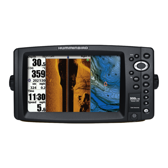
What’s on the Control Head Key Functions Your Fishing System user interface is easy to use. A combination of keys, Your Fishing System has a set of easy to use keys that give you flexibility and control over your fishing experience. different views, and situation-specific, customizable menus allows you to control what you see on the color display. -
Page 20: View Key
Turn Local Sonar On or Off: From the Light and Background submenu, use the 4-WAY Cursor Control Key 4-WAY Cursor Control key to select Local Sonar. Use the LEFT or RIGHT Cursor (RIGHT, LEFT, UP, or DOWN Cursor Keys) key to change the setting. See Setup Menu Tab: Local Sonar for more The 4-WAY Cursor Control key has multiple functions, information. -
Page 21: View Preset Keys
VIEW PRESET Keys INFO Key The VIEW PRESET keys are used to save your three favorite Press the INFO key while in Bird's Eye, Chart, or Combo View views for quick retrieval. Instead of using the VIEW key to to display information about objects that are near an active cycle through all the views to find the one you want, you can cursor. -
Page 22: Goto Key
NOTE: The SD Memory Cards require a separate purchase. For more is activated, any current navigation will be cancelled and the current information, visit our Web site at humminbird.com or contact our Customer route will be discarded without notification (see Man Overboard Resource Center at 1-800-633-1468. -
Page 23: Add Maps To Your Fishing System
WARNING! DO NOT import navigation data from unknown sources into your NOTE: The 800/900 Series™ supports LakeMaster®, Navionics® Gold, Humminbird® unit without first converting the data to the correct format using HotMaps™, HotMaps™ Premium, and Platinum™ Cartography on SD card HumminbirdPC™. - Page 24 The USB Memory Card Reader accessory can be used in conjunction with Select Waypoints, Routes, Tracks. Press the RIGHT Cursor key. your personal computer to view and organize your exported navigation data. Visit our humminbird.com Web site at or contact our Customer Resource Center at 3.
-
Page 25: Update Software
To update the control head software: 1. Install a formatted SD memory card into the card reader connected Set up an online account at humminbird.com so that you will receive the to your PC. latest Humminbird® news and software upgrades for your Fishing System. -
Page 26: What's On The Sonar Display
What’s on the Sonar Display The Fishing System can display a variety of useful information about the area under and adjacent to your boat, including the following items: Thermoclines - Layers of water with different temperatures that appear at different depths and different times of the year. -
Page 27: Understanding The Sonar Display
Understanding the Sonar Display Real Time Sonar (RTS™) Window It is important to understand the A Real Time Sonar (RTS™) Window appears on the right side of the display significance of the display. The display does in the Sonar Views. The RTS Window™ always updates at the fastest rate show literal 3-dimensional... -
Page 28: Sonar Colors And Bottom View
Sonar Colors and Bottom View Sonar View: Original Palette Sonar Colors: Original Palette As the boat moves, the unit charts the HIGH changes in depth on the display to create Intensity Return a profile of the Bottom Contour. The Sonar View displays the sonar return intensity with different colors. -
Page 29: Switchfire
Structure ID™ represents weak returns in blue and strong returns in red SwitchFire® when Sonar Colors is set to Original. If the Sonar Colors palette is changed, SwitchFire® controls how the sonar returns are displayed in the Sonar the Structure ID™ will display the strongest return as specified by the Views. -
Page 30: What's On The Side Imaging® Display
What’s on the Side Imaging® Display (Side Imaging® models only [899ci HD SI and 999ci HD SI]) Side Imaging® displays a number of easily recognizable features that allow for accurate interpretation of bottom contour and structure. For Side Imaging®, the bottom composition determines the intensity of the sonar return. -
Page 31: Understanding The Side Imaging® Display
Understanding the Side Imaging® Display Each time the unit pings, a strip of data representing all the echoes received by the transducer are put together on the display to form It is important to understand how Side Imaging® technology produces the the image that you see. -
Page 32: Side Imaging® Frequencies And Coverage
Side Imaging® Frequencies and Coverage 455 kHz provides maximum coverage with 180° total beam width Side Imaging® sonar uses two very precise sonar beams that are directed to either side of the boat. The beams “illuminate” the bottom contour, structure, and fish, and the results are displayed in a “picture-like” image on the screen. -
Page 33: For Best Performance
Boat speed: 2 to 6 mph Straight line navigation See humminbird.com for a side imaging sonar tutorial and additional Minimum turning time and wave turbulence information. Boat speed: Side Imaging® is best performed at boat speeds between 2 to 6 mph. -
Page 34: On The Water Interpretation
On the Water Interpretation Submerged Ravine with Timber Submerged Bridge, Creek Channel, and New Bridge Piling Possible drop off Submerged tree Submerged timber Submerged ravine New bridge pilings Submerged Bridge: A Closer Perspective Creek channel Submerged bridge Submerged Bridge What’s on the Side Imaging® Display... - Page 35 Submerged Bridge, Alternative Perspective Submerged Swimming Pool Submerged Bridge Swimming pool Submerged Standing and Fallen Timber, and Bait Fish Submerged Barge with Dumped Logs Bait fish Dumped logs Standing and fallen timber Submerged barge What’s on the Side Imaging® Display...
-
Page 36: What's On The Down Imaging® Display
What’s on the Down Imaging® Display (859ci HD DI, 959ci HD DI, 899ci HD SI, and 999ci HD SI only) Down Imaging® uses unique sonar technology to provide information about the area directly below your boat. The razor-thin, high- definition profiling beams produce the detailed sonar data that you see on the display. -
Page 37: Understanding The Down Imaging® Display
Understanding the Down Imaging® Sensitivity Down Imaging® Display Use Down Sensitivity to control how the sonar returns appear on the The images you see on the Down display. Increase the sensitivity to reveal weaker returns that may be of Imaging® display are produced interest, especially in very clear water or greater depths. -
Page 38: Views
Hidden to Visible or vice versa. 899ci HD SI and 999ci HD SI: Chart/Side Combo View • Available Views: The available Views on your Humminbird® unit will To program each PRESET key: vary with the model and the transducer attached to your control head. -
Page 39: Sonar View
To change the Digital Readouts: Sonar View Each view displays digital readout information (such as speed or time), Sonar View presents a historical log of sonar returns. The most recent sonar which varies with the view selected, the accessory attached, and whether returns are charted on the right side of the display. -
Page 40: Sonar Zoom View
Sonar View Sonar Zoom View Sonar Zoom View provides a magnified view of the bottom and structure. The Sonar Zoom View makes it easier to see separate sonar returns that would usually be displayed close together, such as those caused by fish suspended close to the bottom or within structure. -
Page 41: Split Sonar View
Sonar Zoom View Split Sonar View Split Sonar View displays sonar returns from each down beam frequency on separate sides of the screen. You can use the Split Sonar View to make side by side comparisons between the sonar returns from both beams. •... -
Page 42: Side Imaging® View (899Ci Hd Si And 999Ci Hd Si Only)
Split Sonar View (859ci HD, 959ci HD, 899ci HD SI, and 999ci HD SI) Side Imaging® View (899ci HD SI and 999ci HD SI only) Side Imaging® View shows a shadowed right- and left-looking view from the boat as the boat passes over the bottom. See Understanding the Side Imaging®... - Page 43 - Navigation readouts will display at the bottom of the screen Side Imaging® View, with Active Cursor and Zoom when navigation starts. - Boat Icon: When you start navigation, the boat icon at the top of the screen will indicate the direction the boat needs to turn to reach the waypoint.
-
Page 44: Down Imaging® View (859Ci Hd Di, 959Ci Hd Di, 899Ci Hd Si And 999Ci Hd Si Only)
Down Imaging® View - Zoom+: Press the ZOOM+ key, and a zoom box will appear and magnify the area you choose, providing more detail in the (859ci HD DI, 959ci HD DI, 899ci HD SI, and 999ci HD SI only) individual sonar returns. -
Page 45: Snapshot And Recording View (Optional-Purchase Sd Memory Card Required)
Down Imaging® View, with Active Cursor and Zoom Snapshot and Recording View (optional-purchase SD Memory card required) Snapshot and Recording View displays the screen snapshots and recordings that are saved on the optional-purchase SD card installed in the control head. Use this view to review the snapshot and recording file details, start recording, and adjust the recording settings. - Page 46 Snapshot and Recording View Screen Snapshots Screen Snapshots are saved pictures of the view on the screen. The screen snapshot will include the menus, dialog boxes, warnings, and messages that were active when the screen snapshot was taken. Saved Screen Snapshots can be viewed from the Snapshot and Recording View or Chart View.
- Page 47 SD and highlight a snapshot file. Snapshot File Name card (see humminbird.com for details). You will notice that a .DAT (or Time + Date of Snapshot a .TXT) file is created for every .PNG screen snapshot. This data file is 2.
- Page 48 Recording and Playback Notes about Recording: • While recording, press the EXIT key to exit the Snapshot and The Recording feature records active sonar information. When the recording Recording X-Press™ Menu and scroll to a different view. Recording is played back, the views that were active during the recording are available will continue.
- Page 49 Change Playback Settings: Notes about Playback: 1. Press the MENU key once to • “Playback” will flash periodically on the screen to indicate that the open the Snapshot and control head is playing a saved recording and not a “live” view. Recording X-Press™...
-
Page 50: Side Beam View (With Optional-Purchase Quadrabeam Plus™ Transducer)
Recording Information Side Beam View (with optional-purchase QuadraBeam PLUS™ transducer) Side Beam View displays sonar data from the left and right 455 kHz beams and the 200 kHz down-looking beam in one view. This view is available if an optional-purchase QuadraBeam PLUS™ transducer accessory is connected and Connected Transducer is set to QuadraBeam (see Sonar Menu Tab: Connected Transducer). - Page 51 Default layout: The top portion of the display presents a historical log of Classic layout: The top portion of the display presents a historical log of sonar returns from the 200 kHz down-looking sonar beam. New information sonar returns from the 200 kHz down-looking sonar beam. New information in the down beam panel scrolls from right to left.
-
Page 52: Bird's Eye View
Slanted layout: This layout is presented as three slanted panels Bird’s Eye View representing the two 455 kHz side sonar beams and the 200 kHz down- Bird’s Eye View shows a 3D perspective view of the track and the chart’s looking sonar beam. -
Page 53: Chart View
Chart View Chart View with Active Cursor Chart View shows cartography from the built-in Contour XD™, built-in UniMap™, or an optional SD map for the area surrounding your current position. The cartography is applied to any standard Chart View or Combo View that displays a chart. -
Page 54: Combo Views
Combo Views Side Imaging /Sonar Combo View ® (899ci HD SI and 999ci HD SI only) Side/Sonar Combo View shows sonar information and Side Imaging® sonar Combo Views display two views (or more) on the screen at the same time. information in a combination split screen, where the Sonar View is displayed You can perform functions for either side of the view, access the X-Press™... -
Page 55: Chart/Bird's Eye Combo View
Chart/Bird’s Eye Combo View Chart/Chart Combo View Chart/Bird’s Eye Combo View shows the Chart and Bird’s Eye views in a Chart/Chart Combo View shows two versions of the Chart view in a combination split screen, where the Bird’s Eye View is displayed on the left combination split screen so that you can see the position of the boat on one and the Chart View is displayed on the right. -
Page 56: Chart/Sonar Combo View
Chart/Sonar Combo View Chart/Side Imaging Combo View ® (899ci HD SI and 999ci HD SI only) Chart/Sonar Combo View shows both the Chart and Sonar views in a Chart/Side Imaging® Combo View shows chart information and Side combination split screen, where the Sonar View is displayed on the left and Imaging®... -
Page 57: Down Imaging®/Side Imaging® Combo View
Down Imaging®/Side Imaging® Combo View Chart/Down Imaging® Combo View (899ci HD SI and 999ci HD SI only) (859ci HD DI, 959ci HD DI, 899ci HD SI, and 999ci HD SI only) Down/Side Imaging® Combo View shows Down Imaging® and Side Chart/Down Imaging®... -
Page 58: Down Imaging®/Sonar Combo View
Down Imaging®/Sonar Combo View Down Imaging®/Side Imaging®/Sonar Combo View (859ci HD DI, 959ci HD DI, 899ci HD SI, and 999ci HD SI only) (899ci HD SI and 999ci HD SI only) Down Imaging®/Sonar Combo View shows traditional Sonar information on Down/Side Imaging®/Sonar Combo View shows Down Imaging®... -
Page 59: View Orientation
View Orientation Viewing Cartography Both Chart and Chart Combo Views allow you to choose the orientation of In the Chart and Chart Combo Views, there are several cartography-related the view (see Navigation Menu Tab: Chart Orientation). In each orientation, functions that you can access using various keys. the view pans automatically so that the boat is always centered on the Panning: Use the 4-WAY Cursor Control key to move the chart around on the display. - Page 60 Zooming: Press the Plus (+) key to Zoom In and the Minus (-) key to Zoom If the cursor is not active, the Chart Info Out to see the cartography at different magnification levels. The zoom level submenu will appear. Use the 4-WAY Cursor is indicated on the left side of the display.
-
Page 61: Introduction To Navigation
Speed Over Ground: Speed of Boat waypoints and routes from scratch. You can edit your navigation data and relative to North Reference Waypoint organize it too. This section will get you started. See your Humminbird® Bearing: Direction to Destination Waypoint Relative to North Reference Route Waypoint Management Guide for complete details. -
Page 62: Open The Waypoint Management Dialog Box
A Route Leg is the path between each waypoint in a route. The color of each route leg is displayed as follows: allows you to organize your waypoints, routes, and tracks on your Humminbird® • Completed Route Leg = Gray. control head. -
Page 63: What's On The Waypoint Management Dialog Box
What’s on the Waypoint Management Dialog Box As you scroll through the Waypoint Management dialog box, press the EXIT key to select the Options menu quickly. Press Use the Waypoint Management dialog box to manage your waypoints, the EXIT key twice to close the dialog box. routes, and tracks. -
Page 64: Save, Edit, Or Delete A Waypoint
Save, Edit, or Delete a Waypoint Directory: Shows the directory structure and the currently selected group. The illustration shows group GP070 as the selected group. Save your Current Position as a Waypoint: On any view, press the MARK key to save the current position of the boat as a waypoint. Arrows: When arrows are displayed on a menu option, additional information or submenus are available. -
Page 65: Navigate To A Waypoint Or Position
Navigate to a Waypoint or Position Add a Waypoint Target or Trolling Grid Navigate to the Cursor Position: From the Chart or Chart Combo Views, use The Waypoint Target shows a target consisting of concentric circles in various the 4-WAY Cursor Control key to move the cursor to a position or waypoint distance ranges centered on the waypoint you choose. -
Page 66: Routes
NOTE: Only one waypoint can have either a target or a grid applied to it at one Adding Waypoints to a Route time. If you apply a target or a grid to a new waypoint, the original waypoint will lose its target or grid. NOTE: The spacing of the rings on the waypoint target and the spacing of the grid lines on the trolling grid are the same as the length of the scale bar on the left edge of the display. -
Page 67: Tracks
Edit the Waypoint Order in a Route: Open the Waypoint Management Review Route Information: Open the Waypoint Management dialog box. dialog box. Select a Route, and press the RIGHT Cursor key to open the Select a saved route, and press the RIGHT Cursor key. Select info, and press Route submenu. -
Page 68: Edit Your Waypoints, Routes, Tracks, And Groups
NOTE: The Edit Waypoint dialog box is also available when you select a waypoint from the Navigation X-Press™ Menu. NOTE: See your Humminbird® Waypoint Management Guide for more information about groups and the other great features of the Waypoint Management dialog box. - Page 69 Edit a Waypoint, Route, Track, or Group Latitude/Longitude: Press the RIGHT or LEFT Cursor keys to move from space to space, and press the UP or DOWN Cursor keys to set 1. Open the Waypoint Management dialog box. the letter or number. 2.
-
Page 70: Man Overboard (Mob) Navigation
Man Overboard (MOB) Navigation MOB Navigation As soon as you know that you have a man overboard (MOB), you should activate MOB navigation to maximize the chances for a successful rescue. MOB navigation allows you to create an MOB waypoint to locate the point at which your man went overboard and the relation of the boat to that point. -
Page 71: The Menu System
The Menu System Start-Up Options Menu The Menu System is divided into easy-to-use menu modules as follows. The Press the MENU key during the power on sequence to view the Start-Up main components of the menu system are as follows: Options Menu, and select one of the modes described on the following pages. -
Page 72: Simulator
Simulator System Status Use Simulator to learn how to use your Fishfinder before taking your boat Use System Status to view system connections and to conduct a unit self- on the water. The Simulator is a very powerful tool that provides a randomly- test. -
Page 73: Accessory Test
Accessory Test lists the accessories connected to the system. GPS Diagnostic View Accessory Test Screen NOTE: The speed accessory will be detected only if the paddlewheel has moved Sky Chart Current Latitude and Longitude since your Fishing System was powered up. Satellite Being Used Satellite Being Monitored GPS Diagnostic View shows a sky chart and numerical data from the GPS... -
Page 74: X-Press™ Menu
X-Press™ Menu Main Menu The X-Press™ Menu provides a shortcut to The Main Menu provides the standard set of your most frequently-used settings. The menu options, including the settings that options provided on the X-Press™ Menu are changed less frequently. The Main Menu correspond with the current view. -
Page 75: Quick Tips For The Main Menu
Note for all Menu Settings Total Screen Update™ - When you change any menu settings that affect The settings in all menus are adjusted in the same way. Simply use the 4- the current view, the view will update immediately (i.e. you don’t have to exit the menu to apply the change to the screen). -
Page 76: User Mode (Normal Or Advanced)
Fishing System. Several menu settings are added to the Main Menu when the User Mode is changed to Advanced. Advanced mode is the default setting when you first power on your Humminbird® Fishing System. To change the User Mode setting: 1. -
Page 77: Sonar X-Press™ Menu
Combo View is on the screen (see Views: Combo Views). NOTE: Menu options are determined by your Humminbird® model. See the following pages • A green arrow on the Combo View points to the active side. for full menu descriptions. -
Page 78: Sensitivity
Lower Range regardless of the manual settings entered. greater depths, increase the sensitivity to see weaker returns that may be of interest. The available Upper Range settings are determined by your Humminbird® If the sensitivity is adjusted too high, the model as follows: display may become too cluttered. -
Page 79: Lower Range
(with optional-purchase QuadraBeam PLUS™ Lower Range regardless of the settings entered manually. Transducer, Side Beam View only) The available Lower Range settings are determined by your Humminbird® Settings: Default, Classic, Slanted, Default = Default model as follows: Quad Layout allows you to choose how sonar information is displayed in the Side Beam View. -
Page 80: Bottom Lock (Sonar Zoom View Only)
NOTE: Quad Layout is only available when an optional-purchase QuadraBeam Side Imaging® X-Press™ Menu PLUS™ transducer is attached and the Side Beam View is active (see Sonar ® (Side Imaging Views only [899ci HD SI and Menu Tab: Connected Transducer). 999ci HD SI]) The Side Imaging®... -
Page 81: Cancel Navigation (Only When Navigating)
Cancel Navigation • The number setting indicates the percentage taken up by the left side of the Combo View. (only when Navigating) • Selecting Left sets the left side of the screen to its smallest setting. Settings: Press the RIGHT Cursor key and follow screen instructions. -
Page 82: Si Enhance
SI Enhance • Contrast: Accents the light and dark parts of the Side Imaging® data to provide greater definition. (1 to 20, Default = 10) Settings: Press the RIGHT Cursor key. • Sharpness: Filters the view and sharpens the edges of the Side SI Enhance allows you to adjust your Side Imaging®... -
Page 83: Chart Speed
A slower speed keeps the information on the display longer, Mode for details. which allows you to see an entire area. NOTE: Menu options are determined by your Humminbird® model. See the following pages SI Colors for full menu descriptions. Settings: Blue, Amber 1, Amber 2, Brown, Green, Inverse, Gray, Green/Red, Default = Amber 1 Down Imaging®... -
Page 84: Cancel Navigation (Only When Navigating)
Cancel Navigation • The number setting indicates the percentage taken up by the left side of the Combo View. (only when Navigating) • Selecting Left sets the left side of the screen to its smallest setting. Settings: Press the RIGHT Cursor key and follow screen instructions. -
Page 85: Upper Range (Advanced, Down Imaging® Views Only)
For example, if you are only interested in the area between 20 and 50 feet deep, you should set the Upper Depth Range to 20 and the Lower Depth Range to 50. The Down Imaging® View will then show the 30 foot area between 20 and 50, and will not show the surface or the bottom (assuming the bottom is deeper than 50 feet), and will show greater detail for that DI Enhance Submenu... -
Page 86: Chart Speed
Inverse, Gray, Green/Red, Default = Amber 1 to the side you want to adjust. DI Colors allows you to select which color palette you would like to use for the Down Imaging® display. See Introduction to Navigation and the Humminbird® Waypoint Management Guide more information. -
Page 87: Cancel Navigation (Only When Navigating)
Cancel Navigation Active Side (only when Navigating) (Combo Views only) Settings: Press the RIGHT Cursor key and follow Settings: Left, Right, Default = Left screen instructions. Active Side allows you to select a side of the screen in a Combo View. After Cancel Navigation discards the current route and exits Navigation Mode. -
Page 88: Waypoint [Name]
MENU key once, or use Cursor to Waypoint to select a waypoint from the saved waypoints list. NOTE: See Chart Menu Tab: Chart Detail Level for more information. NOTE: See Introduction to Navigation and the Humminbird® Waypoint Management Guide for more information. Save Current Track... -
Page 89: Save Current Route (Only When Navigating)
For example, when you’ve deviated from a route to navigate around an island, select Reset XTE to update the unit’s course calculations from the NOTE: See Introduction to Navigation and the Humminbird® Waypoint current boat position instead of from the previous waypoint in the route. -
Page 90: Snapshot And Recording X-Press™ Menu
Snapshot and Recording Cancel Navigation X-Press™ Menu (only when Navigating) (Snapshot and Recording View only) Settings: Press the RIGHT Cursor key and follow screen instructions. The Snapshot and Recording X-Press™ Cancel Navigation discards the current route and exits Navigation Mode. Menu provides access to the snapshot This menu option will only appear when you are currently navigating a route. -
Page 91: Delete Image (Optional-Purchase Sd Memory Card, Snapshot And Recording View Only)
Delete Image Delete All Recordings (optional-purchase SD Memory Card, Snapshot (optional-purchase SD Memory Card, Snapshot and Recording View only) and Recording View only) Settings: Press the RIGHT Cursor key and follow Settings: Press the RIGHT Cursor key and follow screen instructions. screen instructions. -
Page 92: Playback Speed
Playback Speed NOTE: Sonar chart speed is increased during Fast Forward and reversed during Rewind. This may result in a reduced quality sonar image, since at higher speeds, (optional-purchase SD Memory Card, Snapshot not every sonar return can be processed. and Recording View only) Settings: Record, Rewind1, Rewind2, Slow Play Reverse, Pause, Slow Play, Normal Play, Fast... -
Page 93: Alarms Menu Tab
Alarms Menu Tab Depth Alarm Settings: Off, 1 to 100 feet, or 0.5 to 30 meters From any view, press the MENU key twice to [International Models only]; Default = Off access the Main Menu. The Alarms tab will Depth Alarm sounds when the depth becomes equal to or less than the be the default selection. -
Page 94: Low Battery Alarm
Low Battery Alarm Temp. Alarm Settings: Off, 8.5V - 13.5V; Default = Off Settings: Off, 33-120 Fahrenheit, 0-50 Celsius [International Models only]; Default = Off Low Battery Alarm sounds when the input battery voltage is equal to or less Temp. Alarm sounds when the water temperature detected by the Fishing than the menu setting. -
Page 95: Arrival Alarm
Drift Alarm Off Course Alarm Settings: Off, 25 to 3000 feet, 10 to 1000 meters [International Models only]; Default = Off Drift Alarm allows you to set the size of a perimeter around the boat’s anchored position. If the anchored boat drifts outside of that perimeter, the Drift Alarm will sound. -
Page 96: Timer Setup
Timer Setup Start Timer Settings: Press the RIGHT Cursor key to open the Settings: Press the RIGHT Cursor key to start the dialog box. Timer. Timer Setup allows you to open a dialog box to create settings for the Start Timer allows you to start the Timer using the saved countdown Timer. -
Page 97: Sonar Menu Tab
NOTE: Menu options are determined by your by starting with the 83 kHz wide beam return, dimming it, and then Humminbird® model. See the following pages overlaying it with the 200 kHz narrow beam return. The darker 200 for full menu descriptions. - Page 98 The Down Imaging® models (859ci HD DI, • When set to 200 kHz, only the returns from the 200 kHz narrow beam 959ci HD DI) allow you to choose 200 kHz or will be displayed in the Sonar View and the Sonar Zoom View. The Split 455 kHz for conical sonar coverage in the Sonar View will continue to display returns from both beams in their traditional sonar views.
-
Page 99: Imaging Frequency (859Ci Hd Di, 959Ci Hd Di, 899Ci Hd Si, And 999Ci Hd Si Only)
Imaging Frequency Surface Clutter (859ci HD DI, 959ci HD DI, 899ci HD SI and 999ci Settings: Low = 1 to High = 10; Default = 5 HD SI only) Surface Clutter adjusts the filter that removes surface clutter noise caused Settings: 800 kHz, 455 kHz;... -
Page 100: Fish Id
Fish ID+™ the display, indicating potential targets. Due to the transducer beam angle, the distance to a fish decreases as the fish moves into the beam, and then Settings: Off, On; Default = Off increases as it moves out again, creating a Fish Arch when this distance Fish ID+™... -
Page 101: Real Time Sonar (Rts™) Window
Real Time Sonar (RTS™) Window Sonar Colors Settings: Wide, Narrow, Off; Default = Narrow Settings: Gray, Green, Inverse, Original Palette, Palette 1, Palette 2, Palette 3; Default = Original RTS Window™ sets the RTS Window™ to Wide or Narrow, or turns it off in Sonar Colors allows you to select which color palette you would like to use the Sonar Views. -
Page 102: Zoom Width (Sonar Zoom View Only)
83 kHz sonar returns in the 200/83kHz Split Sonar View. The 83 kHz sensitivity can be adjusted without affecting the sensitivity of the 200 kHz returns shown in NOTE: Visit our Web site at humminbird.com to order this accessory online or the 200 kHz sonar window. -
Page 103: Depth Lines (Advanced)
Depth Lines SI Range Lines (with Contour Mode Off) (Advanced) Range Numbers Settings: Off, On; Default = On SI Range Depth Lines divide the display into four equal sections which are separated Lines by three horizontal depth lines. The depth of each line is displayed along the depth scale. -
Page 104: Si Readouts (Advanced, Side Imaging® View Only
SI Readouts Max Depth (Advanced, Side Imaging® View only [899ci HD SI (Advanced) and 999ci HD SI]) Settings: Various, see below. Settings: On, Off; Default = On Max Depth controls the maximum depth of operation. When Max Depth is SI Readouts allows you to display or hide the digital readout boxes in the set to Auto, the Fishing System will acquire bottom readings as needed Side Imaging®... -
Page 105: Water Type (Advanced)
NOTE: Make sure that the Water Type is set accurately, especially in salt water, NOTE: Visit our Web site at humminbird.com to determine which accessory as this affects the accuracy of deep water depth readings. In salt water, what transducers are compatible with your Humminbird®... -
Page 106: Connected Transducer
Connected Transducer NOTE: To purchase transducers, visit our Web site at humminbird.com or call our Customer Resource Center at 1-800-633-1468. Settings: Hi-Def Sidescan, Compact Sidescan, Sidescan, DI 200/455, DI 200/83, DI 200/50, Quad Beam, Dual Beam, Dual 50/200, Universal Sonar 2;... -
Page 107: Color Bar
DI Pings Temperature Graph (Sonar View only, with Temperature input) Settings: Off, On, Default = On Temperature Graph allows you to display or suppress a water temperature Down Imaging® graph over the main Sonar View to show temperature changes correlated to beams recent sonar history. -
Page 108: Navigation Menu Tab
• If you choose Color By Depth, you cannot choose one color to NOTE: Menu options are determined by your represent the track. A color range will represent the different Humminbird® model. See the following pages depths on the track instead, from light green (shallowest) to for full menu descriptions. -
Page 109: Waypoints, Routes, Tracks (Waypoint Management Dialog Box)
See Introduction to Navigation: (Breadcrumb Trail, Dashed Line, Solid Line or Wide Line, and if a line, Edit your Waypoints, Routes, Tracks, and Groups and the Humminbird® the color of the line, or Color By Depth). -
Page 110: Chart Orientation
Chart Orientation Waypoint Proximity Flags (Advanced) Settings: North-Up, Heading Up, Course-Up; Default = North-Up Settings: Hidden, Visible; Default = Hidden Chart Orientation allows you to select whether the Chart and Combo Views Waypoint Proximity Flags allows you to display or hide waypoint flags for should be drawn North-Up, Heading Up, or Course-Up. -
Page 111: Waypoint Decluttering (Advanced)
Waypoint Decluttering Trackpoint Interval works in conjunction with Track Min Distance. Both conditions must be met before a trackpoint is added to the current track. (Advanced) During slow travel or drift, setting both Trackpoint Interval and Track Min Settings: Off, On; Default = On Distance to small values will allow you to increase the track resolution. -
Page 112: Map Datum (Advanced)
Map Datum 3D View Outline (Advanced) Settings: Hidden, Visible, Default = Visible Settings: Various, Default = WGS 84 3D View Outline allows you to display or hide an outline on the Chart side of either Chart or Bird's Eye Combo Views that shows what you're viewing Map Datum allows you to change the map coordinate system used by the on the Bird's Eye side of the view. -
Page 113: Chart Menu Tab
Memory Card Slots: Add Maps to Your Fishing System). NOTE: The SD Memory Cards require a separate purchase. For more information, visit our Web site at humminbird.com or contact our Customer Resource Center at 1-800-633-1468. Chart Menu (Advanced, shown with optional-purchase Navionics®... -
Page 114: Set Simulation Position (Advanced)
Set Simulation Position Clear Map Offset (Advanced) (Advanced) Settings: Press the RIGHT Cursor key and follow Settings: Follow screen instructions to activate. screen instructions to activate. Clear Map Offset allows you to clear the Map Offset. The Clear Map Offset Set Simulation Position allows you to set the position of the boat used in menu option is available when Map Offset is active. - Page 115 Custom (Advanced user mode) allows you to display or hide Map Borders, shown with optional-purchase Navionics® Cartography with Custom Chart Layers chart layers on the Navigation Views. The available chart layers include Navigable Canals, Boundaries, Restricted Areas, Coastline, Bridges, etc. To customize the chart layers: Select Chart Detail Level from the Chart Menu Tab.
-
Page 116: Map Borders
Map Borders Auto Range (Advanced) Settings: Hidden, MMC/SD Only, All Visible; Default = MMC/SD Only Settings: On, Off; Default = Off Map Borders allows you to display or hide map borders. The dotted lines of Auto Range, when turned on, sets the chart scale to the lowest range so a Map Border indicate an area which contains a different map. -
Page 117: Offset Speed (With Vessel Offset Turned On)
Offset Speed Depth Highlight Range (+/-) (with Vessel Offset turned on) (optional-purchase LakeMaster® charts only) Settings: 5 to 60 mph, 5 to 50 kts, or 8 to 95 kph Settings: 0 - 60 feet, 0 - 30 fathoms, 0 - 20 meters (International Models only);... -
Page 118: Shallow Water Highlight (Optional-Purchase Lakemaster® Charts Only)
Shallow Water Highlight Chart View with LakeMaster® (optional-purchase LakeMaster® charts only) Settings: 0 - 30 feet, 0 - 5 fathoms, 0 - 10 meters (International Models only); Default = 0 Shallow Water Highlight allows you to select a minimum shallow depth setting so that the depth is highlighted in red in the Chart Views. -
Page 119: Setup Menu Tab
Setup Menu Tab Units - Depth Settings: Domestic Models: Feet, Fathoms; From any view, press the MENU key twice to International Models: Meters, Feet, Fathoms; access the tabbed Main Menu, then press Default = Feet/Meters the RIGHT Cursor key until the Setup tab is Units - Depth selects the units of measure for all depth-related readouts. -
Page 120: Units - Speed (With Speed Input Only)
PC before restoring the unit’s defaults or Triplog Reset resets the Triplog to zero, and will appear in the menu if a updating the software. See your Humminbird® online account at Temp/Speed Accessory is connected and the paddlewheel has moved at humminbird.com and the Waypoint Management guide. -
Page 121: Select Readouts (Advanced)
Select Readouts Chart Views: Readouts 1, 3, and 4 can be customized. Readout 2 (Heading) and Readout 5 (Speed) are fixed and cannot be customized. (Advanced) During navigation: Readout 1 can be customized, and Readouts 2 - 5 are Settings: Various, Default = Off fixed as follows: Readout 2 (Heading), Readout 3 (Bearing), Readout 4 (Split: Select Readouts sets the information to display in each of the 5 fixed- Cross Track Error (XTE) and Distance To Go (DTG)), and Readout 5 (Split: Time... -
Page 122: Depth Offset (Advanced)
Depth Offset Local Time Zone (Advanced) (Advanced) Settings:-10.0 to +10.0 feet or -3.0 to 3.0 meters Settings: Various; Default = EST [UTC-5] - Eastern [International models only], Default = 0.0, or Off Standard Time Depth Offset will adjust the digital depth readout to indicate depth from the Local Time Zone selects your time zone in reference to the time reported by waterline or boats keel. -
Page 123: Gps Output
GPS Output Digits Format (Advanced) Settings: 5 Hz, 10 Hz; Default = 5 Hz Settings: Small tenths, Large tenths, No tenths; Default = Small tenths GPS Output controls the frequency at which data from the GPS Receiver is Digits Format adds a tenth decimal place to the readouts such as sent to the control head. -
Page 124: Local Sonar
The following NMEA sentences are output when NMEA Output is turned On: Demonstration Settings: Off, Visible; Default = Visible DPT - Depth MTW - Water Temperature Demonstration controls whether the Demonstration Mode is visible or off. The Demonstration Mode appears on the screen if you don’t press any keys GLL - Lat/Lon Position during the warning screen at power up. -
Page 125: Views Menu Tab
The down arrow indicates more NOTE: To purchase accessories or any additional equipment for your control head menu options. Press the DOWN configuration, go to humminbird.com or contact our Customer Resource Center Cursor key to scroll through the full menu list. -
Page 126: Screen Snapshot (Optional-Purchase Sd Memory Cards Only)
Screen Snapshot (optional-purchase SD Memory Cards only) (optional-purchase AIS equipment only) Settings: Off, On; Default = Off Settings: Press the RIGHT Cursor key to activate. Screen Snapshot activates the screen snapshot function. When Screen Your Fishing System is compatible with AIS technology. This equipment must Snapshot is enabled, pressing the MARK key creates a saved screen be purchased separately and connected properly to the control head for AIS snapshot on the optional-purchase SD memory card installed in your unit’s... - Page 127 As target information is received, the information is displayed in the Chart Chart View with AIS Views. In Bird’s Eye View, only the target position is displayed. • Vessel Icons identify the type of target. • Alarm & Red Vessel Icon identify a target that has exceeded the CPA (Closest Point of Approach) setting.
- Page 128 To Change Settings in the AIS Submenu: Target Course Line turns course lines off or sets the amount of time represented on the target course line. The length of the course line Highlight AIS in the Accessories MENU Tab, and press the RIGHT Cursor key indicates the last known ship speed, while the direction of the arrow to access the AIS Submenu.
-
Page 129: Maintenance
Transducer Maintenance Use the following information to maintain the transducer operation. Your Humminbird® fishfinder is designed to provide years of trouble free operation with very little maintenance. Use the following procedures to • If your boat remains in the water for long periods of time, algae and ensure your Humminbird®... -
Page 130: Troubleshooting
Troubleshooting Fishing System Defaults to Simulator with a Transducer Attached Before contacting the Humminbird® Customer Resource Center, please read A connected and functioning transducer will cause the newly-started the following section. Taking the time to review these troubleshooting Fishing System to go into Normal operating mode automatically. If, when... -
Page 131: Display Problems
Display Problems There are several main conditions or sources of possible interference that may cause problems with the quality of the information displayed on the control head. Look in the following table for some symptoms of display problems and possible solutions: Problem Possible Cause The control head loses power at high... -
Page 132: Finding The Cause Of Noise
Finding the Cause of Noise Electrical noise usually affects the display with many black dots at high speeds, and high sensitivity readings. One or more of the following sources can cause noise or interference: Possible Source of Noise Isolation Other electronic devices Turn off any nearby electronic devices to see if the problem goes away, then turn them on one at a time to see if the noise re-appears. -
Page 133: Specifications
959ci HD DI ..........1.1 A NOTE: Humminbird® verifies maximum stated depth in saltwater conditions, IPX Rating . - Page 134 899ci HD SI and 999ci HD SI Specifications NOTE: Humminbird® verifies maximum stated depth in saltwater conditions, however actual depth performance may vary due to transducer installation, Depth Capability water type, thermal layers, bottom composition and slope. Side Imaging®: ........150 ft (46 m) DualBeam PLUS™: .
- Page 135 Directive 2002/95/EC of system. The Humminbird® application software and control head include a separate the European Parliament and of the Council of 27 January 2003 on the restriction of service warranty.
- Page 136 Copyright © 2000 Caldera Systems, Inc. All rights reserved. Redistribution and use in source and binary forms, with or without modification, are permitted provided that the following conditions are met: Redistributions of source code must retain the above copyright notice, this list •...
-
Page 137: Glossary
Fish and other objects close to the bottom that fall within the dead zone variety of sources. Many Humminbird® products have a Noise Filter menu setting that will probably not be visible in the sonar beam. Precision sonar beams, such as the allows the user to clear the screen of noise that is difficult to eliminate (also, see Humminbird®... - Page 138 Square) or P-T-P (Peak-to-Peak) measurement systems. Either method is acceptable, structure. Many Humminbird® units operate at up to 40 times per second when in but it is important when comparing power outputs, to make sure that the same single frequency operation.
- Page 139 The length of time that a GPS receiver typically takes to determine depth. Target separation decreases as depth increases due to the need for longer Pulse a position from at least three satellites. Humminbird® GPS receivers provide very fast Pulse Width Width to achieve greater depth.
- Page 140 Glossary GPS & Navigation Terms advent of WAAS has largely negated the need for the added expense of a DBR in the is a very rugged format suitable for the marine environment, but it is not waterproof. United States. MMC is the same format that many digital cameras use. See North, Magnetic Distance To Go The principle reference point of the compass (i.e.
- Page 141 Humminbird® products offer the ability Generally, all GPS units have a limited number of Track Points that can be saved before to name and assign a symbol to the saved location.
-
Page 142: Side Imaging® Transducer Mounting Template (Xhs 9 Hdsi 180 T)
Appendix A Side Imaging® Transducer Mounting Template (XHS 9 HDSI 180 T) NOTE: If you are reproducing or printing this template from an electronic file, start with the following print settings: Scale = None, Paper = 8.5 x 11 inches, Layout = Landscape. -
Page 143: Contact Humminbird
Contact Humminbird® Contact the Humminbird® Customer Resource Center in any of the following ways: By Telephone (Monday - Friday 8:00 a.m. to 4:30 p.m. Central Standard Time): 1-800-633-1468 By e-mail (typically we respond to your e-mail within three business days): service@humminbird.com...