Sign In
Upload
Manuals
Brands
Magellan Manuals
GPS
SporTrak Color
Magellan SporTrak Color Manuals
Manuals and User Guides for Magellan SporTrak Color. We have
6
Magellan SporTrak Color manuals available for free PDF download: User Manual Addendum, User Manual, Reference Manual
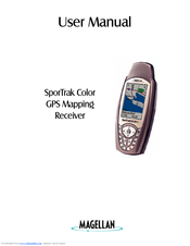
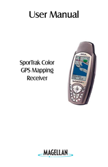
Magellan SporTrak Color User Manual (106 pages)
SporTrak Color GPS Mapping Receiver
Brand:
Magellan
| Category:
GPS
| Size: 4.43 MB
Table of Contents
User Manual
1
License Agreement
2
Table of Contents
3
Introduction
9
About this User Manual
9
Setting up the Sportrak
11
Installing the Batteries
11
Selecting Language
12
Initialization for First Time Use
12
Turning the Sportrak on
12
Enter Your Approximate Position (Initialize)
13
Basic Operation
15
Sportrak Color GPS Receiver
15
Turning Power On/Off
16
Turning the Backlight On/Off
16
Adjusting the Contrast
17
Getting a Position Fix
17
Navigational Screens
17
Map Screen
18
Compass Screen
18
Large Data Screen
18
Position Screens
18
Road Screen
19
Data Screen
19
Speed Screen
19
Satellite Status Screen
19
Accessing the Navigation Screens
19
Saving a Waypoint
20
Using GOTO Routes
22
Creating a GOTO Route
22
Navigating on a Goto Route
23
Navigating on a GOTO Route
24
Summary
24
Reference
25
Power/Backlight/Contrast
25
Turn the Sportrak on
25
Turn the Sportrak off
25
Using the Display Backlight
25
Adjusting the Display Contrast
26
Navigational Screens
26
Selecting NAV Screens
26
Returning to Last Viewed NAV Screen
26
Map Screen
26
Customizing the Map Display
29
Selecting Map Items
29
Setting the Map Detail
29
Turning On/Off Display Waypoints
29
Turning On/Off Topographic Lines
29
Turning On/Off Track Lines
29
Globally Turning Map Items On/Off
30
Setting up Map Data Fields
30
Turning On/Off Displayed Poi's
30
Changing the Data Fields
31
Selecting the Data Fields
31
Turning Data Fields On/Off
31
Two Data Fields Description
31
Horizontal Profile Description
32
Street Information Description
32
Terrain Projection Description
32
Changing the Map Orientation
33
Auto Vs. Auto Detailed
34
Selecting Primary Usage
34
Selecting Track Mode
34
Highlighted Road Vertical Profile Description
35
Selecting Vertical Profile
35
Track History Description
35
Using Vertical Profile
35
Path Check Description
36
Route Vertical Profile Description
36
Compass Screen
37
Customizing the Data Fields
37
Large Data Screen
38
Customizing the Data Fields
38
Position Screen
39
Customizing the Data Fields
39
Resetting the Trip Odometer
39
Selecting the Position Screen
39
GPS Status Messages
41
Selecting Coordinate System, Map Datum and Elevation Mode
41
Projecting a Waypoint
42
Road Screen
43
Customizing the Data Fields
43
Data Screen
44
Customizing the Data Fields
44
Speed Screen
45
Customizing the Data Fields
45
Satellite Status Screen
46
Waypoints / Database
47
Accessing Waypoints in the Database
47
Selecting Waypoints from the Alphabetical List
47
Selecting Waypoints from the Nearest List
47
Selecting Waypoints Nearest to the Cursor
48
Saving Present Position as a Waypoint
48
Creating New Waypoint Manually
48
Creating New Waypoint with Map Cursor
49
Deleting a User Waypoint
49
Editing a User Waypoint
49
Viewing a Map Object on the Map
50
Viewing a User Waypoint on the Map
50
Saving a Map Object as a User Waypoint
50
Searching for a Street Address
51
Routes
52
Creating a GOTO Route
52
Creating a Backtrack Route
52
Creating a Multileg Route
52
Activating/Deactivating a Route
54
Viewing a Route
54
Editing a Route
54
Appending a Leg
55
Deleting a Leg
55
Inserting a Leg
55
Replacing a Leg
55
Appending a Newly Created Waypoint to a Route
56
Reversing a Route
56
Deleting a Route
56
Viewing a Route on the Map Screen
56
Creating a Route Using Track History
56
Setup
57
Initializing the Sportrak
57
Turning the NAV Screens On/Off
57
Selecting the Coordinate System
58
Selecting a Map Datum
58
Selecting the Elevation Mode
58
Selecting the Time Format
59
Selecting NAV Units
59
Selecting the North Reference
59
Setting the Backlight Timer
59
Turning the Beeper On/Off
60
Selecting NMEA Message
60
Selecting the Baud Rate
60
Seletcting Daylight Savings Time
61
Power off Timer
61
Changing Languages
62
Changing the Power Key Settings
62
Clearing Memory
63
Clearing Track History
63
Clearing Wpts/Routes
63
Clearing All Routes
63
Resetting Sportrak to Factory Defaults
63
Clearing All Memory in the Sportrak
63
Sun/Moon Display
64
Accessing the Sun/Moon Screen
64
Changing the Sun/Moon Date
64
Changing the Sun/Moon Position
64
Fish/Hunt Times Display
65
Accessing the Fish/Hunt Screen
65
Changing the Fish/Hunt Date
65
Changing the Fish/Hunt Position
65
Sportrak Alarms
66
Setting the Arrival Alarm
66
Setting the Anchor Alarm
66
Setting the XTE Alarm
66
Setting the GPS Fix Alarm
66
Using the Simulator
67
Turning on the Simulator - Auto Mode
67
Turning on the Simulator - User Mode
67
Turning the Simulator off
67
About Screen
68
Help Screen
68
Frequently Asked Questions
69
Output Data
71
Appendix
72
Troubleshooting
72
Waypoint Icons
73
Contacting Magellan
74
Specifications
75
Compass
76
Heading Vs. Bearing Vs. Course over Ground
76
Navigating with the Compass Screen
78
Calibrating the Compass
78
Extended Calibration
79
Using the Barometer and Temperature Screens
82
Accessories
84
Mapsend Streets
85
Using Mapsend
86
Connecting to External Devices
89
Connecting to External Power Source
90
Waas
91
Glossary
92
Advertisement
Magellan SporTrak Color User Manual (74 pages)
Magellan (Thales Navigation) GPS Receiver User Manual GPS 315, 320
Brand:
Magellan
| Category:
GPS
| Size: 3.14 MB
Table of Contents
License Agreement
2
Table of Contents
3
Introduction
9
Sportrak User Manual
9
Sportrak GPS Receiver
10
Getting Started
11
Installing the Batteries
11
Proper Handling - Signal Reception
12
Power on
12
Initialize
13
Initialize for First Time Use
13
Select Language
13
Key Layout Screen
14
Initialize Alert
14
Select Approximate Position
14
Getting a Fixed Position
17
Saving Your Waypoint
17
Basic Operation
19
Entering Information
19
Navigation Screens
19
Using the Status Screen
20
Using the Position Screen
21
Using the NAV 1 Screen
22
Customizing the NAV 1 Screen
22
Using the Compass Screen
23
Customizing the Compass Screen
23
Using the NAV 2 Screen
24
Customizing the NAV 2 Screen
24
Using the Plot Screen
25
Selecting PAN-N-SCAN
26
Setting Track History
26
Clearing Track History
26
Setting up the Plotter
27
Setting Hide Data/Show Data
28
Using the Road Screen
29
Customizing the Road Screen
29
Using the Speed Screen
30
Resetting the Odometer
30
Resetting the Trip Odometer
31
Setting the Speed Average
31
Using the Time Screen
32
Selecting Time Format
32
Resetting Elapsed Time
33
Reference
34
Working with Waypoints
35
Creating a User Waypoint
36
Editing a User Waypoint
36
Creating, Editing, Deleting a Message
37
Deleting a User Waypoint
37
Finding a Non-Userwaypoint
38
Sorting a Waypoint
38
Projecting a Waypoint
38
Datasend™ CD (Optional)
39
Using Datasend
39
Working with Routes
40
Creating/Clearing a GOTO
40
Creating a GOTO on the Plotter Screen
40
Creating a man over Board Route
41
Creating a Backtrack Route
41
Creating a Multi-Leg Route
42
Viewing/Editing a Route
43
Inserting a Leg
43
Changing a Waypoint in a Route
43
Adding a Waypoint at the End of
44
Route
44
Deleting a Waypoint in a Route
44
Saving a Route
44
Activating/Deactivating a Route
44
Reversing a Route
45
Using Plot View in a Route
45
Deleting a Route
45
Working with Trackroute
46
Auxiliary Functions
47
Working with Sun/Moon and Fish/Hunt
47
Selecting the Simulate Mode
48
Selecting Contrast
48
Selecting Alarm/Message
49
Accessing the Alarm/Message Menu
49
Selecting Anchor Alarm
49
Selecting Arrival Alarm
50
Selecting XTE Alarm
50
Selecting Proximity Alarm
50
Selecting GPS Fix Alarm
51
Viewing the Alarm/Msg Menu
52
Selecting Alarm Defaults
52
Clearing Alarm Defaults
52
Selecting Language
52
Customizing
53
Selecting Setup
53
Selecting Initialize
53
Disabling NAV Screens
53
Selecting a Coordinate System
54
Selecting Map Datum
55
Selecting Elevation Mode
55
Selecting Time Format
56
Selecting NAV Units
56
Selecting North Reference
56
Selecting Light Timer
57
Selecting the Beeper
57
Selecting Personalize
57
Selecting Clear Memory
58
Selecting NMEA
58
Selecting Baud Rate
59
Troubleshooting
60
Frequently Asked Questions
61
Contacting Magellan
64
Connecting to the Sportrak
65
Waas
67
Available Datums
68
Magellan SporTrak Color User Manual (48 pages)
GPS Mapping Receiver
Brand:
Magellan
| Category:
GPS
| Size: 1.27 MB
Table of Contents
User Manual
1
License Agreement
2
Thales Navigation Magellan Products Limited Warranty
3
Table of Contents
5
Introduction
11
About this User Manual
11
Setting up the Sportrak
13
Installing the Batteries
13
Selecting Language
14
Initialization for First Time Use
14
Turning the Sportrak on
14
Enter Your Approximate Position (Initialize)
15
Basic Operation
17
Sportrak Color GPS Receiver
17
Turning Power On/Off
18
Turning the Backlight On/Off
18
Adjusting the Contrast
19
Getting a Position Fix
19
Navigational Screens
19
Map Screen
20
Compass Screen
20
Large Data Screen
20
Position Screens
20
Road Screen
21
Data Screen
21
Speed Screen
21
Satellite Status Screen
21
Accessing the Navigation Screens
21
Saving a Waypoint
22
Using GOTO Routes
24
Creating a GOTO Route
24
Navigating on a GOTO Route
26
Summary
26
Reference
27
Power/Backlight/Contrast
27
Turn the Sportrak on
27
Turn the Sportrak off
27
Using the Display Backlight
27
Adjusting the Display Contrast
28
Navigational Screens
28
Selecting NAV Screens
28
Returning to Last Viewed NAV Screen
28
Map Screen
28
Customizing the Map Display
31
Selecting Map Items
31
Setting the Map Detail
31
Turning On/Off Display Waypoints
31
Turning On/Off Topographic Lines
31
Turning On/Off Track Lines
31
Globally Turning Map Items On/Off
32
Setting up Map Data Fields
32
Turning On/Off Displayed Poi's
32
Changing the Data Fields
33
Selecting the Data Fields
33
Turning Data Fields On/Off
33
Two Data Fields Description
33
Horizontal Profile Description
34
Street Information Description
34
Terrain Projection Description
34
Changing the Map Orientation
35
Auto Vs. Auto Detailed
36
Selecting Primary Usage
36
Selecting Track Mode
36
Selecting Vertical Profile
37
Track History Description
37
Using Vertical Profile
37
Highlighted Road Vertical Profile Description
37
Route Vertical Profile Description
38
Path Check Description
38
Compass Screen
39
Customizing the Data Fields
39
Large Data Screen
40
Customizing the Data Fields
40
Position Screen
41
Selecting the Position Screen
41
Resetting the Trip Odometer
41
Customizing the Data Fields
41
GPS Status Messages
43
Selecting Coordinate System, Map Datum and Elevation Mode
43
Projecting a Waypoint
44
Road Screen
45
Customizing the Data Fields
45
Data Screen
46
Customizing the Data Fields
46
Speed Screen
47
Customizing the Data Fields
47
Satellite Status Screen
48
Advertisement
Magellan SporTrak Color User Manual (48 pages)
GPS Mapping Receiver
Brand:
Magellan
| Category:
GPS
| Size: 1.27 MB
Table of Contents
User Manual
1
License Agreement
2
Thales Navigation Magellan Products Limited Warranty
3
Table of Contents
5
Introduction
11
About this User Manual
11
Setting up the Sportrak
13
Installing the Batteries
13
Selecting Language
14
Initialization for First Time Use
14
Turning the Sportrak on
14
Enter Your Approximate Position (Initialize)
15
Basic Operation
17
Sportrak Color GPS Receiver
17
Turning Power On/Off
18
Turning the Backlight On/Off
18
Adjusting the Contrast
19
Getting a Position Fix
19
Navigational Screens
19
Map Screen
20
Compass Screen
20
Large Data Screen
20
Position Screens
20
Road Screen
21
Data Screen
21
Speed Screen
21
Satellite Status Screen
21
Accessing the Navigation Screens
21
Saving a Waypoint
22
Using GOTO Routes
24
Creating a GOTO Route
24
Navigating on a GOTO Route
26
Summary
26
Reference
27
Power/Backlight/Contrast
27
Turn the Sportrak on
27
Turn the Sportrak off
27
Using the Display Backlight
27
Adjusting the Display Contrast
28
Navigational Screens
28
Selecting NAV Screens
28
Returning to Last Viewed NAV Screen
28
Map Screen
28
Customizing the Map Display
31
Selecting Map Items
31
Setting the Map Detail
31
Turning On/Off Display Waypoints
31
Turning On/Off Topographic Lines
31
Turning On/Off Track Lines
31
Globally Turning Map Items On/Off
32
Setting up Map Data Fields
32
Turning On/Off Displayed Poi's
32
Changing the Data Fields
33
Selecting the Data Fields
33
Turning Data Fields On/Off
33
Two Data Fields Description
33
Horizontal Profile Description
34
Street Information Description
34
Terrain Projection Description
34
Changing the Map Orientation
35
Auto Vs. Auto Detailed
36
Selecting Primary Usage
36
Selecting Track Mode
36
Selecting Vertical Profile
37
Track History Description
37
Using Vertical Profile
37
Highlighted Road Vertical Profile Description
37
Route Vertical Profile Description
38
Path Check Description
38
Compass Screen
39
Customizing the Data Fields
39
Large Data Screen
40
Customizing the Data Fields
40
Position Screen
41
Selecting the Position Screen
41
Resetting the Trip Odometer
41
Customizing the Data Fields
41
GPS Status Messages
43
Selecting Coordinate System, Map Datum and Elevation Mode
43
Projecting a Waypoint
44
Road Screen
45
Customizing the Data Fields
45
Data Screen
46
Customizing the Data Fields
46
Speed Screen
47
Customizing the Data Fields
47
Satellite Status Screen
48
Magellan SporTrak Color User Manual Addendum (112 pages)
Magellan SporTrak SporTrak Color: Supplementary Guide
Brand:
Magellan
| Category:
GPS
| Size: 1.6 MB
Magellan SporTrak Color Reference Manual (49 pages)
GPS Mapping Receiver
Brand:
Magellan
| Category:
GPS
| Size: 1.29 MB
Table of Contents
New Destination
9
Clearing Memory
17
Sun / Moon Display
18
Using the Simulator
21
Help Screen
22
Frequently Asked Questions
23
Output Data
25
Troubleshooting
26
Waypoint Icons
27
Contacting Magellan
28
Specifications
29
Navigating with the Compass Screen
32
Calibrating the Compass
32
Extended Calibration
33
Using the Barometer and Temperature Screens
36
Mapsend Streets
39
Using Mapsend
40
Connecting to External Devices
43
Advertisement
Related Products
Magellan SporTrak SporTrak Color
Magellan SporTrak Pro Marine - Hiking GPS Receiver
Magellan GPS Satellite Navigator Meridian XL
Magellan RoadMate SE4
Magellan smartGPS
Magellan SporTrak Series
Magellan Switch series
Magellan Switch
Magellan 300GPS
Magellan 330 Series
Magellan Categories
GPS
Car Navigation system
Security System
Keypad
Tent
More Magellan Manuals
Login
Sign In
OR
Sign in with Facebook
Sign in with Google
Upload manual
Upload from disk
Upload from URL