Sign In
Upload
Manuals
Brands
kaarta Manuals
GPS
STENCIL 2
kaarta STENCIL 2 Mobile Mapping System Manuals
Manuals and User Guides for kaarta STENCIL 2 Mobile Mapping System. We have
2
kaarta STENCIL 2 Mobile Mapping System manuals available for free PDF download: User Manual, Quick Start Manual
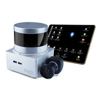
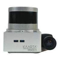
kaarta STENCIL 2 User Manual (147 pages)
Brand:
kaarta
| Category:
Analytical Instruments
| Size: 15.23 MB
Table of Contents
Care
2
Introduction
2
Overview
2
Scope
2
Release Notes
3
Table of Contents
5
Chapter 1
10
Getting Started
10
What's in the Box
10
Getting to Know Stencil 2
10
Getting to Know Stencil 2 - Older Units
11
Status Indicator
12
Power/Operating Mode Buttons
13
Using Stencil 2 out of the Box
14
Before You Begin Mapping
14
Start Mapping
14
Stop Mapping
14
Scan Folder Contents
15
Chapter 2
18
Stencil 2 Operations
18
It's a Computer
18
Using the Ipad
18
Desktop Icons
20
Tool Icons
22
Mapping with the Feature Tracker
24
Feature Tracker Best Practice
25
Recording Color Images While Mapping
26
Using the Mode Switch Icons
26
Kaarta User Interface
28
File Structure-Mapping/Localizing Scans
32
Localization
34
Localizing Based on a Prior Map Overview
35
Confidence Values
36
Chapter 3
38
Tools for Additional Functionality
38
Loop Closure Tool
38
Sharpening Tool
38
Floor Planner Tool
39
Command Line Tools
42
Cloudcompare Command Line Editor Tool (ALPHA VERSION)
49
Using Point Clouds from Other Programs
50
Chapter 4
52
GNSS Operations
52
Integrating GNSS with Stencil
52
GPS Setup
52
GNSS Monitor Status
53
Syncing Stencil Clock to GNSS Time
53
Finding the USB Port on Stencil 2, if Not Known
53
Recording GNSS Raw Data to Use for PPK Processing
54
Processing PPK Data
54
Using the Loop Closure Tool Overview
55
Key Poses and Geo-Locating Point Clouds
56
Loop Closure Using Confidence Values
59
Running Loop Closure Twice
59
Loop Closure with GNSS Data
60
Loop Closure Tool Settings
60
GNSS Loop Closure Example
69
Loop Closure Tool Effect
70
Using Separately Logged Data in the Loop Closure Tool
72
Using Non-GNSS Data for Loop Closure
73
Chapter 5
74
Case Studies
74
Case Study 1: Loop Closure Mapping Without GNSS Data
74
Case Study 2: Ground Vehicle Navigation
76
Case Study 3: Air-Ground Collaborative Mapping
77
Chapter 6
79
Tips for Collecting Better Data
79
General
79
Handheld Scanning - Indoors
80
Handheld Scanning - Outdoors
80
Vehicle Mounted Scanning
81
Aerial Scanning
82
Request for Additional Scanning Tips
82
Problems / Issues
83
. P L y F I L E E R R O R O R N O N - G E N E R a T I O N
83
Sun Glare
83
Double Registration
84
Small Rooms/Narrow Hallways
85
Reflections
86
Darker/Brighter Environments
86
Using Cloudcompare
87
Visualization Basics
87
Colorize Point Cloud by Z-Coordinates
89
Colorizing the Point Cloud by Time Using Scalar Fields
90
Colorization Scales and Intensity Values
91
Geo-Locating Point Clouds
94
Cleaning and Merging .Ply Files
96
Point Cloud Cleanup
96
Merging Point Clouds
97
ICP Matching in Cloudcompare
97
Chapter 7
102
Faq
102
Customizing Velodyne Wiring
108
Wiring the Connector
108
Mounting Stencil 2
110
Parameter Definitions
111
Typical Parameters to Set
122
Working with ROS
124
Mode Switching Commands
124
Start / Stop Mapping Using ROS Commands
124
Creating a Reference Map for Localization
124
Remote Commands Not Supported
125
Coordinate Transforms for Localization
125
Important Localization Topics
126
Reporting Global Position During Localization
126
Localizing Based on Current GNSS Location
126
Sensor Calibration
128
Ethernet
128
Replaying Stencil 2 Data
133
Replaying Bag Files in Localization Mode
135
Advertisement
kaarta STENCIL 2 Quick Start Manual (2 pages)
Brand:
kaarta
| Category:
GPS
| Size: 1.89 MB
Advertisement
Related Products
kaarta STENCIL 2-16
kaarta STENCIL 2-32
kaarta STENCIL PRO
kaarta Categories
Scanner
Measuring Instruments
Analytical Instruments
GPS
Automobile Accessories
More kaarta Manuals
Login
Sign In
OR
Sign in with Facebook
Sign in with Google
Upload manual
Upload from disk
Upload from URL