Sign In
Upload
Manuals
Brands
Garmin Manuals
GPS
GPSMAP 520 - Marine GPS Receiver
Garmin GPSMAP 520 - Marine GPS Receiver Manuals
Manuals and User Guides for Garmin GPSMAP 520 - Marine GPS Receiver. We have
10
Garmin GPSMAP 520 - Marine GPS Receiver manuals available for free PDF download: Owner's Manual, Gebruikershandleiding, Instructions Manual, Installation Instructions Manual, Quick Reference Manual, Reference Manual, Quick Start Manual, Declaration Of Conformity
Garmin GPSMAP 520 - Marine GPS Receiver Owner's Manual (132 pages)
2-way Radio & GPS
Brand:
Garmin
| Category:
Two-Way Radio
| Size: 1 MB
Table of Contents
Warnings and Cautions
4
Table of Contents
8
Introduction
11
Getting to Know Your Rino 520/530
11
Front of the Rino 520/530
12
Back of the Rino 520/530
13
Main Display Pages
14
Operating the Rino 520/530
15
Shortcuts Menu
15
Status Bar Overview
16
Pop-Up Messages
16
Unit Operation
17
Radio Page
17
Initializing the Rino 520/530
17
Using Name and Symbol Fields
18
Setting the Channel and Code
20
Adjusting the Volume and Squelch Level
21
Scanning and Monitoring
22
Radio Page Option Menu
23
Setup Radio
24
Setup Tones
26
Setup Scanlist
26
Use Weather Radio
27
Use Weather Alert
27
Turn Radio/Gps On/Off
28
Status Window
28
GPS Status
28
Radio Transmission/Reception Status
28
Radio Page Status Indicators
29
Using the Rino 520/530 Radio Features
30
Peer-To-Peer Positioning
30
New Contact Page Overview
30
Sending a Location
33
Map Page
34
Map Page Options
36
Using the Pan Map Option
37
Programming the Data Fields
38
Data Field Options
38
Guidance Text
38
Setting up the Map
39
General Setup
40
Tracks Setup
40
Text Setup
41
Measuring Distance
41
Compass Page
42
Using the Compass Page
42
Compass Page Options
44
Using Sight 'N Go
45
Calibrating the Compass
45
Altimeter Page
47
Altimeter Page Options
48
Viewing Pressure/Elevation Plots
49
Adjusting the Zoom Ranges
49
Pan Plot
50
Resetting Data
50
Calibrating the Altimeter
51
Programming Data Fields
51
Main Menu Page
52
Satellite Page
53
Sky View Graphic
53
Waas
54
Satellite Strength
54
Satellite Page Options
55
Trip Computer Page
57
Trip Computer Page Options
57
Waypoints
58
Mark Waypoint Page
58
Creating Waypoints
59
Averaging a Waypoint
60
Projecting a Waypoint
60
Editing a Waypoint
60
Find
62
Finding a Waypoint
63
Finding a Geocache
64
Finding a Contact
65
Finding a City
66
Finding an Exit
67
Finding a Point of Interest
68
Finding an Address or Intersection
70
Recent Finds
72
Using Go to Navigation
73
Tracks Page
74
Using the Tracback Feature
75
Setting up the Track Log
77
Using Track Profiles
77
Routes Page
78
Creating and Using a Route
78
Editing a Route
79
Adding or Editing from the Route Map Page
82
Setting up Routing Methods
83
Navigating a Route
84
Using the Turn-By-Turn Active Route Page
84
Highway Page
85
Setup Pages
86
System Setup Page
86
Radio Setup Page
87
Display Setup Page
87
Tones Setup Page
88
Page Sequence Setup
88
Map Setup Page
88
Routing Setup Page
89
Geocache Setup
89
Marine Setup
89
Time Setup Page
90
Units Setup Page
91
LORAN TD Format
91
Heading Setup Page
93
Calibration Setup Page
93
Altimeter Setup
94
Welcome Page Setup
94
Interface Setup Page
95
Proximity Waypoints
97
Calendar
98
Alarm Clock
100
Calculator
101
Stopwatch
102
Stopwatch Lap Options
102
Sun & Moon
103
Hunt & Fish
104
Games
105
Memory Race
105
Geko Smak
105
Nibbons
106
Gekoids
106
Beast Hunt
106
Assimilation
107
Clothesline
107
Waypoint Bomber
107
Appendix
108
About FRS/GMRS Radio
108
FRS Features
108
Frs Limitations
109
Specifications
110
Battery Life
111
Standard Accessories Provided with the Unit
112
Optional Accessories
112
Installing Accessories
112
Transferring Mapsource Data
113
Radio Troubleshooting Guide
114
GPS Troubleshooting Guide
115
Radio Frequency Charts
116
FRS/GMRS Radio Frequency Chart
116
Weather Radio Frequency Chart
117
Data Field Definitions
119
Interface Information
121
FCC Compliance Information
122
FCC Licensing Information
123
Limited Warranty
124
Software License Agreement
126
Product Registration
126
Contact Garmin
126
Index
127
Advertisement
Garmin GPSMAP 520 - Marine GPS Receiver Owner's Manual (72 pages)
GPSMAP 500 Series
Brand:
Garmin
| Category:
GPS
| Size: 5 MB
Table of Contents
Tips and Shortcuts
3
Manual Conventions
3
Quick Links
3
Table of Contents
4
Warnings
6
Important Information
6
Getting Started
7
Unit Overview
7
Turning the Unit on or off
8
Adjusting the Backlight
8
Using the Keypad
9
Acquiring GPS Satellite Signals
10
Using Simulator Mode
10
Restoring Factory Settings
11
Viewing System Information
11
Inserting and Removing SD Cards
11
Understanding the Home Screen
12
Using Charts
13
Using the Navigation Chart
13
Navigation Chart Settings
14
Understanding Chart Data
15
Panning the Navigation Chart
15
Accessing Additional Object Information
16
Viewing Tide Station Information
17
Using Bluechart G2 Vision
17
Using Mariner's Eye 3D
18
Navigation Chart
18
Mariner's Eye 3D Settings
18
Using Fish Eye 3D
19
Fish Eye 3D Settings
19
Using Fishing Charts
19
Enabling High Resolution Satellite Imagery
20
Viewing Aerial Photos
21
Full Screen
21
Viewing Current Station Information
22
Detailed Road and POI Data
22
Using Automatic Guidance
22
Changing the Chart Settings
22
Changing the Chart Appearance
23
Using the Chart/Sonar Screen
24
Where to
25
Navigating to a Destination
25
Creating and Using Waypoints
27
Creating and Using Routes
29
Viewing Information
31
Viewing Numbers
31
Viewing Tide Station Information
32
Viewing Current Information
32
Viewing Celestial Information
33
Viewing User Data
33
Viewing Other Boats
34
Configuring the Unit
35
Configuring System Settings
35
Changing Units of Measure
35
Configuring Communications Settings
36
Setting Alarms
37
Setting Navigation Alarms
37
Setting System Alarms
37
Setting Sonar Alarms
38
Setting Weather Alarms
38
Configuring My Boat
38
Configuring Other Boats
40
Configuring XM Audio
40
Using Sonar
41
Understanding the Full Screen
41
Understanding the Flasher
41
Understanding the Split Freq Screen
42
Understanding the Split Zoom Screen
42
Understanding the Temp Log Screen
43
Setting up Sonar
43
Advanced Sonar Settings
44
Installing the Unit
45
Step 1: Select a Location
45
Step 2: Mount the Unit
46
Step 3: Install the Transducer
48
Mounting the Transducer on a Transom
50
Shoot-Thru-Hull Installation
52
Step 4: Install the Wiring Harness
54
Step 5: Test the Installation
57
Appendix
59
Specifications
59
Product Registration
60
Caring for the Unit
60
Contact Garmin
60
Water Immersion
60
Alarms and Messages
61
Weather Data Warranty
65
XM Satellite Radio Service Agreement
66
Software License Agreement
66
Limited Warranty
67
FCC Compliance
68
Industry Canada Compliance
68
Declaration of Conformity (Doc)
68
Optional Accessories
68
Index
69
Garmin GPSMAP 520 - Marine GPS Receiver Owner's Manual (72 pages)
GPSMAP 400 Series; GPSMAP 500 Series
Brand:
Garmin
| Category:
GPS
| Size: 2 MB
Table of Contents
Tips and Shortcuts
3
Manual Conventions
3
Quick Links
3
Table of Contents
4
Declaration of Conformity (Doc)
6
Product Registration
6
Contact Garmin
6
Getting Started
7
Unit Overview
7
Turning the Unit on or off
9
Initializing Unit Settings
9
Adjusting the Backlight
10
Using the Keypad
11
Acquiring GPS Satellite Signals
11
Using Simulator Mode
12
Viewing System Information
12
Restoring the Original Factory Settings
12
Inserting and Removing SD Cards
12
Understanding the Home Screen
13
Using Charts
14
Using the Navigation Chart
14
Navigation Chart Menu
15
Understanding Chart Data
16
Navigating to a Point on the Chart
17
Changing the Navigation Chart Settings
18
Changing the Chart Appearance
19
Using the Split Navigation Chart
20
Using Perspective 3D
21
Using Mariner's Eye 3D
22
Using Fish Eye 3D
23
Fish Eye 3D Settings
23
Using Fishing Charts
24
Enabling High Resolution Satellite Imagery
25
Viewing Aerial Photos
26
Viewing Current-Station Information
26
Detailed Road and POI Data
27
Using Automatic Guidance
27
Using the Chart/Sonar Screen
27
Where to
28
Navigating to a Destination
28
Creating and Using Waypoints
30
Creating and Using Routes
31
Using Tracks
32
Using Bluechart G2 Vision
34
Navigating with a Garmin Autopilot
35
Viewing Information
36
Viewing a Compass
36
Viewing Numbers
36
Viewing Trip Information
37
Viewing Fuel Gauges
37
Viewing Tide-Station Information
38
Viewing Current Information
38
Viewing User Data
39
Viewing Other Vessels
41
Configuring the Chartplotter
43
Configuring System Settings
43
Configuring Units of Measure
43
Changing the System Language
44
Configuring Navigation Preferences
44
Configuring Communications Settings
45
Setting Alarms
46
Setting Navigation Alarms
46
Setting System Alarms
47
Setting Sonar Alarms
47
Setting the Total Fuel Onboard Alarm
47
Configuring My Boat
48
Configuring Other Vessels
49
Using Sonar
50
Understanding the Full Screen
50
Understanding the Split Frequency Screen
50
Understanding the Split Zoom Screen
51
Understanding the Temp Log Screen
51
Setting up Sonar
52
Advanced Sonar Settings
53
Digital Selective Calling (DSC)
55
Using the Chartplotter with a VHF Radio
55
Adding a DSC Contact
56
Viewing the DSC List
56
Receiving Distress Calls
56
Man-Overboard Distress Calls Initiated from a VHF Radio
57
Man-Overboard Distress Calls Initiated from the Chartplotter
57
Position Tracking
57
Placing an Individual Routine Call
58
Calling an AIS Target
59
Appendix
60
Specifications
60
Physical Specifications
60
Alarms and Messages
61
Capturing Screenshots
64
Caring for the Unit
65
Cleaning the Case
65
Cleaning the Screen
65
Software License Agreement
66
Index
67
Advertisement
Garmin GPSMAP 520 - Marine GPS Receiver Instructions Manual (28 pages)
Flush Mount Kit Instructions (multilingual)
Brand:
Garmin
| Category:
Accessories
| Size: 0 MB
Garmin GPSMAP 520 - Marine GPS Receiver Installation Instructions Manual (12 pages)
GPSMAP 400 Series; GPSMAP 500 Series
Brand:
Garmin
| Category:
GPS
| Size: 2 MB
Table of Contents
Selecting a Mounting Location
2
Mounting the Chartplotter
2
Shoot-Thru-Hull Installation
5
Installing the Wiring Harness
6
Connecting the Wiring Harness to Power
6
Testing the Installation
9
Physical Specifications
10
Garmin GPSMAP 520 - Marine GPS Receiver Reference Manual (2 pages)
Garmin GPSMAP 431: Reference Guide
Brand:
Garmin
| Category:
GPS
| Size: 0 MB
Table of Contents
Finding a Marine Service and Navigating to It
1
Marking a Waypoint or man Overboard (MOB)
1
Searching for a Destination by Name
1
Editing or Deleting a Waypoint
1
Turning the Unit on or off
2
Acquiring GPS Satellite Signals
2
Adjusting the Display Settings
2
Panning and Zooming on the Navigation Chart
2
Zooming in and out on the Map
2
Using Routes and Tracks
2
Using the Keypad
2
Garmin GPSMAP 520 - Marine GPS Receiver Quick Reference Manual (2 pages)
Garmin GPSMAP 400: Reference Guide
Brand:
Garmin
| Category:
GPS
| Size: 0 MB
Table of Contents
Where to Creating and Using Waypoints
1
Turning the Unit on or off Using the Keypad
2
Acquiring GPS Satellite Signals
2
Creating and Using Routes
2
Adjusting the Backlight
2
Panning the Navigation Chart
2
Zooming in and out on the Map
2
Garmin GPSMAP 520 - Marine GPS Receiver Quick Start Manual (2 pages)
2-way radio & GPS
Brand:
Garmin
| Category:
Two-Way Radio
| Size: 0 MB
Garmin GPSMAP 520 - Marine GPS Receiver Declaration Of Conformity (1 page)
Declaration of Conformity
Brand:
Garmin
| Category:
Marine GPS System
| Size: 0 MB
(Dutch) Garmin GPSMAP 520 - Marine GPS Receiver Gebruikershandleiding (72 pages)
GPSMAP 500-SERIE
Brand:
Garmin
| Category:
Marine GPS System
| Size: 5 MB
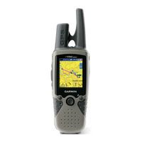
Table of Contents
Tips en Snelkoppelingen
3
Uitleg Van de Handleiding
3
Snelkoppelingen
3
Table of Contents
4
Waarschuwingen
6
Belangrijke Informatie
6
Aan de Slag
7
Overzicht Van Het Apparaat
7
Het Apparaat In- of Uitschakelen
8
De Schermverlichting Aanpassen
8
Het Toetsenbord Gebruiken
9
GPS-Satellietsignalen Ontvangen
10
De Simulatormodus Gebruiken
10
De Fabrieksinstellingen Herstellen
11
Systeeminformatie Weergeven
11
SD-Kaarten Plaatsen en Verwijderen
11
Het Startscherm
12
Kaarten Gebruiken
13
De Navigatiekaart Gebruiken
13
Informatie Van Het Getijdenstation Weergeven
17
Bluechart G2 Vision Gebruiken
17
Mariner's Eye 3D Gebruiken
18
Fish Eye 3D Gebruiken
19
Viskaarten Gebruiken
19
Satellietbeelden Met Hoge Resolutie Inschakelen
20
Luchtfoto's Weergeven
21
Informatie Van Het Getijdenstation Weergeven
22
Gedetailleerde Gegevens Voor Wegen en Poi's
22
Automatische Begeleiding Gebruiken
22
De Kaartinstellingen Wijzigen
22
Het Scherm Kaart/Sonar Gebruiken
24
Waarheen
25
Navigeren Naar Een Bestemming
25
Waypoints Maken en Gebruiken
27
Routes Maken en Gebruiken
29
Informatie Weergeven
31
Cijfers Weergeven
31
Informatie Van Het Getijdenstation Weergeven
32
Huidige Informatie Weergeven
32
Informatie over Zon en Maan Weergeven
33
Gebruikersgegevens Weergeven
33
Andere Boten Weergeven
34
Het Apparaat Configureren
35
Systeeminstellingen Configureren
35
Maateenheden Wijzigen
35
Communicatie-Instellingen Configureren
36
Alarmen Instellen
37
Mijn Boot Configureren
38
Andere Boten Configureren
40
XM Audio Configureren
40
Sonar Gebruiken
41
Het Volledige Scherm
41
De Flitser
41
Het Gesplitste Frequentiescherm
42
Het Gesplitste Zoomscherm
42
Het Temperatuurlogscherm
43
De Sonar Instellen
43
Geavanceerde Sonarinstellingen
44
Het Apparaat Installeren
45
Stap 1: Een Locatie Selecteren
45
Stap 2: Het Apparaat Bevestigen
46
Stap 3: de Transducer Installeren
48
Stap 4: de Kabelboom Installeren
54
Stap 5: de Installatie Testen
57
Appendix
59
Specificaties
59
Productregistratie
60
Onderhoud
60
De Behuizing Reinigen
60
Alarmen en Berichten
61
Garantie Met Betrekking Tot Weersinformatie
65
XM Satellite Radio-Serviceovereenkomst
66
Softwarelicentieovereenkomst
66
Beperkte Garantie
67
Voldoen Aan FCC-Regelgeving
68
Overeenstemming Met Canadese Regelgeving
68
Conformiteitsverklaring
68
Optionele Accessoires
68
Index
69
Advertisement
Related Products
Garmin GPSMAP 5208 - Marine GPS Receiver
Garmin GPSMAP 520s GPSMAP 520
Garmin GPSMAP 520/520s
Garmin GPSMAP 5212 - Marine GPS Receiver
Garmin GPSMAP 521
Garmin GPSMAP 526s
Garmin GPSMAP 526/526s
Garmin GPSMAP 525/525s
Garmin nuvi 52LM
Garmin GPSMAP 525 - Marine GPS Receiver
Garmin Categories
GPS
Watch
Car Navigation system
Avionics Display
Marine Equipment
More Garmin Manuals
Login
Sign In
OR
Sign in with Facebook
Sign in with Google
Upload manual
Upload from disk
Upload from URL