Sign In
Upload
Manuals
Brands
Garmin Manuals
GPS
ECHOMAP PLUS
Garmin ECHOMAP PLUS Manuals
Manuals and User Guides for Garmin ECHOMAP PLUS. We have
1
Garmin ECHOMAP PLUS manual available for free PDF download: Owner's Manual
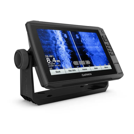
Garmin ECHOMAP PLUS Owner's Manual (128 pages)
Brand:
Garmin
| Category:
GPS
| Size: 9.06 MB
Table of Contents
Table of Contents
3
Introduction
9
ECHOMAP Plus 40 Device View
9
Device Keys
10
ECHOMAP Plus 60 Front View
11
Device Keys
12
ECHOMAP Plus 60 Connector View
12
ECHOMAP Plus 70/90 Front View
13
Device Keys
13
ECHOMAP Plus 70/90 Connector View
14
Assigning a Shortcut Key
14
Tips and Shortcuts
14
Accessing the Manuals from the Web
15
Inserting Memory Cards
15
Acquiring GPS Satellite Signals
15
Selecting the GPS Source
16
Customizing the Chartplotter
16
Customizing the Home Screen
16
Customizing Pages
16
Creating a New Combination Page with the ECHOMAP Plus 70/90
16
Creating a New Combination Page with the ECHOMAP Plus 60
17
Creating a New Combination Page with the ECHOMAP Plus 40
17
Customizing the Data Overlays
18
Setting the Vessel Type
18
Adjusting the Backlight
18
Adjusting the Color Mode
18
Changing the Background Image
18
Activecaptain App
19
Activecaptain Roles
19
Getting Started with the Activecaptain App
20
Enabling Smart Notifications
20
Receiving Notifications
21
Managing Notifications
21
Making Notifications Private
21
Updating Software with the Activecaptain App
22
Updating Charts with Activecaptain
22
Charts and 3D Chart Views
23
Navigation Chart and Fishing Chart
23
Zooming in and out of the Chart
23
Panning the Chart with the Keys
24
Selecting an Item on the Map Using the Device Keys
24
Chart Symbols
24
Measuring a Distance on the Chart
24
Creating a Waypoint on the Chart
24
Navigating to a Point on the Chart
25
Viewing Location and Object Information on a Chart
25
Viewing Details about Navaids
25
Heading Line and Angle Markers
26
Premium Charts
27
Viewing Tide Station Information
27
Showing Satellite Imagery on the Navigation Chart
28
Viewing Aerial Photos of Landmarks
29
Automatic Identification System
29
AIS Targeting Symbols
29
Heading and Projected Course of Activated AIS Targets
30
Activating a Target for an AIS Vessel
30
Viewing a List of AIS Threats
30
Setting the Safe-Zone Collision Alarm
31
AIS Aids to Navigation
31
AIS Distress Signals
32
Turning off AIS Reception
33
Chart Menu
33
Chart Layers
34
Fish Eye 3D Settings
37
Supported Maps
37
Garmin Quickdraw Contours Mapping
37
Mapping a Body of Water Using the Garmin Quickdraw Contours Feature
38
Adding a Label to a Garmin Quickdraw Contours Map
38
Garmin Quickdraw Community
38
Connecting to the Garmin Quickdraw Community with Activecaptain
38
Connecting to the Garmin Quickdraw Community with Garmin Connect
39
Garmin Quickdraw Contours Settings
40
Navigation with a Chartplotter
41
Basic Navigation Questions
42
Route Color Coding
42
Destinations
42
Searching for a Destination by Name
43
Selecting a Destination Using the Navigation Chart
43
Searching for a Marine Services Destination
43
Setting and Following a Direct Course Using Go to
43
Stopping Navigation
43
Waypoints
43
Marking Your Present Location as a Waypoint
44
Creating a Waypoint at a Different Location
44
Marking an MOB Location
44
Projecting a Waypoint
44
Viewing a List of All Waypoints
44
Editing a Saved Waypoint
44
Moving a Saved Waypoint
45
Browsing for and Navigating to a Saved Waypoint
45
Deleting a Waypoint or an MOB
45
Deleting All Waypoints
45
Routes
46
Creating and Navigating a Route from Your Present Location
46
Creating and Saving a Route
46
Viewing a List of Routes
46
Editing a Saved Route
46
Browsing for and Navigating a Saved Route
47
Browsing for and Navigating Parallel to a Saved Route
47
Deleting a Saved Route
47
Deleting All Saved Routes
47
Auto Guidance
48
Setting and Following an Auto Guidance Path
48
Creating and Saving an Auto Guidance Path
48
Adjusting an Auto Guidance Path
48
Canceling an Auto Guidance Calculation in Progress
49
Setting a Timed Arrival
49
Auto Guidance Path Configurations
49
Tracks
50
Showing Tracks
50
Setting the Color of the Active Track
50
Saving the Active Track
51
Viewing a List of Saved Tracks
51
Editing a Saved Track
51
Saving a Track as a Route
51
Browsing for and Navigating a Recorded Track
51
Deleting a Saved Track
51
Deleting All Saved Tracks
51
Retracing the Active Track
52
Clearing the Active Track
52
Managing the Track Log Memory During Recording
52
Configuring the Recording Interval of the Track Log
52
Boundaries
52
Creating a Boundary
53
Converting a Route to a Boundary
53
Converting a Track to a Boundary
53
Editing a Boundary
53
Setting a Boundary Alarm
53
Deleting a Boundary
53
Deleting All Saved Waypoints, Tracks, Routes, and Boundaries
53
Sailing Features
54
Setting the Vessel Type for Sailing Features
54
Sail Racing
54
Starting Line Guidance
54
Using the Race Timer
54
Setting the Distance between the Bow and the GPS Antenna
55
Laylines Settings
55
Setting the Keel Offset
56
Sailboat Autopilot Operation
57
Wind Hold
57
Tack and Gybe
57
Heading Line and Angle Markers
58
Setting the Heading Line and Angle Markers
58
Viewing Sailing Vessel Data
59
Sonar Fishfinder
59
Stopping the Transmission of Sonar Signals
59
Traditional Sonar View
60
Split-Frequency Sonar View
60
Split-Zoom Sonar View
60
Flasher View
61
Flasher Page Shortcuts
62
Garmin Clearvü Sonar View
63
Garmin Sidevü™ Sonar View
64
Sidevü Scanning Technology
65
Measuring Distance on the Sonar Screen
65
Panoptix Sonar Views
65
Livevü down Sonar View
66
Livevü Forward Sonar View
67
Realvü 3D Forward Sonar View
68
Realvü 3D down Sonar View
69
Realvü 3D Historical Sonar View
70
Frontvü Sonar View
71
Livescope Sonar View
71
Selecting the Transducer Type
72
Calibrating the Compass
72
Selecting a Sonar Source
72
Renaming a Sonar Source
73
Creating a Waypoint on the Sonar Screen
73
Pausing the Sonar Display
73
Viewing Sonar History
73
Sonar Sharing
73
Adjusting the Level of Detail
74
Adjusting the Color Intensity
74
Traditional, Garmin Clearvü, and Sidevü Sonar Setup
74
Setting the Zoom Level on the Sonar Screen
75
Setting the Scroll Speed
75
Adjusting the Range
75
Sonar Appearance Settings
76
Sonar Alarms
76
Advanced Sonar Settings
77
Transducer Installation Settings
77
Sonar Frequencies
78
Turning on the A-Scope
79
Panoptix Sonar Setup
79
Adjusting the Realvü Viewing Angle and Zoom Level
79
Adjusting the Realvü Sweep Speed
79
Livevü Forward and Frontvü Sonar Settings
80
Livevü and Frontvü Appearance Settings
81
Realvü Appearance Settings
81
Panoptix Transducer Installation Settings
82
Autopilot
83
Autopilot Screen
84
Adjusting the Step Steering Increment
84
Setting the Power Saver
84
Selecting the Preferred Heading Source
85
Enabling the Shadow Drive™ Feature
85
Engaging the Autopilot
85
Adjusting the Heading Using the Helm
85
Adjusting the Heading with the Chartplotter in Step Steering Mode
85
Steering Patterns
86
Following the U-Turn Pattern
86
Setting up and Following the Circles Pattern
86
Setting up and Following the Zigzag Pattern
86
Following the Williamson Turn Pattern
86
Reactor™ Autopilot Remote Control
86
Pairing a Reactor Autopilot Remote Control with a Chartplotter
87
Changing the Functions of the Reactor Autopilot Remote Control Action Keys
87
Force® Trolling Motor Control
87
Connecting to a Trolling Motor
87
Adding the Trolling Motor Controls to Screens
88
Trolling Motor Control Bar
88
Trolling Motor Settings
89
Assigning a Shortcut to the Trolling Motor Remote Control Shortcut Keys
89
Calibrating the Trolling Motor Compass
89
Setting the Bow Offset
90
Digital Selective Calling
90
Chartplotter and NMEA 0183 VHF Radio Functionality
90
Turning on DSC
90
DSC List
90
Viewing the DSC List
90
Adding a DSC Contact
90
Incoming Distress Calls
91
Navigating to a Vessel in Distress
91
Position Tracking
91
Viewing a Position Report
91
Navigating to a Tracked Vessel
91
Creating a Waypoint at the Position of a Tracked Vessel
91
Editing Information in a Position Report
92
Deleting a Position-Report Call
92
Viewing Vessel Trails on the Chart
92
Individual Routine Calls
92
Selecting a DSC Channel
92
Making an Individual Routine Call
92
Making an Individual Routine Call to an AIS Target
93
Gauges and Graphs
93
Viewing the Compass
93
Viewing Trip Gauges
93
Resetting Trip Gauges
93
Viewing Engine and Fuel Gauges
93
Engine Alert Icons
94
Selecting the Number of Engines Shown in Gauges
94
Customizing the Engines Shown in Gauges
94
Enabling Status Alarms for Engine Gauges
94
Enabling some Engine Gauge Status Alarms
94
Setting the Fuel Alarm
94
Setting the Fuel Capacity of the Vessel
95
Synchronizing the Fuel Data with the Actual Vessel Fuel
95
Viewing the Wind Gauges
95
Configuring the Sailing Wind Gauge
95
Configuring the Speed Source
95
Configuring the Heading Source of the Wind Gauge
95
Customizing the Close-Hauled Wind Gauge
96
Digital Switching
96
Adding and Editing a Digital Switching Page
96
Tide, Current, and Celestial Information
96
Tide Station Information
96
Current Station Information
97
Celestial Information
97
Viewing Tide Station, Current Station, or Celestial Information for a Different Date
97
Viewing Information for a Different Tide or Current Station
97
Media Player
97
Opening the Media Player
98
Media Player Icons
98
Selecting the Media Device and Source
98
Playing Music
98
Browsing for Music
98
Setting a Song to Repeat
98
Setting All Songs to Repeat
98
Setting Songs to Shuffle
99
Adjusting the Volume
99
Enabling and Disabling Zones
99
Muting the Media Volume
99
VHF Radio
99
Scanning VHF Channels
99
Adjusting the VHF Squelch
99
Radio
99
Setting the Tuner Region
99
Changing the Radio Station
99
Changing the Tuning Mode
100
Presets
100
DAB Playback
100
Setting the DAB Tuner Region
100
Scanning for DAB Stations
100
Changing DAB Stations
101
DAB Presets
101
Siriusxm Satellite Radio
101
Locating a Siriusxm Radio ID
101
Activating a Siriusxm Subscription
102
Customizing the Channel Guide
102
Saving a Siriusxm Channel to the Presets List
102
Unlocking Siriusxm Parental Controls
102
Setting the Device Name
103
Updating the Media Player Software
103
Device Configuration
103
Turning on the Chartplotter Automatically
103
System Settings
104
Display Settings
104
Satellite Positioning (GPS) Settings
104
Viewing the Event Log
104
Viewing System Software Information
104
Viewing E-Label Regulatory and Compliance Information
105
My Vessel Settings
105
Setting the Keel Offset
106
Setting the Water Temperature Offset
107
Setting the Fuel Capacity of the Vessel
107
Synchronizing the Fuel Data with the Actual Vessel Fuel
107
Customizing Engine Gauge and Fuel Gauge Limits
107
Communications Settings
108
Nmea 0183
108
NMEA 2000 Settings
108
Wi-Fi Network
109
Setting Alarms
109
Navigation Alarms
109
System Alarms
110
Setting the Fuel Alarm
110
Units Settings
110
Navigation Settings
110
Other Vessel Settings
111
Restoring the Original Chartplotter Factory Settings
111
Sharing and Managing User Data
111
Connecting to a Garmin Device to Share User Data
112
User Data Sharing Cable Wiring Diagram
112
Selecting a File Type for Third-Party Waypoints and Routes
113
Copying User Data from a Memory Card
113
Copying User Data to a Memory Card
113
Backing up Data to a Computer
114
Restoring Backup Data to a Chartplotter
114
Saving System Information to a Memory Card
114
Clearing Saved Data
114
Appendix
115
Activecaptain and Garmin Express
115
Garmin Express App
115
Installing the Garmin Express App on a Computer
115
Registering Your Device Using the Garmin Express App
116
Updating Your Charts Using the Garmin Express App
117
Software Updates
117
Cleaning the Screen
118
Screenshots
118
Capturing Screenshots
119
Copying Screenshots to a
119
Computer
119
Troubleshooting
119
My Device will Not Acquire GPS
119
Signals
119
My Device will Not Turn on or Keeps Turning off
119
My Sonar Does Not Work
120
My Device Is Not Creating Waypoints in the Correct Location
120
My Device Does Not Display the Correct Time
120
Garmin Support Center
120
Specifications
121
All Models
121
4-Inch Models
121
6-Inch Models
122
9-Inch Models
123
Sonar Models Specifications
123
NMEA 0183 Information
124
NMEA 2000 PGN Information
126
Advertisement
Advertisement
Related Products
Garmin ecoRoute HD
Garmin eTrex Mariner
Garmin eTrexVista
Garmin eTrex Legend H
Garmin Edge 800
Garmin eTrex 30
Garmin Edge 820
Garmin EDGE 1030
Garmin eTrex High Sensitivity
Garmin EDGE 1030 PLUS
Garmin Categories
GPS
Watch
Car Navigation system
Avionics Display
Marine GPS System
More Garmin Manuals
Login
Sign In
OR
Sign in with Facebook
Sign in with Google
Upload manual
Upload from disk
Upload from URL