Sign In
Upload
Manuals
Brands
Eagle Manuals
GPS
IntelliMap 480
Eagle IntelliMap 480 Manuals
Manuals and User Guides for Eagle IntelliMap 480. We have
1
Eagle IntelliMap 480 manual available for free PDF download: Installation And Operation Instructions Manual
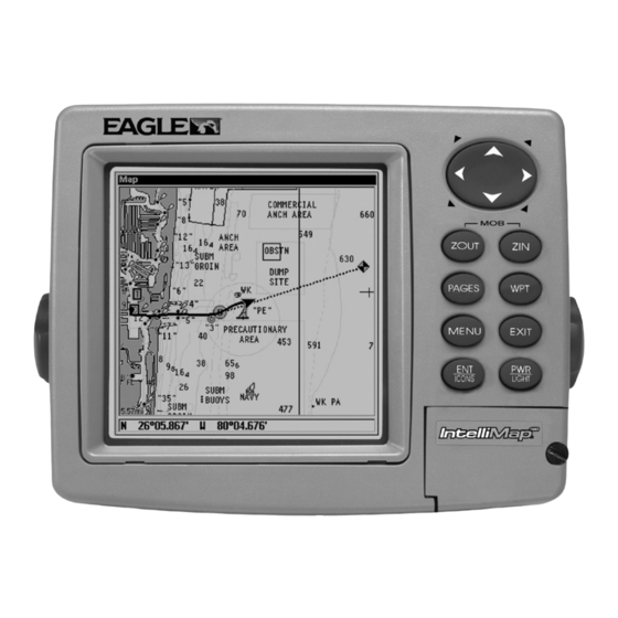
Eagle IntelliMap 480 Installation And Operation Instructions Manual (128 pages)
Eagle Electronics Installation and Operation Instructions Mapping GPS Receiver IntelliMap 480
Brand:
Eagle
| Category:
GPS
| Size: 2.89 MB
Table of Contents
Table of Contents
3
Capabilities and Specifications: Intellimap 480
8
How GPS Works
10
Introduction to GPS and WAAS
12
How to Use this Manual: Typographical Conventions
14
Sec. 2: Installation & Accessories
17
Preparations
17
GPS Antenna/Receiver Module Installation
17
Power Connections
18
NMEA/DGPS Cable Connections
19
NMEA/DGPS Wiring
20
Mounting the Unit: Bracket, In-Dash or Portable
20
MMC or SD Card Memory Card Installation
24
Other Accessories
25
Sec. 3: Basic GPS Operations
27
Keyboard
27
Power/Lights (Turn Unit on and Off)
28
Main Menu
28
Satellite Status Page
30
Navigation Page
32
Map Page
34
Background Map Vs. Mapcreate Map Content
35
Basic GPS Quick Reference
39
Find Your Current Position
40
Moving Around the Map: Zoom & Cursor Arrow Keys
40
Selecting any Map Item with the Cursor
41
Searching
41
Set a Waypoint
43
Create Waypoint at Current Position
44
Create Waypoint on Map
45
Create Waypoint by Entering a Position
45
Navigate to a Waypoint
45
Set man Overboard (MOB) Waypoint
46
Navigate Back to MOB Waypoint
46
Navigate to Cursor Position on Map
47
Navigate to a Point of Interest
48
Creating and Saving a Trail
48
Displaying a Saved Trail
50
Navigating Trails
51
Visual Trailing
51
Navigate a Trail (Forward)
51
Navigate a Back Trail (Backtrack, or Reverse)
53
Transfer Custom Maps and GPS Data Files
54
Cancel Navigation
56
Sec. 4: Advanced GPS Operations
57
Find Distance from Current Position to Another Location
57
Find Distance from Point to Point
57
Icons
58
Create Icon on Map
58
Create Icon at Current Position
58
Delete an Icon
58
Navigate to an Icon
59
Routes
59
Create and Save a Route
60
PC-Created Routes
60
Routes Created in the Unit
60
Delete a Route
62
Edit a Route Name
63
Edit Route Waypoints
63
Navigate a Route
64
Navigate a Route in Reverse
64
Trails
65
Delete a Trail
65
Edit a Trail Name
65
Edit a Trail Color
66
Edit a Trail Pattern
66
Utilities
67
Alarm Clock
67
Sun/Moon Rise & Set Calculator
67
Trip Calculator
67
Trip down Timer
67
Trip up Timer
67
Waypoints
67
Delete a Waypoint
67
Edit a Waypoint (Name, Symbol and Position)
67
Selecting a Waypoint
68
Set a Waypoint by Average Position
68
Set a Waypoint by Projecting a Position
69
Sec. 5: System & GPS Setup Options
71
Alarms
71
Auto Satellite Search
72
Check MMC Files and Storage Space
73
Communications Port Configuration
73
Configure DGPS
74
Configure NMEA
75
Coordinate System Selection
75
Setup Loran TD
76
Map Fix
77
Customize Page Displays
78
Customize Satellite Status Page
78
Customize Navigation Page
78
Customize Map Page
79
DGPS Status
79
GPS Simulator
79
Simulating Trail or Route Navigation
80
Initialize GPS
80
Map Auto Zoom
81
Map Data
81
Show Map Data
82
Pop-Up Map Information
82
Map Boundaries
82
Fill Water with White
82
Map Overlays (Range Rings; Lat/Long Grid)
82
Map Datum Selection
83
Map Detail Category Selection
84
Map Orientation
84
Navionics Charts
86
Display a Navionics Chart
86
Port Information
87
Tidal Current Information
88
Tide Information
89
Pop-Up Help
91
Position Pinning
91
Reset Options
92
Require DGPS
92
Screen Contrast and Brightness
93
Set Language
94
Set Local Time
94
Show WAAS Alarm
95
Software Version Information
95
Sounds and Alarm Sound Styles
96
Track Smoothing
97
Trail Options
97
Delete All Trails
98
Flash Trails on Screen Option
98
Update Trail Option
98
Update Trail Criteria (Auto, Time, Distance)
98
Trail Update Rate (Time, Distance)
98
Delete Trail
99
New Trail
99
Trail Visible/Invisible and Other Trail Options
99
Units of Measure
100
Sec. 6: Searching
101
Find Addresses
101
Find any Item Selected by Map Cursor
104
Find Interstate Highway Exits
105
Find Map Places or Points of Interest (POI)
107
Find Streets or Intersections
108
Find Waypoints
112
Sec. 7: Supplemental Material
115
Fcc Compliance
119
Index
121
How to Obtain Service
126
Advertisement
Advertisement
Related Products
Eagle IntelliMap Journey
Eagle IntelliMap 640C
Eagle IntelliMap 320
Eagle ID-6300
Eagle FISH ID 2 - ADDITIONAL
Eagle Power II
Eagle III
Eagle I
Eagle Fish ID 128
Eagle ICA-D212-725
Eagle Categories
Sonar
GPS
Cables and connectors
Fish Finder
Accessories
More Eagle Manuals
Login
Sign In
OR
Sign in with Facebook
Sign in with Google
Upload manual
Upload from disk
Upload from URL