Sign In
Upload
Download
Table of Contents
Contents
Add to my manuals
Delete from my manuals
Share
URL of this page:
HTML Link:
Bookmark this page
Add
Manual will be automatically added to "My Manuals"
Print this page
×
Bookmark added
×
Added to my manuals
Manuals
Brands
Magellan Manuals
GPS
GPS 4000 XL
User manual
Magellan GPS 4000 XL User Manual
Magellan satellite navigator user manual
Hide thumbs
1
2
3
4
5
6
7
8
9
10
11
12
13
14
15
16
17
18
19
20
21
22
23
24
25
26
27
28
29
30
31
32
33
34
35
36
37
38
39
40
41
42
43
44
45
46
47
48
49
50
51
52
53
54
55
56
57
58
59
60
61
62
63
64
65
66
67
68
69
70
71
72
73
74
75
76
77
78
79
80
81
82
83
84
85
86
87
88
89
90
91
92
93
94
95
96
97
98
99
100
101
102
103
104
105
Table Of Contents
106
page
of
106
Go
/
106
Contents
Table of Contents
Troubleshooting
Bookmarks
Table of Contents
GPS 4000 XL Field Reference Card
Contents
Packing List
Conventions Used in this Manual
Getting Started
GPS 4000 XL Description
Installing the Batteries
First Time Use
Initializing the Receiver
Initializing with Known Coordinates
Proper Handling - Signal Reception
Taking Your First Position Fix
Saving Your Position as a Landmark
Saving a Landmark with Different Coordinates
Introduction to Routes
Creating a GO to
Reference
Powering the GPS 4000 XL
Turning the Receiver on
Inputing Data
Turning the Display Light On/Off
Turning the Receiver off
Contrast
Using the NAV Screens
1St and 2Nd Position Screen
NAV 1 Screen
Course Deviation Indicator (CDI)
NAV 2 Screen
Customizing the NAV Screens
Pointer Screen
Plotter Screen
Deleting Plotter Track
Accessing the PAN N SCAN Functions
Creating a Landmark from PAN N SCAN
Viewing a Landmark Message in PAN N SCAN
Creating a GO to Route in PAN N SCAN
Creating a GO to COORD from PAN N SCAN
Road Screen
Viewing Destination Landmark Messages
The Bell Icon Alert
Working with Landmarks
Saving a Position as a Landmark
Attaching a Message to a Landmark
Creating a Landmark with User-Entered Coordinates
Three Possible Formats for LAT/LON Coordinates
Viewing a Stored Landmark
Viewing a Landmark Message
Editing a Landmark Message
Deleting a Landmark Message
Projecting a Landmark
Landmark Projection (LMK PROJ)
Triangulation (TRIANG)
Map Projection (MAP PROJ)
Editing a Landmark
Deleting a Landmark
Using the LAST FIX Buffer
Viewing the Last Fix Buffer
Copying a Last Fix as a Landmark
Deleting a Last Fix
Working with Routes
GO to (Activating)
Creating a Coordinate GO to Route
Creating a Backtrack Route
Accessing the Route Menu
Creating a Route
Deactivating a Route
Activating a Route
Reversing a Route
Editing a Route
Adding a Leg to the End of a Route
Inserting a Leg in a Route
Deleting a Leg from a Route
Replacing a Landmark in a Route
Viewing a Leg in a Route
Activating a Leg of a Route
Deleting a Route
Using the SUN/MOON Screen
Tracking with the Trip Odometer
Clearing Memory with Clear Menu
Resetting the Odometer
Resetting the Trip Odometer
Clearing All Last Fixes
Clearing Plotter Track
Clearing All Landmarks and Routes
Customizing the GPS 4000 XL Satellite Receiver
Initializing
Clearing All Memory
Selecting a Coordinate System
Selecting the Elevation Mode
Selecting Time Display and Changing the Time
Selecting Speed Units
Selecting Distance Units
Selecting Elevation Units
Selecting the North Reference
Selecting a Map Datum
Selecting NMEA Format
Selecting the Baud Rate
Activating or Deactivating the 2Nd Position Function
Changing Landmark Sorting Order
Setting the Plotter Orientation
Setting Plotter Track History
Setting Map Scale and Measurement Units
Adjusting Screen Contrast
Using the Map Distance Tool (UTM Grids Only)
Viewing the Status of Available Satellites
Viewing the Sat Status Screen
Simulating Navigation with the GPS 4000 XL
Turning the Simulation Mode on
Icons
Warnings and Other Messages
Troubleshooting
When All else Fails... Contacting Customer Service
Connecting External Power/Devices
Wiring List
Connecting to an External Antenna
Uploading/Downloading Landmark Data
Swivel Mounting Bracket (Optional)
To Install on a Dash Board or Other Horizontal Surface
To Install as a Wall-Mount
Wall Mount Configuration Diagram
Removing the GPS 4000 XL from the Swivel Mounting Base
NMEA Data Messages
Data Transfer
NMEA Message Definitions
Output Data Format
APA Autopilot Format a
APB Autopilot Sentence "B"
BWC to Selected Landmark, Great Circle
GGA Global Positioning System Fix Data
GLL Geographic Position - Latitude/Longitude
RMB Generic Navigation Information (Immediately Follows RMC)
RMC Transit Specific (to be Followed by RMB)
VTG Actual Track and Ground Speed (SOG)
Available Datums
Specifications
Coordinate Systems
Other Coordinate Systems
User-Defined Grid Table
What Is GPS?
Accuracy
Dgps
Where to Get more Information
Abbreviations
City Reference Chart
Glossary
Index
Advertisement
Quick Links
1
Gps 4000 Xl Field Reference Card
2
Getting Started
3
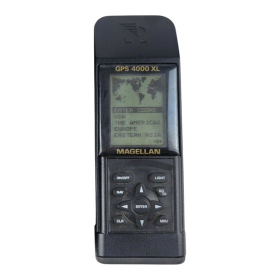
Gps 4000 Xl Description
4
First Time Use
5
Installing the Batteries
6
Initializing the Receiver
Download this manual
Table of
Contents
Previous
Page
Next
Page
1
2
3
4
5
Advertisement
Table of Contents
Need help?
Do you have a question about the GPS 4000 XL and is the answer not in the manual?
Ask a question
Questions and answers
Subscribe to Our Youtube Channel
Related Manuals for Magellan GPS 4000 XL
GPS Magellan GPS 315 User Manual
Magellan (thales navigation) gps receiver user manual gps 315, 320 (74 pages)
GPS Magellan Magellan GPS 315 User Manual
Magellan gps receiver user manual 315, 320 (78 pages)
GPS Magellan GPS 3000 User Manual
Magellan satellite navigator user guide (83 pages)
GPS Magellan GPS 3000 XL User Manual
Magellan (thales navigation) satellite navigator user manual (102 pages)
GPS Magellan GPS 300 User Manual
Satellite navigator (48 pages)
GPS Magellan 300GPS User Manual
Magellan gps 300 cover user manual (48 pages)
GPS Magellan Magellan GPS 310 User Manual
Satellite navigator (62 pages)
GPS Magellan GPS Receiver User Manual
Magellan's gps receiver user manual (75 pages)
GPS Magellan RoadMate 1200 - Automotive GPS Receiver User Manual Addendum
Triton user manual addendum - english, french, spanish (8 pages)
GPS Magellan RoadMate 1200 - Automotive GPS Receiver Brukerhåndbok
Manual - norwegian (32 pages)
GPS Magellan RoadMate 1200 - Automotive GPS Receiver Användarhandbok
Manual - swedish (31 pages)
GPS Magellan RoadMate 1200 - Automotive GPS Receiver Käyttöopas
Manual - finnish (30 pages)
GPS Magellan RoadMate 1200 - Automotive GPS Receiver Manuale Dell'utente
Manual - italian (30 pages)
GPS Magellan GPS Satellite Navigator Meridian XL Reference Manual
Magellan (thales navigation) gps satellite navigator reference guide (95 pages)
GPS Magellan GPS Receiver SkyNav 5000 User Manual
Magellan (thales navigation) gps receiver user guide (84 pages)
GPS Magellan GPS Tracker User Manual
Magellan gps tracker user manual (102 pages)
Related Products for Magellan GPS 4000 XL
Magellan GPS 315
Magellan GPS 3000
Magellan GPS 3000 XL
Magellan GPS 320
Magellan GPS 300
Magellan Magellan GPS 310
Magellan GPS Receiver
Magellan GLOBAL SATELLITE TELEPHONE
Magellan GSC 100
Magellan 300GPS
Magellan 330 Series
Magellan 330X - GPS Map
Magellan 5430T-LM
Magellan 750NAV
Magellan 9270T-LM
Magellan 980588-01 - GPS Companion For Palm V/Vx
Table of Contents
Save PDF
Print
Rename the bookmark
Delete bookmark?
Delete from my manuals?
Login
Sign In
OR
Sign in with Facebook
Sign in with Google
Upload manual
Upload from disk
Upload from URL


Need help?
Do you have a question about the GPS 4000 XL and is the answer not in the manual?
Questions and answers