Table of Contents
Advertisement
Quick Links
Advertisement
Table of Contents

Related Manuals for Garmin fēnix


Summary of Contents for Garmin fēnix
- Page 1 ™ Owner’s Manual August 2012 190-01507-00_0A Printed in Taiwan...
- Page 2 Garmin. The Bluetooth ® word mark and logos are owned by the Bluetooth SIG, Inc. and any use of such marks by Garmin is under license. Mac ® is a registered trademark of Apple Computer, Inc. Windows ® is a registered trademark of Microsoft Corporation in the United States and other countries. Other trademarks...
-
Page 3: Table Of Contents
Table of Contents Using the Stopwatch ............. 6 Adding a Custom Time Zone ..........6 Editing a Custom Time Zone ..........6 Introduction..............1 Alerts ..................7 Getting Started ................1 Setting a Proximity Alarm ............7 Charging the Device .............. 1 Calculating the Size of an Area .......... -
Page 5: Introduction
Introduction Keys WARNING Always consult your physician before you begin or modify any exercise program. See the Important Safety and Product Information guide in the product box for product warnings and other important information. Getting Started When using your device the first time, you should complete these tasks to set up the device and get to know the basic features. -
Page 6: Turning On A Sensor Mode
20–30 minutes. on Windows ® computers and as a mounted volume on TIP: To purchase a tempe™ wireless temperature sensor, go Mac ® computers. to www.garmin.com. When you have the tempe paired with Start BaseCamp. the fēnix (page... -
Page 7: Creating A Custom Profile
Select a profile. The device displays time to destination , distance to destination , and estimated time of arrival The profile you selected is now the active profile. Any changes Select to view the compass page. you make are saved to the active profile. Creating a Custom Profile You can customize your settings and data fields for a particular activity or trip. -
Page 8: Routes
Select the Orange key. Before you can share data wirelessly, you must be within 10 Select Routes. feet (3 m) of a compatible Garmin ® device. Select a route. Your device can send or receive data when connected to another compatible device. You can share waypoints, Select Delete >... -
Page 9: Navigating To A Destination
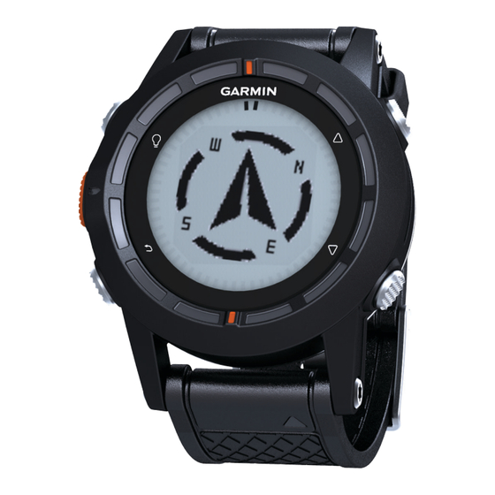
Navigating to a Destination • Compass navigation (page • Compass settings (page You can navigate to a destination using the compass or map (page Calibrating the Compass Select the Orange key. NOTICE Select Start GPS. Calibrate the electronic compass outdoors. To improve heading Wait while the device locates satellites. -
Page 10: Calibrating The Barometric Altimeter
Select Setup > Sensors > Altimeter. A chirp is a small Garmin accessory that is programmed and left in a geocache. You can use your fēnix to find a chirp in a Select Baro. Plot or Elev. Plot. geocache. For more information about the chirp, see the chirp Select an option. -
Page 11: Alerts
Select the Orange key. Pairing is the connecting of ANT+ wireless sensors, for Select Alerts > Proximity > Create New. example, connecting a heart rate monitor with your Garmin Select a location. device. Enter a radius. Bring the device with range (3 m) of the sensor. -
Page 12: Setting Your Heart Rate Zones
The Setup menu contains numerous ways to customize your device. Garmin recommends that you take the time to familiarize yourself with the settings for each feature. If you take the time to customize your settings before your activity, you will spend less time adjusting the watch during your activity. -
Page 13: System Settings
WAAS: Sets the device to use Wide Area Augmentation Contrast: Adjusts the screen contrast. System (WAAS) GPS signals. For information about WAAS, go to www.garmin.com/aboutGPS/waas.html. Map Settings Hold Keys: Allows you to customize the hold function of the Select Setup > Map. -
Page 14: Position Format Settings
(page 10). battery is low, a message appears on your Select the Orange key. compatible Garmin device. Select Setup > Fitness > User. Water resistance Water resistant to 98.4 ft. (30 m) Modify the settings. NOTE: This product does not transmit heart rate data to your GPS device while swimming. -
Page 15: Data Management
• Files from BaseCamp or HomePort. Go to www.garmin.com /trip_planning. Registering Your Device • GPI custom POI files from the Garmin POI Loader. Go to Help us better support you by completing our online registration www.garmin.com/products/poiloader. today. • GPX track files. -
Page 16: Heart Rate Zone Calculations
Heart Rate Zone Calculations Zone % of Perceived Exertion Benefits Maximum Heart Rate 50–60% Relaxed, easy pace, Beginning-level rhythmic breathing aerobic training, reduces stress 60–70% Comfortable pace, Basic cardiovascular slightly deeper training, good breathing, conversation recovery pace possible 70–80% Moderate pace, more Improved aerobic difficult to hold capacity, optimal... -
Page 17: Index
Index types 11 editing 4 fishing times 7 viewing on the map 4 fitness 10 accessories 11 satellite page 7 alarms 7 geocaches 4–6, 10, 11 satellite signals 2, 7 clock 6 downloading 6 screen 9 proximity 7 navigating to 6 settings 8–11 alerts 7 navigation, geocaches 6 sharing data 4 location 7 GPS 9, 10 Sight 'N Go 5 almanac signal 1, 2, 7 software hunting and fishing 7... - Page 18 1200 East 151st Street Olathe, Kansas 66062, USA Garmin (Europe) Ltd. Liberty House, Hounsdown Business Park Southampton, Hampshire, SO40 9LR UK Garmin Corporation No. 68, Zhangshu 2nd Road, Xizhi Dist. New Taipei City, 221, Taiwan (R.O.C.) © 2012 Garmin Ltd. or its subsidiaries...
- Page 19 Keys fēnix™ Quick Start Manual WARNING See the Important Safety and Product Information guide in the product box for product warnings and other important information. WARNING Always consult your physician before you begin or modify any exercise program. Select to turn the backlight on and off. Hold to turn the device on and off.
- Page 20 20–30 minutes. Start hiking. TIP: To purchase a tempe™ wireless temperature sensor, go When you want to take a break or pause the device from to www.garmin.com. See the owner's manual for more tracking, hold > Pause Track. information.
-
Page 21: Stopping Navigation
Continue to walk in that direction until you reach the Pairing is the connecting of ANT+ wireless sensors, for destination. example, connecting a heart rate monitor with your Garmin Navigating Using TracBack ® device. Bring the device with range (3 m) of the sensor. - Page 22 Garmin Ltd. or its subsidiaries. These trademarks may not be used without the express permission of Garmin. ® The Bluetooth word mark and logos are owned by the Bluetooth SIG, Inc. and any use of such marks by Garmin is under license. Garmin (Europe) Ltd. ®...
Need help?
Do you have a question about the fēnix and is the answer not in the manual?
Questions and answers