Sign In
Upload
Download
Table of Contents
Contents
Add to my manuals
Delete from my manuals
Share
URL of this page:
HTML Link:
Bookmark this page
Add
Manual will be automatically added to "My Manuals"
Print this page
×
Bookmark added
×
Added to my manuals
Manuals
Brands
Garmin Manuals
GPS
GPSMAP1022
Owner's manual
Garmin GPSMAP1022 Owner's Manual
Hide thumbs
1
2
Table Of Contents
3
4
5
6
7
8
9
10
11
12
13
14
15
16
17
18
19
20
21
22
23
24
25
26
27
28
29
30
31
32
33
34
35
36
37
38
39
40
41
42
43
44
45
46
47
48
49
50
51
52
53
54
55
56
57
58
59
60
61
62
63
64
65
66
67
68
69
70
71
72
73
74
75
76
77
78
79
80
81
82
83
84
85
86
87
88
89
90
91
92
93
94
95
96
97
98
99
100
101
102
103
104
105
106
107
108
109
110
111
112
113
114
115
116
117
118
119
120
121
122
123
124
125
126
127
128
129
130
131
132
133
134
135
136
137
138
139
140
141
142
143
144
145
146
147
148
149
150
151
152
153
154
155
156
157
158
159
160
161
162
163
164
165
166
167
168
169
170
171
172
173
174
175
176
177
178
179
180
181
182
183
184
185
186
187
188
189
190
191
192
193
194
195
196
197
198
199
200
201
202
203
204
205
206
207
208
209
210
211
212
213
214
page
of
214
Go
/
214
Contents
Table of Contents
Troubleshooting
Bookmarks
Table of Contents
Table of Contents
Introduction
Device Overview
Keys
Connector View
Tips and Shortcuts
Accessing Owner's Manuals on the Chartplotter
Accessing the Manuals from the Web
Garmin Support Center
Inserting Memory Cards
Acquiring GPS Satellite Signals
Selecting the GPS Source
Customizing the Chartplotter
Home Screen
Pinning a Feature Button
Rearranging the Category Items
Assigning a Shortcut Key
Setting the Vessel Type
Adjusting the Backlight
Adjusting the Color Mode
Adjusting the Color Theme
Enabling Screen Lock
Turning on the Chartplotter Automatically
Automatically Turning off the System
Customizing Pages
Customizing the Startup Screen
Recommended Startup Image Dimensions
Creating a New Combination Page
Adding a Smartmode Layout
Customizing the Layout of a Smartmode or Combination Page
Deleting a Combination Page
Customizing the Data Overlays
Resetting the Station Layouts
Presets
Managing Presets
Saving a New Preset
Controlling the Chartplotter
Voice Control
Changing the Voice Control Language
Supported Headsets
Pairing a Wireless Headset with a Garmin Chartplotter
Using a Wireless Headset with a Garmin Chartplotter
Chartplotter Voice Commands
GRID Remote Control
Pairing the GRID Device with the Chartplotter from the Chartplotter
Pairing the GRID Device with the Chartplotter from the GRID Device
Rotating the GRID Remote Input Device
Activecaptain® App
Activecaptain and Garmin Bluenet Considerations
Activecaptain Roles
Getting Started with the Activecaptain App
Enabling Smart Notifications
Receiving Notifications
Managing Notifications
Making Notifications Private
Updating Software with the Activecaptain App
Updating Charts with Activecaptain
Chart Subscriptions
Communication with Wireless Devices
Wi-Fi Network
Setting up the Wi-Fi Network
Connecting a Wireless Device to the Chartplotter
Changing the Wireless Channel
Changing the Wi-Fi Host
Wireless Remote Control
Pairing the Wireless Remote Control with the Chartplotter
Turning on and off the Remote Backlight
Disconnecting the Remote Control from All Chartplotters
Wireless Wind Sensor
Connecting a Wireless Sensor to the Chartplotter
Adjusting the Wind Sensor Orientation
Viewing Boat Data on a Garmin Watch
Viewing Boat Data on a Garmin Nautix™ Device
Charts and 3D Chart Views
Detailed Charts
Activating a Marine Chart Subscription
Purchasing a Chart Subscription with Activecaptain
Renewing Your Subscription
Navigation Chart and Fishing Chart
Chart Symbols
Zooming in and out of the Chart
Panning the Chart with the Keys
Selecting an Item on the Map Using the Device Keys
Measuring a Distance on the Chart
Creating a Waypoint on the Chart
Viewing Location and Object Information on a Chart
Viewing Details about Navaids
Navigating to a Point on the Chart
Premium Chart Features
Fish Eye 3D Chart View
Viewing Tide Station Information
Animated Tide and Current Indicators
Showing Tides and Current Indicators
Showing Satellite Imagery on the Navigation Chart
Viewing Aerial Photos of Landmarks
Automatic Identification System
AIS Targeting Symbols
Heading and Projected Course of Activated AIS Targets
Viewing a List of AIS Threats
Activating a Target for an AIS Vessel
Deactivating a Target for an AIS Vessel
Viewing Information about a Targeted AIS Vessel
Showing AIS Vessels on a Chart or 3D Chart View
Setting the Safe-Zone Collision Alarm
AIS Aids to Navigation
AIS Distress Signals
Turning off AIS Reception
Chart Menu
Chart Layers
Chart Layer Settings
Depth Layer Settings
Laylines Settings
My Vessel Layer Settings
Other Vessels Layer Settings
User Data Layer Settings
Water Layer Settings
Depth Range Shading
Weather Layer Settings
Radar Overlay Settings
Chart Settings
Fish Eye 3D Settings
Supported Maps
Garmin Quickdraw Contours Mapping
Mapping a Body of Water Using the Garmin Quickdraw Contours Feature
Adding a Label to a Garmin Quickdraw Contours Map
Garmin Quickdraw Community
Connecting to the Garmin Quickdraw Community with Activecaptain
Downloading Garmin Quickdraw Community Maps Using Activecaptain
Sharing Your Garmin Quickdraw Contours Maps with the Garmin Quickdraw Community Using Activecaptain
Connecting to the Garmin Quickdraw Community with Garmin Connect
Downloading Garmin Quickdraw Community Maps Using Garmin Connect
Quickdraw Community Using Garmin Connect
Sharing Your Garmin Quickdraw Contours Maps with the Garmin
Garmin Quickdraw Contours Settings
Navigation with a Chartplotter
Basic Navigation Questions
Route Color Coding
Destinations
Searching for a Destination by Name
Selecting a Destination Using the Navigation Chart
Searching for a Marine Services Destination
Setting and Following a Direct Course Using Go to
Stopping Navigation
Waypoints
Marking Your Present Location as a Waypoint
Creating a Waypoint at a Different Location
Marking a man Overboard or Other SOS Location
Projecting a Waypoint
Viewing a List of All Waypoints
Editing a Saved Waypoint
Moving a Saved Waypoint
Browsing for and Navigating to a Saved Waypoint
Deleting a Waypoint or an MOB
Deleting All Waypoints
Routes
Creating and Navigating a Route from Your Present Location
Creating and Saving a Route
Viewing a List of Routes and Auto Guidance Paths
Editing a Saved Route
Finding and Navigating a Saved Route
Browsing for and Navigating Parallel to a Saved Route
Initiating a Search Pattern
Deleting a Saved Route
Deleting All Saved Routes
Auto Guidance
Setting and Following an Auto Guidance Path
Creating and Saving an Auto Guidance Path
Adjusting a Saved Auto Guidance Path
Canceling an Auto Guidance Calculation in Progress
Setting a Timed Arrival
Auto Guidance Path Configurations
Adjusting the Distance from Shore
Tracks
Showing Tracks
Setting the Color of the Active Track
Saving the Active Track
Viewing a List of Saved Tracks
Editing a Saved Track
Saving a Track as a Route
Browsing for and Navigating a Recorded Track
Deleting a Saved Track
Deleting All Saved Tracks
Retracing the Active Track
Clearing the Active Track
Managing the Track Log Memory During Recording
Configuring the Recording Interval of the Track Log
Boundaries
Creating a Boundary
Converting a Route to a Boundary
Converting a Track to a Boundary
Editing a Boundary
Linking a Boundary to a Smartmode Layout
Setting a Boundary Alarm
Disabling All Boundary Alarms
Deleting a Boundary
Deleting All Saved Waypoints, Tracks, Routes, and Boundaries
Sailing Features
Setting the Vessel Type for Sailing Features
Sail Racing
Starting Line Guidance
Setting the Starting Line
Using the Starting Line Guidance
Starting the Race Timer
Stopping the Race Timer
Setting the Distance between the Bow and the GPS Antenna
Laylines Settings
Polar Tables
Importing a Polar Table Manually
Showing Polar Data in Data Fields
Setting the Keel Offset
Sailboat Autopilot Operation
Wind Hold
Changing the Wind Hold Type
Adjusting the Wind Hold Angle
Engaging Wind Hold
Engaging Wind Hold from Heading Hold
Tack and Gybe
Setting a Tack Delay
Tacking and Gybing from Heading Hold
Tacking and Gybing from Wind Hold
Enabling the Gybe Inhibitor
Heading Line and Angle Markers
Setting the Heading Line and Angle Markers
Viewing Sailing Vessel Data
Sonar Fishfinder
Stopping the Transmission of Sonar Signals
Traditional Sonar View
Split-Frequency Sonar View
Split-Zoom Sonar View
Garmin Clearvü Sonar View
Garmin Sidevü Sonar View
Sidevü Scanning Technology
Measuring Distance on the Sonar Screen
Panoptix Sonar Views
Livevü down Sonar View
Livevü Forward Sonar View
Realvü 3D Forward Sonar View
Realvü 3D down Sonar View
Realvü 3D Historical Sonar View
Garmin Frontvü Sonar View
Livescope Sonar View
Perspective View
Selecting the Transducer Type
Selecting a Sonar Source
Renaming a Sonar Source
Creating a Waypoint on the Sonar Screen
Pausing the Sonar Display
Viewing Sonar History
Sonar Sharing
Adjusting the Level of Detail
Adjusting the Range, Gain, and Brightness with the Knob
Adjusting the Color Intensity
Sonar Setup
Setting the Zoom Level on the Sonar Screen
Setting the Scroll Speed
Adjusting the Range
Sonar Noise Rejection Settings
Sonar Appearance Settings
Sonar Alarms
Advanced Sonar Settings
Transducer Installation Settings
Sonar Frequencies
Creating a Frequency Preset
Selecting the Transducer Frequency
Turning on the A-Scope
Panoptix Sonar Setup
Adjusting the Realvü Sweep Speed
Livevü Forward and Garmin Frontvü Sonar Settings
Setting the Livevü and Garmin Frontvü Transducer Transmit Angle
Livevü and Garmin Frontvü Appearance Settings
Livevü and Garmin Frontvü Layout Settings
Setting the Garmin Frontvü Depth Alarm
Panoptix Transducer Installation Settings
Realvü Appearance Settings
Calibrating the Compass
Setting the Bow Offset
Livescope and Perspective Sonar Settings
Livescope and Perspective Sonar Setup
Livescope and Perspective Appearance Settings
Livescope and Perspective Layout Settings
Livescope and Perspective Transducer Installation Settings
Radar
Radar Interpretation
Radar Overlay
Radar Overlay and Chart Data Alignment
Transmitting Radar Signals
Stopping the Transmission of Radar Signals
Setting up the Timed Transmit Mode
Enabling and Adjusting a Radar no Transmit Zone
Adjusting the Radar Range
Tips for Selecting a Radar Range
Motionscope Doppler Radar Technology
Enabling a Guard Zone
Defining a Circular Guard Zone
Defining a Partial Guard Zone
Marpa
MARPA Targeting Symbols
Acquiring MARPA Targets Automatically
Removing MARPA Targets Automatically
Assigning a MARPA Tag to an Object
Removing a MARPA Tag from a Targeted Object
Viewing Information about a MARPA-Tagged Object
Viewing a List of AIS Threats
Showing AIS Vessels on the Radar Screen
VRM and EBL
Showing and Adjusting the VRM and the EBL
Measuring the Range and Bearing to a Target Object
Echo Trails
Turning on Echo Trails
Adjusting the Length of the Echo Trails
Clearing the Echo Trails
Radar Settings
Radar Gain
Adjusting Gain on the Radar Screen Automatically
Adjusting Gain on the Radar Screen Manually
Minimizing Nearby Large-Object Interference
Minimizing Side-Lobe Interference on the Radar Screen
Radar Filter Settings
Adjusting Rain Clutter on the Radar Screen
Adjusting Sea Clutter on the Radar Screen
Averaging Multiple Scans on the Radar Screen
Radar Options Menu
Radar Setup Menu
Reducing Cross Talk Clutter on the Radar Screen
Radar Appearance Settings
Radar Installation Settings
Measuring and Setting the Front-Of-Boat Offset
Setting a Custom Park Position
Radar My Vessel Layer Settings
Selecting a Different Radar Source
Advertisement
Quick Links
1
Inserting Memory Cards
Download this manual
GPSMAP
10X2/12X2 SERIES
®
Owner's Manual
Table of
Contents
Previous
Page
Next
Page
1
2
3
4
5
Advertisement
Table of Contents
Need help?
Do you have a question about the GPSMAP1022 and is the answer not in the manual?
Ask a question
Questions and answers
Related Manuals for Garmin GPSMAP1022
GPS Garmin GpsMap 12” Common Settings
(3 pages)
GPS Garmin GPSMAP620 Safety Instruction
Garmin gps receiver user manual (2 pages)
GPS Garmin GPSMAP230 Features And Specifications
(2 pages)
GPS Garmin GPSMAP1222 Owner's Manual
(214 pages)
GPS Garmin GPS 155XL Installation Manual
Aviation kit (59 pages)
GPS Garmin GPSmap 60 Using Manual
Gps (12 pages)
GPS Garmin GPS 20x Technical Specifications
Garmin gps system technical specifications (19 pages)
GPS Garmin GPS 50 Owner's Manual
Garmin gps 50 personal navigator owner's manual (79 pages)
GPS Garmin GPS 10 Quick Start Manual
For smartphone (20 pages)
GPS Garmin GPS Manual
Garmin gps field guide (25 pages)
GPS Garmin GPS Beginner's Manual
Garmin gps (9 pages)
GPS Garmin GPS Receiver User Manual
Garmin gps receiver user manual (20 pages)
GPS Garmin GPS 76 Owner's Manual
Gps navigator (78 pages)
GPS Garmin GPS 73 Owner's Manual
(14 pages)
GPS Garmin GNS 400W Pilot's Manual & Reference
Garmin gps receiver pilots guide & reference guide (220 pages)
GPS Garmin GPS 175 Maintenance Manual
Part 23 aml stc (95 pages)
Summarization of Contents
Introduction and Device Overview
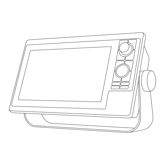
Device Overview
Provides an overview of the chartplotter's physical buttons and their functions.
Keys and Controls
Details the function of each physical key and the rotary knob on the device.
Connector View
Illustrates and identifies the various ports and connectors on the chartplotter.
Tips, Manuals, and Support
Offers shortcuts, explains how to access manuals, and provides support contact info.
Memory Cards and GPS Setup
Inserting Memory Cards
Instructions for inserting and securing SD memory cards into the chartplotter.
Acquiring GPS Satellite Signals
Details the process for the device to acquire satellite signals for GPS positioning.
Selecting the GPS Source
Guide to choosing the preferred GPS data source if multiple are available.
Customizing the Chartplotter Interface
Home Screen Overview
Explains the home screen layout and access to chartplotter features.
Feature Button and Category Customization
Details on pinning features, rearranging categories, and assigning shortcuts.
Display and Power Settings
Covers backlight, color modes, screen lock, and automatic power options.
Page and Layout Customization
Instructions for customizing startup screens and creating new combination pages.
SmartMode Layouts and Presets
Guides for managing SmartMode layouts and saving custom presets.
Controlling the Chartplotter and ActiveCaptain App
Voice Control Features
Explains how to use voice commands for chartplotter functions.
Voice Commands for Functions
Lists voice commands for device, navigation, media, and weather functions.
ActiveCaptain App Overview
Introduces the ActiveCaptain app for managing the chartplotter and data.
ActiveCaptain App Setup and Notifications
Guides on getting started, enabling smart notifications, and managing them.
Software and Chart Updates via ActiveCaptain
Instructions for updating software and charts using the ActiveCaptain app.
Wireless Device Communication
Details on connecting wireless devices, Wi-Fi setup, and remote controls.
Charts and 3D Chart Views
Detailed Charts and Subscriptions
Information on chart types, features, and managing subscriptions.
Chart Navigation and Interaction
Covers panning, selecting items, measuring distance, and creating waypoints.
Navigating and Premium Chart Features
Guides on navigating to points and exploring premium chart capabilities.
Tide, Current, and AIS Information
Details on viewing tide/current data, AIS targets, and aids to navigation.
Chart Layers and Settings
Explains how to customize chart layers, depth, vessel, and other vessel data.
Garmin Quickdraw Contours Mapping
Supported Maps
Information on supported map types for use with Garmin devices.
Quickdraw Contours Mapping Features
Details on creating and managing custom depth contour maps.
Garmin Quickdraw Community Access
Guides on connecting to and downloading/sharing maps from the community.
Quickdraw Contours Settings
Covers settings for recording offset, survey coloring, and depth shading.
Navigation with a Chartplotter
Basic Navigation and Route Color Coding
Explains basic navigation questions and route color coding conventions.
Destinations and Go To Navigation
Covers searching destinations, using Go To, and stopping navigation.
Waypoints Management and SOS
Details on creating, editing, and managing waypoints, including SOS locations.
Routes and Auto Guidance Navigation
Guides on creating, navigating, and managing routes and auto guidance paths.
Track Management and Boundaries
Covers tracking boat paths, managing track logs, and setting up boundaries.
Sailing Features
Sailing Feature Setup
Explains setting vessel type, sail racing features, and starting line guidance.
Laylines and Polar Tables
Covers laylines settings, importing polar tables, and displaying polar data.
Sailboat Autopilot Operation
Details on wind hold, tacking/gybing, and autopilot adjustments for sailboats.
Sonar Fishfinder Operations
Sonar Signal Transmission and Views
Covers stopping sonar transmission and descriptions of sonar views.
Panoptix Sonar Views and Settings
Details on various Panoptix sonar views and transducer setup.
Sonar Setup and Tuning
Guides on scroll speed, noise rejection, appearance, alarms, and frequencies.
Radar System Usage
Radar Interpretation and Overlay
Explains how to interpret radar displays and use radar overlay on charts.
Radar Transmission and Filter Settings
Covers radar transmission modes, guard zones, and filter adjustments.
MARPA and AIS Vessel Display
Details on MARPA targeting, AIS vessel display, VRM/EBL, and echo trails.
Radar Gain and Interference Reduction
Guides on adjusting gain and minimizing interference for optimal radar performance.
Radar Installation and Appearance Settings
Covers radar options, setup menus, appearance, and installation settings.
Autopilot System Control
Autopilot Configuration and Screen
Details on autopilot setup, preferred heading source, and screen overview.
Steering Modes and Patterns
Explains adjusting heading, steering patterns like U-Turn and Zigzag.
Autopilot Controls via Watch, GRID, and Remote
Covers controlling autopilot using Garmin watches, GRID remote, and Reactor remote.
Yamaha and Trolling Motor Autopilot
Details on Yamaha autopilot integration and Force trolling motor control.
Digital Selective Calling (DSC)
DSC Functionality with VHF Radio
Explains DSC features when connected to a VHF radio for calls and distress.
Position Tracking and DSC List Management
Covers tracking vessels, managing DSC list, and editing position reports.
Individual Routine Calls via DSC
Guides on making individual routine calls and selecting DSC channels.
Gauges and Graphs for System Monitoring
Viewing and Customizing Gauges
Instructions for viewing, customizing, and setting limits for engine and fuel gauges.
Engine Alarms and Data Settings
Details on engine alert icons, changing gauge data, and Yamaha engine settings.
Fuel, Wind, and Trip Monitoring
Covers setting fuel alarms, viewing wind gauges, and trip data.
Graph Settings
Guides on setting graph range, time scales, and disabling filtering.
inReach Messages and Digital Switching
inReach Message Management
Covers receiving, replying, sending messages, and SOS calls via inReach.
Communicating During SOS Calls
Details on communicating with the Garmin Response Team during an SOS call.
Digital Switching System Control
Guides on adding/editing switching pages and configuring Boat Switch device.
Controlling Third-Party Equipment
Power-Pole Anchor System Integration
Instructions for enabling and controlling the Power-Pole anchor system.
Mercury Engine and Troll Control
Covers enabling Mercury Helm, Troll, and Cruise control features.
Mercury Engine Details and Active Trim
Guides on viewing Mercury engine data and controlling Active Trim.
Dometic Optimus Features and Control
Details on Optimus system features and activating the Optimus overlay bar.
Tide, Current, and Celestial Information
Tide and Current Overlays
Explains how to add and view tide and current station information.
Celestial and Almanac Information
Provides information on celestial events and almanac data from charts.
Messages and Warnings Management
Viewing and Managing System Messages
Covers viewing, sorting, filtering, saving, and clearing messages and warnings.
Media Player for Audio System Control
Media Player Overview and Controls
Details on opening the media player, icons, and adjusting volume levels.
Stereo Zones, Groups, and Music Playback
Guides on managing stereo zones, groups, and playing music.
Radio Operation and SiriusXM Setup
Covers tuning radio stations, DAB playback, and SiriusXM subscription.
SiriusXM Parental Controls and Device Settings
Details on setting parental controls, changing passcodes, and device names.
SiriusXM Weather Information
SiriusXM Weather Requirements and Data
Covers subscription needs, data broadcasts, and weather warnings.
Weather Forecasts and Conditions
Details on storm cells, hurricanes, forecasts, sea conditions, and visibility.
Local Weather and Subscription Info
Guides on viewing local weather near buoys and subscription status.
Viewing Video and Camera Systems
Video Source Selection and Management
Covers selecting video sources, alternating feeds, and camera settings.
Garmin VIRB Action Cameras
Instructions for connecting and controlling VIRB action cameras.
Surround View Camera System
Details on the surround view system, camera changes, and controls.
Device Configuration Settings
System Settings Overview
Covers system settings, sounds, display, GPS, and station information.
Preferences and Navigation Settings
Details on units, language, filters, and navigation preferences.
Communications Settings and Protocols
Covers NMEA 0183/2000 settings, device naming, and network technologies.
Alarm Settings and Vessel Configuration
Details on navigation, system, sonar, weather, and fuel alarms.
My Vessel Settings and Calibration
Covers keel offset, temperature offset, fuel, and water speed calibration.
Sharing and Managing User Data
Restoring Factory Settings
Guides on resetting device or station settings to factory defaults.
User Data Transfer and Management
Covers importing/exporting data, backing up, and saving system information.
Appendix: Software and Support
ActiveCaptain and Garmin Express Apps
Overview of apps for managing chartplotter, charts, and device updates.
Device Registration and Software Updates
Guides on registering the device and updating software/charts via Garmin Express.
Troubleshooting Common Issues
Provides solutions for GPS signal loss, power issues, and waypoint problems.
Product Specifications
Lists detailed technical specifications for GPSMAP 10x2 and 12x2 models.
Table of Contents
Save PDF
Print
Rename the bookmark
Delete bookmark?
Delete from my manuals?
Login
Sign In
OR
Sign in with Facebook
Sign in with Google
Upload manual
Upload from disk
Upload from URL
Need help?
Do you have a question about the GPSMAP1022 and is the answer not in the manual?
Questions and answers