
Related Manuals for Lowrance Elite 4


Summarization of Contents
Introduction
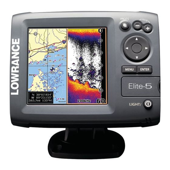
Unit Controls
Describes the functions of the unit's buttons and controls.
Getting Started
Covers turning on/off, Man Overboard, backlight, and audio settings.
Inserting microSD cards
Instructions for inserting and removing microSD cards from the unit.
Basic Operation
Setup wizard
Guides users through initial unit setup and configuration.
Pages
Introduces the unit's four main display pages.
Selecting Pages
Explains how to switch between different display pages.
Page menus
Details how to access menus specific to each page view.
Accessing the Settings menu
Shows how to navigate to the unit's settings menu.
Working with menus
Explains different menu types like scrollbars and dropdowns.
Dialogs
Describes dialog boxes used for input or information display.
Entering text
Instructions for inputting text for waypoints, routes, or trails.
Fishing Modes
Introduces preset sonar settings for specific fishing conditions.
Cursor
Explains how to move the cursor for map interaction.
Goto cursor
Describes how to navigate to a specific cursor location.
Advanced Mode
Details features and settings enabled in Advanced Mode.
Standby mode
Explains how to lower power consumption by turning off sonar.
Restore defaults
How to reset unit options and settings to default values.
Adjusting the display
Refers to Sonar section for display adjustments like sensitivity.
Pages
Steer Page
Features a compass and navigation data panel.
Sonar Page
Displays water column data and amplitude scope.
Chart/Sonar Page
Displays a split screen of chart and sonar data.
Chart Page
Shows real-time map movement from a bird's-eye view.
Chart/Sonar split
Allows changing panel display in Chart/Sonar view.
Overlay Data
Displays selected data on the sonar page.
Show
Enables or disables the display of overlay data.
Configure
Used to select overlay data to be displayed on screen.
Customizing Overlay Data
Adjusts the size and/or location of overlay data.
Using your Sonar
Trackback
Review recent sonar history by moving cursor left.
Sonar Menu
Accesses sonar options and settings for display appearance.
New Waypoint
Places a waypoint at current or cursor position.
Adjust (Advanced Mode only)
Adjusts Sensitivity and Colorline/Grayscale settings.
Sensitivity
Controls the level of detail shown on the display.
Auto Sensitivity
Keeps sensitivity optimal for most conditions, on by default.
Colorline/Grayscale
Separates strong and weak sonar echoes for easier identification.
Depth Range
Selects the deepest range shown on the display.
Custom Range - Upper and Lower Limits (Advanced Mode only)
Selects a section of the water column to view.
Frequency
Controls the transducer frequency used by the unit.
Ping Speed (Advanced Mode only)
Controls the rate the transducer sends sonar waves.
Sonar Options
Accesses sonar display settings and configuration options.
Split Zoom and Split Flasher
Switches sonar display from full screen to split screen.
Color
Changes display look using palettes with varying color/brightness.
Amplitude Scope
Displays amplitude of real-time echoes before they appear.
Fish ID
Displays fish echoes as symbols instead of arches.
Ice Mode
Optimizes sonar settings for ice fishing.
Overlay Data
Displays data on top of the sonar screen.
Settings
Accesses the Sonar settings menu.
Stop Sonar
Pauses the unit's sonar for closer inspection.
Using your Chart
Chart Menu
Accesses options for chart operation.
New Waypoint
Creates a waypoint at current or cursor position.
Waypoints, Routes, Trails
Used to create, edit, navigate, and delete waypoints, routes, trails.
Edit
Allows editing waypoint name, icon, and coordinates.
New
Creates a new waypoint at cursor or vessel position.
Show
Displays the selected waypoint on the map.
Goto
Allows navigation to a waypoint.
Delete and Delete All
Deletes selected or all waypoints.
Sort
Controls how the waypoints list is sorted.
Routes Screen
Manage routes: create, edit, navigate, delete.
Creating a route
Instructions for creating a route from waypoints or chart points.
To cancel navigation
Steps to cancel active route navigation.
Edit and New Route menus
Edit/create routes, names, and control display.
Displayed
Shows or hides routes on the display to reduce clutter.
Delete and Delete All
Deletes individual routes or all routes.
Trails Screen
Manage trails: create, edit, navigate, delete.
Creating trails
Customize trail name and color during creation.
To create a trail
Step-by-step instructions for creating a new trail.
Edit and New Trail menus
Edit/create trails, names, colors, and convert to routes.
Navigating a trail
How to navigate a trail that has been saved as a route.
To save a trail as a route
Steps to save a trail as a navigable route.
Displayed and Record
Show/hide trails and manage trail recording.
Overlay Data
Select data to display on the chart screen.
Settings
Accesses the Chart settings menu.
Orientation
Select map orientation (North Up or COG).
Settings
Sonar
Adjustments for Sonar options and display settings.
Noise Rejection
Filters unwanted signals using advanced signal processing.
Surface Clarity (Advanced Mode only)
Reduces surface clutter by decreasing receiver sensitivity.
Manual Mode
Restricts digital depth capability for advanced users.
Fishing Mode
Enhances performance with preset sonar settings.
Reset Fishing Mode
Resets selected fishing mode to default settings.
Installation
Accesses Keel Offset and Temp Calibration settings.
Keel Offset
Measure depth from transducer to the keel.
Temperature calibration
Calibrates transducer temperature sensor data.
Reset water distance
Resets the water distance measurement to zero.
Alarms
Enables alarms and selects alarm thresholds.
Arrival Radius
Sets the threshold for the arrival alarm.
Off Course Distance
Sets the threshold for the off-course alarm.
WAAS/MSAS/EGNOS
Turns on augmentation systems for improved GPS accuracy.
Bearings
Selects calculation method for bearing (True/Magnetic North).
Magnetic Variation
Controls calculation of magnetic variation.
Chart
Controls map data and display settings on the chart screen.
Chart Data
Selects the source of map data (Lowrance or Navionics).
COG Extension
Line extending from position icon estimating time/distance ahead.
Grid Lines
Displays latitude/longitude values for location reference.
Waypoints, Routes and Trail displays
Control display properties for waypoints, routes, and trails.
Waypoints, Routes, Trails
Accesses the screen for managing waypoints, routes, and trails.
Units
Selects the unit of measure used by the unit.
NMEA 0183 Output
Selects NMEA 0183 sentences for VHF radio connection.
Simulator
Simulates GPS and sonar activity for practice.
Specifications
Elite 5 - General
Details case size, display, backlight, and communications for Elite 5.
Elite 5 - Power
Lists power requirements, voltage input, and current drain for Elite 5.
Elite 5 - GPS
Details GPS antenna and mapping compatibility for Elite 5.
Sonar (Elite 5 only)
Specifies sonar capabilities like max depth and frequency for Elite 5.
Elite 5 - Mapping card slot
Information on the mapping card slot for Elite 5.
Elite 5 - GPS Antenna
Details the GPS antenna options for Elite 5.
Elite 5 - Mapping compatibility
Lists compatible mapping services for Elite 5.
Elite 5 - Waypoints, Routes & Trails
Specifies limits for waypoints, routes, and trails on Elite 5.
Elite 4 & Mark 4 - General
Details case size, display, backlight, and communications for Elite 4/Mark 4.
Elite 4 & Mark 4 - Power
Lists power requirements, voltage input, and current drain for Elite 4/Mark 4.
Elite 4 & Mark 4 - GPS
Details GPS antenna and mapping compatibility for Elite 4/Mark 4.
Sonar
Specifies sonar capabilities like max depth and frequency for Elite 4/Mark 4.
Elite 4 & Mark 4 - Mapping card slot
Information on the mapping card slot for Elite 4/Mark 4.
Elite 4 & Mark 4 - GPS Antenna
Details the GPS antenna options for Elite 4/Mark 4.
Elite 4 & Mark 4 - Mapping compatibility
Lists compatible mapping services for Elite 4/Mark 4.
Elite 4 & Mark 4 - Waypoints, Routes & Trails
Specifies limits for waypoints, routes, and trails on Elite 4/Mark 4.
Need help?
Do you have a question about the Elite 4 and is the answer not in the manual?
Questions and answers