Table of Contents
Advertisement
Quick Links
Advertisement
Table of Contents

Related Manuals for Brickhouse Security TrackPort Pro


Summary of Contents for Brickhouse Security TrackPort Pro
- Page 1 TrackPort Pro User’s Guide...
-
Page 2: What's Inside
What’s Inside... -
Page 3: Getting Started
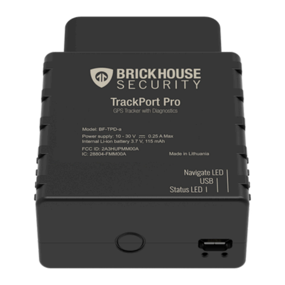
The TrackPort Pro plugs into your vehicle’s OBD-II port, usually located under the dashboard on the driver’s side. Please refer to your vehicle’s manual for the exact location of your OBD-II port. Once securely plugged in, the device will attempt to connect to the 4G network and report its location to the GPS tracking platform. - Page 4 Device LED Description Behavior Meaning Navigation LED Solid Connecting to satellites. Device is not ready to track. Navigation LED Blinking Every Second Connected to the satellites and ready to track. Firmware is being updated. The device should continue to track Navigation LED Blinking Fast Navigation LED Off The device is powered off.
- Page 5 5 seconds to every minute. When your car ignition is off the TrackPort Pro has an internal battery that allows it to send a location update once an hour while your vehicle is parked.
- Page 6 If you have already registered in the system but forgot your password, enter your email address and click Next. On the next page, click on the Forgot password link. If the entered information matches the existing data in the database, instructions for setting your password will be sent to you via email.
-
Page 7: User Settings
User Settings To choose user parameters, click on the username in the right corner of the top panel and press the ‘User settings’ button in the dropdown menu. Next, follow the steps: • Indicate your time zone. • Select the type of daylight savings time used in your region. Please select the settings properly, as they will be used when generating reports, messages, and elsewhere throughout the system. - Page 8 Editing Your Unit Make sure the device is displayed on the monitoring tab before editing a unit. Click the wrench icon next to the unit you want to edit in the 'Units' tab of the work area. When shown on the map, a unit is represented by an icon with a caption displaying its name.
- Page 9 Alternatives to Icons Unit icons can be replaced with simple motion indicators. This option is called Replace unit icons with motion state signs and is set in the user settings. The following symbols are: ● Green arrow: the unit is moving, and the direction of the arrow indicates the direction of movement ●...
-
Page 10: Monitoring Tab
Monitoring Tab The Monitoring tab gives access to the main tracking features. Here you can watch the movement of units on the map, send commands and messages to them, monitor parameter changes online, etc. To open the Monitoring tab, click on its heading in the top panel. The tab has a list of units that you can monitor on the map. - Page 11 To locate a unit on the map, click on its name in the list. The map centers and zooms in on the selected unit. The map displays only those units that are selected in the list. You can select or deselect all units at once using the checkbox in the top left corner of the list.
- Page 12 Live Diagnostic Data You can view live diagnostic data reported by your vehicle in the Monitoring tab. If you are using a web browser, click the device icon next to your tracker’s name, and the information display will open up. If you are using the Locate GPS app, select the device and tap on the Sensors dropdown arrow and it will display the information.
-
Page 13: Vehicle Identification Number
Vehicle Identification Number The TrackPort Pro can extract the Vehicle Identification Number of the car it is installed on and use it to automatically fill out the Profile data in the web platform. Click on the wrench icon to open the Unit Properties menu. The first time you do, a message will appear telling you that a VIN has been detected and to select the Profile tab. - Page 14 There, you can save the VIN and it will automatically populate known information, including vehicle make and model, some engine information, and cargo capacities. Available information will vary, depending on what the manufacturer has made available. Any blank fields can be filled in by hand if you want to maintain a full profile of the vehicle being monitored.
-
Page 15: Tracks Tab
Tracks Tab A track is a line drawn on the map to show how a unit moved during the indicated period. A track is mapped using the points from where messages were reported. Each point stores the date and time when the message was received and coordinates at the point, as well as other parameters (speed, sensors, etc.). - Page 16 Mapping a Track 1. Select a unit in the dropdown list. Its contents depend on the list in the Monitoring tab and access to the units. 2. Adjust the desired parameters for the track (color, thickness, etc.). 3. Define the time interval within which you want to get the data. 4.
- Page 17 Below, we see the result of choosing a single track (one solid color), but you can also select to show a single unit with varying colors for different sensor values and speeds. This will display the trip for the requested time period. You can now see the trip and play it back.
- Page 18 Also, you can click on the circled icon below to see the trip as a geofence in the result line. If you hover the mouse over the icon on the map on the tracking tab, the tooltip will provide you with information.
-
Page 19: Reports Tab
Reports Tab To switch to the Reports tab, click the Reports header in the top panel and select the same name item in the main menu customizer. Reports on the activity of a unit are presented in the form of tables and graphs. They can be viewed in a browser window, as well as exported to files of various formats. - Page 20 Geofences and Notifications Creating a New Geofence By setting up a geofence and creating notifications, the platform can alert you when a GPS device you are monitoring enters or exits the defined area. You can be notified via text or email if it crosses into or out of the zone. Geofences can report units’...
- Page 21 3. Click on New in the menu and give your geofence a clear name and description. It will be helpful when you receive alerts, as you will know which geofence is being triggered and can find the vehicle quickly. 4. After clicking the New button, a help window appears to provide you with instructions for drawing geofences. Choose a geofence type on the left: line, polygon, or circle.
- Page 22 ● Double-click on any place on the map to put the first point. Add more points using the same method. Put the points as close or as far from each other as you want. ● Double-click on a segment between them to insert a point between two other points. ●...
- Page 23 Line: Polygon:...
- Page 24 When finished, press Save. In case of a mistake, press Clear and try again. To close the create mode without saving results, press Cancel. It is IMPORTANT that you create a notification for the newly created geofence for you to receive alerts. Creating a new Geofence Notification In the BrickHouse Locate GPS platform, you can receive notification for any unit activity or change in the device's state.
- Page 25 3. Choose Geofence and click Next. 4. Select when the notification should be triggered: ● When the unit enters the geofence (Inside geofence); ● When the unit leaves the geofence (Outside geofence). Select the resource whose geofences should be displayed in the list (select All available to view the geofences of all available resources).
- Page 26 Using the icon , move the items from the left list to the right one. 5. Select Notification Actions Notify by email - When this action is selected, you can add email addresses to which the notification should be sent. To do this, check the box to the right of the field and specify an address.
- Page 27 Notify by SMS - This action is used to set up SMS notifications. Type one or more telephone numbers in the international format, for example, +375293293294. When all fields for entering phone numbers are filled in, additional slots appear automatically. 6.
- Page 28 7. At the last stage of creating a notification, specify the parameters for its triggering and click OK. The created notification appears in the list in the left part of the window.
- Page 29 Getting to Know the BrickHouse Locate GPS Mobile App The BrickHouse Locate GPS mobile app is available on the Google Play and iOS App Store and can provide you with the same advanced tracking functionality as the web-based GPS platform. The app can be used on any smartphone or device that runs on Android or iOS.
-
Page 30: Login Screen
Login Screen Enter the same username and password you use on the web platform to log in to the mobile app. -
Page 31: Unit Selection
Unit Selection Once logged in, you will see the list of units active on the account under the Monitoring tab. Adding items to the list 1. Select the Units or Groups tab. 2. Tap the icon located to the right of the search and tap Select items. 3. -
Page 32: Map View
The General information section consists of tabs with unit properties. To select the tabs you want displayed in the section, click Configure tab view at the end of the list and enable or disable the required tabs using the switch. The indicated settings are applied to all the units at the same time. - Page 33 Tilt Gestures You can tilt the map by placing two fingers on it and moving them up (increasing tilt angle) or down (decreasing tilt angle). Map Rotation To rotate the map, place two fingers and apply a rotation motion. After the map has been rotated, a compass icon appears in the top right corner.
- Page 34 The top row shows summary info. ● trip duration ( ● track length in trips ( ● parking duration ( Clicking on the time of the day will move the map to show the position where the unit was. The top panel displays the menu in the upper right corner which opens when you click on the menu button.
- Page 35 Report Execution To execute a report, follow the steps described below. 1. Select a report template. ● Geofence ● Location History ● Trips and Parkings 2. Select a unit/unit group (depending on the selected template, the list shows all the available objects). 3.
- Page 36 Thank you for choosing BrickHouse Security for your GPS tracking needs. For further support with the Locate GPS platform or anything else, please reach out to us by email, phone, or live chat at BrickHouseSecurity.com. Email: support@brickhousesecurity.com Phone: 800-654-7966 You can also find lots of learning materials including instructional videos on how to use specific features of the Locate GPS platform at: help.brickhousesecurity.com...
Need help?
Do you have a question about the TrackPort Pro and is the answer not in the manual?
Questions and answers