Table of Contents
Advertisement
Quick Links
Advertisement
Table of Contents

Subscribe to Our Youtube Channel
Related Manuals for Voxson Voxtrack GPS800

Summary of Contents for Voxson Voxtrack GPS800
- Page 1 Voxtrack 800 Navigation Software User Guide...
- Page 2 Voxtrack 800 Navigation Software User Guide Notices, Disclaimers and Terms of Use Limited Product Warranty. Homeland Security Technology Corporation (HSTC) warrants to the Client that the Products shall substantially conform to HSTC’s specification for a period of one (1) year from the date of the original purchase by the end user (the "Warranty Period"). As HSTC 's sole obligation and Client's exclusive remedy for any breach of warranty, HSTC agrees, at its sole option, to (i) use reasonable efforts to repair the Product with new or refurbished replacement parts;...
-
Page 3: Table Of Contents
Switch Maps...36 Help...36 5.10 About...36 Chapter 6 Settings ... 37 Introduction ...37 The Settings Menu...38 GPS Status And Settings...38 Home Button Settings ...40 General Settings ...41 Map Settings ...42 Route Settings ...43 Alert Settings...45 Visual Notifications...46 6.10 Look & Feel...48... - Page 4 Voxtrack 800 Navigation Software User Guide Chapter 7 Changing Map Views ... 49 Introduction ...49 How to Zoom and Scroll...49 Types of View ...50 Chapter 8 Auto & Favorites Alerts ... 53 Introduction ...53 Configuring Auto Alerts Category ...53 Configuring Auto Alerts Items ...54 Favorites Alerts ...54 Chapter 9 Glossary...
- Page 5 Figure 14 - Turn by Turn Dialog ... 35 Figure 15 - GPS Status Screen... 38 Figure 16 - GPS Settings Dialog ... 39 Figure 17 - Home Button Settings Screen... 40 Figure 18 - General Settings Dialog ... 41 Figure 19 - Map Settings Dialog...
- Page 6 Voxtrack 800 Navigation Software User Guide Note: This hand book provides a reference guide to the VOXTRACK 800 navigation system, and the basic functions of the device are described, mainly in respect of navigation software. The contents of this manual may be changed at any time without prior notification. No liability shall be assumed for technical or editorial errors or omissions herein;...
-
Page 7: Your New Voxtrack 800
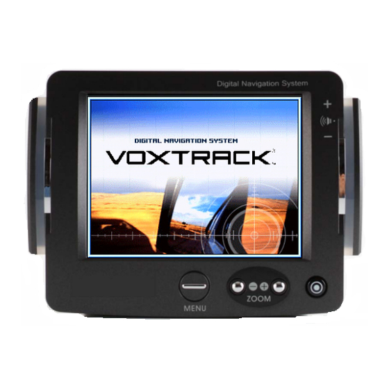
1.1 Introduction The Voxtrack 800 Navigation Device is a full-featured mobile satellite navigation system. It utilizes GPS (Global Positioning System) satellites to pinpoint your location utilizing the latest mapping data technology to get you to your destination in the most efficient and timely manner. -
Page 8: Register Your Device
Options Menu by pressing the select 1.5 Technical Support If you have other questions about Voxtrack 800 navigation system, please contact your supplier or Voxson Technical Support via email at support@voxson.com or by telephone Hotline: (07) 3868 1277. button, cycle to the... -
Page 9: Starting Voxtrack 800 Navigation
Voxtrack 800 Navigation Software User Guide Starting Voxtrack 800 Navigation 2.1 Introduction This chapter will guide you through how to enter navigation mode on the Voxtrack 800 and start the navigation software. 2.2 Starting the Navigation Software The Voxtrack 800 navigation software and the digital map material are supplied on the included SD memory card. - Page 10 2D map perspective. NOTE: The position indicated on the map initially may not be your current location if the GPS has not been allowed time to calculate a position fix. The GPS will automatically search for satellite signals when the unit is on and may take up to several minutes to calculate a position fix.
-
Page 11: Chapter 3 Hardware Installation
Voxtrack 800 Navigation Software User Guide Hardware Installation 3.1 Introduction This chapter will guide you through the installation of the Voxtrack 800 navigation system. Warning Carefully select a safe location to install the DO NOT INSTALL the device in any place that could: ♦... -
Page 12: Installing The Voxtrack 800 Navigation System In Your Vehicle
Voxtrack 800 Hardware User Manual included in the package. Note: The GPS may take a few minutes to find its current location initially. For best results, ensure that the GPS has a clear view of the sky. -
Page 13: Chapter 4 Navigating A Route
This chapter will help you to define and plan a route. You will be able to select a destination, set your origin, or plan a journey. The route calculated in real time is from your current GPS position. There are several ways to configure your destination using the Menu button ( ). -
Page 14: Map Description
Statistics Button Location Icons shows your current location while in Navigation Mode. shows your last known GPS location while in Navigation Mode. This is not your current location, because there is no valid GPS information at this time. shows the Origin in Planner Mode. - Page 15 Displays GPS status, such as information about your satellite fix, and the latitude, longitude and altitude of your position. The icon appears green when there is a GPS fix, and red when there is no GPS fix. Also provides a link to the GPS Settings screen.
-
Page 16: Figure 2 - Menu Structure
Voxtrack 800 Navigation Software User Guide Menu Button The Menu Button opens the Destination Menu. Pressing the buttons at the bottom of the screen allows you to cycle between the Destination Menu, the Options Menu and the Settings Menu as seen in Figure 2. -
Page 17: The Destination Menu
Voxtrack 800 Navigation Software User Guide 4.3 The Destination Menu At the map screen, press the Destination menu. You can choose your destination from the following options: • Address list • Point of Interest (POI) list • Favorites list • History list From your current position, the route is calculated and displayed as a blue line. -
Page 18: Navigate To An Address (Or Intersection)
Voxtrack 800 Navigation Software User Guide 4.4 Navigate To An Address (or Intersection) When you navigate to an address, there are several ways of defining your destination. You can navigate to a destination by selecting an address, a zip/postal code, or an intersection. - Page 19 Voxtrack 800 Navigation Software User Guide Lets you search for an address by first entering the City, then the Street, then the Number. Lets you search for an address by first entering the Street, then the City, then the Number. Lets you search for an address by first entering the Zip/Postal Code, then the Street, then the Number.
- Page 20 Voxtrack 800 Navigation Software User Guide Once you have entered your destination, there are several options available on the toolbar found at the bottom of the screen. is shown as a blue line on the map. displays its details. Favourites Folder, or to set it as your Origin. As you drive, Voxtrack 800 provides you with turn-by-turn voice and visual directions, letting you know when your next turn is coming up until you arrive at your destination.
-
Page 21: Navigate To A Point Of Interest (Poi)
Voxtrack 800 Navigation Software User Guide Navigate To A Point of Interest (POI) The Points of Interest (POI) list is a collection of potential destinations of interest in predefined categories. POIs are identified on the map by various icons (eg: POI navigation is especially handy when you need to find a facility, attraction or amenity by category or type. - Page 22 Highlight your choice and click your route. The route is shown on the map as a blue line from your current GPS position. You can select on the map, or press to your Favourites or to set it as your Origin. You can also select Settings to define your Search Radius and Search Centre.
-
Page 23: Navigate To A Favorite
Highlight your selection and click calculate your route. The route is shown on the map as a blue line from your current GPS position. You can also select destination on the map, or press delete your choice, or to set it as your Origin. -
Page 24: Save To Favorites
Voxtrack 800 Navigation Software User Guide 4.7 Save to Favorites When selecting a Destination, which you may use regularly, you can save it to your personalized Favorites list. At the map screen, press the Destination menu. Select and specify your desired destination as described previously, be it from Address, POI, History or Contacts. -
Page 25: Navigate To A History Item
Highlight your selected History item and click shown on the map as a blue line from your current GPS position. You can also select destination on the map, or press destination to your Favourites or to set it as your Origin. -
Page 26: Navigate To A Point On The Map
Cursor Dialog, and select Set As Origin. All new route calculations will use this as the starting point, but only if you are in Planner Mode. In Navigation Mode, your current GPS location is always your Origin. Page 26 of 59 Dialog Box on the... -
Page 27: Trip Planning
Voxtrack 800 Navigation Software User Guide 4.10 Trip Planning Trip planning is useful when you have more than one destination along your route. This process is similar to the procedures used to enter or select a destination and initiate navigation, except that you must be in Planner Mode. When you press the departure point to the first waypoint. -
Page 28: Figure 9 - Adding A Trip Folder
Voxtrack 800 Navigation Software User Guide Note: If this is the first time you are using Trip Planner you will need to create a Trip Folder in which to store your trip details. You can use any name. For this example we will be using My trip. From the tool bar at the top of the screen, click Tools and select Add to create a trip folder. -
Page 29: Figure 10 - Trip Planner And Waypoints Dialogs
To calculate the route, press Navigate The route is shown as a blue line from your current GPS position. * Remember to change back to Navigational Mode. * See Section 6.7 Route Settings for a description of Navigation Mode and Planner Mode. -
Page 30: Avoid Roads
Voxtrack 800 Navigation Software User Guide 4.11 Avoid Roads You can specify that certain roads be excluded from your route calculations. For example, you may prefer to not travel on any toll roads. From the Destination Menu, press the Avoid Roads button to display a list of road categories. -
Page 31: Figure 12 - Avoid Roads (Items)
Voxtrack 800 Navigation Software User Guide Figure 12 - Avoid Roads (Items) Once you have specified your road restrictions, press MENU button to return to the map screen. Page 31 of 59... -
Page 32: Chapter 5 Options
Voxtrack 800 Navigation Software User Guide 5.1 Introduction There are various route and map options available from the Options Menu. This chapter contains the following topics: • Showing your Route • Displaying Directions • Canceling your Route • Recording and Playing Back a Route •... -
Page 33: The Options Menu
Voxtrack 800 Navigation Software User Guide 5.2 The Options Menu The Options Menu provides choices for displaying your route, displaying your driving directions, canceling a route, playing and recording a route, switching maps, selecting your mode of travel, and getting help with basic navigation. 5.3 Show Route This option displays your route on the map screen in its entirety, plus details such as the address of and distance to... -
Page 34: Figure 13 - Driving Directions
Voxtrack 800 Navigation Software User Guide Figure 13 - Driving Directions The Driving Directions screen also gives you several route options: Show Route Displays your route on the map screen in its entirety, plus details such as the address of your destination, the ETA, and the ETR. -
Page 35: Turn By Turn
Voxtrack 800 Navigation Software User Guide 5.5 Turn By Turn This view indicates the distance to your next turn, and the name of the next street immediately after completing the previous turn. Voice and visual prompts are displayed at varying intervals to indicate your next turn or change of direction. -
Page 36: Play
Voxtrack 800 Navigation Software User Guide 5.7 Play This feature allows you to record your route as you’re traveling, and then to play it back on the map screen at a later time. From the Play/Record screen, you can record a route, play back a route, change the speed of the playback, and delete recordings. -
Page 37: Chapter 6 Settings
Voxtrack 800 Navigation Software User Guide 6.1 Introduction You can easily change the default settings of maps, views and route parameters to suit your personal preferences. This chapter contains the following topics: • GPS Status • Home Button Settings • General Settings •... -
Page 38: The Settings Menu
Navigation mode, the software automatically acquires GPS signals and constantly updates your vehicle's location and position. The GPS may take a few minutes to find its current location initially. For best results, ensure that the GPS has a clear view of the sky. -
Page 39: Figure 16 - Gps Settings Dialog
1. COM Port - Defines the Communications Port. 2. Baud Rate - Transmission rate of data. 3. Protocol - Default is NMEA. Find GPS – Searches for and locates the GPS signal. Set GPS - Sets the GPS Configuration. Press the MENU button to save your selections and return to the GPS Satellite graphic screen. -
Page 40: Home Button Settings
Voxtrack 800 Navigation Software User Guide 6.4 Home Button Settings The Home Button Settings button lets you define an address or POI as your home destination. Whenever you want to navigate to your home destination (for example, the nearest gas station), press the In the Home Button Settings screen, select either POI Mode or Address Mode to set your desired destination. -
Page 41: General Settings
Voxtrack 800 Navigation Software User Guide 6.5 General Settings The General Settings screen allows you to choose the unit of measurement for your route. Figure 18 - General Settings Dialog All distances are displayed in imperial or metric units. 1. Imperial (Miles and yards) 2. -
Page 42: Map Settings
Voxtrack 800 Navigation Software User Guide 6.6 Map Settings The Map Settings screen lets you customize your map display. Figure 19 - Map Settings Dialog Map Orientation Forward is up – orients the map so that your forward direction is always at the top. North is up –... -
Page 43: Route Settings
Navigation Mode – Provides voice instructions as you drive. This mode is the one you will use most frequently. Voxtrack 800 uses the satellite-based global positioning system (GPS) to constantly detect your current position. As you drive, your location is compared to the destination you have chosen and you will be constantly provided with accurate driving directions. -
Page 44: Route Generation
Voxtrack 800 Navigation Software User Guide Route generation Quickest route – Voxtrack 800 calculates the route by picking the shortest distance and highest speed limits. Shortest route – Voxtrack 800 calculates the route by picking the shortest distance. U Turn Usage U Turn enabled - If you select this option, the route will be calculated by including any U Turns that are needed. -
Page 45: Alert Settings
Voxtrack 800 automatically recalculates a new route and updates ETA and distances. 3. Low Signal - Warns that you are in an area of low GPS signal. 4. GPS Not Found - Alerts you if the GPS signal is lost, or if power is removed from the GPS receiver. -
Page 46: Visual Notifications
Voxtrack 800 Navigation Software User Guide 6.9 Visual Notifications The Visual Notifications screen lets you choose how Voxtrack 800 notifies you of your upcoming turns. Figure 22 - Visual Notifications Screen 1. Text – Visual notification is displayed in written form. 2. - Page 47 Voxtrack 800 Navigation Software User Guide When the Turning Lights feature is enabled, the LEDs will blink at a rate of once per second at the following distances from the maneuver: • At 500 meters from the maneuver, the blue LED will blink for 5 seconds.
-
Page 48: Look & Feel
Voxtrack 800 Navigation Software User Guide 6.10 Look & Feel The Look & Feel screen allows you to customize the sound and appearance of Voxtrack 800 navigation software. Figure 23 - Look & Feel Screen Voice Prompts – Default or change to different voice. Skin –... -
Page 49: Chapter 7 Changing Map Views
Voxtrack 800 Navigation Software User Guide Changing Map Views 7.1 Introduction You can change your view of the map, and the way in which the map is displayed on the screen. This chapter contains a description of the following topics: •... -
Page 50: Types Of View
Voxtrack 800 Navigation Software User Guide When Automatic Zoom is not selected, you can zoom in or zoom out manually and it will remain at that level. You can scroll the map by holding your stylus on the screen, and dragging the image in any direction. 7.3 Types of View button on the map screen toggles between 4 types of views: 2D, 2D Night, 3D and 3D Night. -
Page 51: Figure 26 - 3D View
Voxtrack 800 Navigation Software User Guide The route, start point and destination (outlined in blue) are clearly visible under a variety of weather and driving conditions. 3D View The 3D view is a simplified three-dimensional view showing the map in a basic 3D relief. It shows the basic relief (outline) and details of the surrounding roads and general area. -
Page 52: Figure 27 - 3D Night View
Voxtrack 800 Navigation Software User Guide Origin Figure 27 - 3D Night View Page 52 of 59... -
Page 53: Chapter 8 Auto & Favorites Alerts
Voxtrack 800 Navigation Software User Guide Auto & Favourites Alerts 8.1 Introduction An Automatic Alert refers to an item that you can configure so that Voxtrack 800 will alert you when you are within a certain distance of the item’s location. You can configure two distances for each Automatic Alert. -
Page 54: Configuring Auto Alerts Items
Voxtrack 800 Navigation Software User Guide To display the map position of items in the Auto Alerts category, check the box to the left of the category name, just as you would to display map positions of items in any other category. Select Save to complete the configuration. -
Page 55: Chapter 9 Glossary
Does not allow for any delays. A list of Frequently Asked Questions with Answers. The GPS (Global Positioning System) is a "constellation" of 24 well-spaced satellites that orbit the Earth and make it possible for Vehicles/ people/ assets enabled with GPS receivers to pinpoint their location. - Page 56 Page 56 of 59 Description equator - expressed in degrees. Path or trajectory of a body through space. A GPS satellite traces out an orbit about the earth. A place or item of interest along the selected route. A man-made object, or device that orbits the earth.
-
Page 57: Chapter 10 Index
Voxtrack 800 Navigation Software User Guide 2D View... 53 3D View... 54 Address ... 18 Known ... 17 Button Descriptions ... 14 Plan ... 16 City Find ... 19 Name... 19 Com Ports ... 41 Favorites ... 24 Glossary ... 57 Baud Rate ... - Page 58 Zoom ... 52 Route generation... 46 Save Favorites ... 24 New Origin ... 26 Settings Alert... 47 General ... 43 GPS... 40 Map Orientation... 44 Route... 45 Units ... 43 Shortest route... 46 Speed ... 47 Start Point... 26 Street Find...
- Page 59 Voxtrack 800 Navigation Software User Guide NOTES Page 59 of 59...
Need help?
Do you have a question about the Voxtrack GPS800 and is the answer not in the manual?
Questions and answers