Table of Contents
Advertisement
Quick Links
Set up and Configuration of the
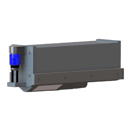
Imagenex DT101
DT101
Date
Revision
Prepared by
Author
Technical Manual
Multibeam Echosounder
Imagenex Technology Corp.
209-1875 Broadway Street
Port Coquitlam, BC
Canada V3C 4Z1
Telephone: +1 (604) 944-8248
Fax: +1 (604) 944-8249
info@imagenex.com
www.imagenex.com
/ DT102
Xi
Xi
Document Number
29 October 2020
01
Imagenex Technology Corp.
Tarry Waterson
/ DT102
Xi
Multibeam Echosounder
430-041-01
For Issue
Xi
Advertisement
Table of Contents

Related Manuals for IMAGENEX DT101Xi


Summary of Contents for IMAGENEX DT101Xi
- Page 1 Technical Manual Set up and Configuration of the Imagenex DT101 / DT102 Multibeam Echosounder Imagenex Technology Corp. 209-1875 Broadway Street Port Coquitlam, BC Canada V3C 4Z1 Telephone: +1 (604) 944-8248 Fax: +1 (604) 944-8249 info@imagenex.com www.imagenex.com DT101 / DT102 Multibeam Echosounder...
-
Page 2: Table Of Contents
Table of Contents Introduction ............................5 1.1. Document Identification ......................... 5 1.2. System Overview .......................... 5 1.3. Document Overview ........................5 1.4. Reference Documents ........................5 1.4.1. Acronyms and Abbreviations ....................6 System Description ........................... 7 2.1. Introduction ............................ 7 2.2. - Page 3 APPENDIX A DT101 / DT102 Spec Sheets ................35 DT100 SIR – DT101 APPENDIX B / DT102 Sonar Cable ............43 APPENDIX C DT100 SIR unit interface .................... 44 WINDOWS™ TCP/IP Set-up and TROUBLESHOOTING ......... 60 APPENDIX D APPENDIX E QUICK CHECK LIST ....................
- Page 4 Figures and Tables Figure 2-1 Examples of MBES data acquired with a DT101 on a small survey vessel 7 Figure 3-1 Orientation of the DT101 Figure 3-2 Orientation of the DT102 Figure 3-3 MRU Axes of Rotation ([mm] and inches): 11 Figure 3-4 General convention for sensor static offsets 12 Figure 3-5 Acoustic centre of transducer ([mm] and inches) 13 Figure 3-6 Line spacing example [Manual on Hydrography] 15...
-
Page 5: Introduction
1. Introduction 1.1. Document Identification This document describes the recommended configuration and set-up of the DT101 and DT120 Multibeam Echo Sounders and outlines considerations to be made whilst planning and conducting a multibeam bathymetric survey. 1.2. System Overview The DT101 and DT102 are advanced Multibeam Echo Sounder systems with optional integrated motion reference units and sound velocity sensors. -
Page 6: Acronyms And Abbreviations
1.4.1. Acronyms and Abbreviations Acronym Meaning MBES Multibeam Echo Sounder Motion Reference Unit Sound Velocity Sensor Sound Velocity Remotely Operated Vehicle Autonomous Underwater Vehicle Unmanned Surface Vehicle Autonomous Surface Vehicle Inertial Measurement Unit Common Reference Point Centre of Gravity Line of Sight Global Navigation System GNSS Global Navigation Satellite System... -
Page 7: System Description
System Description 2.1. Introduction Both the DT101 and DT102 are beamforming multibeam echosounders (MBES) with optional internally integrated motion reference unit (MRU) and sound velocity sensor (SVS). The DT101 is a 120° X 3° system while the DT102 is a 180° X 3° system. Both DT101 and DT102 MBESs are a single instrument optionally integrating the sonar, MRU and SVS into one sleek and compact unit. -
Page 8: System Requirements
2.3. System Requirements The minimum requirements to gather bathymetric data using a MBES system is as follows: • A platform (vessel / vehicle) • A MBES • A sound velocity (SV) sensor • A motion reference unit (MRU) or Inertial Measurement Unit (IMU) •... -
Page 9: Preparation
The Sensor Interface Relay (DT100 SIR) unit provides power for the integrated MRU and SV sensor (if fitted) as well as the sonar head so no additional power is required for the Imagenex supplied equipment. Power is also made available on the GNSS (GPS), Heading and Sound Velocity ports (at user selectable 12 and 24 VDC See APPENDIX C 6. -
Page 10: Figure 3-1 Orientation Of The Dt101
The MBES unit forward / aft line should be mounted and orientated as parallel as possible to the vessels fore aft line, as indicated in Figure 3-1 Orientation of the DT101Xi and Figure 3-2 Orientation of the DT102Xi ([mm] and inches):... -
Page 11: Figure 3-3 Mru Axes Of Rotation ([Mm] And Inches)
• It is good practice, where possible, to mount the MRU as close as possible to the intersection of the roll and pitch axes or at the centre of gravity (COG) of the vessel. This minimized the heave induced by the lever arms (the physical 3-dimensional offsets between the MRU centre of rotation and the acoustic centre of MBES). -
Page 12: Establishing Of Vessel Reference Frame And Sensor Static Offsets
• The minimum specification for the DT100 SIR box control computer is as follows: Intel i5 processor 8 GB Ram USB 3.0 A discreet hardware Ethernet port supported by a Realtek PCIE GBE family chipset (not an FE family chipset) (see bullet point above). 3.2.2. -
Page 13: Figure 3-5 Acoustic Centre Of Transducer ([Mm] And Inches)
Note that Hypack adopts a different convention in the vertical (Z). See below from the Hypack systems manual: The vertical offset is the distance below the static waterline of the vessel. This is the waterline location when the boat is stationary. Of course, this point changes under various conditions (weight of passengers, fuel and cargo), but you have to start somewhere. -
Page 14: Vessel Dimensional Control / Shape File
3.2.3. Vessel Dimensional Control / Shape File Most navigation packages allow the user to input the size / shape of the vessel and define various points of interest by means of a shape file. It is recommended that the Surveyor generates such a shape file as a means of quality control and that during survey operations, the locations of, for example the MBES, GPS antenna, etc., are shown on the nav screen. -
Page 15: Figure 3-6 Line Spacing Example [Manual On Hydrography]
Figure 3-6 Line spacing example [Manual on Hydrography] For Special Order and Order 1a surveys, no recommended maximum line spacing is given as there is an overriding requirement for full sea floor search and it is generally recommended that line spacing be such that 100% overlap per swath is achieved. -
Page 16: Ping Rate And Survey Speed
Where: LS = Line spacing (m) A = overlap required (e.g. 75% coverage; A = 0.75, 100% coverage A=1) Z = Approximate depth below transducer (m) Ø = Set Beam Angle - (e.g. 120) (°) 3.2.5. Ping Rate and Survey Speed There is a relationship between the survey speed, water depth, fore / aft beam width, overall swath width and ping rate. - Page 17 Cross-track (Eq 4) (�� + �� �� �� ���� = 2�� ∅ (Eq 5) �� �� × tan ( �� ( ��/2 ) 2�� (Eq 6) �� �� tan ( 90 − 2∅ �� Where: ct = cross-track footprint length (m) = cross-track ensonification size at outer beam (m) = cross-track ensonification size at nadir (m) z = water depth (m)
-
Page 18: Datum Set-Up
The footprint on the seabed approximates an ellipse with semi-minor axis = ct (Eq 4) and semi-major axis = lt (Eq 7). The semi-minor axis is the axis of interest as the long-track direction will be saturated with scans if the correct survey speed is achieved (See Section 3.2.5 Ping Rate and Survey Speed). -
Page 19: Background Graphics
3.2.9. Background Graphics Most navigation software allows for the loading of electronic navigational charts (ENCs). If used, ENCs normally need to be purchased and loaded as an aid during survey. If ENCs are not to be used, it is recommended to digitize and load the coastline and any navigation hazards that may exist in the survey area. 3.2.10. -
Page 20: Pre-Survey Observations
Most SV sensors can be set to log at set depths or continuously. The set depth is a better option as the profile is generally smoother. Imagenex has free software to process CTD casts and collate the output as set intervals. There are various formulae (for example Del Grosso, Chen and Millero, Mackenzie etc.) for calculating sound velocity and are maximum depth and region specific. -
Page 21: Mbes Patch Test
The angular deflection of the sound impulse as a result of the temperature gradient is given by Snell’s Law: sin ∅ ��2 (Eq 12) sin ∅ ��1 ��2 × sin ∅ (Eq 13) ∅ = arcsin ( ��1 Where Ø = Angle of refracted beam (rad) Ø... - Page 22 The purpose of the patch test is to measure these errors and derive compensation values for Latency, Pitch, Roll, and Yaw. The following table (Table 4-1) describes the parameters affected by the various rotations and latency: Parameter Affects Latency Sounding position Roll Sounding position and depth Pitch...
-
Page 23: Latency
4.2.1. Latency Coincident lines of approximately 100 m are run at different speeds (4 knots and 8 knots) over a sloping terrain or a conspicuous topographic feature. Slow Fast Latency lines Figure 4-1 Lines must be run in the same direction, in order to eliminate the effect of a potential pitch offset, which would leak into the along-track displacements. -
Page 24: Figure 4-2 [Sketch Courtesy Of A Godin]
[Sketch courtesy of A Godin] Figure 4-2 Data should be logged keeping speed changes (per run) to a minimum. During processing, a subset of the feature / slope along the most pronounced point at nadir should be extracted and processed using the patch test utility in the MBES processing package. The output of this process should be the latency offset, that when applied would bring the feature / slope points (at the different speed runs) to the same spatial location. -
Page 25: Roll
4.2.1. Roll A section of flat seabed should be selected and lines run at the same speed but on reciprocal headings: Same line, reciprocal headings Figure 4-3 Roll lines The roll offset can be approximated, using the following equation (Eq 15): ��... -
Page 26: Pitch
It is recommended to repeat the exercise using various cross profiles and the average derived and applied. The Surveyor should verify the sign of the roll corrections. Hypack automatically corrects for the sign and the reported pitch correction should be applied as is. Other patch test software may require an inversion of the sign and the Surveyor must be aware of this. -
Page 27: Yaw
sketch courtesy of A Godin] Figure 4-6 [ The latency derived in Section 4.2.1 should be applied prior to any processing. The inconsistencies in position of the feature / slope is as a result of an error in pitch alignment between MRU and MBES head. -
Page 28: Figure 4-7 Yaw Lines
Figure 4-7 Yaw lines The yaw offset can be approximated, using the following equation (Eq 17): �� (Eq 17) �� −1 �� = sin �� �� Where γ= Yaw offset (deg) = along-track displacement h = The relative cross track distance for beam i (m) Figure 4-8 shows the along-track profiles and represent the apparent seafloor swept by the outer beams. -
Page 29: Bar Check
The output of this process will be the yaw correction, that when applied would bring the along-track profiles together. It is recommended that another set of lines be run in the same configuration and re-processed to verify the calibration. If not possible, it is recommended that additional along-track overlapping datasets are processed and the average applied. -
Page 30: Check Lines
Figure 4-9 Reference surface lines 4.4.2. Check lines A new sound velocity cast within the reference surface area should be undertaken. A pair of parallel lines (>300m long), inside the reference surface should be run as shown in Figure 4-10. Inter-swath overlap is not required. -
Page 31: Figure 4-11 Hypack Xyz Options
4.4.3.1. Reference Model Processing A sounding grid should be defined (in Hypack this is done prior to commencement of the survey and is called an MTX file) that is within the test area with a cell size of 0.3 m x 0.3 m. Tides and sound velocity should be applied to all logged data. -
Page 32: Figure 4-13 Hypack Example
Another output is shown below (Figure 4-13) and is produced by Hypack. The X axis shows the distance from nadir and Y axis (left) shows the residual (or uncertainty) between computed reference average depth and check lines at the 95% confidence level. As can be seen (and expected), the residual increases with distance from nadir. -
Page 33: Operations
It is highly recommended that during all data acquisition the Imagenex proprietary .IGX format file is logged. In the Imagenex DT100 SIR software, the user selects File > Record Start… and a file with parameters determined by Setup > Automatic Filenames, Automatic Filename Type and Set Maximum Filesize will be logged. -
Page 34: Data Processing
Data Processing The processing of multibeam data is a specialized undertaking and cannot comprehensively be covered in this document. The following bullet points are fundamental considerations to be made during data processing: • Data should be loaded with the correct sounding grid cell size (see Section 3.2.6). •... -
Page 35: Appendix Adt101 Xi / Dt102 Xi Spec Sheets
APPENDIX A DT101 / DT102 SPEC SHEETS DT101 Doc no: 430-041-01 35 of 64... - Page 36 Doc no: 430-041-01 36 of 64...
- Page 37 Doc no: 430-041-01 37 of 64...
- Page 38 Doc no: 430-041-01 38 of 64...
- Page 39 DT102 Doc no: 430-041-01 39 of 64...
- Page 40 Doc no: 430-041-01 40 of 64...
- Page 41 Doc no: 430-041-01 41 of 64...
- Page 42 Doc no: 430-041-01 42 of 64...
-
Page 43: Appendix Bdt100 Sir - Dt101 / Dt102 Sonar Cable
- VIN +VIN +VIN XMIT+ XMIT+ XMIT- XMIT- IMAGENEX TECHNOLOGY CORP Subconn D4TSP Cable (50 ft - 15.24m) Title: DT100 SIR – DT101 / 2Xi Sonar Cable Document Number: 837-200-305 Rev 00 Date: 2019/09/03 Sheet 1 of 1 Figure 6-1 Sonar Cable Schematic... -
Page 44: Appendix Cdt100 Sir Unit Interface
APPENDIX C DT100 SIR UNIT INTERFACE Figure 6-2 Sensor Interface Relay Schematic Doc no: 430-041-01 44 of 64... - Page 45 The connection of sensors to the DT100 SIR unit is detailed below: 1. Sonar Head • Connection is made via the supplied DT100 SIR – DT101 / 2 interface cable via the 20 pin Samtec (green keyed) connector: Panel = Samtec ACRK-22-02-G-S-C-P-2 20 pin (Green Keyed) Cable = Samtec ACPK-22-02-G-T-P-2 Direction (Relative to SIR) Function...
- Page 46 2. GNSS (GPS) • The GNSS is connected via a Samtec 20 pin (4+16) (blue keyed) connector: Panel = Samtec ACRK-22-05-G-S-C-P-3 4+16 pin (Blue Keyed) Cable = Samtec ACPK-22-05-G-T-P-3 Direction (Relative to SIR) Function Note GPS Heading RS232 GPS (($GPGGA, $GPVTG, $GPZDA) RS232 Reserved Signal Common...
- Page 47 • Communication parameters are set as follows in the SIR unit: Item Settings Baud rate 19200 Number of bits Stop bit Parity bit None Supported strings Valid NMEA ($GPGGA, $GPVTG, $GPZDA and optional $HEHDT) Table 6-3 • Power is available on Pin 18, Pin 20 (12 VDC or 24 VDC option depending on jumper setting (see Figure 6-8)) for powering of GNSS if required: •...
-
Page 48: Figure 6-3 Gps Cw Pps External
GPS / RTK ( with PPS External) RX GPS (blue) TX GPS Signal GND (brown) Signal GND GPS / Blue Samtec 20 pin RTK cw DB9 (F) DB9 (M) TX PPS Change Jumpers in SIR COMMON on outer PPS COMMON Figure 6-3 GPS cw PPS External Doc no: 430-041-01 48 of 64... -
Page 49: Figure 6-4 Dual Antenna Gnss Cw Pps External
GNSS (Dual Antenna) with Heading (PPS Internal) RX GPS Heading (green) TX Heading RX GPS (blue) TX GPS Signal GND (brown) Signal GND PPS (+) (orange) TX PPS GNSS (dual Blue Samtec 20 pin PPS COM PPS Common antenna) DB9 (F) DB9 (M) cw PPS Figure 6-4 Dual Antenna GNSS cw PPS External... -
Page 50: Figure 6-5 Gnss With Internal Pps
GNSS with PPS Internal RX GPS (blue) TX GPS Signal GND (brown) Signal GND TX PPS Signal GND (orange) Signal GND (green) PPS COM GNSS cw Blue Samtec 20 pin DB9 (F) DB9 (M) Figure 6-5 GNSS with Internal PPS Doc no: 430-041-01 50 of 64... -
Page 51: Figure 6-6 Gnss (No Heading Nor Internal Pps)
GNSS RX GPS (blue) RX GPS Signal GND (brown) Signal GND Blue Samtec 20 pin GNSS Figure 6-6 GNSS (no heading nor internal PPS) Doc no: 430-041-01 51 of 64... -
Page 52: Figure 6-7 Jumpers For Heading And Pps Selection
Figure 6-7 Jumpers for Heading and PPS Selection Doc no: 430-041-01 52 of 64... - Page 53 3. Motion Reference Unit (MRU) • The MRU is connected via a Samtec 20 pin (4+16) (yellow keyed) connector: Panel = Samtec ACRK-22-05-G-S-C-P-4 4+16 pin (Yellow Keyed) Cable = Samtec ACPK-22-05-G-T-P-4 Direction (Relative to SIR) Function Note RS232 Reserved Signal Common Heading Assist RS232 Signal Common...
- Page 54 4. Heading • Heading is connected via a Samtec 8 pin (blue keyed) connector: Panel = Samtec ACRK-22-03-G-S-C-P-3 8 pin (Blue Keyed) Cable = Samtec ACPK-22-03-G-T-P-3 Direction (Relative to SIR) Function Note Power Power HEADING RS232 Reserved Signal Common SHLD Shield Table 6-6 •...
- Page 55 5. Sound Velocity Sensor (SVS) • Sound Velocity is connected via a Samtec 8 pin (orange keyed) connector: Panel = Samtec ACRK-22-03-G-S-C-P-1 8 pin (Orange Keyed) Cable = Samtec ACPK-22-03-G-T-P-1 Direction (Relative to SIR) Function Note +24 VDC Power Power Common RS232 Reserved Signal Common...
-
Page 56: Figure 6-8 Power Supply Voltage Option
Figure 6-8 Power Supply Voltage Option Doc no: 430-041-01 56 of 64... - Page 57 7. Ethernet (SIR Processing and Beamforming Computer) • Standard 100 Mbps Ethernet via RJ45 connector. Recommended wired as T-568B (no crossover): Colour White/Orange (Transmit +) Orange (Transmit -) White/Green (Receive +) Blue White/Blue Green (Receive -) White/Brown Brown Table 6-11 •...
- Page 58 9. PPS BNC connector • Depending on the user jumper settings (see Figure 6-7) the 1PPS input can be provided via either the GPS or the BNC connector. • This optional input receives 0 – 5 VDC logic level 1PPS pulses. 10.
- Page 59 11. Samtec Connector Pin Outs Sonar Head GNSS (GPS), MRU Heading, Sound Velocity 12-36 VDC Power Table 6-15 Doc no: 430-041-01 59 of 64...
-
Page 60: Appendix Dwindows™ Tcp/Ip Set-Up And Troubleshooting
APPENDIX D WINDOWS™ TCP/IP SET-UP AND TROUBLESHOOTING The SIR unit communicates with the DT101_SIR software running on an attached PC. The connection to the SIR unit is made via Ethernet and uses the TCP/IP protocol. In order for connection to occur, the TCP/IP parameters need to be set-up in Windows™. - Page 61 Now the computer is on the same network as the sonar head. When starting the DT100_SIR program, the IP address stored in the “DT100.INI” file is read and a connection will be established. A loopback IP address can also be set in the DT100_SIR program (Setup > IP Address: Output IP Address). This sets an internal IP address so that both the DT100_SIR program and any navigation package may be run on the same computer.
- Page 62 Remove any firewalls present • Select the “Advanced” Tab. De-select the Firewall option (if present). Click ‘Configure’ (in the General tab). • Set Link speed to “Auto” or “10Mbps” • In the ‘Advanced’ tab, select ‘Link Speed / Duplex Mode’ and set to either ‘Auto Mode’ or ‘10 Full Mode’. •...
-
Page 63: Appendix Equick Check List
7. Measure offsets and update in navigation software 430-0 Check Document No Page Mobilization 8. Check most recent version of software (https://imagenex.com/interior- 430-040-00 page/software-download) 9. Set baud rate in external sensors (19200, 8, N, 1) 430-0 10. Connect sensors 430-0 11. - Page 64 Check Document No Page Software configuration 30. Set Range (1.5 to 2 X water depth) 430-040-00 31. Set Gain (start at 10 dB and adjust) 430-040-00 32. Set Display Gain (50%) 430-040-00 33. Set-up IP addresses 430-040-00 34. Set-up units 430-040-00 35.
Need help?
Do you have a question about the DT101Xi and is the answer not in the manual?
Questions and answers