Lowrance 100 Installation And Operation Instructions Manual
Lowrance airmap 100 aviation: operation instruction
Hide thumbs
Also See for 100:
- Installation and operation instructions manual (72 pages) ,
- Installation instructions manual (28 pages)
Table of Contents
Advertisement
Advertisement
Table of Contents

Related Manuals for Lowrance 100


Summary of Contents for Lowrance 100
- Page 1 ® AirMap 100 INSTALLATION AND OPERATION INSTRUCTIONS ®...
- Page 2 For more information, consult the factory customer service department. All features and specifications subject to change without notice. Lowrance Avionics may find it necessary to change or end our policies, regulations, and special offers at any time. We reserve the right to do so without notice.
- Page 3 This device complies with Part 15 of the FCC Rules. Operation is subject to the following two conditions: (1) this device may not cause harmful interference, and (2) this device must accept any interference received, including interference that may cause undesired operation. Note: This equipment has been tested and found to comply with the limits for a Class B digital device, pursuant to Part 15 of the FCC Rules.
-
Page 4: Definition Of Terms/Abbreviations
DEFINITION OF TERMS/ABBREVIATIONS Due to space considerations, the digital displays use abbreviations for some names. They are as follows: ALT ... Altitude BRG ... Bearing - The direction from your present position to a waypoint. CDI ... Course Deviation Indicator - Shows your distance to the side of the desired course line. -
Page 5: Table Of Contents
INTRODUCTION ... 1 SA - What is it? ... 2 Don’t Get Lost ... 2 GETTING STARTED ... 3 Power ... 3 BATTERIES ... 3 Battery Installation ... 3 NiMH Battery ... 3 External Antenna ... 4 Yoke Mount ... 5 OPERATION ... - Page 6 WAYPOINTS ... 42 Waypoint Menu ... 42 Saving Your Present Position as a Waypoint (Quick Save Method) ... 42 Saving The Cursor Position as a Waypoint ... 43 Saving Your Present Position as a Waypoint (Select Number Method) ... 43 Saving a New Position ...
-
Page 7: Introduction
Thank you for purchasing a Lowrance Avionics AirMap 100. With its large LCD screen, easy to use menus, and outstanding performance, we think you’ll be happy with your AirMap 100 for many years. No other handheld GPS receiver on the market today has the AirMap’s combination of 12 ®... -
Page 8: Sa - What Is It
(The position can be better than that or worse than that the other 5% of the time.) In other words, the position shown on your receiver is within 100 meters of your actual position, 95% of the time. That’s over 300 feet! Not exactly pinpoint accuracy, but then few people need positioning accuracy greater than this. -
Page 9: Getting Started
5 to 35 volts DC using the external power cable. If the power cable is used, the AirMap 100 automatically switches to it if the external power is greater than the battery voltage. If for any reason the external power fails, the unit automatically switches to the batteries. -
Page 10: External Antenna
You must use a charger supplied by Lowrance in order to charge the battery. Also, this charger will only charge a DR-121. It will not charge any other type of battery installed in the unit, including ni-cads or rechargeable alkallines.) -
Page 11: Yoke Mount
WINDSHIELD DASH Moisten the suction cups and press them firmly against the inside of the windshield, away from your line of sight. Route the antenna’s cable to the GPS receiver and it’s ready for use. YOKE MOUNTING Included with your AirMap is a yoke mounting bracket. -
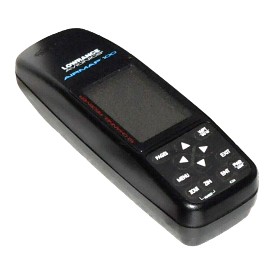
Page 12: Operation
OPERATION Keyboard There are 12 keys on the keyboard. You navigate through the menus, adjust the chart’s cursor, and enter data using the arrow keys. The five major modes of operation are accessed using the PAGES key. Press the MENU key PAGES to select or adjust a feature from a list. - Page 13 50 feet of the actual location. However, this number is only valid if you’re using DGPS or if S/A is turned off. Due to S/A, the accuracy can only be less than 100 meters, 95% of the time, per U.S. government specifications. Although the expected error is not accurate unless you have a DGPS receiver, it does give you an indicator of the fix quality the unit currently has.
-
Page 14: Finding Your Position
It begins searching for the satellites using the above data that it ac- quired the last time it was turned on. This probably was at the Lowrance factory. Since it’s almost certain that you’re not at the Lowrance factory, it’s probably looking for the wrong satellites. -
Page 15: Position Acquisition
thereby giving it the data it needs to determine which satellites are in view. Once the satellites are known, the receiver searches for only those satellites, making a lock faster than an auto search method. Position Acquisition When the receiver locks onto the satellites and calculates a position, it shows the message “Position Acquired”... -
Page 16: Navigation Screens
To change modes, simply press the PAGES key. A screen similar to the one at right appears. Use the up or down arrow keys to change modes. (The windows mode is shown as “groups”. Group “A” is the first win- dows group.) Press the right arrow key while the above menu is showing to switch between different versions of each mode. -
Page 17: Course Deviation Indicator (Cdi)
Lines on either side of the present position show the current cross track error range. Cross track error is the distance you are off-course to the side of the desired course line. The course line is an imaginary line drawn from your position when you started navigating to the destination way- point. -
Page 18: Map
The AirMap 100 has a ground map of the world built inside. This map has the majority of its detail in far southern Canada, the continental United States and Hawaiian islands, northern Mexico, the Bahamas, and Ber- muda. - Page 19 The available ranges are: 0.1, 0.15, 0.2, 0.3, 0.4, 0.6, 0.8, 1, 1.5, 2, 3, 4, 5, 6, 8, 10, 15, 20, 30, 40, 60, 80, 100, 150, 200, 300, 400, 600, 800, 1000, 1500, and 2000 miles.
-
Page 20: Cursor
Cursor Pressing an arrow key turns on two dotted lines that intersect at the present position symbol. These lines are called a “cursor” and have many uses. To turn the cursor on, simply press the arrow key in the direction you want the cursor to move. -
Page 21: Obstructions
Obstructions Your Airmap has obstruction capability. The database installed in your unit lets you see ground obstructions on the map display such as radio and television tow- ers. The obstruction portion of the database covers all of the continental United States, Alaska, and parts of Canada, Mexico, and Bahamas. -
Page 22: Airspace
arrow key. Finally, select “OBSTRUCT OPTIONS” and press the right arrow key. The screen at right appears. The defaults are: obstructions from 205 to 499 feet (shown as 200-500 on the menu) off. Obstructions 500 feet and above off. MSL defaults on. You can change any of these by highlighting the desired menu, then pressing the left or right arrow keys. - Page 23 With “AIRSPACE STATUS” highlighted, press the right arrow key. The center screen above shows next. In this example, we’re in Tulsa class “C” airspace. The time and distance remaining until we leave the inner ring of the airspace (assuming we keep the present track and speed) shows on this screen above the ceiling and floor of the airspace.
-
Page 24: Map Setup
This is the information for the airspace that the cursor is resting on. If there are more pages of information about the airspace, press the left or right arrow keys to view them. To erase this screen, simply press the EXIT key. - Page 25 In the north-up view shown at right, we're travelling southeast towards camp, saved as waypoint number 14. In this view, the present position indicator appears to move towards the lower right corner of the screen. NORTH-UP In the track-up view, the present position moves straight towards the top of the display.
-
Page 26: Autozoom
AUTOZOOM This receiver has an autozoom feature that eliminates much of the button pushing that competitive units force you to make. It works in conjunction with the navigation features. First, recall a waypoint. (See the waypoint section for more information on navigating to a waypoint.) Then, with the autozoom mode on, the unit zooms out until the entire course shows, from the present position to the destination waypoint (recalled waypoint). -
Page 27: View Destination
To use the autozoom feature, first press the MENU key, select “Map 1 Setup”, then “Map Options”. Highlight “Auto Zoom”, then press the right arrow key to turn it on. Press the EXIT key repeatedly to erase the menus. VIEW DESTINATION The GPS receiver normally centers the present position on the screen and moves the map past it. -
Page 28: Earth Map Options
EARTH MAP OPTIONS The earth map consists of the built-in background map of the world. To change the Earth map options, first press the MENU key, then select the Earth Map label. Press the right arrow key. The screen shown at right appears. -
Page 29: Gray Fill
and graphics which can make it unreadable. There are two detail levels: normal and high. The difference between the two shows below. The screen on the left is normal detail, on the right is high detail. Both screens are on the 60 mile range. -
Page 30: Map Boundaries
Map Boundaries The Map Boundary feature shows the area that’s cov- ered by the detailed background map. The solid line on the screen at right shows the coverage area of the de- tail in the built-in background map. If you download SmartMap, WorldMap, or other more detailed maps, the map boundary feature will show their coverage ar- eas, also. -
Page 31: Runway Extensions
Runway Extensions This unit can draw a line on the screen that extends the runway which makes it easier to line up on the runway during final approach. To use the extension, you must first navigate to an airport. (See the Navigation section for more details.) In this example, (shown at right) we’re navigating to Mangham Regional airport in Nacogdoches, Texas. -
Page 32: Plot Trail Options
TRAIL OPTIONS The line extending from the present position symbol is called a plot trail. You can customize the plot trail and save trails using the trail options menu. To use it, press the MENU key, select “MAP SETUP”, then “TRAIL OPTIONS”. -
Page 33: Show Trail
PLOT TRAILS - Trails Shown The current plot trail shows on the plotter by default. To place a previously saved trail onto the plotter, choose “TRAILS SHOWN” from the Trail Options menu. The screen shown at right appears. Highlight the desired trail on this screen, then press the right arrow key to select it. - Page 34 Place Icon - Cursor Position To place an icon at the cursor’s position, first use the arrow keys to move the cursor to the location that you wish to place the icon. Next, press the ENT key. Now select the icon using the arrow keys. While it’s selected, press the ENT key.
-
Page 35: Map Downloading
Press the EXIT key to erase the cursor. Map Downloading The AirMap 100 has a background map of the world permanently installed inside. You can send an enhanced map from an optional IMS MapSelect CD-ROM to the unit using a personal computer. -
Page 36: Transferring Map Data
“OK”. Now click on the “GPS” label, then “Initialize”. This starts the communication between the GPS unit and the computer. If the communications fail, try switching the baud rate on the AirMap 100 to a lower setting. Once the communications are established, click on the “Map Select”... -
Page 37: Windows
WINDOWS The windows feature provides ten different data screens chosen for their broad range of navigation information and ease of use. To use the windows feature, press the PAGES key, then highlight the “GROUP A” label at the bottom of the screen. - Page 38 Group B This screen has a map in the track-up mode on the top half with bearing (BRG), distance to go (DIS), track (TRK) and the CDI on the lower half. (See page 10 for an explanation of the CDI.) Group C A half screen map in the track-up mode again appears at the top.
- Page 39 Group F This screen shows two position windows. Each can show the position in different formats. (See Position Format in the GPS Setup section for more details.) Group G The group G screen shows DGPS information. There must be a DGPS receiver connected to the unit in or- der to use this screen.
- Page 40 row key. The screen shown below left appears. Now press the right arrow key. The screen below center appears. Using the arrow keys, enter the alarm’s time. Press the ENT key. The unit returns to the clock alarm menu. CLOCK ALARM MENU Highlight the “CLOCK ALM OFF ON”...
- Page 41 Group J There are three timers on this screen and an odometer (TRIP METER). The trip timer is described in group I. The trip meter measures the distance you’ve travelled since it was last reset. To reset the trip meter, press the MENU key, then select “TRIP METER RESET”...
-
Page 42: Reprogram Window Groups
counting until you stop it. When it reaches the alarm’s time setting, a tone sounds. Press the EXIT key to shut the alarm off. The countdown timer starts from a time that you enter and counts down to zero. (Note: When the countdown timer reaches zero, it begins count- ing up until you press the EXIT key. -
Page 43: Reprogram Boxes
If you finish selecting windows before filling the group with windows, press the ENT key. To leave the reprogramming menu without saving the changes, simply press the EXIT key. In this example, the finished group “B” looks like the one at right. Reprogram Boxes The digital boxes on MAP 2 and 3 and both NAV screens can be reprogrammed, changing the informations... -
Page 44: Reset Groups
Thanks to the Jeppesen database and the GPS receiver’s ability to save locations in memory, (waypoints) you can navigate to virtually any loca- tion. The AirMap 100 can also store up to 750 user waypoints. You can store your present position, the cursor’s location, or enter latitude/longi- tude positions as waypoint locations. - Page 45 USER AIRPORT To find a particular airport, VOR, NDB, or intersection, first switch to the appropriate database. In this example, we’ll use the airport database. Suppose we’re planning a trip to Fort Smith Regional airport in Fort Smith, Arkansas. There are three ways to find this airport in the AirMap’s database.
- Page 46 Select the first letter in the identifier by pressing the up or down arrow keys until the letter “F” appears in the “ID” field. When it does, press the right arrow key once. This moves the selector to the second number in the identifier field.
- Page 47 This is the communication frequencies screen. In this example, all applicable com frequencies for Fort Smith Regional airport are shown. Also, this airport has more frequencies that can be shown on one page. Press the left or right arrow keys to view the rest of the radio information.
-
Page 48: User Database - Waypoints
OTHER AVIATION DATABASES The VOR, NDB, and intersection databases work the same as the airport. Simply switch to the desired database, highlight the ID, name, or city (where applicable) and select the location you wish to view. When you’re finished with these screens, press the EXIT key to erase them. -
Page 49: Saving The Cursor Position As A Waypoint
Saving The Cursor Position as a Waypoint When the cursor is showing on the map and you press the WPT key twice, the cursor’s position is placed into the first available waypoint num- ber. In the example screen shown below, the cursor is placed at the desired location. -
Page 50: Saving A New Position
Saving a New Position To save a position other than the cursor’s or the present position as a waypoint, first select the waypoint num- ber as described on the previous page. Next, select “CREATE WPT”. The screen shown at the bottom of the previous page appears. -
Page 51: Project A Waypoint
Project a Waypoint You can save a waypoint even if you don’t know it’s position or location on the map. This unit lets you project the location of a waypoint from a known waypoint us- ing only bearing and distance from the known way- point. -
Page 52: Selecting A Waypoint
SELECTING A USER WAYPOINT In order to edit or navigate to a user waypoint, you must first select it. There are three ways to do this: by waypoint number, waypoint list, or search by name. All selection methods are on the user waypoint menu. Waypoint Number To select a waypoint by its number, simply highlight the “WPT”... -
Page 53: Navigation
ENT key. The waypoint now has the new icon. NAVIGATION The AirMap 100 makes it easy to navigate to any location. All you have to do is select the location from the database, then highlight the “GO TO” label on the waypoint screen and press the right arrow key. The unit im- mediately shows navigation information to the waypoint on all navigation, map, and windows screens. -
Page 54: Navigating To A Cursor Location
CAUTION! The AirMap 100 does NOT take land features, altitudes, restricted or pro- hibited areas, or any other feature into account when it projects the track line on the screen. Therefore, you must use care when navigating on the... -
Page 55: Other Waypoint Options
OTHER WAYPOINT OPTIONS Move a Waypoint You can move all information from one user waypoint number to another to help organize the waypoints. In this example, we’ll move all of the information in way- point number 1 to waypoint number 10. To do this, high- light the “MOVE WPT”... -
Page 56: Nearest" Feature
“NEAREST” FEATURE The AirMap 300 can show a list of the nearest airports, VORs, NDBs, intersections, or user waypoints to your present position. To use this feature, simply press the Z-OUT and Z-IN keys at the same time . The screen shown at right ap- pears. -
Page 57: Routes
Waypoint Options You can customize the method used to show a user waypoint on the map screens. To do this, first press the MENU key, then select “MAP SETUP”, finally select “WAYPOINT OPTIONS”. The screen shown at right ap- pears. You can turn all of the waypoints, their symbols, names, or numbers on or off. - Page 58 Add From Waypoint List This screen is virtually identical to the database screen Select a user waypoint, airport, VOR, NDB, or intersection. You can select a user way- point either by using the waypoint number, waypoint name, or from the waypoint list.
-
Page 59: Delete A Waypoint From Route
mark a location with the cursor that isn’t a waypoint, the unit will create a waypoint and add it to the route. To add another location or waypoint to the route, move the cursor to that location and press the ENT key. When you’re finished, press the EXIT key. -
Page 60: Waypoint Information
Now highlight the first waypoint in the route that you wish to start with and press the right arrow key. (The first waypoint in the route is used in this example.) The screen shown at right appears. Now select “DIRECT TO”... -
Page 61: Delete A Route
The selected waypoint number appears at the top of this screen. In this example, Jones airport (Riverside) in Tulsa was selected. Information about the waypoint shows at the bottom of the screen. When you’re fin- ished with this screen, press the EXIT key to erase it. Delete a Route To erase a route, highlight the “ROUTE #”... -
Page 62: System Setup
SYSTEM SETUP Many features are listed under the “System Setup” la- bel on the main menu. These commands affect the ba- sic operation of the unit. To use them, press the MENU key, then “System Setup”. The screen at right appears. Audio/Screen To turn the speaker off or on, adjust the contrast and backlight, select “AUDIO/SCREEN”... -
Page 63: Set Local Time
Set Local Time When this unit is first initialized, it may not show the correct time for your location due to daylight savings time, time zone variances, and so on. If the time shown on the clock displays is incorrect, select “SET LOCAL TIME”... -
Page 64: Nmea Output
If your other equipment works, then no setup will need to be performed. If your other equipment doesn’t rec- ognize the NMEA data being sent by the AirMap 100 and the wiring is correct, then you may need to change the NMEA or the serial communication settings. - Page 65 TO AIRMAP 100 AIRMAP 100 WIRES WHITE WIRE RED WIRE TO +12V BLACK WIRE GROUND WIRES OTHER DEVICE’S WIRES OTHER DEVICE’S RECEIVE DATA WIRE TO AIRMAP 100 AIRMAP 100 GREEN WIRE WIRES WHITE WIRE RED WIRE TO +12V BLACK WIRE...
-
Page 66: Serial Communication Setup
If you have any other Magnavox or Starlink compatible DGPS receiver connected to the AirMap 100, you may need to change the settings. To do this, move the black box to the “Configure DGPS” label and press the right arrow key. A screen similar to the one at right appears. -
Page 67: Reset Groups
Reset Groups To return all window groups and boxes on the navigation and mapping screens to their factory defaults, select “RESET GROUPS” on the Sys- tem Setup menu. Finally, press the right arrow key. All window groups and digital boxes are reset to their factory settings. System Info The system information screen shows the release date and the software’s version number. -
Page 68: Position Format
The military grid reference system (MGRS) uses two grid lettering schemes, which are referred to as standard and alternate MGRS on the AirMap 100. Your position and datum in use determines which one to use. If you use the standard, and your position is off significantly, then try using the alternate. -
Page 69: Pcf (Position Correction Factor)
EXIT key. A list of the datums used by the AirMap 100 is in the back of this manual. PCF (Position Correction Factor) Another method used to make your display match a chart or map is called “PCF”... -
Page 70: Position Pinning
AirMap 100 and the one on our chart. After you’ve entered the latitude/longitude correction, press the ENT key to accept it. The AirMap 100 erases the PCF entry screen and returns to the navigation or mapping screens with the correction factor applied. -
Page 71: Alarms
ALARMS This GPS receiver has several alarms. You can set an arrival alarm to sound a warning tone when you cross a preset distance from a waypoint. For example, if you have the arrival alarm set to .1 mile, then the alarm will sound when you come within .1 mile of the recalled waypoint. -
Page 72: Airspace Alarms
(as displayed on the AirMap 100), plus or minus 1000 feet. For example, if the ceiling of an airspace that you are heading for is 4000 feet and the AirMap 100 is show- ing 4500 feet, the airspace alarm will be triggered and a message will be shown on the display, as shown above. -
Page 73: Sunrise/Set Moonrise/Set Calculator
The screen shown at right appears. If you simply press the right arrow key, turning the simu- lator on, the AirMap 100 will start from your present position and follow a track of 355° at 100 miles per hour. -
Page 74: E6B Computer
To change either the track or speed, highlight the one you want to change, then press the right or left arrow key. When the numbers are correct, press the EXIT key. Starting Position Normally, the starting position for the simulator is your present position. - Page 75 simply highlight each item on the list at right, press the right arrow key, enter the values, and finally press the ENT key. You’ll need the indicated altitude “I ALT”, baro- metric pressure (BARO) in inches of mercury, outside air temperature (I TEMP), and calibrated airspeed (CAS).
- Page 76 Vertical Navigation The AirMap 100 can help you decide when to let down for an approach to an airport. To use this feature, first press the MENU key, then highlight the “E6B Computer” label. Now highlight the “Vertical Navigation” label as shown at right and press the right arrow key.
-
Page 77: Aviation Data Download
To update the aviation database, first connect the cable supplied with your unit to a serial port on the computer. Next, connect the other end to the AirMap 100. Turn the computer and the unit on, and place the diskette in the computer. - Page 78 AirMap. If you have problems, click on “Help” on the data transfer program. The aviation data update service for your Lowrance Avionics portable GPS receiver consists of copyrighted data compilations owned by Jeppe- sen Sanderson, Inc., which have a limited, non-exclusive license to use as specifically set forth herein.
-
Page 79: Jeppesen Database Upgrade
Updates to the aviation database are available as follows: 1. A onetime no-charge update is available in the event that the data- base enclosed in the AirMap 100 or on the diskette at the time of purchase has expired. This update offer is valid during the first 30 days from original purchase and dated proof of purchase is required. -
Page 80: Datum List
DATUMS WGS 84 ... WGS 1984 DEFAULT Default ADINDAN ... Adindan MEAN Mean for Ethiopia, Sudan ADINDAN ... Adindan BURKINA Burkina Faso FASO ADINDAN ... Adindan CAMEROON Cameroon ADINDAN ... Adindan ETHIOPIA Ethiopia ADINDAN ... Adindan MALI Mali ADINDAN ... Adindan SENEGAL Senegal... - Page 81 CARTHAGE ... Carthage - Tunisia TUNISIA CH-1903 ... Switzerland CHATHAM ... Chatham Island Astro 1971 ISLAND ASTRO New Zealand (Chatham Island) NEW ZEALAND CHUA ASTRO ... Chua Astro PARAGUAY Paraguay CORREGO ... Corrego Alegre ALEGRE Brazil BRAZIL DABOLA ... Dabola GUINEA Guinea DJAKARTA ...
- Page 82 IRELAND ... Ireland 1965 1965 Ireland ISTS 061 ... ISTS 061 Astro 1968 ASTRO 1968 South Georgia Islands S GEORGIA ISTS 073 ... ISTS 073 Astro 1969 ASTRO 1969 Diego Garcia DIEGO GARCIA JOHNSTON ... Johnston Island 1961 ISLAND Johnston Island 1961 KANDAWALA ...
- Page 83 N AMERICAN ... North American 1927 1927 CANAL Canal Zone ZONE N AMERICAN ... North American 1927 1927 CUBA Cuba N AMERICAN ... North American 1927 1927 Greenland (Hayes Peninsula) GREENLAND N AMERICAN ... North American 1927 1927 MEXICO Mexico N AMERICAN ...
- Page 84 ITALY (SARDINIA) ... Italy (Sardinia) RT 90 ... Sweden SANTO (DOS) ... Santo (DOS) ’65 ESPIRITO 1965 Espirito Santo Island SANTO ISLAND SAO BRAZ ... Sao Braz AZORES Azores (Sao Miguel, Santa Maria Islands) SAPPER HILL ... Sapper Hill 1943 1943 EAST East Falkland Island FALKLND ISLE...
-
Page 85: Ups Return Service
LOWRANCE AVIONICS FULL ONE-YEAR WARRANTY “We", “our”, or “us” refers to LOWRANCE AVIONICS, adivision of LEI, the manufacturer of this product. “You” or “your” refers to the first person who purchases this product as a consumer item for personal, family, or household use. - Page 86 There are six easy steps: 1. Call Lowrance at the toll-free number on the back of this manual for a Return Authorization (RA) number and instructions about what acces- sories to return. Do not return a product to the factory without a Return Authorization (RA) Number! 2.
-
Page 87: Warranty
2) LEI Extras, Inc. P.O. Box 129 Catoosa, OK 74015-0129 or call 800-324-0045 (USA orders only.) Lowrance Avionics may find it necessary to change or end our shipping policies, regulations, and special offers at any time. We reserve the right to do so without notice. -
Page 88: Database License Agreement
THIS IS A LEGAL AGREEMENT BETWEEN THE END-USER WHO FIRST PURCHASES THIS PRODUCT AS A CONSUMER ITEM FOR PERSONAL, FAMILY, OR HOUSEHOLD USE (“YOU”) AND LOWRANCE ELECTRONICS, INC., THE MANUFACTURER OF THIS PRODUCT. (“WE”, “OUR”, OR “US”). USING THE PRODUCT ACCOMPANIED BY THIS LICENSE AGREEMENT CONSTITUTES ACCEPTANCE OF THESE TERMS AND CONDITIONS. -
Page 89: Databases Limited Warranty
DATABASES LIMITED WARRANTY “We”, “our”, or “us” refers to Lowrance Avionics, a division of LEI, the manufacturer of this product. “You” or “your” refers to the first person who purchases the product as a consumer item for personal, family, or household use. The Databases Limited Warranty applies to the one or more databases that your product may contain. - Page 90 (Canadian Customers Only) We back your investment in quality products with quick, expert service and genuine Lowrance replacement parts. If you need service or repairs, contact the Lowrance Factory Customer Service Department at the toll-free number listed below. A techni- cian may be able to solve the problem and save you the inconvenience of returning your unit.
- Page 91 Your unit is covered by a full one-year warranty. (See page 79 inside this manual for complete warranty details.) If your unit fails and the failure is not covered by the original warranty, Lowrance has a flat-rate repair policy that covers your unit and accessories packed with the unit at the factory.
Need help?
Do you have a question about the 100 and is the answer not in the manual?
Questions and answers