Laser Technology LTI TruPulse 200X Quick Reference Manual
Interface to esri's field maps for ios via eos's tools pro app
Hide thumbs
Also See for LTI TruPulse 200X:
- User manual (62 pages) ,
- Quick reference field manual (14 pages) ,
- Manual (6 pages)

Subscribe to Our Youtube Channel
Related Manuals for Laser Technology LTI TruPulse 200X


Summary of Contents for Laser Technology LTI TruPulse 200X
- Page 1 LTI TruPulse 200X Interface Esri’s Field Maps for iOS EOS’s Tools Pro Quick Reference Guide Conductor Clearance Android Sales/Partner Product Intro August 2021...
- Page 2 LTI’s TruPulse 200X high-precision mapping laser has BT output to OVERVIEW any mobile device. Eos has written a laser interface into their Tools Pro app. Through the standard Offset function in Field Maps, laser measurements can automatically be recorded. Basic Steps •...
- Page 3 The TruPulse 200X’s Bluetooth module is compatible with Connect Laser to Device Windows, Android and Apple iOS. The first time you connect the laser to your device, it will need to be paired. 1. In the laser Settings menu, turn Bluetooth “On” when using the laser alone; and “Enc”...
- Page 4 Esri’s Field Maps app can be configured to allow a Laser offset Field Maps: Point Offset position to be calculated when using Eos’s Arrow Gold GNSS product. This guide assumes the user has installed Eos’s Tools Pro app and connected their Eos Arrow Gold receiver to the device 5.
- Page 5 Eos’s Tools Pro app will record data from the laser and Tools Pro: Range-Range generate the remote position for the feature. The TruPulse 200X can be used alone in a very accurate 2-shot method. Pull down the Measurement Method menu; choose Range-Range/ Intersect and confirm the laser is connected (Figure 9A)
- Page 6 Range-Range/Intersect method continued… Tools Pro: Range-Range 13A. Step #3: Move to the 2 control point, tap Start (Figure 13A) and when the GPS data is recorded, tap Next 14A. Step #4: Aim at the target again and measure the HD, confirm values for Slope Distance and Inclination come through (Figure 14A) and tap Next 15A.
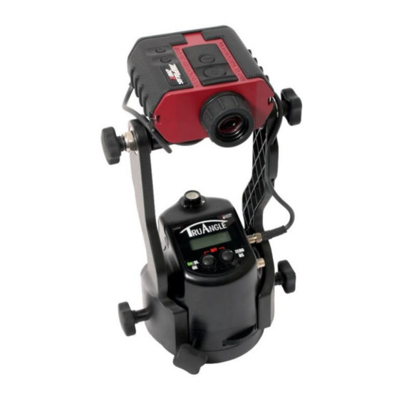
- Page 7 To measure offset locations with a single laser shot, choose the Tools Pro: Range-Backsight Range-Backsight method. This guide assumes the TruPulse 200X and TruAngle are configured, powered On and connected to the device. *The TruAngle needs to be zeroed in any direction and ready to fire From the Measurement Method menu, select Range-Backsight and confirm the laser connection (Figure 9B)
- Page 8 Range-Backsight method continued… Tools Pro: Range-Backsight 13B. Step #4: Aim and fire the laser system at the Target point, confirm values for Slope Distance, Azimuth and Inclination come through (Figure 13B) 14B. If the data looks good, tap Send (Figure 14B) to deliver the offset location to Collector 15B.
- Page 9 Field Maps: Store Location Esri’s Field Maps app will now consume the Laser Offset position calculated within the Eos Tools Pro app. 17. Field Maps will display the new point in red and if OK, tap Submit (Figure 17) 18. The updates will be sent to the app (Figure 18) 19.
-
Page 10: Product Resources
Product Resources https://eos-gnss.com/product/solutions/laser- mapping/ Product Page/User’s Guides: https://www.lasertech.com/TruPulse-Laser-Rangefinder.aspx https://www.esri.com/en-us/arcgis/products/arcgis- field-maps/overview Stay informed! Find out about Laser Technology products, updates, and training resources by keeping track of us on FaceBook (/LaserTechnologyInc), Twitter (@LaserTechPro) and YouTube (/user/LaserTechPro) - Page 11 EOS Tools Pro app or other products built by Laser Technology, Inc? Please contact us at: 1.877.696.2584 or 1.303.649.1000 info@lasertech.com Laser Technology, Inc. 6912 S. Quentin St. Centennial, CO 80112 www.lasertech.com Conductor Clearance Android Sales/Partner Product Intro August 2021...
Need help?
Do you have a question about the LTI TruPulse 200X and is the answer not in the manual?
Questions and answers