
Subscribe to Our Youtube Channel
Related Manuals for Furuno GP-1650W


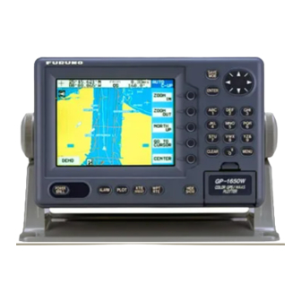
Summary of Contents for Furuno GP-1650W
- Page 1 COLOR DGPS/PLOTTER COLOR GPS/PLOTTER GP-1650WD, GP-1650W FURUNO/NAVIONICS GP-1650WD, GP-1650W FURUNO/C-MAP NT...
- Page 2 All rights reserved. All rights reserved. Printed in Japan Printed in Japan PUB.No. PUB.No. OME-44240 OME-44240 ( ( HIMA HIMA ) ) GP-1650W/1650WD GP-1650W/1650WD Your Local Agent/Dealer Your Local Agent/Dealer FIRST EDITION : FIRST EDITION : AUG. AUG. 2002 2002 : AUG.
-
Page 3: Safety Instructions
Immediately turn off the power at the switchboard if the equipment is emitting smoke or fire. Continued use of the equipment can cause fire or electrical shock. Contact a FURUNO agent for service. Do not operate the equipment with wet hands. -
Page 4: Table Of Contents
TABLE OF CONTENTS FOREWORD ... iv SYSTEM CONFIGURATION ... v WHAT IS WAAS?... vi OPERATIONAL OVERVIEW Display Unit Controls ...1-1 Inserting Mini Chart Card ...1-2 Turning the Power On/Off ...1-2 Adjusting Tone and Brilliance ...1-3 Plotter Displays...1-4 Steering/Highway Displays ...1-4 Menu Operation, Soft Keys ...1-5 Demonstration Display...1-6 PLOTTER DISPLAYS... - Page 5 10. CUSTOMIZING YOUR UNIT 10.1 CHART SETUP OPTIONS menu 10-1 10.2 DISPLAY OPTIONS menu... 10-3 10.3 GPS/DGPS/TD OPTIONS menu ... 10-4 10.4 CONFIGURATION menu... 10-8 11. USING C-MAP NT MODEL 11.1 Inserting Chart Card ... 11-1 11.2 Cursor and Data Display ... 11-2 11.3 Tidal Information...
-
Page 6: Foreword
Congratulations on your choice of the FURUNO GP-1650WD COLOR DGPS/PLOTTER, GP-1650W COLOR GPS/PLOTTER. We are confident you will see why the FURUNO name has become synonymous with quality and reliability. For over 50 years FURUNO Electric Company has enjoyed an enviable reputation for innovative and dependable marine electronics equipment. -
Page 7: System Configuration
(GP-1650WD) GPA-017 (GP-1650W) DISPLAY UNIT Rectifier PR-62 Ship's mains Ship's mains 100/110/115/220/230 VAC 12-24 VDC , 50/60 Hz ANTENNA UNIT Receives signal from GPS satellite and beacon reference station. (GP-1650WD only) External equipment (Autopilot, etc.) DGPS beacon receiver (GP-1650W only) -
Page 8: What Is Waas
SBAS signal. Furuno will accept no responsibility for the use of the signal for other than the above stated purpose. It is the user’s responsibility to exercise common prudence and navigational judgment while using the SBAS signal in the developmental phase. -
Page 9: Operational Overview
1. OPERATIONAL OVERVIEW This chapter acquaints you with the basics of your unit - from turning on the power to the soft key menu operation. Display Unit Controls Registers items on menus. Soft key's functions change depending on the display. POWER ALARM PLOT... -
Page 10: Inserting Mini Chart Card
When the unit is turned on, it proceeds in the sequence shown in the figure in below, after displaying the FURUNO information display. Displayed for about five seconds. START UP TEST... -
Page 11: Adjusting Tone And Brilliance
When the satellite signal is being received normally, the GP-1650WD/1650W displays various abbreviations at the bottom left-hand corner of the display which show DGPS/GPS receiver status. The table in below shows these abbreviations and their meanings. Display abbreviations Indication Meaning... -
Page 12: Plotter Displays
1. OPERATIONAL OVERVIEW Plotter Displays Press the [PLOT] key. Each time this key is pressed, the display mode changes in the sequence shown below. For display mode, refer to Chapter 2. WP-002 FISH BRIDGE DGPS 3D [Plotter Display] DATE: JUN 02 2002 TIME 23:59:59 TRIP:123nm POSITION... -
Page 13: Menu Operation, Soft Keys
Options are selected with the cursor pad. 1. Press the [MENU] key to display the main menu. MENU CHART SETUP OPTIONS DISPLAY OPTIONS GPS/DGPS/TD OPTIONS CONFIGURATION DGPS 3D Main menu 2. Press appropriate soft key to display desired menu. For example, press the DISPLAY OPTIONS soft key. -
Page 14: Demonstration Display
1. OPERATIONAL OVERVIEW Demonstration Display The demonstration display provides simulated operation of this unit. On the plotter display, own ship tracks, at the speed selected, a figure eight course or any course you enter, starting from position entered. All controls are operative; you may set destination, enter waypoints, etc 1. -
Page 15: Plotter Displays
135 12.345' E 16.3kt 002WP FISH BRIDGE DGPS 3D Icon (chart) Own ship GPS status marker Waypoint name Waypoint mark Plotter display, north-up mode Course-up Press the COURSE UP soft key to show the course-up display. When destination is set it... -
Page 16: Cursor
2. PLOTTER DISPLAYS Cursor Turning on the cursor, shifting the cursor Press the cursor pad to turn the cursor on, and the cursor appears at the own ship’s position. Operate the cursor pad to shift the cursor. The cursor moves in the direction of the arrow or diagonal pressed on the cursor pad. -
Page 17: Selecting Chart Scale/Range
Selecting Chart Scale/Range Chart scale (range) may be selected with the ZOOM IN or ZOOM OUT soft key. ZOOM IN expands the chart; ZOOM OUT shrinks it. 2. PLOTTER DISPLAYS Mini Chart Cards The mini chart cards contain nautical charts. When you insert a suitable mini chart card in the slot and your boat is near land, a chart appears. - Page 18 When this happens, select proper chart scale. When scrolling the chart outside the indices. Chart symbols FURUNO mini chart card The table below shows FURUNO mini chart symbols and their meanings. FURUNO chart symbols Symbol Description Summit Wreck Lighthouse...
- Page 19 Aid to navigation data Selected FURUNO and NAVIONICS mini chart cards can show buoy and lighthouse data. Simply place the cursor on the lighthouse or buoy mark. Place the cursor on a lighthouse or buoy mark. Placing the cursor on the mark Example of data displayed Period (ex.: 6 seconds)
-
Page 20: Navigation Data Display
To return to the normal nav data display, press the RETURN soft key. GPS satellite monitor display The GPS satellite monitor display shows information about GPS satellites. Press the SAT INFO soft key. Your display should look something like the following illustration. -
Page 21: Steering Display
Beacon information display The DGPS beacon receiver-equipped model, can show DGPS reference station information. Press the BEACON INFO soft key to show the DGPS reference station information. DGPS reference station information Receive data status Beacon receiver setting status MODE AUTO SEARCH FREQ 288.0kHz BAUD... -
Page 22: Highway Display
2. PLOTTER DISPLAYS How to read the XTE indication The black boat-shaped mark shows own boat’s movement and direction, and the amount to steer to return to course. Using the figure shown on the previous page as an example, you would steer right by 000.02 nautical miles to return to course. -
Page 23: Changing Operation Mode
2.10 Changing Operation Mode Operation mode can be changed among PLEASURE, FISHING1 and FISHING2. FISHING1 or 2 mode provides mark/line entry at the cursor or own ship’s position. On FISHING 1 or 2 mode, pressing the [HIDE/SHOW] key changes the function of soft keys. -
Page 24: Navigation Trip Distance
CONFIGURATION and SYSTEM MENU soft keys. 2. Press the MEMORY/TRIP CLEAR soft key to open the clear memory menu. CLEAR PLOTTER MEMORY CLEAR GPS MEMORY CLEAR ALL MEMORY TRIP METER RESET DGPS 3D Clear memory menu 3. Press ▼to select TRIP METER RESET. -
Page 25: Track
3. TRACK Displaying Track 1. Press the [MENU] key to open the main menu. CHART SETUP OPTIONS DISPLAY OPTIONS GPS/DGPS/TD OPTIONS CONFIGURATION DGPS 3D Main menu 2. Press the CHART SETUP OPTIONS soft key to open the CHART SETUP OPTIONS menu. -
Page 26: Changing Track Color
Track Plotting Method, Interval In drawing the track, first the ship’s position (fed from the DGPS/GPS receiver, WAAS) is stored into the unit’s memory at an interval of time or distance. A shorter interval provides better reconstruction of the track, but the storage time of the track is reduced. -
Page 27: Changing Track Memory Capacity
Track plotting interval 1. Press the [MENU] key followed by the CHART SETUP OPTIONS and TRACK CONTROL soft keys. 2. Press ▲ or ▼ to select TIME INTERVAL or DIST INTERVAL. 3. Press the EDIT soft key to display the INTERVAL window. -
Page 28: Erasing Tracks
3. TRACK Erasing Tracks Be absolutely sure you want to erase track; erased track cannot be restored. Erasing tracks by area You can erase tracks within an area you set. 1. Press the [MENU] key followed by the CHART SETUP OPTIONS, TRACK CONTROL and ERASE T &... -
Page 29: Mark
4. MARK You can enter marks to denote important locations, such as a good fishing spot. In the default condition, you may enter 3000 marks. Entering Marks Select the FISHING 1 or FISHING 2 mode to enable entry of marks on the PLOTTER display. -
Page 30: Changing Mark Attributes
4. MARK Changing Mark Attributes You can select shape, line and color of marks and lines on the plotter display. 1. Press the [HIDE/SHOW] key to show the MARK EDIT soft key. 2. Press the MARK EDIT soft key to show the MARK/LINE window. -
Page 31: Changing Mark Size
Changing Mark Size Mark size can be selected from STD (standard) and SMALL. 1. Press the [MENU] key to display the main menu. 2. Press the CHART SETUP OPTIONS soft key. 3. Press the CHART DETAILS soft key to open the CHART DETAILS menu. LAT/LON GRID GREEN TEXT INFO... -
Page 32: Displaying Track And Mark Points
A target mark ( ) shows a radar target’s position. This mark is inscribed on the plotter display and saved as a waypoint when a certain key is pressed on the radar. Some FURUNO radars can output a target mark to this plotter. TRACK CONTROL... -
Page 33: Waypoints
5. WAYPOINTS Entering Waypoints In navigation terminology, a waypoint is a particular location on a voyage whether it be a starting, intermediate or destination point. A waypoint is the simplest piece of information your equipment requires to get you to a destination, in the shortest distance possible. -
Page 34: Mark Shape
5. WAYPOINTS 2. Press the WAYPOINTS soft key to display the WAYPOINTS menu. ADD/EDIT/MOVE WAYPOINTS LOCAL LIST ALPHA/NUMERIC LIST WAYPOINT BY CURSOR WAYPOINT BY RANGE & BEARING DGPS 3D Waypoints menu 3. Press the WAYPOINT BY CURSOR soft key. The plotter display appears. 4. - Page 35 Changing waypoint name, comment, proximity alarm radius 1. If necessary, you can change the name (up to 6 characters), comment (up to 13 characters), L/L position and the proximity alarm radius (explained in detail in Chapter 8) as follows: Select the NAME, COMMENT or PROXIMITY ALARM RADIUS field.
-
Page 36: Erasing Individual Waypoints
5. WAYPOINTS Entering waypoints by latitude and longitude position 1. Press the [WPT/RTE] key to open the WAYPOINT & ROUTE menu. 2. Press the WAYPOINTS soft key to open the WAYPOINT menu. 3. Press the LOCAL LIST (lists waypoints in order from nearest to furthest) or ALPHA/NUMERIC LIST (lists waypoints in alphanumeric order) soft key. -
Page 37: Changing Waypoint Data
Changing Waypoint Data You can change the waypoint data through the waypoint list. 1. Press the [WPT/RTE] key, WAYPOINTS, and LOCAL LIST or ALPHA/NUMERIC LIST soft keys. 2. Press ▲ or ▼ to select the waypoint you want to change. 3. -
Page 38: Waypoint Mark Size
5. WAYPOINTS Waypoint Mark Size You may change the size of all waypoint marks to small or large (default), or turn them off. 1. Press the [MENU] key to open the main menu. 2. Press the CHART SETUP OPTIONS soft key. -
Page 39: Routes
6. ROUTES Often a trip from one place to another involves several course changes, requiring a series of route points (waypoints) which you navigate to, one after another. The sequence of waypoints leading to the ultimate destination is called a route. Your unit can automatically advance to the next waypoint on a route, so you do not have to change the destination waypoint repeatedly. -
Page 40: Connecting Routes
6. ROUTES 4. If desired you can change the route name shown and/or add a comment. To change route name, press the [CLEAR] key to clear the route name. Use the cursor pad to position the cursor and then press appropriate alphanumeric key. To enter a comment, place the cursor in the COMMENT window. -
Page 41: Inserting, Removing Waypoints
Inserting, Removing Waypoints Inserting waypoints through the route list Waypoints can be inserted in routes as follows: 1. Press the [WPT/RTE] key followed by the ROUTES soft key to open the ROUTE menu. 2. Select a route by pressing ▲ or ▼. 3. - Page 42 6. ROUTES Inserting waypoints on the plotter display Inserting waypoints before the first waypoint or after the last waypoint 1. Press the [WPT/RTE] key followed by the ROUTES soft key to open the ROUTE menu. 2. Press ▲ or ▼ to select the route desired. 3.
-
Page 43: Creating Track-Based Routes
Creating Track-based Routes You can create routes based on your ship’s track by entering waypoints at own ship’s position. This feature is useful when you wish to retrace a track. 1. Press the [WPT/RTE] key to open the WAYPOINT & ROUTE menu. 2. -
Page 44: Erasing Routes
6. ROUTES 7. Press the [SAVE/MOB] key with a touch-and-release action to enter a waypoint mark at own ship position. A new waypoint is created under the next consecutive waypoint number and that waypoint is added to the route. 8. Repeat step 7 whenever you change course. -
Page 45: Navigation
7. NAVIGATION Navigating to “Quick Points” The “quick point” feature allows you to navigate to point(s) without retaining the data indefinitely in your unit’s memory. Each time a quick point is entered previous quick points have the same numbers as newly entered ones are written over. -
Page 46: Navigating To Waypoints (Waypoint List)
7. NAVIGATION Navigating to Waypoints (waypoint list) 1. Press the [WPT/RTE] key to open the WAYPOINT & ROUTE menu. 2. Press the WAYPOINTS soft key to open the WAYPOINTS menu. 3. Press the LOCAL LIST or ALPHA/NUMERIC LIST soft key to show corresponding waypoint list. - Page 47 SELECT PORT SERVICE Sample port service list 8. If you selected PORT at step 7, use the cursor pad to select a port and press the [ENTER] key. Make a route using the soft keys and press the [ENTER] key. (If you want to go directly to that port, simply press the ADD QP soft key followed by the [ENTER] key.)
-
Page 48: Following A Route
7. NAVIGATION Following a Route 1. Press the [WPT/RTE] key followed by the ROUTE soft key to open the route list. 2. Press ▲ or ▼ to select a route. 3. Press the GO TO soft key to show the plotter display. - Page 49 SPD 10.0kt GPS AVG SPD Select speed for ETA window 4. Key in speed manually in the SPD field, or use GPS speed data by selecting GPS AVG SPD. 5. Press the ENTER soft key to register your selection. Switching waypoints...
-
Page 50: Canceling Navigation
7. NAVIGATION To select waypoint switching method do the following: 1. Press the [MENU] key. 2. Press the DISPLAY OPTIONS soft key. 3. Select WAYPOINTS SW. 4. Press the EDIT soft key to show the waypoint sw window. WAYPOINTS SW AUTO 1 AUTO 2 MANUAL... -
Page 51: Plotter Alarms
8. PLOTTER ALARMS Introduction There are five plotter-related alarms which generate both audible and visual alarms: Arrival alarm, Anchor Watch alarm, XTE (Cross Track Error) alarm, Proximity alarm, and Speed alarm. When an alarm setting is violated the buzzer sounds, and the speaker icon ( in red. -
Page 52: Arrival Alarm
8. PLOTTER ALARMS Arrival Alarm The arrival alarm informs you that your boat is approaching a destination waypoint. The area that defines an arrival zone is that of a circle which you approach from the outside of the circle. The alarm will be released if your boat enters the circle. -
Page 53: Xte (Cross Track Error) Alarm
XTE (Cross Track Error) Alarm The XTE alarm warns you when your boat is off its intended course. When the XTE alarm is active, two red dashed lines mark the XTE alarm area. Alarm Own ship's setting position : Alarm How the XTE alarm works 1. -
Page 54: Alarm Information
8. PLOTTER ALARMS Alarm Information When an alarm setting has been violated the buzzer sounds and the speaker icon (shown in red) appears. You can see which alarm has been violated, as well as silence the buzzer, on the alarm menu display. 1. -
Page 55: Memory Card Operations
9. MEMORY CARD OPERATIONS The following data can be saved to memory cards: • Mark/line • Waypoints/routes • Track • Configuration (menu settings) Formatting Memory Cards Before you can use a memory card it must be formatted. Note that formatting a used card erases all saved data. -
Page 56: Saving Data To Memory Card
9. MEMORY CARD OPERATIONS 7. Press the [ENTER] key to format (or press the [CLEAR] key to escape). Now FORMATTING MEMORY CARD appears. Do not remove the card while it is being formatting. When the formatting is completed, FORMAT COMPLETED appears. -
Page 57: Loading Data From Memory Card
Error messages Memory card not inserted Press the [ENTER] key to return to the SAVE DATA display. MEMORY CARD NOT INSERTED. INSERT CARD PRESS "ENTER" key TO CONTINUE. Not inserted message Unformatted memory card Press the [ENTER] key to return to the SAVE DATA display. - Page 58 9. MEMORY CARD OPERATIONS NOW LOADING DATA FROM MEMORY CARD. DO NOT TURN OFF THE POWER UNTIL LOADING COMPLETE. Load data message After loading is completed, the following message appears. COMPLETE LOADING DATA. PRESS "ENTER" KEY TO CONTINUE. Complete message 7.
-
Page 59: Customizing Your Unit
10. CUSTOMIZING YOUR UNIT This section describes the various options which allow you to set up your unit to suit your needs. 10.1 CHART SETUP OPTIONS menu The chart offset options menu provides three menus: chart offset, track control, and chart details. - Page 60 DEPTH INFO information is not. SECTOR INFO: Turns lighthouse viewable angle indication (on FURUNO charts) on/off. Viewing angle is shown as an arc extending RETURN from lighthouse position. Arc color, white or green, is the color of the light beam. This feature is available with selected charts.
-
Page 61: Display Options Menu
Display setup menu DISPLAY SETUP menu description RNG & BRG MODE The GPS receiver calculates the range, bearing, cross track error (XTE) and ETA to TO waypoint when you set a destination. The range and bearing can be calculated by... -
Page 62: Gps/Dgps/Td Options
Selects the language for operation display for ENGLISH or FRENCH. 10.3 GPS/DGPS/TD OPTIONS menu This menu sets up GPS and DPGS receivers and enables display of position in Loran C or Decca TDs. 1. Press the [MENU] key. 2. Press the GPS/DGPS/TD OPTIONS soft key to display the GPS/DGPS/TD options menu. - Page 63 DGPS 3D GPS SETUP options menu LOCAL TIME OFFSET GPS uses UTC time. If you would rather use local time, enter the time difference between it and UTC time. Use the +<-->- soft key to switch from plus to minus and vice versa.
- Page 64 60 seconds, which is suitable for most conditions. LAT OFFSET, LON OFFSET GPS-generated position may be off from the chart. In this case, you can apply an offset to GPS position to refine position accuracy. Mark the equipment indication on the chart, and then calculate the L/L error.
- Page 65 TD SETUP menu This menu selects the Loran C or Decca chain to use to display position in TDs. To display it, press the [MENU] key followed by the GPS/DPGS/TD OPTIONS and TD SETUP soft keys. CORRECTION1 CORRECTION2 DEC CHAIN...
-
Page 66: Configuration Menu
10. CUSTOMIZING YOUR UNIT Displaying DECCA TDs 1. Select DEC CHAIN and press the EDIT soft key to show the chain sta. pair window. CHAIN STA. PAIR FRENCH Chain sta. pair window 2. Press ▲ or ▼ to select Decca chain number. - Page 67 FORMAT Selects NMEA0183 version 1.5 or 2.0. If you are unsure of the version number, try both equipment and choose the one which outputs data correctly. LAT/LON FORMAT (GGA only) Selects the minute of latitude and longitude positions in hundredths, thousandths or ten thousandths.
- Page 68 Note 2: DGPS position fix is not available when uploading or downloading data. Download waypoint/route to PC 1. Connect the PC to the GP-1650W series as shown on the next page. 2. Press the DOWNLOAD WPT/RTE TO PC soft key. You are asked if you are...
- Page 69 Waypoint data format PFEC, GPwpl, llll.lll, a, yyyyy.yyy, a, c----c, c, c----c, A <CR><LF> Waypoint data format 1: Waypoint latitude 2: N/S 3: Waypoint longitude 4: E/W 5: Waypoint name (Number of characters is fixed to 6 and space code is placed when the number of characters are less than 6: Waypoint color 7: Waypoint comment (1 byte for mark code...
- Page 70 10. CUSTOMIZING YOUR UNIT This page is intentionally left blank. 10-12...
-
Page 71: Using C-Map Nt Model
11. USING C-MAP NT MODEL The GP-1650WD/1650W C-MAP NT series uses FURUNO mini chart cards and C-MAP NT-FP chart cards. These charts show accurate coastlines, depth contours, place names, aids to navigation such as buoys and lighthouses, and other navigational marks. -
Page 72: Cursor And Data Display
11. USING C-MAP NT MODEL 11.2 Cursor and Data Display Besides its fundamental functions of providing position data, the cursor can also show caution area, depth area, source of data, etc. Further, you can display information about an icon by placing the cursor on it. -
Page 73: Tidal Information
Objects Navigation mark, fixed Extended navigational aid, ge Light Light Light Light Depth contour Land area Source of data Object windows 3. Press ▲ or ▼ to select the item desired. 4. Press the [ENTER] key to display detailed information. Navigation mark, fixed Light. -
Page 74: Navigation To Ports, Port
11. USING C-MAP NT MODEL 5. Press the DATE soft key to open the DATE window. DATE DD/MM/YYYY 01 / 01 / 2000 DATE window 6. Use ◄ or ► to position the cursor where desired and then press the appropriate numeric keys to enter a date. - Page 75 7. Press the NEAR SRVICE soft key. The SELECT PORT SERVICE window appears. Currently selected icon SELECT PORT SERVICE Health emergency SELECT PORT SERVICE window 8. Use the cursor pad to select service mark desired. Currently selected icon is circumscribed. The name of currently selected icon appears at the top of the window.
-
Page 76: Setting Chart Setup Options
DEPTH INFO soft key: Turns the DEPTH INFO display on/off and sets it color on FURUNO charts, or selects the depth areas limit and spot sounding & bathymetric range in C-MAP NT-FP chart. NORTH FROM 16.45nm... -
Page 77: Selecting Chart Scale/Range
1. With the CHART DETAILS menu displayed, press the DEPTH INFO soft key to show the following display. FOR FURUNO CHART DEPTH < 10 m DEPTH = 10 m YELLOW DEPTH > 10 m LIGHT BLUE DEPTH INFO 10 m : APPROX. 30 ft or 5 fa... -
Page 78: Displaying Program Number
11. USING C-MAP NT MODEL 11.7 Displaying Program Number 1. Press the [MENU] key to open the main menu. 2. Press the CONFIGURATION soft key to show the CONFIGURATION n menu. 3. Press the SYSTEM MENU soft key to open the SYSTEM MENU. 4. -
Page 79: Maintenance
12. MAINTENANCE & TROUBLESHOOTING 12.1 Maintenance Regular maintenance is essential for good performance. A maintenance program should be established and should at least include the items listed in below. Item Antenna Check for loosened and corroded bolts. Check connection point for watertightness. -
Page 80: Replacement Of Fuse, Battery
Loran or Decca chain codes are entered on the DISPLAY UNIT. enter TD offset on the GPS/DGPS/TD OPTIONS menu. try to decrease GPS speed smoothing setting on the GPS/DGPS/TD OPTIONS menu. ) appears on the display. Code Number 000-144-941 Then …... -
Page 81: Error Messages
12.4 Error Messages The GP-1650W/1650WD displays the following error messages on the alarm menu to alert you to possible trouble. Error messages Error Message Meaning, remedy No GPS signal. Check NO GPXS FIX antenna cable. NO DIFFERENTIAL No DGPS signal. Check antenna. - Page 82 12. MAINTENANCE & TROUBLESHOOTING Keyboard test This test checks all controls for proper operation. 1. Press the [MENU] followed by the CONFIGURATION, SYSTEM MENU and SELF TEST soft keys to display the TEST menu. 2. Press the KEYBOARD TEST soft key to display the screen for testing the keyboard.
-
Page 83: Clearing Memories
CONFIGURATION and SYSTEM MENU soft key. 2. Press the MEMORY/TRIP CLEAR soft key to open the clear memory menu. CLEAR PLOTTER MEMORY CLEAR GPS MEMORY CLEAR ALL MEMORY TRIP METER RESET DGPS 3D Clear memory menu 3. Press ▲ or ▼ to select memory or trip meter reset. - Page 84 12. MAINTENANCE & TROUBLESHOOTING This page is intentionally left blank. 12-6...
-
Page 85: Menu Tree
CHART SETUP OPTIONS Default settings shown in bold italic. DEPTH INFO Soft key FURUNO chart DEPTH < 10m ( ON , OFF ; RED ) DEPTH = 10m ( ON , OFF ; YELLOW ) DEPTH > 10m ( ON , OFF ; LIGHT BLUE ) DEPTH INFO ( ON , OFF ;... - Page 86 BWC: For GREAT CIRCLE DEMO MODE DEMO SPEED DEMO START LAT DEMO START LON CLEAR PLOTTER MEMORY ( NO , YES) CLEAR GPS MEMORY ( NO , YES) CLEAR ALL MEMORY ( NO , YES) TRIP METER RESET ( NO , YES)
-
Page 87: Loran C Chains
LORAN C CHAINS c i f c i f c i f c i f Ø t l y – – – – – – – – – – – – – – – – – – – – – –... -
Page 88: Decca Chains
DECCA CHAINS c i t s i t a l l s i t c i t s i l s i t y i l " " " " " " " " " " " c i t "... -
Page 89: World Time
WORLD TIME... -
Page 90: Geodetic Chart List
GEODETIC CHART LIST 001: WGS84 002: WGS72 003: TOKYO : Mean Value (Japan, Korea & Okinawa) 004: NORTH AMERICAN 1927 : Mean Value (CONUS) 005: EUROPEAN 1950 : Mean Value 006: AUSTRALIAN GEODETIC 1984 : Australia & Tasmania 007: ADINDAN-MN : Mean Value (Ethiopia &... -
Page 91: Specifications
C/A code, WAAS All in view, 8-state Kalman filter 10 m (95% of the time, HDOP 4) 5 m (95% of the time), external data required for GP-1650W 3 m (95% of the time) 999 kts Warm start: 12 s approx., Cold start: 90 s approx. - Page 92 Display Unit Vibration COATING COLOR Display Unit Antenna Unit FURUNO or NAVIONICS chart card available, C-MAP chart card also available for C-MAP NT Model IEC61162-1, NMEA 0183 Ver1.5 $**DBT, $**DPT, $**MTW, $**TLL, $GPWPL IEC61162-1, NMEA 0183 Ver1.5 $GPAAM, $GPAPB, $GPBOD, $GPBWR/GPBWC, $GPGLL,...
-
Page 93: Index
Downloading data 10-10 Error messages 12-3 Fix mode 10-6 Fuse replacement 12-2 Geodetic chart list A-6 Geodetic datum 10-5 GPS satellite monitor display 2-6 GPS/DGPS/TD options menu 10-4-10-8 Great circle 10-3 Grid 10-2 Highway display 2-8 Indications enlargement of nav data 2-6... - Page 94 INDEX Magnetic bearing 10-3 Magnetic variation 10-4 Maintenance 12-1 Mark color 4-3 number used 4-4 entering 4-1 erasing 4-4 line 4-3 displaying 4-4 shape 4-2 Memory card formatting 9-1 loading data 9-3 saving data 9-2 Memory clear 12-5 Memory, I/O port test 12-3 MENU key 1-5 Menu tree A-1–A-2 Mini chart cards...
- Page 95 Setup NMEA port 1 menu 10-9 Setup NMEA port 2 menu 10-9 Smoothing position 10-5 speed/course 10-5 Soft keys 1-5 Speed GPS speed averaging 10-6 input (for ETA calculation) 7-5 unit 10-3 Speed alarm 8-3 Steering display 2-7 System configuration v System menu 10-12...
Need help?
Do you have a question about the GP-1650W and is the answer not in the manual?
Questions and answers