Garmin TREAD Owner's Manual
Hide thumbs
Also See for TREAD:
- Owner's manual (176 pages) ,
- Installation instructions manual (14 pages) ,
- Owner's manual (76 pages)
Table of Contents
Advertisement
Quick Links
Advertisement
Table of Contents

Related Manuals for Garmin TREAD


Summary of Contents for Garmin TREAD
- Page 1 TREAD ™ Owner’s manual...
- Page 2 © 2021 Garmin Ltd. or its subsidiaries All rights reserved. Under the copyright laws, this manual may not be copied, in whole or in part, without the written consent of Garmin. Garmin reserves the right to change or improve its products and to make changes in the content of this manual without obligation to notify any person or organisation of such changes or improvements.
-
Page 3: Table Of Contents
Broadcasting a Message ............5 Viewing Previous Routes and Destinations ......11 Broadcasting a Location ............6 Garmin PowerSwitch™ App ............. 11 Viewing a Group Ride Notification ......... 6 Activating a Power Switch ............ 11 Exiting a Group Ride .............. 6 Turning Off All Switches ............ - Page 4 Traffic Settings ................22 Changing the route calculation mode ........16 Units and time settings ............. 22 Taking a Route Using Garmin Adventurous Routing™ .... 16 Setting the Time ..............22 Taking a detour ................. 17 Language and Keyboard Settings ..........22 Going home ................
- Page 5 Garmin PowerSwitch Specifications ........27 My Garmin PowerSwitch will not stay connected ....27 Wireless Cameras ..............27 Pairing the Camera with a Garmin Navigation Device ..27 Viewing the Wireless Camera ..........27 Installing a memory card for maps and data ......28 Data management ..............
-
Page 7: Getting Started
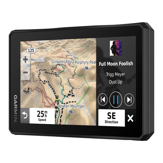
Active vehicle profile. Select to view the vehicle profile settings. Current time. Select to set the time (Setting the Time, page 22). Device Overview Battery charge level. Tread app connection status (Pairing Your Phone and Headset, page 13). Temperature. Select to view the weather forecast (Viewing the Weather Forecast, page 10). -
Page 8: Vehicle Profiles
Tighten the knob slightly. Installation If necessary, rotate the Group Ride mount so that the Garmin logo faces up and adjust the mount for better viewing Mounting Your Device in an ATV or Side-by- and operation. Side Tighten the knob to secure the mount. -
Page 9: Installing The Antenna On The Group Ride Mount
Avoid wires, gauges, air bags, air bag covers, heating, ventilation, and air conditioning and other items when drilling pilot holes and attaching the mount to the vehicle. Garmin is not responsible for any damages or consequences arising from the installation. -
Page 10: Removing Your Device From The Mount
• You can start navigating to your destination quickly using the feature. recommended route, or you can select an alternative route NOTE: if you do not assign a collection category to your Garmin (Starting a route, page 14). Explore data, it appears as an unorganised collection. -
Page 11: Pitch And Roll
Select one or more collection categories from the list. Each time you disconnect your device from the mount, the device prompts you to calibrate the compass. Select Save. If you experience irregular compass behaviour, for example, Your collections appear as icons on the map. after moving long distances or after extreme temperature changes, you can manually calibrate the compass to improve Pitch and Roll... -
Page 12: Broadcasting A Location
Transmitting Your Voice Auto Zoom to Group: enables the map to automatically zoom Before you can transmit your voice, you must pair your Tread to the active group ride. device with a compatible Bluetooth headset or connect the fist Reset Default Settings: allows you to reset all group ride microphone. -
Page 13: Adjusting The Radio Volume
Select View Map. Connecting an inReach Device Select anywhere on the map. Bring the inReach device within 3 m (10 ft.) of your Tread Select an option: device. • Drag the map to pan left, right, up, or down. -
Page 14: Viewing A Map Tool
Custom Search, and enter the name of a business or category. NOTICE Select Save. Garmin is not responsible for the accuracy or timeliness of the traffic information. Towns Ahead Before you can use this feature, your device must be receiving... -
Page 15: Customising The Map
Select > Incidents. • Music files stored on your Tread device. • Bluetooth audio from a paired phone. Select an item in the list. If there is more than one incident, use the arrows to view Adding the Music Player Tool to the Map additional incidents. -
Page 16: Planning A Trip
Select a saved trip. Before you can use this feature, your device must be receiving weather data. You can connect your device to the Tread app to Select the vehicle profile icon, and select the vehicle you plan receive weather data (Pairing Your Phone and Headset, to use while navigating the trip (optional). -
Page 17: Viewing The Weather Radar
> Round Trip. Activating a Power Switch Select Start Location. Before you can use the Garmin PowerSwitch app to activate a Select a location, and select Select. switch, you must install your Garmin PowerSwitch device in your vehicle and pair it with the Garmin PowerSwitch app. -
Page 18: Adding A Custom Layout
Adding a Custom Layout turns switches on or off automatically when the conditions of the You can add a custom layout tab to the Garmin PowerSwitch routine are met. For example, you can set a routine to turn on a app. -
Page 19: Bluetooth Feature Status Icons
Tread app during the pairing process or later. map tool at the edge of the screen. If the device is moving, you Place the Tread device and your headset or phone within 3 m must verify you are a passenger and not the driver before you (10 ft.) of each other. -
Page 20: Hands-Free Calling
The Bluetooth device can Some options may not be compatible with your phone. connect to your Tread device automatically in the future. TIP: if you close the in-call options page, you can open it again Select >... -
Page 21: Starting A Route By Using The Map
The device calculates a route to the location and guides you using voice prompts and information on the map (Your route on the map, page 15). A preview of the major roads in your route appears at the edge of the map for several seconds. If you need to stop at additional destinations, you can add the locations to your route (Adding a location to your route,... -
Page 22: Avoiding Delays, Tolls And Areas
Save. drive. Custom Avoidances Taking a Route Using Garmin Adventurous Custom avoidances allow you to select specific areas or Routing ™ sections of road to avoid. When the device calculates a route, it... -
Page 23: Taking A Detour
HISTORY® (Finding HISTORY points NOTICE of interest, page 19). Garmin is not responsible for the accuracy or timeliness of the • To find national parks and explore park maps, select traffic information. National Parks (Finding National Parks, page 19). -
Page 24: Points Of Interest
Select to view alternate routes to the locations. restaurants, hotels, and entertainment venues. Select to start navigating to the location using Garmin Adven- turous Routing. Finding a location by category Go! Select to start navigating to the location using the recom- Select Search. -
Page 25: Finding Parking Near Your Current Location
Select Search > iOverlander. Finding petrol stations and prices Before you can use this feature, your device must be connected Select a category. to a supported phone running the Tread app (Pairing Your Select a location. Phone and Headset, page 13). -
Page 26: Viewing History
Select Search > > Remove Shortcut(s). Garmin is not responsible for any traffic fines or citations that Select a shortcut to remove. you receive for failing to follow all applicable traffic laws and Select the shortcut again to confirm. -
Page 27: Enabling Or Disabling Rider Alerts
While you are using a motorcycle vehicle profile, helmet law and Select > Driver Assistance > Rider Alerts. eye protection notifications may appear on your Tread device. Select or clear the tick box next to each alert. Notifications appear the first time your device acquires satellites... -
Page 28: Navigation Settings
Navigation settings Rider Alerts: allows you to enable or disable alerts for upcoming zones or road conditions (Rider Awareness Select > Navigation. Features and Alerts, page 20). Calculation Mode: sets the route calculation method. Speeding Alert: alerts you when you are exceeding the speed Off-Route Recalculation: sets recalculation preferences when limit. -
Page 29: Device And Privacy Settings
Software Licences: displays software licensing information. You can purchase an approved Garmin AC-DC adapter Device Data Reporting: shares anonymous data to improve the suitable for home or office use from a Garmin dealer or device. www.garmin.com. The device may charge slowly when connected to a third-party adapter. -
Page 30: Updating Maps And Software Using A Wi-Fi Network
Wipe the device dry. The small end of the cable connects to the mini-USB port Cleaning the Touchscreen on your Tread device and the large end connects to an Use a soft, clean, lint-free cloth. available USB port on your computer. -
Page 31: Avoiding Theft
(Disconnecting a Bluetooth device, page 14) and pilot holes and attaching the mount to the vehicle. Garmin is not complete the pairing process (Pairing Your Phone and responsible for any damages or consequences arising from the Headset, page 13). -
Page 32: Opening The Front Cover
Connecting a Control Input You can connect to the control terminals to enable the Garmin PowerSwitch device to turn on customisable outputs. For example, you can connect your vehicle ignition switch to a control input terminal to turn on accessories automatically each time you start your vehicle. -
Page 33: Pairing With A Garmin Navigation Device
Your device can display the video feed from one or more connected wireless cameras. Pairing the Camera with a Garmin Navigation Device You can pair the camera with a compatible Garmin navigation device. For more information about compatible Garmin devices, go to the product page at garmin.com/bc40. -
Page 34: Installing A Memory Card For Maps And Data
Plug the larger end of the USB cable into a port on your computer. When your Tread device prompts you to enter file transfer mode, select Yes. A picture of your device connected to a computer appears on Use the arrows in the centre of the screen to move the coloured distance guidance lines up or down. -
Page 35: Adding Basecamp™ Data To Garmin Explore
™ Data to Garmin Explore You can export your BaseCamp data files and import them to Garmin Explore for use with your Tread device. Export your data from BaseCamp: • If you are using an Apple computer, see Exporting Data from BaseCamp with an Apple Computer, page •... -
Page 36: Index
See cameras notifications 13, 21 barometer 5 Garmin Connect 12 battery Garmin Explore 18 charging 23 on-screen buttons 1 Garmin Express, updating software 24 maximising 25 owner's manual 9 going home 17 problems 25 GPS 1, 29 Bluetooth 22 group ride 5, 6 Bluetooth technology 12–14, 25 pairing 27 guidance lines, aligning 27... - Page 37 TracBack 10 tracks 4 Tracks 4 traffic 8, 17, 22 alternative route 16 incidents 8, 17 map 8, 17 searching for delays 8, 17 transportation modes 2 changing 10 travel history 23 Tread, connecting 13 trim ring 4 trip information 8 resetting 8 view 8 trip planner 9, 10 editing a trip 10 shaping points 10 Tripadvisor 19 troubleshooting 25, 27 unit ID 23...
- Page 38 March 2021 GUID-16B1D74D-857B-4FFB-8DE2-A0960FE0D090 v2...
Need help?
Do you have a question about the TREAD and is the answer not in the manual?
Questions and answers