Sign In
Upload
Manuals
Brands
Garmin Manuals
GPS
GPSMAP 7400 Series
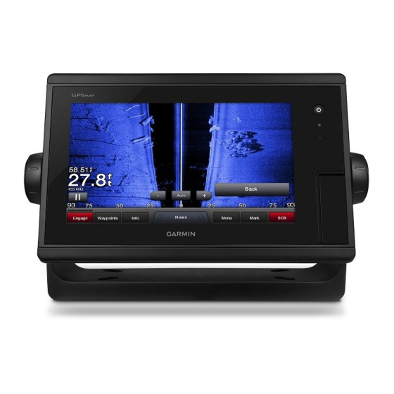
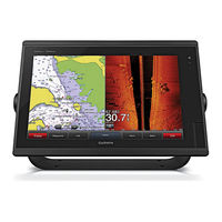
Garmin GPSMAP 7400 Series Manuals
Manuals and User Guides for Garmin GPSMAP 7400 Series. We have
9
Garmin GPSMAP 7400 Series manuals available for free PDF download: Owner's Manual, Field Service Manual, Installation Instructions Manual, Installation Insrtuctions
Garmin GPSMAP 7400 Series Owner's Manual (176 pages)
Brand:
Garmin
| Category:
GPS
| Size: 11 MB
Table of Contents
Table of Contents
3
Introduction
13
Device Overview
13
Connector View
14
Using the Touchscreen
14
On-Screen Buttons
15
Locking and Unlocking the Touchscreen
17
Tips and Shortcuts (MFD Models)
17
Protective Cover
18
Accessing Owner's Manuals on the Chartplotter
18
Accessing the Manuals from the Web
18
Garmin Support Center
18
Inserting Memory Cards
19
Acquiring GPS Satellite Signals
19
Selecting the GPS Source
19
Customizing the Chartplotter
20
Home Screen
20
Adding an Item to Favorites
21
Customizing Pages
21
Customizing the Layout of a Smartmode or Combination Page
21
Customizing the Startup Screen
21
Recommended Startup Image Dimensions
22
Adding a Smartmode Layout
22
Creating a New Combination Page
23
Deleting a Combination Page
23
Customizing the Data Overlays
24
Resetting the Station Layouts
24
Presets
24
Saving a New Preset
24
Managing Presets
25
Setting the Vessel Type
25
Adjusting the Backlight
25
Adjusting the Color Mode
25
Turning on the Chartplotter Automatically
25
Enabling Screen Lock
25
Automatically Turning off the System
26
Activecaptain App
26
Activecaptain Roles
26
Getting Started with the Activecaptain App
27
Enabling Smart Notifications
27
Receiving Notifications
28
Managing Notifications
28
Making Notifications Private
28
Updating Software with the Activecaptain App
29
Updating Charts with Activecaptain
29
Communication with Wireless Devices
29
Wi-Fi Network
30
Setting up the Wi-Fi Wireless Network
30
Connecting a Wireless Device to the Chartplotter
30
Changing the Wireless Channel
30
Changing the Wi-Fi Host
30
Wireless Remote Control
30
Pairing the Wireless Remote Control with the Chartplotter
30
Turning on and off the Remote Backlight
31
Disconnecting the Remote from All Chartplotters
31
Wireless Wind Sensor
31
Connecting a Wireless Sensor to the Chartplotter
31
Adjusting the Wind Sensor Orientation
31
Viewing Boat Data on a Garmin Watch
31
Viewing Boat Data on a Garmin Nautix™ Device
32
Charts and 3D Chart Views
32
Navigation Chart and Fishing Chart
33
Zooming in and out Using the Touchscreen
33
Chart Symbols
33
Measuring a Distance on the Chart
34
Creating a Waypoint on the Chart
34
Viewing Location and Object Information on a Chart
34
Viewing Details about Navaids
34
Navigating to a Point on the Chart
35
Premium Charts
36
Fish Eye 3D Chart View
36
Viewing Tide Station Information
37
Animated Tide and Current Indicators
37
Showing Tides and Current Indicators
37
Showing Satellite Imagery on the Navigation Chart
38
Viewing Aerial Photos of Landmarks
38
Automatic Identification System
38
AIS Targeting Symbols
39
Heading and Projected Course of Activated AIS Targets
40
Activating a Target for an AIS Vessel
40
Viewing Information about a Targeted AIS Vessel
40
Deactivating a Target for an AIS Vessel
40
Viewing a List of AIS and MARPA Threats
40
Setting the Safe-Zone Collision Alarm
41
AIS Aids to Navigation
41
AIS Distress Signals
42
Navigating to a Distress Signal Transmission
42
AIS Distress Signal Device Targeting Symbols
43
Enabling AIS Transmission Test Alerts
43
Turning off AIS Reception
43
Chart Menu
43
Chart Layers
44
Chart Layer Settings
44
Depth Layer Settings
44
My Vessel Layer Settings
45
Laylines Settings
45
User Data Layer Settings
45
Other Vessels Layer Settings
46
Water Layer Settings
46
Depth Range Shading
47
Weather Layer Settings
47
Radar Overlay Settings
48
Chart Settings
48
Fish Eye 3D Settings
48
Supported Maps
48
Garmin Quickdraw Contours Mapping
49
Mapping a Body of Water Using the Garmin Quickdraw Contours Feature
49
Adding a Label to a Garmin Quickdraw Contours Map
49
Garmin Quickdraw Community
50
Connecting to the Garmin Quickdraw Community with Activecaptain
50
Downloading Garmin Quickdraw Community Maps Using Activecaptain
50
Sharing Your Garmin Quickdraw Contours Maps with the Garmin Quickdraw Community Using Activecaptain
50
Connecting to the Garmin Quickdraw Community with Garmin Connect
50
Sharing Your Garmin Quickdraw Contours Maps with the Garmin Quickdraw Community Using Garmin Connect
51
Downloading Garmin Quickdraw Community Maps Using Garmin Connect
51
Garmin Quickdraw Contours Settings
52
Navigation with a Chartplotter
52
Basic Navigation Questions
53
Destinations
53
Searching for a Destination by Name
53
Selecting a Destination Using the Navigation Chart
53
Searching for a Marine Services Destination
53
Setting and Following a Direct Course Using Go to
54
Stopping Navigation
54
Waypoints
54
Marking Your Present Location as a Waypoint
54
Creating a Waypoint at a Different Location
54
Marking an SOS Location
54
Projecting a Waypoint
55
Viewing a List of All Waypoints
55
Editing a Saved Waypoint
55
Moving a Saved Waypoint
55
Browsing for and Navigating to a Saved Waypoint
56
Deleting a Waypoint or an MOB
56
Deleting All Waypoints
56
Routes
56
Creating and Navigating a Route from Your Present Location
57
Creating and Saving a Route
57
Viewing a List of Routes and Auto Guidance Paths
57
Editing a Saved Route
57
Browsing for and Navigating a Saved Route
58
Browsing for and Navigating Parallel to a Saved Route
58
Initiating a Search Pattern
59
Deleting a Saved Route
59
Deleting All Saved Routes
59
Auto Guidance
59
Setting and Following an Auto Guidance Path
59
Creating and Saving an Auto Guidance Path
60
Adjusting a Saved Auto Guidance Path
60
Canceling an Auto Guidance Calculation in Progress
60
Setting a Timed Arrival
60
Auto Guidance Path Configurations
61
Adjusting the Distance from Shore
62
Tracks
62
Showing Tracks
62
Setting the Color of the Active Track
63
Saving the Active Track
63
Viewing a List of Saved Tracks
63
Editing a Saved Track
63
Saving a Track as a Route
63
Browsing for and Navigating a Recorded Track
63
Deleting a Saved Track
63
Deleting All Saved Tracks
63
Retracing the Active Track
64
Clearing the Active Track
64
Managing the Track Log Memory During Recording
64
Configuring the Recording Interval of the Track Log
64
Boundaries
64
Creating a Boundary
64
Converting a Route to a Boundary
65
Converting a Track to a Boundary
65
Editing a Boundary
65
Linking a Boundary to a Smartmode Layout
65
Setting a Boundary Alarm
65
Disabling All Boundary Alarms
65
Deleting a Boundary
66
Deleting All Saved Waypoints, Tracks, Routes, and Boundaries
66
Sailing Features
66
Setting the Vessel Type
66
Sail Racing
66
Starting Line Guidance
66
Setting the Starting Line
66
Using the Starting Line Guidance
67
Starting the Race Timer
67
Stopping the Race Timer
67
Setting the Distance between the Bow and the GPS Antenna
67
Laylines Settings
68
Setting the Keel Offset
69
Sailboat Autopilot Operation
69
Wind Hold
70
Setting the Wind Hold Type
70
Engaging Wind Hold
70
Engaging Wind Hold from Heading Hold
70
Adjusting the Wind Hold Angle with the Autopilot
70
Tack and Gybe
70
Tacking and Gybing from Heading Hold
70
Tacking and Gybing from Wind Hold
70
Setting a Tack and Gybe Delay
70
Enabling the Gybe Inhibitor
71
Adjusting the Autopilot Response
71
Heading Line and Angle Markers
71
Setting the Heading Line and Angle Markers
71
Sonar Fishfinder
72
Stopping the Transmission of Sonar Signals
72
Changing the Sonar View
72
Traditional Sonar View
72
Split-Frequency Sonar View
73
Split-Zoom Sonar View
73
Garmin Clearvü™ Sonar View
73
Sidevü Sonar View
74
Advertisement
Garmin GPSMAP 7400 Series Owner's Manual (74 pages)
Brand:
Garmin
| Category:
GPS
| Size: 11 MB
Table of Contents
Table of Contents
3
Introduction
9
Device Overview
9
Connector View
9
Using the Touchscreen
9
On-Screen Buttons
9
Locking and Unlocking the Touchscreen
9
Tips and Shortcuts
9
Accessing Owner's Manuals on the Chartplotter
10
Downloading the Manuals from the Web
10
Garmin Support Center
10
Inserting Memory Cards
10
Acquiring GPS Satellite Signals
10
Selecting the GPS Source
10
Customizing the Chartplotter
10
Home Screen
10
Adding an Item to Favorites
11
Customizing Pages
11
Customizing the Layout of a Smartmode or Combination Page
11
Adding a Smartmode Layout
11
Creating a New Combination Page
11
Deleting a Combination Page
11
Customizing the Data Overlays
11
Resetting the Station Layouts
12
Presets
12
Saving a New Preset
12
Managing Presets
12
Setting the Vessel Type
12
Adjusting the Backlight
12
Adjusting the Color Mode
12
Customizing the Startup Screen
12
Turning on the Chartplotter Automatically
12
Automatically Turning off the System
12
Getting Started with the Activecaptain App
13
Enabling Smart Notifications
13
Receiving Notifications
13
Managing Notifications
13
Updating Software with the Activecaptain App
13
Updating Charts with Activecaptain
14
Communication with Wireless Devices
14
Wi-Fi Network
14
Setting up the Wi-Fi Wireless Network
14
Connecting a Wireless Device to the Chartplotter
14
Changing the Wireless Channel
14
Changing the Wi-Fi Host
14
Wireless Remote Control
14
Pairing the Wireless Remote Control with the Chartplotter
14
Turning on and off the Remote Backlight
14
Adjusting the Wind Sensor Orientation
15
Viewing Boat Data on a Garmin Watch
15
Viewing Boat Data on a Garmin Nautix Device
15
Charts and 3D Chart Views
15
Navigation Chart and Fishing Chart
15
Zooming in and out Using the Touchscreen
15
Chart Symbols
16
Measuring a Distance on the Chart
16
Creating a Waypoint on the Chart
16
Viewing Location and Object Information on a Chart
16
Viewing Details about Navaids
16
Navigating to a Point on the Chart
16
Premium Charts
16
Fish Eye 3D Chart View
17
Viewing Tide Station Information
17
Animated Tide and Current Indicators
17
Showing Tides and Current Indicators
17
Showing Satellite Imagery on the Navigation Chart
17
Viewing Aerial Photos of Landmarks
17
Automatic Identification System
17
AIS Targeting Symbols
17
Heading and Projected Course of Activated AIS Targets
18
Activating a Target for an AIS Vessel
18
Viewing Information about a Targeted AIS Vessel
18
Deactivating a Target for an AIS Vessel
18
Viewing a List of AIS and MARPA Threats
18
Setting the Safe-Zone Collision Alarm
18
AIS Distress Signals
18
Navigating to a Distress Signal Transmission
18
AIS Distress Signal Device Targeting Symbols
18
Enabling AIS Transmission Test Alerts
19
Turning off AIS Reception
19
Chart Menu
19
Chart Layers
19
Chart Layer Settings
19
Depth Layer Settings
19
My Vessel Layer Settings
19
Laylines Settings
19
User Data Layer Settings
20
Other Vessels Layer Settings
20
Water Layer Settings
20
Weather Layer Settings
20
Radar Overlay Settings
20
Chart Settings
20
Fish Eye 3D Settings
20
Supported Maps
21
Garmin Quickdraw Contours Mapping
21
Mapping a Body of Water Using the Garmin Quickdraw Contours Feature
21
Adding a Label to a Garmin Quickdraw Contours Map
21
Garmin Quickdraw Community
21
Connecting to the Garmin Quickdraw Community with Activecaptain
21
Downloading Garmin Quickdraw Community Maps Using Activecaptain
21
Sharing Your Garmin Quickdraw Contours Maps with the Garmin Quickdraw Community Using Activecaptain
21
Connecting to the Garmin Quickdraw Community with Garmin Connect
22
Sharing Your Garmin Quickdraw Contours Maps with the Garmin Quickdraw Community Using Garmin Connect
22
Downloading Garmin Quickdraw Community Maps Using Garmin Connect
22
Garmin Quickdraw Contours Settings
22
Depth Range Shading
22
Garmin GPSMAP 7400 Series Owner's Manual (68 pages)
Brand:
Garmin
| Category:
GPS
| Size: 6 MB
Table of Contents
Table of Contents
3
Introduction
9
Device Overview
9
Using the Touchscreen
9
On-Screen Buttons
9
Locking and Unlocking the Touchscreen
9
Tips and Shortcuts
9
Accessing Owner's Manuals on the Chartplotter
9
Downloading the Manuals
9
Garmin Support Center
10
Inserting Memory Cards
10
Acquiring GPS Satellite Signals
10
Selecting the GPS Source
10
Customizing the Chartplotter
10
Home Screen
10
Adding an Item to Favorites
10
Customizing Pages
10
Customizing the Layout of a Smartmode or Combination Page
10
Adding a Smartmode Layout
10
Creating a New Combination Page
11
Deleting a Combination Page
11
Customizing the Data Overlays
11
Resetting the Station Layouts
11
Presets
11
Saving a New Preset
11
Managing Presets
11
Setting the Vessel Type
11
Adjusting the Backlight
11
Adjusting the Color Mode
11
Customizing the Startup Screen
12
Turning on the Chartplotter Automatically
12
Automatically Turning off the System
12
Activecaptain App
12
Activecaptain Roles
12
Getting Started with the Activecaptain App
12
Receiving Smart Notifications
12
Updating Software with the Activecaptain App
13
Updating Charts with Activecaptain
13
Communication with Wireless Devices
13
Wi-Fi Network
13
Setting up the Wi-Fi Wireless Network
13
Connecting a Wireless Device to the Chartplotter
13
Changing the Wireless Channel
13
Changing the Wi-Fi Host
13
Wireless Remote Control
13
Pairing the Wireless Remote Control with the Chartplotter
13
Wireless Wind Sensor
14
Connecting a Wireless Sensor to the Chartplotter
14
Adjusting the Wind Sensor Orientation
14
Connecting a Quatix Watch to the Chartplotter
14
Connecting a Garmin Nautix Device to the Chartplotter
14
Charts and 3D Chart Views
14
Navigation Chart and Fishing Chart
14
Zooming in and out Using the Touchscreen
15
Chart Symbols
15
Measuring a Distance on the Chart
15
Creating a Waypoint on the Chart
15
Viewing Location and Object Information on a Chart
15
Viewing Details about Navaids
15
Navigating to a Point on the Chart
15
Premium Charts
15
Viewing Tide Station Information
16
Animated Tide and Current Indicators
16
Showing Tides and Current Indicators
16
Showing Satellite Imagery on the Navigation Chart
16
Viewing Aerial Photos of Landmarks
16
Automatic Identification System
16
AIS Targeting Symbols
16
Heading and Projected Course of Activated AIS Targets
17
Activating a Target for an AIS Vessel
17
Viewing Information about a Targeted AIS Vessel
17
Deactivating a Target for an AIS Vessel
17
Viewing a List of AIS and MARPA Threats
17
Setting the Safe-Zone Collision Alarm
17
AIS Distress Signals
17
Navigating to a Distress Signal Transmission
17
AIS Distress Signal Device Targeting Symbols
17
Enabling AIS Transmission Test Alerts
17
Turning off AIS Reception
18
Chart Menu
18
Chart Layers
18
Chart Layer Settings
18
Depth Layer Settings
18
My Vessel Layer Settings
18
Laylines Settings
18
User Data Layer Settings
18
Other Vessels Layer Settings
19
Water Layer Settings
19
Weather Layer Settings
19
Radar Overlay Settings
19
Chart Settings
19
Fish Eye 3D Settings
19
Supported Maps
19
Garmin Quickdraw Contours Mapping
19
Mapping a Body of Water Using the Garmin Quickdraw Contours Feature
20
Adding a Label to a Garmin Quickdraw Contours Map
20
Garmin Quickdraw Community
20
Connecting to the Garmin Quickdraw Community with Activecaptain
20
Downloading Garmin Quickdraw Community Maps Using Activecaptain
20
Sharing Your Garmin Quickdraw Contours Maps with the Garmin Quickdraw Community Using Activecaptain
20
Connecting to the Garmin Quickdraw Community with Garmin Connect
20
Sharing Your Garmin Quickdraw Contours Maps with the Garmin Quickdraw Community Using Garmin Connect
20
Downloading Garmin Quickdraw Community Maps Using Garmin Connect
21
Garmin Quickdraw Contours Settings
21
Depth Range Shading
21
Navigation with a Chartplotter
21
Basic Navigation Questions
22
Destinations
22
Searching for a Destination by Name
22
Selecting a Destination Using the Navigation Chart
22
Searching for a Marine Services Destination
22
Stopping Navigation
22
Waypoints
22
Marking Your Present Location as a Waypoint
22
Creating a Waypoint at a Different Location
22
Marking an SOS Location
22
Deleting a Waypoint or an MOB
23
Deleting All Waypoints
23
Setting and Following a Direct Course Using Go to
23
Routes
23
Creating and Navigating a Route from Your Present Location
23
Creating and Saving a Route
23
Viewing a List of Routes and Auto Guidance Paths
23
Editing a Saved Route
23
Browsing for and Navigating a Saved Route
23
Browsing for and Navigating Parallel to a Saved Route
24
Deleting a Saved Route
24
Deleting All Saved Routes
24
Auto Guidance
24
Setting and Following an Auto Guidance Path
24
Creating and Saving an Auto Guidance Path
24
Adjusting a Saved Auto Guidance Path
24
Canceling an Auto Guidance Calculation in Progress
24
Setting a Timed Arrival
24
Auto Guidance Path Configurations
24
Adjusting the Distance from Shore
25
Tracks
25
Showing Tracks
25
Setting the Color of the Active Track
25
Saving the Active Track
25
Viewing a List of Saved Tracks
25
Editing a Saved Track
25
Saving a Track as a Route
25
Browsing for and Navigating a Recorded Track
25
Deleting a Saved Track
26
Deleting All Saved Tracks
26
Retracing the Active Track
26
Clearing the Active Track
26
Managing the Track Log Memory During Recording
26
Configuring the Recording Interval of the Track Log
26
Boundaries
26
Creating a Boundary
26
Converting a Route to a Boundary
26
Converting a Track to a Boundary
26
Synchronizing User Data Across the Garmin Marine Network
27
Deleting All Saved Waypoints, Routes, and Tracks
27
Advertisement
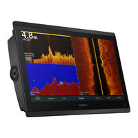
Garmin GPSMAP 7400 Series Owner's Manual (82 pages)
Brand:
Garmin
| Category:
Marine GPS System
| Size: 7 MB
Table of Contents
Table of Contents
3
Introduction
9
Protective Cover
9
Device Overview
9
Using the Touchscreen
9
On-Screen Buttons
9
Locking and Unlocking the Touchscreen
9
Connector View (10, 12, and 16-Inch Models)
9
Connector View (17, 22, and 24-Inch Models)
10
Connector View (8700 Models)
10
Tips and Shortcuts (MFD Models)
10
Tips and Shortcuts (8700 Model)
10
Accessing Owner's Manuals on the Chartplotter
10
Downloading the Manuals from the Web
10
Garmin Support Center
11
Memory Cards
11
Inserting Memory Cards (10, 12, and 16-Inch Models)
11
Inserting a Memory Card (17, 22, and 24-Inch Models and 8700)
11
Acquiring GPS Satellite Signals
11
Selecting the GPS Source
11
Customizing the Chartplotter
11
Home Screen
11
Adding an Item to Favorites
12
Customizing the Home Screen
12
Customizing Pages
12
Customizing the Layout of a Smartmode or Combination Page
12
Changing the Background Image
12
Recommended Background Image Dimensions
12
Customizing the Startup Screen
12
Recommended Startup Image Dimensions
12
Adding a Smartmode Layout
12
Creating a New Combination Page
13
Deleting a Combination Page
13
Customizing the Data Overlays
13
Resetting the Station Layouts
13
Presets
13
Saving a New Preset
13
Managing Presets
13
Setting the Vessel Type
13
Adjusting the Backlight
14
Adjusting the Color Mode
14
Turning on the Chartplotter Automatically
14
Automatically Turning off the System
14
Activecaptain App
14
Activecaptain Roles
14
Getting Started with the Activecaptain App
14
Enabling Smart Notifications
14
Receiving Notifications
15
Managing Notifications
15
Making Notifications Private
15
Updating Software with the Activecaptain App
15
Updating Charts with Activecaptain
15
Communication with Wireless Devices
15
Wi-Fi Network
16
Setting up the Wi-Fi Wireless Network
16
Connecting a Wireless Device to the Chartplotter
16
Changing the Wireless Channel
16
Changing the Wi-Fi Host
16
Wireless Remote Control
16
Pairing the Wireless Remote Control with the Chartplotter
16
Turning on and off the Remote Backlight
16
Disconnecting the Remote from All Chartplotters
16
Wireless Wind Sensor
16
Charts and 3D Chart Views
17
Navigation Chart and Fishing Chart
17
Zooming in and out Using the Touchscreen
17
Chart Symbols
17
Measuring a Distance on the Chart
17
Creating a Waypoint on the Chart
17
Viewing Location and Object Information on a Chart
17
Viewing Details about Navaids
17
Navigating to a Point on the Chart
18
Premium Charts
18
Fish Eye 3D Chart View
18
Viewing Tide Station Information
18
Animated Tide and Current Indicators
18
Showing Tides and Current Indicators
19
Showing Satellite Imagery on the Navigation Chart
19
Viewing Aerial Photos of Landmarks
19
Automatic Identification System
19
AIS Targeting Symbols
19
Heading and Projected Course of Activated AIS Targets
19
Activating a Target for an AIS Vessel
20
Viewing Information about a Targeted AIS Vessel
20
Deactivating a Target for an AIS Vessel
20
Viewing a List of AIS and MARPA Threats
20
Setting the Safe-Zone Collision Alarm
20
AIS Aids to Navigation
20
AIS Distress Signals
20
Navigating to a Distress Signal Transmission
20
AIS Distress Signal Device Targeting Symbols
20
Enabling AIS Transmission Test Alerts
20
Turning off AIS Reception
21
Chart Menu
21
Chart Layers
21
Chart Layer Settings
21
Depth Layer Settings
21
My Vessel Layer Settings
21
Laylines Settings
21
User Data Layer Settings
22
Other Vessels Layer Settings
22
Water Layer Settings
22
Depth Range Shading
22
Weather Layer Settings
22
Radar Overlay Settings
22
Chart Settings
22
Fish Eye 3D Settings
23
Supported Maps
23
Garmin Quickdraw Contours Mapping
23
Mapping a Body of Water Using the Garmin Quickdraw Contours Feature
23
Adding a Label to a Garmin Quickdraw Contours Map
23
Garmin Quickdraw Community
23
Connecting to the Garmin Quickdraw Community with Activecaptain
23
Downloading Garmin Quickdraw Community Maps Using Activecaptain
23
Sharing Your Garmin Quickdraw Contours Maps with the Garmin Quickdraw Community Using Activecaptain
24
Connecting to the Garmin Quickdraw Community with Garmin Connect
24
Sharing Your Garmin Quickdraw Contours Maps with the Garmin Quickdraw Community Using Garmin Connect
24
Downloading Garmin Quickdraw Community Maps Using Garmin Connect
24
Garmin Quickdraw Contours Settings
24
Garmin GPSMAP 7400 Series Owner's Manual (60 pages)
Brand:
Garmin
| Category:
GPS
| Size: 2 MB
Table of Contents
Table of Contents
3
Introduction
9
Device Overview
9
Using the Touchscreen
9
On-Screen Buttons
9
Tips and Shortcuts
9
Locking the Touchscreen
9
Accessing Owner's Manuals on the Chartplotter
9
Downloading the Manuals
9
Getting more Information
9
Inserting a Memory Card
9
Inserting Memory Cards
10
Software Update
10
Loading the New Software on a Memory Card
10
Updating the Device Software
10
GPS Satellite Signals
10
Selecting the GPS Source
10
Customizing the Chartplotter
10
Home Screen
10
Adding an Item to Favorites
11
Customizing Pages
11
Customizing the Layout of a Smartmode or Combination Page
11
Adding a Smartmode Layout
11
Adding a Custom Combination Screen
11
Customizing the Data Overlays
11
Resetting the Station Layouts
11
Presets
11
Saving a New Preset
11
Managing Presets
11
Setting the Vessel Type
12
Adjusting the Backlight
12
Adjusting the Color Mode
12
Charts and 3D Chart Views
12
Navigation Chart and Offshore Fishing Chart
12
Zooming in and out Using the Touchscreen
12
Selecting a Map
12
Measuring a Distance on the Chart
12
Chart Symbols
12
Showing a Different Chart
12
Creating a Waypoint on the Chart
13
Viewing Location and Object Information on a Chart
13
Viewing Details about Navaids
13
Navigating to a Point on the Chart
13
Heading Line and Angle Markers
13
Setting the Heading and Course over Ground Lines
13
Turning on Angle Markers
13
Premium Charts
13
Viewing Tide Station Information
14
Animated Tide and Current Indicators
14
Showing Tides and Current Indicators
14
Showing Satellite Imagery on the Navigation Chart
14
Viewing Aerial Photos of Landmarks
14
Garmin Quickdraw Contours Mapping
14
Mapping a Body of Water Using the Garmin Quickdraw Contours Feature
14
Adding a Label to a Garmin Quickdraw Contours Map
15
Garmin Quickdraw Contours Settings
15
Automatic Identification System
15
AIS Targeting Symbols
15
Heading and Projected Course of Activated AIS Targets
15
Showing AIS and MARPA Vessels on a Chart or on a 3D Chart View
15
Activating a Target for an AIS Vessel
16
Viewing Information about a Targeted AIS Vessel
16
Deactivating a Target for an AIS Vessel
16
Viewing a List of AIS and MARPA Threats
16
Setting the Safe-Zone Collision Alarm
16
AIS Distress Signals
16
Navigating to a Distress Signal Transmission
16
AIS Distress Signal Device Targeting Symbols
16
Enabling AIS Transmission Test Alerts
16
Turning off AIS Reception
16
Waypoints and Tracks Settings on the Charts and Chart Views
17
Chart Appearance Settings
17
Other Vessels Settings on the Charts and Chart Views
17
Laylines Settings
17
Fish Eye 3D Settings
17
Navigation with a Chartplotter
18
Basic Navigation Questions
18
Destinations
18
Searching for a Destination by Name
18
Selecting a Destination Using the Navigation Chart
18
Searching for a Marine Services Destination
18
Stopping Navigation
18
Waypoints
18
Marking Your Present Location as a Waypoint
18
Creating a Waypoint at a Different Location
18
Viewing a List of All Waypoints
19
Editing a Saved Waypoint
19
Moving a Saved Waypoint
19
Browsing for and Navigating to a Saved Waypoint
19
Deleting a Waypoint or an MOB
19
Deleting All Waypoints
19
Setting and Following a Direct Course Using Go to
19
Routes
19
Creating and Navigating a Route from Your Present Location
19
Creating and Saving a Route
19
Viewing a List of Routes and Auto Guidance Paths
20
Editing a Saved Route
20
Browsing for and Navigating a Saved Route
20
Browsing for and Navigating Parallel to a Saved Route
20
Deleting a Saved Route
20
Deleting All Saved Routes
20
Auto Guidance
20
Setting and Following an Auto Guidance Path
20
Creating and Saving an Auto Guidance Path
20
Adjusting a Saved Auto Guidance Path
21
Canceling an Auto Guidance Calculation in Progress
21
Setting a Timed Arrival
21
Auto Guidance Path Configurations
21
Adjusting the Distance from Shore
21
Tracks
22
Showing Tracks
22
Setting the Color of the Active Track
22
Saving the Active Track
22
Viewing a List of Saved Tracks
22
Editing a Saved Track
22
Saving a Track as a Route
22
Browsing for and Navigating a Recorded Track
22
Deleting a Saved Track
22
Garmin GPSMAP 7400 Series Owner's Manual (52 pages)
Brand:
Garmin
| Category:
GPS
| Size: 2 MB
Table of Contents
Table of Contents
3
Customizing the Chartplotter
7
Introduction
7
Downloading the Manuals
7
Front View
7
Getting more Information
7
Gps Satellite Signals
7
Home Screen
7
Adding a Custom Combination Screen
8
Adding an Item to Favorites
8
Resetting the Station Layouts
8
Software Update
7
Adjusting the Backlight
8
Adjusting the Color Mode
8
Adding a Smartmode Layout
8
Charts and 3D Chart Views
8
Navigation Chart and Offshore Fishing Chart
9
Chart Symbols
9
Showing a Different Chart
9
Viewing Location and Object Information on a Chart
9
Zooming in and out Using the Touchscreen
9
Premium Charts
10
Viewing Details about Navaids
10
Viewing Tide Station Information
10
Showing Satellite Imagery on the Navigation Chart
11
Viewing Aerial Photos of Landmarks
11
Automatic Identification System
11
Ais Targeting Symbols
11
Chart and 3D Chart View Settings
12
Turning off Ais Reception
12
Setting the Safe-Zone Collision Alarm
12
Ais Distress Signals
12
Navigation and Fishing Chart Setup
13
Chart Appearance Settings
13
Navigation with a Chartplotter
14
Basic Navigation Questions
14
Searching for a Destination by Name
14
Selecting a Destination Using the Navigation Chart
14
Searching for a Marine Services Destination
14
Creating a Waypoint at a Different Location
14
Marking an Sos Location
14
Deleting All Waypoints
15
Auto Guidance
16
Auto Guidance Line Configurations
17
Showing Tracks
17
Stopping Navigation
18
Retracing the Active Track
18
Synchronizing User Data Across the Garmin Marine Network
18
Setting the Keel Offset
19
Sailing Features
19
Sail Racing
19
Starting Line Guidance
19
Sonar
20
Sonar Views
20
Sailboat Autopilot Operation
20
Wind Hold
20
Traditional Sonar View
20
Downvü Sonar View
20
Sidevü Sonar View
21
Split-Zoom Sonar View
21
Split-Frequency Sonar View
21
Changing the Sonar View
22
Creating a Waypoint on the Sonar Screen
22
Measuring Distance on the Sonar Screen
22
Pausing the Sonar Display
22
Viewing Sonar History
22
Sonar Sharing
22
Selecting a Sonar Source
22
Renaming a Sonar Source
22
Adjusting the Level of Detail
22
Adjusting the Color Intensity
23
Adjusting the Range of the Depth or Width Scale
23
Setting the Zoom Level on the Sonar Screen
23
Setting the Scroll Speed
23
Sonar Frequencies
23
Selecting Frequencies
24
Creating a Frequency Preset
24
Customizing the Panoptix Sonar Views
24
Adjusting the Appearance of the Livevü Sonar Views
24
Setting the Livevü Transducer Transmit Angle
24
Adjusting the Realvü Viewing Angle and Zoom Level
24
Adjusting the Appearance of the Realvü Sonar Views
24
Adjusting the Realvü Sweep Speed
24
Turning on the A-Scope
24
Selecting the Transducer Type
24
Realvü Sonar Settings
25
Livevü Sonar Settings
25
Sonar Noise Rejection Settings
25
Sonar Appearance Settings
25
Sonar Alarm Settings
25
Advanced Sonar Settings
25
Transducer Installation Settings
26
Sonar Recordings
26
Recording the Sonar Display
26
Stopping the Sonar Recording
26
Deleting a Sonar Recording
26
Playing Sonar Recordings
26
Garmin GPSMAP 7400 Series Field Service Manual (18 pages)
Brand:
Garmin
| Category:
GPS
| Size: 3 MB
Table of Contents
Table of Contents
1
Tools Needed
2
Important Information Regarding the Field Repair of GPSMAP 7400/7600 Series Chartplotters
2
Troubleshooting
2
Important Troubleshooting Information
2
Loading the New Software on a Memory Card
2
Updating the Device Software
2
About the Test Mode Screen
2
Activating Test Mode
2
Testing
3
Testing the Display
3
Testing the Touchscreen
3
Calibrating the Touchscreen
3
Testing GPS
3
Testing the Power Button Board
4
Locating Problems
4
Testing NMEA 0183
4
Disassembly and Reassembly Procedures
5
Opening the Housing
5
Models
5
Models
7
Separating the Rear Housing from the Front Housing: 16 In. Models
8
Removing the Connector Board: 7 In. and 8 In. Models
9
Removing the Main Board: 7 In. and 8 In. Models
10
Removing the Main Board: 10 In. and 12 In. Models
11
Removing the Main Board: 16 In. Models
11
Reassembling the Housing
12
Repair Procedures
13
Replacing the SD Card Door
13
Replacing Weather Caps
13
Replacing the Rear Housing
14
Replacing the Front Case Assembly: 7 In. and 8 In. Models
14
Replacing the Front Case Assembly: 10 In. and 12 In. Models
15
Replacing the Connector Board: 7 In. and 8 In. Models
15
Replacing the Main Board: 7 In. and 8 In. Models
15
Replacing the Main Board: 10 In., 12 In., and 16 In. Models
16
Replacing the SD Card Port
16
Replacing the Power Button Board: 10 In., 12 In., and 16 In. Models
17
Replacing the Patch Antenna: 8 In., 10 In., and 12 In. Models
17
Replacing the Patch Antenna: 16 In. Models
17
Garmin GPSMAP 7400 Series Installation Insrtuctions (7 pages)
Brand:
Garmin
| Category:
GPS
| Size: 1 MB
Table of Contents
Installation Instructions
1
Important Safety Information
1
Tools Needed
1
Mounting Considerations
1
Registering Your Device
1
Software Update
1
Loading the New Software on a Memory Card
1
Updating the Device Software
1
Bail Mounting the Device
2
Flush Mounting the Device
2
Cable and Connection Considerations
3
Additional Grounding Consideration
3
Garmin Marine Network Considerations
3
About the Wiring Harness
3
Connecting the Wiring Harness to Power
3
Power Cable Extensions
3
NMEA 0183 Connection Considerations
4
NMEA 2000 Considerations
4
Lamp or Horn Connections
4
Video Input and Output Considerations
4
Physical Specifications
5
Electrical Specifications
5
NMEA 2000 PGN Information
5
Specifications
5
Nmea 0183 Information
6
Garmin GPSMAP 7400 Series Installation Instructions Manual (9 pages)
Brand:
Garmin
| Category:
Marine Equipment
| Size: 1 MB
Table of Contents
Bail Mounting the Device
2
Flush Mounting the Device
2
Cable and Connection Considerations
3
Additional Grounding Consideration
3
NMEA 0183 Connection Considerations
4
Lamp or Horn Connections
4
Video Input and Output Considerations
4
Physical Specifications
5
Electrical Specifications
5
Nmea 0183 Information
6
J1939 PGN Information
7
Advertisement
Related Products
Garmin GPSMAP 741 Guide
Garmin GPSMAP 741xs Guide
Garmin GPSMAP 740/740s
Garmin GPSMAP 743xsv
Garmin GPSMAP 743
Garmin GPSMAP 76CS
Garmin Nuvi 765T - Automotive GPS Receiver
Garmin Nuvi 755T - Automotive GPS Receiver
Garmin Camper 770
Garmin Montana 700i
Garmin Categories
GPS
Watch
Car Navigation system
Avionics Display
Marine Equipment
More Garmin Manuals
Login
Sign In
OR
Sign in with Facebook
Sign in with Google
Upload manual
Upload from disk
Upload from URL