Table of Contents
Advertisement
Quick Links
Download this manual
See also:
Installation Manual
Advertisement
Table of Contents

Related Manuals for Furuno GP-1871F


Summary of Contents for Furuno GP-1871F
-
Page 2: Safety Instructions
If the label is missing or damaged, damage to, or failure of, the equipment. contact a FURUNO agent or dealer about replacement. About the TFT LCD The TFT LCD is constructed using the latest LCD techniques, and displays 99.99% of its pixels. -
Page 3: Table Of Contents
TABLE OF CONTENTS FOREWORD ........................vii SYSTEM INTRODUCTION ..................1-1 1.1 How to Turn the Power On/Off................... 1-1 1.2 Brilliance/Color Adjustments ..................1-1 1.3 How to Lock the Screen ..................... 1-2 1.4 Home Screen and Displays..................1-2 1.4.1 How to select a display .................. 1-2 1.4.2 How to add pages .................. - Page 4 TABLE OF CONTENTS 3.1 Tracks Overview......................3-1 3.2 How to Show/Hide All Tracks ..................3-1 3.3 Track Recording ......................3-1 3.4 How to Set Up Tracks....................3-2 3.5 How to Delete Tracks ....................3-2 3.5.1 How to delete an individual track..............3-3 3.5.2 How to delete a section of track ..............3-3 3.5.3 How to delete tracks automatically ..............3-3 3.5.4...
- Page 5 TABLE OF CONTENTS 5.9.1 How to delete a route from the pop up menu..........5-7 5.9.2 How delete routes from the [Routes] list ............5-7 5.9.3 How to delete routes from the menu .............. 5-7 5.10 Route Calculation Speed Setup ................. 5-7 5.11 Show/Hide Routes On-Screen ...................
- Page 6 TABLE OF CONTENTS 6.19.3 How to set the fish size notification ..............6-12 6.19.4 How to set the seabed composition alarm ...........6-12 6.20 Restoring Factory Defaults ..................6-12 RADAR ........................7-1 7.1 Radar Screen Overview .....................7-1 7.2 Transmit/Standby .......................7-1 7.3 Tune Initialize ......................7-1 7.4 How to Reduce Clutter ....................7-1 7.5 How to Change the Range ..................7-2 7.6 Changing Orientation Modes..................7-2...
- Page 7 TABLE OF CONTENTS 9.3.1 How to set up and edit the Multi-Instrument Display........9-1 9.3.2 Instrument display examples................9-3 9.3.3 How to change the displayed instrument ............9-3 9.3.4 How to change the information shown for an instrument ....... 9-3 9.3.5 How to delete an instrument page ..............
-
Page 8: Foreword
A Word to the Owner Congratulations on your choice of the FURUNO GP-1871F, GP-1971F GPS/WAAS Chart Plotter with Fish Finder. We are confident you will see why the FURUNO name has become synonymous with quality and reliability. Since 1948, FURUNO Electric Company has enjoyed an enviable reputation for innovative and dependable marine electronics equipment. - Page 9 FOREWORD This page is intentionally left blank. viii...
-
Page 10: System Introduction
SYSTEM INTRODUCTION How to Turn the Power On/Off The power button is located on the lower-left side of the outer edge of the screen. Press and hold the button to turn the power on. A short “beep” sound is released to indicate that the power is on, then the start-up procedure begins. -
Page 11: How To Lock The Screen
1. SYSTEM INTRODUCTION How to Lock the Screen You can lock the on-screen icons/buttons to prevent accidental operation. To lock the icons/buttons, press the power switch to show the [Brilliance] pop up win- dow, then tap the toggle box at [Touch Screen] to show [OFF]. The touch screen is now locked and all screen-based operations are disabled. -
Page 12: How To Edit And Delete
1. SYSTEM INTRODUCTION • Full screen (Single section, undivided): Plotter, Fish Finder, Plotter + Fish Finder (right-side quarter of the screen), Radar; • Two sections: Plotter, Fish Finder, Radar; • Three sections: Left-side of the screen (Plotter, Fish Finder, Radar), Right-side top or bottom quarter screen (Plotter, Fish Finder, Radar, Instruments). -
Page 13: How To Switch Screen Operation In Multi-Section Layouts
1. SYSTEM INTRODUCTION 1.4.4 How to switch screen operation in multi-section layouts When the screen is divided into two or more sections, you can operate most screens individually by switching the active screen. To switch active screens, tap the screen you wish to operate. -
Page 14: Slide-Out Menu
1. SYSTEM INTRODUCTION 1.5.1 Slide-out menu Swipe the right edge of the screen leftwards to show the slide-out menu. The slide-out menu contains operations and functions for the currently displayed screen are shown in the slide-out menu. Simply tap the required item in the slide-out menu to use that function or operation. - Page 15 1. SYSTEM INTRODUCTION 3. Tap the menu you want to access. Drag the menu to show menu items which do not appear on-screen. Top layer of Menu items for the selected Menu options for sub-menu items the menu top layer menu appear here. appear in an overlaid window.
-
Page 16: Data Area (Data Boxes)
1. SYSTEM INTRODUCTION Back button Cursor Backspace Deletes the character to the left of the cursor. Confirm and apply the value or setting. Tap to toggle between numeric and alphabet. Space bar Move the cursor left or right. Cancel input and close the keyboard. -
Page 17: Countdown Beeps
1. SYSTEM INTRODUCTION Countdown Beeps When you turn the system off, the count-down timer is accompanied by a beep for each second in the count-down. You can enable/disable the beep to suit your require- ments. 1. Tap the [Home] icon to show the [Home] screen, then tap [Settings] => [General] =>... -
Page 18: How To Erase An Mob Mark
1. SYSTEM INTRODUCTION 1.9.2 How to erase an MOB mark Tap the range/bearing indication at the bottom-right of the screen to show the pop up window. Tap [Cancel MOB]. A confirmation message appears. Tap [Yes] or [No] as appropriate. 1.10 Wireless LAN Setup You can use the wireless LAN to update weather information and software. - Page 19 1. SYSTEM INTRODUCTION • [Slide Show From SD]: Displays images (photos) stored on the inserted SD card as a slide show. • [Simulation]: Activates the simulation mode and allows you set parameters for the simulation. 4. Tap the [<] icon at the top-left of the selection window to go back to the [Simula- tion] menu.
-
Page 20: Plotter
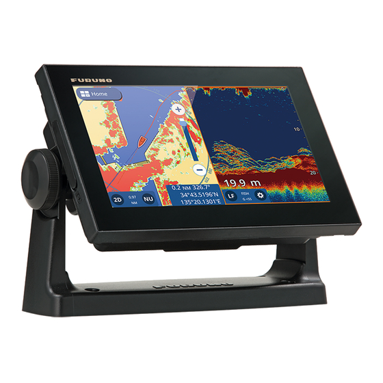
PLOTTER Plotter Overview The Plotter page can be displayed in full-screen, or with the Radar, Fish Finder or In- struments pages. [ Home ] icon Center icon (returns own ship to screen center) Heading line (green solid line) Range Own ship icon Data slide area... -
Page 21: Changing The Display Range
2. PLOTTER Changing the Display Range There are two methods you can use to increase or decrease the display range. You can use the range slider and buttons, or use the pinch motion on the touch screen. Zoom in Tap the slider bar, drag the slider, or tap the [+]/[-] icons to zoom in or out. -
Page 22: Cog Vector Settings
2. PLOTTER The heading line (green, solid The COG vector (red, dashed line) extends from the bow of line) extends from the bow of the own ship icon in the the own ship icon to indicate direction you are heading. your course and speed. -
Page 23: How To Offset The Own Ship Icon
2. PLOTTER 2.6.4 How to offset the own ship icon You can offset the default "center" location for the own ship icon. When you tap the [Center] icon (top-right corner of the screen), the ship and chart are moved to the cen- ter of the screen. -
Page 24: Chart Display Angle
2. PLOTTER estimated trip time is based on the speed entered at [Route Planning Speed] in the [Settings] => [Routes] menu => [Routes] tab. Ruler button End point “B” Start point “A” Distance Bearing Estimated trip time 5. To move the end point “B”, drag the icon to the new location. Note: You can relocate the first point “A”. -
Page 25: Radar Overlay
2. PLOTTER List of chart objects related to the selected location. Action buttons Multimedia content ( Shown only when available. ) Detailed information for selected object or location The related chart objected listed, available actions, photos and detailed information vary depending on the location selected. The following list shows the actions which may be available. -
Page 26: How To Use The Autopilot For Navigation
2. PLOTTER How to show the autopilot’s course from the [Settings] menu 1. From the [Home] screen, tap [Settings] => [Ship and Tracks] => [Ship]. 2. Tap the toggle box at [NAVpilot Course] to show [ON]. 3. Tap the [x] at the top-right of the menu to close the menu. How to show the autopilot’s destination from the pop up menu Tap the own ship icon to show the pop up menu, then tap the toggle box at [NAVpilot Course] to show [ON]. -
Page 27: Tide Information
2. PLOTTER Weather data update status Fill check box to show tide stations Time scale (24 hr format) Drag the slider (yellow circle) to adjust the time shown on-screen. Playback ( ) or pause ( ) the weather forecast. Show Show previous next day... -
Page 28: How To View Tidal Current Information
2. PLOTTER • Tap a location on the chart. From a tide station Tap the tide station to show the chart pop up menu, then tap [Chart Info] => [Tide Height Station] => [Graph]. Tide graph for the selected tide station appears. From the slide-out menu or [Home] screen From the [Home] screen, tap [Tide], or swipe the right-hand side of the screen left- wards to show the slide-out menu, then tap [Tide]. -
Page 29: How To View Satellite Status
2. PLOTTER C-Weather tidal Standard chart current icon tidal current icon The current’s direction is indicated by the arrow’s direction, speed and current strength are indicated in the following manner: Icon type Current’s speed indication Current’s strength indication Standard icon Size increases as current speed Color changes as follows: increases. -
Page 30: Tracks
TRACKS Tracks Overview Your boat’s track is plotted on the display with position information fed from the inter- nal GPS navigator, or from the NMEA2000 network (requires position data input from the NMEA2000 network). Previous track Current track How to Show/Hide All Tracks Swipe the Plotter screen from the bottom upwards to show the layered menu, then tap [Show All Tracks] to toggle between [ON] and [OFF]. -
Page 31: How To Set Up Tracks
3. TRACKS How to Set Up Tracks You can set the recording interval, track color (single or multicolor) and track thick- ness. 1. From the [Home] screen, tap [Settings] => [Ship and Tracks] => [Track]. The track settings appear in the right-hand side of the screen. 2. -
Page 32: How To Delete An Individual Track
3. TRACKS • Delete a section of the track • Delete track automatically • Delete all tracks 3.5.1 How to delete an individual track Note: Active individual tracks cannot be deleted. 1. Tap the track to delete. The pop up menu appears. 2. - Page 33 3. TRACKS This page is intentionally left blank.
-
Page 34: Points And Polylines
POINTS AND POLYLINES Points and Event Marks A point, in navigation terminology, is a location you mark on the display. A point can be a fishing spot, reference point and other important locations. You can create a new point from the Plotter, Radar, Fish Finder or Weather screens. You can also set a point as a destination and create a route. -
Page 35: Point/Event Mark Creation
4. POINTS AND POLYLINES 2. Tap [Reset to Factory Defaults] in the right-hand side of the screen. A confirmation message appears. 3. Tap [Yes] to restore default settings for the [Points] menu, or tap [No] to cancel. 4. Tap the [x] at the top-right corner of the menu to close the menu. Point/Event Mark Creation 4.3.1 How to create a point... -
Page 36: How To Search The Points List
4. POINTS AND POLYLINES 4.4.2 How to search the points list 1. Tap the search button at the top-left of the [Points] list. The software keyboard ap- pears. 2. Enter the name, or part of the name, for the point(s) you want to search for, then tap [OK]. -
Page 37: How To Delete All Points Or Specified Points
4. POINTS AND POLYLINES 1. From the [Home] screen, tap [List] => [Points] to show the [Points] list. 2. Tap the point to you want to delete. 3. Tap [Delete]. A confirmation message appears. 4. Tap [Yes] to delete the point. 4.6.3 How to delete all points or specified points 1. -
Page 38: How To Edit A Point From The [Points] List
4. POINTS AND POLYLINES 4.7.2 How to edit a point from the [Points] list Tap any information field to edit the information. Tap a point to Tap a point to show its details. show its details. Information fields not shown in this figure •... -
Page 39: How To Create A Polyline
4. POINTS AND POLYLINES 4.10 How to Create a Polyline Polylines are a combination of several straight lines. Each straight line is referred to as a “Vertex”. 1. Tap the location you want to start a polyline from. The pop up menu appears. 2. -
Page 40: Polyline Color Setup
4. POINTS AND POLYLINES 4.12 Polyline Color Setup To change the color of a polyline, follow the procedure below. 1. From the [Home] screen, tap [List] => [Polylines]. 2. Tap the line whose color you want to change. The polyline information window ap- pears. - Page 41 4. POINTS AND POLYLINES 4. Tap any vertex to show the vertex information. 5. Tap [Delete]. A confirmation window appears. 6. Tap [Yes] to delete the selected vertex. 7. Tap the [x] at the top-right corner of the menu to close the menu.
-
Page 42: Routes
ROUTES What is a Route? Often a trip from one place to another involves several course changes, requiring a series of route points (waypoints) which you navigate to, one after another. The se- quence of waypoints leading to the ultimate destination is called a route. Once you create a route, you can navigate it. -
Page 43: How To Use Easy Routing
5. ROUTES To create a new planned route, do the following: 1. Tap the location you want to start a route from. The pop up menu appears. 2. Tap [New Route]. The screen changes to route creation mode and the selected location becomes the first route point of the route. -
Page 44: Routes List
5. ROUTES inal source material used in producing such charts. Always remember that you should navigate with the most detailed and up-to-date chart available from FURUNO, and new information from National Hydrographic Offices may render your charts obsolete at any time. Easy Routing is only an aid to navigation and must be used in conjunction with conventional navigation practices. -
Page 45: How To Search The Routes List
5. ROUTES Swipe the list up or down to show routes which are not displayed on the screen. Tap to sort the list by [ Name ] or [ Date ] Search Tap to delete button all routes Orange highlight indicates Scrollbar appears active route... -
Page 46: Extending Routes On-Screen
5. ROUTES • [Delete]: Tap to show a confirmation message, then tap [Yes] to delete the selected route. • [Locate on Map]: Tap to show the location of the route on the map. The map moves to show the selected route at the center of the screen. •... -
Page 47: Moving Route Points On-Screen
5. ROUTES 4. Tap [Save] to save the new route point to the route. Moving Route Points On-screen You can move a route point in a route as follows: 1. Tap the route point you want to move. The pop up menu appears. 2. -
Page 48: How To Delete A Route From The Pop Up Menu
5. ROUTES • From the Routes list • From the menu. 5.9.1 How to delete a route from the pop up menu 1. Tap the route point you want to delete. The pop up menu appears. 2. Tap [Delete Route]. A confirmation message appears. 3. -
Page 49: How To Navigate A Route
5. ROUTES 5.12 How to Navigate a Route 5.12.1 How to select a route from the screen 1. Tap the route you want to navigate. The pop up menu appears. 2. Tap [Start Nav]. The active leg (course to the next The XTD lines appear as colored waypoint in the route) is shown as dotted lines, parallel with the... -
Page 50: How To Follow A Route In Reverse Order
5. ROUTES Line 2 Line 1 Obstacle Original course 1. Tap the next route point, or a leg in the route to show the pop up menu. 2. Tap [Restart Nav]. 5.13.2 How to follow a route in reverse order You can follow the route points of a route in reverse order. -
Page 51: How To Adjust The Size Of The Arrival Notification Area
5. ROUTES 5.13.5 How to adjust the size of the arrival notification area The arrival notification area is a fixed-radius area around each route point and is shown as a dotted red circle. The area is used to calculated the turning point towards the next route point and also as an alert trigger. -
Page 52: Fish Finder
FISH FINDER Fish Finder Display [ Home ] icon Time mark Depth scale Depth Quick settings shortcut Gain mode and value Frequency toggle The quick settings shortcut gives you access to regularly used settings such as gain adjustment and TVG, as well as other settings. Tap the cog icon to show the quick set- tings menu. -
Page 53: Start/Stop Transmission
6. FISH FINDER Start/Stop Transmission Transmission can be controlled from the [Settings] menu. To open the [Settings] menu, follow the procedure below. 1. Open the menu. 2. Tap the toggle box at [Transmission] to show [ON] and [OFF] as required. 3. -
Page 54: Bottom Discrimination Display
6. FISH FINDER Weak reflection (small fish or noise) Fish echo Strong reflection (bottom) Single frequency display A-scope display To show or hide the A-scope display, swipe the bottom of the screen upwards to show the layered menu, then tap the toggle box at [A-Scope]. Select [ON] to show the A- Scope, or [OFF] to hide the A-Scope. -
Page 55: Automatic Fish Finder
6. FISH FINDER How to set the bottom discrimination display Note: Auto range is automatically turned on when the bottom discrimination display is activated. 1. Swipe the bottom of the screen upwards to show the layered menu. 2. Tap the toggle box at [Bottom Discrimination] to select [ON]. 3. -
Page 56: How To Offset The Bottom Echo
6. FISH FINDER istics, etc. Set the gain to show a slight amount of noise on the screen. Increase the gain for greater depths and lower the gain for shallow waters. To adjust the gain, tap the cogwheel icon to open the [Settings] menu then drag the slide bar at [Gain Value], or tap the keyboard icon at [Gain Value] to input the gain val- 6.5.3 How to offset the bottom echo... -
Page 57: How To Adjust The Gain
6. FISH FINDER 6.6.4 How to adjust the gain You can adjust the gain (sensitivity) of the transducer. The correct setting shows some background noise on the screen. If you do not use enough gain, weak echoes are erased. If you use more gain than necessary, the background noise hides both weak and strong targets. -
Page 58: White Edge
6. FISH FINDER 1. Tap the cogwheel icon to open the [Settings] menu then select [Sensitivity]. 2. Tap the [White Marker] toggle box to select [ON]. The [Range] settings are now selectable. 3. Drag the slider bar, or tap the keyboard icon to input a value. The higher the number, the stronger echo is displayed in white. -
Page 59: Depth/Time Measurements
6. FISH FINDER the screen. A slow advance speed shortens the school of fish. Use a fast advance speed to see the hard bottom. Use a slow advance speed to see the smooth bottom. ™ Note: When ACCU-FISH or Bottom Discrimination is active, the picture advance speed may be slowed. -
Page 60: Fish Finder Display Settings
6. FISH FINDER 6.16 Fish Finder Display Settings Display settings for the fish finder can be changed from the [Settings] => [Fish Finder] menu. Referring to the list below, changed the settings as required. • [Palettes] => [Day Palette]/[Night Palette]: Set the color scheme to use for Day/ Night palettes. -
Page 61: How To Activate Accu-Fishtm, Select Display Information
6. FISH FINDER 6.17.2 How to activate ACCU-FISH , select display information 1. From the [Home] screen, tap [Settings] => [Fish Finder]. 2. At [ACCU-FISH Info] and select the information to display. [Off]: Hide the fish size/depth indications, showing only the icon. [Fish Size]: Show fish size. -
Page 62: Rezboost
6. FISH FINDER Note: When more than one filter is used, the filters are applied in numerical order. ™ 6.18 RezBoost ™ With connection of a RezBoost capable transducer, echo resolution can be im- proved. For example, previously it was difficult to distinguish fish from the seabed ™... -
Page 63: How To Set The Fish Size Notification
6. FISH FINDER 3. Set the [Depth] (from transducer) to set the start point for the detection area. Drag the slider, or tap the keyboard icon to input a value. 4. Set the Range (width) of the detection area in a similar manner. 5. -
Page 64: Radar
RADAR Radar Screen Overview When connected to a radar, you can view the radar echoes on screen. The radar screen also shows various navigational data in the data boxes at the left-hand side of the screen. 1: Own ship icon 2: TX/Standby button 3: Chart range 4: North Up/ Head Up button... -
Page 65: How To Change The Range
7. RADAR How to Change the Range There are two methods you can use to change the range: pinch the radar screen, or use the range slide bar. Zoom in Tap the [+]/[-] icons or drag the slider. Slide bar Zoom out Zoom in Zoom out... -
Page 66: Show/Hide The Own Ship Icon
7. RADAR Show/Hide the Own Ship Icon Swipe the bottom of the screen upwards to show the layered menu, then tap the toggle box at [Own Ship Icon] to show [ON] or [OFF] as required. Measuring Range and Bearing 7.9.1 How to estimate the distance to a target You can estimate the distance (range) to a target by counting the number of range rings between your vessel and the target. -
Page 67: How To Change The Bearing Reference
7. RADAR 7.9.3 How to change the bearing reference Bearing can reference to either North (True) or relative to your heading (Relative). Heading data input is required to show or change the bearing reference. 1. From the [Home] screen, tap [Settings] => [Radar] => [General]. The menu op- tions appear in the right-hand side of the screen. -
Page 68: How To Change Echo Colors
7. RADAR 4. Tap any location on the sentry zone. The pop up menu appears. 5. Tap [Resize SZ]. The sentry zone now appears with a yellow colored dashed line and a box appears at each corner of the zone. Sentry zone corner. -
Page 69: Bearing Scale Reference Setup
7. RADAR 1. From the [Home] screen, tap [Settings] => [Radar] => [General]. The menu op- tions appear in the right-hand side of the screen. 2. Tap the color indication at [Day Background Color], then tap the background color to use. 3. -
Page 70: Restoring Factory Defaults
7. RADAR • [Sector Start Angle]: Sets the angle at which [Sector Suppression] begins. This menu item can be adjusted regardless of the setting for [Sector Suppression], however the setting has no effect until [Sector Suppression] is enabled. • [Sector Width]: Sets the width for [Sector Suppression]. This menu item can be adjusted regardless of the setting for [Sector Suppression], however the set- tings has no effect until [Sector Suppression] is enabled. - Page 71 7. RADAR This page is intentionally left blank.
-
Page 72: Ais/Dsc Operations
AIS/DSC OPERATIONS AIS Overview AIS (Automatic Identification System) is a system that continuously transmits and re- ceives the identification, position, and other AIS data of vessels equipped with an AIS transponder within communicating range. The AIS broadcasts this information over a VHF transceiver. -
Page 73: How To Ignore Slow Targets
8. AIS/DSC OPERATIONS How to Ignore Slow Targets You can set a speed for “slow” targets. Targets moving at speeds than this settings are ignored, helping keep the screen free of unnecessary AIS targets. Targets deemed as “slow” do not trigger the CPA/TCPA alarms. 1. -
Page 74: Ais List Sub Menu Operations
8. AIS/DSC OPERATIONS • [Name]: Sorts the list by name, in alphanumerical order. • [Call Sign]: Sorts the list by call sign, in alphanumerical order. • [Range/BRG]: Sorts the list by range, in ascending order of distance from own ship. •... -
Page 75: Ais Sart Operations
8. AIS/DSC OPERATIONS 8.10 AIS SART Operations You can be alerted to an active/test AIS SART (Search And Rescue Transponder) in your area when the system receives the respective AIS SART sentence. Test AIS SARTs are not shown by default. To show them, tap [Home] => [Settings] => [AIS and DSC], then tap the [AIS SART TEST] toggle box to select [ON]. -
Page 76: Dsc Device Selection
8. AIS/DSC OPERATIONS 8.14 DSC Device Selection 1. From the [Home] screen, tap [Settings] => [Interface] => [Select Input Device]. 2. Scroll down the menu, then tap [DSC]. 3. Select the NMEA format that the radiotelephone uses. Available options are [NMEA0183] or [NMEA2000 Auto]. -
Page 77: Dsc List Overview
8. AIS/DSC OPERATIONS 8.17 DSC List Overview Tap a sorting method to sort the list. Tap the Refresh button to update the list. DSC sender’s name, callsign, MMSI and Drag the scrollbar to date/time of show targets which transmission are not displayed on-screen. -
Page 78: How To Delete Dsc Messages
8. AIS/DSC OPERATIONS 8.17.4 How to delete DSC messages The system can store up to 100 DSC messages. You can selected when to delete messages. 1. From the [Home] screen, tap [Settings] => [AIS and DSC]. 2. Tap the setting at [DSC Calls List] to show the options, then tap the desired option. 3. - Page 79 8. AIS/DSC OPERATIONS This page is intentionally left blank.
-
Page 80: Instrument Display
INSTRUMENT DISPLAY Instrument Display Overview With the connection of appropriate sensors, you can view information regarding your vessel, such as roll/pitch, speed and engine information. Data is displayed in graphic, digital, analog or NAVpilot formats. The instrument display is available when using the three-section display screen layout. - Page 81 9. INSTRUMENT DISPLAY 3. Long-tap the instrument display at the right-hand side of the page. The editing menu appears. Trash can Add Page button button Instruments list 4. From the instruments list, tap the instrument you want to display. 5. To add a second instrument to the current window, tap the [Add Page] button, then select the instrument you want to add.
-
Page 82: Instrument Display Examples
9. INSTRUMENT DISPLAY 9.3.2 Instrument display examples Compass Speed Meter Rudder Timer Pitch and Roll Graph Double Graph Single data box Multi data box Wind meter Engine meter Highway Autopilot 9.3.3 How to change the displayed instrument If you have more than one instrument selected for the Multi-Instrument page, swipe the page up or downwards to show the next page. -
Page 83: How To Use The Timer Instruments
9. INSTRUMENT DISPLAY 9.3.6 How to use the timer instruments 1. Referring to section 9.2.1, set [Timer] as the displayed instrument. 2. Tap the timer window to show the timer settings. 3. Select the desired option. Countdown timer Countdown + trip Stopwatch •... -
Page 84: 10. Notifications
10. NOTIFICATIONS 10.1 Notifications Overview The system releases alarms and messages, collectively referred to as notifications, when the specified conditions are met. When the conditions for a notification are met, the system releases an audible alert and the screen shows the relevant message at the top of the screen. You can silence the audible alert by tapping the message, however the messages remains on the screen until the corresponding alarm/notification is deactivated, or the cause for the notification is gone. -
Page 85: Depth Notification
10. NOTIFICATIONS 2. At the [Grounding] toggle box, select [ON] to activate the grounding notification. The settings for the notification become active. 3. Drag the slide bar or tap the keyboard to set the depth. When the detected seabed is less than this setting, the notification is triggered. 10.3.2 Depth notification The depth notification alerts you when the seabed is within a preset range. -
Page 86: Arrival Notification
10. NOTIFICATIONS 3. Drag the slide bar or tap the keyboard to set the distance. When your vessel drifts off-route more than this setting, the notification is triggered. Own ship Destination Alert position waypoint setting Intended course : Alert area 10.3.5 Arrival notification The arrival notification alerts you when you are within the preset distance from the next... -
Page 87: Temperature Notification
10. NOTIFICATIONS 1. Open the [Notifications] menu then select [Navigation]. 2. At the [Trip] toggle box, select [ON] to activate the trip notification. The settings for the notification become active. 3. At [Max Trip Distance], drag the slide bar or tap the keyboard to set the distance. When your boat travels more than this setting in one trip, the notification is trig- gered. -
Page 88: Wind Notifications
10. NOTIFICATIONS percentage, the notification is triggered. For [Waste Water] and [Black Water], when the tank volume is above this percentage, the notification is triggered. 10.5 Wind Notifications 1. Open the [Notifications] menu then select [Wind]. 2. Tap the toggle box to show [ON] for the notification(s) you want to set. 3. -
Page 89: How To View The Notifications List
10. NOTIFICATIONS 10.7.1 How to view the notifications list From the [Home] screen, tap [Lists] => [Notices and System Messages]. 10.7.2 Notification types The system uses three types of notifications. • Alert notifications: notification related to your vessel, navigation and surroundings. •... -
Page 90: Notification/Messages
10. NOTIFICATIONS 10.8 Notification/Messages • General Notifications Arriving at Destination Enterred the arrival area of the destination waypoint. Anchor Watch Exceeded Drifted more than the set distance from the anchor point. Cross Track Distance Exceeded Off-course by more than the preset distance. Ship Speed Outside Preset Range Speed is over/under the preset. - Page 91 10. NOTIFICATIONS • System Errors Position Lost Positioning fix is lost (EPFS signal interrupted or stopped). Heading Lost Heading is lost (HDG signal interrupted or stopped). Radar Connection Lost Disconnected from the radar or signal is stopped/interrupted. Radar Trigger Error The radar has a problem with the transmission trigger.
-
Page 92: 11. Other Settings/Functions
11. OTHER SETTINGS/FUNCTIONS This chapter covers settings, functions and menus not previously described in this manual. 11.1 [General] Menu To show the [General] menu, tap the [Home] icon => [Settings] => [General]. [Date and Time] sub-menu • [UTC]: Select [ON] to use UTC time, [OFF] to use the internal clock. •... -
Page 93: File Management
11. OTHER SETTINGS/FUNCTIONS Factory Defaults sub-menu Resets the [Units] menu to factory default settings. A confirmation message appears when you tap [Reset to Factory Defaults]. Tap [Yes] to reset the menu, tap [No] to can- cel. 11.3 File Management If you have a microSD card inserted in one of the card slots, you can save/load data such as routes, points, tracks, menu settings and screenshots. -
Page 94: How To Load Menu Settings From A Microsd Card
11. OTHER SETTINGS/FUNCTIONS 11.3.4 How to load menu settings from a microSD card 1. Insert a microSD card (the card must have appropriate data saved) into one of the card slots. 2. From the [Home] screen, tap [Settings] => [Files] => [Settings Backup]. 3. -
Page 95: How To Take A Screenshot
11. OTHER SETTINGS/FUNCTIONS 11.5 How to Take a Screenshot A screenshot is a “copy” of the displayed screen you are currently viewing. Screen- shots are automatically saved to an inserted microSD card (excludes chart cards). 1. Insert a microSD card into one an available card slot. 2. - Page 96 Il testo completo della dichiarazione di conformità UE è disponibile al seguente indirizzo Internet: Latvian Ar šo Furuno Electric Co., Ltd. deklar , ka augst k min ts radioiek rta atbilst (LV) Direkt vai 2014/53/ES. Pilns ES atbilst bas deklar cijas teksts ir pieejams š d interneta vietn :...
- Page 97 O texto integral da declaração de conformidade está disponível no seguinte endereço de Internet: Romanian Prin prezenta, Furuno Electric Co., Ltd. declar c men ionat mai sus tipul de (RO) echipamente radio este în conformitate cu Directiva 2014/53/UE. Textul integral al declara iei UE de conformitate este disponibil la urm toarea...
Need help?
Do you have a question about the GP-1871F and is the answer not in the manual?
Questions and answers
The depth showing on the display is not the same as the depth shown on the bottom of the screen
The depth on the Furuno GP-1871F display may appear different from the depth shown at the bottom of the screen due to the attenuation of ultrasonic waves. A school of fish at greater depths may appear in weaker colors compared to an equally strong school in shallow water. This happens because ultrasonic waves weaken as they travel deeper. To correct this and display schools of fish in consistent colors at different depths, the TVG (Time Variable Gain) function automatically adjusts the gain.
This answer is automatically generated