
Related Manuals for Lowrance GlobalMap 5150C


Summary of Contents for Lowrance GlobalMap 5150C
-
Page 1: Operation Instructions
Pub. 988-0152-221 www.lowrance.com ® GlobalMap 5150c Mapping GPS Receiver Operation Instructions... - Page 2 We reserve the right to do so without notice. All features and specifications subject to change without notice. On the cover: GlobalMap 5150c. All screens in this manual are simulated. For free owner's manuals and the most current information on this product, its operation and accessories, All rights reserved.
-
Page 3: Table Of Contents
Section 1: Read Me First! ...1 Capabilities and Specifications: GlobalMap 5150c...2 How GPS Works ...4 Introduction to GPS and WAAS...6 How to use this manual: typographical conventions ...8 Arrow Keys...8 Keyboard ...8 Menu Commands...8 Instructions = Menu Sequences ...8 Section 2: Installation & Accessories ...11 Preparations ...11... - Page 4 Navigate to a Point of Interest...50 Creating and Saving a Trail...50 Displaying a Saved Trail ...52 Navigating Trails ...52 Transfer Custom Maps and GPS Data Files...56 Cancel Navigation...58 Section 4: Advanced GPS Operations...59 Find Distance from Current Position To Another Location...59 Find Distance from Point to Point ...59 Icons ...60 Create Icon on Map ...60...
- Page 5 Coordinate System Selection...76 Customize Page Displays ...78 GPS Simulator...79 Initialize GPS ...80 Map Auto Zoom ...80 Map Data ...81 Show Map Data ...81 Pop-up Map Information...81 Map Boundaries ...81 Fill Water With White ...82 Map Datum Selection ...82 Map Detail Category Selection ...83 Map Fix ...84 Map Orientation...85 NauticPath™...
- Page 6 NOTICE! The storage and operation temperature range for your unit is from -20 degrees to +167 degrees Fahrenheit (-28 degrees to +75 degrees Cel- sius). Extended storage or operation in temperatures higher or lower than specified will damage the liquid crystal display in your unit. This type of damage is not covered by the warranty.
-
Page 7: Section 1: Read Me First
First, we want to thank you for buying an Lowrance GPS unit. Whether you're a first time user or a professional fisherman, you'll dis- cover that your GlobalMap 5150c is easy to use, yet capable of handling demanding navigation tasks. When you team your unit with our cus- tom mapping software MapCreate™, you have an incredible combina-... -
Page 8: Capabilities And Specifications: Globalmap 5150C
GPS options in Section 5, System Setup and GPS Setup Options. Section 5 is organized in alphabetical order. In Section 6, we go into more detail on one of the GlobalMap 5150c most remarkable capabilities — Searching. We'll introduce a search... - Page 9 Case size: ...5.4" H x 6.9" W x 3.4" D (13.8 x 17.6 x 8.6 MMC slots: ...Two, with waterproof door (SD card Recording: ... MMC & SD cards for recording GPS trip de- Back-up memory:...Built-in memory stores GPS data for dec- Languages: ...10;...
-
Page 10: How Gps Works
How GPS Works You'll navigate faster and easier if you understand how the GlobalMap 5150c scans the sky to tell you where you are on the earth – and, where you're going. But if you already have a working understanding of GPS receivers and the GPS navigation system, skip on ahead to Section 2, Installation &... - Page 11 GPS Data Files (file format *.usr) can be shared be- tween Lowrance GPS or sonar/GPS units or even personal computers. This GlobalMap 5150c has one more thing in common with a personal computer. Just as computers have a floppy disk drive for storing and ex- changing files, the unit has a slot for an MMC (MultiMedia Card) or SD card (Secure Digital card) flash memory card.
-
Page 12: Introduction To Gps And Waas
Section 2, Installation & Accessories, on page 11, so you can mount your GlobalMap 5150c and plug in the power. Or you might want to see how our text formatting makes the manual tuto- rials easy to skim. - Page 13 Speed, direction of travel, and distance are all calculated from position information. Therefore, in order for the GlobalMap 5150c to determine direction of travel, you must be moving and the faster, the better. This is not to say that it won’t work at walk- ing or trolling speeds —...
-
Page 14: How To Use This Manual: Typographical Conventions
Also remember that this unit will always show navigation information in the shortest line from your present position to a waypoint, regardless of terrain! It only calculates position, it can’t know what’s between you and your destination, for example. It’s up to you to safely navigate around obstacles, no matter how you’re using this product. - Page 15 4. The wait message disappears and the GlobalMap 5150c begins show- ing navigation information along the trail. Now, begin moving and fol- low your GlobalMap 5150c. Translated into complete English, step 1 above would mean: "Start on the Map Page. Press the Menu key twice. Next, repeatedly press (or press and hold) the down arrow key to scroll down the menu and select (highlight) the My Trails menu command.
- Page 16 Notes...
-
Page 17: Section 2: Installation & Accessories
GPS Antenna/Receiver Module Installation The GlobalMap 5150c package includes the LGC-12w GPS module. This device contains the GlobalMap 5150c external antenna and re- ceiver for GPS and WAAS signals. The antenna/receiver module comes with a 25-foot extension cable. This module can be mounted on a flat surface or pole, or a magnet is included for temporary mounting on any ferrous surface. -
Page 18: Power Connections
Power Connections The GlobalMap 5150c works from a 12-volt battery system. For the best results, attach the power cable directly to the battery. You can at- tach the power cable to an accessory or power buss, but you might have problems with electrical interference. - Page 19 This will protect both the unit and the power cable in the event of a short. It uses a 3-amp fuse. Power connections for the GlobalMap 5150c GPS unit. WARNING: This product must be independently fused with the en- closed 3-amp fuse (or equivalent), even if you connect to a fused accessory or power buss.
-
Page 20: Nmea Cable Connections
NMEA is a standard communications format for marine electronic equipment. For example, an autopilot can connect to the NMEA inter- face on the GlobalMap 5150c and receive positioning information. The GlobalMap 5150c can exchange information with any device that transmits or receives NMEA 0183 data. -
Page 21: Nmea Wiring
NMEA-compatible device. Mounting the Unit: Bracket, In-Dash or Portable You can install the GlobalMap 5150c on the top of a dash with the sup- plied gimbal bracket. It can also be installed in the dash or mounted on a portable power supply. -
Page 22: Bracket Installation
You should also make sure there is enough room behind the GlobalMap 5150c to attach the power and GPS antenna/receiver module cables. A drawing on the next page shows the dimensions of a gimbal-mounted GlobalMap 5150c. - Page 23 GlobalMap 5150c. If you choose to fill in the hole, be sure to position the cables against the rear edge of the hole as you apply the fill material.
-
Page 24: Portable Installation
Portable Installation Like many Lowrance products, the GlobalMap 5150c is capable of port- able operation by using an optional portable power pack (PPP). The power pack expands the uses for your GPS unit. The PPP makes it easy to transfer your unit from a boat to a car, recreational vehicle, airplane or other vehicle without drilling and mounting a second bracket. -
Page 25: Mmc Or Sd Card Memory Card Installation
Installing batteries in a typical portal power pack. MMC or SD Card Memory Card Installation Your GlobalMap 5150c uses a MultiMedia Card to store information, such as custom maps, waypoints, trails and other GPS data. The unit can also use Secure Digital Cards (SD card or SDC) to store data. -
Page 26: Cleaning Towel
Thumb screw Memory card compartment with a 16 MB MMC card installed. To remove an MMC 1. Open the card compartment door by unscrewing the thumb screw. The screw should only be finger tight. If it was over-tightened, use a thumbnail, a coin or a screwdriver to open the door. -
Page 27: Face Cover
MapCreate CD-ROM (left) and MMC card reader for USB ports on the Now that you have your GlobalMap 5150c installed, move on to Section 3, Basic GPS Operations. There, we'll present a series of step-by-step tutorials to teach you the basics of GPS navigation. - Page 28 Notes...
-
Page 29: Section 3: Basic Gps Operations
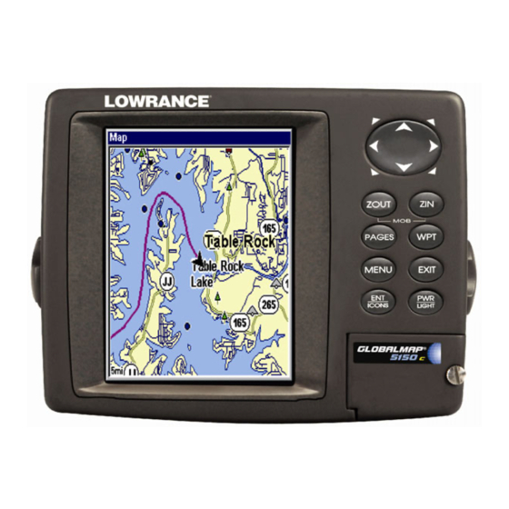
BUT, if you just can't wait to get outside, turn to the one-page Quick Reference on page 39. Keyboard GlobalMap 5150c GPS unit, front view, showing Map Page, keyboard and access door for the MMC slot. 1. PWR/LIGHT (Power & Light) – The PWR key turns the unit on and off and activates the backlight. -
Page 30: Power/Lights On And Off
3. MENU – Press this key to show the menus and submenus, which allow you to select a command or adjust a feature. This also accesses search functions for streets, intersections, addresses and highway exits. 4. ARROW KEYS – These keys are used to navigate through the menus, make menu selections and move the map cursor. - Page 31 Point of Interest or map cursor location; or after you reach the end of a route or trail. GPS Setup command: sets various GPS receiver options. System Setup command: sets general configuration options. Sun/Moon Calculations command: finds the rising and setting time of the sun and the moon.
-
Page 32: Satellite Status Page
Pages The unit has three Page displays that represent the three major operat- ing modes. They are the Satellite Status Page, the Navigation Page and Map Page. They are accessed by pressing the or ← to select a Page. (Clear the Pages Menu by pressing Pages Menu, showing some Map display options. - Page 33 You can use this to see which satellites are obstructed by obstacles in your immediate area if the unit is facing north. The GPS receiver is tracking satellites that are in bold type. The re- ceiver hasn't locked onto a satellite if the number is grayed out, there- fore it isn't being used to solve the position.
-
Page 34: Navigation Page
3. Highlight RESS menu with five expandable data categories: GPS Data, Navigation, Trip Calculator, Time and Sensor Data. 4. Highlight the desired data category and press pand the list, revealing several subcategories with checkboxes next to them. 5. Select the desired subcategory and press checkmark in the checkbox, showing the selected data is set for display. - Page 35 shown by an arrow in the center of the screen. Your trail history, or path you've just taken, is depicted by the line extending from the ar- row. The arrow pointing down at the top of the compass rose indicates the current track (direction of travel) you are taking.
- Page 36 The Off Course window shows the current cross track error. This shows the distance you are off-course to the side of the desired course line. The course line is an imaginary line drawn from your position when you started navigating to the destination waypoint. The course line is shown on the Navigation Page screen (and the Map Page screen) as a dotted line.
-
Page 37: Map Page
In the preceding example figure, the driver is headed northwest (a 345º track) toward a waypoint 346º (bearing) away. The cross track error range (white corridor) is 0.15 miles either side of the course. The driver is headed toward trail waypoint 1, which is 0.3 miles away. The vehicle is 234 feet right of the original course. - Page 38 Map Page opening screen (left). Map oomed to 100 miles (center). Map zoomed to 10 miles (right). Over Zoomed means you have reached the detail limits in an area covered only by the basic background map. Zooming in any closer will reveal no more map details because a high- detail custom map has not been loaded on the MMC for this area.
-
Page 39: Background Map Vs. Mapcreate Map Content
Background map vs. MapCreate map content The special built-in Lowrance background map contains basic world- wide coverage of major inland lakes, rivers, streams and coastal wa- ters, plus key cities, highways, and more. MapCreate custom maps include massive amounts of information not found in the background map. - Page 40 Interstate Minor Streets Marker School When the map is zoomed out far enough, most POIs appear as square dots (left). As you zoom in closer, the symbols become readable icons. In the 0.2 mile zoom example (right), the cursor has selected the Cupps Café...
-
Page 41: Map With Custom Gauges
Digital Data map page option. In pages that have two major windows (such as two maps) you can tog- back forth between windows pressing . This allows you to change which map your cursor PAGES PAGES moves on, and which map the menu operates on. Pages Menu with Two Map option selected (left). - Page 42 Overlay Data selected on Map with Custom Gauges menu. To customize digital gauge display: 1. Press , highlight Map, select PAGES 2. Press , select MENU shown menu will appear. 3. Highlight RESS menu with five expandable data categories: GPS Data, Navigation, Trip Calculator, Time and Sensor Data.
-
Page 43: Resize Window Command
Ground Speed is set to small size (left). The size Ground Speed data has been changed to Large (right). Resize Window command Resize Window is another extremely handy feature for pages that have two major windows. You can change the relative size of the windows, as well as horizontal or vertical layout, to suit your viewing preference. -
Page 44: Choose Viewable Pages
3. To change the window size again or revert back to the original dis- play, just follow the steps above. (Most dual-window displays use half the screen for each window by default.) You can also use the Reset Op- tions command to revert to the factory default. NOTE: The units described by this manual are all capable of using this command. -
Page 45: Basic Gps Quick Reference
Basic GPS Quick Reference Start outdoors, with a clear view of the open sky. As you practice, try navi- gating to a location at least a few blocks away. While you're learning, navigation in too small an area will constantly trigger arrival alarms. 1. -
Page 46: Find Your Current Position
Find Your Current Position Finding your current position is as simple as turning the unit on. Un- der clear sky conditions, the unit automatically searches for satellites and calculates its position in approximately one minute or less. NOTE: "Clear sky" means open sky, unobstructed by terrain, dense foliage or structures. -
Page 47: Selecting Any Map Item With The Cursor
Distance measured by cursor Cursor line The selected wreck (the Empress) to the southeast is 12.81 miles away. Selecting Any Map Item with the Cursor 1. Use the zoom keys and the arrow keys to move around the map and find the item you wish to select. - Page 48 After the unit has acquired a position: 1. Press |↓ to POI-R 2. You could search the entire restaurant category, but in this example we will narrow our search. Press → to 3. The unit says it is calculating, then a list of restaurants appears, with the closest at the top of the list, and the farthest at the bottom of the list.
- Page 49 POI information screen on fast food restaurant nearest this position. Screen shows name, street address, phone number, latitude/longitude, distance to restaurant and its compass bearing. The first figure shows Go To waypoint command (left). Second figure shows Find On Map command (right).
-
Page 50: Set A Waypoint
NOTE: Search works from mapping and POI data loaded in the unit. If you do not have a high-detailed custom map (containing POI data) for the area you are searching loaded on the MMC, you may not find anything. Set a Waypoint A waypoint is simply an electronic "address,"... - Page 51 Step 1. Step 3. Sequence for setting a waypoint. Step 1: while traveling, quickly press WPT twice to call up Find Waypoint screen (seen in Step 2) and set a point. Step 3: message says the waypoint has been saved. Step 4: vehi- cle continues on its way;...
-
Page 52: Navigate To A Waypoint
3. Press ↓ to ATITUDE change the first character, then press → to the next character and re- peat until the latitude is correct. Press 4. Press ↓ to ONGITUDE change the first character, then press → to the next character and repeat until the longitude is correct. -
Page 53: Set Man Overboard (Mob) Waypoint
Course line (red) Off course range, set at 0.15 mile Navigation Page, navigating toward waypoint 001 and leaving a trail. Set Man Overboard (MOB) Waypoint One of boating's most terrifying events is having a friend or family member fall overboard. This situation can be deadly on any body of wa- ter —... -
Page 54: Navigate To Cursor Position On Map
Navigating to Man Overboard: "Man Overboard activated" message (left). The Navigation Page (center) with Map Page (right). The victim is astern of the vessel; the GPS shows which direction to steer to for the rescue. The man overboard position is also stored in the waypoint list for fu- ture reference. - Page 55 Navigate to cursor. In this example, the cursor has selected 3. Press MENU location. The Map Page will display a red line from your current position to the cur- sor position. The Navigation Page displays a compass rose showing navi- gation information to your destination.
-
Page 56: Navigate To A Point Of Interest
Navigate to a Point of Interest For POIs that are in view on the map, you can easily use the Navigate to Cursor command above. Use the cursor to select the POI. The other method involves searching for POIs with the Find Waypoint command, launched with the lier in this section, or turn to Sec. - Page 57 Visible Active symbol symbol Sequence for saving a trail and beginning a new one. My Trails com- mand (left). The Trails Menu (center). The arrow to the right of Trail 3 indicates the trail is "active," and the check to the left indicates the trail is visible on the map display.
-
Page 58: Displaying A Saved Trail
You can save and recall up to 10 different plot trails, which can also be copied to your MMC for archiving or for transfer to your MapCreate software. Tip: Another quick way to stop recording one trail and begin a new one is to use the New Trail command: Press RAILS Caution:... -
Page 59: Visual Trailing
The other two methods provide a full range of navigation data and work with both the Map Page and Navigation Page. The only difference between them is "navigating a trail" follows a trail forward (from start to end) while "backtracking" follows a trail in reverse (from end to start.) When hiking at walking speed with a hand-held GPS, we often just use visual back trailing because it is a bit better at following each little... - Page 60 Figure 1. Figure 2. Figure 4. Figure 3. Navigate a trail menu sequence: Fig. 1, My Trails command. Fig. 2, Trails Menu. Fig. 3, Edit Trail Menu. Fig. 4, Edit Route Menu with Navigate Route command highlighted for Trail 1. A trail is always con- verted to a "route"...
- Page 61 North Present position arrow Magenta trail line Trail point Navigate trail, map views: driver (left) is heading southeast straight toward trail point 3. Driver (right) has reached point 3 and has turned southwest to follow the trail. Track or compass heading indicator Trail Bearing arrow waypoint...
-
Page 62: Transfer Custom Maps And Gps Data Files
4. Press → to EVERSE begins showing navigation information along the trail, in reverse. NOTE: If you are already located at or near the end of your trail, the arri- val alarm will go off as soon as you hit Enter. Just press clear the alarm and proceed. - Page 63 The Transfer My Data submenu asks if you want to save data to the MMC or load data from the MMC into the unit's memory. 2. The Transfer My Data menu includes a message which tells you if an MMC is present or not. If no MMC is present, you must first insert a card into the unit in order to activate the Load or Save commands.
-
Page 64: Cancel Navigation
4. Loading to unit memory: There may be more than one GPS Data File (*.USR) on the card. To select a file, press lection box, use ↓ or ↑ to highlight the file, then press selection. Next, press ↓ to pletion message when the data transfer is finished. -
Page 65: Section 4: Advanced Gps Operations
Advanced GPS Operations Find Distance from Current Position To Another Location 1. While on the Map Page press: 2. Center your cursor over the position you want to find the distance to. A rubber band line appears, connecting your current position to the cursor's location. -
Page 66: Icons
Icons Icons are graphic symbols used to mark some location, personal point of interest or event. They can be placed on the map screen, saved and re- called later for navigation purposes. These are sometimes referred to as event marker icons. This unit has 42 different symbols you can pick from when creating an icon. -
Page 67: Delete An Icon
Delete an Icon You can delete all the icons at one time, you can delete all icons repre- sented by a particular symbol, or you can use the cursor to delete a se- lected icon from the map. 1. Press |↓... -
Page 68: Create And Save A Route
The course from one waypoint to the next is a leg; routes are composed of one or more legs. The legs of all GPS routes are based on straight lines between waypoints. A route provides the automatic capability to navigate through several waypoints without having to reprogram the unit after arriving at each waypoint. - Page 69 Route Planning highlighted on Main Menu (left), will open the Route List screen (right). 2. If necessary, press ↑ to select , then press . (To add to OUTE an existing route, press ↓ or ↑ to route name| 3. Press ↓ to |↓...
- Page 70 Route creation sequence (left to right): Fig. 1. Set route waypoint (1) at the cove entrance. Fig. 2. Move cursor northeast to set point (2) at channel entrance. Fig. 3. With point (2) set, move cursor southeast to mark channel exit with waypoint (3). In figures 2 and 3, notice the rubber band line extending from the previously set waypoint to the cursor.
-
Page 71: Delete A Route
8. To save your route, press screen, with the route automatically named "Route 1" and stored in the unit's internal memory. You can edit the route and run other commands, but if you are finished with the route for now, r e t u r n t o t h e l a s t p a g e d i s p l a y e d b y p r e s s i n g repeatedly. -
Page 72: Navigate A Route
3. Use ↓ and ↑ to select a command from the Edit Route Waypoints menu and press route by clicking on a map location with the cursor. Add Waypoint calls up the Waypoint List so you can insert a waypoint from the list. Re- move Waypoint will delete the waypoint from the route. -
Page 73: Navigate A Route In Reverse
Route Planning command on Main Menu (left). Routes menu (center). Edit Route menu (right). Navigate Route command is selected. 2. Press ↓ to select route name| Upon arrival press |↓ to MENU MENU The following figures show what the Navigation Page and Map Page look like while navigating a route. -
Page 74: Trails
Figure 1. Navigating along a route: Fig. 1 shows the Navigation Page at the start of a route, heading straight for the first waypoint (Wpt 1). In Fig. 2, the traveler has arrived at Wpt 1; the arrival alarm has been trig- gered and the bearing arrow on the compass rose has turned to point Figure 3. -
Page 75: Edit A Trail Name
Tip: You can also delete all trails at once: 1. Press MENU 2. Press → to Edit a Trail Name To edit a trail name: press . Press ↑ or ↓ to change the first character, then press name| → to the next character and repeat until the name is correct. Press then repeatedly to return to the previous page display. -
Page 76: Utilities
Edit Trail Menu with Pattern option selected (left). Edited trail with Utilities Utilities are useful tools for traveling or for outdoor activities. Alarm Clock To get to the alarm clock menu: press LARM LOCK Sun/Moon Rise & Set Calculator To get to the Sun/Moon menu: press ALCULATIONS Trip Calculator To get to the Calculator menu: press... -
Page 77: Edit A Waypoint
To delete a waypoint from the map: 1. Use the arrow keys to select the waypoint with the cursor. 2. Press |→ to the previous page and clear the cursor, press To delete all waypoints at one time: press |↓ to ETUP ELETE to the previous page, press... -
Page 78: Selecting A Waypoint
Selecting a Waypoint To select a waypoint on the map (for navigating to, for editing, etc.,) use the arrow keys and center the cursor over the waypoint. A highlighted halo will appear around the waypoint. Set a Waypoint by Average Position This feature sets a waypoint at the current position after taking several position readings and averaging them. -
Page 79: Section 5: System & Gps Setup Options
Section 5: System & GPS Setup Options Alarms This unit has several GPS alarms. The factory default setting has all of these but the anchor alarm turned on. You can turn the alarms off and on and change their distance settings. You can set an arrival alarm to flash a warning message and sound a tone when you cross a preset distance from a waypoint. -
Page 80: Check Mmc Files And Storage Space
3. To change distance settings, scroll gory, then press → | ↓ to change the first character, then press → to the next character and repeat until the name is correct. 4. When your adjustments are finished, return to the last page dis- played by repeatedly pressing IMPORTANT ALARM NOTES: Anchor Alarm - The anchor alarm may be triggered even when... -
Page 81: Configure Nmea
Menus for changing Com Port settings. For connectors and wiring information for another device, see page 15. For assistance in configuring the unit to communicate with another device, consult the factory; customer service phone numbers are in the back of this manual. Also see the entry below for Configure NMEA. To set Com Port Configuration: 1. -
Page 82: Coordinate System Selection
• GSA and GSV transmits fix mode, DOP values, and satellites in view information. • DBT transmits the depth below the transducer. • DPT transmits the depth • MTW transmits the water temperature. • VLW transmits the distance traveled through water as meas- ured by the paddle wheel. - Page 83 UTM's are marked on USGS topographic charts. This system divides the Earth into 60 zones, each 6 degrees wide in longitude. British, Irish, Finnish, German, New Zealand, Swedish, Swiss, Taiwan, and Greek grid systems are the national coordinate system used only in their respective countries.
-
Page 84: Customize Page Displays
Customize Page Displays Every Page display option except Full Map (on the Map Page) has cus- tomizable data boxes to provide constant on-screen information. The various data available from your unit are divided into categories in the Data Viewer menu. These categories include GPS Data, Naviga- tion, Trip Calculator and Time. -
Page 85: Gps Simulator
GPS Simulator The GPS simulator lets you use the unit as if you were outdoors navigat- ing somewhere. It's a great way to practice using your unit. You can set the starting location by entering latitude/longitude (Starting Position) or from a stored waypoint, map place or POI location ( mand). -
Page 86: Initialize Gps
3. Begin navigating along the trail/route. (If you are close enough to the first waypoint, the arrival alarm will usually go off as soon as naviga- tion begins. Press press ↑ to increase speed to the desired setting. 4. Press to turn off the steering and speed boxes. -
Page 87: Map Data
Map Data This menu lets you turn the map off, if desired (which turns the map screen into a GPS plotter); turn off or on the pop-up map info boxes; draw the map boundaries or boxes around the areas of high detail; or fill land areas with gray. -
Page 88: Fill Water With White
Fill Water With White From the Map Page, press . With the option highlighted, press ATER HITE (turn on) and uncheck it (turn off.) After the option is set, press to return to the page display. EXIT EXIT Map Overlays (Range Rings; Lat/Long Grid) The map screen can be customized with four range rings and/or grids that divide the plotter into equal segments of latitude and longitude. -
Page 89: Map Detail Category Selection
Different datums can be selected; to change the datum: 1. Press MENU MENU 2. Scroll ↓ or ↑ to select the desired datum, then press 3. To return to the last page displayed, press A list of the datums used by this unit is in the back of this manual. GPS Setup Menu, left, Map Datum Menu, right. -
Page 90: Map Fix
Map Fix Map Fix is used with charts or maps. This system asks for a reference position in latitude/longitude, which you take from a marked location on the map. It then shows the present position as distance on the map from that reference point. -
Page 91: Map Orientation
Configure a map fix so the unit can find your position on a printed chart or topographical map. Press → to ELECT Select the waypoint (or a landmark of POI) that you saved the refer- ence point under and press tion screen with the command unit returns to the Configure Map Fix menu. -
Page 92: Nauticpath™ Usa Marine Charts
This is fine if you're always traveling due north. What you see to your left corresponds to the left side of the map, to your right is shown on the right side of the map, and so on. However, if you travel any other direction, the map doesn't line up with your view of the world. -
Page 93: Port Information
To view Chart Note information: 1. Use the arrow keys to move the cursor over a Chart Note icon. When it's selected, a pop-up name box appears. 2. Press to display the Note Information screen. 3. To scroll through the Chart Note screen, use ↑ ↓ arrow keys to read the information. -
Page 94: Tidal Current Information
Port Services icon NauticPath chart showing Port Services icon selected by cursor. When first highlighted, the Pop-Up name box appears. Tidal Current Information NauticPath charts contain Tidal Current information, represented at large zoom ranges by a box icon with the letter "C." These icons will appear when you are zoomed in to a 6-mile range. - Page 95 Cursor lines NauticPath chart showing Tidal Current Station icon selected by cur- sor (left). Icon animates automatically at .08-mile zoom range (right). Current Time Line Velocity Scale The Tidal Current Information screen displays daily tidal current data for this station on this date at the present time. The graph at the top of the screen is an approximate view of the flood and ebb pattern for the day, from midnight (MN), to noon (NN) to midnight (MN).
-
Page 96: Tide Information
To select another date: 1. Use ← → to highlight month, day or year, then press 2. Use ↑ ↓ to select the desired month, day or year and press To clear the information screen, press Tide Information NauticPath charts contain Tidal Information, represented at large zoom ranges by a box icon with the letter "T."... -
Page 97: Navionics ® Charts
Current Time Line MLLW Line Tide Table The Tide Information screen displays daily tidal data for this station on this date at the present time. The graph at the top of the screen is an approximate view of the tidal range pattern for the day, from midnight (MN) to noon (NN) to midnight (MN). -
Page 98: Overlay Data
2. From the Map Page, press . Select the Map Name, then press HOICE WARNING: You should never format the MMC containing your Navionics chart. Formatting the MMC will permanently erase the chart from the card. Overlay Data On any Page display but Status you can float additional data of your own choosing in your display window. -
Page 99: To Remove Overlaid Data
A category with a "+" next to it is expandable, meaning its contents are currently hidden. Selecting the category name and pressing contents, so you can choose items within it. An expanded category (one with a "–" next to its name) can be collapsed to hide its contents, and make more room on your screen. -
Page 100: Pop-Up Help
Overlay Data Shown, with Date option selected (left). Overlay Data Shown menu with Date Removed from the list (right). To move overlaid data: You may find it useful to rearrange data that is floating in your display window. 1. From one of the Map Pages, press 2. -
Page 101: Reset Options
System Setup Menu (left) with Pop-up Help command highlighted. The second example (right) shows the Pop-up Help message for the Initial- ize GPS command, located on the Status Page menu. Reset Options To reset all features to their factory defaults: 1. -
Page 102: Screen Contrast And Brightness
1. Press |↓ to |↓ to MENU MENU GPS S WAAS ETUP EQUIRE 2. To return to the last page displayed, press EXIT EXIT 3. You can return to this command and press again to turn the fea- ture off. Require WAAS command on the GPS Setup Menu. -
Page 103: Set Language
To adjust the display's brightness: Press ↓ to RIGHTNESS scale is minimum contrast; the right end is maximum contrast. To adjust the screen's display mode: Press ↓ to ISPLAY Set Language This unit's menus are available in 10 languages: English, French, Ger- man, Spanish, Italian, Danish, Swedish, Russian, Dutch and Finnish. -
Page 104: Show Waas Alarm
To set the Month: Press ↓ to month, then press To set the Day: Press ↓ to the day, then press To set the Year: Press ↓ to lect the year, then press The last field in this menu is to automatically adjust with the time change caused by Daylight Sav- ing Time (you should only have to set it once). -
Page 105: Sounds And Alarm Sound Styles
Sounds and Alarm Sound Styles Sounds triggered by key strokes and alarms can be adjusted: You first press MENU Sounds command (left). The Sounds menu (right). To set Key Press Sounds: With the option highlighted, press check it (turn on) and uncheck it (turn off.) After the option is set, press to return to the page display. -
Page 106: Trail Options
Track Smoothing option, turned on. Trail Options There are several options you can use with trails. Some affect all trails, other options can be applied to a particular trail. You can change the way trails are updated, display or hide trails, create a new trail, delete a trail, etc. -
Page 107: Update Trail Option
Update Trail Option This menu lets you change the way the trail updates occur. WARNING: If you uncheck the Update Trail option, automatic trail creation and recording will be turned off. You must turn it back on to record trails. The default setting is on. From the Trails Menu, press ↓... -
Page 108: Delete Trail
Specific Trail Options Delete Trail To delete a specific trail: From the Trails Menu, press ↓ to Trail Name| . The Edit Trail menu appears as seen in the following fig- ure. Press ↓ to |← to ELETE RAIL Edit Trail menu. New Trail To manually start a new trail, in the Trails Menu, make sure RAIL... -
Page 109: Units Of Measure
Main Menu with Transparency selected. To adjust Menu Transparency level: Press |↓ to . The slider bar MENU MENU RANSPARENCY RANSPARENCY appears. Press ↑ or ↓ to move the bar. The lower end of the scale makes the menus opaque; the upper end is maximum transparency. Units of Measure This menu sets the speed and distance (statute or nautical miles, me- ters), depth (feet, fathoms, or meters), temperature (degrees Fahren-... - Page 110 Notes...
-
Page 111: Section 6: Searching
Section 6: Searching NOTE: The background map loaded in your unit lets you to search for U.S. Interstate Highway exits and exit services, as well as some land features, including cities and lakes. For a full set of searchable land features, including landmarks, streets, addresses and Points of In- terest, you must load your own high-detail custom map produced with our Mapcreate software. -
Page 112: Find Addresses
In search results, the distance and bearing to the selected item will be calculated from the current position. In the case of a cursor search, the search results show distance and bearing from the cur- sor, but an individual waypoint's information screen shows distance and bearing from the current (or last known) position. - Page 113 Find Address menu (left). Find Street menu (center) with Find By Name field active. Street name entry complete (right). 5. To enter a city name, press ↓ to want to find addresses only within a particular city. This option is de- signed so you can limit an address search to a single city if necessary (see the following note).
- Page 114 6. When the necessary search fields are filled in, press ↓ to . Your unit asks you to wait while it searches for the ad- DDRESS dress. (If an address is not in the database, a message appears saying the address could not be found.) 7.
-
Page 115: Find Any Item Selected By Map Cursor
Map Page showing location of the address on the map, highlighted by cursor (left). This address is a business in the POI database, so you can display the POI information window, then navigate to it (center). This address is not in the POI database (right), so the Waypoint key will not display any information for this address. - Page 116 Find Highway Exits (left). Find Exit menu (right). 2. First, select a highway name by pressing , which calls up the Find By Name menu. There are two highway search options: A. You can spell out the highway name in the top selection box. Press ↑ or ↓ to change the first letter, then press →...
- Page 117 Find Exit menu, with an exit selected in the Exit List. 4. In the Exit Information screen you have two choices. A. Press navigate or "go to" the exit. B. Press →| map. Go To Exit option (left). Find On Map option (right). Tip: You can also look up some additional information on the Exit Ser- vices located near this exit.
-
Page 118: Find Map Places Or Points Of Interest (Poi)
Exit Information screen (left). General location and amenities information (right). Find Map Places or Points of Interest (POI) 1. Press , press to select a map place or POI category, then ↓ ↑ press . (To narrow your search, press → or ← to select a subcate- gory before pressing .) You will be given two options;... - Page 119 Find by Nearest option (left) with POI list (right). 3. Search by name of POI. Press ↓ to . There are two op- tions: A. You can spell out the POI in the top selection box. Press ↑ or ↓ to change the first letter, then press → to move the cursor to the next letter and repeat until the name is correct, then press .
-
Page 120: Find Streets Or Intersections
Go To POI option (left). Find on Map POI option (right). Find Streets or Intersections Find a Street |↓ to and the Find 1. From the Map Page, press MENU TREETS Streets Menu appears. Find Streets command (left). Find Streets menu (right). 2. - Page 121 Find Street By Name menu. Spell out name in the top box, or select from the list in the lower box. 3. The Find Streets menu reappears with the street you're searching for in the First Street box. (In this example, it's I-35.) To search for that street, press ↓...
-
Page 122: Find An Intersection
Map Page showing results of a street search. The cursor points to the located street. If you want to navigate to the found street at the cursor location, just press MENU EXIT Find an Intersection You must enter one street in the First Street dialog box and enter the next street in the Second Street dialog box. - Page 123 5. The Find Streets menu reappears with the first and second street dialog boxes filled in. In this example, we selected I-44 as our second street. You could now use similar techniques to select a city or Zip code, but your search will probably be faster if you leave those boxes blank. (You can specify a city and/or Zip code later on to narrow the search, if the resulting list is too long.) Find Intersection command highlighted (left).
-
Page 124: Find Waypoints
If you want to navigate to the found intersection, just press MENU EXIT Find Waypoints 1. Press |↑ to AYPOINTS 2. If searching for the Nearest waypoint, press . If searching for the waypoint By Name, press to ↓ . (To search by name, jump to step 5.) Find Waypoint menu (left). - Page 125 A. To navigate to the waypoint, press . (The Go To Waypoint com- mand is already highlighted.) The unit will show navigation informa- tion to the waypoint. B. To find the waypoint, press → to . The Map Page appears with the cursor highlighting the found waypoint. Waypoint Information screens with the Go To Waypoint command se- lected (left).
- Page 126 Find By Name menu (left). Waypoint Information screen (center). Found waypoint (right) is highlighted by cursor on Map Page. A. To navigate to the waypoint, press is already highlighted.) The unit will show navigation information to the waypoint. B. To find the waypoint, press → to Page appears with the cursor highlighting the found waypoint.
-
Page 127: Section 10: Supplemental Material
Section 10: Supplemental Material Datums Used by This Unit WGS 1984 Default Adindan Mean for Ethiopia, Sudan Adindan Burkina Faso Adindan Cameroon Adindan Ethiopia Adindan Mali Adindan Senegal Adindan Sudan Afgooye Somalia Ain el Abd 1970 Bahrain Ain el Abd 1970 Saudi Arabia Anna 1 Astro 1965 Cocos Islands... - Page 128 Chua Astro Paraguay Corrego Alegre Brazil Dabola Guinea Djakarta (Batavia) Indonesia (Sumatra) DOS 1968 New Georgia Islands (Gizo Island) Easter Island 1967 Easter Island European 1950 Mean for Austria, Belgium, Denmark, Finland, France, West Germany, Gi- braltar, Greece, Italy, Luxembourg, Nether- lands, Norway, Por- tugal, Spain, Swe- den, Switzerland...
- Page 129 Naparima BWI Trinidad & Tobago North American 1927 Mean for Antigua, Barbados, Barbuda, Caicos Islands, Cuba, Dominican Republic, Grand Cayman, Jamaica, Turks Islands North American 1927 Mean for Belize, Cos- ta Rica, El Salvador, Guatemala, Hondu- ras, Nicaragua North American 1927 Mean for Canada North American 1927 Mean for CONUS...
- Page 130 Point 58 Sweden Santo (DOS) 1965 Espirito Santo Island Sao Braz Azores (Sao Miguel, Santa Maria Islands) Sapper Hill 1943 East Falkland Island Schwarzeck Nambia Selvagem Grande Salvage Islands SGS 85 Soviet Geodetic Sys- tem 1985 South American 1969 Mean for Argentina, Bolivia, Brazil, Chile, Colombia, Ecuador, Guyana, Paraguay,...
-
Page 131: Fcc Compliance
FCC Compliance This device complies with Part 15 of the U.S. Federal Communi- cations Commission (FCC) Rules. Operation is subject to the fol- lowing two conditions: (1) this device may not cause harmful in- terference, and (2) this device must accept any interference re- ceived, including interference that may cause undesired opera- tion. - Page 132 Notes...
- Page 133 Notes...
- Page 134 Notes...
- Page 135 LOWRANCE DATABASES LICENSE AGREEMENT THIS IS a LEGAL AGREEMENT BETWEEN THE END-USER WHO FIRST PURCHASES THIS PRODUCT AS a CONSUMER ITEM FOR PERSONAL, FAMILY, OR HOUSEHOLD USE ("YOU") AND LOWRANCE ELECTRONICS, a DIVISION OF LEI, THE MANUFACTURER OF THIS PRODUCT ("WE", "OUR", OR "US").
-
Page 136: Databases Limited Warranty
DATABASES LIMITED WARRANTY "We", "our", or "us" refers to Lowrance Electronics, a division of LEI, the manu- facturer of this product. "You" or "your" refers to the first person who purchases the product as a consumer item for personal, family, or household use. The Da- tabases Limited Warranty applies to the one or more databases that your prod- uct may contain. - Page 137 LOWRANCE ELECTRONICS FULL ONE-YEAR WARRANTY "We," "our," or "us" refers to LOWRANCE ELECTRONICS, a division of LEI, the manu- facturer of this product. "You" or "your" refers to the first person who purchases this product as a consumer item for personal, family, or household use. We warrant this product against defects or malfunctions in materials and workmanship, and against failure to conform to this product's written specifications, all for one (1) year from the date of original purchase by you.
-
Page 138: How To Obtain Service
How to Obtain Service… …in the USA: We back your investment in quality products with quick, expert service and genuine Lowrance replacement parts. If you're in the United States and you have technical, return or repair questions, please con- tact the Factory Customer Service Department. Before any product can be returned, you must call customer service to determine if a return is necessary. -
Page 139: Accessory Ordering Information
Accessory Ordering Information for all countries To order Lowrance GPS accessories such as power cables or MMC cards, please contact: 1) Your local marine dealer, sporting goods or consumer electronics store. Most quality dealers that handle marine electronic equipment or other consumer electronics should be able to assist you with these items. -
Page 140: Visit Our Web Site
Visit our web site: Lowrance Pub. 988-0152-221 © Copyright 2006 All Rights Reserved Printed in USA 121206 Lowrance Electronics, Inc.