
Related Manuals for Lowrance iFINDER Expedition C


Summary of Contents for Lowrance iFINDER Expedition C
-
Page 1: Operation Instructions
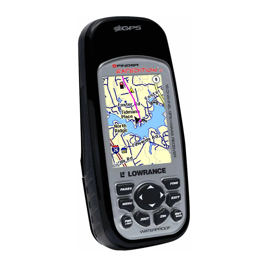
Pub. 988-0160-001 www.lowrance.com Mapping GPS & MP3 Player Operation Instructions... - Page 2 Ltd. Exit Authority and eXitSource are trademarks of Zenrin Co. Ltd. Lowrance Electronics may find it necessary to change or end our policies, regulations and special offers at any time. We reserve the right to do so without notice. All features and specifications subject to change without notice.
-
Page 3: Table Of Contents
Section 1: Read Me First! ... 1 Specifications: ... 2 How the iFINDER Expeditionc Works ... 4 Introduction to GPS, WAAS and EGNOS ... 6 How to use this manual: typographical conventions ... 8 Arrow Keys ... 8 Keyboard ... 8 Menu Commands ... - Page 4 Clearing a Trail... 38 Transfer Custom Maps and GPS Data Files ... 38 Switch to Advanced Mode... 40 Section 4: Advanced Mode Operation... 41 Keypad... 41 Power/lights on and off ... 42 Main Menu ... 42 Pages ... 43 Satellite Status Page ... 43 Status Menu ...
- Page 5 Edit a Trail Name ... 59 Edit a Trail Color ... 59 Edit a Trail Pattern ... 59 Transfer Custom Maps and GPS Data Files ... 59 Utilities... 60 Sun/Moon Calculation... 60 Trip Calculator... 61 Alarm Clock... 61 Down Timer... 61 Up Timer ...
- Page 6 Customize Page Displays ... 78 Customize Digital Data Page ... 78 Customize Navigation Page ... 79 Customize Map Page ... 79 External Passive Antenna ... 79 GPS Simulator ... 80 Map Auto Zoom ... 81 Scouting... 81 Map Data... 83 Popup Map Information... 83 Draw Map Boundaries...
- Page 7 Recent Finds ... 107 Current Route ... 107 Find Addresses... 108 Find Home Waypoint... 110 Find Interstate Highway Exits ... 110 Find Map Places or Points of Interest (POI) ... 111 Find Streets or Intersections... 113 Find Waypoints (Advanced Mode only) ... 116 Section 7: Music Mode ...
- Page 8 When a GPS unit is used in a vehicle, the vehicle operator is solely re- sponsible for operating the vehicle in a safe manner. Vehicle operators must maintain full surveillance of all pertinent driving, boating or fly- ing conditions at all times.
-
Page 9: Section 1: Read Me First
Here's how: The manual is organized into seven sections. This first section is an introduction to Lowrance GPS. It tells you the basics you need to know before you can make the unit look around and tell you where you are. -
Page 10: Specifications
When you come to a GPS menu command on the iFINDER screen, you can look it up in the manual by skimming over the table of contents, flipping through Section 3 or scanning through the command portion of Section 4. - Page 11 Recording: ... Removable MMC or SD memory cards for MMC slots: ... One, inside battery compartment. Accepts Background map:... Built-in custom, detailed Lowrance map. Custom mapping: ... Accepts custom, higher-detail MapCreate 6 Mapping memory: ... Up to 1 GB on one MMC (MultiMedia Card)
-
Page 12: How The Ifinder Expeditionc Works
NOTE: The above memory capacities refer only to the iFINDER's on-board memory. The amount of GPS data you can record and save for re- call later is only limited by the number of MMC cards you have. How the iFINDER ExpeditionC Works You'll navigate faster and easier if you understand how the iFINDER scans the sky to tell you where you are on the earth —... - Page 13 GPS data files, erase 'em and record new ones, over and over and over again. Like any computer file, these GPS Data Files (file format *.usr) can be shared between iFINDERs, other Lowrance GPS and so- nar/GPS combo units and even personal computers.
-
Page 14: Introduction To Gps, Waas And Egnos
How to Use This Manual on page 8. But, if you want to understand the current state of satellite navigation, look over this segment describing how GPS and its new companions WAAS and EGNOS work together to get you where you're going. - Page 15 These signals can be easily blocked by trees, buildings, an automobile roof and even your body. Like most GPS receivers, the iFINDER doesn’t have a compass or any other navigation aid built inside. It relies solely on the signals from the satellites to calculate a position.
-
Page 16: How To Use This Manual: Typographical Conventions
Alaska, that do not yet receive robust WAAS coverage. Continued WAAS development is planned to extend WAAS coverage in the years to come. WAAS boosts the accuracy of land GPS navigation, but the system is designed for aircraft. The satellites are in a fixed orbit around the Equator, so they appear very low in the sky to someone on the ground in North America. -
Page 17: Instructions = Menu Sequences
some kind with the menu item. Text that you may need to enter or file names you need to select are shown in italic type, such as trail name. Instructions = Menu Sequences Most functions you perform with the iFINDER are described as a se- quence of keystrokes and selecting menu commands. - Page 18 Notes...
-
Page 19: Section 2: Installation & Accessories
Installation & Accessories Power The iFINDER operates from AA batteries or on 3 volts DC using an optional external power cable with a cigarette lighter adapter. When the power cable is used, the iFINDER automatically switches to exter- nal power. If the external power fails, the unit will switch to battery power. -
Page 20: Battery Installation
Battery Installation Turn the unit over so that the back is facing you. With your thumb or nail, pull back on the small clip to release the battery cover latch as shown in the following images. Once the latch is released, pull the bat- tery cover out of the grooves in the bottom of the case. -
Page 21: Cigarette Lighter Power Adapter
The unit can exchange information with any device that transmits or receives NMEA 0183 data. To exchange NMEA data, Lowrance offers an optional data only cable and a power/data combo cable: The PC-DI7 is a NMEA/serial communications cable. It has a standard female DB-9 connector on one end to attach your unit to a computer's serial communications port. -
Page 22: Mmc Or Sd Memory Card Installation
NMEA data to the computer, you can get live position data for GPS-compatible mapping software. You can also run one of our free Lowrance GPS emulators on your lap- top and operate it with real-time position information. To use it, plug the power adapter into a cigarette lighter socket, plug the DB-9 connector into a serial port on the computer and attach the cable to the iFINDER. -
Page 23: Mapping Resources
Remove an MMC Card. 4. Drag the MMC from the slot into the battery compartment. 5. Turn the iFINDER face up and give it a shake to dump the MMC into your hand or onto a work surface. To add an MMC or SDC 1. -
Page 24: External Antenna
Navionics web site. External Antenna A GPS antenna requires a clear view of the sky for optimum operation. Inside a vehicle, your iFINDER can sometimes maintain satellite lock while sitting on the seat beside you, but we don't recommend this for optimum performance. -
Page 25: R-A-M Bracket Mounting Systems
This is especially helpful when operating in areas like dense forests, which can obstruct GPS signals. Your unit will automatically switch between the active RAA-3 and its internal antenna (located in the top of the case). If you purchase the passive FA-8, you must use a menu check box to manually switch between it and the internal antenna. -
Page 26: Other Accessories
R-A-M even has suction cup bases for attachment to windscreens or fiberglass surfaces. See your Lowrance dealer or visit the LEI web site for the latest options. Acces- sory ordering information is on the inside back cover of this manual. -
Page 27: Section 3: Easy Mode Operation
Section 3: Easy Mode Operation This section addresses Easy Mode operation for the iFINDER's main GPS functions. The principles are the same in both operating modes, so this discussion also serves as a good introduction to Advanced Mode work. Before you turn on the iFINDER, it's a good idea to learn about the dif- ferent keys, the three Page screens and how they all work together. -
Page 28: Power/Lights On And Off
But, if you want to learn about the various options, see Sec. 5, System Setup and GPS Setup Options. Main Menu, Easy Mode. The Main Menu commands and their functions are:... -
Page 29: Satellite Status Page
Easy Mode shows only the most commonly used features to simplify the interface and simplify operation. Transfer My Data: load or save GPS Data Files containing waypoints, routes, trails and event marker icons. Software Information: shows the product name and software version of the unit's operating system software, as well as copyright notices. -
Page 30: Navigation Page
North is at the top of the screen. If you hold the unit facing north, you can use it to see which satellites are obstructed by obstacles in your immediate area. The GPS receiver is tracking satellites that are in bold type. The receiver hasn't locked onto a satellite if the number is grayed out, which means it isn't being used to resolve the position. - Page 31 extending from the arrow. The arrow pointing down at the top of the compass rose highlights your current track (direction of travel). Track or compass heading indicator, showing direction of travel Present position arrow Trail line Navigation Page, recording a trail, traveling east. When navigating to a waypoint or following a route, the Navigation screen looks like the one shown in the next image.
-
Page 32: Map Page
Waypoint symbol Cross track error range (off course indicator) Navigation Page, going to cursor. Driver is headed east (a 68º track) toward a cursor location 68º (bearing) away. The cross track error range (white corridor) is 0.20 miles either side of the course. The driver is headed toward the cursor location, which is 0.17 miles away. - Page 33 Map Page opening screen (left); Map zoomed to 100 miles (center); Map zoomed to 6 miles (right). Over Zoomed means you have reached the detail limits in an area covered only by the basic background map. Zooming in any closer will reveal no more map details because a high- detail custom map for this area has not been loaded on the MMC.
- Page 34 What's more important is the large-scale map detail that allows your GPS unit to show a higher level of position accuracy. For example, the background map would show you the general outline and approximate shape of a coastline or water body, but the higher detail in MapCreate shows the shoreline completely and accurately (finer detail).
- Page 35 It shows how to use the Map Categories Drawn menu to turn indi- vidual POI displays off and on. Even though their display is turned off, you can still search for POIs and their icons will pop-up when the unit finds them. The following page contains a 12-step quick reference for Easy Mode operation.
-
Page 36: Easy Mode Quick Reference
IFINDER Expeditionc Easy Mode Quick Reference Start outdoors, with a clear view of the open sky. As you practice, try navigating to a location a few blocks away. Navigation in too small a space, like a backyard, will constantly trigger arrival alarms. 1. -
Page 37: Find Your Current Position
NOTE: Clear sky means open sky, unobstructed by terrain, dense foliage or structures. Clouds do not restrict GPS signal reception. If satellite acquisition takes longer than usual, you may be inside a structure, a vehicle or in terrain that is blocking signal reception. To correct this, be sure you are positioned so the unit has as clear a view of the sky as possible, then turn the unit off and back on again. -
Page 38: Selecting Any Map Item With The Cursor
Now that you have seen how the iFINDER can find where you are, let's search for something else. Searching is one of the most powerful fea- tures in the Lowrance GPS product line. In this example, we'll look for the nearest fast-food restaurant. For more information on different types of searches, refer to Sec. - Page 39 Find Map Places Menu (left); Category Selection menu (center) with list of the nearest restaurants (right). 3. A list of restaurants will appear with the closest at the top of the list and the one furthest from you at the bottom of the list. The location nearest you will be highlighted.
-
Page 40: Set Home Waypoint
Map screen showing found Waypoint. 7. To clear the search and return to the main page display, press repeatedly. Before you exited out of the Search menus, you could have gone looking for another place. NOTE: Search works from mapping and POI data loaded in the unit. If you have not loaded a high-detailed custom map covering the desired search area, you may not find much. -
Page 41: Set Man Overboard (Mob) Waypoint
The example shows the home waypoint set at the cursor location. If the cursor was not active, the point would be placed at the current position. Caution: Saving a new Home waypoint will overwrite and erase the pre- vious Home waypoint. Go Home This command will automatically take you back to the Home waypoint you created. -
Page 42: Navigate To Cursor Position On Map
To cancel navigation to MOB, press |↓ to MENU ANCEL AVIGA- |← to . The iFINDER stops showing navigation in- TION formation. Navigate to Cursor Position on Map command navigates to the current cursor position on URSOR the map. It is a quick and handy way to navigate to anything you can see on the map display. -
Page 43: Navigate To A Point Of Interest
The 15-mile zoom figure (left) shows the course line connecting your current position to your destination. The 60-mile zoom (center) shows both current position and destination on screen. The Navigation Page (right) will also show navigation information. To stop navigating to the cursor, use the Cancel Navigation command: press |↓... -
Page 44: Displaying A Saved Trail
In Easy Mode, this unit automatically creates a plot trail when turned on. The trail is saved in memory when the unit is turned off. The iFINDER continues recording the same trail until you clear the trail, which erases the old trail and begins recording a new trail. NOTE: The iFINDER can record up to 9,999 points per trail, which can be adjusted in Advanced Mode. - Page 45 NOTE: If you are already located at or near the beginning of your back trail, the arrival alarm will go off as soon as you hit Enter. Just press to clear the alarm and proceed. EXIT On the map, your original trail is visible as a solid line, along with a roughly parallel dotted line indicating the back trail to follow.
-
Page 46: Clearing A Trail
2. Press to return to the main page display. EXIT Transfer Custom Maps and GPS Data Files Custom Maps: Custom maps work only from a MMC or SD card. When a card con- taining a Custom Map File is loaded into the unit, the iFINDER auto- matically pulls the map into memory when you turn on the unit. - Page 47 GPS data automatically recorded in the unit's internal memory must be saved to the MMC (as a GPS Data File) in order to store it on your per- sonal computer. GPS Data Files stored on an MMC must be copied from the card to the iFINDER's internal memory before the unit can read them.
-
Page 48: Switch To Advanced Mode
These figures (from left to right) show the menu sequence for naming and saving a GPS Data File from an MMC to the iFINDER's memory. 4. Loading: There may be more than one GPS Data File (*.USR) on the card. To select a file, press to highlight the file, then press ↓... -
Page 49: Section 4: Advanced Mode Operation
Section 4: Advanced Mode Operation Keypad iFINDER ExpeditionC keypad. 1. PWR – The PWR key turns the unit on and off and activates the backlight. 2. PAGES – Pressing this key switches the unit between the four dif- ferent page screens in Advanced Mode. (Satellite, Position, Navigation and Map.) Each page represents one of the unit's major operation modes. -
Page 50: Power/Lights On And Off
The iFINDER will work fine for these instructions right out of the box with the factory default settings. But, if you want to learn about the various options, see Sec. 5, System Setup and GPS Setup Op- tions. 1. To get to the main menu from any page, press . -
Page 51: Satellite Status Page
Mode shows only the most commonly used features to simplify the in- terface and operation. Browse MMC Files: used to save/load GPS data files to an MMC card. Pages Advanced Mode has five Page displays. They are the Satellite Status Page, Digital Data page, Navigation Page, Music Page and Map Page. -
Page 52: Status Menu
Status page is displayed on the screen. Satellite Status Page (left) with Satellite Status Menu (right). Status Menu The Satellite Status Menu allows you to set GPS options such as Track Smoothing, GPS Auto Search and Use Indoors. Digital Data Page This page provides detailed information on the position of the iFINDER's cursor. -
Page 53: Digital Data Menu
Digital Data page (left) with the Digital Data Menu (right). Digital Data Menu The Digital Data Menu allows you to change units of measure, enable sleep mode and customize the digital data boxes with the data most important to you. Navigation Page This screen has a compass rose that not only shows the direction of travel, but also the direction to a recalled waypoint. -
Page 54: Navigation Menu
Navigation Page (left) with Navigation Menu (right). Navigation Menu The Navigation Menu allows you to plan and edit routes, cancel naviga- tion, set alarms and customize the digital data boxes at the bottom of the page. Music Mode Page The Music Mode Page allows you to play both MP3 and Ogg Vorbis mu- sic files. -
Page 55: Map Page
Music Mode Page (left) with Music Mode menu (right). Map Page The map screens your course and track from a bird’s-eye view. By de- fault, this unit shows the map with north always at the top of the screen. (This can be changed. See the topic Map Orientation, in Sec. 5.) If you’re navigating to a waypoint, the map shows your starting loca- tion, present position, course line and destination. -
Page 56: Map Menu
Map Menu The map menu has a variety of options, which include, finding dis- tances, scouting, changing the orientation of the map and viewing and modifying map data. Moving Around the Map: Zoom & Cursor Arrow Keys The map is presented from a bird's-eye view. The current zoom range shows in the lower left corner of the screen. -
Page 57: Find Your Current Position
NOTE: Clear sky means open sky, unobstructed by terrain, dense foliage or structures. Clouds do not restrict GPS signal reception. If for some reason satellite acquisition takes longer, you may be inside a structure or vehicle or in terrain that is blocking signal reception. To correct this, be sure you are positioned so the unit has as clear a view of the sky as possible, then turn the unit off and back on again. -
Page 58: Create Icon At Current Position
ELETE press Load GPS Data Files from an MMC GPS Data files, containing waypoints, routes, trails and event marker icons, must be copied from an MMC to the iFINDER's internal memory before the iFINDER can read them. Here's how: 1. Press... -
Page 59: Navigate
2. If no MMC is present, you must insert a card into the iFINDER to activate the To load data from the MMC to the iFINDER, press → to 3. Loading: There may be more than one GPS Data File (*.USR) on the card. To select a file, press highlight the file, then press . -
Page 60: Cancel Navigation
matically begins navigating to the MOB waypoint. For more details, see this subject in Sec. 3, Easy Mode Operation. Cancel Navigation In Easy Mode: Press |↓ to MENU In Advanced Mode Press |↓ to MENU MENU Navigate a Route 1. From the AVIGATION press |↓... -
Page 61: Navigate A Trail
character, then press → to move the cursor to the next character and re- peat until the name is correct, then press 3. If you don’t want to spell out the name, you can jump directly to the box by pressing press and the waypoint information screen appears with the command selected. -
Page 62: Routes
The course from one waypoint to the next is a leg. Routes are composed of one or more legs. The legs of all GPS routes are based on straight lines between waypoints. A route gives users the capability to navigate through several way- points without having to reprogram the unit after arriving at each waypoint. - Page 63 1. From the AVIGATION press |↓ to MENU MENU 2. Highlight OUTE . The Map Page appears with the cursor showing. 3. Use the Zoom and arrow keys to move the map and cursor until the cursor is centered on the spot where you want the route to begin. If you are starting at your current position or the current cursor position, you are already at the starting spot.
-
Page 64: Delete A Route
3. To save data from the iFINDER to the MMC, press 4. To accept the default name Data for the GPS Data File, press ↓ to . If you wish to rename the file, press lection box. Press ↑ or ↓ to change the first character, then press → to the next character and repeat until the name is correct. - Page 65 2. You could search the entire lodging category, but for this example we will narrow our search. Press → to OTELS OTELS 3. A list of hotels and motels appears, with the closest location at the top of the list and the location furthest from you at the bottom of the list.
-
Page 66: Trails
10 trails in the iFINDER's memory. Since you can copy these trails to MMCs in the form of GPS Data Files (*.usr format), the only true limit on the number of trails you can record is the number of MMCs you can carry in your pockets. -
Page 67: Edit A Trail Name
→ key. When you are satisfied with the new pattern, press main page display. Transfer Custom Maps and GPS Data Files Custom Maps: Custom maps work only from the MMC or SD card. When a card con- taining a Custom Map File is loaded into the unit, it automatically loads the map into memory when the unit is turned on. -
Page 68: Utilities
GPS data automatically recorded in the unit's internal memory must be saved to the MMC (as a GPS Data File) in order to store it on your computer. GPS Data Files stored on an MMC must be copied from the card to the iFINDER's internal memory before the unit can read them. -
Page 69: Trip Calculator
Trip Calculator To access the Trip Calculator, press ALCULATOR Alarm Clock To access the alarm clock menu, press |↓ to TIES LARM Down Timer To access the Down Timer menu, press |↓ to TIES Up Timer To access the Up Timer menu, press IMER Trip Calculator The Trip Calculator is a handy tool for keeping track of detailed route... -
Page 70: Speed, Average Speed And Max Speed
Speed, Average Speed and Max Speed Speed, Average Speed and Max Speed use changes in GPS Position to track ground speed. Trip Time and Trip Distance Trip Time monitors the amount of time spent on the road and Trip Dis- tance measures the distance traveled on your trip. -
Page 71: Interpreting Weather Information
You can press the ← and → keys to scroll through these readings. You can also use ↑ to switch to altitude values or the GPS Position display or ↓ to return to atmospheric pressure values. Pressure History box shows hourly barometer readings. - Page 72 Reading 6 hours ago, selected by left arrow key Reading 23 hours ago Pressure History box, where the unit has been recording in Sleep Mode for several hours. Air pressure peaked 11 hours ago, and has been steadily dropping for the last 10 hours. The prediction is rain. The unit has recorded 23 hourly readings, with the minimum pressure at 981 millibars, the maximum at 989 mb and the average at 986 mb.
-
Page 73: Sleep Mode
You should expect no immediate, significant change in the current con- ditions. Whatever it is, the present weather should continue until you see the symbol change. Rain symbol: indicates a stable low pressure trend. Barometer is typically falling. Predicts an increasing chance of some rain or other precipitation from an approaching low pressure weather front. -
Page 74: Waypoints
When the iFINDER is in Sleep Mode, you can return to normal operation by pressing Waypoints A waypoint is an electronic address, based on the latitude and longi- tude of a position on the earth. It represents a location, spot or destina- tion that can be stored in memory then recalled and used later for navigation purposes. -
Page 75: Create A Waypoint By Projecting A Position
← → keys to bring up with the entry, press to the main page display. Create a Waypoint by Projecting a Position This feature sets a waypoint at a location a specific distance and bear- ing from a reference position. The reference position can be a highway exit, a map place or an item from your waypoints list. -
Page 76: Edit A Waypoint
Edit a Waypoint Waypoint Name To edit a waypoint name, press |↓ to desired waypoint name| and ↓ keys to select the first character, then press → to move to the second character and so on. Press to the main page display, press Waypoint Symbol To edit waypoint symbol, press |↓... -
Page 77: Waypoint Audio Note
Waypoint information screen with Record Audio Note highlighted. Waypoint Audio Note Audio notes are most helpful when you only have time to quick save a waypoint and move on. After saving the waypoint, you can record an audio note, giving specific information related to the waypoint that would have otherwise, been undocumented. - Page 78 Notes...
-
Page 79: Section 5: System & Gps Setup Options
Section 5: System & GPS Setup Options Alarms This unit has several GPS alarms. The factory default setting has all alarms turned on, but you can turn alarms off and on and change their distance settings. You can set an arrival alarm to flash a warning message and sound a tone when you cross a preset distance from a waypoint. -
Page 80: Auto Satellite Search
It then searches for only those satellites. When your GPS receiver is turned on for the first time, it does not know what your position or elevation (altitude) is. The unit begins searching for the satellites using data acquired the last time it was turned on. -
Page 81: Check Mmc Files And Storage Space
(com port). The Com Port Menu, accessed from the System Setup Menu in Advanced Mode, allows you to configure the communi- cations port to send data to another electronic device, like autopilot. until you are on the Satellites page. PAGES GPS A EARCH MENU MENU and press to access information about the tion page (right). -
Page 82: Configure Nmea
Menus for changing Com Port settings. To set Com Port Configuration: 1. Press MENU MENU 2. Press ↓ to OMMUNICATIONS 3. Use the ↓ ↑ keys to select the desired Baud Rate and press Configure NMEA You can configure the unit to use specific NMEA sentences. 2. -
Page 83: Use Waas/Egnos
European equivalent of WAAS. Like WAAS, it makes GPS position cal- culation more accurate. To determine the accuracy in your area, place yourself in a known location and turn on the GPS. Note your location on the map with WAAS/EGNOS on, then turn it off and check again. - Page 84 1. From the Coordinate System menu, press ↓ to press NOTE: If the Loran TD conversion is chosen, you must enter the local Lo- ran chain identification for the master and slaves. |↓ to GPS S ETUP Configure Loran TD menu. |↓ to OORDINATE ETUP...
-
Page 85: Map Fix
To access the Loran Chain Number, Secondary Station 1 or Secondary Station 2 menus, highlight the category and press keys to choose the desired setting and press menu. Map Fix A Map Fix is used with charts or maps. This system asks for a refer- ence position in latitude/longitude, taken from a marked location on the map. -
Page 86: Customize Page Displays
Press ↓ to ELECT RIGIN with three options: My Waypoints, Map Places and Highway Exits. If you saved the reference point as a waypoint, choose pressing . That will launch the Find By Nearest waypoints list with the waypoint nearest your location at the top. Use the ↓ ↑ keys to select the waypoint you want to assign as a reference point and press . -
Page 87: Customize Navigation Page
Customize Navigation Page While on the Navigation Page press to select a data category and press data options for the selected category. Highlight a desired data option and press to turn it on (check) or turn it off (uncheck). You can check or uncheck other data options to change the data displayed in other boxes. -
Page 88: Gps Simulator
GPS Simulator The GPS simulator lets you use the unit to simulate outdoor naviga- tion. The starting location may be set in latitude/longitude, from a stored waypoint, map place or POI location. You can move across the map by using the arrow keys ( and speed in the boxes provided on the simulator screen. -
Page 89: Map Auto Zoom
The scouting feature gives users the capability to map out hunting ar- eas, real estate and other land where property borders are not available in mapping data A scout plot is a type of recordable GPS data that in- cludes a perimeter or boundary marked by waypoints. Scout plots are saved as part of a GPS Data File (with the *.usr suffix). - Page 90 To start a new scouting session: 1. From the Map page, press 2. If you have not created a scout plot before, highlight New Scout and press . Scout 1 will appear in the scout plot list below. Select Scout 1 and Press 3.
-
Page 91: Map Data
The Map Data menu lets you turn off the map — which turns the map screen into a GPS plotter — turn on or off pop-up map info boxes, draw map boundaries or boxes around areas of detail and fill water with white. -
Page 92: Map Overlays (Range Rings, Lat/Long Grid)
The GPS system is based on the WGS-84 datum, which covers the en- tire world. Other datums may also cover the entire world or just a small portion of it. By default, your position is shown using the WGS-84 datum. -
Page 93: Map Detail Category Selection
GPS Setup Menu (left) with Map Datum Menu (right). Map Detail Category Selection This menu determines which of the mapping features are shown on the screen. This includes waypoints, trails, icons, cities, highways, etc. You can turn on or turn off any of these items, customizing the map to your needs. -
Page 94: Map Orientation
Map Orientation By default, this receiver shows the map with north always at the top of the screen (North Up). This is the way most maps and charts are printed on paper. You, however, can change the map orientation to Track Up, Course Up or Heading Up, if you switch to Advanced Mode. -
Page 95: Nauticpath Usa Marine Charts
To change map orientation: . Press ↑ or ↓ From the Map Page, press |↓ to MENU RIENTATION to select an orientation option, then press to return to the EXIT EXIT main page display. Map Menu (left) with Map Orientation menu (right). NauticPath... -
Page 96: Port Information
3. To scroll through the Chart Note screen, use ↑ or ↓ arrow keys to read the information. To return to the main page display, press repeatedly. Entrance to Aransas Pass on a NauticPath chart with 8-nautical mile zoom (left). Remaining images (left to right): same position at 4- nautical mile, 1-nautical mile and 0.3- nautical mile zoom ranges. -
Page 97: Tidal Current Information
3. To scroll through the service information window, use ↑ or ↓ to see the types of services available. To return to the main page display, press repeatedly. EXIT Port Services information screens. Tidal Current Information NauticPath charts contain Tidal Current information, represented at large zoom ranges by a box icon with the letter "C."... - Page 98 Cursor lines NauticPath chart showing Tidal Current Station icon selected by cur- sor (left). Icon animates automatically at .08-mile zoom range (right). Current Time Line Velocity Scale The Tidal Current Information screen displays daily tidal current data for this station on this date at the present time. The graph at the top of the screen is an approximate view of the flood and ebb pattern for the day, from midnight (MN), to noon (NN) to midnight (MN).
-
Page 99: Tide Information
Tide Information NauticPath charts contain Tidal Information, repre- sented at large zoom ranges by a box icon with the letter "T." These icons will appear when you are zoomed in to a 6-mile range. The icon stands for a Tidal Station location. An example is displayed at right. When you zoom in to a sufficiently small zoom range (0.8 nautical mile), the icon becomes an animated gauge showing a rising or falling tidal height for the selected station at the present time. -
Page 100: Navionics Charts
Current Time Line MLLW Line Tide Table The Tide Information screen displays daily tidal data for this station on this date at the present time. The graph at the top of the screen is an approximate view of the tidal range pattern for the day, from midnight (MN) to noon (NN) to midnight (MN). -
Page 101: Pop-Up Help
. Use ↑ ↓ to select the Map Name, then press HOICE EXIT EXIT Map Choice highlighted (left). Lowrance selected from Map Choice WARNING: You should never format the MMC containing your Navionics chart. Formatting the MMC will permanently erase the chart from the card. -
Page 102: Reset Options
Pop-up Help message for the Screen command. Reset Options In Advanced Mode 1. Press MENU MENU In Easy Mode Hold down the PAGES NOTE: Reset Options does not erase any waypoints, routes, icons or plot trails. Advanced Mode's Reset Options command (left) and the Reset Options Menu (right). - Page 103 Screen Command (left) and Contrast bar (right). To adjust the display's brightness: 1. From the screen menu, press ↓ to the brightness. Screen menu with brightness selected. Display mode menu. To adjust the screen's display mode: 1. From the screen menu, press ↓ to to select mode| EXIT 2.
-
Page 104: Set Language
Continuous selected on Light Delay menu. It's ideal for night travel in a vehicle, since the cigarette lighter can be used as the power source. Set Language This unit's menus are available in 10 languages: English, French, Ger- man, Spanish, Italian, Danish, Swedish, Russian, Dutch and Finnish. To select a different language: 1. -
Page 105: Software Version Information
Software Version Information From time to time, Lowrance updates the operating system software in some of its products. These software upgrades usually are offered to customers as free downloads from our web site, www.lowrance.com. -
Page 106: Sounds And Alarm Sound Styles
Software Info command in Easy Mode (left). Advanced mode (center). The Software Info screen (right). The command works the same in both Easy and Advanced Mode, but Software Information is accessed differently in each mode. Easy Mode 1. Press |↓ to MENU 2. -
Page 107: Track Smoothing
Advanced Mode, but also will affect the appear- ance of trails in Easy Mode. . After the option is set, MENU MENU and press RACK MOOTHING RESS OUNDS LARM OUNDS LARM TYLE , select GPS S ETUP to turn it... -
Page 108: General Trail Options
Main Menu (left); Trails Menu (center); Trail Options menu (right). General Trail Options To access the Trails Menu: 1. Press MENU MENU Delete All Trails Once you are in the Trails menu, you can remove all trails from mem- ory by pressing → to Update Trail Option This menu lets you change the way trail updates occur. -
Page 109: Update Trail Criteria
Update Trail Criteria There are three criteria by which trails may be updated: automatic, time or distance. When it is in the default automatic mode, the unit does not update the plot trail while you are traveling in a straight line. Once you deviate from a straight line, the unit drops a plot point (trail waypoint) onto the trail. -
Page 110: Trail Visible/Invisible And Other Trail Options
You can also change the trail color and pattern. For instructions, see the entries on Edit a Trail Color and Edit a Trail Pattern in Sec. 4, Ad- vanced GPS Operations. Units of Measure The Units of Measure menu lets you change the unit of measure used for speed, distance, heading, altitude, time, date, depth and pressure. - Page 111 To set Heading: from the Units of Measure menu, press ↓ to . Use ↑ ↓ to select the desired unit and press EADING To set Altitude: from the Units of Measure menu, press ↓ → to TITUDE AND EPTH To set Depth: from the Units of Measure menu, press ↓...
- Page 112 Notes...
-
Page 113: Section 6: Searching
Section 6: Searching NOTE: The background map loaded in your unit lets you search for U.S. Interstate Highway exits and exit services as well as land features, including cities and lakes. For a full set of searchable land features, including landmarks, streets, addresses and Points of Interest, you must load your own high-detail custom map produced with our MapCreate 6 software. -
Page 114: Selected Item
Cursor crosshairs centered on a POI (left). The Find menu with Se- lected Item highlighted (center). POI information (right). Selected Item The Selected Item function will appear on the Find menu when an item is selected with the cursor crosshairs. It allows you to quickly access information on the selected location. -
Page 115: Recent Finds
To access Destination: 1. When navigating to a location, press press 2. If your destination is listed in the POI database, the POI information window will appear. If you are navigating to a location not listed in the database, an information window will appear displaying the distance to the target as well as your current bearing. -
Page 116: Find Addresses
Current Route highlighted on the Find menu (left). The Route infor- mation window (right) launches when Current Route is selected from Find Addresses 1. Press |↓ to FIND 2. Press to search in the Address field. 3. To enter an address number: with the Address bar highlighted, , then use the ↑... - Page 117 Tip: When entering a street name, do not enter its compass direction (N, S, E or W) in the street name field. Just enter the number or name. If the example below had been a search for 324 E. 9th St, you would enter 9 and press ble 9th streets and let you choose the one you want.
-
Page 118: Find Home Waypoint
6. When the necessary search fields are filled in, press ↓ to . Your unit will begin searching for the address. If an address DRESS is not in the database, a message will appear letting you know the ad- dress could not be found, otherwise a list of addresses will appear. 7. -
Page 119: Find Map Places Or Points Of Interest (Poi)
Find menu. (left); Find Exit menu (center) with Highway highlighted at the top. Press enter and the Find by Name menu (right) will appear. 2. To select a highway name press Name menu. There are two highway search options: A. You can spell out the highway name in the top selection box. - Page 120 Easy Mode Find menu (left); Advanced Mode Find menu (right). 2. Press ↓ ↑ to select a Map Place or POI category, then press . (To narrow your search, press ← or → to select a subcategory before press- .) That will launch the Find By menu, which has two options: search for Nearest or search by Name.
-
Page 121: Find Streets Or Intersections
4. Search by name of POI. When the Find By menu appears, press ↓ and press POI in the top selection box. Press ↑ ↓ to change the first letter, then press → to move the cursor to the next letter and repeat until the name is correct, then press list by pressing to call up the POI's Waypoint Information screen. - Page 122 Find menu with Find Streets highlighted. 2. You must first fill in a street name in the First Street dialog box. Press to display the Find By Name menu. There are two options: A. You can spell out the street in the top selection box. Press ↑ or ↓ to change the first letter, then press →...
- Page 123 Find first street (left); Streets found list (right). If you want to navigate to the found street at the cursor location, just press MENU Find an Intersection You must enter one street in the First Street dialog box, then enter the next street in the Second Street dialog box.
-
Page 124: Find Waypoints (Advanced Mode Only)
Find intersection selected (left); Working message (center); Intersection list (right). 6. To search for the intersection of the two streets, press ↓ to . When the Intersections list appears, press ↑ ↓ to se- NTERSECTION lect the intersection you are searching for and press . - Page 125 List of nearest waypoints (left). Waypoint information screen 4. To see information on the closest waypoint, press point Information screen appears. If you wanted, you could select another waypoint from the list with the ↑ ↓ keys. A. To navigate to the waypoint, press already highlighted.
- Page 126 A. To navigate to the waypoint, press already highlighted. The unit will show navigation information to the waypoint. B. To find the waypoint, press → to appears with the cursor crosshairs centered on the waypoint. To close these menus and return to the main page display, press peatedly.
-
Page 127: Section 7: Music Mode
Section 7: Music Mode The Music Mode Display and Keyboard Commands The Music Mode screen contains a battery power indicator and a volume display for quick reference. When a song or play list is playing, the name of the current song will appear at the top of the screen, as well as the song's quality (in kbps). -
Page 128: Play Control Buttons
Some advanced Map Mode operations, such as achieving a satellite lock or searching for POIs, require intense processing power. If you're having trouble performing advanced GPS operations while listening to music, use the switch over to Map Mode. Once your unit has a lock, switch back to Music Mode and resume playing music. - Page 129 the folder you wish and play only the songs in that folder or you can choose a particular song to play right away. We'll describe the Music Browser under the heading "Play Lists" later in this section. In addition to all these keyboard commands, the Music Mode has its own menu, which is used to set various options.
-
Page 130: Music Mode Practice Run
Music Mode Practice Run Start at your computer. You should already have some MP3 or Ogg Vor- bis music files available. If you need help ripping your CDs to these for- mats, consult the documentation for the CD ripper software. 1. -
Page 131: Play Lists
Play Lists The iFINDER can play both MP3 and Ogg Vorbis music files. It can also recognize m3u-style play list files. Use the key to launch the FIND Browse Music Files screen. Use the Browse Music Files screen to choose which songs to play next. From the music browser you can choose individual songs, play list files, or subfolders to play. -
Page 132: Use Indoors
Use Indoors When you're only using your iFINDER to listen to music, you can pre- serve battery life by turning off the GPS satellite search. To do this, turn on the Use Indoors option. To toggle this feature on or off from the Music Mode, press . -
Page 133: Section 8: Supplemental Material
Section 8: Supplemental Material Datums Used by This Unit WGS 1984 Default Adindan Mean for Ethiopia, Sudan Adindan Burkina Faso Adindan Cameroon Adindan Ethiopia Adindan Mali Adindan Senegal Adindan Sudan Afgooye Somalia Ain el Abd 1970 Bahrain Ain el Abd 1970 Saudi Arabia Anna 1 Astro 1965 Cocos Islands... - Page 134 Chua Astro Paraguay Corrego Alegre Brazil Dabola Guinea Djakarta (Batavia) Indonesia (Sumatra) DOS 1968 New Georgia Islands (Gizo Island) Easter Island 1967 Easter Island European 1950 Mean for Austria, Belgium, Denmark, Finland, France, West Germany, Gi- braltar, Greece, Italy, Luxembourg, Neth- erlands, Norway, Portugal, Spain, Sweden, Switzerland...
- Page 135 Naparima BWI Trinidad & Tobago North American 1927 Mean for Antigua, Barbados, Barbuda, Caicos Islands, Cuba, Dominican Republic, Grand Cayman, Jamaica, Turks Islands North American 1927 Mean for Belize, Costa Rica, El Sal- vador, Guatemala, Honduras, Nicaragua North American 1927 Mean for Canada North American 1927 Mean for CONUS...
- Page 136 Point 58 Sweden Santo (DOS) 1965 Espirito Santo Island Sao Braz Azores (Sao Miguel, Santa Maria Islands) Sapper Hill 1943 East Falkland Island Schwarzeck Nambia Selvagem Grande Salvage Islands SGS 85 Soviet Geodetic System 1985 South American 1969 Mean for Argentina, Bolivia, Brazil, Chile, Colombia, Ecuador, Guyana, Paraguay,...
-
Page 137: Fcc Compliance
FCC Compliance This device complies with Part 15 of the U.S. Federal Communi- cations Commission (FCC) Rules. Operation is subject to the fol- lowing two conditions: (1) this device may not cause harmful in- terference, and (2) this device must accept any interference re- ceived, including interference that may cause undesired opera- tion. - Page 138 Notes...
- Page 139 THIS IS A LEGAL AGREEMENT BETWEEN THE END-USER WHO FIRST PURCHASES THIS PRODUCT AS A CONSUMER ITEM FOR PERSONAL, FAMILY, OR HOUSEHOLD USE ("YOU") AND LOWRANCE ELECTRONICS, INC., THE MANUFACTURER OF THIS PRODUCT ("WE", "OUR", OR "US"). USING THE PRODUCT ACCOMPANIED BY THIS LICENSE AGREEMENT CONSTITUTES ACCEPTANCE OF THESE TERMS AND CONDITIONS.
-
Page 140: Databases Limited Warranty
DATABASES LIMITED WARRANTY "We", "our", or "us" refers to Lowrance Electronics, Inc., the manufacturer of this product. "You" or "your" refers to the first person who purchases the prod- uct as a consumer item for personal, family, or household use. The Databases Limited Warranty applies to the one or more databases that your product may contain. - Page 141 LOWRANCE ELECTRONICS FULL ONE-YEAR WARRANTY "We," "our," or "us" refers to LOWRANCE ELECTRONICS, INC., the manufacturer of this product. "You" or "your" refers to the first person who purchases this product as a consumer item for personal, family or household use.
-
Page 142: How To Obtain Service
…in the USA: We back your investment in quality products with quick, expert service and genuine Lowrance parts. If you're in the United States and you have technical, return or repair questions, please contact the Factory Customer Service Department. Before any product can be returned, you must call customer service to determine if a return is necessary. - Page 143 To locate a Lowrance dealer near you, visit our web site, and look for the Dealer Locator (www.lowrance.com/support/dealerlocator). Or, you can consult your telephone directory for listings.
-
Page 144: Visit Our Web Site
Visit our web site: Lowrance Pub. 988-0160-001 © Copyright 2006 All Rights Reserved Printed in USA 012006 Lowrance Electronics, Inc.