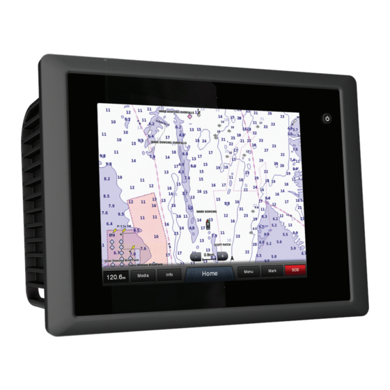
Garmin GPSMAP 8500 Black Box Owner's Manual
Gpsmap® 8000 glass helm series
Hide thumbs
Also See for GPSMAP 8500 Black Box:
- Instructions manual (12 pages) ,
- Quick start manual (4 pages)

Related Manuals for Garmin GPSMAP 8500 Black Box


Summary of Contents for Garmin GPSMAP 8500 Black Box
- Page 1 GPSMAP 8000 Glass Helm Series ® Owner’s Manual March 2013 190-01557-00_0A Printed in Taiwan...
- Page 2 Garmin ® , the Garmin logo, BlueChart ® , g2 Vision ® , GPSMAP ® , and MapSource ® are trademarks of Garmin Ltd. or its subsidiaries, registered in the USA and other countries.
-
Page 3: Table Of Contents
Table of Contents Marking and Navigating to an MOB Location ......8 Viewing a List of all Waypoints ..........8 Editing a Saved Waypoint ............. 8 Introduction..............1 Moving a Saved Waypoint ............ 8 GPSMAP 8000 Series Front View ..........1 Browsing for and Navigating to a Saved Waypoint .... - Page 4 Removing a MARPA Tag from a Targeted Object ..13 Current Station Information ............18 Viewing a List of AIS and MARPA Threats ......13 Celestial Information ..............18 Showing AIS Vessels on the Radar Screen ......13 Viewing Tide Station, Current Station, or Celestial Information VRM and EBL ..............
- Page 5 Configuring NMEA 0183 Output Sentences ....24 Setting the Communication Format for Each NMEA 0183 Port ................. 24 NMEA 2000 Settings ............24 Garmin Marine Network ............24 Setting Alarms ................24 Navigation Alarms ............... 24 System Alarms ..............24 Setting the Fuel Alarm ............
-
Page 7: Introduction
For more information about GPS, go to www.garmin.com /aboutGPS. Stations and Station Layouts When multiple displays are installed on the Garmin ® Marine Network, you can group them together into a station. A station enables the displays to work together, rather than as several separate displays. -
Page 8: Resetting The Station Layouts
• To change the type of data shown on the page, select connected to a radar. This feature is not available with all Overlays > Data, select an option, and follow the on- models. screen instructions to change the data shown. Chart Symbols Resetting the Station Layouts This table contains some of the common symbols you might see... -
Page 9: Navigating To A Point On The Chart
Navigating to a Point on the Chart Fishing Charts: Shows the chart with enhanced bottom contours and without navigational data. This chart works well for offshore deep-sea fishing. CAUTION The Auto Guidance feature is based on electronic chart High Resolution Satellite Imagery: Provides high-resolution information. -
Page 10: Showing And Configuring Tides And Currents
AIS Targeting Symbols Color Current Speed Range Yellow 0 to 1 knot Symbol Description Orange 1 to 2 knots AIS vessel. The vessel is reporting AIS information. The 2 or more knots direction in which the triangle is pointing indicates the direction in which the AIS vessel is moving. -
Page 11: Activating A Target For An Ais Vessel
vessels. Mini Automatic Radar Plotting Aid (MARPA) alarm will sound 10 minutes before the vessel intersects the functionality works with radar. safe zone. You can configure how other vessels appear on a chart or on a AIS Distress Signals 3D chart view. The display range and MARPA settings Self-contained AIS distress signal devices transmit emergency configured for one chart or one 3D chart view are applied only position reports when activated. -
Page 12: Navigation And Fishing Chart Setup
Chart Setup: See page Safety Shading: Sets the appearance of depth shading. Chart Appearance: See page 6. This might appear in the Depth Range Shading: Sets the appearance of depth range Chart Setup menu. shading. Symbols: Shows and configures the appearance of various Navigation and Fishing Chart Setup symbols on the chart, such as the vessel icon, navaid NOTE: Not all settings apply to all charts and 3D chart views. -
Page 13: Basic Navigation Questions
When you start navigation (Go To, Route To, or Guide To), if additional information or to show the location on a chart. you are connected through a NMEA 2000 ® network to a compatible Garmin autopilot, you are prompted to engage the Courses autopilot. -
Page 14: Waypoints
Waypoints Select Navigate To. Select an option: Waypoints are locations you record and store in the device. • To navigate directly to the location, select Go To. Marking Your Present Location as a Waypoint • To create a route to the location, including turns, select From any screen, select Mark. -
Page 15: Viewing A List Of Routes
Viewing a List of Routes A magenta line appears. In the center of the magenta line is a thinner purple line that represents the corrected course Select Info > User Data > Routes. from your present location to the destination. The corrected Editing a Saved Route course is dynamic, and it moves with your boat when you are You can change the name of a route or change the turns the... -
Page 16: Deleting A Saved Track
Sonar Select an option: • To navigate the track from the starting point used when When properly connected to an optional Garmin sounder the track was created, select Forward. module and a transducer, your compatible chartplotter can be • To navigate the track from the destination point used used as a fishfinder. -
Page 17: Turning On The A-Scope
From a Sonar view, select Menu > Sonar Menu > Pic. Advance: Allows the sonar picture to advance faster by Frequency. drawing more than one column of data on the screen for each column of sounder data received. This is especially Select an option: helpful when you are using the sounder in deep water, •... -
Page 18: Radar Display Modes
When you connect your compatible chartplotter to an optional length of the pulsed signal transmitted and received by the Garmin marine radar, such as a GMR™ 1206 xHD or a GMR 24 radar. As the range increases, the radar transmits longer pulses HD, you can view more information about your surroundings. -
Page 19: Defining A Partial Guard Zone
Select the location of the outer guard zone circle. Viewing Information about a MARPA-tagged Object You can view the range, bearing, speed, and other information Select the location of the inner guard zone circle to define about a MARPA-tagged object. the width of the guard zone. -
Page 20: Radar Overlay
Radar Overlay setting for each radar mode is optimized for that mode, and may When you connect your chartplotter to an optional Garmin differ from the automatic gain setting used for another mode. marine radar, you can use the Radar overlay to overlay radar NOTE: Depending upon the radar in use, the gain setting information on the Navigation chart or on the Fishing chart. -
Page 21: Adjusting Sea Clutter On The Radar Screen
Radar Menu > Radar Setup. position reports. Orientation: Sets the perspective of the radar display. The If you have a Garmin NMEA 2000 VHF radio connected to your orientation setting applies to every radar mode. This setting chartplotter, these features are also enabled. -
Page 22: Dsc List
Vessel Incoming Distress Calls Select Info > DSC List. If your Garmin chartplotter and VHF radio are connected using Select a position-report call. NMEA 0183 or NMEA 2000, your chartplotter alerts you when your VHF radio receives a DSC distress call. If position Select Review >... -
Page 23: Making An Individual Routine Call
• Select Auto Configure to automatically detect the The chartplotter sends information about the call to the radio. number of engines. On your Garmin VHF radio, select Call. Customizing the Engines Shown in Gauges Making an Individual Routine Call to an AIS Target... -
Page 24: Viewing Graphs
Select an option: Select an option. • To set all the readings for the present trip to zero, select • To view information for a different date, select Change Reset Trip. Date > Manual, and enter a date. • To set the maximum speed reading to zero, select Reset •... -
Page 25: Alternating Among Multiple Video Sources
XM WX Satellite Weather data is broadcast at five-minute Aspect > Standard. intervals. When the Garmin receiver is turned on, or when a • To adjust the brightness, select Brightness, and select different weather feature is selected, the receiver must receive Up, Down, or Auto. -
Page 26: Hurricane Information
the last seven minutes. The ground-based lightning detection • To view the weather forecast for the next 12 hours, select network detects cloud-to-ground lightning only. Next Forecast or , and to view forecasts up to 48 hours, in 12-hour increments, select Next Forecast or again. Hurricane Information •... -
Page 27: Wave Height, Wave Period, And Wave Direction
attached to the tail of the wind barb indicates the wind speed. A shaded area to view the fish species that are included in the short line represents 5 knots, a long line represents 10 knots, shaded area. and triangle represents 50 knots. Visibility Information Wind Barb Wind Speed... -
Page 28: Turning On The Weather Overlay On A Chart
(if applicable), the software From the Fishing chart, select Menu > Weather. version for an optional Garmin radar (if applicable), and the unit ID number. You may need this information to update the system WX RADAR: Shows WX radar. -
Page 29: Navigation Settings
Map Datum: Sets the coordinate system on which the map is navigating. The available values for the Shoreline Distance structured. Do not change this setting unless you are using a setting are relative, not absolute. To ensure the Auto Guidance map or chart that specifies a different map datum. -
Page 30: Configuring Nmea 0183 Output Sentences
AIS receivers, select NMEA High Speed. Add Fuel to Boat: Allows you to enter the quantity of fuel you • To support the input or output of Garmin proprietary data added to your tank, when you did not entirely fill up the tank for interfacing with Garmin software, select Garmin. -
Page 31: Setting The Water Temperature Offset
If necessary, select the memory card to copy data to. If the wheel turns freely, check the cable connections. Select an option: If you continue to get the message, contact Garmin product • To create a new file, select Add New File, and enter a support. -
Page 32: Copying Waypoints, Routes, And Tracks To Or From All Chartplotters On The Network
Registering Your Device You can transfer information for waypoints, routes, and tracks from one chartplotter connected to the Garmin Marine Network Help us better support you by completing our online registration to every other chartplotter connected to the network. The today. -
Page 33: Nmea 2000 Pgn Information
Type Sentence Description Type Description PGRMZ Z: Altitude 129809 AIS class B "CS" static data report, part SDDBT DBT: Depth below transducer 129810 AIS class B "CS" static data report, part SDDPT DPT: Depth SDMTW MTW: Water temperature 130310 Environmental parameters SDVHW VHW: Water speed and heading 130311 Environmental parameters... -
Page 34: Index
Fish Eye 3D 6 navigation 24 synchronizing with actual fuel 17, 24 tide and current indicators 3 course 24 fuel onboard 24 product registration 26 shallow water 11 sonar 11 Garmin Marine Network 24 water temperature 11 radar 11–13 gauges weather 24 AIS 13 engine 17 anchor drag alarm 24 clutter 15 fuel 17 animated currents, tides 3 color scheme 15... - Page 35 alarms 11 creating 8, 21 appearance 11 deleting 8 bottom lock 10 editing 8 cone 6 overboard 8 depth 10 navigating to 8 depth scale 10 radar 12 frequencies 10 showing 6 gain 10 sonar 10 interference 11 tracked vessel 16 scroll speed 11 viewing list of 8 surface noise 11 weather 21 suspended targets 11 weather 6, 19, 20 views 10 alarms 24 waypoint 10 broadcasts 19 whiteline 11 charts 19, 22 zoom 10...
- Page 36 1200 East 151st Street Olathe, Kansas 66062, USA Garmin (Europe) Ltd. Liberty House, Hounsdown Business Park Southampton, Hampshire, SO40 9LR UK Garmin Corporation No. 68, Zhangshu 2nd Road, Xizhi Dist. New Taipei City, 221, Taiwan (R.O.C.) © 2013 Garmin Ltd. or its subsidiaries...