Table of Contents
Advertisement
Quick Links
Advertisement
Table of Contents

Related Manuals for Garmin GPSMAP 64X Series


Summary of Contents for Garmin GPSMAP 64X Series
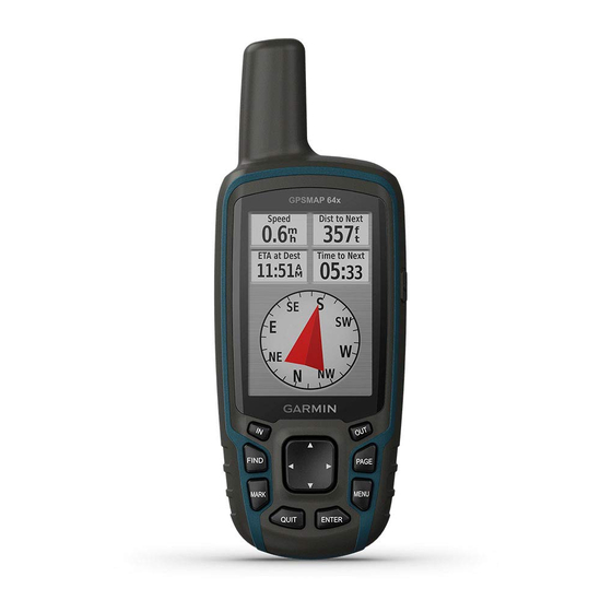
- Page 1 GPSMAP 64 SERIES / GPSMAP 64X ® SERIES Owner’s Manual...
- Page 2 © 2016 Garmin Ltd. or its subsidiaries All rights reserved. Under the copyright laws, this manual may not be copied, in whole or in part, without the written consent of Garmin. Garmin reserves the right to change or improve its products and to make changes in the content of this manual without obligation to notify any person or organization of such changes or improvements.
- Page 3 Device Information............11 Navigating a Saved Route ............. 5 Product Updates ............... 11 Viewing the Active Route ............5 Setting Up Garmin Express ..........11 Stopping Navigation ............... 5 Registering Your Device ............11 Reversing a Route ..............5 Viewing E-label Regulatory and Compliance Information ..11 Tracks ..................
- Page 4 Garmin Support Center ............. 13 Turning On the Backlight ............13 Optional Accessories ..............13 tempe™ ................13 Pairing Your ANT+ Sensors ..........13 Troubleshooting ................ 13 Restarting the Device ............13 Viewing Device Information ..........13 Restoring All Default Settings ..........13 Index ................
-
Page 5: Device Overviews
Introduction Mini-USB port (under weather cap) Camera lens WARNING microSD card slot (under batteries) See the Important Safety and Product Information guide in the product box for product warnings and other important Battery compartment information. Mounting spine Device Overviews Battery cover D-ring GPSMAP Device Overview (No Camera) Battery Information WARNING... -
Page 6: Installing Aa Batteries
Garmin . Attempting to charge a battery that ® was not provided by Garmin can damage the device and void the warranty. Before you can connect the straight connector of the USB cable to your device, you may need to remove optional mount accessories. -
Page 7: Trip Computer
• Select Track Up to show your current direction of travel at also help you avoid hazards near the course, such as shoals or the top of the page. submerged rocks. • Select Automotive Mode to show an automotive To enable the course pointer, from the compass, select MENU > perspective with the direction of travel at the top. -
Page 8: Elevation Plot
Elevation Plot Projecting a Waypoint You can create a new location by projecting the distance and NOTE: The elevation plot is available only with GPSMAP bearing from a marked location to a new location. 64s/sc/st/sx/csx devices. Select Waypoint Manager. By default, the elevation plot displays the elevation over the Select a waypoint. -
Page 9: Purchasing Additional Maps
Select Route Planner. Select Go. Select a route. Purchasing Additional Maps Select Delete Route. Go to your device product page at www.garmin.com. Navigating a Saved Route Click the Maps tab. Select FIND > Routes. Follow the on-screen instructions. Select a route. -
Page 10: Area Calculation
™ Select MENU > View Information > Go. A chirp is a small Garmin accessory that is programmed and left in a geocache. You can use your device to find a chirp in a Deleting a Photo geocache. For more information about the chirp, see the chirp Select Photo Viewer. -
Page 11: Garmin Adventures
LiveTrack: Allows friends and family to follow your activities in Collection or to a list. real time. You can invite followers using email or social media, allowing them to view your live data on a Garmin • From BaseCamp, select Device > Receive from Device, Connect tracking page. -
Page 12: Additional Main Menu Tools
Hiding Notifications Course: The direction from your starting location to a destination. Course can be viewed as a planned or set route. By default, notifications appear on the device screen when they You must be navigating for this data to appear. are received. -
Page 13: System Settings
Select Setup > System > Interface. Time To Destination: The estimated time remaining before you Garmin Spanner: Allows you to use the device USB port with reach the destination. You must be navigating for this data to most NMEA 0183-compliant mapping programs by creating a appear. - Page 14 Use the slider to adjust the backlight level. The device may feel warm when the backlight setting is high. Setting the Device Tones You can customize tones for messages, keys, turn warnings, and alarms. Select Setup > Tones > Tones > On. Select a tone for each audible type.
-
Page 15: Device Information
Select Setup > Altimeter. /express). On your smartphone, install the Garmin Connect app. Auto Calibration: Automatically calibrates the altimeter each This provides easy access to these services for Garmin devices: time the device is turned on. • Software updates Barometer Mode: Variable Elevation allows the barometer to measure changes in elevation while you are moving. - Page 16 • GGZ geocache files. Go to www.garmin.com/geocache. the memory card. • JPEG photo files. Deleting Files • GPI custom POI files from the Garmin POI Loader. Go to www.garmin.com/products/poiloader. NOTICE Installing a Memory Card If you do not know the purpose of a file, do not delete it. Your...
-
Page 17: Specifications
Hardware icon in the system tray, and select your device. accessories. • For Apple computers, select the device, and select File > • Bring the Garmin device within range 3 m (10 ft.) of the ANT+ Eject. accessory. Disconnect the cable from your computer. - Page 18 5, 9–11, 13 device 11 files, transferring 6, 12 sharing data 6 flashlight 6 Sight N' Go 3 smartphone 6 applications 7 Garmin Connect 7 pairing 7 Garmin Express 11 software updating software 11 license 13 geocaches 6, 12 updating 11 downloading 6 version 13 GLONASS 9 specifications 13 GPS 6, 9 stopwatch 8 satellite page 6...
- Page 20 May 2019 190-01702-00_0D...