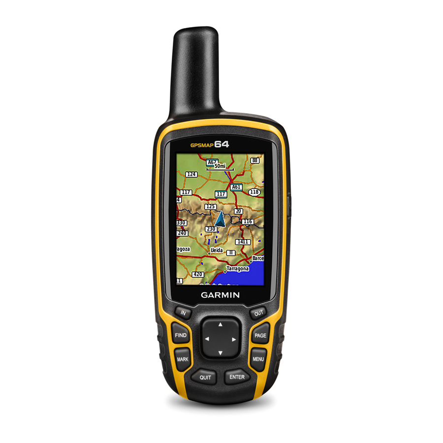
Garmin GPSMAP 64 Owner's Manual
Gps navigation
Hide thumbs
Also See for GPSMAP 64:
- User manual ,
- Quick start manual (6 pages) ,
- Owner's manual (21 pages)
Table of Contents
Advertisement
Advertisement
Table of Contents

Related Manuals for Garmin GPSMAP 64


Summary of Contents for Garmin GPSMAP 64
- Page 1 GPSMAP ® Owner’s Manual February 2014 190-01702-00_0B Printed in Taiwan...
- Page 2 Garmin. The Bluetooth ® word mark and logos are owned by the Bluetooth SIG, Inc. and any use of such marks by Garmin is under license. Mac ® is a registered trademark of Apple Computer, Inc.
-
Page 3: Table Of Contents
Calibrating the Barometric Altimeter ........5 Using Optional Fitness Accessories ........11 Restoring Default Page Settings ..........5 Tips for Pairing ANT+ Accessories with Your Garmin Device . 11 Data Management ..............11 Main Menu Features and Settings........ 5 File Types ................11 Geocaches ................. - Page 4 Cleaning the Device ............12 Troubleshooting ............... 12 Resetting the Device ............12 Restoring All Default Settings ..........12 Index ................13 Table of Contents...
-
Page 5: Device Overview
Do not attempt to use the device to charge a battery that was not provided by Garmin ® . Attempting to charge a battery that was not provided by Garmin can damage the device and void the warranty. -
Page 6: Waypoints, Routes, And Tracks
Replace the battery cover, and turn the D-ring clockwise. From the main menu, select Waypoint Manager. Hold . Select a waypoint. Select Setup > System > AA Battery Type. Select MENU > Project Waypoint. Select Alkaline, Lithium, Traditional NiMH, or Precharged Enter the bearing, and select Done. -
Page 7: Deleting A Route
Select Delete Route. Navigating a Saved Route Purchasing Additional Maps Before you can navigate using a saved route, you must create a Go to your device product page at (www.garmin.com). route. Click the Maps tab. Select FIND > Routes. Follow the on-screen instructions. -
Page 8: Compass
top of the page. Automotive Mode shows an 3D automotive The course pointer indicates your relationship to the course view with the direction of travel at the top. line leading to the destination. The course deviation indicator (CDI) provides the indication of drift (right or left) from the Guidance Text: Sets when the guidance text appears on the course. -
Page 9: Main Menu Features And Settings
Elevation/Distance: Records elevation changes over a A chirp is a small Garmin accessory that is programmed and left distance. in a geocache. You can use your device to find a chirp in a geocache. For more information about the chirp, see the chirp Elevation/Time: Records elevation changes over a period of Owner's Manual at www.garmin.com. -
Page 10: Garmin Adventures
• Select an item from a connected device and drag it to My real time. You can invite followers using email or social Collection or to a list. media, allowing them to view your live data on a Garmin • From BaseCamp, select Device > Receive from Device, Connect tracking page. -
Page 11: Customizing Your Device
Viewing Phone Notifications Bearing: The direction from your current location to a Before you can view notifications, you must pair your device destination. You must be navigating for this data to appear. with your compatible smartphone. Cadence: The number of revolutions of the crank arm or Select >... -
Page 12: System Settings
Select Setup > System > Interface. of acquiring the water temperature. Garmin Spanner: Allows you to use the device USB port with Time of Day: The current time of day based on your current most NMEA 0183-compliant mapping programs by creating a location and time settings (format, time zone, daylight saving virtual serial port. -
Page 13: Marine Settings
Marine Settings Changing the Units of Measure Select Setup > Marine. You can customize units of measure for distance and speed, elevation, depth, temperature, pressure, and vertical speed. Marine Chart Mode: Sets the type of chart the device uses when displaying marine data. Nautical displays various map Select Setup >... -
Page 14: Creating A Custom Profile
Select Setup > Display > Backlight Timeout. Support and Updates Select an option. Garmin Express™ provides easy access to these services for Garmin devices. Some services may not be available for your About the Batteries device. • Product registration WARNING •... -
Page 15: Selecting The Battery Type
On Mac computers, the device • Bring the Garmin device within range 3 m (10 ft.) of the and memory card appear as mounted volumes. -
Page 16: Deleting Files
Do not store the device where prolonged exposure to extreme temperatures can occur, because it can cause permanent Open the Garmin drive or volume. damage. If necessary, open a folder or volume. The device is water resistant to IEC Standard 60529 IPX7. It Select a file. -
Page 17: Index
4, 8, 9, 12 elevation 4, 5 device 9 sharing data 5 Sight N' Go 4 files, transferring 5, 11 smartphone 5 applications 6 pairing 6 Garmin Connect 6 software, updating 10 Garmin Express 10 specifications 10 registering the device 10 stopwatch 7 updating software 10 storing data 11 geocaches 5, 11 sunrise and sunset times 7... - Page 18 1200 East 151st Street Olathe, Kansas 66062, USA Garmin (Europe) Ltd. Liberty House, Hounsdown Business Park Southampton, Hampshire, SO40 9LR UK Garmin Corporation No. 68, Zhangshu 2nd Road, Xizhi Dist. New Taipei City, 221, Taiwan (R.O.C.) © 2013–2014 Garmin Ltd. or its subsidiaries...