Sign In
Upload
Manuals
Brands
Leica Geosystems Manuals
Laser Level
TM6100A
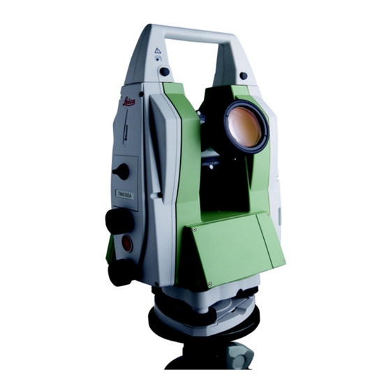
User Manuals: Leica Geosystems TM6100A Theodolite
Manuals and User Guides for Leica Geosystems TM6100A Theodolite. We have
1
Leica Geosystems TM6100A Theodolite manual available for free PDF download: User Manual
Leica Geosystems TM6100A User Manual (126 pages)
Brand:
Leica Geosystems
| Category:
Laser Level
| Size: 5 MB
Table of Contents
Table of Contents
5
1 Description of the System
8
System Components
8
System Concept
11
Software Concept
11
Data Storage and Data Conversion Concept
13
Power Concept
15
Container Contents
16
Instrument Components
17
2 User Interface
20
Keyboard
20
Hot Key Assignments
24
Screen
27
Operating Principles
29
Icons
35
3 Operation
37
Instrument Setup
37
Battery
40
Operating Principles
40
Instrument Battery
41
Working with the Compactflash Card
43
Accessing Survey Application Program
46
Built-In Autocollimation Device
49
Connection to Application Computer
51
Limitation of the Horizontal and Vertical Movements
55
4 Check & Adjust
60
Overview
60
Preparation
63
Combined Adjustment (L, T, I and C)
65
Tilting Axis Adjustment (A)
69
Adjusting the Circular Level of the Instrument and Tribrach
74
Adjusting the Circular Level of the Prism Pole
76
Inspecting the Laser Plummet of the Instrument
77
Servicing the Tripod
79
Adjustment of the Autocollimation Reticule
80
5 Care and Transport
82
Transport
82
Storage
84
Cleaning and Drying
85
Maintenance
87
6 Safety Directions
88
General Introduction
88
Intended Use
89
Limits of Use
91
Responsibilities
92
Hazards of Use
93
Laser Classification
99
General
99
Laser Plummet
101
Electromagnetic Compatibility EMC
104
FCC Statement, Applicable in U
107
7 Technical Data
110
Angle Measurement
110
Conformity to National Regulations
111
Communication Side Cover with Bluetooth
111
General Technical Data of the Instrument
112
8 International Limited Warranty, Software License Agreement
119
Advertisement
Advertisement
Related Products
Leica Geosystems TS15
Leica Geosystems TS11
Leica Geosystems T-Scan
Leica Geosystems T-Scan Collect
Leica Geosystems TPS700 Series
Leica Geosystems TPS700auto
Leica Geosystems Zeno Tab 2
Leica Geosystems TCPS27
Leica Geosystems TS12
Leica Geosystems Jogger 20
Leica Geosystems Categories
Measuring Instruments
Laser Level
Analytical Instruments
Scanner
Receiver
More Leica Geosystems Manuals
Login
Sign In
OR
Sign in with Facebook
Sign in with Google
Upload manual
Upload from disk
Upload from URL