Sign In
Upload
Manuals
Brands
Interphase Manuals
GPS
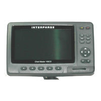
Chart Master Chart Master 11 CV+
Interphase Chart Master Chart Master 11 CV+ Manuals
Manuals and User Guides for Interphase Chart Master Chart Master 11 CV+. We have
1
Interphase Chart Master Chart Master 11 CV+ manual available for free PDF download: User Manual
Interphase Chart Master Chart Master 11 CV+ User Manual (89 pages)
Interphase Chart Master Chart Master 11 CVS+: User Guide
Brand:
Interphase
| Category:
GPS
| Size: 5.1 MB
Table of Contents
Table of Contents
2
About this User Manual
7
Conventions Used
7
How this User Manual Is Organized
7
If You Need Assistance
8
Important Information
9
Warning
9
Warranty Statement
9
Caution
9
Cleaning Procedure for the Plotter Screen
10
Overview
11
Chart Plotter
11
C-Map Nt Max Cartography Information
11
Gps
12
How GPS Works
12
Position Fixing Accuracy: HDOP
13
Getting Started
15
Changing Backlight and Contrast
15
Selecting the Language
15
Using C-Map C-Cards
15
Simulation Mode
15
Controlling the Display
16
Changing Display Mode
16
Moving Around the Chart and Changing Chart Scale
17
Finding Your Boat Position
17
Selecting Look Ahead
17
Selecting Map Orientation
17
Navigation to a Single Destination
17
Range/Bearing Function
18
Selecting Ending Point with Cursor
18
Selecting Ending Point by Entering Range & Bearing
18
Man Overboard (Mob)
18
Inserting MOB
18
Selecting Auto Info on MOB
18
Deleting MOB
18
Operations
19
User Points: Marks and Waypoints
19
Creating a Route
19
Creating Waypoint
19
Creating Mark
19
Editing User Point
19
Deleting User Point
19
Moving User Point
19
Locating User Point on Map
20
Sending/Receiving User Point
20
Selecting User Points List Page
20
Routes
20
Selecting Active Route
20
Creating a Route
20
Selecting Route Color for Color Chart Plotter
21
Deleting Route
21
Following a Route (Activate the Navigation)
21
Inserting Waypoint
21
Reversing Route
21
Selecting Route Report Page
21
Locating Route on Map
21
Sending Route
22
Receiving Route
22
Goto Function
22
Goto Cursor
22
Goto Mark on the Chart Page
22
Goto Mark Using the User Points List
22
Goto Route Using the Select Route Menu
22
Stopping Navigation
22
Using Track
22
Setting up a Track Step
23
Selecting Track Pattern
23
Displaying Track
23
Activating/Deactivating Track Recording
23
Clearing All Tracks
23
Selecting Track Number
23
Data Window Customization
23
Info
24
Setting Automatic Info
24
Selecting Automatic Info
24
Displaying Expanded Info Page (Full Info)
24
Info Tree and Expanded Info Page
24
Info on Objects with Pictures
24
Quick Info on Lakes
25
Full Info on Lakes
26
Port & Tide Info
26
Getting Port Info
26
Getting Tide Info
27
Find Function
28
Finding Port Service
28
Finding Port by Name
28
Finding Port by Distance
28
Finding Lakes Information
29
Finding Lakes by Name
29
Finding Points of Interest
29
Finding Tide Stations
29
Finding Wrecks
30
Finding Obstructions
30
Finding User Points
30
Finding Coordinates
30
Alarms
30
Arrival Alarm
30
XTE Alarm
30
Depth Alarm
30
Anchor Alarm
30
Audible Alarm
31
CM V6/V6I/11Cv+/11Cvs+: External Alarm
31
Grounding Alarm
31
Grounding Alarm Range
31
Grounding Alarm Report
31
3.10 User C-Card
32
User C-CARD Page
32
Formatting User C-CARD
32
Saving File on User C-CARD
32
Loading File from User C-CARD
32
Deleting File from User C-CARD
33
CM 7MI/7CI/7MX/7CXS/11CV+/11CVS+: Changing User C-CARD
33
VIEW VIDEO INPUT for CM 11CV+/11CVS
33
User Setting up
35
Menu
35
Map Orientation
35
Zoom Type
35
Font & Symbols
35
Perspective View
36
Dinamyc Nav-Aids
36
Mixing Levels
36
Safety Status Bar (DSI = Data Safety Indicator)
37
Currents Prediction
38
Map
38
Display Mode
38
Marine Settings
38
Depth Settings
39
Land Settings
39
Chart Settings
39
Underwater Objects Settings
40
General Display
40
Navigation
41
Compass
41
Input/Output Setup
42
CM V6/169CS/7MX/7CXS/11CV+/11CVS+: GPS Connection
42
GPS Setup Menu
42
Autopilot Connection
42
External NMEA Connection
42
C-COM GSM PLUS Connection
42
Output Sentences
43
NMEA Data Input
43
CM 169Cs/169Csi/7Mi/7Ci/7Mx/7Cxs: Cable Wiring Page
43
CM V6/V6I/11Cv+/11Cvs+: Power I/O Cable Wiring Page
43
CM V6/11CV+/11CVS+: GPS Cable Wiring Page
43
CM 11CV+/11CVS+: AUX in I/O Cable Wiring Page
43
Send/Receive Routes & Marks
43
C-Link Menu
43
CM 11CV+/11CVS+: External Output
43
Ais
44
4.8.1 AIS System Definitions
44
Lost Target
45
4.8.2 AIS Menu
45
4.8.3 to Set the Chart Plotter for Receiving AIS
45
4.8.4 Quick Info on AIS Target
45
C-Map Weather Service
45
Mmsi Number
45
4.9.1 C-MAP WEATHER SERVICE Menu
46
Download
46
Copy from C-CARD
47
Prediction
47
Real Time View
47
Type of Data
47
4.10 Fish Finder
47
CM 169Cs/169Csi/11Cv+/CM 11Cvs+: Radar
47
4.12 System Information
48
World Background Charts
48
Worldwide Background Update
48
CM 11Cv+/CM 11Cvs+: Video Input
48
C-Link
49
How C-Link System Works
49
C-Link Serial Connection
49
C-Link Navigation Data Transfer
49
Operations
50
C-Link Serial Connection
50
Master Chart Plotter
51
Slave Chart Plotter
51
C-Link Navigation Data: Acquisition and Display
51
Graphical Representation on Map Display
52
Route Data Report
52
Quick Info
53
System Test
55
Ram Menu
55
DIM Menu
55
Serial Ports
56
Modem Test
56
Dead Reckoning
58
Depth Areas
58
Light Sectors
59
Magnetic Deviation
59
Natural Features
60
Pictures & Diagrams
60
Technical Specifications
63
External Wiring
65
Typical Connections
65
External Nmea Connection
66
External Alarm Connection
66
Installation and Removing
69
Removing the C-CARD
74
Typical Connections
76
Inserting the C-CARD
80
Gps Connection
82
C-COM GSM Plus Connection
83
Advertisement
Advertisement
Related Products
Interphase Chart Master Chart Master 11 CVS+
Interphase Chart Master Chart Master 169CS
Interphase Chart Master 169CSI
Interphase Chart Master Chart Master 7CI
Interphase Chart Master Chart Master 7CXS
Interphase Chart Master Chart Master 7MI
Interphase Chart Master Chart Master 7MX
Interphase Chart Master Chart Master V6
Interphase Chart Master Chart Master V6i
Interphase 180
Interphase Categories
Sonar
Fish Finder
GPS
Marine Equipment
Controller
More Interphase Manuals
Login
Sign In
OR
Sign in with Facebook
Sign in with Google
Upload manual
Upload from disk
Upload from URL