Sign In
Upload
Manuals
Brands
Gssi Manuals
Radar
SIR 4000
Gssi SIR 4000 Ground Penetrating Radar Manuals
Manuals and User Guides for Gssi SIR 4000 Ground Penetrating Radar. We have
3
Gssi SIR 4000 Ground Penetrating Radar manuals available for free PDF download: Manual, Connecting Manual
Gssi SIR 4000 Manual (153 pages)
Penetrating Radar Data Acquisition Unit
Brand:
Gssi
| Category:
Radar
| Size: 7.84 MB
Table of Contents
Table of Contents
5
Unpacking Your System
7
General Description
7
Chapter 1: Introduction
7
Compatibility
8
Analog Antenna Connector
9
Digital Antenna Connector
9
External Power Adapter
9
Hardware Connections - Top
9
GPIO Connector
10
Hardware Connections – Right Side
10
Serial I/O
10
Hardware Connections – Left Side
11
Keypad
11
Control Knob
12
Directional Keypad
12
Power Button
12
Power Status LED
12
Cautions and Warnings
13
Geophysical Survey Systems, Inc. SIR
14
Hardware Setup
15
Chapter 2: Getting Started and Expert Mode Setup
15
Analog Antennas
16
Digital Antennas
16
Expert Mode
17
Introduction Screen
17
Modes
17
Quick 3D
17
Language
18
Last Used Settings, New Project, and Playback
18
Toolbar
18
Units
18
Antenna
19
Antenna Model
19
Antenna Transmit Rate
19
Antenna Type
19
Gps
20
Theme
21
Date/Time
22
Firmware
22
Settings
22
Battery
23
Status
23
Storage
23
Setup Collect/Playback Screen
24
O-Scope (Middle)
25
Setup Menu (Right)
25
Toolbar (Bottom)
26
Collect Mode
27
Setup Menu – Radar
27
Samples/Scan
28
Scans/Second
28
Dielectric
29
Scans/Unit
29
Static Stacking
29
Units/Mark
29
Depth Range
30
Soil Type
30
Time Range
30
During Setup
31
Effects of Changing Dielectric, Soil Type, Depth Range, or Time Range
31
Offset
32
Position Mode
32
Setup Menu - Process
33
Surface (%)
33
Gain Mode
34
Add Point
35
FIR Low Pass and IIR High Pass
35
FIR BG Removal
36
FIR Stacking
36
Custom Filter
37
IIR Low Pass and IIR High Pass
37
IIR Stacking
37
Filters off
38
IIR BG Removal
38
Signal Floor
38
Select Datapath
39
Setup Menu - Output
39
Vertical Scale
40
Vertical Units
40
Horizontal Units
41
Scale Color
41
Show O-Scope
41
Color Slide
42
Color Stretch
42
Colormap
42
Show Hyperbola
42
Amplitude – Point Mode Only
43
Fill – Point Mode Only
43
Setup Menu – System
43
Spacing – Point Mode Only
43
Autosave
44
Save Setup
44
Calibrate SW
45
Recall Setup
45
Survey Wheel Factory Default Calibration Settings
46
Gain
48
In Setup Collect Mode
48
The Toolbar
48
H Cursor
49
Zoom
49
File Info
50
Play Mode
50
In Setup Playback Mode
51
Select File
52
Focus on - Distance Mode Only
53
In Collect Mode
53
Next Point - Point Mode Only
54
Pause/Resume - Time Mode Only
54
Zoom – Distance and Time Mode
55
Output - Distance Mode
58
Output - Time Mode
60
Output - Point Mode
61
In Playback Mode
62
Pause/Resume
62
Cursor dir
63
Expert Mode Setup
69
Setting up Distance Mode Data Collection
69
Chapter 3: Setting up Your SIR 4000 for 2D Data Collection and Playback in Expert Mode
69
Depth/Time Range
70
Radar Menu
70
Gain Mode and Edit Gain Curve
71
Output Menu
71
Process Menu
71
System Menu
71
Data Collection
72
Survey Wheel Calibration
72
Distance Mode Setup
73
Grid Setup
73
Setup for Single Line 3D Collection in Expert Mode
73
Setting up for Time Mode Data Collection
74
Takes Notes
74
Setting up for Point Mode Data Collection
77
Playing Back Collected Data
80
Saving an Image
80
How to Use Screen Capture
81
Quick3D File Structure
83
Chapter 4: Using Quick3D Mode
83
Setting up a Physical 3D Grid
84
Setting up Quick3D Collection
85
Grid Menu
85
X/Y Line Order
86
Step by Step Quick3D Setup
86
Set Grid Limits
88
Enter Collection Screen
88
Collecting 3D Data
89
Position Antenna
89
Begin Collection
89
Orientation – Positioning the Next Line
90
Start/Stop Buttons
90
Estimating the Dielectric
90
Recollecting or Skipping Lines
91
Adding a Line Segment
91
Saving the Grid
92
Modify the 3D Display During Collection
93
GPS Enabled 3D Collection
95
Connect and Configure GPS
95
Begin 3D Collection
95
Monitor GPS Quality
95
Quick3D Playback
96
Select a 3D Grid for Playback
96
Quick3D Playback Options
97
View Toggle
97
Fence X and y
98
Scan Cursor
98
Rotate
99
Output
99
Selecting a Different Quick3D Grid
100
Structurescan2D
101
Chapter 5: Summary of Pre-Set Mode Parameters
101
Structurescan2D Setup
102
What You Can Customize
102
The Dead-Man Switch
104
Backup Cursor
105
Structurescan2D Data Collection
105
Options During Collection
106
Structurescan2D Playback
108
Structurescan3D
109
Structurescan3D Setup
109
Setting up the 3D Grid on Concrete
110
Structurescan3D File Structure
110
Setup Radar Menu
111
Structurescan3D Data Collection
111
Structurescan3D Options During Data Collection
113
Deleting Data from the System
121
Deleting Individual Files
121
Transfer to a PC Via a USB Memory Stick
121
Chapter 6: Data Transfer and File Maintenance
121
Deleting Project Folders
122
Connecting a GPS
123
Chapter 7: Using a GPS with Your SIR 4000
123
Understanding GPS
124
How Does It Work?
124
Main Sources of Error
124
What Is the DZG File?
125
$GSSIS Sentence Structure
125
How to Calculate the Time
125
What Is WAAS
127
What Is NMEA
127
Geophysical Survey Systems, Inc. SIR
128
Appendix A: SIR 4000 System Specifications
129
A.1: System Hardware
129
A.2: Data Acquisition and Software
130
A.3: System Includes
130
Updating the Software and Firmware
131
Appendix B: the How-To's of Field Survey
131
B.1: Site Selection
135
Ground Cover
135
The How-To’s of Field Survey
135
Topography
135
B.2: Targets
136
Site Accessibility
136
Subsurface Conditions
136
Target Size
136
Antennas by Application
137
B.3: Data Collection Methods: 2D Vs. 3D
138
Target Composition
138
3D
139
Appendix C: Dielectric Values for Common Materials
141
2.6 Ghz (Model 52600S)
143
2 Ghz Palm (Model 62000)
143
Appendix D: Listing of Antenna Parameters
143
D.1: Preloaded Setups in Expert Mode
143
1.5/1.6 Ghz (Model 5100S)
144
900 Mhz (Model 3101A)
144
400 Mhz (Model 50400S)
144
270 Mhz (Model 50270S)
145
200 Mhz (Model 5106)
145
100 Mhz (Model 3207)
145
500-Mhz (Model 3102)
146
300-Shallow
146
D.2: Parameter Listing for Older/Specialty Antennae
146
Appendix E: Glossary of Terms and Suggestions for Further Reading
149
Advertisement
GSSI SIR 4000 Manual (163 pages)
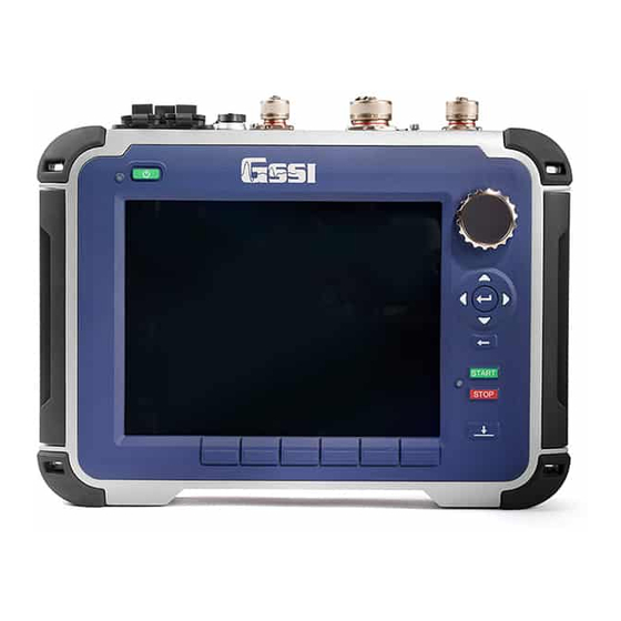
ground penetrating radar
Brand:
GSSI
| Category:
Radar Detector
| Size: 8.83 MB
Table of Contents
Table of Contents
5
Chapter 1: Introduction
7
Unpacking Your System
7
General Description
7
Cautions and Warnings
12
Chapter 2: Getting Started and Expert Mode Setup
13
Hardware Setup
13
Introduction Screen
15
Geophysical Survey Systems, Inc. SIR
15
Setup Collect/Playback Screen
20
The Toolbar
40
Chapter 3: Setting up Your SIR 4000 for 2D Data Collection and Playback in Expert Mode
53
Setting up Distance Mode Data Collection
53
Setup for Single Line 3D Collection in Expert Mode
57
Setting up for Time Mode Data Collection
58
Setting up for Point Mode Data Collection
61
Playing Back Collected Data
64
Saving an Image
64
Chapter 4: Using Quick3D Mode
65
Quick3D File Structure
65
Setting up a Physical 3D Grid
66
Setting up Quick3D Collection
67
Step by Step Quick3D Setup
68
Collecting 3D Data
71
Modify the 3D Display During Collection
73
GPS Enabled 3D Collection
75
Quick3D Playback
76
Chapter 5: Summary of Pre-Set Mode Parameters
81
Structurescan2D
81
Structurescan3D
89
Chapter 6: Setting up Your SIR 4000 for | 2D Data Collection and Playback in Digital 2D Mode
99
Setting up Distance Mode Data Collection
99
Setting up for Time Mode Data Collection in Digital 2D
109
Data Collection in Point Mode
110
Playing Back Collected Data in Digital 2D
113
Saving an Image in Digital 2D
113
Setup for Single Line 3D Collection in Digital 2D
114
Geophysical Survey Systems, Inc. SIR
116
Chapter 7: Setting up Your SIR 4000 for 3D Data Collection and Playback in Digital 3D Mode
117
Digital 3D File Structure
117
Setting up a Physical 3D Grid
118
Setting up Digital 3D Collection
119
Step-By-Step Digital 3D Setup
121
Collecting Digital 3D Data
124
Modify the 3D Display During Collection
127
GPS Enabled 3D Collection
129
Digital 3D Playback
129
Chapter 8: Data Transfer and File Maintenance
133
Transfer to a PC Via a USB Memory Stick
133
Deleting Data from the System
133
Chapter 9: Using a GPS with Your SIR 4000
135
Connecting a GPS
135
Understanding GPS
135
How Does It Work
136
What Is the DZG File
137
What Is WAAS
139
What Is NMEA
139
Appendix A: SIR 4000 System Specifications
141
A.1: System Hardware
141
A.2: Data Acquisition and Software
142
A.3: System Includes
142
Appendix B: Updating the Software and Firmware
143
Appendix C: the How-To's of Field Survey
145
C.1: Site Selection
145
C.2: Targets
146
C.3: Data Collection Methods: 2D Vs. 3D
148
Appendix D: Dielectric Values for Common Materials
149
Appendix E: Listing of Antenna Parameters
151
Preloaded Setups in Digital 2D Mode (Digital Antennas)
151
350Mhz Hyperstacking Antenna (Model 350HS)
151
300/800 Dual Frequency Antenna (Model 50300/800)
151
E.2: Preloaded Setups in Expert Mode
151
E.3: Parameter Listing for Older/Specialty Antennae
153
Appendix F: Basic Linetrac Setup and Interpreting Field Data
157
Appendix G: Glossary of Terms and Suggestions for Further Reading
160
GSSI SIR 4000 Connecting Manual (8 pages)
Juniper Geode GPS
Brand:
GSSI
| Category:
Control Unit
| Size: 0.87 MB
Advertisement
Advertisement
Related Products
GSSI SIR 3000
GSSI SIR 20
GSSI SIR 30
GSSI StructureScan Mini XT
GSSI 5103A
GSSI PaveScan RDM 2.0
GSSI Profiler EMP-400
GSSI UtilityScan
GSSI UtilityScan 50350HS
Gssi Categories
Radar
Measuring Instruments
Radar Detector
Antenna
Fire Extinguisher
More Gssi Manuals
Login
Sign In
OR
Sign in with Facebook
Sign in with Google
Upload manual
Upload from disk
Upload from URL