Table of Contents
Advertisement
Advertisement
Table of Contents

Related Manuals for Lowrance GLOBALMAP 3000


Summary of Contents for Lowrance GLOBALMAP 3000
- Page 1 WWW.LOWRANCE.COM...
- Page 2 Copyright © 2000, 2001 Lowrance Electronics, Inc. All rights reserved. GLOBALMAP 3000 is a trademark of Lowrance Electronics, Inc. ® Lowrance is a registered trademark of Lowrance Electronics, Inc. USE THIS UNIT ONLY AS AN AID TO NAVIGATION. A CAREFUL NAVI- GATOR NEVER RELIES ON ONLY ONE METHOD TO OBTAIN POSI- TION INFORMATION.
-
Page 3: Specifications
This device complies with Part 15 of the FCC Rules. Operation is subject to the following two conditions: (1) this device may not cause harmful interference, and (2) this device must accept any interference received, including interference that may cause undesired operation. Note: This equipment has been tested and found to comply with the limits for a Class B digital device, pursuant to Part 15 of the FCC Rules. -
Page 4: Table Of Contents
INTRODUCTION ... 1 ACCESSORIES ... 1 INSTALLATION ... 1 Mounting ... 1 Power Connections ... 2 NMEA/DGPS Wiring ... 3 Accessory Connections ... 4 MMC ... 5 KEYBOARD ... 6 GPS OPERATION ... 7 Introduction to GPS ... 7 Finding Your Position ... 9 Auto Search ... -
Page 5: Introduction
INTRODUCTION Thank you for purchasing a Lowrance product. No other GPS receiver has the features of the GlobalMap 3000. Countless hours went into the design of this product. We hope that you enjoy using it as much as we have. -
Page 6: Power Connections
IMPORTANT! In order to pass all connectors through the 1" hole in the bracket and dash, first pass the transducer connector up through the hole, then any accessory cables. Next, pass the power cable down through the hole. Fill the hole with a marine sealant. You can now wire the power cable. Power Connections This unit operates from a 12-volt battery system. -
Page 7: Nmea/Dgps Wiring
This gives more accurate positions than is otherwise possible. NMEA/DGPS Wiring The GLOBALMAP 3000 has two NMEA 0183 version 2.0 ports. Com port one can be used for either NMEA or DGPS, Com port two is for NMEA output only. -
Page 8: Accessory Connections
SHIELD (GROUND) GLOBALMAP 3000 The GLOBALMAP 3000 can also accept position information from any GPS receiver that transmits NMEA 0183 data. Use the wiring diagram shown above for NMEA input to the GLOBALMAP 3000. See page 38 and 39 for NMEA and DGPS com port setup instructions. -
Page 9: Mmc
This unit can use up to two MMC (MultiMediaCard) cartridges. They store the maps, waypoint and route information, plot trails, and icons for trans- fer to a computer. To install a MMC cartridge, twist the drawer retainer counter-clockwise and pull. The drawer will come out of the unit. Place the MMC cartridge FACE DOWN. -
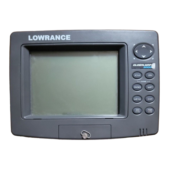
Page 10: Keyboard
KEYBOARD The keyboard has keys arranged in two vertical columns beneath the arrow keys. The menu key near the bottom left corner of the keyboard activates the first menu page. The other keys are used to zoom the dis- play, change modes, and other functions. ZOUT/ZIN - These keys “zoom”... -
Page 11: Gps Operation
GPS OPERATION NOTE: A LGC-12S GPS module or an external GPS receiver with NMEA output must be attached to this unit in order to use the position and navi- gation features. WARNING! Use this product only as an aid to navigation. A careful navigator never relies on only one method to obtain position information. - Page 12 “wandering” of the data shown on the display. If you want better performance, many manufacturers (including Lowrance) sell a DGPS receiver that attaches to your GPS receiver. The DGPS sys- tem transmits correction signals that increase the accuracy to about 10 meters.
-
Page 13: Finding Your Position
FINDING YOUR POSITION Auto Search To lock onto the satellites, the GPS receiver needs to know it’s current position, UTC time, and date. (Elevation (altitude) is also used in the equa- tion, but it’s rarely required to determine a position.) It needs this data so that it can calculate which satellites should be in view. -
Page 14: Position Acquisition
Using this manual initialization method loads a position that’s close to yours into the GPS receiver. It should now have position, time, and date, thereby giving it the data it needs to determine which satellites are in view. Once the satellites are known, the receiver searches for only those satellites, making a lock faster than an auto search method. -
Page 15: Status Screen
North is at the top of the screen. You can use this to see which satellites are obstructed by ob- stacles in your immediate area if you hold the unit facing north. The GPS receiver is tracking satellites that are in bold type. The receiver... -
Page 16: Customizing The Status Screen
hasn’t locked onto a satellite if the number is grayed out, therefore it isn’t being used to solve the position. Beneath the circular graph are the bar graphs, one for each satellite in view. Since the unit has twelve channels, it can dedicate one channel per visible satellite. -
Page 17: Customizing The Navigation Screen
When navigating to a waypoint, the Navigation screen looks like the one at right. Your ground speed, track, distance and bear- ing to waypoint, and course are all shown digitally on this screen. Closing speed is also known as velocity made good. It’s the speed that you’re making towards the waypoint. -
Page 18: Map
There are four different mapping screens: Full Map, Digital Data, Two Po- sition Formats, and Two Maps. (Note: Maps must be downloaded from a MapCreate™ CD-ROM onto a MMC. The MMC must be installed into the unit before maps will show on the screen. -
Page 19: Two Position Formats
“Two Position Formats” is similar to “Digital Data”, except it adds two present position boxes, one showing latitude/longitude and the other shows the present po- sition in UTM. “Two Maps” shows two maps side-by-side. You can customized each map with different settings. For example, the map on the left can have a zoom range of .5 miles, while the one on the right... -
Page 20: Cursor Distance
Cursor Distance You can use the cursor to find the distance between two points. While the cursor is showing, press the MENU key, then select “FIND DISTANCE”. The unit re- turns to the mapping screen. Now move the cursor to the first loca- tion that you want to measure the distance from and press the ENT key. -
Page 21: Auto Zoom
In the track-up view, the present position moves straight towards the top of the display. Remember, in the track-up mode, the screen rotates as you change direction. It always keeps your direction of travel (track) heading towards the top of the screen. TRACK-UP In the course-up mode, the screen is locked into your original bearing... -
Page 22: Range Rings/Grid Lines
Range Rings/Grid Lines The map screen can be custom- ized with rings that are 1/2 of the range and/or grids that divide the plotter into equal segments of lati- tude and longitude. To do this, press the MENU key, then high- light the desired option, then press the ENT arrow key to turn it on. -
Page 23: Icons
ICONS The map has 42 symbols or “icons” available that can be placed any- where on the screen. They can be used to mark fishing or hunting loca- tions, landmarks, boat ramps, and virtually any point of interest. An icon can be placed at your present position or at the cursor’s location. -
Page 24: Plot Trail
To erase only a certain type of icon, select the “Delete By Symbol” menu. The icon menu appears. Highlight the icon style that you want to erase from memory, then press the ENT key. The unit returns to the map screen with all of the selected icons erased. -
Page 25: Edit Trail
Edit Trail To change the settings for an ex- isting trail, highlight the “Saved Trails” menu and press the ENT key. Next, highlight the trail that you wish to change from the list, and press the ENT key. The “Edit Trail”... - Page 26 For example, we ran a course on a local lake, (shown at right) from the boat ramp to a small cove. To navigate back to the boat ramp using the plot trail, press the Menu key twice, select “My Trails” then select the desired plot trail and click on the “Naviate”...
-
Page 27: Trail Options
Trail Options This menu lets you change the way the trail updates occur. The options are automatic, time, or distance. When it’s in the auto- matic mode, the unit doesn’t up- date the plot trail while you’re trav- elling in a straight line. Once you deviate from a straight line, the unit “drops”... -
Page 28: Waypoints
WAYPOINTS This GPS receiver gives you the ability to create your own database of locations, called “waypoints”. You can save your present position, cursor position, or enter a coordinate and save it as a waypoint. For example, you may wish to store the location of your boat dock as a waypoint before starting on a trip. -
Page 29: Saving A New Position
Saving a New Position To save a position other than the cursor’s or the present position as a waypoint, first press the WPT key. The “Find Waypoint” menu appears. “My Waypoints” is high- lighted. Press the right arrow key to move to the Subcategory sec- tion. -
Page 30: Average Position
Average Position This feature averages your posi- tion. This helps to eliminate errors in the position due to atmospheric effects and other conditions. When the “Average Position” menu item is selected, a screen similar to the one at right appears. The small plotter screen shows your present position. -
Page 31: Waypoint Navigation
“Edit Waypoint” returns the unit to the “Edit Waypoint” menu described on page 46. “Delete Waypoint” removes the waypoint from the list. WAYPOINT NAVIGATION This unit makes it easy to navigate to any waypoint. All you have to do is press the WPT key, select the waypoint, then select “Go To Waypoint”... -
Page 32: Man Overboard
The box with the “S” in it was your starting location when the waypoint was recalled. The dotted line is called a course line and is the shortest path from the starting location to the destination. The “D” is the cursor destination, when the cursor position is used as a destination. -
Page 33: Cancel Navigation
The Man Overboard symbol is also placed on the map screen in the appropriate location. You can use the map screen to navi- gate to the Man Overboard loca- tion, if you so desire. To stop the unit from showing navigation to the man overboard position, see the Cancel Naviga- tion section below. -
Page 34: Create A Route
Create a Route To create a route, first press the MENU key twice , highlight the “Route Planning” label, and press the ENT key. The screen shown at right appears. This unit can store up to 100 routes. To create a route, highlight “New Route”... - Page 35 so “Saved” was chosen. A new menu appears, letting you choose from the list of names or from the nearest waypoint to your present position. In this example, “Name” was chosen. The screen at right appears. Select the first waypoint for the route from the list and press the ENT key.
-
Page 36: Follow A Route
Follow a Route To navigate a route, press the MENU key twice, then select “Route Planning”. Using the ar- row keys, highlight “Saved Routes” and press the ENT key. Select the desired route from the list. The “Edit Route” screen ap- pears next. -
Page 37: Gps Setup
and speed in the boxes provided on simulator screen. The altitude is also adjustable. To use the GPS simulator, press the MENU key twice, than select “GPS Setup”, then “GPS Simulator”. The screen at the bottom of the previous page appears. Make the desired settings, then turn the simulator on by highlighting the “Simulator On”... -
Page 38: Map Fix
tems, you must be in the respective country. This unit will pick the match- ing datum for you when you select the grid. See the Datums section for more information. The military grid reference system (MGRS) uses two grid lettering schemes, which are referred to as standard and alternate MGRS on this unit. -
Page 39: Datum
measure up four inches and to the left a half-inch from the reference point on the map to find your location. To use this format, you need to follow these steps in order. First, take your map of the area and determine a reference latitude/longitude. (Note: in order for this system to work, the latitude/longitude lines must be parallel with the edge of the map. -
Page 40: Position Pinning
A list of the datums used by this unit is in the back of this manual. Position Pinning When using a GPS receiver at extremely low speeds, it can have trouble determining your course over ground, or direction you’re travelling. -
Page 41: Gps Alarms
ALARMS This unit has several GPS alarms. You can set an arrival alarm to flash a warning message and sound a tone when you cross a preset distance from a waypoint. For example, if you have the arrival alarm set to .1 mile, then the alarm will flash a message when you come within .1 mile of the recalled waypoint. -
Page 42: System Setup
SYSTEM SETUP Many of the unit’s basic features can be changed from this menu. Press the MENU key twice , then select “System Setup”. The screen at right appears. Units of Measure This menu (shown below) sets the speed and distance (statute or nautical miles, meters), depth (feet, fathoms, or meters), tem- perature (degrees Fahrenheit or... -
Page 43: Configure Dgps
If a DGPS receiver is connect to this unit, highlight the appropri- ate reciever type: “STARLINK DGPS” or “MAGNAVOX DGPS” and press ENT key to turn it on. (Use Starlink DGPS when using Lowrance DGPS Beacon Receiv- ers.) With the exception of serial communications, typically no other setup needs to be made with these receivers. -
Page 44: Reset Options
check mark next to the prefix means that prefix is in use. Select the prefix that you wish to change by highlighting it, then change it by pressing the ENT key. Press the EXIT key when you’re finished with this menu. Reset Options To reset all features to their fac- tory defaults, select “Reset Op-... -
Page 45: Display Settings
respective symbols. The moon symbol shows the approximate phase of the moon. Today’s date shows at the top of the screen. If you want to know the sunrise/sunset for a different date, change it by selecting the month, day, or year by pressing the ENT key, then enter the new date with the arrow keys. -
Page 46: Audio
AUDIO The various sounds that the unit makes can be customized to your own taste. Press the MENU key twice , then select “Sounds” from the main menu. The screen at right appears. The volume control on the right side of the menu adjusts the au- dio level for all sounds. -
Page 47: Warranty Information
LOWRANCE ELECTRONICS, INC FULL ONE-YEAR WARRANTY “We”, “our”, or “us” refers to LOWRANCE ELECTRONICS, INC, the manufacturer of this product. “You” or “your” refers to the first person who purchases this product as a con- sumer item for personal, family, or household use. We warrant this product against defects or malfunctions in materials and workmanship, and against failure to conform to this product’s written specifications, all for one year (1) from the date of original purchase by you. -
Page 48: Datum List
DATUMS WGS 1984 Default Adindan Mean for Ethiopia, Sudan Adindan Burkina Faso Adindan Cameroon Adindan Ethiopia Adindan Mali Adindan Senegal Adindan Sudan Afgooye Somalia Ain el Abd 1970 Bahrain Ain el Abd 1970 Saudi Arabia Anna 1 Astro 1965 Cocos Islands Antigua Island Astro 1943 Antigua (Leeward Islands) Arc 1950... - Page 49 DATUMS Luzon Philipines (Excluding Mindanao) Luzon Philipines (Mindanao) Mahe 1971 Mahe Island Massawa Ethiopia (Eritrea) Merchich Morocco Midway Astro 1961 Midway Islands Minna Cameroon Minna Nigeria Montserrat Island Astro 1958 Montserrat (Leeward Islands) M’Poraloko Gabon Nahrwan Oman (Masirah Island) Nahrwan Saudi Arabia Nahrwan United Arab Emirates...
- Page 50 DATUMS South American 1969 Ecuador (Baltra, Galapagos) South American 1969 Guyana South American 1969 Paraguay South American 1969 Peru South American 1969 Trinidad & Tobago South American 1969 Venezuela South Asia Singapore Tananarive Observatory 1925 Madagascar Timbalai 1948 Brunei, East Malaysia (Sabah, Sarawak) Tokyo Mean for Japan, Korea, Okinawa...
-
Page 51: Database License Agreement
LOWRANCE DATABASES LICENSE AGREEMENT THIS IS A LEGAL AGREEMENT BETWEEN THE END-USER WHO FIRST PURCHASES THIS PRODUCT AS A CONSUMER ITEM FOR PERSONAL, FAMILY, OR HOUSEHOLD USE (“YOU”) AND LOW- RANCE ELECTRONICS, INC., THE MANUFACTURER OF THIS PRODUCT. (“WE”, “OUR”, OR “US”). USING THE PRODUCT ACCOM- PANIED BY THIS LICENSE AGREEMENT CONSTITUTES ACCEP- TANCE OF THESE TERMS AND CONDITIONS. -
Page 52: Database Limited Warranty
DATABASES LIMITED WARRANTY “We”, “our”, or “us” refers to Lowrance Electronics, Inc., the manufacturer of this product. “You” or “your” refers to the first person who purchases the product as a consumer item for personal, family, or household use. The Databases Limited Warranty applies to the one or more databases that your product may contain. -
Page 53: Transferring Gps Data To/From A Mmc
Transferring GPS Data to/from a MMC To transfer waypoints, routes, icons, and plot trails from this unit to a MMC, press the MENU key twice, then select “System Setup”. Next, select “Transfer My Data”. The screen at right ap- pears. All data with check marks next to their labels will be transferred to the MMC. - Page 54 Notes:...
-
Page 55: Accessory Ordering Information
How to Obtain Service (Canadian Customers Only) We back your investment in quality products with quick, expert service and genuine Lowrance replacement parts. If you need service or repairs, contact the Lowrance Factory Customer Service Department at the toll-free number listed below. A techni- cian may be able to solve the problem and save you the inconvenience of returning your unit. - Page 56 How to Obtain Service We back your investment in quality products with quick, expert service and genuine Lowrance and you have questions, please contact the Factory Customer Service Department using our toll-free number listed below. You must send the unit to the factory for warranty service or repair. Please call the factory before sending the unit.
Need help?
Do you have a question about the GLOBALMAP 3000 and is the answer not in the manual?
Questions and answers