
Related Manuals for BENDIXKing KMD 550


Summary of Contents for BENDIXKing KMD 550
- Page 1 KMD 550/850 Multi-Function Display Pilot’s Guide For Software Version 02/01 or later Revision 8 Mar/2007 006-18222-0000...
- Page 2 All rights reserved. Reproduction of this publication or any portion thereof by any means without the express written permission of Honeywell International Inc. is prohibited. For further information contact the Manager, Technical Publications; Honeywell International Inc.; One Technology Center; 23500 West 105th...
- Page 3 Revision History Manual KMD 550/850 Pilot’s Guide Revision 8, March 2007 Part Number 006-18222-0000 Summary Added XM functionality Added DTK readout on Map page Updated SUA boundary labels...
- Page 4 Revision History Manual KMD 550/850 Pilot’s Guide Revision 7, September 2005 Part Number 006-18222-0000 Summary ® Changed Stormscope to registered trademark Updated displays Miscellaneous corrections...
- Page 5 Revision History Manual KMD 550/850 Pilot’s Guide Revision 6, June 2004 Part Number 006-18222-0000 Summary Changed lightning symbols to white Changed airspace classifications Changed display color for Danger, Prohibited and Restricted Airspace Added black border to active flight plan leg display...
- Page 6 Revision History Manual KMD 550/850 Pilot’s Guide Revision 5, January 2003 Part Number 006-18222-0000 Summary Complete manual revision...
- Page 7 Revision History Manual KMD 550/850 Pilot’s Guide Revision 4, January 2003 Part Number 006-18222-0000 Summary Complete manual revision...
- Page 8 Revision History Manual KMD 550/850 Pilot’s Guide Revision 3, May 2002 Part Number 006-18222-0000 Summary Complete manual revision...
- Page 9 Revision History Manual KMD 550/850 Pilot’s Guide Revision 2, November 2001 Part Number 006-18222-0000 Summary Improved display of traffic overlay on the Map Page Small Traffic Window is no longer displayed when the Map Page is in the north-up orientation.
- Page 10 Revision History Manual KMD 550/850 Pilot’s Guide Revision 1, April 2001 Part Number 006-18222-0000 Summary Revised Database Warning Page Added GCO frequencies to Airport MORE INFO Window Added Heliroutes and Helipads to Map Page Airplane symbol now oriented to heading on Map Page...
- Page 11 Revision History Manual KMD 550/850 Pilot’s Guide Revision 0, October 2000 Part Number 006-18222-0000 Summary This is the original release of this publication.
- Page 12 This page intentionally left blank. R-10...
-
Page 13: Table Of Contents
VIDEO DISPLAY ......... .19 Rev 8 Mar/2007 KMD 550/850 Pilot's Guide... - Page 14 INTRODUCTION ......... .41 Rev 8 Mar/2007 KMD 550/850 Pilot's Guide...
- Page 15 APPENDIX A, DISPLAY ICONS ....... .A-1 Rev 8 Mar/2007 KMD 550/850 Pilot's Guide...
- Page 16 Table of Contents Intentionally left blank Rev 8 Mar/2007 KMD 550/850 Pilot's Guide...
-
Page 17: Introduction
We thank you for your decision to purchase a KMD 550/850 and wish you many happy and safe hours flying. Whenever you are using the unit for navigation in the air you should treat it as a supplemental display system. - Page 18 Introduction Intentionally left blank Rev 5 Jan/2003 KMD 550/850 Pilot's Guide...
-
Page 19: General Information
This manual also provides an explanation of each of the individual dis- plays that the KMD 550/850 unit presents. The operating system of the Bendix/King KMD 550/850 keeps to a min- imum the number of key presses necessary to activate the various func- tions, especially those most frequently used in the air. -
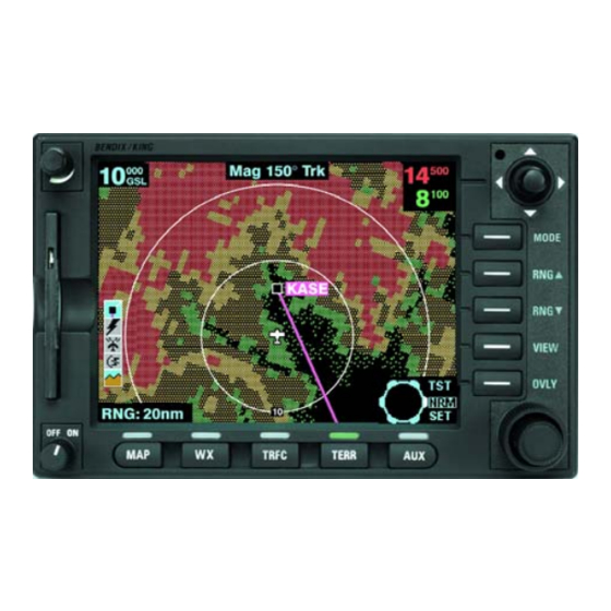
Page 20: Function Select Keys
Pressing this key will decrease the range scale one level on the displayed page. Range scales on other pages will not be affected. VIEW- Pressing this key will sequence through the available views associated with the displayed page. Rev 8 Mar/2007 KMD 550/850 Pilot's Guide... -
Page 21: Soft Labels
If the Fault Indicator appears, cycle the unit power. If the fault re-occurs, the unit needs to be taken to an authorized service center to correct the configuration or repair the unit. Rev 8 Mar/2007 KMD 550/850 Pilot's Guide... -
Page 22: Rev 8 Mar/2007
15 Aircraft Symbol - Indicates present position. Stylized airplane when heading input is present, a plus symbol with no heading. 16 Distance to Waypoint - DIS:###.#nm 17 North Pointer 18 Available Functions - Displays icons representing data available (black) and displayed (color) Rev 8 Mar/2007 KMD 550/850 Pilot's Guide... -
Page 23: Obstacle Labels
General Information ® STORMSCOPE OPTION The KMD 550/850 has the ability to interface and control an L3 WX-500 ® or WX-1000E Stormscope ‘black box’ thunder storm sensor. When the ® Stormscope interface is on and the overlay is enabled, lightning icons will also appear on the display. -
Page 24: Startup Display
The first example is a MAP Function Select Key pop-up. Second is the pop- up displayed when pressing and holding the OVLY Key. Rev 7 Sep/2005 KMD 550/850 Pilot's Guide... -
Page 25: Selecting A Map Display
GRAPHIC AND URBAN AREAS DISPLAY to deter- mine the altitude range for each color. USING THE MAP After power-up, the map will initially be displayed at a range setting of 80nm. Figure 3 Rev 7 Sep/2005 KMD 550/850 Pilot's Guide... - Page 26 While Auto Zoom is enabled, AUTO is displayed in small black text to the right of the current range setting (see Figure 4). Auto zoom can be canceled in one of the following ways: 1. Pressing either RNG Key. 2. The flight plan becomes invalid. Rev 7 Sep/2005 KMD 550/850 Pilot's Guide...
-
Page 27: Data Interrogation
Figure 5 positioning of the joystick pointer much easier.) The aircraft icon will still be displayed in the proper location on the map. Rev 6 Jun/2004 KMD 550/850 Pilot's Guide... -
Page 28: Airport Information
In this case simply turn either knob and the AIRPORT INFO Page will appear as in Figure 6. Figure 7 Rev 6 Jun/2004 KMD 550/850 Pilot's Guide... - Page 29 5. Press the CLEAR Soft Key to return to the moving map or press the FIS INFO Soft Key (if FIS is installed) to view the FIS TEXT Page for the selected airport. Then press the MAP key to return to the moving map. Rev 6 Jun/2004 KMD 550/850 Pilot's Guide...
- Page 30 4. Turn the outer knob clock- wise until the cursor is posi- tioned for the next character. Turn the inner knob to select Figure 10 an A as in Figure 11. Figure 11 Rev 6 Jun/2004 KMD 550/850 Pilot's Guide...
- Page 31 EAGLE GROVE MUN as an airport. 1. Repeat Step 1 through 5 of the previous procedure. 2. Press the KNOB SCAN Soft Key. The Control Knob label will now display SCAN . Figure 14 Rev 6 Jun/2004 KMD 550/850 Pilot's Guide...
-
Page 32: Navaid Information
VOR or NDB and pressing MORE INFO. All available information concerning the chosen data item is then listed. Rev 5 Jan/2003 KMD 550/850 Pilot's Guide... -
Page 33: Airspace Interrogation
R-30 (RS232) data sentence format, in LEG mode, the active flight plan will be sent to the KMD 550/850 and can be displayed as an overlay on the map (see Overlaying Data). An exception to this is during the curved flight segments of approaches (i.e. -
Page 34: Overlaying Data
Therefore the KMD 550/850 has no option but to connect the beginning and end waypoints of the arc or curve with a straight line. Under these circumstances the line on the KMD 550/850 MUST BE IGNORED. -
Page 35: Or Flight Information Services
SELECTING THE ENHANCED GROUND PROXIMITY WARNING SYSTEM Pressing the TERR Function Select Key to display EGPWS. For operation of the EGPWS, see the separate section on EGPWS operation if provided. Rev 8 Mar/2007 KMD 550/850 Pilot's Guide... -
Page 36: Video Display
Operation VIDEO DISPLAY If the unit has a NTSC video source connected, pressing AUX will display the video. Note that on the video dis- play no icons are shown. Rev 8 Mar/2007 KMD 550/850 Pilot's Guide... -
Page 37: System Setup
System Setup SYSTEM SETUP This section of the manual is designed to provide step by step instruc- tions for the setup of the KMD 550/850. Note that not all features dis- cussed in this section are available in all installations. INTRODUCTION... - Page 38 LINE: Shows the symbol used to designate the associated item. TOPO ON/TOPO OFF: Shows the color associated with the selected item when the topographic map is on or off. Rev 7 Sep/2005 KMD 550/850 Pilot's Guide...
- Page 39 Figure 21 will again be displayed. At time RESET VALUES key can be pressed Figure 25 to return to the default setings on that particular display. Rev 6 Jun/2004 KMD 550/850 Pilot's Guide...
-
Page 40: Wx-500 Stormscope ® Setup
26 will now be displayed. Figure 26 Press the STORM SCOPE Key to display Figure 27. Figure 27 Press the NOISE CHECK Key to display the noise check display in Figure 28. Figure 28 Rev 7 Sep/2005 KMD 550/850 Pilot's Guide... - Page 41 After the Self Test is com- plete, Figure 31 will be dis- played. Press the PREV PAGE Key to again display Figure 27. Press PREV PAGE again to exit stormscope setup. Figure 31 Rev 5 Jan/2003 KMD 550/850 Pilot's Guide...
- Page 42 System Setup Intentionally left blank Rev 5 Jan/2003 KMD 550/850 Pilot's Guide...
-
Page 43: Data Cards
DATA AREAS Honeywell produces three data cards based on the ICAO/ARINC geo- graphic areas for KMD 550/850 that cover the entire world. Each card for each area contains the operating software, the appropriate Jeppesen aeronautical data, cartographic data and topological data to a high reso- lution. -
Page 44: Changing The Data Card
Due to Honeywell’s policy of continual development and routine data- base updates, new data cards will become available every 28 days. As a registered owner of a KMD 550/850, you will be offered a 1/3/6/12 monthly data card subscription. DATABASE CYCLE INFORMATION Keeping the database current in the KMD 550/850 is the user’s responsi-... -
Page 45: Definitions, Acronyms And Abbreviations
Knots: Nautical Miles/hr Special Use Airspace: any of the following: prohibited area, restricted area, warning area, alert area, MOA, Class CARSA, Class BTCA, unknown, danger, caution, training, CTA, or TMA type. Rev 5 Jan/2003 KMD 550/850 Pilot's Guide... -
Page 46: Acronyms And Abbreviations
Baud Rate; a measurement of data transmission speed BRG: Bearing CAA: Civil Aviation Authority CAS: Calibrated Airspeed com: communication CDI: Course Deviation Indicator CTA: Control Area CTAF: Common Traffic Advisory Frequency CTR: Control Zone Rev 5 Jan/2003 KMD 550/850 Pilot's Guide... -
Page 47: Rev 8 Mar/2007
Feet Per Minute FSS: Flight Service Station feet Feet Gravitational Acceleration = 32.2 ft/sec2 = 19.3 kt/sec2 GAL: Gallons GCO: Ground Communications Outlet GPS: Global Positioning System GRND: Ground hour HSI: Horizontal Situation Indicator Hertz Rev 8 Mar/2007 KMD 550/850 Pilot's Guide... - Page 48 Military Operation Area MSA: Minimum Safe Altitude MSL: Mean Sea Level msec: milliseconds NDB: Non-Directional Beacon Nautical Miles NPA: Non Precision Approach NVM: Non Volatile Memory OBI: Omni-directional Bearing Indicator OBS: Omni-directional Bearing Selector Rev 5 Jan/2003 KMD 550/850 Pilot's Guide...
-
Page 49: Rev 8 Mar/2007
Mean Time) UTM: Universal Transverse Mercator Volts VDL: VHF Data Link VHF: Very High Frequency VOR: Very High Frequency Omni-directional Radio Range VRP: Visual Reference Point Watts wpt: Waypoint XM Satellite Weather µsec: microsecond Rev 8 Mar/2007 KMD 550/850 Pilot's Guide... -
Page 50: Rev 8 Mar/2007
Definitions, Acronyms & Abbreviations µV: microvolts °C: degrees Celsius °F: degrees Fahrenheit Rev 8 Mar/2007 KMD 550/850 Pilot's Guide... -
Page 51: Wx-500 Stormscope ® Operation
Operation ® WX-500 STORMSCOPE OPERATION INTRODUCTION The Bendix/King KMD 550/850 is capable of being interfaced to an L3 ® WX-500 Stormscope Series II Weather Mapping Sensor. The WX-500 detects electrical discharges associated with thunderstorms within a 200 nm radius of the aircraft. The information is then sent to the KMD 550/850 and will display the location of the thunderstorms both on the ®... -
Page 52: Power-Up
WX-500. If this heading information is valid, the WX-500 and KMD 550/850 will use it. In the absence of an external heading reference, such as an aircraft with only a directional gyro, the... -
Page 53: Switch Between Display Modes
KMD 550/850 plots a "+" symbol (discharge point) on the display when it detects associated discharges within the selected range and view. The KMD 550/850 will plot another "+" close to the first for each additional discharge determined to be associated with the group. -
Page 54: Strike Display Mode
WX-500 Stormscope Operation Strike Display Mode If the strike display mode is selected, the KMD 550/850 immediately plots an "x" symbol (discharge point) on the display for each individual discharge it detects within the selected range and view. The strike dis-... -
Page 55: Operation In Stormscope ® Mode With Flight Plan Overlay
® OPERATION IN STORMSCOPE MODE WITH FLIGHT PLAN OVERLAY If the KMD 550/850 is receiving Flight Plan information from the GPS and a valid heading input is available, the Flight Plan lines and waypoints may be displayed ® on the Stormscope displays in the form of an overlay. - Page 56 White WX, TRFC, TERR Outline CAUTION ® Because the accuracy of the Stormscope sensor is limited, do not rely on the placement of lightning icons for map range settings less than 25 nm. Rev 7 Sep/2005 KMD 550/850 Pilot's Guide...
-
Page 57: Wx-1000E Stormscope ® Operation
OPERATION As mentioned earlier, the WX-1000E lightning information is displayed on the KMD 550/850. The focus on this section is to provide both back- ground information and a more detailed explanation of the operating pro- cedures. The following text assumes you have both the WX-1000E and the KMD 550/850 switched on and that you have selected the ®... -
Page 58: Selecting Stormscope Or Weather Radar
An error message is displayed if a fault is detected. SWITCH BETWEEN WEATHER VIEWS ® The KMD 550/850 can display the Stormscope data in one of two views, either all round (360°) or forward looking only (120°). To switch the display press the VIEW button to toggle between the displays. -
Page 59: Operation In Stormscope ® Mode With Flight Plan Overlay
® OPERATION IN STORMSCOPE MODE WITH FLIGHT PLAN OVERLAY If the KMD 550/850 is receiving Flight Plan information from the GPS and the heading input is valid, the Flight Plan lines and waypoints may be displayed on the ® Stormscope displays in the form of an overlay. - Page 60 3 (Heavy) map scale. CAUTION ® Because the accuracy of the Stormscope sensor is limited, do not rely on the placement of lightning icons for map range settings less than 25 nm. Rev 7 Sep/2005 KMD 550/850 Pilot's Guide...
-
Page 61: Appendix A, Display Icons
Dashed blue Highlighted when the line line with black line with black is designated with the on white label on white label joystick pointer. The heliroute will be labeled with the heliroute name. Rev 7 Sep/2005 KMD 550/850 Appendix A... - Page 62 Setup page (4) setting. dashed line dashed line Highlighted when the line with black on with black on is designated with the white label white label joystick pointer. The boundary label will be “RES”. Rev 7 Sep/2005 KMD 550/850 Appendix A...
- Page 63 Map on black label on black label Setup page (2) setting. The label will indicate the intersection identi- fier. Highlighted when the icon is designated with the joystick pointer. Rev 8 Mar/2007 KMD 550/850 Appendix A...
- Page 64 (no line will be Solid black Solid green shown). approach circle with circle with available line repre- black line repre- senting primary senting primary runway and runway and white on black white on black label label Rev 7 Sep/2005 KMD 550/850 Appendix A...
- Page 65 Map Setup page (2) black label black label setting. The label will indicate the city name. Highlighted when the icon is designated with the joystick pointer. Rev 7 Sep/2005 KMD 550/850 Appendix A...
- Page 66 Black on gray with red Weather radar data invalid / not being received. slash Previously in standby. Black on gray with red Weather radar data invalid / not being received. slash Previously active. Rev 8 Mar/2007 KMD 550/850 Appendix A...
- Page 67 EGPWS with warnings are enabled, not being dis- played. Black on gray with EGPWS with warnings are disabled, not being dis- yellow “!” played. Black on gray with red EGPWS data invalid / not being received. slash Rev 8 Mar/2007 KMD 550/850 Appendix A...
- Page 68 Radio Fault. Graphical METAR overlay is red slash. available but not displayed. Black on gray with Radio Fault. Graphical METAR overlay is red slash; Black, enabled and displayed. green and yellow on cyan. Rev 8 Mar/2007 KMD 550/850 Appendix A...
- Page 69 Honeywell Aerospace Business and General Aviation Honeywell International Inc. One Technology Center 23500 West 105th Street Olathe, KS 66061 Telephone: (913) 712-0400 FAX: (913) 712-1302 www.honeywell.com 006-18222-0000 Rev. 8 3/07 © 2000-2005, 2007 Honeywell International Inc.
Need help?
Do you have a question about the KMD 550 and is the answer not in the manual?
Questions and answers