Garmin HVS GPS17 Technical Specifications
Garmin gps17 hvs technical specification
Hide thumbs
Also See for HVS GPS17:
- Technical specifications (37 pages) ,
- Declaration of conformity (2 pages) ,
- Installation manual (16 pages)

Related Manuals for Garmin HVS GPS17


Summary of Contents for Garmin HVS GPS17
-
Page 1: Specifications
GPS 17x HVS TECHNICAL SPECIFICATIONS Garmin International, Inc. 1200 E. 151 Street Olathe, KS 66062 USA 190-00885-07, Revision A August 2008... - Page 2 Garmin. Garmin hereby grants permission to download a single copy of this manual onto a hard drive or other electronic storage medium to be viewed and to print one copy of this manual or of any revision hereto,...
-
Page 3: Table Of Contents
Accuracy ... 5 1.6.4 Interfaces... 5 1.6.4.1 GPS 17x HVS Electrical Characteristics ... 5 1.6.4.2 Garmin Interface ... 5 1.6.4.3 GPS 17x HVS Protocol ... 5 1.6.4.4 Measurement Pulse Output... 5 2 GPSx 17x HVS Wiring and Pinouts ...6 2.1 GPS 17x HVS Pinout ...6 2.2 GPS 17x HVS Wiring Diagrams...6... - Page 4 One-Pulse-Per-Second (PPS) Output ... 16 Appendix A: Earth Datum List ...18 Appendix B: Garmin Binary Output Format ...21 Appendix C: Changing the Baud Rate in Garmin Mode...25 Appendix D: GPS 17x HVS AND Windows Serial Mouse Issue ...26 Appendix E: Sensor Configuration Software...28 Downloading the Sensor Configuration Software...
-
Page 5: Introduction
Consult the dealer or an experienced radio/TV technician for help. This product does not contain any user-serviceable parts. Repairs should only be made by an authorized Garmin service center. Unauthorized repairs or modifications could result in permanent damage to the equipment, and void your warranty and your authority to operate this device under Part 15 regulations. -
Page 6: Limited Warranty
NOT APPLY TO YOU. Garmin retains the exclusive right to repair or replace the unit or software or offer a full refund of the purchase price at its sole discretion. SUCH REMEDY SHALL BE YOUR SOLE AND EXCLUSIVE REMEDY FOR ANY BREACH OF WARRANTY. -
Page 7: Overview
1.3 OVERVIEW The GPS 17x HVS is an embedded receiver and an antenna. Based on the proven technology found in other Garmin GPS receivers, the GPS 17x HVS tracks multiple satellites at a time while providing fast time-to-first-fix, precise navigation updates once per second, and low power consumption. This generation of GPS sensors includes the capability of FAA Wide Area Augmentation System (WAAS) differential GPS. -
Page 8: Environmental Characteristics
1.5.2 GPS 17x NMEA 2000 The GPS 17x is also available with an NMEA 2000 interface. www.garmin.com/oem for details. 1.6 TECHNICAL SPECIFICATIONS The following specifications are for the GSP 17x HVS. Specifications are subject to change without notice. -
Page 9: Measurement Pulse Output
1.6.4.2 Garmin Interface Refer to the Garmin Device Interface Specification found in the Garmin Device Interface SDK for information about the Garmin Interface. At the time of this printing, this document is located on the Garmin Web site at: www.garmin.com/support/commProtocol.html. -
Page 10: Gpsx 17X Hvs Wiring And Pinouts
GPSX 17X HVS WIRING AND PINOUTS The GPS 17x HVS interfaces to a serial port. The unit accepts TIA-232-F (RS-232) level inputs and transmits voltage levels from ground 3.3 V, TIA-422 (RS-422) polarity. 2.1 GPS 17X HVS PINOUT GPS 17x HVS Color Pin # White... -
Page 11: Figure 3A. Gps 17X Nmea 0183 Hvs Wired For Two-Way Communication
GPS 17x antenna, and connect the white/orange wire (Rx/B) to ground. Note: The orange (accessory on) wire is used when wiring the GPS 17x to a Garmin chartplotter, or other NMEA 0183 device that has a defined accessory signal wire. If you are wiring the GPS 17x to a device that does not have an accessory signal wire, the orange wire from the GPS 17x should be connected to ground. -
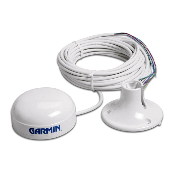
Page 12: Mechanical Characteristics & Mounting
Figure 3b. GPS 17x NMEA 0183 HVS Power/Data Cable MECHANICAL CHARACTERISTICS & MOUNTING The following drawing shows an example for mounting hardware in case you wish to design your own custom mount. Figure 4a shows the dimensions of the bottom of the GPS 17x HVS. Figure 4. -
Page 13: Gps 17X Hvs Software Interface
NMEA 0183 sentences. The characters “$P” indicate that the sentence is a proprietary implementation and the characters and “GRM” indicate that it is Garmin’s proprietary sentence. The letter (or letters) that follow the characters “$PGRM” uniquely identifies that particular Garmin proprietary sentence. -
Page 14: Sensor Initialization Information (Pgrmi)
4.1.2 Sensor Initialization Information (PGRMI) The PGRMI sentence provides information used to initialize the GPS sensor’s set position and time used for satellite acquisition. Receipt of this sentence by the GPS sensor causes the software to restart the satellite acquisition process. If there are no errors in the sentence, it will be echoed upon receipt. -
Page 15: Additional Sensor Configuration Information (Pgrmc1)
All other NMEA 0183 sentence transmission will be suspended temporarily. Sending the sentence “$PGRMO,,G” will cause the COM port to change to Garmin Data Transfer format for the duration of the power cycle. The Garmin mode is required for GPS 17x HVS series product software updates. -
Page 16: Transmitted Nmea 0183 Sentences
4.2 TRANSMITTED NMEA 0183 SENTENCES The subsequent paragraphs define the sentences that can be transmitted by the GPS 17x HVS. 4.2.1 Sentence Transmission Rate Sentences are transmitted with respect to the user selected baud rate. The GPS sensor will transmit each sentence (except where noted in particular transmitted sentence descriptions) at a periodic rate based on the user selected baud rate and user selected output sentences. -
Page 17: Global Positioning System Almanac Data (Gpalm)
4.2.2 Transmitted Time The GPS sensor outputs Coordinated Universal Time (UTC) date and time of day in the transmitted sentences. Before the initial position fix, the on-board clock provides the date and time of day. After the initial position fix, the date and time of day are calculated using GPS satellite information and are synchronized with the measurement pulse output. -
Page 18: Global Positioning System Fix Data (Gpgga)
4.2.4 Global Positioning System Fix Data (GPGGA) $GPGGA,<1>,<2>,<3>,<4>,<5>,<6>,<7>,<8>,<9>,M,<10>,M,<11>,<12>*hh<CR><LF> <1> UTC time of position fix, hhmmss format for GPS 17x HVS <2> Latitude, ddmm.mmmm format for GPS 17x HVS (leading zeros will be transmitted) <3> Latitude hemisphere, N or S <4> Longitude, dddmm.mmmm format for GPS 17x HVS (leading zeros will be transmitted) <5>... -
Page 19: Recommended Minimum Specific Gps/Transit Data (Gprmc)
4.2.7 Recommended Minimum Specific GPS/TRANSIT Data (GPRMC) $GPRMC,<1>,<2>,<3>,<4>,<5>,<6>,<7>,<8>,<9>,<10>,<11>,<12>*hh<CR><LF> <1> UTC time of position fix, hhmmss format for GPS 17x HVS <2> Status, A = Valid position, V = NAV receiver warning <3> Latitude, ddmm.mmmm format for GPS 17x HVS (leading zeros must be transmitted) <4>... -
Page 20: Map Datum
Time dilution of precision, 0 to 9 (rounded to nearest integer value) 4.2.12 Map Datum (PGRMM) The Garmin Proprietary sentence PGRMM gives the name of the map datum currently in use by the GPS sensor. This information is used by the Garmin MapSource real-time plotting application. - Page 21 NMEA 0183 RMC sentence. The accuracy of the one-pulse-per-second output is maintained only while the GPS receiver is computing a valid position fix. To obtain the most accurate results, the one-pulse-per-second output should be calibrated against a local time reference to compensate for cable and internal receiver delays and the local time bias.
-
Page 22: Appendix A: Earth Datum List
APPENDIX A: EARTH DATUM LIST The following is a list of the Garmin GPS 17x HVS Earth datum indices and the corresponding earth datum name (including the area of application): ADINDAN–Ethiopia, Mali, Senegal, Sudan AUSTRALIAN GEODETIC 1984–Australia, Tasmania Island ASTRO DOS 71/4–St. Helena Island ASTRONOMIC STATION 1952–Marcus Island... - Page 23 KERTAU 1948–West Malaysia, Singapore L.C. 5 ASTRO–Cayman Brac Island LIBERIA 1964–Liberia LUZON–Mindanao Island LUZON–Phillippines (excluding Mindanao Island) MAHE 1971–Mahe Island MARCO ASTRO–Salvage Islands MASSAWA–Eritrea (Ethiopia) MERCHICH–Morocco MIDWAY ASTRO 1961–Midway Island MINNA–Nigeria NORTH AMERICAN 1927–Alaska NORTH AMERICAN 1927–Bahamas (excluding San Salvador Island) NORTH AMERICAN 1927–Central America (Belize, Costa Rica, El Salvador, Guatemala, Honduras, Nicaragua) NORTH AMERICAN 1927–Canal Zone...
- Page 24 PROVISIONAL SOUTH AMERICAN 1956–Bolivia, Chile, Colombia, Ecuador, Guyana, Peru, Venezuela SOUTH AMERICAN 1969–Argentina, Bolivia, Brazil, Chile, Colombia, Ecuador, Guyana, Paraguay, Peru, Venezuela, Trinidad and Tobago SOUTH ASIA–Singapore PROVISIONAL SOUTH CHILEAN 1963–South Chile SANTO (DOS)–Espirito Santo Island SAO BRAZ–Sao Miguel, Santa Maria Islands (Azores) SAPPER HILL 1943–East Falkland Island SCHWARZECK–Namibia SOUTHEAST BASE–Porto Santo and Madeira Islands...
-
Page 25: Appendix B: Garmin Binary Output Format
Interface. Refer to the Garmin Device Interface Specification found in the Garmin Device Interface SDK for details on how to form and parse Garmin packets. At the time of this printing, these specs are available from the technical suppport section of our Web site: www.garmin.com/support/commProtocol.html. - Page 26 Satellite Data Record The satellite data has a record ID of 0x72 with 84 (0x54) data bytes. The data bytes contain data for 12 satellites as described below. typedef struct uint8 svid; //space SBAS(WAAS/EGNOS/MSAS) ) uint16 snr; //signal-to-noise ratio uint8 elev;...
- Page 27 Longitude velocity (meters/second) lat_vel Latitude velocity (meters/second) alt_vel Altitude velocity (meters/second) msl_hght Height (mean sea level) (meters) leap_sec UTC leap seconds grmn_days Garmin days (days since December 31, 1989) 190-00885-07 GPS 17x HVS Technical Specifications Page 23 Rev. A...
- Page 28 DLE and ETX bytes: Sample C code to receive the two records should filter DLE and ETX bytes as described below: typedef enum DAT, DLE, } rx_state_type; /* Declare and initialize static variables */ static char in_que[ 256 ]; static int in_que_ptr = 0;...
-
Page 29: Appendix C: Changing The Baud Rate In Garmin Mode
APPENDIX C: CHANGING THE BAUD RATE IN GARMIN MODE In certain cases, you may need to change the default baud rate of your Garmin GPS receiver while in Garmin mode. Follow these steps to temporarily change the baud rate. Refer to the Garmin Device Interface Specification found in the Garmin Device Interface SDK for details on how to form and parse Garmin packets. -
Page 30: Appendix D: Gps 17X Hvs And Windows Serial Mouse Issue
Solution 3: Change the default output of the GPS 17x HVS so that it does not automatically send NMEA 0183 data to the computer (change the default configuration to enable “Binary Output Data”). Use the Garmin Sensor Configuration Software, named SNSRXCFG.EXE, provided on the Web site to enable “Binary Output Data.” To download the software, start at www.garmin.com/oem, select the GPS 17x HVS, and then select Updates and... - Page 31 Sensor Configuration. 8. Place a check mark in the box next to “Binary Output Data” to change the GPS 17x HVS to Garmin Mode. The unit will keep this change in the programming until you change it again in the software.
-
Page 32: Appendix E: Sensor Configuration Software
Selecting a Model After opening the program (snsrcfg.exe), the Set Base Model to… Window appears. Select the radio button next to the type of Garmin sensor you are configuring. Connecting to the Sensor After selecting the type of sensor, the following window opens. This is the Main Interface Screen for the program. -
Page 33: File Menu
File Menu The File Menu allows you to open, save, and print sensor configurations. The items in the File Menu work like most Windows-based programs. Comm Menu The Comm (Communication) Menu allows you to set the port number, baud rate, and then connect and disconnect from the sensor. -
Page 34: View Menu
Switch to NMEA Mode (F10): Switches the unit to NMEA Mode. The sensor must be in NMEA Mode when connected to this software. Switch to Garmin Mode (F11): Switches the unit to Garmin Mode. Update Software (F12): After you have downloaded a new software version for the sensor, you can update the sensor with the new software.
Need help?
Do you have a question about the HVS GPS17 and is the answer not in the manual?
Questions and answers