Garmin GPSMAP 392, 398, 492, 498 Owner's Manual
Garmin owner's manual gpsmap 392,398,492,498
Hide thumbs
Also See for GPSMAP 392, 398, 492, 498:
- Quick reference manual (2 pages) ,
- Specifications (2 pages)
Table of Contents
Advertisement
Quick Links
Advertisement
Table of Contents

Related Manuals for Garmin GPSMAP 392, 398, 492, 498


Summary of Contents for Garmin GPSMAP 392, 398, 492, 498
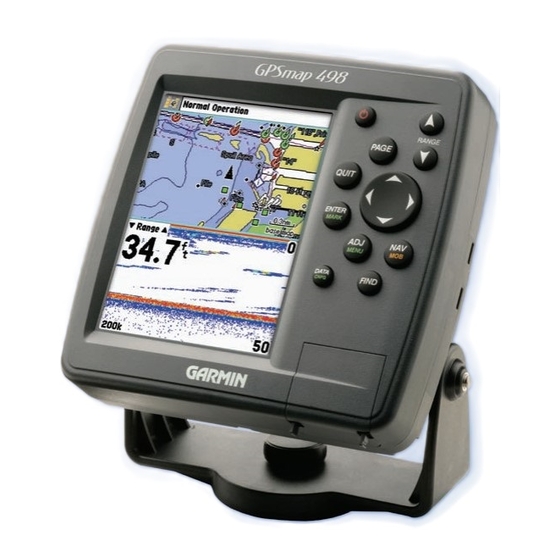
- Page 1 Owner’s Manual GPSMAP 392/398 GPSMAP 492/498 GPSMAP 498 shown...
- Page 2 Information in this document is subject to change without notice. Garmin reserves the right to change or improve its products and to make changes in the content without obligation to notify any person or organization of such changes or improvements. Visit the Garmin Web site (www.garmin.com) for current updates and supplemental information concerning the use and operation of this and other Garmin products.
-
Page 3: About This Manual
® The GPSMAP 392/398/492/498 utilizes the proven performance of Garmin GPS and full-featured mapping to create an unsurpassed portable GPS receiver. Take a moment now to compare the contents of this package with the packing list on the outside of the box. If any pieces are missing, contact your Garmin dealer immediately. -
Page 4: Table Of Contents
NTRODUCTION ABLE OF ONTENTS Table of Contents Introduction ...i About This Manual ... i Manual Conventions ... i Warning ... iv Caution ... v Care Information ... vi Basic Operation ...1 Initializing the Receiver ... 1 Simulator Mode ... 3 Adjusting the Backlight ... - Page 5 Using Sonar ...72 Understanding Sonar ... 72 Sonar Tab Options ... 79 Flasher Page ... 84 Map Split Page ... 85 Appendix ...86 Specifications ... 86 Installing the GPSMAP 492/498 External GPS Antenna ... 87 Mounting the GPSMAP 392/398/492/498 ... 88 Installing the Transducer ...
-
Page 6: Warning
This Notice is being provided in accordance with California’s Proposition 65. If you have any questions or would like additional information, please refer to our Web site at http://www.garmin.com/prop65. Use the electronic chart in the GPSMAP 392/398/492/498 only to facilitate, not to replace, the use of authorized government charts. -
Page 7: Caution
The Global Positioning System (GPS) is operated by the United States Map Data Information: One of the goals of Garmin is to provide customers with the most complete and accurate cartography that is available to us at a reasonable cost. We use a combination of governmental and private data sources, which we identify in product literature and copyright messages displayed to the consumer. -
Page 8: Immersing The Unit In Water
To resolve problems that cannot be remedied using this manual, contact Garmin Product Support in the U.S. at 800/800-1020 or Garmin Europe at 44/0870-8501241. GPSMAP 392/398/492/498 Owner’s Manual... -
Page 9: Basic Operation
ASIC PERATION Initializing the Receiver The first time you turn on the GPSMAP 392/398/492/498, the receiver must be given an opportunity to collect satellite data and establish its present location. To ensure proper initialization, the GPSMAP 392/398/492/498 is shipped from the factory in AutoLocate Mode. - Page 10 ASIC PERATION NITIALIZING THE ECEIVER To graphically initialize the GPSMAP 392/398/492/498: 1. Press and hold ADJ/MENU for the Main Menu. Press up or down on the ROCKER until the GPS tab is highlighted, and then press ADJ/MENU once. 2. Using the ROCKER, highlight Initialize Position, and press ENTER.
-
Page 11: Simulator Mode
Simulator Mode Simulator Mode turns the GPS receiver off for use indoors or practice. You can perform any of the functions discussed in the following pages in Simulator Mode. Keep in mind that the GPSMAP 392/398/492/498 does not track satellites in Simulator Mode, and this mode should never be used for actual navigation. -
Page 12: Adjusting The Backlight
ASIC PERATION DJUSTING THE ACKLIGHT The Set Position, Track Control, Track and Speed fields only show while in Simulator Mode. To enter a simulated speed and heading from the Main Menu: 1. Press and hold ADJ/MENU to show the Main Menu. 2. -
Page 13: Interface Keys
Interface Keys POWER Key • Press and hold to turn the unit on or off. • Press and release to adjust backlighting. PAGE Key • Press to cycle through the main pages. • Press to end an operation in progress and return to the main page. -
Page 14: Entering Data And Selecting Options
ASIC PERATION NTERING ATA AND ELECTING Entering Data and Selecting Options You can select and start options, and enter data to customize the GPSMAP 392/398/492/498 to fit your requirements. Use the ENTER key and the ROCKER to select options, enter names and numbers in data fields, and start your selections. -
Page 15: Using The Map Pointer
Using the Map Pointer The map pointer is controlled by the ROCKER. You can pan to map locations, mark and edit waypoints and routes, and review position data of on-screen map items and waypoints. When you move the map pointer over a map item, a highlighted description of that item appears. -
Page 16: Enter/Mark Key
ASIC PERATION REATING AND SING AYPOINTS Creating and Using Waypoints The GPSMAP 392/398/492/498 stores up to 3,000 alphanumeric waypoints with a user-defined symbol, comments, depth, and water temp, available for each waypoint. Waypoints can be created using two basic methods: ENTER/MARK Key—marks your present location, and provides options to select a map location or map item from the Map Page. -
Page 17: Creating Waypoints Graphically
5. To enter optional comments or a depth, highlight the Comments, Depth, or Water Temp, and press ENTER/MARK, use the ROCKER to enter a value, and press ENTER/MARK. 6. To manually enter a set of coordinates, highlight the location coordinates, and press ENTER/MARK, use the ROCKER to enter the new coordinates, and press ENTER/MARK when finished. -
Page 18: Man Overboard (Mob)
ASIC PERATION OARD Man OverBoard (MOB) The Man OverBoard function (MOB) simultaneously marks and sets a course back to the marked location for quick response to emergency situations. The MOB function allows you to quickly start navigation back to a location. To start the MOB function: 1. -
Page 19: Reviewing And Editing Waypoints
Reviewing and Editing Waypoints You can review, modify, rename, move, or delete waypoints at any time using the Waypoint Edit Page. The Waypoint Edit Page is available for any stored waypoint. Select the waypoint on the map or from the waypoint lists in the Main Menu—Points tab. To access the Waypoint Edit Page: 1. -
Page 20: Navigating To A Destination
ASIC PERATION AVIGATING TO A ESTINATION To change the waypoint symbol: 1. Highlight the waypoint symbol field to the left of the waypoint name, and press ENTER. 2. Use the ROCKER to select a new symbol, and press ENTER. To change the Comment, Location, Coordinates, Depth, or Water Temp: 1. -
Page 21: Selecting A Go To Graphically
To start a Go To from a point list: 1. Press NAV. Highlight Go To Point, and press ENTER. 2. From the Find menu, highlight Waypoints or another menu option, and press ENTER. 3. To select a waypoint from the waypoint lists, use the ROCKER to highlight either the By Name or Nearest tab, select a waypoint, and press ENTER. -
Page 22: Tracback Navigation (Navigating A Track)
ASIC PERATION AVIGATING TO A ESTINATION To Go To a new map point (non-map item): 1. Use the ROCKER to move the map pointer to location. 2. Press NAV. 3. With Go To MAP Point highlighted, press ENTER. TracBack Navigation (Navigating a Track) The TracBack function retraces your path to the starting point using the track log automatically stored in the receiver’s memory. - Page 23 To clear the track log: 1. Press and hold ADJ/MENU to show the Main Menu. 2. Using the ROCKER, highlight the Track tab, and then highlight the Active sub tab. 3. Use the ROCKER to select the Clear button, and press ENTER.
-
Page 24: Following A Track
ASIC PERATION AVIGATING TO A ESTINATION To start a TracBack using the NAV key: 1. Press NAV, highlight TracBack, and press ENTER. 2. To stop TracBack navigation, press NAV, highlight Stop Navigation, and press ENTER. When a TracBack is active, the GPSMAP 392/398/492/498 takes the track log currently stored in memory and divides it into segments called legs. -
Page 25: Creating And Using Routes
Creating and Using Routes You can create and store up to 50 user-defined reversible routes (numbered 1-50), with up to 300 points each. Route Tab To navigate a QUICK NAV route: 1. Press NAV/MOB, and highlight Follow Route. 2. Press ENTER, and highlight Create QUICK NAV Route. 3. - Page 26 ASIC PERATION OUTES ADD appears below the map pointer as you insert points. To create a route using the Route list: 1. Press and hold ADJ/MENU to show the Main Menu. 2. Use the ROCKER to highlight the Route tab, and press ADJ/MENU to show the Route Options menu.
-
Page 27: Find
The following options are available on the Navigation menu by pressing NAV while navigating a route: • Invert Route—reverses the route so you can follow it from the end point back to the beginning. • Re-Evaluate Route—recalculates and reactivates the current route data. - Page 28 ASIC PERATION To Find an item from your current location: 1. From any page, press FIND. 2. Using the ROCKER, highlight a category from the list, and press ENTER. 3. For waypoints and cities, search using By Name or Nearest. Use the ROCKER to highlight a tab. For By Name, use the top field to spell out the name, or scroll down through the list.
-
Page 29: Additional Information
Additional Information Each item on the map has information about the point available. The information varies depending on the type of data loaded on the optional data card. Sub tabs along the top of the detail window contain the information available for the item. Any additional options are shown along the bottom. -
Page 30: Understanding Position Reports
Go To. In order to use DSC, users must first register their VHF radio with the FCC and receive a Maritime Mobile Service Identity (MMSI) number. Garmin does not provide MMSI numbers. For more information about Digital Selective Calling and Maritime Mobile Service Identity (MMSI) numbers, refer to “Appendix.”... -
Page 31: Dsc Directory
When a distress call or position report is placed in the Call List and Log, the information on the Notification Page is retained. To review a DSC call or log entry, highlight the entry and press ENTER. The DSC Entry Review Page is identical to the Notification Page with one exception, the entry can be deleted. -
Page 32: Navigating To A Position Report Or Distress Call
ASIC PERATION 3. Enter the MMSI number, a name, and any comments. 4. When finished, highlight OK, and press ENTER. New Directory Item Page When a distress call, position report, or directory item is named, the name is attached to that particular MMSI number. If a name is used, all DSC entries of the same MMSI number show the name. -
Page 33: Setting Up Dsc
Setting up DSC The DSC Setup tab turns DSC chartplotter information screen On and Off. This also allows you to simulate distress calls and position reports while the unit is in Simulator Mode (see Simulating calls is helpful for practice before connecting to the real system. -
Page 34: Main
> AGES VERVIEW AGES There are four main pages that are always available: Map, Compass, 3D Highway, and Active Route. Pressing PAGE opens a Pages window. You can use the ROCKER or press PAGE repeatedly to cycle though the pages. Three more pages, Map Split, Sonar, and Flasher, are available when the GPSMAP 392/398/492/498 Sounder receives sonar input. -
Page 35: Map Page
Map Page The Map Page provides a comprehensive display of electronic cartography, plotting, and navigational data. When using the unit with optional BlueChart or MapSource data, the Map Page shows your boat on a digital chart, complete with geographic names, map items, navaids, and a host of other chart features. - Page 36 AGES Using the Map Pointer The map pointer pans away from your present location (even outside of your current detail coverage.) As you pan past the edge of the current Map Page, the screen actively scrolls forward to provide continuous map coverage. An hourglass symbol appears by the map pointer while the unit is busy drawing new map details.
-
Page 37: Selecting Map Zoom Ranges
Use the map pointer to create new waypoints directly from the map. To create a waypoint with the map pointer: 1. Use the ROCKER to move the map pointer to the map location. 2. Press ENTER, and the New Map Waypoint window appears. -
Page 38: Map Page Options
AGES Cartography The GPSMAP 392/398 system contains a preloaded U.S. inland freshwater cartography to its enhanced worldwide basemap information. The preloaded inland maps offer 50-meter shoreline resolution throughout the U.S., with even more detailed 10-meter resolution on select lakes. Other details include depth contours, tide and current data, boat ramps, mile markers, hazards, marinas, campgrounds, area roads, and more. - Page 39 To show and select the Map Page options: 1. Press ADJ/MENU. 2. Use the ROCKER to highlight an option, and press ENTER. The available options are Measure Distance, Show/Hide Detail, and Setup. NOTE: Map Pointer, Highway, Location, and Sonar field options are only available on medium and large sized data fields.
-
Page 40: Compass Page
AGES OMPASS Setup—configures the Map Page preferences, including map detail, map orientation, automatic zoom, and various map items and points. Refer to “Main Menu—Map Tab” on information. To change a map setup feature: 1. From the Map Page menu, highlight Setup, and press ENTER. -
Page 41: 3D Highway Page
Bearing Bearing pointer The data window, located at the top of the page, provides a user- selectable layout of various types of useful data. Each data field can be configured to show several data options. The data window layout can be configured to show additional data fields and change the size of the data shown. - Page 42 AGES IGHWAY The four data fields at the top of the page provide additional user-selectable guidance information. A compass ribbon shows your current heading along with a dark, vertical bar that indicates the direct bearing to the navigation point. When the dark vertical indicator (or arrow) lines up with the lighter red bar in the middle, you are heading directly to the navigation point.
-
Page 43: D Highway Page Options
3D Highway Page Options The 3D Highway options page selects the waypoints and tracks shown and shows/hides cartography. To show and select the 3D Highway Page options: 1. Press ADJ/MENU. Select the Hiway tab. 2. Using the ROCKER, highlight an option, and press ENTER. Check or uncheck the options you want to show or... -
Page 44: Active Route Page
AGES CTIVE OUTE Active Route Page The Active Route Page shows each point of the active route, with the point name, distance and choice of Course, ETA, Fuel, Leg Distance, Leg Fuel, Leg Time, Sunrise, Sunset, or Time To for each point from your present location. -
Page 45: Main Menu
The Main Menu provides access to various waypoint, system, navigation, interface management, and setup menus. The 19 Menu tabs are divided into categories by function. The Main Menu is available from any page in the system, and is accessed by pressing and holding ADJ/MENU. - Page 46 Accuracy Signal strength bars The status field indicates “Ready for Navigation” when the GPSMAP 392/398/492/498 has collected the necessary data from satellites to calculate a fix. The unit then updates the location, date, and time. You can use the sky view to help determine if any satellites are being blocked, and whether you have a current location fix.
-
Page 47: Gps Tab Options
GPS Tab Options The GPS tab features an options page that provides access to functions and features relating to the GPS Info Page. To show and select the GPS Tab options: 1. Press ADJ/MENU to open the Main Menu. 2. Using the ROCKER, highlight an option, and press ENTER. GPS Tab Options GPSMAP 392/398/492/498 Owner’s Manual To Disable/Enable WAAS capability:... -
Page 48: Tide Tab
Tide Tab Use the Tide tab to view tide and current information. The Tide tab contains two sub tabs: Tide and Current. Tide Tab Tide Sub Tab The Tide sub tab contains a graphical chart that shows Tide Station information in a 24-hour span starting at midnight. You can choose from different dates and more than 3,000 Tide Stations around the U.S.A. - Page 49 The numbers on the top and bottom of the left side indicate the maximum and minimum levels. The four data fields below the chart indicate event times and levels at which the tide changes starting in the upper-left field, going downward, then to the upper- right, and down again.
-
Page 50: Viewing Tide Information
Viewing Tide Information You can change the date to see tide charts for other days, or move the time bar in approximately five-minute increments to show tide heights at various times. To change the date of the tide chart: 1. Using the ROCKER, highlight the On field, and press ENTER. -
Page 51: Current Sub Tab
Current Sub Tab The Current sub tab contains graphical charts showing information for currents in a 24-hour span starting at midnight. You can choose from different dates and Current Stations around the U.S.A. coastline, Alaska, Hawaii, western Canada, and several of the Caribbean islands. -
Page 52: Trip Tab
3. Select a Current Station from the list, and press ENTER. As you move the highlight over each Current Station in the list, the station is highlighted on the Map window. The distance and bearing from your location to the highlighted station are shown at the bottom of the list. -
Page 53: Celes (Celestial) Tab
Celes (Celestial) Tab The Celestial tab shows celestial data for sun and moon rise and set, moon phase, and the approximate sky view location of the sun and moon. The moon phase shows the current visible portion of the moon as a light color. You can show this data for your present location, a location from the map, or a Find item location. -
Page 54: Points Tab
OINTS Celestial Tab Menu To change the time or date: 1. On the Celestial tab, use the ROCKER to highlight the Days or Hours button, and press ENTER. Press up or down on the ROCKER to change the days or hours. Press QUIT to exit. -
Page 55: User Waypoint List
To select the Points sub tab: 1. Use the ROCKER to highlight the Points tab. A list of stored waypoints appear to the right of the Main Menu list. 2. Press right one time on the ROCKER. The User tab is now highlighted. - Page 56 OINTS To show the waypoint menu options: Using the ROCKER, highlight the User tab, and press ADJ/MENU. To scroll through and review the waypoint list: 1. With the ROCKER, highlight the Points tab, and then highlight the User sub tab. 2.
-
Page 57: Proximity Waypoint List
To delete waypoints by symbol: 1. From the User sub tab, press ADJ/MENU. Select Delete By Symbol, and press ENTER. 2. Use the ROCKER to highlight the symbol of the waypoint(s) to delete, and press ENTER. 3. Press ENTER to delete the waypoint by symbol. Otherwise, choose Cancel, or press QUIT. - Page 58 OINTS To add a proximity waypoint: 1. On the Points tab, highlight the Proximity sub tab. 2. Press ADJ/MENU, and select New Waypoint. The Find screen appears. Highlight Waypoints, and press ENTER. 3. To select a waypoint from the list, use the ROCKER to highlight a waypoint from the User or Nearest tab.
-
Page 59: Route Tab
Route Tab The Route tab shows all the routes currently stored in memory, along with a descriptive name for each route. After you create a route, you can start using it for navigation with the NAV key. You follow the route in the same sequence as it was originally created, or you can invert the route and navigate from the end waypoint back to the beginning waypoint. -
Page 60: Route Review Page
OUTES Route Review Page After you create a route, use the Route Review Page to review and modify the route shown. To show the Route Review Page: 1. Press and hold ADJ/MENU, and then highlight the Route tab. 2. Highlight the route you want to review, and press ENTER. You are now on the Route Edit Map Page. -
Page 61: Route Review Menu Options
On the Route Review Page, you can review the route points (waypoints or map items) one at a time from the list. To review individual route points: 1. Highlight a route, and press ENTER. 2. Press ADJ/MENU, highlight Use List, and press ENTER. 3. - Page 62 OUTES To add a point to an existing route: 1. From the Route Review Page, press ADJ/MENU, highlight Use Map, and press ENTER. 2. Use the ROCKER to move the map pointer labeled “ADD” to the next point in the you want in the route. 3.
- Page 63 To add turns at the beginning or end of the route: 1. Select the first (to add waypoints to the beginning of the route) or last (to add waypoints to the end of the route) route waypoint with the map pointer, and press ADJ/MENU. 2.
- Page 64 OUTES Drag the route leg to an existing waypoint (shown), map item, or a blank spot on the map to create a new route point. Remove—removes a point (waypoint or map item) from a route. This option is available from both the Route Review and Active Route Pages.
-
Page 65: Track Tab
Track Tab Use the Track tab to specify whether or not to record a track log, define how it is recorded, or save track log data for future use. The Track Logs Page also provides an indicator of the memory used for the active track log and allows you to clear the track memory. - Page 66 RACK For the Active tab, the following settings are available: • Record Mode—contains three track recording options: • Off—no track log is recorded. If you select Off, you cannot use the TracBack feature. • Fill—a track log is recorded until the track memory is full.
-
Page 67: Dsc Tab
The Card tab contains options for saving waypoints, routes and tracks to a data card. When data is saved to a data card, it can be exchanged with other compatible units and Garmin’s MapSource software program on your PC. To transfer data on your PC to or from a data card: 1. -
Page 68: Msgs Tab
Msgs Tab The Message tab on the Main Menu shows a list of messages generated by your GPSMAP 392/398/492/498. Use the ROCKER to scroll through the entire list of messages on the Log tab. To view the messages: 1. Press and hold ADJ/MENU twice to open the Main Menu. 2. -
Page 69: Pages Tab
Pages Tab The Pages tab allows you to turn main pages on or off and customize the order. To turn a main page on or off: 1. Use the ROCKER to highlight the page name field. Press ENTER to show a list of pages available. 2. - Page 70 • Orientation—North up: fixes the top of the Map Page to a north heading. Track up: fixes the top of the Map Page to the current track heading. Course up: fixes the map so the direction of navigation is always up. Detail Sub Tab •...
-
Page 71: Source Sub Tab
Source Sub Tab • Basemap—On, Off: turns the built-in base map on or off. • Advanced—On, Off: turns all optional BlueChart/ MapSource data loaded on the data card on or off. The Advanced option box shows a list of the optional BlueChart/ MapSource data loaded on the data card. -
Page 72: Hiway (Highway) Tab
IWAY ONAR Hiway (Highway) Tab The Hiway tab contains screen settings for the 3D Highway Page. Refer to the “Highway Page” section on Temp (Temperature) Tab The Temp tab shows the water temperature log. The temperature log requires input from a temperature transducer/sensor or from a connected NMEA device that provides temperature data. -
Page 73: Systm (System) Tab
• Prepare SW Update Card—prepares a data card to accept software updates from your computer through the data card programmer. Press ADJ/MENU for the following options: • Factory Defaults—restores all settings to Garmin’s original setup values for the entire unit. YSTM YSTEM... - Page 74 YSTM YSTEM Units Sub Tab The Unit tab defines the Position Format, Map Datum, Heading, Distance, Speed, Elevation, Depth, Temperature, and Pressure units. The following settings are available: • Position Format—changes the coordinate system. Only change the position format if you are using a map or chart that specifies a different position format or want to use a format you are familiar with.
- Page 75 • Distance, Speed and Elevation—sets the units of measure for distance, speed, and elevation readouts in Nautical (nm, kt, ft), Nautical (nm, kt, m), Statute (mi, mh, ft), or Metric (km, kh, m) terms. • Heading—sets the reference used in calculating heading information.
- Page 76 Almanac, Request Proximity, Request Routes, Request Tracks, Request Waypoints, Send Almanac, Send Proximity, Send Routes, Send Tracks, and Send Waypoints. • Garmin Remote Sonar—required for use with the GSD 22, GSD 21, or GSD 20. • NMEA In/NMEA Out—supports the input/output of standard NMEA 0183 data, and sonar NMEA input support for the DPT, MTW and VHW sentences.
- Page 77 2. Use the ROCKER to select a setting, and press ENTER. GPSMAP 392/398/492/498 Owner’s Manual To select a transfer mode: 1. Use the ROCKER to select Garmin Data Transfer in the Serial Data Format field. 2. Highlight the Transfer Mode field, and press ENTER.
-
Page 78: Alarm Tab
LARM To adjust the NMEA output: 1. From the Comm tab, highlight NMEA Setup, and press ENTER. 2. Highlight an option, and press ENTER. 3. Use the ROCKER to select a setting, and press ENTER. Press QUIT to return to the Comm tab. Advanced NMEA Output Setup Page Alarm Tab... - Page 79 • Arrival—sets an alarm to sound when at specified distance or time away from a destination waypoint. Enter a distance radius or time for sounding the alarm and use the control field to set the alarm to Off, Dist (Distance), or Time. •...
-
Page 80: Using Sonar
SING ONAR ONAR SING ONAR This section covers the additional sonar options for the GPSMAP 398/498 when used with a transducer and the GPSMAP 392/492 when used with a GSD 22, GSD 21, GSD 20 and tranducer. Read the Installation Instructions to properly install the GSD 22, GSD 21, or GSD 20 and transducer. -
Page 81: Understanding The Sonar Display
Narrow Beam The wide beam is more helpful in shallow water, because it gives you a much wider view of objects in the water, including areas beyond the sides of your boat. At a 30-foot depth, the wide beam covers the area of approximately a 20-foot circle. GPSMAP 392/398/492/498 Owner’s Manual Understanding the Sonar Display One of the first things to understand about sonar is that the... -
Page 82: Sonar Page
SING ONAR ONAR At the top of the screen, you might see a grouping of intense colors. This area is surface clutter, which can be caused by waves or any other sonar interference at the surface of the water. Too much surface clutter can obscure your view of fish. -
Page 83: Using The Sonar Adjustment Menu
Using the Sonar Adjustment Menu The Sonar Adjustment menu gives you direct access to the settings and features most commonly used on the Sonar Page. The option selected currently appears in the upper-left corner of the screen. Press ADJ/MENU to see a list of all options and their current settings. - Page 84 SING ONAR ONAR If Frequency is set to Dual, you can set the Gain separately for each frequency (50 kHz and 200 kHz). Color Gain—ccontrols what colors are applied to the objects on the screen. Auto (default) is the recommended setting. It automatically sets the colors, based on your Auto Color Gain setting.
- Page 85 Zoom—sets a screen zoom scale. The following settings are available: • Off—turns off the Zoom function. • 2x Zoom––displays the 2x zoomed picture. • 4x Zoom––displays the 4x zoomed picture. • Btm (Bottom) Lock––displays returns from the bottom up. When using this setting, “BL” appears at the bottom of the screen.
- Page 86 SING ONAR ONAR PTIONS Show/Hide Pointer—allows you to reference sonar items and mark underwater waypoints. This makes it easier to find and use an object such as a stump for a future fishing location. When using this feature, the Sonar Page pauses. The map pointer does not move off the paused screen and cannot show an area that has scrolled off the screen.
-
Page 87: Sonar Tab Options
Sonar Tab Options When a GSD 22, GSD 21, or GSD 20 is connected to the GPSMAP 392/398/492/498, the Sonar tab appears on the Main Menu. Show Numbers Option To access and change a setting on the Sonar tab: 1. Press and hold ADJ/MENU to access the Main Menu. Use the ROCKER to highlight the Sonar tab. - Page 88 SING ONAR NDERSTANDING ONAR Auto Color Gain—controls what colors are applied to the objects on the screen. Color DCG is based on depth and makes it easier to spot subtle changes in bottom conditions or fish sizes. DynaColor (default) represents the latest in sonar data presentation and is recommended for all applications.
-
Page 89: Graph Sub Tab
To calibrate the water speed: 1. Use the ROCKER to highlight Calibrate Water Speed, and press ENTER. 2. Bring the boat to a cruising speed. Both the top GPS ground speed and uncalibrated water speed appear at the bottom of the calibration window. Note your top speed, stop the boat, and press ENTER. -
Page 90: Transducer Coverage
SING ONAR NDERSTANDING ONAR • Scale—controls the appearance of the depth scale shown vertically along the right side of the graph. You can configure the depth scale to appear in one of four different ways: as an Overlay, in the Corners, Basic, or No Scale. •... - Page 91 Thermoclines are shown as the weakest colors. One of the unique features offered by Garmin is See-Thru technology, which allows the GPSMAP 392/398/492/498 to hear both weak and strong signals simultaneously so as to identify fish returns under the toughest conditions, such as suspended in...
-
Page 92: Flasher Page
SING ONAR LASHER Flasher Page The Flasher page provides an almost instantaneous return of what is below your boat. This page can show depth, fish, bottom content, and structure. When you use the Flasher page, you can adjust the Range, Gain, Color Gain, Frequency, and Scroll settings. See page 79 for information about these settings and how to change them. -
Page 93: Map Split Page
The fish mark itself holds a lot of information. You can tell if fish are bigger or smaller, because the thickness of the red mark correlates to the thickness of the fish. Flasher Page Without Data Fields GPSMAP 392/398/492/498 Owner’s Manual SING Map Split Page The Map Split Page is horizontally divided into two main areas, the... -
Page 94: Appendix
PPENDIX PECIFICATIONS PPENDIX Specifications Physical Specifications Size: (Internal Antenna) 6.2" H x 6.30" W x 3.14" D (15.7 cm x 16.0 cm x 8.0 cm) (External Antenna) 6.2" H x 6.30" W x 3.26" D (15.7 cm x 16.0 cm x 8.3 cm) Weight: Less than 2.0 lb Display: 5.0"... -
Page 95: Installing The Gpsmap 492/498 External Gps Antenna
NSTALLING THE Suggested locations for mounting the external antenna. The Garmin antenna screws directly onto any standard 1" x 14- thread antenna mount. If you need to raise the antenna to avoid shading, try using a 1" x 14-thread extension mast available at most marine dealers. -
Page 96: Mounting The Gpsmap 392/398/492/498
PPENDIX OUNTING THE To install the GPS antenna: 1. Screw the antenna directly onto the 1 2. Route the cable to the mounting location of the unit. Use the appropriate tie-wraps, fasteners, and sealant to secure the cable along the route and through any bulkhead or deck. 3. - Page 97 Tools (not included)—Drill, Screwdriver (Phillips or Standard), three #8 (4 mm) pan head machine bolts with matching nuts and washers and a 5/32” (5 mm) drill bit, OR three #8 pan head self-tapping screws and an appropriately-sized drill bit for drilling starter holes.
-
Page 98: Installing The Transducer
PPENDIX NSTALLING THE RANSDUCER Installing the Transducer The transducer acts as the eyes and ears of your new sonar. Proper transducer installation is critical to the operation of your unit. The transducer transmits sound waves toward the bottom in a cone shape. -
Page 99: Transom Mount Transducer
The following diagram is for mounting the transducer included with the GPSMAP 392/398/492/498 with transducer package. If the transducer lead is too short, extension cables are available from your Garmin dealer. DO NOT cut the transducer lead or any part of the transducer cable, as this will void your warranty. -
Page 100: Connecting The Power/Data Cable
PPENDIX ONNECTING THE OWER Connecting the Power/Data Cable The power/data cable connects the GPSMAP 392/398/492/498 to a DC supply and provides interface capabilities for connecting external devices. The color code in the diagram below indicates the appropriate harness connections. Replacement fuse is a AGC/3AG - 3 Amp fuse. -
Page 101: Interfacing
GPSMAP 392/398/492/498 accepts NMEA input with support for the DBT, DPT, MTW, VHW, and WPL sentences. GPSMAP 392/398/492/498 Owner’s Manual You can download a copy of Garmin’s proprietary communication protocol on the Help and Support section of our Web site at www.garmin.com. -
Page 102: Installing And Removing Data Cards
If you insert a data card and get a “card format not recognized” message, try removing the card and reinserting it. If the card is still not recognized, contact Garmin Support or your Garmin dealer for assistance. Data cards are not waterproof and should not be exposed to moisture or excessive static charges. -
Page 103: Gpsmap 392/398/492/498 Owner's Manual
(WAAS) is being applied to that satellite. Date, Time, and Current Location The GPS gets date and time information from the satellite’s on-board atomic clock. When the GPS receiver has achieved a GPS location, the current location appears in the selected location format. -
Page 104: What Is Waas/Egnos
GPS satellites alone. For this reason, when you enable WAAS on your Garmin GPS receiver, the receiver automatically uses the method that achieves the best accuracy. For more information, go to http://gps.faa.gov. -
Page 105: What Is A Maritime Mobile Service Identity (Mmsi)
Coast Guard when used in an emergency Distress Call. In order to obtain a MMSI number, users must register their VHF radio with the FCC (Form 605). Garmin does not supply this number. How ARE MMSI assignments obtained? -
Page 106: Navigation Terms
PPENDIX AVIGATION ERMS Navigation Terms Avg Speed—the average of all second-by-second speed readings since the last reset. Bearing (BRG)—the compass direction from your current location to a destination. Course—the course between the active from and to waypoints. Depth—the depth below the transducer. This field is active only if a transducer is connected to the GPSMAP 392/398/492/498. - Page 107 Map Pointer—an arrow pointing to your destination. Speed—the current velocity at which you are travelling, relative to a ground position. Also referred to as ground speed. Sunrise—the time at which the sun rises. Sunset—the time at which the sun sets. Time Of Day—the current time.
-
Page 108: Messages And Alarms
Battery Alarm—battery voltage has fallen below the value entered in the Battery Alarm setup. Can’t Read User Card—error reading card; remove and reinsert. Contact your dealer or Garmin Product Support if the problem persists. Can’t Read Voltages That High, Limited To Top Of Range—the voltage value in the Battery Alarm setup is higher than the unit can read. - Page 109 Simulating Operation—the unit is in Simulator Mode. Do not use for normal navigation. Sonar Failed, Unit Needs Repair—there is an internal problem with the unit. Contact your dealer or Garmin Product Support to have the unit serviced. PPENDIX ESSAGES...
- Page 110 PPENDIX ESSAGES Sonar Service Incompatible—(only applied to the GPSMAP 392/492) the external sonar device you are connected to needs a software update. Sonar Service Lost—(only applied to the GPSMAP 392/492) the external sonar device you were connected to has either been disconnected or the GPSMAP 392/492 has lost communication with the sonar device for some other reason.
-
Page 111: Loran Td System
LORAN TD System LORAN-C is a radio navigation aid operated and maintained in the United States by the United States Coast Guard. The name LORAN is an acronym for “LOng RAnge Navigation.” The LORAN system covers the entire United States and the U.S. Coastal Confluence Zone. - Page 112 TD coordinate anywhere in the world. You must know your GRI chain number and secondary stations to create a LORAN TD position. For more information, read our LORAN TD Position Format Handbook, available at the Garmin Web site (www.garmin.com/manuals/LoranTDPositionHandbook_ Manual.pdf.) GPSMAP 392/398/492/498 Owner’s Manual...
-
Page 113: Optional Accessories
WARNING: Garmin accessories have been designed and specifically tested for use with Garmin products. Accessories offered by other manufacturers have not been tested or approved for use with Garmin products. Use of such accessories could cause damage to the GPSMAP 392/398/492/498 and void the warranty. -
Page 114: Software License Agreement
FOLLOWING SOFTWARE LICENSE AGREEMENT. PLEASE READ THIS AGREEMENT CAREFULLY. Garmin grants you a limited license to use the software embedded in this device (the “Software”) in binary executable form in the normal operation of the product. Title, ownership rights, and intellectual property rights in and to the Software remain in Garmin. -
Page 115: Limited Warranty
Garmin retains the exclusive right to repair or replace the unit or software or offer a full refund of the purchase price at its sole discretion. SUCH REMEDY SHALL BE YOUR SOLE AND EXCLUSIVE REMEDY FOR ANY BREACH OF WARRANTY. -
Page 116: Fcc Compliance
Hereby, Garmin, declares that this GPSMAP 392/398/492/498 is in compliance with the essential requirements and other relevant provisions of Directive 1999/5/EC. To view the full Declaration of Conformity, see the Garmin Web site for your Garmin product: http://www.garmin.com/products/ gpsmap498/. Click Manuals, and then select the Declaration of Conformity link. -
Page 117: Index
Find key 5, 19 fish alarm fish symbols flasher page frequency 200 kHz 50 kHz gain gain setting garmin data transfer go to distress call 22, 22–24 position report GPS tab options hard bottom heading line Highway Page, 3D options... - Page 118 NDEX MMSI keel offset keypad usage key beeps narrow beam NAV/MOB Key navaids language navigating license agreement distress call LORAN TD Go To position report magnetic variation routes main menu TracBack main pages navigation terms Man OverBoard NMEA MapSource north up map datum Map Page off course alarm...
- Page 119 tide tab time format WAAS time tab disable/enable time zone warning tools waterproof TracBack water speed activate water temperature alarm track logs waypoints clear creating save creating graphically track tab editing active Enter/Mark saved move track up proximity transducer 82, 90 reviewing transducer type underwater...
- Page 122 For the latest free software updates (excluding map data) throughout the life of your Garmin products, visit the Garmin Web site at www.garmin.com. © Copyright 2006 Garmin Ltd. or its subsidiaries Garmin International, Inc. 1200 East 151 Street, Olathe, Kansas 66062, USA Garmin (Europe) Ltd.
Need help?
Do you have a question about the GPSMAP 392, 398, 492, 498 and is the answer not in the manual?
Questions and answers