Table of Contents
Advertisement
Advertisement
Table of Contents

Related Manuals for Garmin ETREX 22X


Summary of Contents for Garmin ETREX 22X
- Page 1 ETREX 22X/32X ® Owner’s Manual...
- Page 2 © 2019 Garmin Ltd. or its subsidiaries All rights reserved. Under the copyright laws, this manual may not be copied, in whole or in part, without the written consent of Garmin. Garmin reserves the right to change or improve its products and to make changes in the content of this manual without obligation to notify any person or organization of such changes or improvements.
-
Page 3: Table Of Contents
Optional Accessories ..............10 Navigating with the Compass ..........4 Pairing Your ANT+ Sensors ............. 10 Course Pointer ............... 4 Tips for Pairing ANT+ Accessories with Your Garmin Elevation Plot ................4 Device .................. 11 Calibrating the Barometric Altimeter ........4 Troubleshooting ................ -
Page 5: Introduction
Introduction Maximizing Battery Life You can do several things to extend the life of the batteries. WARNING • Reduce the backlight brightness (Adjusting the Backlight See the Important Safety and Product Information guide in the Brightness, page product box for product warnings and other important •... -
Page 6: Creating A Waypoint
You can add a .gpx file that contains waypoints by transferring Select the first point in the route. the file to the GPX folder (Transferring Files to Your Device, Select Use. page 10). Select Select Next Point to add additional points to the Creating a Waypoint route. -
Page 7: Viewing The Current Track
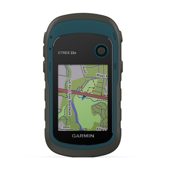
(trail). Waypoint names and symbols on the map. appear on the map. When you are navigating to a destination, your route is marked with a colored line on the map. Purchasing Additional Maps Go to your device product page at garmin.com. Navigation... -
Page 8: Navigating With The Map
Navigating with the Map Calibrating the Compass The device has a 3-axis electronic compass (eTrex 32x devices NOTICE only). You should calibrate the compass after moving long The maps included on your device can create pedestrian or distances, experiencing temperature changes, or changing the cycling routes using roads and trails, but not routes for batteries. -
Page 9: Trip Computer
You can customize chirp ™ the trip computer layout, dashboard, and data fields. A chirp is a small Garmin accessory that is programmed and ® Trip Computer Settings left in a geocache. You can use your device to find a chirp in a From the trip computer, select menu. -
Page 10: Garmin Adventures
See your operating system the battery life. documentation to learn how to map the drive. NOTE: The backlight brightness may be limited when the Open the Garmin or memory card drive or volume. battery is low. Select an option: Select . -
Page 11: Customizing The Data Fields
Press the Thumb Stick controller. Elevation Above Ground: The altitude of your current location above ground level (if maps contain sufficient elevation Customizing the Data Fields information). Elevation - Maximum: The highest elevation reached since the You can customize the data fields displayed on each main page. last reset. -
Page 12: Profiles
You must be navigating for this data to appear. USB Mode: Sets the device to use mass storage mode or Garmin mode when connected to a computer. Vertical Dist to Dest: The elevation distance between your current position and the final destination. You must be GPS and Other Satellite Systems navigating for this data to appear. -
Page 13: Time Settings
/express). On your smartphone, install the Garmin Connect ™ calculation based on distance, time, on-road, or off-road app. routing. This provides easy access to these services for Garmin devices: Calculate Routes for: Sets the method used to calculate your • Software updates route. • Map updates Lock On Road: Locks the blue triangle, which represents your •... -
Page 14: Cleaning The Device
WARNING device memory contains important system files that should not be deleted. Do not use a sharp object to remove user-replaceable batteries. Open the Garmin drive or volume. You can install a microSD ® memory card in the handheld device for additional storage or pre-loaded maps. -
Page 15: Tips For Pairing Ant+ Accessories With Your Garmin Device
• Before you pair the ANT+ accessory with your Garmin device, move 10 m (33 ft.) away from other ANT+ accessories. • Bring the Garmin device within range 3 m (10 ft.) of the ANT+ accessory. • After you pair the first time, your Garmin device automatically recognizes the ANT+ accessory each time it is activated. -
Page 16: Index
Sight N' Go 3 smartphone 5 software, updating 9 elevation 4 specifications 10 stopwatch 6 storing data 10 files, transferring 5, 10 sunrise and sunset times 6 Garmin Express 9 temperature 10 updating software 9 time settings 9 geocaches 5 time zones 9 downloading 5 tones 8 GLONASS 8 tracks 2, 3, 6 GPS 5, 8 navigating 3 satellite page 5... - Page 18 May 2019 190-02552-00_0A...
Need help?
Do you have a question about the ETREX 22X and is the answer not in the manual?
Questions and answers