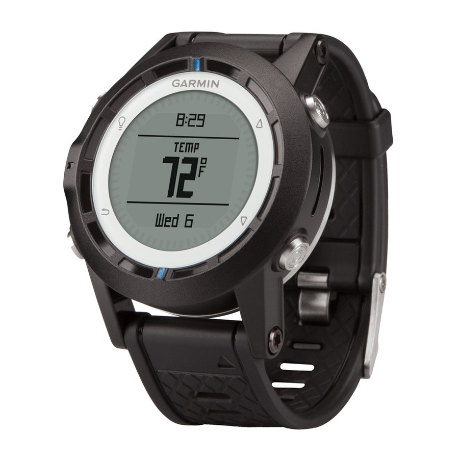
Garmin quatix Owner's Manual
Gps watch
Hide thumbs
Also See for quatix:
- Declaration of conformity (6 pages) ,
- Quick start manual (6 pages) ,
- Product information (44 pages)
Table of Contents
Advertisement
Quick Links
Advertisement
Table of Contents

Related Manuals for Garmin quatix


Summary of Contents for Garmin quatix
- Page 1 ™ Owner’s Manual April 2013 190-01594-00_0B Printed in Taiwan...
- Page 2 Garmin. The Bluetooth ® word mark and logos are owned by the Bluetooth SIG, Inc. and any use of such marks by Garmin is under license. Mac ® is a registered trademark of Apple Computer, Inc. Windows ® is a registered trademark of Microsoft Corporation in the United States and other countries. NMEA 2000 ® and...
-
Page 3: Table Of Contents
Altimeter and Barometer ............2 Changing the Plot Type ............2 Pairing ANT+ Sensors ............... 9 Calibrating the Barometric Altimeter ........2 Tips for Pairing ANT+ Accessories with Your Garmin Acquiring Satellites ..............2 Device ................... 9 Stopping GPS ............... 2 Streaming NMEA 2000 Data ............ -
Page 5: Getting Started
Getting Started When using your device the first time, you should complete these tasks to set up the device and get to know the basic features. Charge the device (page Learn about profiles and sensor data (page Acquire satellites and record your track (page Mark and navigate to a waypoint (page... -
Page 6: Sensors And Gps Data
Select the blue key. Data pages can also show data streamed from your NMEA 2000 network through a Garmin ® GNT™. Select Setup > Sensors > Altimeter > Calibrate. From the time of day page, select to cycle through Follow the on-screen instructions. -
Page 7: Stopping Navigation
The two pointer marks serve as a bearing pointer. The top The two pointer marks serve as a bearing pointer. The top blue mark points in the direction you are facing. blue mark points in the direction you are facing. Align the pointer marks with the top blue mark. -
Page 8: Routes
Sending and Receiving Data Wirelessly information about points along the recorded path, including time, location, and elevation for each point. Before you can share data wirelessly, you must be within 10 feet (3 m) of a compatible Garmin device. Navigation... -
Page 9: Map
Sail Racing Select the blue key. You can use the quatix to increase the likelihood that your boat Select Share Data > Unit to Unit. will cross the start line of a race exactly when the race begins. -
Page 10: Tack Assist
. The bezel marks provide a quick reference NOTE: The quatix uses GPS-based course over ground to that represents your lift angle. determine your course in the tack assist feature, and does not When your boat is consistently lifted, you should recalibrate the account for other factors that can affect your boat's direction, true wind direction or the angle for the current tack. -
Page 11: Configuring Tack Assist Settings
NOTE: When you recalibrate the port or starboard tack direction, the tack angle remains the same, and the mean true wind direction and the opposite tack direction are recalculated. • To change the tack angle, select Tack Angle, and select an angle. -
Page 12: Using Autopilot
Select a time zone. Using Autopilot Select an option: Before you can use the quatix to control an autopilot, you must install and configure a compatible Garmin GHP™ autopilot • To change the time zone, select Edit Zone. system and pair your quatix with the GHC device. For more •... -
Page 13: Calculating The Size Of An Area
10 m (32.9 ft.) away from other ANT+ • Select Change Units to convert the area to a different accessories. unit. • Bring the Garmin device within range 3 m (10 ft.) of the • Select to exit without saving. ANT+ accessory. -
Page 14: Tempe
The setup menu contains numerous ways to customize your Follow the on-screen instructions to select the number of device. Garmin recommends that you take the time to data fields and the type of data to appear. familiarize yourself with the settings for each feature. If you take If necessary, select an existing data page. -
Page 15: Setting The North Reference
Calibrate: Allows you to manually calibrate the compass sensor Method: Selects a track recording method. Auto records the (page tracks at a variable rate to create an optimum representation of your tracks. If you select Distance or Time, you can set Setting the North Reference the interval rate manually. -
Page 16: Updating The Software
DESCENT (descent total): The total elevation distance • Files from HomePort. Go to www.garmin.com/trip_planning. descended since the last reset. • GPI custom POI files from the Garmin POI Loader. Go to DISTANCE (trip odometer): A running tally of the distance www.garmin.com/products/poiloader. -
Page 17: Nmea 2000 Data Fields
ELEVATION: The altitude of your current location above or MOV'N AVG (moving average): The average speed while below sea level. moving since the last reset. FINAL DEST (waypoint at final destination): The last point on MOV'N TIME (moving time): A running tally of the time spent the route to the destination. -
Page 18: Data Pages
GWD (ground wind direction): The direction of the wind TWA (true wind angle): The angle of the wind relative to the relative to the land, referenced from the north. water, referenced from the bow of the boat with a port or starboard angle up to 180 degrees. -
Page 19: Troubleshooting
Select the data page you want to view while the keys are the product. Title, ownership rights, and intellectual property locked. rights in and to the Software remain in Garmin and/or its third- Hold to lock the keys. party providers. -
Page 20: Index
Index locations 2, 9 tracks 2, 4, 11 editing 3 deleting 4 saving 3 trip planner. See routes locking, keys 15 troubleshooting 15 accessories 9, 15 alarms 8 clock 8 main menu, customizing 11 unit ID 11 proximity 8 man overboard, automatic 9 units of measure 11 alerts 8 maps 4 updating software 12 location 8 browsing 5 almanac navigating 5 disconnecting 12 hunting and fishing 9... - Page 22 1200 East 151st Street Olathe, Kansas 66062, USA Garmin (Europe) Ltd. Liberty House, Hounsdown Business Park Southampton, Hampshire, SO40 9LR UK Garmin Corporation No. 68, Zhangshu 2nd Road, Xizhi Dist. New Taipei City, 221, Taiwan (R.O.C.) © 2013 Garmin Ltd. or its subsidiaries...
Need help?
Do you have a question about the quatix and is the answer not in the manual?
Questions and answers