
Related Manuals for South NAVI STATION


Summary of Contents for South NAVI STATION
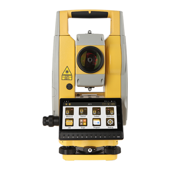
- Page 1 N1 & NAVI STATION Total Station QUICK MANUAL © South Surveying & Mapping Technology CO.,LTD All Rights Reserve...
- Page 2 N1 & NAVI STATION Quick Guide 1. Menu 1.1 Menu Explore View 1.Angle 2.Distance 3.Coordinate 1.Known Point 2.STN.Ht 3.BS Check 4.Resection 5.Point to Line 6.Free Station 1.Measure 7.STN setup w/o CP 2.Station 1.Point 3.Collect 2.Dist Offset 4.Stake Out 3.Plane Offset 5.Job...
- Page 3 1.Angle(Degree/Gon/Mil) 2.Distance(Meter/US feet/Int.Feet/US feet- inch/Int.Feet-Inch) 3.Temp Unit(°C/°F) 4.Press Unit (hPa/mmHg/inHg) 1.Min Reading(0.1”/1”/5”) 2.V angle(V0/H0/±90) 1.Unit 3.Compensator(OFF/X-Axis/XY-ON) 2.Angle 1.Min Reading(1mm/0.1mm) 3.Distance 2.Correction(0.14/0.2/Close) 4.Coordinate 3.Grid Factor(Scale factor/Ave Elev) 5.Comm. 4.T-P set (Temp/Press/PPM) 6.Adjustment 5.Mode(N times/Continuous/Tracking/Single) 7.Others 6.Target(Non-Prism/Sheet/Prism) 8.Function Key 9.Reset to Default 1.Order(NEZ/ENZ) 10.Setting 1.I Angle Set...
- Page 4 2. Measure In Measure sub menu. There are 3 basic survey method. Angle, Distant and Coordinate. Please note it is not saved any measure data under this sub menu. In Angle, you can 0 Set or input certain value Horizontal angle setting. Also, it allows switch vertical angle in regular or slope percentage, right or left of Horizontal.
- Page 5 3.2 Station Height Set Station height by measure a point with known height. Input or Call a known point height and measure it. it will calculate new height for station, press setting . 3.3 Back Sight Check Check current back sight point to shows delta value for angle or for coordinate.
- Page 6 3.6 Free Station An unknown point is used for orientation. Point data collected at this station need to be reduction following calculation to obtain the real coordinates. As the figure shows, STN locate in O point, P is unknown point for orientation, P1 is real back sight, after reduction, all points collect in blue gird will turn to real coordinates shows at green gird.
- Page 7 Application condition. A. B is known points. But it is not sighting STN. Two temporary system has public point C. Operation Process A. Station-STN setup without CP. Input or Call STN. B. To do data collect. During data collect, it needs to collect public point C.
-
Page 8: Distance Offset
4. Collect There are 8 method to do data collect. 4.1 by Points Input Name, Code, reflector height first, aim target and press Meas & Save, or directly press Save. Press Data to check all measure result and press Graph to view location. - Page 9 4.5 MLM MLM function is mainly used to compute the HD/VD/SD/Azimuth between two points. Turn on LOCK, result will be calculated by P1-P2, P1-P3. Turn off LOCK, result will be calculated by P1-P2, P2-P3. Aim Point, Press Meas, Ang.&Dist. Save. When measurement finish, press COGO to check result.
-
Page 10: Stake Out
5. Stake Out 5.1 Point Stake Out Set a coordinate for stake out, it can be called or inputted. Follow the guide on screen, move prism far/near, right /left, up /down, till to all values close to 0, then press SAVE 5.2 Angle &... - Page 11 After defined base line, input stake out point offset value and press NEXT for stake out. 5.6 Arc Stake Out It needs to define an Arc first. there are 3 method to defined Arc. By CENTER/Start Point By Start Pt, End Pt and Radius By Start Pt, Arc Pt and Ent Pt After defined Arc, Select stake out parameter.
- Page 12 7. COGO 7.1 Reduction Refer to 3.6 & 3.7 7.2 Calculate XYZ Calculate with a known point base on direction and distance offset. Press COGO to calculate and Save. 7.3 Inverse Calculate relationship between two points. Points can be called, input or measure.
- Page 13 7.6 Distance & Ange Conversion Convert the unit of distance and Angle. 7.7 Average Calculate the average value of know points. Points can be called, input or measure, press COGO to get result. 7.8 Equidistance Point Defined a line by 2 points and input interval point, all interval points will be calculated and save.
- Page 14 8. Program It includes Road design and Middle line stake out. 8.1 Road Design It can be manual input H- Alignment and V-Alignment. also, it supports import road elements by different file type. Such as excel. for H-Alignment, it needs to input elements such as intersection point NE.
- Page 15 8.2 Middle Line Stake Out Finish road design first, then open a road file, input Start Mile, interval and offset value. Start to Stake out , 9. Setting Angle Degree/Gon/Mil/DDM Unit Distance Meter/US ft/Int ft/US ft- inch / Int.ft-inch °C / F ° Temperature Press Unit hPa/mmHg/inHg...
- Page 16 I angle Set 2C Set H-Axis Error Adjustment E-Bubble Parameter-Constant set Error Display Reticle backlight ON/OFF Soft keypad ON/OFF Others EDM beep ON/OFF Measure Beep ON/OFF Quick code ON/OFF Repeat Name ON/OFF Function Key Define keys function Reset to default YES/NO Setting Update...
-
Page 17: Data Export
Code import only support TXT file and same folder as coordinate data. Graph Import. N1 and NAVI STATION support loading graph as background. In Data center, Graph, Click layer icon, press + to load graph file. - Page 18 11.GNSS Collect For Navi Station, it allows collect data by GNSS for station setup and data collect. It will ask OPEN GNSS or not when enter relate menu. for GNSS data collect, it needs to setup GNSS parameter first. Press Setting.
- Page 19 It read all data from hardware platform and distribute to data collect software such as SurveyStar or others 3 party software. Model: South TS Series Connect Type: Serial Port Device List: ttyMT3:115200 Click CONNET. In Tserver, all setting change will relate to Survey Star.
- Page 20 SOUTH SURVEYING & MAPPING TECHNOLOGY CO., LTD. Add: South Geo-information Industrial Park, No.39 Si Cheng Rd, Guangzhou, China http://www.southinstrument.com...
Need help?
Do you have a question about the NAVI STATION and is the answer not in the manual?
Questions and answers