Table of Contents
Advertisement
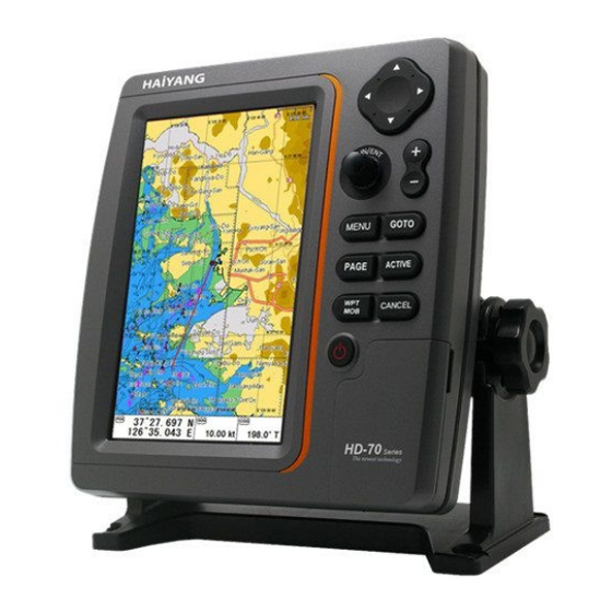
Manual
Handling
The Global Positioning System (GPS) consists of a total 24 GPS satellites that orbit the earth,
enabling you to determine your position anywhere in the world, 24 hours a day, if you can receive
satellite signals. During actual navigation, carefully compare the position data with all available
navigation sources such as Loran C, Decca, other navigators, charts, visual navigation, depth, water
temperature and others. It is your responsibility to make navigation judgments.
DGPS Operation Note :
Your position can be improved by DGPS correction. However, when you are communicating with other
ships, you may use a DGPS corrected position but they may not. Make your position source known
during communication.
The
Electronic Chart :
Only official authorized charts and notices to mariners contain all the information needed for the safety
of navigation and, as always remember, the user is responsible for their prudent use.
Pictorials
This manual uses the following symbols for easy understanding safety instructions. Always follow
these instructions carefully.
WARNING
CAUTION
Important Notice
Keep this manual in a safe place where you can access it quickly.
Always follow this safety instruction to prevent death or injury.
Follow this safety instruction to avoid possible injury or damage to your
property.
Symbol "△" is a CAUTION or WARNING label indicating the safety
instruction.
- 1 -
Advertisement
Table of Contents

Related Manuals for Haiyang HD-77CF


Summarization of Contents
Important Notices
Manual Handling Guidelines
Keep this manual in a safe place for easy access.
System Safety Warnings
General Warning Symbols
Explanation of hazard symbols like Electrical Shock and general warnings.
Installation and Maintenance Cautions
Safety Precautions for Personnel
Safety guidelines for service and maintenance personnel during installation and upkeep.
Operator's Operation Notes
Key Operational Guidelines
Important notes for operators to ensure proper system operation and prevent issues.
Welcome and Safety Introduction
Display Usage Precautions
CAUTIONary notes on using the Color LCD Charting Systems and display care.
Standard Equipment Configuration
Component List (Metal)
Lists the metal components included in the HD-70 SERIES for standard configuration.
Keypad Operation and Functions
Understanding Keypad Controls
Detailed descriptions of each key on the keypad and their respective functions.
Power and Brightness Control
Adjusting Display Settings
Instructions for controlling power, brightness, and contrast using the BRT/PWR button.
Connector Specifications
Metal and Plastic Connector Details
Specifications for various connectors (J4, J3, J2, J1) for metal and plastic models.
Navigating Display Pages
Selecting and Viewing Pages
Guide on how to select and navigate through different display pages using the PAGE key.
Screen Customization
Layout and Display Element Selection
Instructions for customizing the screen layout and selecting individual display elements.
Data Bar Customization
Editing and Formatting Data Bar
Steps for customizing and editing the information displayed in the data bar.
Navigation Data Editing
Customizing Navigation Data Fields
Procedure for selecting and editing navigation data fields like COG, BRG, RNG.
Screen Ratio Adjustment
Adjusting Plotter/Fishfinder Screen Ratios
How to adjust the screen size ratio for simultaneous plotter and fishfinder displays.
Chartplotter Display Elements
Understanding Chartplotter Graphics
Explanation of elements like scale, AIS targets, and vessel icons on the chartplotter screen.
Fishfinder Display Overview
Interpreting Fishfinder Readings
Details on interpreting frequency displays, depth bars, and data bars in fishfinder mode.
Highway Navigation Display
Highway Display Information Components
Information shown on the Highway display, including destination, XTE, and navigation data.
Steering Display Guide
Steering Display Elements Explained
Details on the steering display, including destination, XTE, and navigation information.
GPS Information Display
Satellite List and Navigation Data
Display of GPS satellite information, signal gain, and navigation data.
MOB (Man Over Board) Functionality
Using the MOB Feature
Step-by-step guide on activating, using, and deactivating the Man Over Board function.
Map Orientation Settings
True Motion, Course Up, and Head Up Modes
Explanation of different map orientation modes and their display effects.
Fishfinder Modes Explained
Normal, Bottom Zoom, and Bottom Lock Modes
Detailed descriptions of Normal, Bottom Zoom, and Bottom Lock modes in fishfinder operation.
AIS System Introduction
Improving Safety with AIS
Overview of the Automatic Identification System and its role in enhancing navigation safety.
AIS System Definitions
Key AIS Terminology Explained
Definitions of essential AIS terms such as CPA, TCPA, MMSI, and target types.
Quick AIS Target Information
Accessing AIS Target Details
Procedure to view detailed information about specific AIS targets on the screen.
Tide Information Display
Viewing Tide Data and Graphs
Displays tide information for specific locations, including graphical representations.
C-MAP Functionality
Map Information and Search Features
Using C-MAP for accessing map information and finding services or ports.
C-MAP Data Features
Tide Stations and Wreck Searches
Locating tide stations and searching for wrecks using C-MAP capabilities.
Chartplotter Menu Structure
User Data Management (WPT & Route)
Managing waypoints (WPT) and creating routes within the chartplotter menu.
Track Management (Type 1)
Erasing and Setting Up Tracks
Instructions for erasing tracks by color and configuring track setup parameters.
Track Management (Type 2)
Selecting and Configuring Track Types
Guide to selecting track indices and setting up track parameters for Type 2.
Additional Chartplotter Settings
Vessel Offset, Lines, and Track Function
Covers vessel offset, user lines, names, and the track recording function.
Track and Waypoint Customization
Selecting Track Color and WPT Symbols
Options for customizing the visual appearance of tracks and waypoints.
Waypoint Color and Navigation Settings
Customizing WPT Colors and Navigation Parameters
Settings for waypoint colors, route order, and navigation time (TTG/ETA).
AIS Vessel List and Display Management
Viewing and Sorting AIS Vessel Data
Instructions for displaying AIS targets, sorting vessels, and setting display radius.
AIS Display Options and Alarms
Filtering AIS Types and Configuring Alarms
Options for filtering AIS types and setting up various alarm parameters.
AIS Alarm and Timeout Configuration
Setting AIS Alarms and Timeouts
Configuring radius alarms, speed filters, and AIS message time out settings.
AIS Messages and Fishing Net Alerts
Handling AIS Messages and Fishing Nets
Managing AIS messages, SART messages, and setting up fishing net alarms.
Calendar and Advanced Menu Access
Checking Calendar and Loading Advanced Menu
Accessing calendar information and loading the advanced menu for further settings.
Advanced Menu - Map Settings
Map Orientation and Data Display Configuration
Configuring map orientation, user data visibility, and info display settings.
Advanced Menu - Map Modifications
Latitude, Longitude, and Map Source Selection
Modifying chart latitude/longitude and selecting map sources like HY-MAP or C-MAP.
Advanced Menu - HY-MAP and C-MAP Options
HY-MAP Features and C-MAP Settings
Customizing HY-MAP settings and configuring C-MAP features like satellite images.
Advanced Menu - C-MAP Enhancements
C-MAP Mixing Level and Language Options
Adjusting C-MAP mixing levels, perspective view, chart boundaries, and language.
Advanced Menu - Vessel and Cursor Settings
Vessel Icon, Heading Line, and Cursor Customization
Customizing vessel icon size, heading line, vessel style, and cursor appearance.
Alarm Settings - Navigation and Anchor
Configuring Navigation and Anchor Alarms
Setting up alarms for navigation (arrival, XTE) and anchor status.
Alarm Settings - Interval and User Line
Interval and User Line Alarm Configuration
Configuring interval alarms, user line alarms, and their associated radii.
Fishfinder Menu - Basic Settings
Userdata, Depth Range, and Shift Settings
Basic fishfinder menu options including userdata, depth range, and shift adjustments.
Fishfinder Menu - Interference and Noise Rejection
Reducing Interference and Noise
Functions for rejecting interference from engines and other sources of noise.
Fishfinder Advanced Menu - Display Settings
Display Options for Fishfinder Images
Settings for A-scope, image speed, white line, depth, and temperature display.
Fishfinder Advanced Menu - Color, Pulse, and Power
Color, Pulse, and Output Power Adjustments
Configuring color levels, rejection, pulse, and output power for the fishfinder.
Fishfinder Alarm Settings
Depth, Temperature, and Fish School Alarms
Setting up alarms for depth, temperature, and fish school detection.
Fishfinder - Water Temperature and Speed Source
Water Temperature Correction and Speed Source Selection
Correcting water temperature errors and selecting the speed source (Sensor/NMEA).
General Settings - GPS Configuration
GPS Coordinate System, Datum, and Modifications
Configuring GPS coordinate system, datum, and modifying latitude/longitude.
General Settings - GPS Filters and Units
GPS Filters and LAT/LON Unit Selection
Applying filters for GPS data and selecting units for latitude and longitude.
General Setup - Units and Compass Settings
Unit Selection for Distance, Depth, Temp
Selecting display units for distance, speed, depth, and temperature.
General Setup - Time and Date Configuration
Setting Time, Date, and Calendar Formats
Configuring time format, date format, and calendar settings.
General Settings - Input/Output Configuration
NMEA Output Sentences and Ports Management
Customizing NMEA-0183 sentences and managing input/output ports.
General Settings - Customizing Options
Databar and Navigation Data Customization
Customizing databar display, position, mode, and navigation data types.
System Maintenance and Information
Version Checks and Simulator Use
Checking program, OS, and map versions; using the simulator for demonstrations.
General Settings - Recording and Capture
Screen Recording and Capture Features
Using functions for recording the current screen and capturing screenshots to an SD card.
HY-MAP Icon Guide
Descriptions of HY-MAP Icons
Explanation of various icons used on HY-MAP, covering navigation aids and hazards.
Installation - Display Unit Location
Selecting an Optimal Display Location
Guidance on choosing a suitable location for the display unit for easy viewing and access.
Installation - Power and Cleaning Procedures
Power Connection and Unit Care
Instructions for connecting power and proper care and cleaning of the display unit.
NMEA Reference Information
NMEA 0183 Output Sentences Details
Reference information on NMEA 0183 standard and commonly used output data sentences.
How GPS Works
GPS Satellite Constellation Explanation
Explanation of the GPS satellite constellation and its role in position calculation.
GPS Position Calculation Method
Triangulation for Position Fixing
Describes the triangulation process used by GPS receivers to determine position.
GPS Position Fixing Accuracy
Understanding HDOP for Accuracy
Explanation of HDOP and how satellite geometry affects GPS fix accuracy.
GPS Antenna Installation Guidelines
Optimal Placement for GPS ANT Signal
Best practices for installing the GPS antenna to ensure maximum signal reception.
Installation - Display Unit Mounting
Display Unit Location and Installation Steps
Guidance on selecting a location and installing the display unit with its mounting bracket.
Installation - Power and Sensor Connections
Power Connection and Sensor Integration
Procedures for connecting power and integrating sensors for expanded unit capabilities.
Transducer Installation Guidelines
Sonar Transducer Mounting Precautions
Key considerations and precautions for installing sonar transducers for optimal performance.
Transom Transducer Mounting and Maintenance
Transom Mounting Best Practices
Guidelines for mounting transom transducers and their maintenance for consistent operation.
Through-hull Transducer Installation
Through-hull Mounting and Dead-rise Considerations
Instructions for through-hull transducer installation, including dead-rise and hull shape.
Declaration of Warranty
One Year Guarantee and Service Policy
Details of the one-year warranty, guarantee coverage, and service policy for the product.
Need help?
Do you have a question about the HD-77CF and is the answer not in the manual?
Questions and answers