Table of Contents
Advertisement
Manual
Handling
The Global Positioning System (GPS) consists of a total 24 GPS satellites that orbit the earth,
enabling you to determine your position anywhere in the world, 24 hours a day, if you can receive
satellite signals. During actual navigation, carefully compare the position data with all available
navigation sources such as Loran C, Decca, other navigators, charts, visual navigation, depth, water
temperature and others. It is your responsibility to make navigation judgments.
DGPS Operation Note :
Your position can be improved by DGPS correction. However, when you are communicating with other
ships, you may use a DGPS corrected position but they may not. Make your position source known
during communication.
The
Electronic Chart :
Only official authorized charts and notices to mariners contain all the information needed for the safety
of navigation and, as always remember, the user is responsible for their prudent use.
Pictorials
This manual uses the following symbols for easy understanding safety instructions. Always follow
these instructions carefully.
WARNING
CAUTION
Important Notice
Keep this manual in a safe place where you can access it quickly.
Always follow this safety instruction to prevent death or injury.
Follow this safety instruction to avoid possible injury or damage to your
property.
Symbol "△" is a CAUTION or WARNING label indicating the safety
instruction.
- 1 -
Advertisement
Table of Contents

Related Manuals for Haiyang HD-70 Series


Summarization of Contents
Important Notices and Safety
Manual Handling
Keep manual in a safe place for quick access.
DGPS Operation Note
Guidance on using DGPS correction and communicating position.
Electronic Chart Usage
Emphasizes using official authorized charts for navigation safety.
Pictorial Safety Symbols
Explanation and usage of warning and caution symbols in the manual.
Safety Cautions
Installation Cautions for Service Personnel
Follow installation instructions to avoid injury and malfunction.
Maintenance Cautions for Personnel
Use safety precautions for internal inspection and maintenance.
Operation Notes
Operator Guidelines
Notes for system operation to prevent failure or deterioration.
Transducer Installation Notes
Important considerations for transducer installation by authorized personnel.
Equipment Configuration
Metal Configuration List
Lists standard metal equipment configuration for the HD-70 SERIES.
Plastic Configuration List
Lists standard plastic equipment configuration for the HD-70 SERIES.
System Controls
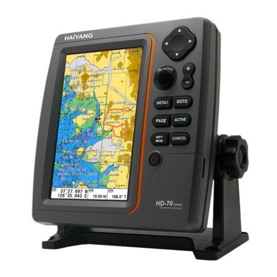
Keypad Layout and Functions
Details the functions of each key on the system's keypad.
Power and Brightness Adjustment
Instructions on how to use the power and adjust brightness/contrast.
Connector Specifications
Metal Connector Details
Technical specifications for metal connectors (J4, J3, J2, J1).
Plastic Connector Details
Technical specifications for plastic connectors (J4, J1).
Display Customization
Page Selection
How to select and view different pages on the display.
Screen Layout Customization
Instructions for selecting screen layout and display formations.
Data Bar Customization
Guide to editing and customizing the data bar information.
Navigation Data Editing
Procedure for editing and customizing navigation data fields.
Screen Ratio Adjustment
How to adjust the screen size for plotter and fishfinder.
Display Modes
Chartplotter Display
Overview of the chartplotter display elements and information.
Fishfinder Display
Description of the fishfinder display, including depth and frequency.
Highway Display
Details the highway display mode for navigation guidance.
Steering Display
Explains the steering display mode for directional guidance.
GPS Information Display
Shows receiver status, satellite list, and gain information.
Special Functions
Man Over Board (MOB) Function
How to use the MOB function to mark a position in emergencies.
Map Orientation Settings
Options for setting map orientation: True Motion, North Up, Course Up.
Fishfinder Modes
Normal Mode
Displays sounder image with surface and sea bottom information.
Bottom Zoom Mode
Magnifies the sounder display from the sea bottom upwards.
Bottom Lock Mode
Divides screen for normal and magnified bottom view.
AIS System
AIS System Introduction
Explanation of the Automatic Identification System's purpose.
AIS System Definitions
Defines key terms related to AIS targets and alarms.
Quick Info on AIS Target
How to view detailed information about AIS targets.
Tide Information
Tide List Icon
Shows the icon used to access tide list information.
Tide Window Display
Displays tide graphs and relevant data for specific locations.
C-MAP Features
C-MAP Information
Provides map information at the vessel's position.
C-MAP Find Function
Allows finding nearest services, ports by name or distance.
C-MAP Tide Stations
Finds nearest tide stations and displays tide graphs.
C-MAP Wrecks Search
Searches for nearest wrecks on the map.
Chartplotter Menu
Main Menu Overview
Accessing the main menu on the activated chartplotter display.
Userdata Management
Entering and storing waypoints and routes.
Route Creation and Management
Creating instant routes using waypoints.
Track Management (Type 1)
Setup and erase functions for track type 1.
Track Management (Type 2)
Setup and erase functions for track type 2.
Vessel Offset Settings
Setting up vessel positions relative to the main screen center.
Track Color Customization
Selecting colors for displaying track data.
WPT Symbol Customization
Selecting shapes for waypoint symbols.
WPT Color Customization
Selecting colors for waypoint symbols.
Navigation Settings
Setting navigation time for TTG or ETA.
AIS Configuration
AIS On/Off Settings
Turns the display of AIS targets overlay on or off.
Vessel List Display
Displays a list of current AIS vessels in view.
Display Radius Setting
Displays range rings centered on the current position.
Vessel Display Options
Customizing display of AIS vessels by color or type.
AIS Alarm Settings
Configuring CPA, TCPA, and radius alarms for AIS.
AIS Time Out Settings
Setting time outs for marking and removing lost AIS targets.
AIS Message Lists
Displays lists of specific AIS messages, like Safety Messages.
Fishing Net Alerts
Setting up alarms for fishing net AIS targets.
Chartplotter Advanced Menu
Advanced Menu Overview
Loading the advanced menu on the chartplotter display.
Map Setting Options
Configuration for map orientation, scale, and display items.
Palette Settings
Adjusting screen visibility using different color palettes.
Latitude/Longitude Modification
Correcting chart errors in latitude or longitude.
Chart Selection (HY-MAP/C-MAP)
Selecting charts from HY-MAP, C-MAP, or external maps.
Vessel and Cursor Settings
Vessel Icon and Heading Line
Adjusting vessel icon size and heading line length.
Cursor Icon Selection
Choosing the cursor icon between Cross and Arrow.
Alarm Settings
Navigation Alarms
Setting arrival and XTE alarms for navigation.
Anchor Alarms
Configuring alarms for vessel anchoring status.
Interval Alarms
Setting alarms for periodic interval notifications.
User Line Alarms
Alarms related to user-defined lines on the chart.
Fishfinder Menu
Fishfinder Menu Overview
Accessing the main menu on the fishfinder display.
Depth Range Settings
Automatic selection of best conditions for depth measurement.
Shift and Zoom Settings
Adjusting shift for detailed bottom view and zoom range.
Fish Size and Symbol Settings
Configuring fish symbols and their display size.
Fishfinder Advanced Menu
Advanced Menu Overview
Loading the advanced menu for fishfinder display.
Display Settings
Configuring A-scope, image speed, white line, and depth display.
Color and Pulse Settings
Adjusting color levels, rejection, screen color, and pulse.
Alarm Settings
Configuring depth, temperature, and fish school alarms.
Water Temperature and Speed Source
Correcting water temp and selecting speed source.
General System Settings
GPS Settings
Controlling and confirming information in the GPS receiver.
Setup and Units
Setting menus and units for user visual confidence.
Time and Date Settings
Adjusting local time, date format, and calendar setup.
Input/Output Configuration
Customizing NMEA-0183 sentences and transmit settings.
Customizing Options
Configuring databar, navigation data, and page modes.
Maintenance Information
Checking system versions and preparing for maintenance.
Other Functions
Recording screen, screen capture, and associated lists.
HY-MAP Icons
Anchor Berths Icon
Description of the anchor berths icon on HY-MAP.
Military Restricted Area Icon
Description of the military restricted area icon.
Yacht Harbor Icon
Description of the yacht harbor and marina icon.
Oil Tanks Icon
Description of the oil tanks icon.
Lights Icon
Description of the lights icon.
Installation Guide
Display Unit Location
Selecting an optimal location for the display unit.
Display Unit Installation
Procedures for mounting the display unit securely.
Power Connection
Connecting the display unit to the ship's power supply.
Care and Cleaning
Guidelines for maintaining and cleaning the display unit.
Sensor Connection
Connecting external sensors to expand unit capabilities.
Transducer Installation
Planning and skill required for optimal sonar transducer installation.
Transom Mounting Procedures
Guidelines for installing transom-mounted transducers.
Through-hull Transducer Installation
Procedures for installing through-hull transducers.
Through-hull Transducer Maintenance
Maintaining through-hull transducers to prevent performance degradation.
GPS System Information
GPS Navigation Principles
Overview of GPS as a satellite-based navigation system.
How GPS Works
Explanation of GPS satellite constellation and position calculation.
Position Calculation Procedure
Detailed steps for determining position using triangulation.
Position Fixing Accuracy (HDOP)
Understanding HDOP for assessing GPS fix accuracy.
GPS Antenna Installation
Recommendations for optimal installation of the GPS antenna.
Warranty Information
One Year Guarantee Details
Coverage details for the main unit and accessories.
Service in Charge Policy
Conditions under which warranty service is not provided.
Need help?
Do you have a question about the HD-70 Series and is the answer not in the manual?
Questions and answers