
Related Manuals for Lowrance Mark 4


Summarization of Contents
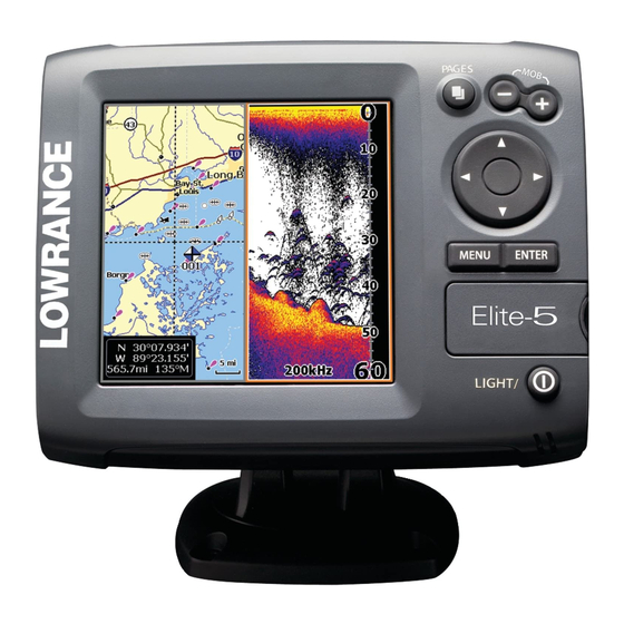
Introduction to Your Lowrance Device
Unit Controls Overview
Lists and explains the function of each unit button and port.
microSD Card Insertion
Instructions on how to insert and remove microSD cards for data storage.
Initial Setup Wizard
Guides the user through initial unit setup when first turned on.
Basic Operation Guide
Pages Overview
Introduces the four main display pages: Sonar, Chart, Sonar/Chart, and Steer.
Selecting Display Pages
How to navigate between different display pages using the keypad.
Accessing Page Menus
Accessing context-sensitive menus for specific display pages.
Navigating Menus
Explains how to use scrollbars, on/off features, and dropdown menus.
Dialogs and Text Entry
Describes dialog boxes for user input and the method for entering text.
Fishing Modes Explained
Introduces preset sonar settings for different fishing conditions.
Cursor Control and Navigation
How to use the keypad to move the cursor and navigate to a location.
Display Pages Explained
Steer Page Details
Displays compass, track, destination direction, and navigation data.
Sonar Page Display
Shows water column movement and amplitude scope for echoes.
Chart/Sonar Split Screen
Displays a split screen view of both chart and sonar data.
Chart Page View
Shows real-time map movement with a bird's-eye view.
Chart/Sonar Panel Adjustment
Allows changing the panel display on the Chart/Sonar page.
Overlay Data on Sonar
Displays selected data on the sonar page.
Configuring Overlay Data
Step-by-step guide to adding and customizing overlay data.
Sonar Operation
Using the Trackback Feature
Reviewing recent sonar history by scrolling backward.
Sonar Menu and Settings
Accessing options and settings affecting the sonar display.
Sonar Features and Settings
Creating Waypoints
Places a waypoint at current position or cursor, allowing name/icon input.
Adjusting Sonar Display
Adjusts Sensitivity, Colorline/Grayscale settings.
Sensitivity Control
Controls display detail level, affecting echo visibility.
Auto Sensitivity Function
Keeps sensitivity optimized for most conditions, on by default.
Colorline and Grayscale Settings
Separates strong/weak echoes to distinguish structure from bottom.
Setting Depth Range
Selects the deepest range shown on the display for water column view.
Custom Sonar Range Limits
Selects water column section, excluding surface.
Transducer Frequency Options
Controls transducer frequency (200kHz and 83kHz) for optimal performance.
Ping Speed Adjustment
Controls transducer sonar wave transmission rate for interference reduction.
Sonar Options Menu
Accesses sonar display settings and configuration options.
Split Zoom and Split Flasher
Switches sonar display between full screen and split screen views.
Sonar Color Palettes
Changes display appearance using palettes with varying color/brightness.
Fish ID Feature
Displays fish echoes as symbols instead of arches.
Ice Mode Operation
Optimizes sonar settings for ice fishing and overlays battery meter.
Overlay Data on Sonar Screen
Selects data to display on top of the Sonar screen.
Sonar Settings Menu
Accesses the Sonar settings menu.
Chart Operation
Chart Menu Functions
Accesses the menu for chart-related operations.
Creating Waypoints on Chart
Places a waypoint at current or cursor position, allowing name/icon input.
Chart Management
Waypoints, Routes, Trails Management
Used to create, edit, navigate, and delete waypoints, routes, and trails.
Editing Waypoints
Allows editing the name, icon, and coordinates of a selected waypoint.
Sorting Waypoints
Controls how the waypoint list is sorted by name or nearest.
Route Creation and Management
Used to create, edit, navigate, and delete routes.
Creating Routes from Chart Points
Step-by-step guide to creating routes by selecting points on the chart.
Navigating Routes
Routes can be navigated forward or reverse.
Cancelling Route Navigation
Steps to cancel active navigation.
Route Editing and Display Options
For editing/creating routes, names, and display properties.
Displaying and Deleting Routes
Shows/hides routes and deletes individual or all routes.
Trails Screen and Creation
Used to create, edit, navigate, and delete trails.
Trail Editing and Management
Edit/create trails, select names, color, display, and convert to route.
Trail Display and Recording
Show/hide trails, and record/resume trail recording.
Chart Overlay Data Display
Selects data to be displayed on top of the Chart screen.
Map Orientation Settings
Selects map orientation as North Up or Course Over Ground (COG).
Chart Settings Menu
Accesses the Chart settings menu.
System Settings
Settings Menu Overview
Accesses installation and configuration settings for the unit.
System Configuration Options
Adjusts unit settings like language, mute audio, and advanced mode.
Language and Audio Settings
Selects language and controls unit audio feedback.
Time and Date Configuration
Sets local time and time/date formats.
GPS Status and Source Selection
Monitors satellite lock and selects the GPS antenna.
Data Port Configuration
Selects device type connected to the data port (NMEA 0183 or sensor).
Chart/Sonar Split Display Options
Allows display of Chart/Sonar pages split vertically or horizontally.
Advanced Mode Features
Enables features and settings only available in Advanced Mode.
Restore Unit Defaults
Switches the unit back to default settings.
File Browsing and Screenshots
Allows viewing microSD files and saving screenshots.
Navigation Settings
Controls Arrival Radius, Off Course distance, and WAAS/MSAS/EGNOS.
Arrival and Off Course Alarms
Sets thresholds for arrival and off-course alarms.
WAAS/MSAS/EGNOS Activation
Turns on/off satellite augmentation systems to increase GPS accuracy.
Bearing and Magnetic Variation
Controls bearing calculation and magnetic variation.
Chart Display Settings
Controls map data and display settings like grid lines, waypoints, routes, trails.
Chart Data Selection
Selects map data (Lowrance or Navionics regional map).
COG Extension and Grid Lines
Displays COG line and latitude/longitude grid for location reference.
Chart Element Display Options
Turn on/off waypoint, route, and trail display properties.
Sonar Settings
Adjusts Sonar options and display settings like Noise Rejection, Surface, Fishing Mode.
Noise Rejection and Surface Clarity
Filters noise and reduces surface clutter for clearer sonar images.
Manual Sonar Mode
Restricts digital depth capability to selected depth range.
Fishing Mode Configuration
Enhances performance with preset sonar settings for specific fishing conditions.
Installation Settings
Provides access to Keel Offset and Temp Calibration settings.
Alarm Settings and Thresholds
Enables alarms and selects alarm thresholds (Arrival, Off Course, Anchor).
Keel Offset and Temp Calibration
Measures keel offset and calibrates transducer temperature sensor.
Reset Water Distance
Resets Water Distance to zero.
Unit of Measure Selection
Selects the unit of measure for various settings.
NMEA 0183 Output Configuration
Selects NMEA 0183 sentences for connection to other devices.
Simulator Mode
Simulates GPS and sonar activity for practice.
Product Specifications
Elite 5 General Specifications
Provides general specifications for the Elite 5 unit.
Elite 5 Sonar and GPS Specs
Details sonar and GPS specifications for the Elite 5.
Elite 4 & Mark 4 General Specs
Provides general specifications for the Elite 4 & Mark 4 units.
Elite 4 & Mark 4 Sonar and GPS Specs
Details sonar and GPS specifications for Elite 4 & Mark 4.
Legal and Warranty Information
Navico Databases License Agreement
Outlines the license terms for the databases included with the product.
Databases Limited Warranty
Outlines the warranty terms and limitations for the databases.
Support and Service Information
How to Obtain Service
Contact information for obtaining service and support in the USA and Canada.
Accessory Ordering Information
Information on ordering accessories from LEI Extras.
Need help?
Do you have a question about the Mark 4 and is the answer not in the manual?
Questions and answers