Table of Contents
Advertisement
Quick Links
Advertisement
Table of Contents

Related Manuals for TOKNAV T20Pro

Summary of Contents for TOKNAV T20Pro
- Page 1 T20Pro GNSS RECEIVER USER GUIDE V1.0 TokNav Information Technology Co., Ltd.
- Page 2 Copyright © TokNav Information Technology Co., Ltd. 2022. All rights reserved. No part of this document may be reproduced or transmitted in any form or by any ways without prior written consent of TokNav Information Technology Co., Ltd. Trademarks and Permissions and other TokNav trademarks are trademarks of TokNav Information Technology Co., Ltd.
- Page 3 TokNav Information Technology CO., LTD. FCC warning: This device complies with part 15 of the FCC Rules. Operation is subject to the following two conditions: (1) This device may not cause harmful interference, and (2) this device must accept any interference received, including interference that may cause undesired operation.
-
Page 4: Table Of Contents
Ⅰ. Before You Start ....................... 1 1.1 Precautions For Safe Operation ................ 1 1.2 Exemption From Liability ................2 Ⅱ. T20Pro At A Glance ....................3 2.1 Appearance ....................... 3 2.2 Display Screen ....................4 2.3 Power On And Off .................... 5 2.4 Insert A SIM Card ..................... - Page 5 TokNav Information Technology CO., LTD. Ⅳ. tSurvey Basic Operations ..................27 4.1 DP0031 Data Controller ................. 27 4.2 Communication ....................28 4.3 New Project ..................... 29 4.4 Import Data ..................... 29 4.5 Export Data ..................... 30 4.6 Localization ....................31 4.7 Rover Mode Setting ..................
-
Page 6: Ⅰ. Before You Start
Ignoring this indication may result in personal injury or property damage. 1.1.1 Warning 1. Do not disassemble and open the device by yourself. Only TokNav Information Technology authorized distributors can disassemble or rebuild the device. 2. Please do not cover the charger when charging. -
Page 7: Exemption From Liability
TokNav Information Technology CO., LTD. 4. Keep the device away from burning gas or liquid, and avoid placing it in an open flame or high-temperature environment. This may cause an explosion.. 5. Avoid short-circuiting the battery to prevent the risk of fire.. -
Page 8: Ⅱ. T20Pro At A Glance
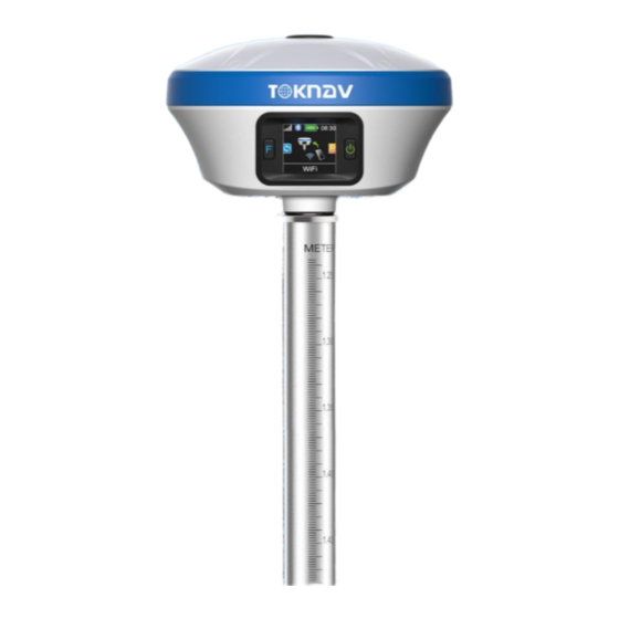
TokNav Information Technology CO., LTD. Ⅱ. T20Pro At a Glance The body of the T20Pro is designed with magnesium alloy material, which is durable and has better heat dissipation effect, and weighs only 900g. It supports IP68 dustproof and waterproof, and can work continuously for 20 hours when fully charged. -
Page 9: Display Screen
TokNav Information Technology CO., LTD. Network status The mobile network is not turned on. Network status The mobile network online. Bluetooth status when Bluetooth is not connected. Bluetooth status when Bluetooth is connected. Battery information The remaining battery of the device. -
Page 10: Power On And Off
TokNav Information Technology CO., LTD. 2.3 Power on And Off Power on: Press and hold the power button for 3 seconds until the buzzer "beeps". Release the button, the device starts to power on, and the panel light flashes. The device will not start until the buzzer emits a "beep"... -
Page 11: Install The Radio Antenna
TokNav Information Technology CO., LTD. It takes 4 hours to fully charge the battery: 1. Red light: The battery is charging. 2. Green indicator light: The battery is fully charged. To charge the battery, open the type-C cover, connect one end of the data cable to the type-C interface, and the other end to the charger. - Page 12 TokNav Information Technology CO., LTD. Altimeter BB0039 Optional T20Pro yellow toolbox mobile station Optional packaging 30 cm extension rod (yellow) BBO036 Optional Thin hand (5 inches) - with touch pen DP0031 Optional Book shelf BB0037 Optional 7-pin to USB and serial ports...
-
Page 13: Ⅲ. Web Ui
TokNav Information Technology CO., LTD. Ⅲ. Web UI The device WIFI can be used as a hotspot, allowing connection from a PC, smartphone, or tablet. Once connected, you can manage the working status, change the working mode, configure basic settings, download raw data, update firmware and register devices, etc. -
Page 14: System View
TokNav Information Technology CO., LTD. 3.1 System View ① GNSS Status: Quality, Latitude, Longitude, Height, Satellite, Ref station ② Register Info: SN, Expired Date, Scheme, Exception; The registration code is a valid time code that authorizes the location function of the device. -
Page 15: Skyplot
TokNav Information Technology CO., LTD. Click Upgrade Firmware below to automatically identify and upgrade the positioning board firmware, tilt module firmware, and device firmware. There will be a prompt below during the upgrade process, and the device will restart after the upgrade is complete. - Page 16 TokNav Information Technology CO., LTD. ② GNSS System: Elev Cutoff, System, Table, Chart. If it is found that the device receives fewer satellites under normal environment, you can enter this page to check whether all satellite systems have been turned on.
-
Page 17: Data Stream
TokNav Information Technology CO., LTD. 3.4 Data Stream The data stream is mainly used to debug data information; you can view the current data status, as shown in the following below:... - Page 18 TokNav Information Technology CO., LTD. For example: 1. Message Text: see 3.9 in this section for the configuration of text data. 2. Message Raw 3. Message Diff: when the device is the base station, you can check whether there is differential data output here.
- Page 19 TokNav Information Technology CO., LTD. 4. Message Static: When the device is static mode, you can check whether there is static data output here. 5. Ntrip Client: When the device is set as a rover station and uses Ntrip Client to...
-
Page 20: Mode Config
TokNav Information Technology CO., LTD. 3.5 Mode Config ① Working Mode: You can choose Rover Mode/ Base Mode/ Static Mode, and select the Elev Cutoff at the same time; 1. Rover Mode: the following parameters (Station Name, Elev Cutoff, Diff Age Max, Height Type, Antenna Height, Record, PPK) can be configured. - Page 21 TokNav Information Technology CO., LTD. 3. Static Mode: the following parameters (Station Name, Elev Cutoff, PDOP Threshold, Sample Interval, Height Type, Antenna Height, Record) can be configured.
-
Page 22: Others Config
TokNav Information Technology CO., LTD. ② Data link: You can choose No Data link/ Bluetooth/ Wifi/ Built-in Network/ Built-in Radio/ External Radio/ XLink. 1. Bluetooth: the device obtains the differential data of tSurvey software accessed by the manual network through Bluetooth connection to the manual;... -
Page 23: File
TokNav Information Technology CO., LTD. ③ Others: Time Zone, Voice. 3.7 File File management can delete and download data of each channel in batches, as shown below: 3.8 Log It provides the download of the operation log of the device. When the device experiences abnormal behavior during use, you can download the log generated at the corresponding time here to the supplier for troubleshooting. -
Page 24: Message Text
TokNav Information Technology CO., LTD. 3.9 Message Text You can set the type and frequency of output data in text format, as shown below. After configuration, you can check whether there is corresponding text data output in 3.4 of this section. - Page 25 TokNav Information Technology CO., LTD. <6> GPS status: 0=no positioning, 1=single point positioning, 2=SBAS differential positioning, 4=RTK fixed solution, 5=RTK floating point solution, 6=inertial navigation positioning <7> The number of satellites (00~12) using the solution position <8> HDOP horizontal precision factor (0.5~99.9) <9>...
-
Page 26: Remote Assistance
TokNav Information Technology CO., LTD. GPGSV $GPGSV,<1>,<2>,<3>,<4>,<5>,<6>,<7>,…<4>,<5>,<6>,<7>*hh <1> Total number of GSV statements <2> Number of GSV in this sentence <3> Total number of visible satellites (00~12, the previous 0 will also be transmitted) <4> PRN code (pseudo-random noise code) (01~32, the previous 0 will also be transmitted), which can be understood as satellite number. -
Page 27: Data Config
TokNav Information Technology CO., LTD. 3.11 Data Config The device has 24G storage space (recyclable storage) and supports five channels (CH01/CH02/CH03/CH04/CH05) to save various files, as shown in the figure below. We can configure the data source, file period, file name and file format of each channel for storage as required. - Page 28 TokNav Information Technology CO., LTD. Data: Period: Name: Format:...
- Page 29 TokNav Information Technology CO., LTD. File name naming rules: 1.The time in file name is converted from Assume GPS leap second is 18, Time Zone offset is GPS time directly. +08:00, Then 00:00:18 means 08:00:00 of local lime. 2.Key words in file name yyyy =>...
- Page 30 TokNav Information Technology CO., LTD. 2. Base (CH02) When the device is set as the reference station, the device will automatically configure CH02 to store and locate the original data by default. If PPK is enabled, CH05 will also be automatically configured by default to store location post- processing data, as shown in the following figure.
- Page 31 TokNav Information Technology CO., LTD. Note: Whenever the tSurvey software connects to the device through Bluetooth, the device will automatically configure CH04 to store Bluetooth monitor data. If there is any problem with the settings of the Bluetooth connection device, you can...
-
Page 32: Ⅳ. Tsurvey Basic Operations
TokNav Information Technology CO., LTD. Ⅳ. tSurvey Basic Operations It describes the basic operations to start using the device. 4.1 DP0031 Data Controller The DP0031 TD-LTE wireless computer is a rugged, multi-function wireless computer designed with a 5-inch sunlight readable HD touch screen and alphanumeric keypad, equipped with a powerful octa-core processor and Android operating system for perfect adaptability with measuring handbook software. -
Page 33: Communication
Charging time: less than 4 hours (fast charging). 4.2 Communication Operation: Device → Communication The device manufacturer selects [TokNav], the device type defaults to [RTK(T20Pro/T20Plus/T5/T5Lite/T20/T20Pro)], and the connection type selects [Bluetooth]. Click the Bluetooth name in the device parameters to jump to the device search... -
Page 34: New Project
TokNav Information Technology CO., LTD. 4.3 New Project Action: Project → Project Manager → New Enter the name of the item. Others are additional information and can be left blank. Fill in by default or according to actual data. Click [Next].Jump to the coordinate system parameter interface. -
Page 35: Export Data
TokNav Information Technology CO., LTD. 4.5 Export Data Operation: Project→ Export Data Confirmation export path, input file name, select length unit, angle format and data format, click export to export data file. -
Page 36: Localization
TokNav Information Technology CO., LTD. 4.6 Localization Example: four-parameter conversion. - Page 37 TokNav Information Technology CO., LTD. Correctly configure the rover station to obtain fixed state, click [Collect Point] to measure two known control points in the survey area. Operation: Project → Localization Localization is a special design of software, which is designed for specific survey work in China.
- Page 38 TokNav Information Technology CO., LTD. Note: In the parameter report, the plane conversion parameters and elevation conversion parameters can be checked. The scale parameter is generally infinitely close to 1. If the value does not match, please check the operation whether there is any operation error or coordinate error in...
-
Page 39: Rover Mode Setting
TokNav Information Technology CO., LTD. 4.7 Rover Mode Setting Operation: Device → Rover Set basic parameters such as height cut-off angle, differential delay and whether PPK is enabled. Click "Data Link" to select the required data link. 4.7.1 Phone Internet Data Link Select "Manual network"... - Page 40 TokNav Information Technology CO., LTD. 4.7.2 Device Internet Data Link Insert the SIM card into the device, select "device Network" for the data link, enter the parameter setting, select the connection mode, CORS setting and APN setting, click "OK" to automatically return to the rover station setting interface, click "Get ", select the access point base station, click "Apply"...
-
Page 41: Base Mode Setting
TokNav Information Technology CO., LTD. 4.7.3 Internal Radio Data Link Plug in the radio antenna of the device, select "built-in radio station" for the data link, enter the parameter setting, click "Default radio station setting" in the lower left corner to configure the radio station channel, select the channel and protocol content, click "OK"... - Page 42 TokNav Information Technology CO., LTD. 4.8.1 Device Internet Data Link Insert the SIM card into the device, select "device Network" for the data link, enter the parameter setting, select CORS setting and APN setting, click "OK" to automatically return to the reference station setting interface, the base station access point is the machine number by default, click "Start Base Station"...
-
Page 43: Static Mode Setting
TokNav Information Technology CO., LTD. 4.8.2 Internal Radio Data Link Plug in the radio antenna of the device, select "Built-in radio" for the data link, enter the parameter setting, click "Default radio setting" at the lower left corner to configure the radio channel, select the channel and protocol content, click "OK ", and automatically return to the reference station setting interface, click"... - Page 44 TokNav Information Technology CO., LTD. Log in to the device web page (see Ⅲ WebUI for details), click [File]. Find the folder corresponding to the time to download the static data.
-
Page 45: Point Survey
TokNav Information Technology CO., LTD. 4.10 Point Survey Operation: Survey → Point Survey Open the point survey page, and view the current power of the device in the upper right of the survey display interface. Amount, CORS connection status, positioning accuracy (H: horizontal accuracy and, V: elevation accuracy), satellite... -
Page 46: Tilt Survey
TokNav Information Technology CO., LTD. Click this icon to turn tilt survey on or off. Click the icon to set acquisition parameters, information display and function menu. Click this icon to view the coordinate point library of the current project and the collected point coordinates, which are the same as the function of "coordinate point... - Page 47 TokNav Information Technology CO., LTD. 3. Support calibration of centering rod, and eliminate survey error caused by curvature of centering rod. Open the point survey page, click the bottom column to input the antenna height parameter (height of the centering rod), and then light up the tilt survey icon at the lower left corner, that is, turn on the tilt survey function.
-
Page 48: Device Activation
TokNav Information Technology CO., LTD. 1. When the tilt survey is started, sometimes with the movement and rotation, the tilt icon will change from green to red. At this time, the centering rod needs to shake according to the prompt, and the sampling can be carried out until the icon turns green;... -
Page 49: Software Activation
TokNav Information Technology CO., LTD. 4.13 Software Activation Operation: Project → About Software In the process of using the software, you need to pay attention to the expiration date of the software. If it has expired, you need to activate. Click "Project"→ "About Software"... -
Page 50: Ⅴ. Technical Indicator
TokNav Information Technology CO., LTD. Ⅴ. Technical Indicator Item Specification remarks Hardware Qualcomm Cortex-A7 Linux L1C/A, L1C, L2P(Y), L2C, L5 GLONASS L1, L2, L3 B1I, B2I, B3I, B1C, B2a, B2b GALILEO E1, E5a, E5b, E6 QZSS L1, L2, L5 SBAS... - Page 51 TokNav Information Technology CO., LTD. charging current Work Temperature -20℃ ~+60℃ Storage Temperature -40℃ ~+85℃ ENVIRONMENTAL Shock Withstand 1.5M pole drop Protection IP68 Material Magnesium alloy main body, ABS/PC top cover Dimension Φ143.5mm*90.7mm PHYSICAL Weight ≤0.90kg M68K Device 1 SET...
- Page 52 TokNav Information Technology CO., LTD. TokNav Information Technology Co., Ltd. Support: info@TokNav.cn Website: https://www.TokNav.cn...
Need help?
Do you have a question about the T20Pro and is the answer not in the manual?
Questions and answers
le code d'activation T20 Pro a expiré et je n'arrive pas à contacter le fournisseur . comment faire ?
To reactivate an expired activation code for the TOKNAV T20Pro:
1. Device Activation:
- Go to Device → Device Activation.
- Check if the device registration code is expired.
- If expired, input or scan a new device registration code.
2. Software Activation:
- Go to Project → About Software.
- Check if the software activation code is expired.
- If expired, click Software Activation and input or scan a new software activation code on the jump page.
This answer is automatically generated
Mais comment avoir le nouveau code permanent et le fournisseur est devenu injoignable
Je n'arrive pas à contacter le fournisseur qui est devenu injoignable tout le temps et le code d'activation de mon appareil T20 Pro a expiré . Comment avoir un nouveau code permanent