
Subscribe to Our Youtube Channel
Related Manuals for OLEI LR-16F


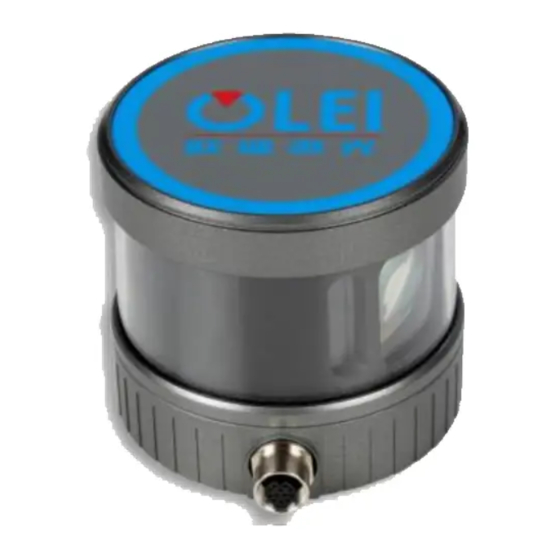
Summary of Contents for OLEI LR-16F
- Page 1 Sensing Reality! Lidar Sensors LR-16F User Manual Please read this user manual for best product performance before using the product. Be sure to keep this manual properly for future reference. OMEN-16F-202012...
-
Page 2: Table Of Contents
User Manual LR-16F 目录 Document description .............................. 1 Safety Instruction ..............................1 Working Principle ..............................1 Installation and operation ............................2 4.1. Mechanical interface ............................2 4.2. Electrical interface ..............................3 4.2.1. Definition of aviation plugin ......................... 3 4.2.2. Definition of GPS ............................4 4.3. -
Page 3: Document Description
3. Working Principle With 16 laser emitting components rotating rapidly, LR-16F emits high-frequency laser beams to continuously scan the external environment; the ranging algorithm provides three- dimensional point cloud data and object reflectivity, allowing the machine to see the surrounding environment, and providing guarantee for positioning, navigation, obstacle avoidance, etc. -
Page 4: Installation And Operation
C—Speed of light 4. Installation and operation 4.1. Mechanical interface LR-16F lidar can be installed at the bottom. There is one M8 screw hole (hole depth is 5mm) at the bottom of the main body for installation. Figure 2 Installation interface of LR-16F... -
Page 5: Electrical Interface
LR-16F component includes one Lidar main body, one junction box, one power adapter and one network cable. Operating voltage scope of LR-16F is 12~30VDC. The input end of the power adapter is connected to 220VAC; the voltage at the power supply output end is converted to 12VDC by the power adapter, and is connected to the junction box. -
Page 6: Definition Of Gps
User Manual LR-16F 4.2.2. Definition of GPS GPS definition is shown in Table 2 definition Table 2 Definition of GPS interface Figure 4 Definition of GPS 5V is the output voltage, used for GPS power supplying; PPS uses 3.3V TTL level; RXD, TXD uses 232 level. -
Page 7: Communication Interface
User Manual LR-16F 4.3. Communication interface The LR-16F is connected to the computer by a standard Ethernet RJ-45 interface. The computer IP address should be set up before communication. The lidar and computer IP must be set in the same subnet without any conflict. The output package are mainly divided into data package and information package, the port number of the data package is 2368, and the port number of the information package is 9866. -
Page 8: Serial Port And Pps
The serial port and PPS are mainly used when connecting to GNSS equipment. In order to synchronize the lidar clock with GNSS, standard time signal provided by the GNSS receiver should be input into LR-16F, including PPS signal and serial GPRMC data. OMEN-16F-202012... -
Page 9: Definition Of Vertical Angle
User Manual LR-16F The PPS signal should be a TTL level signal, the signal pulse length is 20ms~200ms, and the GPRMC data must be completed within 500ms of the rising edge of the synchronous pulse. Figure 8 PPS synchronous sequence The baud rate of the serial port has the following options: 4800, 9600, 115200bps, 8bit data bit, no parity bit, stop bit 1. -
Page 10: Format Of Data Package
Figure 9 Schematic diagram of vertical angle definition 7. Format of data package LR-16F enables laser point cloud data transmission. Please refer to the following for the analysis of lidar point cloud data. The information transmission between the LR-16F and the computer follows the UDP standard network protocol. -
Page 11: Header File
User Manual LR-16F Figure 10 Format of point cloud information packet The total length of the data frame is 1248 bytes, among which Frame header: 42 bytes Data block: 12×(2+2+96)=1200 bytes Time stamp: 4 bytes. Factory mark: 2 bytes 7.1.2. -
Page 12: Time Stamp
User Manual LR-16F The laser returned data consists of 12 data blocks. Each data block starts with a 2-byte identifier 0xFFEE, followed by a 2-byte azimuth angle and a total of 32 data points. The laser returned value of each channel contains a 2-byte distance value and a 1-byte calibration reflectivity value. -
Page 13: Definition Of Header
User Manual LR-16F Note: The port number of the information package cannot be changed, the local and target ports are both 9866 7.2.2. Definition of header Offset Length Description Ethernet II include Destination MAC:(6 Byte) Sourse MAC:(6 Byte) Type: (2 Byte) Internet Protocol include Version &... -
Page 14: Setup The Protocol
User Manual LR-16F offset Length Description GPS enable & baud rate, 0x00: GPS power off 0x01: GPS power on, baud rate 4800 0x02: GPS power on, baud rate 9600 0x03: GPS power on, baud rate 115200 Reserved Reserved The temperature of the upper circuit board, the data should multiply by 0.0625℃... -
Page 15: Numerical Calculation
8. Numerical calculation 8.1. Coordinate conversion The information in the LR-16F data package is the azimuth value and distance value established in the polar coordinate system. It’s more convenient to construct three- dimensional scene through the point cloud data by converting polar coordinate value to Cartesian coordinate system. -
Page 16: Azimuth
8.3. Azimuth interpolation LR-16F can directly obtain the azimuth angle of the first 16-line laser pulse sequence in each data block through the data package, and then obtain the azimuth angle value of the second 16-line laser pulse sequence through interpolation calculation. -
Page 17: Distance
4)Calculate seconds:258+78403/1000000=258.078403 8.6. Emission time The laser emission time of each channel of LR-16F is 3us, and there is a waiting time of 3us after all 16-line lasers are emitted. The total time for each 16 channels of laser to complete a round is 51us. -
Page 18: Parameter Configuration Of Upper Computer Software
User Manual LR-16F Figure 12 Laser emission time In fact, the final emission time should add a time stamp. The time stamp records the emission time of the first channel of the first data block in each data package. The true... -
Page 19: Configuration Software
User Manual LR-16F The web page setting interface and the upper computer software interface may change due to continuous updated products, and the actual content shall prevail. 9.2. Configuration software The configuration software 3D Lidar config Ver1.0.2 is mainly used to modify and configure the basic parameters of 16-line lidar. -
Page 20: Ros Driver Package
ROS driver package Olam3D_C.zip. Refer to Appendix G for specific building and compiling steps Please contact technical staff from OlEI if necessary. Note: If a red error message appears during the process of driver installation, it maybe caused by limited authority under Ubuntu. -
Page 21: Appendix A: Data Package
User Manual LR-16F Appendix A: Data Package OMEN-16F-202012... - Page 22 User Manual LR-16F OMEN-16F-202012...
- Page 23 User Manual LR-16F OMEN-16F-202012...
-
Page 24: Appendix B: Mechanical Dimensions
User Manual LR-16F Appendix B: Mechanical Dimensions OMEN-16F-202012... -
Page 25: Appendix C: Timetable
User Manual LR-16F Appendix C: Timetable Data Block 1020 1122 1023 1125 1026 1128 1029 1131 1032 1134 1035 1137 1038 1140 1041 1143 First Firing 1044 1146 1047 1149 1050 1152 1053 1155 1056 1158 1059 1161 1062 1164... -
Page 26: Appendix D: Gps Code Analysis
User Manual LR-16F Appendix D: GPS code analysis //GPS Timestam Parse and lidar Timestam Parse var temp = new byte[4]; Buffer.BlockCopy(DataBytes, 1200, temp, 0, temp.Length); // 1.Reverse var t = temp.Reverse().ToArray(); var str1 = Convert.ToString(t[0], 2).PadLeft(8, '0'); var str2 = Convert.ToString(t[1], 2).PadLeft(8, '0');... -
Page 27: Appendix F: Analysis Of Interpolation Code
User Manual LR-16F The horizontal offset of each channel of the radar is set as A The vertical offset of each channel of the radar is set as B The spatial coordinate system of each channel of the radar is set as X, Y, Z... -
Page 28: Appendix G:ros
(http://wiki.ros.org/indigo/Installation/Ubuntu). 3.Download and install libpcap-dev. Note: The operating environment of the driver is ROS1.0 version. If you need ROS2.0 version, please contact the technical staff of OLEI. The appendix demonstrates the driver construction and operation under ROS1.0 version. G.2 Construction 1. -
Page 29: Real-Time Display
User Manual LR-16F G.4 Real-time display 1. Open a new terminal and run rviz >rosrun rviz rviz -f olei_lidar 2. Add a topic PointCloud2 in rviz 3. If there is an error prompt “no fixed frame”, use the instruction: >rosrun tf static_transform_publisher 0 0 0 0 0 0 1 map olei_lidar 10... - Page 30 User Manual LR-16F Official WeChat Regarding changes in specifications, etc., without notice! Hangzhou Ole-systems Co., Ltd. No. 35, Jiuhuan Road, Jianggan District, Hangzhou City, Zhejiang Province, China Web: www.ole-systems.com Email: sales@ole-systems.com (+86) 400 102 5850 TEL: Copyright: Hangzhou Ole-systems Co., Ltd.
Need help?
Do you have a question about the LR-16F and is the answer not in the manual?
Questions and answers