Table of Contents
Advertisement
Quick Links
Advertisement
Table of Contents

Subscribe to Our Youtube Channel
Related Manuals for Boeing ForeFlight Sentry


Summary of Contents for Boeing ForeFlight Sentry
- Page 1 Sentry Pilot’s Guide...
- Page 2 Copyright © 2022 ForeFlight LLC. All rights reserved. Unauthorized commercial distribution of this manual or any revisions is strictly prohibited. ForeFlight® is a registered trademarks of ForeFlight, LLC and may not be used without the permission of ForeFlight.
-
Page 3: Warranty Information
WARRANTY INFORMATION By using your Sentry, Sentry Mini, or Sentry Plus, you accept and agree to the following terms and conditions: All device operational procedures must be learned on the ground. Received traffic information is to be used as an aid to situational awareness and is merely supplemental and advisory in nature. -
Page 4: Table Of Contents
CONTENTS WARRANTY INFORMATION ..................3 INTRODUCTION ......................6 Mounting Sentry ........................7 Connecting to Sentry ......................8 Local Network Setting .......................8 Firmware Updates ........................9 SENTRY ........................10 Power Button ........................11 LED Status ........................11 Connecting to Sentry ......................12 Sentry Network Name (SSID) ..................12 WPA2 Security ........................13 Battery ..........................13 SENTRY MINI ......................14 Powering Sentry Mini ......................15... - Page 5 CONTENTS Traffic Information Service Broadcast (TIS-B) ..............37 How TIS-B is received ....................38 ADS-B and TIS-B Differences ..................38 ADS-B Ownship ......................39 False Traffic Alerts ......................40 ADS-B WEATHER ....................41 ADS-B Ground Based Towers ...................41 Tower Location on Map ....................42 FIS-B Tower Tiers and Look-Ahead Range ..............42 Weather Replay ........................44 ADS-B Map Layers ......................44 ForeFlight Pack ........................45...
-
Page 6: Introduction
INTRODUCTION Sentry portable receivers are compact, powerful devices that deliver real-time weather, traffic, WAAS GPS, and more to ForeFlight Mobile. Sentry receivers work exclusively with ForeFlight Mobile on your iPad and iPhone and can connect to five devices simultaneously. For additional device details, refer to the table below. -
Page 7: Mounting Sentry
INTRODUCTION Mounting Sentry Sentry, Sentry Mini, and Sentry Plus can be mounted with the provided RAM mount. RAM mount includes a quick release that allows you to detach the receiver while leaving the mount in place. For best results, mount your receiver vertically on a side window where it can have an unobstructed view of nearby aircraft and ADS-B ground towers. -
Page 8: Connecting To Sentry
INTRODUCTION Connecting to Sentry Whether you’re connecting to Sentry, Sentry Mini, or Sentry Plus, start by powering the device on. Sentry and Sentry Plus can be powered on by holding the power button for approximately two seconds until the LEDs illuminate. Power Sentry Mini on by connecting the provided USB- C cable to a 5 volt, 2 amp power source. -
Page 9: Firmware Updates
INTRODUCTION Firmware Updates Sentry firmware updates are provided by ForeFlight. If updated firmware is available for your Sentry, Sentry Mini, or Sentry Plus, ForeFlight will prompt you to update the firmware. If you do not receive a prompt to update your firmware, ForeFlight has determined you already have the latest firmware installed. -
Page 10: Sentry
SENTRY Sentry is the original device designed for ForeFlight to deliver real-time weather, traffic, GPS, and more. Sentry is equipped with a built-in rechargeable battery capable of 12 hours of use. Sentry creates a wireless network to connect up to five devices simultaneously. Sentry Features Tap a Sentry feature to learn more. -
Page 11: Power Button
SENTRY Power Button Sentry has a single button located in the center of the device. Press and hold the button for approximately two seconds to power Sentry on or off. When powered on, the ADS-B, CO, GPS, and PWR LEDs are activated. LED Status Sentry has four LEDs. -
Page 12: Connecting To Sentry
SENTRY Connecting to Sentry To connect to Sentry, power the device on by holding the power button for approximately two seconds. When powered on, Sentry creates its own wireless network capable of connecting to five devices simultaneously. With Sentry powered on, open the iPad/iPhone Settings app and select Wi-Fi. Locate Sentry’s wireless network and tap to connect. -
Page 13: Wpa2 Security
SENTRY WPA2 Security Sentry does not have a passcode by default. A passcode can be assigned from the Maps Settings or Devices view. To assign a passcode, 1. Select More > Devices > Sentry > Sentry Network. 2. Tap the WPA2 Security Enabled toggle. 3. -
Page 14: Sentry Mini
SENTRY MINI Sentry Mini is an entry-level, compact ADS-B receiver measuring 3.3 x 2.3 x 0.6 inches and weighing 44 grams. Sentry Mini provides real-time weather, traffic, and WAAS GPS to ForeFlight Mobile. Sentry Mini does not have an internal battery. Power Sentry Mini on by connecting to a portable or aircraft panel 5-volt power source. -
Page 15: Powering Sentry Mini
SENTRY MINI Powering Sentry Mini Sentry Mini is not equipped with an internal battery. To power Sentry Mini, plug the provided USB-C cable into a portable or aircraft 5V (volt) 2A (amp) power source. When Sentry Mini is powered on, the GPS and ADS-B LEDs illuminate and Sentry Mini creates a wireless network. -
Page 16: Connecting To Sentry Mini
SENTRY MINI Connecting to Sentry Mini To connect to Sentry Mini, power the device on by connecting a 5-volt 2 amp power source. When powered on, Sentry Mini creates its own wireless network capable of connecting five devices simultaneously. With Sentry Mini powered on, open the iPad/iPhone Settings app and select Wi-Fi. Locate Sentry Mini’s wireless network and tap to connect. -
Page 17: Sentry Plus
SENTRY PLUS Sentry Plus is the latest, most capable Sentry receiver available for use with ForeFlight Mobile version 14.4 or later. Sentry Plus is a battery-powered device that delivers real-time weather, traffic, GPS, and more to ForeFlight Mobile. Sentry Plus Features Tap a Sentry Plus feature to learn more. -
Page 18: Power Button
SENTRY PLUS Power Button Sentry Plus has a single button located below the OLED display. Press and hold the button for two seconds to power Sentry Plus on or off. When powered on, the OLED display, ADS-B, CO, GPS, and PWR LEDs are activated. LED Status Sentry Plus has four LEDs. -
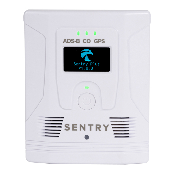
Page 19: Oled Display
SENTRY PLUS OLED Display Sentry Plus is equipped with an OLED display. The display is automatically enabled when the device is powered on and remains on until the device is powered off. When Sentry Plus is initially powered on, a splash screen depicts the Sentry logo and installed firmware version. After the splash screen, Sentry Plus displays the first of four possible views. -
Page 20: Oled Views
SENTRY PLUS OLED Views The Sentry Plus OLED display contains four views. Each view displays real-time information. The Sentry Plus log indicates Sentry Plus is connected to ForeFlight. Press the power button to cycle between the available views. Acceleration depicts real-time accelerometer data. Acceleration is measured on the •... -
Page 21: Battery
SENTRY PLUS Battery Sentry Plus is equipped with a rechargeable battery. The battery is designed to provide up to 18 hours of use on a full charge. The battery is not designed to be replaced. When Sentry Plus is powered on, battery percentage is depicted in the top left corner of the OLED display. -
Page 22: Connectivity
SENTRY PLUS Connectivity When powered on, Sentry Plus automatically creates a wireless network which can connect up to five devices simultaneously. Sentry Plus does not have a wireless network password by default. Connect to Sentry Plus by powering it on and selecting its wireless network from your iPad or iPhone Wi-Fi Settings. -
Page 23: Wpa2 Security
SENTRY PLUS WPA2 Security Sentry Plus does not have a passcode by default. A passcode can be assigned from the Maps or Devices view. To assign a passcode, 1. Select More > Devices > Sentry Plus > Sentry Plus Network. 2. -
Page 24: Wi-Fi Client Support
SENTRY PLUS Wi-Fi Client Support If your aircraft is equipped with a wireless network, Sentry Plus can join the network and provide its data through the aircraft’s wireless network. Sentry Plus will remember the aircraft’s wireless network and automatically join in the future when powered on. Connecting Sentry Plus to an aircraft network allows ForeFlight to receive data from Sentry Plus and the aircraft simultaneously. -
Page 25: Simultaneous Data Feeds
SENTRY PLUS Simultaneous Data Feeds When Sentry Plus is connected to an aircraft’s wireless network (e.g., Satcom Direct, GoGo), ForeFlight can receive data from Sentry Plus and the aircraft’s WiFi network simultaneously. The data that ForeFlight is able to send or receive depends largely on the aircraft’s network settings. -
Page 26: Accelerometer (G-Load)
SENTRY PLUS Accelerometer (g-Load) Sentry Plus is equipped with an accelerometer. The accelerometer detects loads placed on the pitch axis during flight. Real-time accelerometer data can be displayed on the OLED display and on the ForeFlight Mobile instrument panel. Accelerometer Data G-Meter Instrument Panel... - Page 27 SENTRY PLUS g-Load in Track Logs Track Logs recorded with Sentry Plus or with ForeFlight Mobile while connected to Sentry Plus include g Load data. To display g-Load in Track Log, tap the Track Log Layer Selector and select g Load. When g Load is selected, data from the accelerometer is displayed on the scale.
-
Page 28: Flight Data Recorder
SENTRY PLUS Flight Data Recorder Sentry Plus is equipped with an integrated Flight Data Recorder. The Flight Data Recorder automatically captures track, altitude, attitude, groundspeed, and g-Load data from Sentry Plus for every flight. The Flight Data Recorder automatically starts a Track Log each time Sentry Plus is powered on. - Page 29 SENTRY PLUS After selecting Import From Sentry Plus, ForeFlight displays up to 16 Track Logs stored on the Sentry Plus internal memory. Track Logs that have already been imported to ForeFlight display a green checkmark. Track Logs that have not been imported display a blue download button above the size of the individual Track Log.
- Page 30 SENTRY PLUS When automatic track log import is enabled, Sentry Plus will finalize and import Track Logs into ForeFlight before powering off (provided the criteria above are met). If a Track Log is not imported before power off due to not meeting one of the conditions, the next time Sentry Plus is powered on, it will import the Track Log into ForeFlight as long as the conditions are met.
- Page 31 SENTRY PLUS Deleting ForeFlight Track Log recorded with Sentry Plus Deleting a Track Log from ForeFlight does not delete it from Sentry Plus. Track Logs recorded with Sentry Plus that are imported and later deleted from ForeFlight can be imported again (provided it has not been overwritten).
-
Page 32: Flarm
SENTRY PLUS FLARM FLARM is a collision avoidance technology popular in the glider pilot community (particularly in Europe). Sentry Plus is equipped with a FLARM receiver providing additional traffic awareness for general aviation and light aircraft. FLARM operates on different frequencies in different regions of the world. The FLARM receiver in Sentry Plus operates on the European FLARM SRD860 frequency band (868.2 MHz to 868.4 MHz). -
Page 33: Ads-B Traffic
ADS-B TRAFFIC ADS-B data is broadcast on either the 978 MHz or 1090 MHz frequency (1090 MHz is required internationally and above FL180). Sentry, Sentry Mini, and Sentry Plus are dual-band receivers capable of detecting traffic on both ADS-B frequencies. Aircraft do not need to be ADS-B Out equipped for Sentry to receive traffic. -
Page 34: Traffic Icons
ADS-B TRAFFIC Traffic Icons Traffic icons are depicted in ForeFlight based on several variables. Moving targets are displayed as arrowheads pointing in the direction of travel. Stationary targets, or targets with no direction or speed information, are displayed as diamonds. Airborne traffic targets are cyan. -
Page 35: Traffic Alerts
ADS-B TRAFFIC Traffic Alerts Visual traffic alerts are enabled by default. Tap More > Settings > Alerts to review your selections. When traffic is within 25 seconds of being less than 1.3 nm and +/- 1,200’, the traffic target turns red, and a pop-up alert appears regardless of which ForeFlight view is active. -
Page 36: Hide Distant Traffic
ADS-B TRAFFIC Hide Distant Traffic All traffic detected by Sentry is displayed in ForeFlight when the Traffic map layer is selected. To reduce the amount of traffic displayed on the map, enable the Hide Distant Traffic setting. When Hide Distant Traffic is enabled, traffic more than 15 nm or more than 3,500 feet above or below your position is removed from the map. -
Page 37: Traffic Information Service Broadcast (Tis-B)
ADS-B TRAFFIC Traffic Information Service Broadcast (TIS-B) The Traffic Information Service Broadcast (TIS-B) is a component of ADS-B traffic. The TIS-B broadcast includes non-ADS-B Out equipped traffic on the 978 MHz frequency. TIS-B is broadcast for the benefit of client aircraft. A client aircraft is any aircraft that is ADS-B Out equipped. -
Page 38: How Tis-B Is Received
ADS-B TRAFFIC How TIS-B is received TIS-B traffic is broadcast on the 978 MHz frequency. Only Mode-C traffic detected by surveillance radar within 15 nm and 3500’ of ADS-B Out equipped aircraft are transmitted via TIS-B. Air-to-air ADS-B broadcasts are not a part of TIS-B. Pilots using a Sentry receiver within the service volume of an ADS-B ground station will receive TIS-B data for display in ForeFlight. -
Page 39: Ads-B Ownship
ADS-B TRAFFIC ADS-B Ownship ADS-B Ownship is the process of identifying a traffic target as being your aircraft. There are a few benefits for determining ADS-B Ownship. Your aircraft’s traffic target is suppressed from • the ForeFlight map when ownship is detected. Information from your ADS-B Out transmission •... -
Page 40: False Traffic Alerts
ADS-B TRAFFIC False Traffic Alerts If Sentry detects your aircraft’s ADS-B Out equipment and the information does not match Sentry’s GPS, your aircraft will appear as a traffic target. Ownship status can not be assigned to an aircraft if GPS data does not match. If ownship is not assigned to your aircraft, your aircraft may generate false traffic alerts if detected. -
Page 41: Ads-B Weather
ADS-B WEATHER The Flight Information Service Broadcast (FIS-B), commonly referred to as ADS-B weather, is a continuous ground-based weather and NOTAM broadcast. FIS-B also includes station information: latitude, longitude, tower type, and tower status. ForeFlight can display ADS-B weather, NOTAMs, and tower information on the map when connected to Sentry, Sentry Mini, or Sentry Plus. -
Page 42: Tower Location On Map
ADS-B WEATHER Tower Location on Map ForeFlight can display the towers Sentry is receiving data from on the map. Any data being received from a tower (including station data only) will result in the tower being displayed on the map. To display ADS-B towers, open Map Settings >... - Page 43 ADS-B WEATHER ADS-B Tower Tier Look-Ahead Range Refer to the table below to determine weather product availability and broadcast range. Surface Low Altitude Medium High Altitude Weather Product Towers Tier Altitude Tier Tier CONUS NEXRAD Not Provided Entire CONUS 150 nm 200 nm 250 nm REGIONAL NEXRAD...
-
Page 44: Weather Replay
ADS-B WEATHER Weather Replay All Sentry receivers have an integrated memory chip that allows them to store up to 30 minutes of weather and NOTAM data. When Sentry is powered on and receiving ADS-B data, it automatically starts storing the information it receives. Sentry automatically deletes data older than 30 minutes. -
Page 45: Foreflight Pack
ADS-B WEATHER ForeFlight Pack ForeFlight can download charts, weather, NOTAMs, and fuel price information for your upcoming flight so that you can access the information en route. Pack requires an active internet connection and can not be completed while connected to Sentry. ForeFlight recommends Packing for your flights before heading to the aircraft. -
Page 46: Packing With Sentry
ADS-B WEATHER Packing with Sentry When you pack for a flight and connect to Sentry, ForeFlight displays the latest information it has available. For example, if you pack for a flight and check the METARs along your route before receiving FIS-B data, ForeFlight will display the METARs from when you packed. After you depart and start to receive FIS-B data, ForeFlight will automatically delete the packed METARs and display the FIS-B data provided by your Sentry. -
Page 47: Conus And Regional Nexrad
ADS-B WEATHER CONUS and Regional NEXRAD Medium and high altitude FIS-B towers broadcast CONUS precipitation radar for the Continental United States (CONUS). Regional NEXRAD is broadcast by all tower tiers and is higher resolution than CONUS NEXRAD with a faster refresh rate. To display ADS-B NEXRAD, select the Radar (Composite) map layer. -
Page 48: Animated Ads-B Radar
ADS-B WEATHER Animated ADS-B Radar When Radar (Composite) is selected, the animate (play) button is displayed left of the time slider at the bottom of the Maps view. The time slider and play button are removed when less than two radar frames are available. ForeFlight will animate (loop) up to 10 frames of NEXRAD data. -
Page 49: Cloud Tops (Ads-B)
ADS-B WEATHER Cloud Tops (ADS-B) The Cloud Top (ADS-B) weather layer is included with all subscriptions when connected to Sentry. Cloud tops are a forecast map layer from the National Weather Service (NWS). Cloud tops are derived from satellite temperature sensors using the High-Resolution Rapid Refresh (HRRR) model. -
Page 50: Icing (Ads-B)
ADS-B WEATHER Icing (ADS-B) The Icing (ADS-B) weather layer is included with all subscriptions when connected to Sentry. ADS-B icing is an NWS graphical forecast with a look ahead range of 150 nm to 250 nm. Forecast icing severity and anticipated presence of super-cooled large droplets (SLD) are provided for every 2,000 ft up to 24,000ft MSL. -
Page 51: Turbulence (Ads-B)
ADS-B WEATHER Turbulence (ADS-B) The Turbulence (ADS-B) weather layer is included with all subscriptions when connected to Sentry (or another supported ADS-B receiver). Turbulence (ADS-B) is an NWS forecast map layer with a look-ahead range of 150 nm to 250 nm. Turbulence (ADS-B) displays the forecast eddy dissipation rate (EDR) (i.e., turbulence intensity) based on a medium aircraft weight category. -
Page 52: Freezing Lvls (Ads-B)
ADS-B WEATHER Freezing Lvls (ADS-B) The Freezing Level (ADS-B) layer is included with all subscriptions when connected to Sentry. The map layer provides a graphical representation of freezing levels across North America. Freezing levels are delineated with color-coded lines at 4000 feet intervals (MSL) up to 24,000 feet (MSL). -
Page 53: Airmets, Sigmets, Cwas
ADS-B WEATHER AIRMETs, SIGMETs, CWAs ForeFlight combines AIRMETs, SIGMETs, and Center Weather Advisories (CWA) into a single map layer. When the AIR/SIGMET/CWAs map layer is selected, the AIR/SIGMET/CWA Filters individual weather products can be filtered with the buttons near the bottom of the map. Buttons highlighted in blue are selected, and the relevant advisories are displayed graphically on the map during the appropriate active time. -
Page 54: Pireps
ADS-B WEATHER PIREPs Pilot reports (PIREPs) are broadcast over ADS-B with a range of 250 nm, 375 nm, and 500 nm for low, medium, and high altitude towers, respectively. PIREPs are issued by pilots as needed and are automatically refreshed in ForeFlight every ten minutes. PIREPs are displayed graphically on the map when the PIREPs layer is active. -
Page 55: Lightning
ADS-B WEATHER Lightning The Lightning layer is included with all subscriptions when connected to Sentry. Lighting provides a graphical representation of the observed cloud-to-ground lightning strike density and polarity every five minutes from the U.S. national lightning detection network. Lighting data is transmitted over FIS-B with a 150 to 250 nm look-ahead range. Tap a lightning icon to reveal the number of strikes within the given radius. -
Page 56: Metars
ADS-B WEATHER METARs All tower types transmit METARs. Low altitude towers transmit METAR data for airports within 250 nm. If receiving data exclusively from low altitude towers, it will not be possible to display ADS-B METAR data for airports that are greater than 250 nm from the towers. -
Page 57: Sua
ADS-B WEATHER Special Use Airspace (SUA) is an area designated for operations that may impose limitations on aircraft not participating (Alert Area, Controlled Firing Area, Military Operations Area, Prohibited Area, Restricted Area, and Warning Area). SUA status is broadcast over the FIS-B NOTAM-D feed and displayed textually in ForeFlight. - Page 58 ADS-B WEATHER Temporary Flight Restrictions (TFR) Temporary Flight Restrictions (TFRs) are issued via FDC NOTAM. TFRs temporarily restrict non-participating aircraft access to airspace. TFRs from the preceding 30 days (with properly formatted graphical information) are displayed on the Maps view when the TFRs map layer is selected.
-
Page 59: Winds & Temperatures Aloft
ADS-B WEATHER Winds & Temperatures Aloft Winds & Temperatures Aloft are broadcast over FIS-B with a look-ahead range up to 1000 nm. Winds & Temperatures aloft are included with all subscriptions when connected to Sentry. To view Winds & Temperatures Aloft, tap an airport icon and select Weather > Winds. FIS-B Winds &... -
Page 60: Waas Gps
WAAS GPS Sentry, Sentry Mini, and Sentry Plus are equipped with an integrated WAAS GPS. Sentry can receive GNSS position data from up to three GNSS constellations concurrently (GPS, Galileo, and GLONASS). Sentry GPS is capable of signal spoofing detection and advanced jamming techniques. -
Page 61: Troubleshooting Gps
WAAS GPS Troubleshooting GPS If Sentry GPS accuracy exceeds 100 meters, ForeFlight will not display your position on the map. To troubleshoot GPS issues or to compare GPS accuracy with the iOS device’s internal GPS (if equipped), select More > Devices > Sentry and disable Use as GPS. When Use as GPS is deselected, ForeFlight uses the iOS device's internal GPS (if equipped). -
Page 62: Ahrs
AHRS Sentry and Sentry Plus provide ForeFlight Mobile with an attitude and (GPS) heading reference system (AHRS). Attitude data is provided by a 3-axis accelerometer and digital gyroscope. ForeFlight Mobile’s backup attitude indicator displays Sentry’s attitude and GPS track information in real-time. Attitude and GPS track information can be reviewed post-flight with ForeFlight Track Log. -
Page 63: Mounting Location
AHRS Mounting Location To provide accurate pitch and roll information, Sentry must communicate to ForeFlight where it is mounted. Selecting a mounting location is one of the options provided during the initial setup process. The initial setup menu is automatically displayed anytime ForeFlight recognizes a new Sentry or Sentry Plus. -
Page 64: Calibrating Ahrs
AHRS Calibrating AHRS Sentry and Sentry Plus AHRS can be calibrated automatically or manually. Calibrating Sentry AHRS ensures the backup attitude indicator displays a level horizon when straight and level. The recommended method is to calibrate AHRS automatically. Automatically Calibrating AHRS To automatically calibrate Sentry or Sentry Plus AHRS, perform the following 1. - Page 65 AHRS Manually Calibrating AHRS To manually calibrate AHRS, follow the steps below. 1. Open ForeFlight’s backup attitude indicator by tapping the Attitude Indicator button in the upper toolbar. 2. Tap the AHRS settings (gear) button near the bottom left corner of the screen. 3.
-
Page 66: Carbon Monoxide
CARBON MONOXIDE Sentry and Sentry Plus are equipped with an electronic carbon monoxide (CO) sensor. The sensor continuously monitors the concentration of CO and alerts you of dangerous levels via in-app visual and audible alerts. The sensor has a life span of ten years and cannot be replaced. -
Page 67: Alarms
CARBON MONOXIDE Alarms Sentry and Sentry Plus are equipped with stand-alone, built-in carbon monoxide alarms. If CO concentration rises to a dangerous level, the following actions occur: The CO LED changes to red. • The in-app notification is displayed. • An audible alert is played over the iOS device •... -
Page 68: Barometer
BAROMETER Sentry and Sentry Plus are equipped with an integrated barometer. The barometer sends ForeFlight ambient air pressure information (uncorrected). Barometric data is used to determine pressure altitude or cabin pressure in ForeFlight Mobile. Pressure Altitude To display pressure altitude, open the ForeFlight Instrument Panel by tapping the airspeed indicator button (see image). - Page 69 This page intentionally left blank...
- Page 70 ForeFlight, LLC 2323 S Shepherd Dr, Houston, TX 77019 www.foreflight.com...
Need help?
Do you have a question about the ForeFlight Sentry and is the answer not in the manual?
Questions and answers