Garmin GPSMAP 5008 Quick Reference Manual
Garmin gpsmap 5008: quick start
Hide thumbs
Also See for GPSMAP 5008:
- Printing manual (2 pages) ,
- Owner's manual (116 pages) ,
- Important safety information (48 pages)
Table of Contents
Advertisement
Quick Links
Finding a Marine Service and Navigating to It
To find a marine service from your current location:
1.
From the Home screen, touch Where
To?.
2. Touch the marine service category to which you want to navigate. The unit shows the list of the
50 nearest locations and the distance and bearing to each.
3. Touch the marine service item to which you want to navigate. A screen containing information
about the selected marine service appears.
4.
Touch Navigate To > Go
To. (Or, touch Guide To when using a preprogrammed BlueChart g2
Vision card to use Auto Guidance.)
5. Follow the colored line on the screen to the destination.
List of Marine Service Items
Navigating to a Destination on the Chart
To navigate to a destination on the chart:
1.
From the Home screen, touch Charts > Navigation
Chart.
2. Touch the point on the chart to where you want to navigate. A pointer (
3.
Touch Navigate
To.
4.
Touch Go To to navigate directly to the location, or touch Route To
the location.
5. Follow the line on the Navigation Chart to the destination.
Navigation Chart
To mark your current location as a waypoint:
1. From the Home screen, touch Mark.
2.
Touch Edit Waypoint
temperature, or position.
To create a new waypoint:
1.
From the Home screen, touch Charts > Navigation
2. Touch the location you want to designate as a waypoint.
3. Touch
Create
Waypoint.
Navigation Chart
Go to Destination
To edit a waypoint:
1. Touch the waypoint on the navigation chart.
) marks the point.
2. Touch the button for the waypoint you want to
edit.
3.
Touch Edit
Waypoint.
to create a specific route to
4. Touch the waypoint attribute you want to change
(Name, Symbol, Depth, Water
Position).
To delete a waypoint:
1. From the Home screen, touch Information >
User
Data > Waypoints.
2. Touch the waypoint you want to delete.
3. Touch Delete.
Follow the Route
Marking a Waypoint
to designate a specific name, symbol, water depth, water
Chart.
Create Waypoint Screen
Editing or Deleting a Waypoint
Temp, or
Edit or Delete a Waypoint
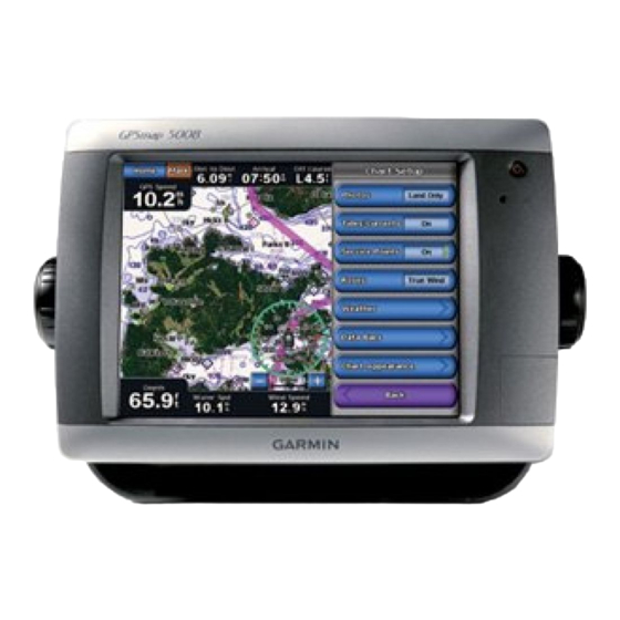
GPSMAP
5000 Series
®
quick reference guide
Advertisement
Table of Contents

Related Manuals for Garmin GPSMAP 5008


Summary of Contents for Garmin GPSMAP 5008
- Page 1 Finding a Marine Service and Navigating to It To find a marine service from your current location: From the Home screen, touch Where To?. 2. Touch the marine service category to which you want to navigate. The unit shows the list of the 50 nearest locations and the distance and bearing to each. 3. Touch the marine service item to which you want to navigate. A screen containing information about the selected marine service appears. Touch Navigate To > Go To. (Or, touch Guide To when using a preprogrammed BlueChart g2 Vision card to use Auto Guidance.) 5. Follow the colored line on the screen to the destination. List of Marine Service Items Go to Destination Navigating to a Destination on the Chart To navigate to a destination on the chart: From the Home screen, touch Charts > Navigation Chart.
- Page 2 4. Touch the location of the first turn. Touch Add Turn. Repeat until the route is complete. To edit a route: From the Home screen, touch Information > User Data > Routes. 2. Touch the route to edit. Touch Edit Route. You can edit the route name, turns, or delete the route. Routes Screen Route Information Please visit www.garmin.com for additional documentation and information. January 2008 Part Number 190-00803-01 Rev. B Printed in Taiwan...
Need help?
Do you have a question about the GPSMAP 5008 and is the answer not in the manual?
Questions and answers