Table of Contents
Advertisement
Quick Links
Advertisement
Table of Contents

Related Manuals for Carlson Surveyor 2


Summary of Contents for Carlson Surveyor 2
- Page 2 © Copyright 2015 Carlson Software. All rights reserved. Information is subject to change without notice. Juniper Systems® is a registered trademark of Juniper Systems, Inc. Allegro Field PC™ and JSNav™ are recognized trademarks of Juniper Systems, Inc. ActiveSync, Excel, Hotmail, Internet Explorer, Microsoft, MSN, Outlook, PowerPoint, Visual Studio,...
-
Page 3: Table Of Contents
CONTENTS Getting Started ............................ 9 The Anatomy of the Surveyor2 ....................... 9 Front and Back Features ......................9 Battery Compartment and Card Slots ..................10 Connector Module ........................10 Perform Initial Tasks ........................10 Review Documentation ......................11 Apply a Screen Protector (Optional) ..................11 Install the Battery Pack, SD Card, and Mini SIM Card ............... - Page 4 Keyboard Backlight ........................25 Display and Touchscreen ....................... 26 Display and Touchscreen Settings ..................... 26 Display Backlight Settings ......................29 Disabling and Enabling the Touchscreen ................... 31 Power Management ........................31 Charging the Battery Pack ......................32 Battery Life ..........................32 Summary of Options to Reduce Power Usage................
- Page 5 Suspending and Resuming the Surveyor2 ................. 45 Resetting the Surveyor2 ......................45 Powering Off and On the Surveyor2 ..................46 Restoring the Surveyor2 to its Factory State (Clean Boot) ............46 Subdued Lighting (Tactical) Mode ....................47 Set Up During a Reset ........................ 47 Adjust Brightness Using the Keyboard ..................
- Page 6 GPS/GNSS Accuracy ........................62 GPS/GNSS Settings ........................62 GPS Intermediate Driver ........................ 63 NMEA Sentences ........................... 63 JSNav Application .......................... 64 Use the Touchscreen or Keyboard with JSNav ................65 JSNav Settings ..........................66 Camera............................... 73 Camera Settings for Still Images ....................73 Pictures Menu ..........................
- Page 7 Maintenance of Your Modem ....................... 84 Storage, Maintenance, and Recycling ....................86 Storing the Surveyor2 and Battery Pack..................86 Storing the Surveyor2 for Less Than Two Weeks ..............86 Storing the Surveyor2 for More than Two Weeks ..............86 Protecting the Touchscreen ...................... 86 Cleaning the Surveyor2 ......................
-
Page 9: Getting Started
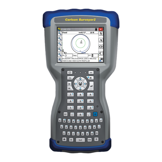
GETTING STARTED The Carlson Surveyor2 Rugged Handheld™ data collector features Bluetooth, Wi-Fi and an alphanumeric keyboard. Standard accessories include a lithium-ion battery pack, AC wall charger, USB micro client sync cable, hand strap, capacitive stylus with tether and tripod hook. A camera, GPS/GNSS, and cellular data modem are options. -
Page 10: Battery Compartment And Card Slots
BATTERY COMPARTMENT AND CARD SLOTS 1. Battery Door, Screws 2. Battery Pack 3. Mini SIM Card Slot 4. Micro SD/SDHC Card Slot 5. Battery Compartment 6. Connector Protector CONNECTOR MODULE onnector Module 2. USB Client, Micro 3. Microphone/Speaker Jack 4. USB Host, Full Size 5. -
Page 11: Review Documentation
REVIEW DOCUMENTATION The owner’s manual, quick start guide and Microsoft® License Agreement are available in multiple languages. Other documents like release notes are available in English. These documents are located on our website at: View, download, and print documents as desired. www.carlsonsw.com (Adobe Reader must be installed on your computer. -
Page 12: Attach The Hand Strap And Stylus Tether
now before you install the battery pack or at another time. See more details about these cards in Chapter 2, Hardware Components, Micro SD Cards and Chapter 8, 3G Data Modem, Install the Mini SIM Card. 3. Place the Li-Ion battery pack in the compartment. Make sure the + and - symbols on the battery pack label align with the symbols inside the compartment. -
Page 13: Perform Set Up
One end of the stylus tether is attached to the stylus. To attach the tether to the handheld, follow these steps: 1. Push the free tether loop through one of the tether attachment points on the back of the handheld towards the top. Insert the stylus with the attached tether through this loop and tighten the loop. -
Page 14: Install The Operating System In Other Languages
6. Press the power key to suspend the handheld. Charge the battery pack at room temperature (68° F or 20° C) for 4 to 5 hours. While the battery pack is charging, the red LED blinks. When it is fully charged, the red LED is solid. INSTALL THE OPERATING SYSTEM IN OTHER LANGUAGES The operating system is provided in English by default. -
Page 15: Windows Start Menu
Title Bar Shortcuts to Favorite Applications Dashboard with Function Gadgets Tiles/Soft Keys This screen is automatically shown when the Surveyor2 is turned on. You can get to it from any other screen by pressing and releasing the Home screen key on the keyboard. WINDOWS START MENU The Windows Start menu gives you access to all of the applications on the Surveyor2. -
Page 16: Vertical And Horizontal Movement
The Windows® Embedded Handheld operating system enhances the ability of the handheld to recognize touch gestures, making it easy to use a finger to navigate. Use of the capacitive stylus is an option. The keyboard keys can also be used. Navigation options vary depending on the screen you are viewing. -
Page 17: Updates To The Operating System And Documents
Perform the selected action by pressing the return key or the center action key . For dashboard gadgets like Wi-Fi, one press of the return key shows you which icon is selected; a second key press performs the action, and a third key press turns the action off. For application icons on the Start screen or in favorites, continue to use the arrow keys on the navpad and return or action keys until you get to the screen or menu you want. -
Page 19: Hardware Components
HARDWARE COMPONENTS This chapter discusses the Surveyor2 Rugged Handheld hardware features and usage. KEYBOARD FEATURES The Surveyor2 has a numeric keyboard, function keys, and a QWERTY keyboard. The keys are sealed and have backlight illumination. Some keys and LEDs are programmable. - Page 20 Shift + CTRL + Blue + Press and Release KeyPress KeyPress KeyPress Helmet Run SurvCE (may be programmable key) Soft user programmable key Function Task Escape Manager Keyboard Left Tab brightness Left Tab down Keyboard Right brightness Right Tab Turn Arrow Move up cursor backlight up...
- Page 21 Toggle Back Touchscreen Space Backspace (delete left of cursor) (enable or disable) Enter Enter (return) & & Alt Command (Sticky on 2nd press) - (minus) _ (underscore)
- Page 22 (period) Blue Command (sticky on 2nd press) Wi-Fi Control Panel Screen Grab Task Manager & Power Control Panel...
-
Page 23: Ctrl Power Shortcut Keys
Record Audio Notes Sensors Control Panel Flashlight Toggle GNSS Control Panel < Start screen Home screen Shift command Shift, one key press CAPS Lock, two key presses Release CAPS Lock, three key presses Space Space Control command (sticky on second press) Power Suspend or resume, one key press Open Power Menu, press and hold... -
Page 24: Programmable Keys
As mentioned in the keyboard table above, the Surveyor2 has the following Power Shortcut Keys: CTRL + Description Keypress Record Audio Note Bluetooth Control Panel Camera Toggle Flashlight Internal GNSS Control Panel Toggle Display & Keyboard Backlights On/OFF Power Control Panel Screen Grab –... -
Page 25: Keyboard Backlight
3. At the bottom of the screen under 2. Assign a program; select the down arrow key to display a list of programs and functions. Select the item you want to reassign to the selected key. KEYBOARD BACKLIGHT Make keyboard brightness adjustments by pressing the blue + forward tab or back tab keys to increase or decrease the keyboard brightness. -
Page 26: Display And Touchscreen
Note: The keyboard backlight turns off when the display backlight dims or the Surveyor2 is suspended. DISPLAY AND TOUCHSCREEN The Surveyor2 has a bright color display and capacitive touchscreen with a diagonal viewing area of 4.2 inches (107 mm). It is easy to view outdoors and is sealed against water and dust. The Windows®... - Page 27 Select the preferred mode, and tap Load. Do not interrupt the loading process. You can try different modes to see which one works best for you. The Stylus mode typically works best with a capacitive stylus, the Finger mode typically works best with a finger and the Water mode typically works best when using the Surveyor2 in the rainy or misty conditions when moisture will be present on the screen.
- Page 28 Note: A key is not set to launch this feature by default. To use this feature, go to the Buttons control panel, Program Buttons screen to assign a key to launch the function. Select the Windows soft key or press the CTRL+ home keys, then Settings >...
-
Page 29: Display Backlight Settings
Then holding the right soft key and tapping the display, would zoom the display by a factor of 2 as shown: This makes it easier to select points on the touchscreen with the stylus or your finger. When you are finished releasing the right soft key returns the display to no zoom or the standard size. DISPLAY BACKLIGHT SETTINGS The display backlight can be toggled off and on by pressing the CTRL + L keys. - Page 30 DIMMING THE DISPLAY AUTOMATICALLY The display has a minimum brightness setting that it dims to when the Surveyor2 is idle for the time interval indicated. The display backlight dims by 50% or more, so the display is still partially visible. You can adjust the dim time interval (see the above screen image) for battery and/or external power by selecting Battery Power or External Power on the top menu bar.
-
Page 31: Disabling And Enabling The Touchscreen
and then for battery and/or external power select how long the screen stays on when it is not in use. Shorter times save battery power. When the “On battery power” or “On external power” boxes are checked and the Surveyor2 times out, not only is the display turned off, but the Surveyor goes into a suspend state. -
Page 32: Charging The Battery Pack
approved batteries may void your product warranty. CHARGING THE BATTERY PACK To charge the battery pack, suspend the handheld, and then refer to the instructions in Chapter 1, Getting Started. It typically takes 4 to 5 hours to fully charge a battery pack. We recommend that you keep the handheld battery pack charging when it is not in use for up to two weeks. -
Page 33: Summary Of Options To Reduce Power Usage
Battery packs last approximately 1,000 to 3,000 charging cycles before they need to be replaced. This is impacted by applications and environmental factors. SUMMARY OF OPTIONS TO REDUCE POWER USAGE You can adjust some settings to preserve power: Turn off the display (suspend) after a set interval. See Display Backlight Suspend Interval earlier in this chapter. -
Page 34: Flashlight
The Blue LED is not tied to a key or a notification by default. The green and blue LEDs can be programmed through the JS Application Programming Interface (JSAP). Please contact Carlson Software technical support for more information. FLASHLIGHT Surveyor2 Geo models (Geo and Geo Cell units) have a flash LED located underneath the camera window on the back of the Surveyor2. -
Page 35: Connector I/O Module
2. Loosen the screws to the battery compartment, and remove the door. The hand strap remains attached. The Surveyor2 is not sealed against water and dust when the battery door is not installed properly. 3. Remove the battery pack. 4. An image on the battery compartment label shows the correct location and orientation for the SD card (slot on the right). -
Page 36: Audio Features
5. COM1: RS-232C 9-pin D-sub connector, 5 V @500 mA available on pin 9 (ring in) under program control 6. Power input jack: 12 to 24 VDC for power input and battery charging The connector I/O module is user-replaceable. Contact our sales department or your supplier for details. - Page 37 From the Output screen you can adjust the speaker options. Select the Input screen from the horizontal menu near the top of the screen. You can adjust the onboard and headset microphones as desired.
-
Page 39: Programs And Settings
PROGRAMS AND SETTINGS This chapter discusses the Surveyor2 Rugged Handheld built-in programs and settings. HOME SCREEN The Home screen is your main control center for the Surveyor2. View vital system information and quickly access functions and applications that are frequently used. The default home screen for a basic unit is shown below. -
Page 40: Dashboard
DASHBOARD The dashboard consists of a background image and up to six dashboard gadgets that serve as functional indicators and control keys. You can switch between two color schemes and select which gadgets are shown. Tap on the menu soft key and select Switch Color Scheme to change color schemes or Configure to select gadgets. -
Page 41: Gadget Color Indicators
3G Data Modem (Geo model with cell modem): Shows the on/off state of the optional cellular modem. Flashlight: Shows the on/dim/off state of flashlight feature (included with camera). GADGET COLOR INDICATORS Wi-Fi, Bluetooth, GPS and 3G data modem gadgets indicate status using these colors: Gray: Off or inactive Yellow: Partial state (getting satellite fix, etc.) Green: Active and available... -
Page 42: Tile Bar
You can use it to jump between the applications you use most. While running an application, press the Home key and select a different application from your favorites. To return to the first application, press the home key again, then tap on the first application you were running. You can customize which application shortcuts are shown. -
Page 43: Windows Start Menu
Minimize Edit Navigate back Delete Menu On-screen keyboard WINDOWS START MENU The Windows Start menu gives you access to all of the applications on the Surveyor2. You can get to the Start menu from any screen by tapping the Windows tile (soft key) on the display or pressing the CTRL+ Home keys on the keyboard. -
Page 44: Mega Keys (And Mega Keys Night) Keyboard Features
The default keyboard is Mega Keys, featuring large keys and increased functionality. To view and select other options including Block Recognizer, Letter Recognizer, and Mega Keys Night, press and hold the keyboard tile . To turn the on-screen keyboard off, press the keyboard tile. -
Page 45: Suspending And Resuming The Surveyor2
Some keys have an extra character bar that includes items like accented characters or additional symbols. These keys have three dots in the bottom right corner like the z key . Press and hold the key to bring up the extra bar. Tap the desired item or dismiss the bar by tapping outside of the bar. -
Page 46: Powering Off And On The Surveyor2
If the Surveyor2 is unresponsive, slow, or programs won’t launch, performing a reset might solve the issue. You may be asked to perform a reset when an application is installed. CAUTION: Be aware that during a reset, applications are closed and unsaved work may be lost. Follow these steps to reset your Surveyor2: 1. -
Page 47: Subdued Lighting (Tactical) Mode
3. When the screen turns black, press and hold the power key again until the bios screen is shown. 4. Move the top slider on the screen to the right to set or clear factory defaults (this clean boots the handheld). 5. -
Page 48: Compass And Accelerometer
COMPASS AND ACCELEROMETER The Surveyor2 has a built-in compass and accelerometer. The compass is used for embossing GPS information on pictures taken with the camera, or embedding GPS information into jpg files. The compass is also used by the JSNav program. The accelerometer assists the compass in determining direction, even when the device is not resting flat. -
Page 49: Communicating With A Desktop Computer
The Magnetic Declination angle is the difference between True North and magnetic North. Applications that are using True North use this value to adjust the readings from the compass. To calibrate the compass, select Calibrate Compass. Rotate the handheld around all three axis several times in every orientation possible (for at least 10 seconds). -
Page 50: Information For Software Developers
The Getting Started screen provides information on current settings, help for setting up features and applications, and shortcuts to set up screens. To see a list of topics press Start > Getting Started. INFORMATION FOR SOFTWARE DEVELOPERS For Surveyor2 SDK information, contact Carlson Software technical support. -
Page 52: Bluetooth® Wireless Communication
BLUETOOTH WIRELESS COMMUNICATION ® The Surveyor2 has built-in Bluetooth® wireless technology, allowing you to connect it to other wireless devices with Bluetooth technology. Minimum performance between similar objects in an unobstructed environment is approximately 100 feet (30 meters). Line of sight ranges up to 1500 feet (450 meters) are possible when paired with Class I Bluetooth devices The handheld provides simple configuration options for the following types of Bluetooth devices: ... -
Page 53: Bluetooth Control Panel
Note: If the Bluetooth radio is turned on and then the handheld is suspended, wireless Bluetooth turns off to save battery power. When the Surveyor2 resumes (turns on), the radio turns on automatically. BLUETOOTH CONTROL PANEL To create a partnership with and connect to other Bluetooth devices, such as headphones, keyboards, and modems, follow these steps: 1. -
Page 54: Serial Device (Com) Control Panel
a) If the device has an assigned passcode, enter the number and press Next. b) If a passcode is required but has not been assigned, enter an alphanumeric passcode between 1 and 16 characters in length. Press Next. c) If a passcode is not required, leave the box blank and press Next. Note: If you are unsure whether or not the device requires a passcode and if one has already been assigned to the device, see the user documentation that came with the device. - Page 55 2. After the handheld searches, a list of discovered devices is shown. Select the device you want to connect to from the list and tap Connect. A COM port is automatically assigned for the device. You can change it to another COM port if desired. 3.
-
Page 57: Wi-Fi Wireless Networking
WI-FI WIRELESS NETWORKING The Surveyor2 has built-in Wi-Fi wireless networking to connect to the Internet or a office network. CONNECTING TO A WI-FI NETWORK To use Wi-Fi, you need to be in range of a Wi-Fi access point to make a connection. To actively look for a network connection, complete the following steps: From the Home screen, turn Wi-Fi on by selecting the Wi-Fi gadget . -
Page 58: Wi-Fi Dialog Box
3. Select the network to which you want to connect. If you want to add a new network, select Add New from the top of the list. 4. Configuration and authentication setup screens are shown. Depending on the network you are connecting to, you may need to make some selections from pull down lists and enter information like a passkey. -
Page 59: Adjusting Wi-Fi Settings
Tap on the screen outside of the dialog box to remove it temporarily. You can also disable it to keep it from appearing in the future. When this dialog box is shown, select the Menu soft key and select “Don’t show this message again” from the list. ADJUSTING WI-FI SETTINGS To add a new Wi-Fi network or edit settings, open the Wi-Fi control panel, select the Menu soft key and make desired selections from the pull-down list. -
Page 61: Gps/Gnss
GPS/GNSS Surveyor2 Geo models have an internal GPS/GNSS receiver with 2 to 5 meter accuracy. USING GPS/GNSS To use the internal GPS/GNSS, tap on the GPS/GNSS status gadget to turn it on. The GPS/GNSS starts looking for satellites to use for a fix. The green LED on the keyboard blinks periodically, and a satellite icon is placed on the title top bar. -
Page 62: Gps/Gnss Accuracy
This reduces accuracy. The more items between you and the satellites, the lower the accuracy. Note: SurvCE configures the internal GPS/GNSS receiver when GPS Rover uses Carlson and the Manufacturer and Surveyor2 L1 as the Model. When using SurvCE there is typically no need to configure the GPS/GNSS settings from the control panel. -
Page 63: Gps Intermediate Driver
power when suspended. You might want to restart the GNSS receiver after changing settings. GPS INTERMEDIATE DRIVER The GPS Intermediate Driver (GPSID) is used to allow more than one program to use data from the GPS receiver. The GNSS control panel controls how the GPSID is used. The GPSID can output data on another COM port in a way that allows multiple programs to access the same COM port. -
Page 64: Jsnav Application
GSV messages will be generated. Total number of messages being transmitted and the number of the current message are indicated in the first two fields of the message. If multiple GPS, GLONASS, etc. satellites are in view, then separate GSV messages with Talker ID GP for GPS satellites in view, GL for GLONASS and GA for GALILEO satellites will be generated. -
Page 65: Use The Touchscreen Or Keyboard With Jsnav
Note: Calibrate the compass and accelerometer before you use JSNav. Refer to Chapter 3, Programs and Settings, Compass and Accelerometer Calibration. From the Home screen select the JSNav gadget . A splash screen appears while the application opens, and then the main JSNav screen appears. Select the satellite icon in the upper right corner to turn GPS on or off. -
Page 66: Jsnav Settings
JSNAV SETTINGS Tap on the menu icon in the upper left corner of the screen, and select Settings from the list. Go through the menu options to set up JSNav. Note: These settings only impact the JSNav application. To set up GPS/GNSS go to the GNSS Settings control panel discussed earlier in this chapter. - Page 67 Waypoint Settings: Set up the waypoint file naming scheme, including the waypoint prefix, increment step size, and current value. For example, if the waypoint prefix is Point, increment step size is 10, current value is 100, and default file type is .kml, file names would be Point110.kml, Point120.kml, Point130.kml, etc.) Also select the number of points to average.
- Page 68 To navigate back to the waypoint you just collected, select the compass icon. A rotating compass is shown. Walk in the direction of the red arrow. The distance shown decreases as you get closer. Text saying Arrived is shown and you hear a beep (if audio notifications are set up) when you reach the navigation distance threshold set up in GPS Settings.
- Page 69 To collect points in a track, select the play key and start moving along the desired track. Select the pause key as needed and select play to start again. Current position information, total distance, altitude change, and points in the track are collected. When you are finished, select the stop key.
- Page 70 To select all of the files, tap the check box at the bottom of the screen. You can delete export all selected files. Exported files are placed into a directory called Exports inside of your \My Documents folder. IMPORTING WAYPOINTS AND TRACKS Waypoint and track file formats must be .kml, .kmz or .csv.
-
Page 73: Camera
CAMERA Surveyor2 Geo models have a 5MP camera. Juniper Geotagging™ gives you the ability to embed and emboss photos with the date, time, and GPS position. The camera window and flash are located on the back of the Surveyor2. Note: The flash can also be used as a flashlight. See Chapter 2, Hardware Components, Flashlight. -
Page 74: Pictures & Videos Control Panel
PICTURES & VIDEOS CONTROL PANEL To view or change additional settings, select Options from the Menu soft key. The Camera control panel is shown. Use the horizontal scrolling menu near the top of the screen to see what the setting are and make changes as needed. GEOTAGGING When pictures are geotagged, the date, time, latitude, longitude, file name, and notes can be included with the pictures with the emboss and embed options. - Page 75 Select the information you want to emboss on pictures, the position, and the color. The selected information is embossed on pictures, making it part of the images. 3. You can build GPS information into jpg files from the Embed Options screen. (This information does not appear on the images.) You can select Use True North.
-
Page 76: Take Photos And Select Photo Options
Embed GPS allows you to put images into programs like Google Earth™ and sort them by location, etc. If you select User Note, the note screen is shown after a photo is taken. Enter a note for the image and press OK. TAKE PHOTOS AND SELECT PHOTO OPTIONS Press the + C keys to turn the camera on. -
Page 77: Photo Options
Note: The built-in accelerometer is used to detect the handheld orientation when the picture is snapped and save the image in the right orientation. While the photo is being saved, a disk symbol is shown briefly. The full photo is then shown on the screen. -
Page 78: Audio
Select Menu again to view and adjust settings as desired. Press the action key or the return key to start recording a video. Press the key again to end the video. Note: To take photos instead of videos, select Menu and select Still (see previous screen). AUDIO You can record sound with videos. -
Page 79: Library Menu Options
LIBRARY MENU OPTIONS Select a photo or video, then the Menu soft key. You can send, delete, edit, etc. the selected photo or video. -
Page 81: 3G Data Modem
3G DATA MODEM The 3G data modem is included in the Surveyor2 Standard Cell and Surveyor2 Geo Cell models, adding Wide Area Network data modem capability. The modem is installed at the factory. The modem is a cellular data modem, type GSM/UMTS. It is five band modem compatible. The modem operates in different modes, depending on the wireless provider and the signal strength. -
Page 82: Set Up The Cell Modem
To remove the SIM card, pull the tray open and remove the card. Push the empty tray in until it catches. 5. Replace the battery pack, and attach the battery door. 6. Power on the Surveyor2. Note: If the modem was on before shutting the Surveyor2 down to insert the SIM card, you are prompted to configure the data connection when you reboot. -
Page 83: Connection Problems
Select Automatically configure connection. The name of your carrier appears. Select Next. A progress graphic is shown on the next screen while your Internet settings are configured. You can now access the Internet. Open Internet Explorer to test your setup. CONNECTION PROBLEMS If the connection fails to automatically configure, there might not be a signal where you are located. -
Page 84: Maintenance Of Your Modem
Operation of your cell modem close to other electronic equipment may also cause interference if the equipment is inadequately protected. Observe any warning signs and manufacturers’ recommendations. Do not place the cell modem alongside computer discs, credit or travel cards, or other magnetic media. -
Page 86: Storage, Maintenance, And Recycling
STORAGE, MAINTENANCE, AND RECYCLING Follow the instructions in this chapter to properly maintain and recycle the Surveyor2. STORING THE SURVEYOR2 AND BATTERY PACK When the handheld is not being charged and is suspended, it draws a small amount of power. This power draw is used to maintain the memory (RAM) of the handheld in the same state it was when it was suspended. - Page 87 TOUCHSCREEN 1. Disable the touchscreen by pressing the power key until the Power Key menu appears. Tap on Disable TS. 2. Remove the screen protector if you want to clean underneath it. 3. Apply warm water or a mild cleaning solution to a microfiber cloth and gently wipe off the touchscreen.
- Page 88 If you cannot find a location, contact Carlson Software technical support for information about disposal. The Li-Ion battery packs for your Surveyor2 are recyclable. Avoid placing them in the trash or municipal waste system.
-
Page 90: Limited Product Warranty
Carlson Software warrants any expansion packs (RTK GPS or Other) shall be free from defects in materials and workmanship, under normal intended use, for a period of 12 months from the date of shipment from the factory. -
Page 91: Remedy
LIMITATION OF LIABILITY To the fullest extent allowed by law, the obligation of Carlson shall be limited to the repair or replacement of the product. Carlson shall in no event be liable for special, incidental, or consequential, indirect, special or punitive damages of any kind, or for loss of revenue or profits, loss of business, loss of information or data, or other financial loss arising out of or in connection with the sale, installation, maintenance, use performance, failure, or interruption of any product. -
Page 92: Extended Warranties
Functional analysis performed after repair Repair turnaround within 10 working days of receipt unless special circumstances exist Shipping costs to return device to customer EXTENDED WARRANTIES The Surveyor2 can be warranted up to 5 years (including the standard warranty period) through the purchase of an extended warranty. -
Page 93: System Information For Your Surveyor2
SYSTEM INFORMATION FOR YOUR SURVEYOR2 When you contact a repair center you need some unique system ID information for your Surveyor2 (serial number, model number, etc.). Select the System Info icon from the favorites bar on the Home screen or tap Start > Settings > System > System Information to view the System Information menu. -
Page 95: Product Warnings
PRODUCT WARNINGS Follow the warnings listed below to use the Surveyor2 and accessories safely. BATTERY WARNINGS ▲WARNING! This device comes with a lithium ion rechargeable battery pack. To reduce the risk of fire or burns, do not disassemble, crush, puncture, short external contacts, or expose the battery pack to fire. -
Page 96: Certifications And Standards
Use only wall chargers intended for the Surveyor2. Using any other external power source can damage your product and void your warranty. CERTIFICATIONS AND STANDARDS FCC - UNITED STATES In compliance with the FCC rules 47 CFR 15.19(a)(3), the statements that follow must appear on the device or in the user documentation. -
Page 97: Industry Canada
This cell modem is compliant with FCC regulations when operated within the temperature range of -30°C to +50°C. Do not operate the cell modem outside of this temperature range. INDUSTRY CANADA In compliance with Industry Canada rules, the following statement must appear on the device or in the user documentation: This Class B digital apparatus complies with Canadian ICES-003. - Page 98 1 to 13. Outdoor operation is permitted on channels 1 to 8, as transmit power in the band 2454 to 2483.5 MHz is limited to 10 mW. The latest requirements may be found at: http://www.art-telecom.fr DECLARATION OF CONFORMITY The Declaration of Conformity for CE Marking is available by contacting Carlson Software technical support.
-
Page 100: Surveyor2 Rugged Handheld Specifications
SURVEYOR2 RUGGED HANDHELD SPECIFICATIONS FEATURE SPECIFICATION Microsoft Windows Embedded Handheld 6.5.3 (completely compatible with ® Operating Microsoft Windows Mobile 6.5.3) ® ® System English, French, German, Spanish, Brazilian Portuguese Processor 1GHz ARM Cortex A8 i.MX53 Memory 512 MB DDR2 RAM Primary Data ... - Page 101 Internet Explorer Internet Sharing Software JSNav Included Carlson Home screen, customizable with selectable dashboard gadgets and program shortcuts On-Screen Keyboards, Mega Keys and Mega Keys Night Notes Pictures & Videos Remote Desktop Mobile ...
- Page 102 FEATURE SPECIFICATION Geo with Standard features plus Camera, and GPS Geo Cell with Standard features plus Camera, GPS, and Cell, US/North America and CE/EU Models 5MP resolution Autofocus Camera (Geo Video capture models) JPEG image format ...
- Page 103 Note: Specifications are subject to change without notice.
Need help?
Do you have a question about the Surveyor 2 and is the answer not in the manual?
Questions and answers