Kenwood DNX892 Instruction Manual
Gps navigation
Hide thumbs
Also See for DNX892:
- Instruction manual (143 pages) ,
- Quick start manual (60 pages) ,
- Quick start manual (211 pages)

Related Manuals for Kenwood DNX892


Summary of Contents for Kenwood DNX892
- Page 1 GPS NAVIGATION SYSTEM DNX892 DNX772BH DNX692 DNX572BH GPS NAVIGATION INSTRUCTION MANUAL © IM386_Nav_K_En_00...
-
Page 2: Table Of Contents
Contents Navigation End-User License Agreements Starting a Route Previewing Multiple Routes Following a Route Getting Started Using the Navigation Map Using the Navigation System Adding a Point to a Route Help When You Need It Taking a Detour Searching Help Topics Stopping the Route Status Bar Icons Using Suggested Routes... - Page 3 Using the Apps Traffic Information About the Apps Understanding Traffic About ecoRoute Traffic Data Using INRIX Traffic Service Creating a Vehicle Profile About the Traffic Icon Resetting Your Vehicle Profile Traffic on Your Route Calibrating Fuel Economy Viewing Traffic on Your Route Taking the ecoChallenge Manually Avoiding Traffic on Your Route About ecoChallenge Scores...
-
Page 4: End-User License Agreements
Software License Agreement under copyright laws and international copyright treaties. The Garmin Products are licensed, not BY USING THE DNX892 / DNX772BH / DNX692 sold. The structure, organization and code of / DNX572BH, YOU AGREE TO BE BOUND BY THE... - Page 5 illegal or unauthorized purpose; or restrictions set forth in the following paragraphs, you may copy the applicable Garmin Product • transmit any viruses, worms, defects, Trojan only as necessary for your use to (i) view it, and horses, or any items of a destructive nature. (ii) save it, provided that you do not remove any copyright notices that appear and do not modify In the event that you are located outside of the...
- Page 6 End-User License Agreements warranty exclusions, so to that extent the above display your estimated time to destination and exclusion may not apply to you. relevant traffic information regarding the predicted route. Information related to your driving routines would be accessible to any other person who uses Disclaimer of Liability.
- Page 7 experience with the Content provided by a new provider may not duplicate your experience with Entire Agreement. These terms and conditions the previous Content supplier. constitute the entire agreement between Garmin and its licensors, including the licensors, service providers, channel partners, suppliers and affiliated Export Control.
- Page 8 End-User License Agreements version will control. Government End Users. If End User is an agency, department, or other entity of the United States Government, or funded in whole or in part by the U.S. Government, then use, duplication, reproduction, release, modification, disclosure or transfer of the Application and accompanying documentation is subject to restrictions as set forth in DFARS 252.227-7014(a)(1) (JUN 1995) (DOD...
- Page 9 English...
-
Page 10: Getting Started
Getting Started The first time you use your Kenwood Navigation System, you need to set up your system. The Help menu provides additional information. Help When You Need It WARNING See "Safety Precautions and Important Information" Select Apps > Help to view information in the Quick Start Guide for product warnings and about using the device. -
Page 11: Satellite Signals
Adding a Shortcut Satellite Signals You can add shortcuts to the Where To? menu. A After your vehicle is turned on, the navigation shortcut can point to a location, a category, or a system begins acquiring satellite signals. The search tool. The Where To? menu can contain up to system may need a clear view of the sky to acquire 36 shortcut icons. -
Page 12: Finding Locations
Finding Locations The navigation system offers many methods for finding locations. The detailed maps loaded in your navigation system contain locations, such as restaurants, hotels, and auto services. You can use categories to browse for nearby businesses and attractions. Finding a Location by Category Enter a search term. -
Page 13: Finding Fuel Stations And Prices
Finding Fuel Stations and Prices Finding a City Before you can use this feature, your device Before you can find a city, you must add a must be connected using Bluetooth to access shortcut to the cities search tool (page 11). -
Page 14: Finding A Location Using Coordinates
Finding Locations Finding a Location Using Coordinates Select an option: Before you can find a location using coordinates, • Select a location marker. you must add a shortcut to the coordinates • Select a point, such as a street, intersection, or search tool (page 11). address location. You can find a location using latitude and If necessary, select the location description longitude coordinates. -
Page 15: Going Home
Going Home Select an area on the map. Select Where To? > Go Home. The address of the location appears at the bottom of the screen. Editing Your Home Location Information Select the location description. Select Where To? > Saved > Home. Select Set Location. Select > > Edit. Saving a Location Enter your changes. -
Page 16: Starting A Route To A Saved Location
Finding Locations Starting a Route to a Saved Location Assigning Categories to a Saved Location You can add custom categories to organize your Select Where To? > Saved. saved locations. ⁄ If necessary, select a category, or select All Saved Places. •... -
Page 17: Navigation
• To add or remove map layers, select safe driving judgment at all times. Garmin and JVC KENWOOD will not be responsible for any traffic • To view specific location categories, select fines or citations you receive for failing to follow all and select a category icon. -
Page 18: Adding A Point To A Route
Navigation Adding a Point to a Route Using Suggested Routes Before you can use this feature, you must save at While navigating a route, select least one location and enable the travel history return to the main menu. feature (page 15). -
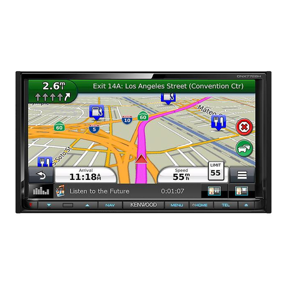
Page 19: Navigating To An Exit
Navigating to an Exit Adding a Custom Avoidance Area Custom avoidances allow you to avoid specific From the map, select > Exit Services > areas and sections of road. You can enable and disable custom avoidances as needed. Select Go!. Select Settings >... -
Page 20: Deleting Custom Avoidances
Navigation Deleting Custom Avoidances Select Settings > Navigation > Custom Avoidances. Select an option: • To delete all custom avoidances, select • To delete one custom avoidance, select the avoidance, and select > Delete. Enabling Advanced Detours Select Settings > Navigation > Advanced Detours. Taking a Detour Around Specified Areas You can take a detour for a specified distance along your route or detour around specific roads. -
Page 21: The Map Pages
The Map Pages You can customize which data appear on the map and view upcoming turns and current location information. Customizing the Map Layers Changing the Map Perspective You can customize which data appear on the Select Settings > Map & Vehicle > Driving map, such as icons for points of interest and road Map View. -
Page 22: Viewing A List Of Turns
The Map Pages Viewing a List of Turns Viewing Junctions When you are navigating a route, you can view all While navigating a route, you can view the of the turns and maneuvers for your entire route junctions on major roadways. When you approach and the distance between turns. -
Page 23: Resetting Trip Information
Resetting Trip Information From the map, select > Trip Computer. Select > Reset All. Select an option: • When not navigating a route, select Select All to reset every data field, except the speedometer, on the page. • Select Reset Trip Data to reset the information on the trip computer. • Select Reset Max. Speed to reset the maximum speed. • Select Reset Trip B to reset the odometer. Viewing Current Location Information You can use the Where Am I? page to view information about your current location. - Page 24 Traffic Camera, and more. The coverage of these services depends on availability in your region. Enter the current fuel price. For details, see other Kenwood system manuals. Enter how much fuel your vehicle has used About ecoRoute since the last fill up.
- Page 25 Resetting Your Score Exporting a Mileage Report You can restart your current ecoChallenge. Select Apps > ecoRoute™ > ecoChallenge. Connect a USB mass storage device to your Kenwood unit. Select > Reset. Select Apps > ecoRoute™ > Mileage Report. Select Yes.
- Page 26 Using the Apps Viewing Weather Near a Different City Planning a Trip You can use the trip planner to create and save a Select Apps > Weather > Current Location. trip with multiple destinations. Select an option: Select Apps > Trip Planner. • To view weather for a favorite city, select a city Select New Trip.
- Page 27 Editing a Saved Trip Finding Parking Before you can use this feature, your device Select Apps > Trip Planner. must be connected using Bluetooth to access connected services. This feature is not available Select a saved trip. in all areas. You can find detailed parking information, Select including parking availability in nearby garages,...
- Page 28 Traffic Data Using INRIX Traffic Service NOTICE Garmin and JVC KENWOOD is not responsible for You can purchase a traffic subscription to receive the accuracy or timeliness of the traffic information. traffic data using INRIX Traffic Service. When your...
- Page 29 Traffic on Your Route Viewing Traffic on the Map When calculating your route, the navigation The traffic map shows color-coded traffic flow system examines the current traffic and and delays on nearby roads. automatically optimizes the route for the shortest From the map, select time.
- Page 30 Customizing the Settings You can customize the settings of your GPS navigation system. Customizing the Navigation System Changing the Navigation Settings Select Settings. Select Settings > Navigation. • Calculation Mode—sets route preference. Select a setting category. • Avoidances—sets road features to avoid on a route. •...
- Page 31 Customizing the Settings Updating the Time Settings Restoring Settings You can restore a category of settings or all Select Settings > Units & Time. settings to the factory default values. • Current Time—select Automatic to update the time Select Settings. automatically.
- Page 32 Follow the on-screen instructions. WARNING Updating the Map Data Garmin and JVC KENWOOD are not responsible for You can purchase updated map data from Garmin the consequences of using custom POI databases, or ask your Kenwood dealer or Kenwood service or for the accuracy of custom POI databases.
- Page 33 For the latest free software updates (excluding map data) throughout the life of your Garmin products, visit the Garmin Web site at www.garmin.com/kenwood. © 2015 Garmin Ltd. or its subsidiaries Garmin International, Inc. 1200 East 151st Street, Olathe, Kansas 66062, USA Garmin (Europe) Ltd.
Need help?
Do you have a question about the DNX892 and is the answer not in the manual?
Questions and answers