Table of Contents
Advertisement
Advertisement
Table of Contents

Related Manuals for Rand McNally TND 85


Summary of Contents for Rand McNally TND 85
- Page 2 Intentional or unintentional changes or modifications to the equipment accordance with the instructions. However, there is no guarantee that not expressly approved by Rand McNally could void the user’s authority interference will not occur in a particular installation. If this equipment to operate the equipment.
- Page 3 About GPS The Global Positioning System (GPS) is a constellation of satellites that a GPS receiver uses to calculate geographical positions. To determine a position, data from at least three satellites is required. To determine elevation, the data from four or more satellites is required. Accuracy of the positioning varies from 10 feet to several hundred feet, depending on vehicle placement and the surrounding environment.
-
Page 4: Table Of Contents
Table of Contents Table of Contents 1. Your Device ..................1 Filter POIs ................... 27 What’s Included ................. 2 POIs ....................28 Install the Mount ................2 Home/Work ..................29 History & Bookmarks ................ 30 TND™ Tablet 85 Hardware ............... 3 Route Map Window ................ -
Page 5: Your Device
• Do not open the navigation device casing. • Follow navigation system instructions only when local regulations • Do not attempt to replace the battery. Contact Rand McNally and road traffic allow you do so. Customer Support with questions about the battery. -
Page 6: What's Included
1. Your Device What’s Included Install the Mount Rand McNally TND™ Tablet Note: Follow all local regulations governing the placement of the mount. • Two-piece mount: - Magnet 1. Select an area with a line of sight to the sky and GPS satellites. -
Page 7: Tnd™ Tablet 85 Hardware
1. Your Device TND™ Tablet 85 Hardware Home Volume Power Down Up Dash cam Micro USB (power) Audio out Micro SD card Main Menu TND™ Tablet 85 User Manual... -
Page 8: Getting Started
Wi-Fi connection. Registration In the next step, you’ll be prompted to register your tablet with Rand McNally. Your registration ensures that you have access to the latest information and updates, as well as customer support. TND™ Tablet 85 User Manual... -
Page 9: Navigating Your Tnd Tablet 85
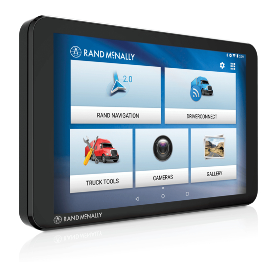
2. Getting Started Navigating Your TND Tablet 85 Android User Interface Bluetooth® Do not disturb Swipe down at top to view settings Wi-Fi is on Indicates remaining battery power Current time Settings View installed apps Back Return to last home screen View open apps Main Menu Rand Navigation 2.0... -
Page 10: Tnd Tablet 85 Quick Settings
2. Getting Started TND Tablet 85 Quick Settings • Bluetooth – Pair with another device using Bluetooth. • Wi-Fi – Connect to a wireless network. • Connect to Car Stereo – Connect your headphone output to a vehicle aux input. •... -
Page 11: Android Settings
2. Getting Started Android Settings • Do not disturb – Options for disabling notifications and alarms. • Network & Internet – Options for Wi-Fi, data usage, tethering, VPN, and Airplane mode. • Connected devices – Options for Bluetooth, Cast, printing, and •... -
Page 12: Rand Navigation 2.0
3. Rand Navigation 2.0 Home Screen Single-line Search Tap to begin tying, and enter a destination, address, or Point of Interest. You can access any destination from the single-line search. Map View Mode Tap to switch the map view: 3D map, North up, or Heading up. Wi-Fi Connected Services Tap to enable fuel prices, weather and traffic on the map. - Page 13 3. Rand Navigation 2.0 1. Tap Up or Down to view options. Preferences Page Preferences Page 2. Tap the option to be set. 3. Enter the new information. Route Warnings 4. Tap Back to save changes. Traffic ............11 Warning type ..........13 Recalculation ..........11 Auto dismiss ..........13 Preferred route ........11...
- Page 14 3. Rand Navigation 2.0 General Options General Options Language English Load Prompt Enabled Español Always loaded Français Specify whether mileage should be For the screen and spoken instructions. calculated with the truck empty, always loaded, or whether to display a prompt Units U.S.
- Page 15 3. Rand Navigation 2.0 Truck Info Options Route Options Traffic On/Off slider (requires Wi-Fi connection) Hazmat Type None Explosives Recalculation Auto Gases Manual Flammable Liquids Flammable Solids Preferred Route Fastest route Oxidizers Shortest route Poison Radioactive ETA Adjustment Increase ETA more Corrosives Increase ETA some ETA ok...
- Page 16 3. Rand Navigation 2.0 Options Options Day/Night Mode Automatic Truck POI Icons On/Off slider Night Select icons to display on map Select travel centers, service, weigh Route Color Tap the color to select. stations and truck POIs to display on the map.
- Page 17 3. Rand Navigation 2.0 Warnings Options Warnings Options Warning Type None Speed limit On/Off slider Audio & Visual Set the amount over the posted limit at Visual only which the warning appears. Audio only Set a user-defined maximum speed to be warned whenever the truck exceeds that speed, regardless of posted Auto Dismiss Warnings...
-
Page 18: Destination Search
3. Rand Navigation 2.0 Destination Search To access this window from the Home Screen, tap Where to? Single-line Search Begin typing to search for a destination. Guided Search Tap to access the guided search options. Points of Interest Tap to search for a point of interest (POI), such as a travel center, restaurant, etc. -
Page 19: Single-Line Search
3. Rand Navigation 2.0 Single-line Search To access the single-line search window from the Home Screen, tap Where to? From this screen, you can begin typing an address, point of interest, or any other destination type. The single-line search will return matching results below. -
Page 20: Guided Search
3. Rand Navigation 2.0 Guided Search New Location Tap to route to a destination by entering the address, city center, intersection, or by entering latitude and longitude coordinates. My Trips Tap to review your saved trips. History Tap to review your recent destinations. Address Book Tap to select a destination from your Address Book. -
Page 21: Using Guided Search
3. Rand Navigation 2.0 Using Guided Search The Guided Search Keyboard in the Rand Navigation 2.0 app helps you quickly locate your destination. Auto-Complete Keyboard As you key in characters, the keyboard only displays the next possible letter or number. Letters and numbers that cannot be entered in sequence are disabled. -
Page 22: New Location
3. Rand Navigation 2.0 New Location Address Navigate to an address by entering the city (or postal code), street, and house number. City Center Navigate to a city center. Intersection Navigate to the intersection of two roads within a specified city. Coordinates Navigate to a coordinate location. -
Page 23: My Trips
3. Rand Navigation 2.0 My Trips Multi-Stop Trips Tap to view a list of saved multi-stop trips or to create a new one. Trails Use Trails to record a “bread-crumb” path where your truck has traveled. TND™ Tablet 85 User Manual... -
Page 24: Multi-Stop Trips
3. Rand Navigation 2.0 Multi-Stop Trips Displays a list of recent destinations. Tap to review and edit a saved trip. Tap + New Trip to start a new multi-stop trip. Trip details: Displays the stops along your trip. Tap the X to remove a stop. Tap + Add a Location to add a new stop. -
Page 25: Trails
3. Rand Navigation 2.0 Trails Use Trails to record a “bread-crumb” path where your truck has traveled. The Trails feature is beneficial when traveling in areas where there is no road network. Tap to open an existing trail. Tap to record a new trail. Tap to edit or delete a trail. -
Page 26: History
3. Rand Navigation 2.0 History Displays a list of recent destinations. Destination Tap an entry in the list to navigate to the destination. Distance Displays the distance to each destination from your current location. Options Tap to access additional options. Edit: Allows you to select and delete an entry in the history list. -
Page 27: Address Book
3. Rand Navigation 2.0 Address Book Displays your saved bookmarks, contacts, and group. Bookmarks Navigate to a a saved address. Contacts Navigate to the stored address from a saved contact. Note: Contacts are stored in the Contacts app. You can add contacts manually or import them. -
Page 28: Address Book: Contacts
3. Rand Navigation 2.0 Address Book: Contacts In order to use contacts for navigation, you first need to set them up in the Rand Navigation 2.0 app. You can add contacts manually or import them. Create a New Contact Tap to manually create a new contact. Search Tap to search for an existing contact. -
Page 29: Address Book: Groups
3. Rand Navigation 2.0 Address Book: Groups Use Groups to organize your contacts and destinations into categories for easier searching. Available Groups Displays the groups you have created. New Group Tap to create a new group. Group Destination Displays the destinations stored in the selected group. Tap a destination to begin navigation. -
Page 30: Pois
3. Rand Navigation 2.0 POIs Displays Points of Interest (POIs) near your current location, near a specific location, along your intended travel route, or near your destination. My Truck Tap to display POIs near your current location. A city Tap to display POIs near a specific city. My route Tap to display POIs along your route. -
Page 31: Filter Pois
3. Rand Navigation 2.0 Filter POIs Truck-related points of interest such as Travel Centers and Truck Services can include several amenities. To select only the locations with the amenities that you are interested in, filter your search results. Nearby Places Lists destinations near your location that match the category selected. -
Page 32: Pois
3. Rand Navigation 2.0 POIs When you select a POI category, a list of suggestions provided by Yelp (if applicable) and a list of nearby places display. Note: A Wi-Fi connection is required in order to display Yelp information. Yelp Suggestions Displays top-rated suggestions from Yelp. -
Page 33: Home/Work
3. Rand Navigation 2.0 Home/Work You can set bookmarks for a Home and a Work location. This is useful so you can quickly navigate to these destinations. Tap Add Work or Add Home to set these locations. Select Location Tap New Location, History, or POIs to select a Home or Work destination from among these options. -
Page 34: History & Bookmarks
3. Rand Navigation 2.0 History & Bookmarks History Displays your destinations that you have previously navigated to. Bookmarks Displays your saved locations. For both History and Bookmarks: Tap on the title of the tab to display the list of destinations. Tap the destination to begin navigation. -
Page 35: Route Map Window
3. Rand Navigation 2.0 Route Map Window Settings Tap to open the Settings screens. ETA/Time/Distance Tap to change the view between the following options: ETA, Yard ETA, Remaining Time, Remaining Distance, Yard Time, Elevation. Location View Tap to toggle between displaying the current location by city, street name, or by the next cross street. -
Page 36: Exits
3. Rand Navigation 2.0 Exits Slide out to show points of interest at upcoming exits. The list displays the distance to the next exit, exit name and number, and a count of available amenities. 1. Tap on an exit to display a list of POIs at the exit. 2. -
Page 37: Route Options
3. Rand Navigation 2.0 Route Options Route Overview Displays the directions, highways and summary of your trip. Search/Add Stop Tap to add an additional destination(s) to your route. Detour/Avoid Tap to manage locations to avoid on the route, and automatically calculate detours around them. -
Page 38: Route Overview
3. Rand Navigation 2.0 Directions Tab Route Overview Direction Tab Displays the turn-by-turn directions for the current route. Highways Tab Displays the highways along your route, with the number of miles to travel on each. Summary Tab Displays the total travel time and distance for your route, as well as summaries for each leg of the trip (for multi-stop trips). -
Page 39: Detour/Avoid
3. Rand Navigation 2.0 Detour/Avoid From Route Options, tap Detour/Avoid. There are four options available to set up detours and permanent avoids: 1. Next miles alllows you to detour a certain number of miles. Use the slider to set the number of miles to detour/avoid. 2. - Page 40 3. Rand Navigation 2.0 Detour/Avoid When selecting A road, zoom in and out on the map to center the target over the road to avoid. The road is highlighted in red. Tap Permanent Avoid to always avoid it. Tap Detour to avoid it on this trip. When selecting An area, tap on the map to set points for an area to avoid.
-
Page 41: Weather
3. Rand Navigation 2.0 Weather When enabled, Weather displays current weather condition overlays on the map. Notes: • Requires a Wi-Fi connection. • The refresh speed of the weather display is dependent on the connection speed. Weather information is updated every few minutes while Wi-Fi connection is active. -
Page 42: Traffic
3. Rand Navigation 2.0 Traffic To view traffic information, tap to enable the Traffic slider on the map screen. Traffic conditions will overlay on the map when traffic is enabled. Note: Requires a Wi-Fi connection. Tap to enable traffic. Tap to view details and enter settings. Select to view traffic flow, incidents, or both (All). - Page 43 3. Rand Navigation 2.0 Traffic Icons Police Accident Traffic Event Closure Carriageway Danger Exit Blocked Entrance Blocked Delay Spillage Road Work Road Weather Rain Snow Rock Fall High Temperature Low Temperature Wind Thunderstorm Tornado Blizzard Avalanche Heavy Moderate Size Limit Weight Limit Visibility Traffic Standstill...
-
Page 44: Fuel
3. Rand Navigation 2.0 Fuel To view fuel price information, tap to enable the Fuel slider on the map screen. Current fuel prices will overlay on the map at various stations when enabled. Note: Requires a Wi-Fi connection. Tap to enable fuel prices. Tap to view details and enter settings. -
Page 45: Virtual Dashboard
3. Rand Navigation 2.0 Virtual Dashboard Current location. Displays current times at the yard, current location and destination, as well as estimated time of arrival. Sunrise and sunset times based on vehicle location (latitude/longitude) and day. Current speed (above) and posted speed limit (below). Note: Turns red when speed limit warning exceeded. -
Page 46: Fuel Logs
3. Rand Navigation 2.0 Fuel Logs 1. From the Virtual Dashboard, tap Add Fuel. 2. Tap a field to enter information. You can edit the following fields: Fuel quantity, Fuel price, Total cost, Taxable, Location, Station, Date, Last odometer, Current odometer. Distance, Current econo- my, and Average economy are calculated automatically based on your entries. -
Page 47: Junction View
3. Rand Navigation 2.0 Junction View When on a route, Junction Views display when you have an upcoming maneuver. Set distance in Settings > Route. Once past the maneuver, Junction View closes and the previous window displays. Signs to follow for the next maneuver. Includes exit number and highway name/number if applicable. -
Page 48: Truck Tools
Transfer address books, custom POIs, and saved trips from your old TND device. Rand Motor Carrier’s Road Info View Rand McNally Truck Emergency contact information and truck regulations. Rand Motor Carrier’s Road Atlas A digital version of Rand McNally’s Motor Carriers’ Road Atlas. Get Apps Notes Calendar Calculator Unit Converter Quickly convert distance, weight, temperature, and many more. -
Page 49: Tripmaker
4. TripMaker® TripMaker is a trip planning app that allows you to easily browse the map and set up a multi-stop trip. Add via points and send your trip to the Rand Navigation 2.0 app for truck-friendly routing. Please note that TripMaker does not provide truck routing. View Help in the TripMaker app to learn more. -
Page 50: Motor Carriers' Road Atlas
5. Motor Carriers’ Road Atlas A digital version of Rand McNally’s Motor Carriers’ Road Atlas. Tap Maps at the top right to select pages by state. Tap Legend at the left to view the map legend. Swipe with one finger to move the center of the map. -
Page 51: Dash Cam
6. Dash Cam Record high quality video of your travels with the Dash Cam app. Tap to start or stop recording. Set your video preferences. Tap to view Gallery. Tap to record audio or mute. Tap to take a still photo. Tap to change settings. -
Page 52: Driverconnect
The DriverConnect app connects to a Rand McNally Electronic Logging Device (ELD) over a Bluetooth connection. The app automatically syncs driving data from the ELD with the Rand McNally DriverConnect portal via a Wi-Fi or cellular transmission. Visit http://www.randmcnally.com/category/e-logs for up-to-date information on compatible ELDs. -
Page 53: More Information
8. More Information For more information • Rand McNally Website www.randmcnally.com/trucking • Support www.randmcnally.com/support • GPS accessories store.randmcnally.com • Facebook www.facebook.com/randtrucking TND™ Tablet 85 User Manual... - Page 54 Neither this manual nor any parts thereof may be reproduced for any purpose whatsoever without the express written consent of Rand McNally, Inc., nor may it be transmitted in any form either electronically or mechanically, including photocopying, and recording.
Need help?
Do you have a question about the TND 85 and is the answer not in the manual?
Questions and answers
How do I reset the fuel and mileage
why does my rand mcnally tnd t85 turn on and off