Garmin G1000 NXi Pilot's Manual
Cessna nav iii
Hide thumbs
Also See for G1000 NXi:
- Pilot's manual (538 pages) ,
- System maintenance manual (403 pages) ,
- Reference manual (260 pages)
Table of Contents
Advertisement
Quick Links
Advertisement
Table of Contents

Related Manuals for Garmin G1000 NXi


Summary of Contents for Garmin G1000 NXi
- Page 1 ® Pilot’s Guide Cirrus SR2x Cessna Nav III...
- Page 3 SYSTEM OVERVIEW FLIGHT INSTRUMENTS AUDIO PANEL & CNS FLIGHT MANAGEMENT HAZARD AVOIDANCE AFCS ADDITIONAL FEATURES APPENDICES INDEX...
- Page 5 Except as expressly provided herein, no part of this manual may be reproduced, copied, transmitted, disseminated, downloaded or stored in any storage medium, for any purpose without the express written permission of Garmin. Garmin hereby grants permission to download a single copy of this manual and of any revision to this manual onto a hard drive or other electronic storage medium to be viewed for personal use, provided that such electronic or printed copy of this manual or revision must contain the complete text of this copyright notice and provided further that any unauthorized commercial distribution of this manual or any revision hereto is strictly prohibited.
- Page 6 AC-U-KWIK Organizations from any cause of action, claims or losses related to any actual or alleged inaccuracies in the information arising out of Garmin’s use of the information in the datasets. Some jurisdictions do not allow the limitation or exclusion of implied warranties or liability for incidental or consequential damages so the above limitations or exclusions may not apply to licensee.
- Page 7 Do not use terrain avoidance displays as the sole source of information for maintaining separation WARNING: from terrain and obstacles. Garmin obtains terrain and obstacle data from third party sources and cannot independently verify the accuracy of the information. Always refer to current aeronautical charts and NOTAMs for verification of displayed aeronautical WARNING: information.
- Page 8 Do not clean display surfaces with abrasive cloths or cleaners containing ammonia. They will CAUTION: harm the anti-reflective coating. Repairs should only be made by an authorized Garmin service center. Unauthorized repairs or CAUTION: modifications could void both the warranty and affect the airworthiness of the aircraft.
- Page 9 • Garmin equipment will only recognize and use databases that are obtained from Garmin or Jeppesen. Databases obtained from Garmin or Jeppesen that have a Type 2 Letter of Authorization (LOA) from the FAA are assured compliance with all data quality requirements (DQRs). A copy of the Type 2 LOA is available for each applicable database and can be viewed at http://fly.garmin.com by selecting ‘Aviation Database Declarations.’...
- Page 10 REVISION INFORMATION Record of Revisions Part Number Revision Date Page Range Description 190-02177-00 01/06/2017 i - I-6 Production release with GDU software version 20.05. Garmin G1000 NXi Pilot’s Guide for the Cessna Nav III 190-02177-00 Rev. A...
-
Page 11: Table Of Contents
Marker Beacon Annunciations 4.6 Audio Panels Preflight Procedure ...... 116 ............66 Altitude Alerting 4.7 Abnormal Operation ........... 117 .......... 67 Low Altitude Annunciation ............. 117 Stuck Microphone 190-02177-00 Rev. A Garmin G1000 NXi Pilot’s Guide for the Cessna Nav III... - Page 12 Conflict Situational Awareness & Alerting (CSA) ..........206 Closest Point of FPL ......326 Airborne and Surface Applications ........206 User-Defined Holding Patterns ............. 327 Traffic Description Garmin G1000 NXi Pilot’s Guide for the Cessna Nav III 190-02177-00 Rev. A...
- Page 13 Activating SiriusXM Satellite Radio Services ..........406 Using SiriusXM Radio 8.6 Flight Data Logging ..........409 8.7 Connext Setup ............. 411 8.8 Auxiliary Video (Optional) ........413 ............. 413 Video Setup 190-02177-00 Rev. A Garmin G1000 NXi Pilot’s Guide for the Cessna Nav III...
- Page 14 TABLE OF CONTENTS lank viii Garmin G1000 NXi Pilot’s Guide for the Cessna Nav III 190-02177-00 Rev. A...
-
Page 15: Section 1 System Overview
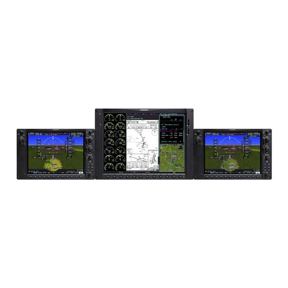
SECTION 1 SYSTEM OVERVIEW 1.1 SYSTEM DESCRIPTION This section provides an overview of the G1000 NXi Integrated Avionics System as installed in the Cessna Nav III. The system presents flight instrumentation, position, navigation, communication, and identification information to the pilot through large-format displays. - Page 16 • GTS 800 Traffic Advisory System • KR 87 ADF Receiver • L3 Stormscope Lightning Strike and Thunderstorm • KTA 870 Traffic Avoidance System Detection • CO Guardian Carbon Monoxide Detection Garmin G1000 NXi Pilot’s Guide for Cessna Nav III 190-02177-00 Rev. A...
- Page 17 Garmin Equipment Non-Garmin Equipment Figure 1-1 System (LRU Configuration) For information on non-Garmin equipment, consult the applicable optional interface user’s guide. NOTE: This document assumes that the reader is already familiar with the operation of this additional equipment. Garmin G1000 NXi Pilot’s Guide for Cessna Nav III...
-
Page 18: System Controls
The system controls are located on the PFD and MFD bezels and audio panel. The controls for the PFD and MFD are discussed within the following pages of this section. PFD/MFD CONTROLS Only with Garmin AFCS Figure 1-2 PFD/MFD Controls Garmin G1000 NXi Pilot’s Guide for Cessna Nav III 190-02177-00 Rev. A... - Page 19 Gives access to IFR departure procedures (DPs), arrival procedures (STARs), and approach procedures (IAPs) for a flight plan or selected airport ENT Key Validates/confirms menu selection or data entry Garmin G1000 NXi Pilot’s Guide for Cessna Nav III 190-02177-00 Rev. A...
- Page 20 Controls the active pitch reference for the Pitch Hold, Vertical Speed, and Flight Level Change modes. *This Key only appears on the MFD. **This Key only appears on the MFD with Garmin AFCS option. Garmin G1000 NXi Pilot’s Guide for Cessna Nav III 190-02177-00 Rev. A...
-
Page 21: Secure Digital Cards
To remove, gently press on the SD card to release the spring latch and eject the card. SD Card Slots Figure 1-3 PFD/MFD Display Bezel SD Card Slots Garmin G1000 NXi Pilot’s Guide for Cessna Nav III 190-02177-00 Rev. A... -
Page 22: System Operation
(to ensure that no databases have expired), the pilot is prompted to continue. Pressing the ENT Key acknowledges this information and displays the Navigation Map Page on the MFD. Garmin G1000 NXi Pilot’s Guide for Cessna Nav III 190-02177-00 Rev. A... -
Page 23: Normal Operation
Flight Management Section), while the left portion of the MFD is dedicated to the Engine Indication System (see the EIS Section). Both displays offer control for COM and NAV frequency selection. Figure 1-4 System Normal Operation Garmin G1000 NXi Pilot’s Guide for Cessna Nav III 190-02177-00 Rev. A... -
Page 24: Reversionary Mode
Pressing this button again deactivates reversionary mode. NAV1 and COM1 Flagged Invalid (provided by the failed PFD) DISPLAY BACKUP Button Manually Activates/Deactivates Reversionary Mode on All Displays Figure 1-5 Reversionary Mode (Failed PFD) Garmin G1000 NXi Pilot’s Guide for Cessna Nav III 190-02177-00 Rev. A... -
Page 25: System Annunciations
The status of detected LRUs can be checked on the Aux - System Status Page. Active LRUs are indicated by green check marks; failed by red or amber ‘X’ s . Failed LRUs should be noted and a service center or Garmin- authorized dealer informed. - Page 26 GPS signals are not present receiving valid data. (see POH). Display system is not receiving airspeed input from the air data computer. Table 1-1 System Annunciations Garmin G1000 NXi Pilot’s Guide for Cessna Nav III 190-02177-00 Rev. A...
-
Page 27: System Status
The System Status Page displays the status and software version numbers for all detected system LRUs. Pertinent information on all system databases is also displayed. Active LRUs are indicated by green check marks and failed LRUs are indicated by red “X”s. Failed LRUs should be noted and a service center or Garmin dealer informed. -
Page 28: Adahrs Operation
ADAHRS no-Mag Data Valid Pitch/Roll. Invalid Heading. ADAHRS no-Mag/ no-Air Data ADAHRS coast- on-gyros until Invalid Pitch/Roll/ invalid Heading. ADAHRS no-Mag/ coast-on-gyros until invalid Table 1-2 ADAHRS Operation Garmin G1000 NXi Pilot’s Guide for Cessna Nav III 190-02177-00 Rev. A... -
Page 29: Ahrs Operation
Air Data Available and Reliable? AHRS Normal AHRS no-Mag AHRS no-Mag/ AHRS no-GPS AHRS coast-on-gyros Mode Mode no-Air Mode Mode until invalid Heading Invalid Heading Invalid Attitude/Heading Invalid Figure 1-7 AHRS Operation Garmin G1000 NXi Pilot’s Guide for Cessna Nav III 190-02177-00 Rev. A... -
Page 30: Gps Receiver Operation
If the sensor annunciation persists, check for a system failure message in the Messages Window on the PFD. If no failure message exists, check the GPS Status Page and compare the information for GPS1 and GPS2. Discrepancies may indicate a problem. Garmin G1000 NXi Pilot’s Guide for Cessna Nav III 190-02177-00 Rev. A... - Page 31 Each satellite is represented by an oval containing the Pseudo-random noise (PRN) number (i.e., satellite identification number). Satellites whose signals are currently being used are represented by solid ovals. • Satellite Status Garmin G1000 NXi Pilot’s Guide for Cessna Nav III 190-02177-00 Rev. A...
- Page 32 In most cases performing a RAIM prediction is not necessary. However, in some cases, the selected approach may be outside the SBAS coverage area and it may be necessary to perform a RAIM prediction for the intended approach. Garmin G1000 NXi Pilot’s Guide for Cessna Nav III 190-02177-00 Rev. A...
- Page 33 • ‘RAIM Available’—RAIM is predicted to be available for the specified waypoint, time, and date • ‘RAIM not Available’—RAIM is predicted to be unavailable for the specified waypoint, time, and date Garmin G1000 NXi Pilot’s Guide for Cessna Nav III 190-02177-00 Rev. A...
- Page 34 3) Press the FMS Knob, and turn the large FMS Knob to highlight ‘EGNOS’, ‘MSAS’ or ‘WAAS’. 4) Press the ENT Key to uncheck the box. 5) Press the FMS Knob to remove the cursor. Garmin G1000 NXi Pilot’s Guide for Cessna Nav III 190-02177-00 Rev. A...
- Page 35 Each satellite has a 30-second data transmission that must be collected (signal strength bar is hollow) before the satellite may be used for navigation (signal strength bar becomes solid). Garmin G1000 NXi Pilot’s Guide for Cessna Nav III 190-02177-00 Rev. A...
-
Page 36: Accessing System Functionality
Level 2 collum. If a softkey on Level 2 provides yet another set of softkey functions, those new available softkeys are then explained in the Level 3 column, etc. Garmin G1000 NXi Pilot’s Guide for Cessna Nav III 190-02177-00 Rev. A... - Page 37 Airport identifiers are displayed when the airport is within approximately 9 nm. Wind Displays the wind option softkeys. Wind information not displayed. Option 1 Headwind/Tailwind and crosswind components. Garmin G1000 NXi Pilot’s Guide for Cessna Nav III 190-02177-00 Rev. A...
- Page 38 Activates the Special Position Identification (SPI) pulse for 18 seconds, identifying the transponder return on the ATC screen. Tmr/Ref Displays Timer/References Window. Nearest Displays Nearest Airports Window. Table 1-3 PFD Softkeys Garmin G1000 NXi Pilot’s Guide for Cessna Nav III 190-02177-00 Rev. A...
- Page 39 FPL: Displays VSD profile information for active flight plan. TRK: Displays VSD profile information along current track. Garmin G1000 NXi Pilot’s Guide for Cessna Nav III 190-02177-00 Rev. A...
- Page 40 Displays approach procedure chart. Displays weather information. NOTAM Displays NOTAM information for selected airport, when available. Checklist When available, displays optional checklists Table 1-4 MFD Navigation Map Page Softkeys Garmin G1000 NXi Pilot’s Guide for Cessna Nav III 190-02177-00 Rev. A...
-
Page 41: Menus
4) The CLR Key may be pressed to remove the menu and cancel the operation. Pressing the FMS Knob also removes the displayed menu. No Options with NRST Window Displayed on PFD Options with FPL Window Displayed on MFD Figure 1-10 Page Menu Examples Garmin G1000 NXi Pilot’s Guide for Cessna Nav III 190-02177-00 Rev. A... -
Page 42: Mfd Page Groups
(or from the page menu). In this case, the page remains set to the selected page until a different page softkey is pressed, even if a different page group is selected. Garmin G1000 NXi Pilot’s Guide for Cessna Nav III 190-02177-00 Rev. A... - Page 43 • XM Radio Pages - XM Information (Info Softkey) - XM Radio (Radio Softkey) • System Status • Video (optional) • ADS-B Status • Connext Setup • Databases Garmin G1000 NXi Pilot’s Guide for Cessna Nav III 190-02177-00 Rev. A...
- Page 44 Procedure Loading Page is opened. Turning the FMS Knob does not scroll through the Procedure pages • Departure Loading • Arrival Loading • Approach Loading Garmin G1000 NXi Pilot’s Guide for Cessna Nav III 190-02177-00 Rev. A...
-
Page 45: System Settings
2) Press the Defaults Softkey; or press the MENU Key, highlight ‘Restore Page Defaults’, and press the ENT Key. The message ‘Restore Setup X Page Defaults?’ is displayed. 3) With ‘OK’ highlighted, press the ENT Key. Garmin G1000 NXi Pilot’s Guide for Cessna Nav III 190-02177-00 Rev. A... - Page 46 (shown on the Aux - GPS Status Page). System time (displayed in the lower right corner of the PFD) can be displayed in three formats: local 12-hr, local 24-hr, or UTC. Local time is set by adding/ subtracting an offset (hours:minutes) to/from UTC. Garmin G1000 NXi Pilot’s Guide for Cessna Nav III 190-02177-00 Rev. A...
- Page 47 5) If necessary, use the FMS Knob to enter the desired time offset (±HH:MM) and press the ENT Key to confirm selection. Figure 1-14 Date/Time Settings (System Setup 1 Page) Garmin G1000 NXi Pilot’s Guide for Cessna Nav III 190-02177-00 Rev. A...
- Page 48 HDDD°MM’SS.S” MGRS 1m MGRS 10m * Default setting ** Contact a Garmin-authorized service center to change this setting *** Not configurable Table 1-6 Display Units Settings (System Setup Page) Changing a display unit setting: 1) While on the System Setup 1 Page, press the FMS Knob momentarily to activate the flashing cursor.
- Page 49 3) Turn the large FMS Knob to highlight the distance field in the Arrival Alert Box. 4) Use the FMS Knob to enter a trigger distance and press the ENT Key. Garmin G1000 NXi Pilot’s Guide for Cessna Nav III 190-02177-00 Rev. A...
- Page 50 3) Turn the large FMS Knob to highlight the voice field in the Audio Box. 4) Use the FMS Knob to select the desired voice setting and press the ENT Key. Garmin G1000 NXi Pilot’s Guide for Cessna Nav III 190-02177-00 Rev. A...
-
Page 51: System Utilities
If the timer is reset before reaching zero on a countdown, the digits are reset to the initial value. If the timer is counting up when reset, the digits return to zero. Garmin G1000 NXi Pilot’s Guide for Cessna Nav III 190-02177-00 Rev. A... - Page 52 Resetting the flight timer: 1) Use the FMS Knob to select the Aux - Utility Page. 2) Press the MENU Key. 3) With ‘Reset Flight Timer’ highlighted, press the ENT Key. Garmin G1000 NXi Pilot’s Guide for Cessna Nav III 190-02177-00 Rev. A...
- Page 53 3) Use the FMS Knob to highlight the desired reset option and press the ENT Key. The selected parameters are reset to zero and begin to display data from the point of reset. Garmin G1000 NXi Pilot’s Guide for Cessna Nav III 190-02177-00 Rev. A...
- Page 54 Use the FMS Knob to enter the desired time (HH:MM) and press the ENT Key. 10) Press the ENT Key again or use the large FMS Knob to move the cursor to enter the next message. Garmin G1000 NXi Pilot’s Guide for Cessna Nav III 190-02177-00 Rev. A...
- Page 55 The softkey reverts to the ‘Alerts’ label. Pressing the Alerts Softkey again removes the Alerts Window from the display and the scheduler message is deleted from the message queue. Figure 1-17 PFD Alerts Window Garmin G1000 NXi Pilot’s Guide for Cessna Nav III 190-02177-00 Rev. A...
-
Page 56: Display Backlighting
6) Use the FMS Knob to enter the desired backlighting and press the ENT Key. 7) To remove the menu, press the CLR or MENU Key. Figure 1-18 PFD Setup Menu Garmin G1000 NXi Pilot’s Guide for Cessna Nav III 190-02177-00 Rev. A... -
Page 57: Section 2 Flight Instruments
(MDA) or decision height (DH) • Vertical Navigation (VNV) indications • Wind data • Outside air temperature (OAT) The PFD also displays various alerts and annunciations. 190-02177-00 Rev. A Garmin G1000 NXi Pilot’s Guide for the Cessna Nav III... - Page 58 Softkeys COM Frequency Box System Time Navigation Status Box Generic Timer Slip/Skid Indicator Transponder Data Box Attitude Indicator Selected Heading Bug Figure 2-1 Primary Flight Display (Default) Garmin G1000 NXi Pilot’s Guide for the Cessna Nav III 190-02177-00 Rev. A...
- Page 59 Required Vertical Speed Indicator Inset Map Vertical Deviation Indication Bearing Information Windows VNV Target Altitude Minimum Descent Altitude/ Decision Height Flight Plan Window Figure 2-2 Additional PFD Information 190-02177-00 Rev. A Garmin G1000 NXi Pilot’s Guide for the Cessna Nav III...
-
Page 60: Flight Instruments
The trend vector is absent if the speed remains constant or if any data needed to calculate airspeed is not available due to a system failure. Garmin G1000 NXi Pilot’s Guide for the Cessna Nav III 190-02177-00 Rev. A... - Page 61 3) Turn the FMS Knob to scroll as needed to highlight ‘All References On’, ‘All References Off’ or ‘Restore Defaults’. 4) Press the ENT Key. 5) To remove the References Window, press the CLR Key or the Tmr/Ref Softkey. 190-02177-00 Rev. A Garmin G1000 NXi Pilot’s Guide for the Cessna Nav III...
-
Page 62: Attitude Indicator
10˚, up to 90˚. Minor pitch marks are shown for intervening 5˚ increments, up to 25˚ below and 45˚ above the horizon line. Between 20˚ below to 20˚ above the horizon line, minor pitch marks occur every 2.5˚. When the optional Garmin Synthetic Vision System (Garmin SVT ) is activated, the pitch ™... -
Page 63: Altimeter
2) Press the ALT Units Softkey. 3) Press the Meters Softkey to turn on metric altitude readouts. 4) Press the Back Softkey twice to return to the top-level softkeys. 190-02177-00 Rev. A Garmin G1000 NXi Pilot’s Guide for the Cessna Nav III... - Page 64 Setting the Baro Transition Alerts: 1) Use the FMS Knob to select the Aux - System Setup 1 Page on the MFD. 2) Press the FMS Knob to activate the cursor. Garmin G1000 NXi Pilot’s Guide for the Cessna Nav III 190-02177-00 Rev. A...
-
Page 65: Vertical Speed Indicator (Vsi)
Glideslope Indicator, like a glideslope needle on a conventional indicator. If a localizer frequency is tuned and there is no glideslope, “NO GS” is displayed in place of the diamond. 190-02177-00 Rev. A Garmin G1000 NXi Pilot’s Guide for the Cessna Nav III... - Page 66 If the approach downgrades past the final approach fix (FAF), “NO GP” is displayed in place of the diamond. Preview Glidepath Glidepath Indicator Indicator Figure 2-13 Glidepath Indicator Garmin G1000 NXi Pilot’s Guide for the Cessna Nav III 190-02177-00 Rev. A...
-
Page 67: Horizontal Situation Indicator (Hsi)
The Desired Track (DTK) is shown in magenta to the upper right of the HSI when the selected navigation source is GPS and OBS Mode 190-02177-00 Rev. A Garmin G1000 NXi Pilot’s Guide for the Cessna Nav III... -
Page 68: Current Track Indicator
The end of the trend vector gives the heading predicted in six seconds, based on the present turn rate. A standard-rate turn is shown on the indicator by the trend vector stopping at the standard turn Garmin G1000 NXi Pilot’s Guide for the Cessna Nav III 190-02177-00 Rev. A... - Page 69 • GPS-derived great circle distance to bearing source • Pointer icon (BRG1 = single line, BRG2 = double line) • Frequency (NAV) • Station/waypoint identifier (NAV, GPS) 190-02177-00 Rev. A Garmin G1000 NXi Pilot’s Guide for the Cessna Nav III...
-
Page 70: Course Deviation Indicator (Cdi)
If the course deviation data is not valid, the CDI is not displayed. Navigation Source Flight Phase Scale Crosstrack Error Figure 2-19 Course Deviation Indicator Garmin G1000 NXi Pilot’s Guide for the Cessna Nav III 190-02177-00 Rev. A... - Page 71 NAV1 Selected for Tuning NAV2 Selected for Tuning LOC1 VOR2 Selected Selected Selected Pressing the CDI Softkey Cycles through Navigation Sources Figure 2-21 Selecting a Navigation Source 190-02177-00 Rev. A Garmin G1000 NXi Pilot’s Guide for the Cessna Nav III...
- Page 72 CDI is scaled accordingly and the selected setting is displayed rather than the flight phase annunciation. Garmin G1000 NXi Pilot’s Guide for the Cessna Nav III 190-02177-00 Rev. A...
- Page 73 • Within 31 nm of the destination airport (terminal area), the CDI scale gradually decreases from 2.0 nm to 1.0 nm over a distance of 1.0 nm, except under the following conditions: 190-02177-00 Rev. A Garmin G1000 NXi Pilot’s Guide for the Cessna Nav III...
- Page 74 - The next leg in the missed approach procedure is not a CA, CD, CF, CI, CR, DF, FA, FC, FD, FM, IF, or TF - After any leg in the missed approach procedure that is not a CA or FA Garmin G1000 NXi Pilot’s Guide for the Cessna Nav III 190-02177-00 Rev. A...
- Page 75 OBS Mode. The flight plan on the moving map retains the modified course line. 190-02177-00 Rev. A Garmin G1000 NXi Pilot’s Guide for the Cessna Nav III...
- Page 76 SUSP Softkey deactivates the suspension and resumes automatic sequencing of approach waypoints, and the SUSP Softkey becomes the OBS Softkey. SUSP SUSP Softkey Annunciation Figure 2-27 Suspending Automatic Waypoint Sequencing Garmin G1000 NXi Pilot’s Guide for the Cessna Nav III 190-02177-00 Rev. A...
-
Page 77: Supplemental Flight Data
Figure 2-29 Wind Data Displaying wind data: 1) Press the PFD Opt Softkey. 2) Press the Wind Softkey to display wind data to the left of the HSI. 190-02177-00 Rev. A Garmin G1000 NXi Pilot’s Guide for the Cessna Nav III... -
Page 78: Generic Timer
PFD in conjunction with the “TOD within 1 minute” message and “Vertical track” voice alert. See the Flight Management and AFCS sections for details on VNV features. VNV indications are removed from the PFD according to the criteria listed in the table. Garmin G1000 NXi Pilot’s Guide for the Cessna Nav III 190-02177-00 Rev. A... - Page 79 Current crosstrack or track angle error has exceeded limit Active altitude-constrained waypoint can not be reached within maximum allowed flight path angle and vertical speed Table 2-3 VNV Indication Removal Criteria 190-02177-00 Rev. A Garmin G1000 NXi Pilot’s Guide for the Cessna Nav III...
-
Page 80: Pfd Annunciations And Alerting Functions
Altitude) an aural tone is heard. The Selected Altitude changes to amber text on a black background and flashes for five seconds. Within 1000 ft Within 200 ft Deviation of ±200 ft Figure 2-32 Altitude Alerting Visual Annunciations Garmin G1000 NXi Pilot’s Guide for the Cessna Nav III 190-02177-00 Rev. A... -
Page 81: Low Altitude Annunciation
If the aircraft proceeds to climb after having reached the MDA, once it reaches 50 feet above the MDA, alerting is disabled. The function is reset when a new approach is activated, or on the next avionics power cycle. 190-02177-00 Rev. A Garmin G1000 NXi Pilot’s Guide for the Cessna Nav III... - Page 82 5) If TEMP COMP was selected, press the ENT Key or turn the large FMS Knob to highlight the next field and then enter the temperature (-59˚C to 59˚C) 6) To remove the window, press the CLR Key or the Tmr/Ref Softkey. Figure 2-35 BARO and TEMP COMP MDA/DH Garmin G1000 NXi Pilot’s Guide for the Cessna Nav III 190-02177-00 Rev. A...
-
Page 83: Abnormal Operations
The following items on the PFD are then shown in amber: • Current Track Bug • Wind Data • Ground Speed • Distances in the Bearing Information Windows • GPS bearing pointers • Desired track (DTK) 190-02177-00 Rev. A Garmin G1000 NXi Pilot’s Guide for the Cessna Nav III... -
Page 84: Unusual Attitudes
• Wind data • VNV Target Altitude – Flight Plan • Selected Heading readout • True Airspeed – Alerts • Selected Course readout – Procedures • Transponder Status Box Garmin G1000 NXi Pilot’s Guide for the Cessna Nav III 190-02177-00 Rev. A... -
Page 85: Section 3 Engine Indication System
When unsafe operating conditions occur, the corresponding displays flash to indicate cautions and warnings. If sensory data to an instrument becomes invalid or unavailable, a red “X” is displayed across the instrument. 190-02177-00 Rev. A Garmin G1000 NXi Cockpit Reference Guide for the Cessna NAV III... -
Page 86: Engine Display
ENGINE INDICATION SYSTEM 3.1 ENGINE DISPLAY Engine Display Engine System Display Figure 3-2 Model 172R Garmin G1000 NXi Cockpit Reference Guide for the Cessna NAV III 190-02177-00 Rev. A... - Page 87 Voltmeter Displays the main and essential bus voltages (M, S Bus Volts) Ammeter Displays the main and standby battery load in amperes (M, S Battery Amps) 190-02177-00 Rev. A Garmin G1000 NXi Cockpit Reference Guide for the Cessna NAV III...
- Page 88 ENGINE INDICATION SYSTEM Engine Display Engine System Display Figure 3-3 Model 172S Garmin G1000 NXi Cockpit Reference Guide for the Cessna NAV III 190-02177-00 Rev. A...
- Page 89 Voltmeter Displays the main and essential bus voltages (M, S Bus Volts) Ammeter Displays the main and standby battery load in amperes (M, S Battery Amps) 190-02177-00 Rev. A Garmin G1000 NXi Cockpit Reference Guide for the Cessna NAV III...
- Page 90 ENGINE INDICATION SYSTEM Engine Display Engine System Display Figure 3-4 Model 182T Garmin G1000 NXi Cockpit Reference Guide for the Cessna NAV III 190-02177-00 Rev. A...
- Page 91 Voltmeter Displays the main and essential bus voltages (M, S Bus Volts) Ammeter Displays the main and standby battery load in amperes (M, S Battery Amps) 190-02177-00 Rev. A Garmin G1000 NXi Cockpit Reference Guide for the Cessna NAV III...
- Page 92 ENGINE INDICATION SYSTEM Engine Display Engine System Display Figure 3-5 Model T182T Garmin G1000 NXi Cockpit Reference Guide for the Cessna NAV III 190-02177-00 Rev. A...
- Page 93 Voltmeter Displays the main and essential bus voltages (M, S Bus Volts) Ammeter Displays the main and standby battery load in amperes (M, S Battery Amps) 190-02177-00 Rev. A Garmin G1000 NXi Cockpit Reference Guide for the Cessna NAV III...
- Page 94 ENGINE INDICATION SYSTEM Engine Display Engine System Display Figure 3-6 Model 206H Garmin G1000 NXi Cockpit Reference Guide for the Cessna NAV III 190-02177-00 Rev. A...
- Page 95 Voltmeter Displays the main and essential bus voltages (M, S Bus Volts) Ammeter Displays the main and standby battery load in amperes (M, S Battery Amps) 190-02177-00 Rev. A Garmin G1000 NXi Cockpit Reference Guide for the Cessna NAV III...
- Page 96 ENGINE INDICATION SYSTEM Engine Display Engine System Display Figure 3-7 Model T206H Garmin G1000 NXi Cockpit Reference Guide for the Cessna NAV III 190-02177-00 Rev. A...
- Page 97 Voltmeter Displays the main and essential bus voltages (M, S Bus Volts) Ammeter Displays the main and standby battery load in amperes (M, S Battery Amps) 190-02177-00 Rev. A Garmin G1000 NXi Cockpit Reference Guide for the Cessna NAV III...
-
Page 98: Engine Page
RST Fuel Resets gallons of fuel remaining to zero (0). GAL REM Sets gallons of fuel remaining Table 3-1 Engine Page Softkeys Figure 3-8 Engine Page Garmin G1000 NXi Cockpit Reference Guide for the Cessna NAV III 190-02177-00 Rev. A... - Page 99 CYLINDER HEAD TEMPERATURE Cylinder Head Temperature (CHT) readout is shown near the bottom Engine Lean Page. Cylinder Head Temperatures in Cyan Figure 3-12 Cylinder Head Temperatures (CHT) 190-02177-00 Rev. A Garmin G1000 NXi Cockpit Reference Guide for the Cessna NAV III...
- Page 100 Fuel used (GAL Used) and range (in nautical miles) are calculated based on the displayed fuel remaining (GAL REM) and the fuel flow totalizer. The calculated range also takes into account the aircraft’ s heading and the wind direction and speed. Garmin G1000 NXi Cockpit Reference Guide for the Cessna NAV III 190-02177-00 Rev. A...
- Page 101 6) Turn the small FMS Knob to select ‘On’ or ‘Off’. 7) Turn the large FMS Knob to highlight the reserve fuel time, how long the aircraft can fly after reaching the reserve fuel. 190-02177-00 Rev. A Garmin G1000 NXi Cockpit Reference Guide for the Cessna NAV III...
- Page 102 The fuel display shows the fuel quantity in each tank in gallons (gal). Fuel quantity for each tank is normally shown along a horizontal bar indicator. A caution or warning is issued for low fuel quantity. Figure 3-17 Fuel Display Garmin G1000 NXi Cockpit Reference Guide for the Cessna NAV III 190-02177-00 Rev. A...
-
Page 103: Eis Display (Reversionary Mode)
The Engine Display, in reversionary mode, is identical to the normal EIS Display on the MFD. EIS Display Figure 3-18 Reversionary Mode (EIS Shown) 190-02177-00 Rev. A Garmin G1000 NXi Cockpit Reference Guide for the Cessna NAV III... - Page 104 ENGINE INDICATION SYSTEM lank Garmin G1000 NXi Cockpit Reference Guide for the Cessna NAV III 190-02177-00 Rev. A...
-
Page 105: Section 4 Audio Panel And Cns
(PFD). The Transponder Data Box is located to the left of the System Time Box. The data box displays the active four-digit code, mode, and reply status. Garmin G1000 NXi Pilot’s Guide for the Cessna Nav III 190-02177-00 Rev. A... -
Page 106: Pfd Controls And Frequency Display
AUDIO PANEL AND CNS PFD CONTROLS AND FREQUENCY DISPLAY Figure 4-1 PFD Controls, NAV/COM Frequency Tuning Boxes, and DME Tuning Window Garmin G1000 NXi Pilot’s Guide for the Cessna Nav III 190-02177-00 Rev. A... - Page 107 Transponder Data Box – Indicates the selected transponder code, operating mode, reply, and ident status for the applicable transponder. DME Softkey – Displays the DME Tuning Window. Garmin G1000 NXi Pilot’s Guide for the Cessna Nav III 190-02177-00 Rev. A...
-
Page 108: Audio Panel Controls
COM1 Key. COM2 – When selected, audio from the #2 COM receiver can be heard. COM3 MIC – Not used in Cessna Nav III aircraft. Garmin G1000 NXi Pilot’s Guide for the Cessna Nav III 190-02177-00 Rev. A... - Page 109 PASS Knob – Turn to adjust Copilot/Passenger intercom volume or squelch. The MAN SQ Key must be selected to allow squelch adjustment. DISPLAY BACKUP Button – Manually selects Reversionary Mode. Garmin G1000 NXi Pilot’s Guide for the Cessna Nav III 190-02177-00 Rev. A...
-
Page 110: Com Operation
COM signals. When Automatic Squelch is disabled, COM audio reception is always on. Continuous static noise is heard over the headsets and speaker, if selected. Garmin G1000 NXi Pilot’s Guide for the Cessna Nav III 190-02177-00 Rev. A... -
Page 111: Com Transceiver Manual Tuning
PFD. When the desired frequency is entered, it becomes a standby frequency. Pressing the Frequency Transfer Key places this frequency into the COM Active Frequency Field. Garmin G1000 NXi Pilot’s Guide for the Cessna Nav III 190-02177-00 Rev. A... - Page 112 3) Press the ENT Key to load the COM frequency into the standby field of the selected COM radio. 4) Press the Frequency Transfer Key on either PFD to transfer the frequency to the COM Active Frequency Field. Garmin G1000 NXi Pilot’s Guide for the Cessna Nav III 190-02177-00 Rev. A...
- Page 113 PFD1 COM Standby Field. Cursor then Select INFO 1 advances to the Softkey for AIRPORT, next frequency. RUNWAYS, and FREQUENCIES Windows Figure 4-6 WPT – Airport Information Page Garmin G1000 NXi Pilot’s Guide for the Cessna Nav III 190-02177-00 Rev. A...
-
Page 114: Frequency Spacing
While the COM CONFIG Window is selected, the softkeys are blank. Select 8.33-kHz or 25.0-kHz COM Frequency Channel Spacing Figure 4-7 Aux – System Setup 1 Page Garmin G1000 NXi Pilot’s Guide for the Cessna Nav III 190-02177-00 Rev. A... -
Page 115: Nav Operation
Audio verification of the selected station identifier is still required, and can be accomplished by selecting the corresponding NAV radio on the audio panel and pressing the NAV VOL/ID Knob. Garmin G1000 NXi Pilot’s Guide for the Cessna Nav III 190-02177-00 Rev. A... -
Page 116: Nav Radio Selection And Activation
2) Press the Frequency Transfer Key to transfer the frequency to the NAV Active Frequency Field. 3) Adjust the volume level with the NAV VOL/ID Knob. 4) Press the NAV VOL/ID Knob to turn the Morse code identifier audio on and off. Garmin G1000 NXi Pilot’s Guide for the Cessna Nav III 190-02177-00 Rev. A... -
Page 117: Auto-Tuning A Nav Frequency From The Mfd
5) Press the ENT Key to load the NAV frequency into the standby field of the selected NAV radio. 6) Press the Frequency Transfer Key to transfer the frequency to the NAV Active Frequency Field. Garmin G1000 NXi Pilot’s Guide for the Cessna Nav III 190-02177-00 Rev. A... - Page 118 WPT – Airport Information, WPT – VOR Information, and NRST – Nearest Frequencies Pages on the MFD in a similar manner using the appropriate softkeys or MENU Key, the FMS Knob, and the ENT Key. Garmin G1000 NXi Pilot’s Guide for the Cessna Nav III 190-02177-00 Rev. A...
-
Page 119: Marker Beacon Receiver
If the MKR/MUTE Key is pressed during signal reception (O, M, I indication) while marker beacon audio is muted, the audio is deselected and the MKR/MUTE Key Annunciator is extinguished. Garmin G1000 NXi Pilot’s Guide for the Cessna Nav III 190-02177-00 Rev. A... -
Page 120: Dme Tuning
The LO SENS function (annunciator extinguished) results in a narrower marker dwell while over a station. DME TUNING When turning on the G1000 NXi for use, the system remembers the last frequency used for DME NOTE: tuning and the NAV1 NAV2, or HOLD state prior to shutdown. -
Page 121: Mode S Transponder
Selecting the Ident Softkey while in Mode or Code Selection initiates the ident function and reverts to the top-level softkeys. After 45 seconds of transponder control inactivity, the system reverts back to the top-level softkeys. Garmin G1000 NXi Pilot’s Guide for the Cessna Nav III 190-02177-00 Rev. A... -
Page 122: Transponder Mode Selection
ADS-B out. Mode S replies will not include altitude information. Mode C altitude reporting is inhibited. Garmin G1000 NXi Pilot’s Guide for the Cessna Nav III 190-02177-00 Rev. A... - Page 123 Transponder Data Box, and all transponder replies requesting altitude information are provided with pressure altitude information. Airborne ALT Mode (Mode C Altitude Reporting) Figure 4-18 Altitude Mode Garmin G1000 NXi Pilot’s Guide for the Cessna Nav III 190-02177-00 Rev. A...
-
Page 124: Ident Function
Transponder Data Box for a duration of 18 seconds. After the Ident Softkey is selected while in Mode or Code Selection, the system reverts to the top-level softkeys. Garmin G1000 NXi Pilot’s Guide for the Cessna Nav III 190-02177-00 Rev. A... -
Page 125: Flight Id Reporting
ID Function Figure 4-21 Ident Softkey and Indication FLIGHT ID REPORTING If the Flight ID is required but the system is not configured for it, contact a Garmin-authorized service NOTE: center for configuration. When the Flight ID must be entered before flight operation, the identifier is placed in the Timer/References Window on the PFD. -
Page 126: Additional Audio Panel Functions
Speaker audio is muted when the PTT is pressed. Certain aural alerts and warnings (autopilot, traffic, altitude) are always heard on the speaker, even when the speaker is not selected. The speaker volume is adjustable within a nominal range. Contact a Garmin-authorized service center for volume adjustment. - Page 127 When both the PILOT and COPLT Annunciators are extinguished, everyone hears the selected radios, aural alerts, and is able to communicate with everyone else. Garmin G1000 NXi Pilot’s Guide for the Cessna Nav III 190-02177-00 Rev. A...
-
Page 128: Split Com
Pressing the PLAY Key again during play of a memory block stops play. If a COM input signal is detected during play of a recorded memory block, play is halted. Garmin G1000 NXi Pilot’s Guide for the Cessna Nav III 190-02177-00 Rev. A... -
Page 129: Entertainment Inputs
MUSIC INPUT #1 and MUSIC INPUT #2 cannot be completely turned off. Audio level for NOTE: MUSIC INPUT #1 and MUSIC INPUT #2 can be adjusted by a Garmin-authorized service center. The Audio Panel provides two stereo auxiliary entertainment inputs: MUSIC INPUT #1 and MUSIC INPUT #2. -
Page 130: Audio Panels Preflight Procedure
6) Reset squelch to automatic, or adjust to the appropriate level manually. Once this procedure has been completed, the pilot and copilot can change settings, keeping in mind the notes above. Garmin G1000 NXi Pilot’s Guide for the Cessna Nav III 190-02177-00 Rev. A... -
Page 131: Abnormal Operation
COM1 transceiver. Audio is not available on the speaker during Fail-safe operation. REVERSIONARY MODE The red DISPLAY BACKUP Button selects the Reversionary Mode. See the System Overview Section for more information on Reversionary Mode. Garmin G1000 NXi Pilot’s Guide for the Cessna Nav III 190-02177-00 Rev. A... - Page 132 AUDIO PANEL AND CNS lank Garmin G1000 NXi Pilot’s Guide for the Cessna Nav III 190-02177-00 Rev. A...
-
Page 133: Section 5 Flight Management
The Direct-to Window, the Flight Plan Window, the Procedures Window, and the Nearest Airports Window can be displayed in the lower right corner of the PFD. Details of these windows are discussed in detail later in the section. Garmin G1000 NXi Pilot’s Guide for Cessna Nav III 190-02177-00 Rev. A... -
Page 134: Navigation Status Box And Data Bar
• Active flight plan leg (e.g., ‘D-> KICT’ or ‘KIXD -> KCOS’) or flight plan annunciations (e.g., ‘Turn right to 021˚ in 8 seconds’) • Distance (DIS) and Bearing (BRG) to the next waypoint or flight plan annunciations (e.g., ‘TOD within 1 minute’) Garmin G1000 NXi Pilot’s Guide for Cessna Nav III 190-02177-00 Rev. A... - Page 135 4) Turn the small FMS Knob to display and scroll through the data options list to select the desired data. 5) Press the ENT Key. Selecting the Defaults Softkey returns all fields to the default setting. Garmin G1000 NXi Pilot’s Guide for Cessna Nav III 190-02177-00 Rev. A...
-
Page 136: Using Map Displays
• Track up (Track up) aligns the top of the map display to the current ground track. • Heading up (HDG up) aligns the top of the map display to the current aircraft heading. Garmin G1000 NXi Pilot’s Guide for Cessna Nav III 190-02177-00 Rev. A... - Page 137 4) Turn the small FMS Knob to select the desired orientation. 5) Press the ENT Key to select the new orientation. 6) Press the FMS Knob to return to the base page. Garmin G1000 NXi Pilot’s Guide for Cessna Nav III 190-02177-00 Rev. A...
-
Page 138: Map Range
(timer set on Map Settings Window). Auto zoom is suspended while the map pointer is active. Garmin G1000 NXi Pilot’s Guide for Cessna Nav III 190-02177-00 Rev. A... - Page 139 10) Repeat step 9 for ‘Min Look FWD’ (zero to 99 minutes) and ‘Time Out’ (zero to 99 minutes). 11) Press the FMS Knob to return to the Navigation Map Page. Garmin G1000 NXi Pilot’s Guide for Cessna Nav III 190-02177-00 Rev. A...
-
Page 140: Map Panning
60 seconds, the map reverts back to centered on the aircraft position and the flashing pointer is removed. Map Pointer Information Map Pointer Figure 5-9 Navigation Map - Map Pointer Activated Garmin G1000 NXi Pilot’s Guide for Cessna Nav III 190-02177-00 Rev. A... - Page 141 3) ‘Review Airspaces’ should already be highlighted, if not select it. Press the ENT Key to display the Airspace Information Page for the selected airspace. 4) Press the CLR or ENT Key to exit the Airspace Information Page. Garmin G1000 NXi Pilot’s Guide for Cessna Nav III 190-02177-00 Rev. A...
-
Page 142: Measuring Bearing And Distance
5) To exit the Measure Bearing/Distance option, push the Joystick; or select ‘Stop Measuring’ from the Page Menu and press the ENT Key. Measurement Pointer Lat/Long Information Measurement Line Figure 5-11 Navigation Map - Measuring Bearing and Distance Garmin G1000 NXi Pilot’s Guide for Cessna Nav III 190-02177-00 Rev. A... -
Page 143: Topography
3) Select the TER Softkey until ‘Off’ is shown on the softkey to remove topographic data from the navigation map. When topographic data is removed from the page, all navigation data is presented on a black background. Garmin G1000 NXi Pilot’s Guide for Cessna Nav III 190-02177-00 Rev. A... - Page 144 1) Press the MENU Key with the Navigation Map Page displayed. The cursor flashes on the ‘Map Settings’ option. 2) Press the ENT Key. The Map Settings Menu is displayed. 3) Select the ‘Map’ group. 4) Press the ENT Key. Garmin G1000 NXi Pilot’s Guide for Cessna Nav III 190-02177-00 Rev. A...
- Page 145 3) Select the ‘Map’ group and select the ENT Key. 4) Highlight the ‘Topo Scale’ field. 5) Select ‘On’ or ‘Off’. 6) Press the FMS Knob to return to the Navigation Map Page. Garmin G1000 NXi Pilot’s Guide for Cessna Nav III 190-02177-00 Rev. A...
-
Page 146: Map Symbols
Local Road (Local Road) Railroads (RAILROAD) Large City (> 200,000) 1000 Medium City (> 50,000) Small City (> 5,000) State/Province 1000 River/Lake Latitude/Longitude (LAT/LON) 1000 Table 5-1 Land Symbol Information Garmin G1000 NXi Pilot’s Guide for Cessna Nav III 190-02177-00 Rev. A... - Page 147 Intersection (INT) Non-directional Beacon (NDB) VOR Compass Rose On/Off Visual Reporting Point (VRP) 1000 Temporary Flight Restriction (TFR) 1000 VNAV Constraints 1000 1000 Table 5-2 Aviation Symbol Information Garmin G1000 NXi Pilot’s Guide for Cessna Nav III 190-02177-00 Rev. A...
- Page 148 For example, enabling “Runway Extension” displays a dashed line on the map extending from each runway of an airport in the flight plan when the range is set at or below the value of the map settings option. Garmin G1000 NXi Pilot’s Guide for Cessna Nav III 190-02177-00 Rev. A...
- Page 149 Decluttering the PFD Inset Map: 1) Press the Map/HSI Softkey. 2) Select the Detail Softkey. The current declutter level is shown. With each selection, another level of map information is removed. Garmin G1000 NXi Pilot’s Guide for Cessna Nav III 190-02177-00 Rev. A...
- Page 150 Intersections (does not declutter if used to define airway) Class B Airspaces/TMA Class C Airspaces/TCA Class D Airspaces Other Airspaces/ADIZ Obstacles Cities Roads Railroads State/Province Boundaries Table 5-4 Navigation Map Items Decluttered for each Detail Level Garmin G1000 NXi Pilot’s Guide for Cessna Nav III 190-02177-00 Rev. A...
-
Page 151: Airways
MENU Key from the Navigation Map Page. The Airway range can also be programmed to only display Airways on the MFD when the map range is at or below a specific number. Garmin G1000 NXi Pilot’s Guide for Cessna Nav III 190-02177-00 Rev. A... - Page 152 Airways Symbols Symbol Range (nm) Range (nm) Low Altitude Airways (V Routes and T Routes) High Altitude Airways (J Routes and Q Routes) Table 5-5 Airways Symbol Information Garmin G1000 NXi Pilot’s Guide for Cessna Nav III 190-02177-00 Rev. A...
-
Page 153: Additional Navigation Map Items
The location will be shown as a cyan arc when the aircraft is actually climbing or descending. Selected Altitude Intercept Arc Figure 5-16 Navigation Map - Range to Altitude Arc Garmin G1000 NXi Pilot’s Guide for Cessna Nav III 190-02177-00 Rev. A... - Page 154 Figure 5-18 Navigation Map - Wind Vector The wind vector is not displayed until the aircraft is moving. It is not displayed on the Waypoint NOTE: Information pages. Garmin G1000 NXi Pilot’s Guide for Cessna Nav III 190-02177-00 Rev. A...
- Page 155 V shape in front of the aircraft symbol on the map. This is only available if SVT is installed on the aircraft. Lateral Field of View Boundaries Figure 5-20 Navigation Map - Field of View Garmin G1000 NXi Pilot’s Guide for Cessna Nav III 190-02177-00 Rev. A...
-
Page 156: Ifr/Vfr Charts
Navigation Status Box Navigation Page Title Map Orientation VFR Chart Map Range Active Flight Plan Leg Aircraft Icon at Present Position Figure 5-21 GPS Navigation Information on the VFR Chart Garmin G1000 NXi Pilot’s Guide for Cessna Nav III 190-02177-00 Rev. A... - Page 157 Map Orientation Map Range IFR High Altitude Chart Active Flight Plan Leg Aircraft Icon at Present Position Figure 5-23 GPS Navigation Information on the IFR High Altitude Chart Garmin G1000 NXi Pilot’s Guide for Cessna Nav III 190-02177-00 Rev. A...
- Page 158 2) Turn the FMS Knob to highlight the ‘Display VFR’ field, the ‘Display IFR Low’ field, or the ‘Display IFR High’ field. 3) Press the ENT Key. The selected chart is displayed. Garmin G1000 NXi Pilot’s Guide for Cessna Nav III 190-02177-00 Rev. A...
-
Page 159: Waypoints
- Type (symbol) City Entry Field Entry Field - Facility Name - City Entered Waypoint on Map Area Showing Entered Waypoint Waypoint Location Figure 5-24 Waypoint Information Window Garmin G1000 NXi Pilot’s Guide for Cessna Nav III 190-02177-00 Rev. A... -
Page 160: Airports
After a flight plan has been loaded, it defaults to the destination airport. On a flight plan with multiple airports, it defaults to the airport which is the current active waypoint. Garmin G1000 NXi Pilot’s Guide for Cessna Nav III 190-02177-00 Rev. A... - Page 161 • Runway lighting type: No Lights, Part Time, Full Time, Unknown, or PCL Freq (for pilot-controlled lighting) • COM Availability: TX (transmit only), RX (receive only), PT (part time), i (additional information available) Garmin G1000 NXi Pilot’s Guide for Cessna Nav III 190-02177-00 Rev. A...
- Page 162 Procedures High/Med/Low Clicks/Second • Approach: Approach Facility • Charts: Low Altitude Chart • FBO: Type, Frequencies, Name, Frequency, Frequency Number Services, Fees, Fuel, Credit Parameter Cards, Phone/Fax Numbers Garmin G1000 NXi Pilot’s Guide for Cessna Nav III 190-02177-00 Rev. A...
- Page 163 A departure, arrival, or approach can be loaded using the softkeys on the Airport Information Page. See the Procedures section for details. METARs or TAFs applicable to the selected airport can be selected for display (see the Hazard Avoidance section for details about weather). Garmin G1000 NXi Pilot’s Guide for Cessna Nav III 190-02177-00 Rev. A...
- Page 164 Approach Available Type Length of Longest Runway COM Freq. Info. - Identification - Frequency Additional Airports (within 200 nm) Nearest Softkey Figure 5-28 Nearest Airports Window on PFD Garmin G1000 NXi Pilot’s Guide for Cessna Nav III 190-02177-00 Rev. A...
- Page 165 Nearest Airports Window and the Airport Information Window.) 4) Press the CLR Key or the Nearest Softkey to close the PFD Nearest Airports Window. Garmin G1000 NXi Pilot’s Guide for Cessna Nav III 190-02177-00 Rev. A...
- Page 166 4) Turn the FMS Knob to highlight the desired airport. (Pressing the ENT Key also moves to the next airport.) 5) Press the FMS Knob to remove the flashing cursor. Garmin G1000 NXi Pilot’s Guide for Cessna Nav III 190-02177-00 Rev. A...
- Page 167 6) Use the FMS Knob to enter the minimum runway length (zero to 25,000 feet) and press the ENT Key. 7) Press the FMS Knob to remove the flashing cursor. Garmin G1000 NXi Pilot’s Guide for Cessna Nav III 190-02177-00 Rev. A...
-
Page 168: Intersections
2) Press the ENT Key or turn either FMS Knob to select an identifier in the Nearest Intersection Box. 3) Press the FMS Knob to remove the flashing cursor. Garmin G1000 NXi Pilot’s Guide for Cessna Nav III 190-02177-00 Rev. A... - Page 169 - Bearing/Distance to Intersection intersection from aircraft position Nearest Intersection Intersection Lat/Long Reference VOR Info - Identifier/Type (symbol) - VOR Frequency - Bearing/Distance to VOR Figure 5-32 Nearest Intersections Page Garmin G1000 NXi Pilot’s Guide for Cessna Nav III 190-02177-00 Rev. A...
-
Page 170: Ndbs
2) Press the ENT Key or turn either FMS Knob to select an identifier in the Nearest NDB Box. 3) Press the FMS Knob to remove the flashing cursor. Garmin G1000 NXi Pilot’s Guide for Cessna Nav III 190-02177-00 Rev. A... - Page 171 Navigation Map - Bearing/Distance to Showing Selected NDB from aircraft position NDB Information - Facility Name/City - Type - Lat/Long Nearest NDB NDB Frequency Figure 5-34 Nearest NDB Page Garmin G1000 NXi Pilot’s Guide for Cessna Nav III 190-02177-00 Rev. A...
-
Page 172: Vors
1) With the VOR Information Page displayed, enter an identifier, the name of the VOR, or the city in which it’s located in the VOR Box. 2) Press the ENT Key. 3) Press the FMS Knob to remove the flashing cursor. Or : Garmin G1000 NXi Pilot’s Guide for Cessna Nav III 190-02177-00 Rev. A... - Page 173 Showing Nearest - Bearing/Distance to VOR from aircraft position VOR Information - Facility Name/City - Class/Magnetic Variation - Lat/Long Nearest VOR VOR Frequency Figure 5-36 Nearest VOR Page Garmin G1000 NXi Pilot’s Guide for Cessna Nav III 190-02177-00 Rev. A...
-
Page 174: Vrps
2) Press the ENT Key or turn either FMS Knob to select an identifier in the Nearest VRP Box. 3) Press the FMS Knob to remove the flashing cursor. Garmin G1000 NXi Pilot’s Guide for Cessna Nav III 190-02177-00 Rev. A... - Page 175 Navigation Map - Bearing/Distance to VRP Showing Nearest VRP from aircraft position Nearest VRP VRP Information - VRP Name - Country - Lat/Long Figure 5-38 Nearest VRP Page Garmin G1000 NXi Pilot’s Guide for Cessna Nav III 190-02177-00 Rev. A...
-
Page 176: User Waypoints
2) Press the ENT Key or turn either FMS Knob to select an identifier in the Nearest User Box. 3) Press the FMS Knob to remove the flashing cursor. Garmin G1000 NXi Pilot’s Guide for Cessna Nav III 190-02177-00 Rev. A... - Page 177 6) If desired, change the storage method of the waypoint to temporary by moving the cursor to “Temporary” and selecting the ENT Key to check the box. 7) Press the FMS Knob to remove the flashing cursor. Or : Garmin G1000 NXi Pilot’s Guide for Cessna Nav III 190-02177-00 Rev. A...
- Page 178 3) Enter a user waypoint name (up to six characters). 4) Press the ENT Key to accept the selected name. The first reference waypoint box is highlighted. Garmin G1000 NXi Pilot’s Guide for Cessna Nav III 190-02177-00 Rev. A...
- Page 179 4) Turn the small FMS Knob to make any changes. 5) Press the ENT Key to accept the changes. 6) Press the FMS Knob to remove the flashing cursor. Garmin G1000 NXi Pilot’s Guide for Cessna Nav III 190-02177-00 Rev. A...
- Page 180 3) Select ‘Normal’ or ‘Temporary’ as desired, and press the ENT Key. 4) Press the FMS Knob to remove the flashing cursor and return to the User Waypoint Information Page. Garmin G1000 NXi Pilot’s Guide for Cessna Nav III 190-02177-00 Rev. A...
- Page 181 2) Press the MENU Key. 3) Select ‘Delete All User Waypoints.’ 4) Press the ENT Key twice to confirm the selection. 5) Press the FMS Knob to remove the flashing cursor. Garmin G1000 NXi Pilot’s Guide for Cessna Nav III 190-02177-00 Rev. A...
-
Page 182: Airspaces
(Military), Other Airspace, Air Defense Identification Zone (ADIZ), and Temporary Flight Restriction (TFR). Class B Airspace Restricted Area Class D Airspace Alert Area Class C Airspace MOA (Military) ADIZ Warning Area Figure 5-41 Airspaces Garmin G1000 NXi Pilot’s Guide for Cessna Nav III 190-02177-00 Rev. A... - Page 183 Map ranges for the airspace boundaries are selected from the Airspace Group in the Map Settings Menu. See Table 5-3 for the default and maximum ranges for each type of airspace and the symbol used to define the airspace area. Garmin G1000 NXi Pilot’s Guide for Cessna Nav III 190-02177-00 Rev. A...
- Page 184 Special use airspace is near and ahead of the aircraft position. ARSPC NEAR – Airspace near – less than 2 nm. Special use airspace is within 2 nm of the aircraft position. Table 5-7 PFD Airspace Alert Messages Garmin G1000 NXi Pilot’s Guide for Cessna Nav III 190-02177-00 Rev. A...
- Page 185 5) Turn the small FMS Knob clockwise to turn smart airspace ‘On’ or counterclockwise to turn smart airspace ‘Off’. 6) Press the FMS Knob to remove the flashing cursor. Garmin G1000 NXi Pilot’s Guide for Cessna Nav III 190-02177-00 Rev. A...
-
Page 186: Direct-To-Navigation
VNV Constraints - City - Altitude at Arrival - Along Track Offset Map of Selected Point Desired Course Location of Destination - Bearing/Distance Figure 5-44 Direct-to Window - MFD Garmin G1000 NXi Pilot’s Guide for Cessna Nav III 190-02177-00 Rev. A... - Page 187 Window, the Active Flight Plan Page, or the Active Flight Plan Window. Waypoint Submenu - Flight Plan Waypoints - Nearest Airports - Recent Waypoints - User Waypoints Figure 5-46 Waypoint Submenu Garmin G1000 NXi Pilot’s Guide for Cessna Nav III 190-02177-00 Rev. A...
- Page 188 2) Press the Direct-to Key to display the Direct-to Window with the selected waypoint as the direct-to destination. 3) Press the ENT Key. The cursor is now displayed on ‘Activate?’. 4) Press ENT again to activate the direct-to. Garmin G1000 NXi Pilot’s Guide for Cessna Nav III 190-02177-00 Rev. A...
- Page 189 2) Highlight the course field. 3) Enter the desired course. 4) Press the ENT Key. The cursor is now displayed on ‘Activate?’. 5) Press the ENT Key again to activate the direct-to. Garmin G1000 NXi Pilot’s Guide for Cessna Nav III 190-02177-00 Rev. A...
- Page 190 Removing a VNV altitude constraint: 1) Press the Direct-to Key to display the Direct-to Window. 2) Press the MENU Key. 3) With ‘Clear Vertical Constraints’ highlighted, press the ENT Key. Garmin G1000 NXi Pilot’s Guide for Cessna Nav III 190-02177-00 Rev. A...
-
Page 191: Flight Planning
If an approach, departure, or arrival procedure is no longer available, the procedure is deleted from the affected stored flight plan(s), and an alert is displayed (see Miscellaneous Messages in Appendix A) advising that one or more stored flight plans need to be edited. Garmin G1000 NXi Pilot’s Guide for Cessna Nav III 190-02177-00 Rev. A... -
Page 192: Flight Plan Creation
- Time to Top of Descent - Vertical Speed Target Non-Active, - Flight Path Angle Flight Plan Leg - Vertical Speed Target - Vertical Deviation Figure 5-47 Active Flight Plan Page Garmin G1000 NXi Pilot’s Guide for Cessna Nav III 190-02177-00 Rev. A... - Page 193 - Comment Selected Flight Plan Selected FPL Info - Departure Waypoint - Destination Waypoint - Total Flight Plan Distance - Enroute Safe Altitude Figure 5-49 Flight Plan Catalog Page Garmin G1000 NXi Pilot’s Guide for Cessna Nav III 190-02177-00 Rev. A...
- Page 194 5) Repeat step number 4 to enter each additional enroute waypoint. 6) When all waypoints have been entered, press the FMS Knob to remove the cursor (if required). Garmin G1000 NXi Pilot’s Guide for Cessna Nav III 190-02177-00 Rev. A...
- Page 195 Press the ENT Key. The stored flight plan is modified as each waypoint is entered. 7) Repeat step number 6 to enter each additional enroute waypoint. 8) When all waypoints have been entered, press the FMS Knob to remove the cursor. Garmin G1000 NXi Pilot’s Guide for Cessna Nav III 190-02177-00 Rev. A...
-
Page 196: Flight Plan Import/Export
8) Press the ENT Key to initiate the export. 9) Press the ENT Key to confirm the export. The exported flight plan will not contain any procedures or airways. NOTE: Garmin G1000 NXi Pilot’s Guide for Cessna Nav III 190-02177-00 Rev. A... - Page 197 Flight Plan Catalog page. Pending Connext Action Annunciator Pending Flight Plan Store? or Activate? Selection Delete Softkey Store Softkey Activate Softkey Figure 5-50 Preview Flight Plan Page Garmin G1000 NXi Pilot’s Guide for Cessna Nav III 190-02177-00 Rev. A...
- Page 198 Turn the FMS Knob to highlight ‘Store Flight Plan’. c) Press the ENT Key to store the flight plan. The pending flight plan is stored and the pending annunciation is removed. Garmin G1000 NXi Pilot’s Guide for Cessna Nav III 190-02177-00 Rev. A...
- Page 199 6) With ‘OK’ highlighted, press the ENT Key to delete the pending flight plan. The pending flight plan is removed from the Flight Plan Catalog Page. To cancel the request, press the CLR Key, or highlight ‘CANCEL’ and press the ENT Key. Garmin G1000 NXi Pilot’s Guide for Cessna Nav III 190-02177-00 Rev. A...
- Page 200 The stored flight plan was not successfully exported to the SD card. The SD card may not have sufficient available memory or the card may have been removed prematurely. Table 5-9 Flight Plan Import/Export Messages Garmin G1000 NXi Pilot’s Guide for Cessna Nav III 190-02177-00 Rev. A...
-
Page 201: Adding Waypoints To An Existing Flight Plan
ENT Key. The new waypoint now exists in the flight plan. If the identifier entered in the Waypoint Information Window has duplicates, a Duplicate Waypoint NOTE: Window is displayed. Use the FMS Knob to select the correct waypoint. Garmin G1000 NXi Pilot’s Guide for Cessna Nav III 190-02177-00 Rev. A... -
Page 202: Adding Airways To A Flight Plan
The system also anticipates the desired airway and exit point based on loaded flight plan waypoints. Airway Entry Waypoint Selected Airway Airways Available at TOP Preview of Selected Airway Airway Waypoint Sequence Figure 5-53 Select Airway Page - Selecting Airway Garmin G1000 NXi Pilot’s Guide for Cessna Nav III 190-02177-00 Rev. A... - Page 203 The system only allows correct airway sequences to be inserted. If the pilot subsequently inverts the flight plan, the system inverts the airway waypoint sequence and removes the airway header. Garmin G1000 NXi Pilot’s Guide for Cessna Nav III 190-02177-00 Rev. A...
-
Page 204: Adding Procedures To A Stored Flight Plan
The route is defined by selection of a departure, the transition waypoints, and a runway. Departure Airport Selected Departure Departures Available at KMKC Preview of Selected Departure Waypoint Departure Sequence Figure 5-56 Departure Loading Page - Selecting the Departure Garmin G1000 NXi Pilot’s Guide for Cessna Nav III 190-02177-00 Rev. A... - Page 205 Departure Airport Selected Departure Selected Runway Preview of Selected Selected Transition Departure Departure Transition Selected Departure End Points Available Point Figure 5-57 Departure Loading Page - Selecting Transition Garmin G1000 NXi Pilot’s Guide for Cessna Nav III 190-02177-00 Rev. A...
- Page 206 5) Select a transition for the selected arrival. Press the ENT Key. 6) Select a runway served by the selected arrival, if required. Press the ENT Key. 7) Press the ENT Key to load the selected arrival procedure. Garmin G1000 NXi Pilot’s Guide for Cessna Nav III 190-02177-00 Rev. A...
- Page 207 The route for a selected approach is defined by designating transition waypoints. Destination Airport Selected Approach Approaches Available at KCOS Preview of Selected Approach Figure 5-60 Approach Loading Page - Selecting the Approach Garmin G1000 NXi Pilot’s Guide for Cessna Nav III 190-02177-00 Rev. A...
- Page 208 6) Press the ENT Key to load the selected approach procedure. Destination Airport Selected Approach Selected Transition Transitions Available with Selected Approach Preview of Selected Approach Approach Waypoint Sequence Figure 5-61 Approach Loading Page - Selecting the Transition Garmin G1000 NXi Pilot’s Guide for Cessna Nav III 190-02177-00 Rev. A...
-
Page 209: Flight Plan Storage
4) With ‘OK’ highlighted, press the ENT Key. The flight plan is stored in the next available position in the flight plan list on the Flight Plan Catalog Page. Garmin G1000 NXi Pilot’s Guide for Cessna Nav III 190-02177-00 Rev. A... - Page 210 4) With ‘OK’ highlighted, press the ENT Key to copy the flight plan. To cancel the request, press the CLR Key, or highlight ‘CANCEL’ and press the ENT Key. Garmin G1000 NXi Pilot’s Guide for Cessna Nav III 190-02177-00 Rev. A...
-
Page 211: Flight Plan Editing
3) With ‘OK’ highlighted, press the ENT Key to delete the active flight plan. To cancel the request, press the CLR Key, or highlight ‘CANCEL’ and press the ENT Key. Garmin G1000 NXi Pilot’s Guide for Cessna Nav III 190-02177-00 Rev. A... - Page 212 3) Press the ENT Key. The ‘Remove <procedure name> from flight plan?’ window is displayed. 4) With ‘OK’ highlighted, press the ENT Key. To cancel the request, press the CLR Key, or highlight ‘CANCEL’ and press the ENT Key. Garmin G1000 NXi Pilot’s Guide for Cessna Nav III 190-02177-00 Rev. A...
- Page 213 7) With ‘OK’ highlighted, press the ENT Key. To cancel the request, press the CLR Key, or highlight ‘CANCEL’ and press the ENT Key. 8) Press the FMS Knob to remove the flashing cursor. Garmin G1000 NXi Pilot’s Guide for Cessna Nav III 190-02177-00 Rev. A...
- Page 214 6) Use the FMS Knobs to edit the comment. 7) Press the ENT Key to accept the changes. 8) Press the FMS Knob to remove the flashing cursor. Garmin G1000 NXi Pilot’s Guide for Cessna Nav III 190-02177-00 Rev. A...
-
Page 215: Along Track Offsets
4) Enter a positive or negative offset distance in the range of +/- 1 to 999 nm (limited by leg distances). 5) Press the ENT Key to create the offset waypoint. 6) Press the FMS Knob to remove the flashing cursor. Garmin G1000 NXi Pilot’s Guide for Cessna Nav III 190-02177-00 Rev. A... -
Page 216: Parallel Track
5) Press the ENT Key to activate parallel track. Press the FMS Knob or the CLR Key to cancel the parallel track activation. Offset Direction Offset Distance Activation Prompt Figure 5-64 Parallel Track Window Garmin G1000 NXi Pilot’s Guide for Cessna Nav III 190-02177-00 Rev. A... - Page 217 2) Press the MENU Key, highlight ‘Parallel Track’, and press the ENT Key. The Parallel Track Window is displayed with ‘Cancel Parallel Track?’ highlighted. 3) Press the ENT Key. Garmin G1000 NXi Pilot’s Guide for Cessna Nav III 190-02177-00 Rev. A...
-
Page 218: Activating A Flight Plan Leg
3) Select the CUM Softkey to view cumulative waypoint distance, or select the Leg-Leg Softkey to view leg-to-leg waypoint distance. 4) Select the Back Softkey to return to the top level active flight plan softkeys. Garmin G1000 NXi Pilot’s Guide for Cessna Nav III 190-02177-00 Rev. A... - Page 219 1) Press the FPL Key to display the Active Flight Plan Page (MFD) or the Active Flight Plan Window (PFD). 2) Press the MENU Key, highlight ‘Collapse Airways’ or ‘Expand Airways’, and press the ENT Key. The airways are collapsed/expanded. Garmin G1000 NXi Pilot’s Guide for Cessna Nav III 190-02177-00 Rev. A...
-
Page 220: Closest Point Of Fpl
3) If desired, use the FMS Knobs to edit the entry course, and press the ENT Key. 4) Use the small FMS Knob to select ‘Inbound’ or ‘Outbound’ course direction, and press the ENT Key. Garmin G1000 NXi Pilot’s Guide for Cessna Nav III 190-02177-00 Rev. A... - Page 221 2) Press the MENU Key to display the Page Menu with the cursor on the ‘Cancel Direct-To NAV’ selection. 3) Press the ENT Key. The holding pattern is removed. Garmin G1000 NXi Pilot’s Guide for Cessna Nav III 190-02177-00 Rev. A...
- Page 222 Map of Hold Location Expect Further Clearance Time Load Hold in Active Flight Plan Figure 5-67 Creating a User Defined Holding Pattern at an Active Flight Plan Waypoint Garmin G1000 NXi Pilot’s Guide for Cessna Nav III 190-02177-00 Rev. A...
- Page 223 Expect Further Clearance Time Load Hold and Activate Direct To Hold At Direct To Waypoint Selection Figure 5-68 Creating a User Defined Holding Pattern at a Direct To Waypoint Garmin G1000 NXi Pilot’s Guide for Cessna Nav III 190-02177-00 Rev. A...
-
Page 224: Vertical Navigation
1) Press the FPL Key to display the Active Flight Plan Page on the MFD. 2) Select the Cncl VNV Softkey; or press the MENU Key, highlight ‘Cancel VNV’, and press the ENT Key. Vertical navigation is disabled. Garmin G1000 NXi Pilot’s Guide for Cessna Nav III 190-02177-00 Rev. A... - Page 225 Key. The cursor is now located in the Active VNV Profile box. 3) Turn the FMS Knobs as needed to edit the values. 4) Press the FMS Knob to remove the flashing cursor. Garmin G1000 NXi Pilot’s Guide for Cessna Nav III 190-02177-00 Rev. A...
-
Page 226: Altitude Constraints
Note that these altitudes are displayed as cyan text up to, but not including, the FAF. The FAF is always a “reference only” altitude and cannot be designated, unless the selected approach does not provide vertical guidance. In this case, the FAF altitude can be designated. Garmin G1000 NXi Pilot’s Guide for Cessna Nav III 190-02177-00 Rev. A... - Page 227 4) Press the ENT Key to accept the altitude constraint; if the selected waypoint is an airport, an additional choice is displayed. Turn the small FMS Knob to choose ‘MSL’ or ‘AGL’, and press the ENT Key to accept the altitude. Garmin G1000 NXi Pilot’s Guide for Cessna Nav III 190-02177-00 Rev. A...
- Page 228 4) Select ‘EDIT’ and press the ENT Key. 5) Edit the value using the FMS Knobs, and press the ENT Key. 6) Press the FMS Knob to remove the flashing cursor. Garmin G1000 NXi Pilot’s Guide for Cessna Nav III 190-02177-00 Rev. A...
-
Page 229: Procedures
‘hdg’ preceding the DTK (e.g. ‘hdg 008°’). A flight plan leg requiring the pilot to manually initiate sequencing to the next leg displays ‘MANSEQ’ as the identifier. Heading Leg Terminating at the Specified Altitude Manually Sequenced Heading Leg Figure 5-71 Procedure Leg Identifiers Garmin G1000 NXi Pilot’s Guide for Cessna Nav III 190-02177-00 Rev. A... - Page 230 The cursor moves to the Sequence box or the Minimums box. The procedure is previewed on the map. 7) Press the Info 1 Softkey or the Info 2 Softkey to return to the Airport Information Page. Garmin G1000 NXi Pilot’s Guide for Cessna Nav III 190-02177-00 Rev. A...
- Page 231 4) Press the MENU Key to display the <Procedure> Information Page Menu. 5) Turn the FMS Knob to highlight ‘Load <procedure>’. 6) Press the ENT Key to load the procedure into the active flight plan. Garmin G1000 NXi Pilot’s Guide for Cessna Nav III 190-02177-00 Rev. A...
-
Page 232: Departures
7) Select a transition (if required) and press the ENT Key. ‘Load?’ is highlighted. 8) Press the ENT Key to load the departure procedure. Available Procedure Actions Departure Airport Loaded Procedures Departure Preview Departure Choices Figure 5-72 Departure Selection Garmin G1000 NXi Pilot’s Guide for Cessna Nav III 190-02177-00 Rev. A... - Page 233 4) With ‘OK’ highlighted, press the ENT Key. To cancel the removal request, highlight ‘CANCEL’ and press the ENT Key. 5) Press the FMS Knob to remove the flashing cursor. Garmin G1000 NXi Pilot’s Guide for Cessna Nav III 190-02177-00 Rev. A...
-
Page 234: Arrivals
7) Select a runway (if required) and press the ENT Key. ‘Load?’ is highlighted. 8) Press the ENT Key to load the arrival procedure. Available Procedure Actions Destination Airport Loaded Procedures Arrival Preview Arrival Choices Figure 5-74 Arrival Selection Garmin G1000 NXi Pilot’s Guide for Cessna Nav III 190-02177-00 Rev. A... - Page 235 4) With ‘OK’ highlighted, press the ENT Key. To cancel the removal request, highlight ‘CANCEL’ and press the ENT Key. 5) Press the FMS Knob to remove the flashing cursor. Garmin G1000 NXi Pilot’s Guide for Cessna Nav III 190-02177-00 Rev. A...
-
Page 236: Approaches
Advisory vertical guidance is provided (downgrades to LNAV if SBAS available) SBAS unavailable) RNAV GPS approach using published LPV minima (downgrades to LNAV if SBAS unavailable) (available only if SBAS available) Table 5-11 Approach Service Levels Garmin G1000 NXi Pilot’s Guide for Cessna Nav III 190-02177-00 Rev. A... - Page 237 FOR GPS’ is displayed. GPS provides guidance to the approach, but the HSI must to be switched to a NAV receiver to fly the final course of the approach. Garmin G1000 NXi Pilot’s Guide for Cessna Nav III 190-02177-00 Rev. A...
- Page 238 Destination Airport Loaded Procedures Approach Preview Approach Choices Figure 5-76 Approach Selection Selected Approach Loaded Approach Procedure Loading Page Selection Softkeys LOAD or ACTIVATE? Annunciation Figure 5-77 Approach Loading Garmin G1000 NXi Pilot’s Guide for Cessna Nav III 190-02177-00 Rev. A...
- Page 239 Activating a previously loaded approach with vectors to final: 1) Press the PROC Key to display the Procedures Window. 2) Highlight ‘Activate Vector-to-Final’ and press the ENT Key. Garmin G1000 NXi Pilot’s Guide for Cessna Nav III 190-02177-00 Rev. A...
- Page 240 3) Press the ENT Key. The aircraft automatically sequences to the MAHP. Or : Fly past the MAP, and press the SUSP Softkey on the PFD. Or : Press the Go-Around Button. Garmin G1000 NXi Pilot’s Guide for Cessna Nav III 190-02177-00 Rev. A...
- Page 241 ’. Again, if the aircraft altitude is lower than the prescribed altitude, a direct-to is established on a Course to Altitude leg when the missed approach procedure is activated. Garmin G1000 NXi Pilot’s Guide for Cessna Nav III 190-02177-00 Rev. A...
- Page 242 FMS Knob to highlight ‘Activate’ and press the ENT Key to load and activate the approach procedure. 7) The message ‘Obstacle clearance is not provided for visual approaches’ is displayed. Press ENT to continue. Garmin G1000 NXi Pilot’s Guide for Cessna Nav III 190-02177-00 Rev. A...
- Page 243 FLIGHT MANAGEMENT Figure 5-79 Loading Visual Approach Garmin G1000 NXi Pilot’s Guide for Cessna Nav III 190-02177-00 Rev. A...
- Page 244 6) Press the ENT Key. The compensated altitudes for the approach are shown in the flight plan. Selected Temperature FAF Altitude Compensated Altitude Temperature Compensation Selected Figure 5-80 Temperature Compensation Garmin G1000 NXi Pilot’s Guide for Cessna Nav III 190-02177-00 Rev. A...
- Page 245 Activating/cancelling temperature compensation for the loaded approach altitudes does not select/ NOTE: deselect temperature compensated minimums (MDA/DH), nor does selecting/deselecting temperature compensated minimums activate/cancel temperature compensated approach altitudes. Garmin G1000 NXi Pilot’s Guide for Cessna Nav III 190-02177-00 Rev. A...
-
Page 246: Trip Planning
• Calibrated Airspeed - The primary source is from the air data system, and the secondary source of information is GPS ground speed. • Indicated Altitude - The primary source is the barometric altitude, and the secondary source of information is GPS altitude. Garmin G1000 NXi Pilot’s Guide for Cessna Nav III 190-02177-00 Rev. A... - Page 247 • Enroute safe altitude (ESA) - The ESA is shown as nnnnnFT • Destination sunrise and sunset times (SUNRISE, SUNSET) - These times are shown as hours:minutes of the time at the destination. Garmin G1000 NXi Pilot’s Guide for Cessna Nav III 190-02177-00 Rev. A...
- Page 248 Figure 5-83 Trip Planning Page - Flight Plan Mode Selected Flight Plan Selected Leg(s) Not Available Not Available Selected Starting and Ending Waypoints Figure 5-84 Trip Planning Page - Waypoint Mode Garmin G1000 NXi Pilot’s Guide for Cessna Nav III 190-02177-00 Rev. A...
- Page 249 2) Turn the FMS Knobs to move the cursor onto the Departure Time field and enter the desired value. Press the ENT Key. The statistics are calculated using the new value and the cursor moves to the next entry field. Repeat until all desired values have been entered. Garmin G1000 NXi Pilot’s Guide for Cessna Nav III 190-02177-00 Rev. A...
-
Page 250: Abnormal Operation
Also, while the system is in DR Mode, some terrain functions are not available. Additionally, the accuracy of all nearest information (airports, airspaces, and waypoints) is questionable. Finally, airspace alerts continue to function, but with degraded accuracy. Garmin G1000 NXi Pilot’s Guide for Cessna Nav III 190-02177-00 Rev. A... - Page 251 Indicator Dead Reckoning Annunciation Bearing Pointer/ Distance Nav Data Bar Dead Reckoning Annunciation Subdued Aircraft Symbol Figure 5-85 Dead Reckoning Mode - GPS Derived Data Shown in Amber Garmin G1000 NXi Pilot’s Guide for Cessna Nav III 190-02177-00 Rev. A...
- Page 252 FLIGHT MANAGEMENT lank Garmin G1000 NXi Pilot’s Guide for Cessna Nav III 190-02177-00 Rev. A...
-
Page 253: Section 6 Hazard Avoidance
• Terrain Awareness and Warning System Class-B (TAWS-B) Traffic • Traffic Information Service (TIS) • Garmin GTS 800 or Honeywell KTA 870 Traffic Advisory System (TAS) Traffic (Optional) • Automatic Dependent Surveillance-Broadcast (ADS-B) Traffic (Optional) 190-02177-00 Rev. A Garmin G1000 NXi Pilot’s Guide for the Cessna Nav III... -
Page 254: Data Link Weather
The SiriusXM Weather service, available with the Garmin GDL 69A and 69A SXM data link receiver and an active service subscription, updates its weather data periodically and automatically, and transmits this information to the aircraft’... - Page 255 (for SiriusXM (for SiriusXM Satellite Weather Radio) Weather Products (Available Products for Service Class Indicated in Green) Select to Display XM Information page Figure 6-1 XM Information Page 190-02177-00 Rev. A Garmin G1000 NXi Pilot’s Guide for the Cessna Nav III...
-
Page 256: Weather Product Age
It does not represent the rate at which the weather information is updated or when the Data Link Receiver receives new data. The service provider and its weather data suppliers define and control the data update intervals, which are subject to change. Garmin G1000 NXi Pilot’s Guide for the Cessna Nav III 190-02177-00 Rev. A... - Page 257 Radar Coverage Not Available No product image Temporary Flight Restriction (TFR) No product image Terminal Aerodrome Forecast (TAF) No product image Table 6-1 SiriusXM Weather Product Symbols and Data Timing 190-02177-00 Rev. A Garmin G1000 NXi Pilot’s Guide for the Cessna Nav III...
-
Page 258: Displaying Data Link Weather Products
The Weather Data Link Page also provides system-wide controls for selecting the data link weather source, if more than one source has been installed. The page title indicates the selected data link weather source (e.g., “XM”, “FIS-B”). Garmin G1000 NXi Pilot’s Guide for the Cessna Nav III 190-02177-00 Rev. A... - Page 259 The system presents the softkeys for the selected source on the Weather Data Link Page, and for map overlays used throughout the system. The following figures show the softkeys for the Weather Data Link Page based on the selected source. 190-02177-00 Rev. A Garmin G1000 NXi Pilot’s Guide for the Cessna Nav III...
- Page 260 HAZARD AVOIDANCE WEATHER DATA LINK (XM) PAGE SOFTKEYS Figure 6-4 Weather Data Link (XM) Page Weather Product Softkeys Garmin G1000 NXi Pilot’s Guide for the Cessna Nav III 190-02177-00 Rev. A...
- Page 261 3) Turn the FMS Knob to scroll through the legends if more are available than fit in the window. 4) To remove the Weather Legends Window, press the Legend Softkey, the ENT or the CLR Key, or press the FMS Knob. 190-02177-00 Rev. A Garmin G1000 NXi Pilot’s Guide for the Cessna Nav III...
- Page 262 If the pilot increases the map range beyond this selected maximum range, the system removes the weather product from the map. If more than one data link weather source has been Garmin G1000 NXi Pilot’s Guide for the Cessna Nav III 190-02177-00 Rev. A...
- Page 263 5) Highlight the desired default(s) to restore (all or for selection) and press ENT Key. 6) When finished, press the FMS Knob or press the CLR Key. 190-02177-00 Rev. A Garmin G1000 NXi Pilot’s Guide for the Cessna Nav III...
- Page 264 Displaying Data Link Weather Products on the Navigation Map Page: 1) Select the Navigation Map Page. 2) Press the Map Opt Softkey. 3) Press the softkey to enable/disable the desired weather product. Garmin G1000 NXi Pilot’s Guide for the Cessna Nav III 190-02177-00 Rev. A...
- Page 265 The page menus also provide an alternative to using the softkeys to enable/disable data link weather product overlays on maps. 190-02177-00 Rev. A Garmin G1000 NXi Pilot’s Guide for the Cessna Nav III...
-
Page 266: Weather Product Overview
Figure 6-7 NEXRAD Weather Product on the Weather Data Link (XM) Page Garmin G1000 NXi Pilot’s Guide for the Cessna Nav III 190-02177-00 Rev. A... - Page 267 2) Turn the FMS Knob to select ‘Weather Setup’ and press the ENT Key. 3) With Product Group 1 selected, turn the large FMS Knob to highlight the NEXRAD Region field. 190-02177-00 Rev. A Garmin G1000 NXi Pilot’s Guide for the Cessna Nav III...
- Page 268 The intensity level reflected by each square represents the highest level of radar reflectivity sampled within the area. • Unknown precipitation below 52ºN is displayed as rain regardless of actual precipitation type. Garmin G1000 NXi Pilot’s Guide for the Cessna Nav III 190-02177-00 Rev. A...
- Page 269 • Any precipitation displayed between 52ºN and 55ºN is displayed as mixed precipitation regardless of actual precipitation type. • If the precipitation type is unknown, the system displays the precipitation as rain, regardless of actual precipitation type. 190-02177-00 Rev. A Garmin G1000 NXi Pilot’s Guide for the Cessna Nav III...
- Page 270 NEXRAD information should never be used as a basis for maneuvering in, near, or around areas of hazardous weather regardless of the information it contains. Garmin G1000 NXi Pilot’s Guide for the Cessna Nav III 190-02177-00 Rev. A...
- Page 271 Turn the small FMS Knob to highlight ‘On’ to enable the display of NEXRAD for the continental United States or ‘Off’ to disable. b) Press the ENT Key. 190-02177-00 Rev. A Garmin G1000 NXi Pilot’s Guide for the Cessna Nav III...
- Page 272 Figure 6-12 Continental US (CONUS) NEXRAD Weather Product on the Weather Data Link (FIS-B) Page When both NEXRAD options are enabled on the Weather Data Link (FIS-B) Page menu, a combined NOTE: version is displayed. Garmin G1000 NXi Pilot’s Guide for the Cessna Nav III 190-02177-00 Rev. A...
- Page 273 NEXRAD coverage being displayed. The system shows composite radar data from all available NEXRAD sites inside of this boundary area. 190-02177-00 Rev. A Garmin G1000 NXi Pilot’s Guide for the Cessna Nav III...
- Page 274 The display of no radar coverage is enabled when NEXRAD is selected for display. Areas where radar data is not currently available, has not yet been received, or is not being collected are indicated in gray shade of purple. Garmin G1000 NXi Pilot’s Guide for the Cessna Nav III 190-02177-00 Rev. A...
- Page 275 • Sun strobes (when the radar antenna points directly at the sun) • Interference from buildings or mountains, which may cause shadows • Metallic dust (chaff) from military aircraft, which can cause alterations in radar scans 190-02177-00 Rev. A Garmin G1000 NXi Pilot’s Guide for the Cessna Nav III...
- Page 276 Since Echo Tops and Cloud Tops use the same color scaling to represent altitude, display of these weather products is mutually exclusive. When Echo Tops is activated, NEXRAD and Cloud Tops data are removed. No Radar Coverage Figure 6-18 Echo Tops Legend Garmin G1000 NXi Pilot’s Guide for the Cessna Nav III 190-02177-00 Rev. A...
- Page 277 Since Cloud Tops and Echo Tops use the same color scaling to represent altitude, display of these weather products is mutually exclusive. When Cloud Tops is activated, Echo Tops data is removed. Figure 6-20 Cloud Tops Legend 190-02177-00 Rev. A Garmin G1000 NXi Pilot’s Guide for the Cessna Nav III...
- Page 278 Displaying Data Link Lightning information on the Navigation Map Page: 1) Turn the FMS Knob to select the Navigation Map Page. 2) Select the Map Opt Softkey. 3) Select the XM LTNG or DL LTNG Softkey. Garmin G1000 NXi Pilot’s Guide for the Cessna Nav III 190-02177-00 Rev. A...
- Page 279 Displaying Cell Movement information on the Weather Data Link (XM) Page: 1) Select the Weather Data Link (XM) Page using the FMS Knob. 2) Select the Cell MOV Softkey. Figure 6-24 Cell Movement Legend 190-02177-00 Rev. A Garmin G1000 NXi Pilot’s Guide for the Cessna Nav III...
- Page 280 SIGMET and AIRMET weather products are not available unless at least one SIGMET or AIRMET has been received. The weather product age indicates ‘N/A’ when no SIGMET or AIRMET is available. Garmin G1000 NXi Pilot’s Guide for the Cessna Nav III 190-02177-00 Rev. A...
- Page 281 3) To view the text of the SIGMET or AIRMET, press the Joystick and move the Map Pointer over the icon. 4) Press the ENT key. The following figure shows sample SIGMET text. Sample SIGMET Text SIGMET/AIRMET Legend Figure 6-26 SIGMET/AIRMET Text and Legend 190-02177-00 Rev. A Garmin G1000 NXi Pilot’s Guide for the Cessna Nav III...
- Page 282 1) On the Weather Data Link Page, press the METAR Softkey. 2) Press the Joystick and pan to the desired airport. 3) Press the ENT Key. The Weather Information Page is shown with METAR and TAF text. Garmin G1000 NXi Pilot’s Guide for the Cessna Nav III 190-02177-00 Rev. A...
- Page 283 The METAR flag color is determined by the information in the METAR text. The system displays a gray METAR flag when the system cannot determine the METAR category based on the information available. Figure 6-29 METAR Legend 190-02177-00 Rev. A Garmin G1000 NXi Pilot’s Guide for the Cessna Nav III...
- Page 284 Surface Analysis and City Forecast information is available for current and forecast weather conditions. Forecasts are available for intervals of 12, 24, 36, and 48 hours. Figure 6-30 Current Surface Analysis Data Garmin G1000 NXi Pilot’s Guide for the Cessna Nav III 190-02177-00 Rev. A...
- Page 285 Or : Pr ess the Off Softkey to disable the display of the weather product. Figure 6-31 Surface Analysis Legend 190-02177-00 Rev. A Garmin G1000 NXi Pilot’s Guide for the Cessna Nav III...
- Page 286 Displaying Freezing Level information: 1) Select the Weather Data Link (XM) Page. 2) Select the More WX Softkey. 3) Select the FRZ LVL Softkey. Figure 6-33 Freezing Levels Legend Garmin G1000 NXi Pilot’s Guide for the Cessna Nav III 190-02177-00 Rev. A...
- Page 287 Headwind and tailwind components aloft are available inside the Vertical Situation Display (VSD) on the Navigation Map Page. The displayed components are relative to current aircraft altitude and track, but not to aircraft speed. 190-02177-00 Rev. A Garmin G1000 NXi Pilot’s Guide for the Cessna Nav III...
- Page 288 1) Select the Navigation Map Page. 2) Press the Map Opt Softkey. 3) Press the Inset Softkey. 4) Press the VSD Softkey to enable/disable the Vertical Situation Display. Garmin G1000 NXi Pilot’s Guide for the Cessna Nav III 190-02177-00 Rev. A...
- Page 289 National Weather Service (NWS). This can include information on tornadoes, severe thunderstorms, and flood conditions. Flood Warnings Thunderstorm Warning Additional Information on Flood Warning Selected with Map Pointer Figure 6-37 County Flood Warning 190-02177-00 Rev. A Garmin G1000 NXi Pilot’s Guide for the Cessna Nav III...
- Page 290 The system displays the projected track information in the form of DD/HH:MM. Cyclone Figure 6-39 Cyclone Weather Product on the Weather Data Link (XM) Page Garmin G1000 NXi Pilot’s Guide for the Cessna Nav III 190-02177-00 Rev. A...
- Page 291 4) Select a softkey for the desired altitude level: 1,000 feet up to 30,000 feet. Select the Next or PREV Softkey to cycle through the altitude softkeys. The ICNG Softkey label changes to indicate the altitude selected. 190-02177-00 Rev. A Garmin G1000 NXi Pilot’s Guide for the Cessna Nav III...
- Page 292 HAZARD AVOIDANCE Light Icing Potential Moderate Icing Potential Figure 6-41 Icing Data at 18,000 Feet Figure 6-42 Icing Potential Legend Garmin G1000 NXi Pilot’s Guide for the Cessna Nav III 190-02177-00 Rev. A...
- Page 293 4) Select a softkey for the desired altitude: 21,000 feet up to 45,000 feet. Press the Next or PREV Softkey to cycle through the altitude softkeys. The TURB Softkey label changes to indicate the altitude selection. Figure 6-43 Turbulence Weather Product at 21,000 Feet Figure 6-44 Turbulence Legend 190-02177-00 Rev. A Garmin G1000 NXi Pilot’s Guide for the Cessna Nav III...
- Page 294 6) Use the FMS Knob or the ENT Key to scroll through the PIREP or AIREP text. 7) Press the FMS Knob or the CLR Key to return to the Weather Data Link (XM) Page. Garmin G1000 NXi Pilot’s Guide for the Cessna Nav III 190-02177-00 Rev. A...
- Page 295 The age of TFR data is not shown; however, if TFR data is not available or has expired, the system displays ‘TFR N/A’ in the upper-left corner of maps on which TFRs can be displayed. 190-02177-00 Rev. A Garmin G1000 NXi Pilot’s Guide for the Cessna Nav III...
- Page 296 4) If necessary, turn the FMS Knob to select ‘Review Airspaces’ and press the ENT Key. The system displays the TFR Information window. 5) Press the FMS Knob or the CLR Key to remove the TFR Information window. Garmin G1000 NXi Pilot’s Guide for the Cessna Nav III 190-02177-00 Rev. A...
- Page 297 7) Press the ENT Key to select an option. 8) Press the FMS Knob or CLR Key to return to the Navigation Map Page with the changed settings. 190-02177-00 Rev. A Garmin G1000 NXi Pilot’s Guide for the Cessna Nav III...
-
Page 298: Fis-B Weather Status
3) Turn the small FMS Knob to highlight ‘Enable FIS-B Weather’ or ‘Disable FIS-B Weather’, and press the ENT Key. Figure 6-50 Viewing FIS-B Weather Status on the ADS-B Status Page Garmin G1000 NXi Pilot’s Guide for the Cessna Nav III 190-02177-00 Rev. A... - Page 299 The system is receiving the FIS-B weather service, and is waiting to receive the REGIONAL NEXRAD AWAITING DATA weather product from the FIS-B data broadcast. SIGMET WINDS/TEMPS ALOFT Table 6-5 Aux-ADS-B Status Page Messages for FIS-B Weather 190-02177-00 Rev. A Garmin G1000 NXi Pilot’s Guide for the Cessna Nav III...
-
Page 300: Stormscope Lightning Detection System
2) Turn the small FMS Knob to select the Stormscope Page. 3) Turn the Joystick clockwise to increase the map range or counter-clockwise to decrease the map range. Garmin G1000 NXi Pilot’s Guide for the Cessna Nav III 190-02177-00 Rev. A... - Page 301 2) Select the Clear Softkey. Or : a) Press the MENU Key. b) Turn the FMS Knob to highlight ‘Clear Lightning Data’, then press the ENT Key. 190-02177-00 Rev. A Garmin G1000 NXi Pilot’s Guide for the Cessna Nav III...
-
Page 302: Setting Up Stormscope On The Navigation Map
Strike mode indicates the approximate location of lightning strikes. Selecting the ‘cell’ or ‘strike’ mode on the Navigation Map: 1) Press the MENU Key. 2) With ‘Map Settings’ selected, press the ENT Key. Garmin G1000 NXi Pilot’s Guide for the Cessna Nav III 190-02177-00 Rev. A... - Page 303 7) Press the FMS Knob to return to the Navigation Map Page. To change the display range on the Navigation Map Page, turn the Joystick clockwise to increase the map range or counter-clockwise to decrease the map range. 190-02177-00 Rev. A Garmin G1000 NXi Pilot’s Guide for the Cessna Nav III...
-
Page 304: Terrain Displays
Individual obstructions may be shown if available in the database. Garmin verifies the data to confirm accuracy of the content. However, the displayed information should never be understood as being all-inclusive and data may still contain inaccuracies. -
Page 305: Relative Terrain Symbology
On-Ground Legend was shown in order to provide the flight crew with the most information possible. On-Ground Legend In-Air Legend Figure 6-53 Relative Terrain Legend 190-02177-00 Rev. A Garmin G1000 NXi Pilot’s Guide for the Cessna Nav III... - Page 306 Yellow obstacle is between 100 ft and 1000 ft below the aircraft altitude White obstacle is more than 1000 ft below aircraft altitude Table 6-7 Relative Obstacle Symbols and Colors Garmin G1000 NXi Pilot’s Guide for the Cessna Nav III 190-02177-00 Rev. A...
- Page 307 The setup menu also controls the map range settings above which terrain and obstacle data are decluttered from the display. If a map range larger than the map range setting is selected, the data is removed from the map. 190-02177-00 Rev. A Garmin G1000 NXi Pilot’s Guide for the Cessna Nav III...
- Page 308 100’ Below Aircraft Terrain Display Altitude) Enabled Icon Red Terrain Area (Above or Within Terrain Legend 100’ Below Aircraft Altitude) Figure 6-56 Terrain Information on the Navigation Map Page Garmin G1000 NXi Pilot’s Guide for the Cessna Nav III 190-02177-00 Rev. A...
- Page 309 Yellow Terrain (Between 100’ and 1000’ Below the Aircraft Red Terrain Altitude) (Above or Within 100’ Below the Aircraft Altitude) Terrain Legend Figure 6-57 Terrain Proximity Page 190-02177-00 Rev. A Garmin G1000 NXi Pilot’s Guide for the Cessna Nav III...
-
Page 310: Terrain-Svt And Taws-B Alerting Displays
• Press the ENT Key (accesses the Terrain-SVT or TAWS-B Page) Pop-up Alert Annunciation Alert Figure 6-58 TAWS-B Alert Annunciations Potential Impact Area Terrain Legend Alert Annunciation Figure 6-59 Navigation Map Page (After TAWS-B Pop-up Alert Acknowledgment) Garmin G1000 NXi Pilot’s Guide for the Cessna Nav III 190-02177-00 Rev. A... - Page 311 “Obstacle Ahead, Pull Up; Obstacle Ahead, Pull Up” “Obstacle, Obstacle; Pull Up, Pull Up” Imminent Obstacle Impact Warning (IOI) “Obstacle Ahead, Pull Up; Obstacle Ahead, Pull Up”* 190-02177-00 Rev. A Garmin G1000 NXi Pilot’s Guide for the Cessna Nav III...
-
Page 312: Forward Looking Terrain Avoidance
FLTA alerts or the pilot manually inhibits them. There are two types of FLTA alerts, Reduced Required Terrain/Obstacle Clearance (RTC or ROC respectively) and Imminent Terrain/Obstacle Impact (ITI or IOI respectively). Garmin G1000 NXi Pilot’s Guide for the Cessna Nav III 190-02177-00 Rev. A... -
Page 313: Additional Taws-B Alerting
PDA alerting begins when the aircraft is below 700 feet AGL within 15 nm of the destination airport and ends when the aircraft is 0.5 nm from the runway threshold. 190-02177-00 Rev. A Garmin G1000 NXi Pilot’s Guide for the Cessna Nav III... - Page 314 NCR alerts can be triggered by either altitude loss or sink rate. 1000 “DON’T SINK” “TOO LOW, TERRAIN” Altitude Loss (Feet) Figure 6-63 Negative Climb Rate (NCR) Altitude Loss Garmin G1000 NXi Pilot’s Guide for the Cessna Nav III 190-02177-00 Rev. A...
-
Page 315: System Status
System Not Available” is generated. When sufficient GPS signal is returns and the aircraft is within the database coverage area, the voice alert “Terrain System Available” is generated. 190-02177-00 Rev. A Garmin G1000 NXi Pilot’s Guide for the Cessna Nav III... - Page 316 ‘TAWS N/A’ annunciation, and issues the “TAWS Not Available” voice alert. When the GPS signal integrity returns and the aircraft is within the database coverage area, the system issues the voice alert, “TAWS Available” . Garmin G1000 NXi Pilot’s Guide for the Cessna Nav III 190-02177-00 Rev. A...
- Page 317 † Annunciation is shown on TAWS-B Page and the Navigation Map Page when Terrain is enabled. * “TAWS Available” will be heard when sufficient GPS signal is received, or Terrain database coverage area re- entered. Table 6-13 TAWS-B System Status Annunciations 190-02177-00 Rev. A Garmin G1000 NXi Pilot’s Guide for the Cessna Nav III...
-
Page 318: Traffic Information Service (Tis)
(for speeds greater than 500 fpm in either direction) to the right of the target symbol. Traffic symbols for aircraft without altitude reporting capability appear without altitude separation or climb/descent information. Garmin G1000 NXi Pilot’s Guide for the Cessna Nav III 190-02177-00 Rev. A... -
Page 319: Displaying Traffic Data
Enabling/disabling traffic information on the PFD Inset Map or HSI Map: 1) On the PFD, press the Map/HSI Softkey. 2) Press the Traffic Softkey to enable/disable the display traffic information on the Inset Map or HSI Map. 190-02177-00 Rev. A Garmin G1000 NXi Pilot’s Guide for the Cessna Nav III... -
Page 320: Traffic Map Page
Press the TIS OPER Softkey to begin displaying traffic. Or : a) Press the MENU Key. b) Select ‘Operate Mode’ (shown if TIS is in Standby Mode) and press the ENT Key. Garmin G1000 NXi Pilot’s Guide for the Cessna Nav III 190-02177-00 Rev. A... -
Page 321: Tis Alerts
As long as a single TA remains on the display, no additional voice alerts are generated. If a second TA appears on the display or if the number of TAs initially decreases and then subsequently increases, another voice alert is generated. 190-02177-00 Rev. A Garmin G1000 NXi Pilot’s Guide for the Cessna Nav III... - Page 322 2) Press the TNA Mute Softkey. The status is displayed in the upper left corner of the Traffic Map Page. Or : a) Press the MENU Key. b) Select ‘‘’Not Available” Mute On’ (shown if TNA muting is currently off) and press the ENT Key. Garmin G1000 NXi Pilot’s Guide for the Cessna Nav III 190-02177-00 Rev. A...
-
Page 323: System Status
UNAVAILABLE TIS is unavailable or out of range * Contact a service center or Garmin dealer for corrective action Table 6-15 TIS Failure Annunciations The traffic mode is annunciated in the upper right corner of the Traffic Map Page. When the aircraft is on the ground, TIS automatically enters Standby Mode. - Page 324 The traffic service is unavailable or out of range *Shown as symbol on Traffic Map Page **Shown in center of Traffic Map Page Table 6-17 TIS Traffic Status Annunciations Garmin G1000 NXi Pilot’s Guide for the Cessna Nav III 190-02177-00 Rev. A...
-
Page 325: Tas Traffic
The Garmin GTS 800 is capable of tracking up to 45 intruding aircraft equipped with Mode A or C transponders, and up to 30 intruding aircraft equipped with Mode S transponders. A maximum of 30 aircraft with the highest threat potential can be displayed simultaneously. - Page 326 (and therefore range) in order to limit potential interference from other signals. If a Honeywell KTA 870 TAS is installed with a Garmin GTX 33 ES or GTX 330 transponder, the system uses the following symbols to represent traffic.
- Page 327 When this altitude is above own aircraft, it is preceded by a ‘+’ symbol; a minus sign ‘-’ indicates traffic is below own aircraft. 190-02177-00 Rev. A Garmin G1000 NXi Pilot’s Guide for the Cessna Nav III...
- Page 328 Intruder range is within 0.55 nm and vertical separation is within 800 feet. Intruder closing rate provides less than 20 seconds of separation or intruder range is within 0.55 NM. Table 6-20 TA Sensitivity Level and TA Alerting Criteria Garmin G1000 NXi Pilot’s Guide for the Cessna Nav III 190-02177-00 Rev. A...
-
Page 329: Tas Alerts
A TA will be displayed for at least eight seconds, even if the condition(s) that initially triggered the TA are no longer present. Traffic Appears when TA is Detected Figure 6-69 Traffic Annunciation (PFD) 190-02177-00 Rev. A Garmin G1000 NXi Pilot’s Guide for the Cessna Nav III... -
Page 330: System Test
2) Turn the small FMS Knob to select ‘Test Mode’. 3) Press the ENT Key. TAS Test Mode Figure 6-70 System Test in Progress with Test Pattern Garmin G1000 NXi Pilot’s Guide for the Cessna Nav III 190-02177-00 Rev. A... -
Page 331: Operation
HAZARD AVOIDANCE OPERATION The Garmin GTS 800 TAS automatically changes from Standby to Operating mode eight seconds NOTE: after takeoff. The system also automatically changes from Operating to Standby mode 24 seconds after landing. When the avionics system initially receives power on the ground, the traffic system is in Standby Mode. The system must be in Operating Mode for traffic to be displayed and for TAs to be issued. - Page 332 1) Press the MENU Key. 2) Turn the small FMS Knob to select one of the following (see softkey description in the previous step 2): Above • • Normal Garmin G1000 NXi Pilot’s Guide for the Cessna Nav III 190-02177-00 Rev. A...
- Page 333 When traffic is selected on maps other than the Traffic Map Page, the system shows a traffic status icon to indicate traffic is enabled for display as well as the altitude display mode (Above, Below, Normal, Unres). 190-02177-00 Rev. A Garmin G1000 NXi Pilot’s Guide for the Cessna Nav III...
- Page 334 6) Turn the small FMS Knob to scroll through options (On/Off, range settings, etc.). 7) Press the ENT Key to select an option. 8) Press the FMS Knob or CLR Key to return to the Navigation Map Page. Garmin G1000 NXi Pilot’s Guide for the Cessna Nav III 190-02177-00 Rev. A...
- Page 335 Data is being received from the TAS unit, but the unit is self-reporting a failure FAILED Incorrect data format received from the TAS unit Table 6-23 TAS Failure Annunciations 190-02177-00 Rev. A Garmin G1000 NXi Pilot’s Guide for the Cessna Nav III...
- Page 336 Data is not being received from the TAS unit *Shown as symbol on Traffic Map Page **Shown in center of Traffic Map Page Table 6-24 TAS Traffic Status Annunciations Garmin G1000 NXi Pilot’s Guide for the Cessna Nav III 190-02177-00 Rev. A...
-
Page 337: Ads-B Traffic
ADS-B information. Aircraft lacking either ADS-In, ADS-B Out, or both ADS-B capabilities may also be referred to as ADS-B nonparticipating aircraft. 190-02177-00 Rev. A Garmin G1000 NXi Pilot’s Guide for the Cessna Nav III... - Page 338 ADS-B WITH TAS When the system is receiving ADS-B In traffic and with a Garmin GTS 800 TAS in Operating Mode, the system attempts to match (or “correlate”) data the two traffic sources. When a correlation is made, the system displays the traffic information for the tracked aircraft determined to be the most accurate.
-
Page 339: Conflict Situational Awareness & Alerting (Csa)
When a TA occurs with is equipment, the displays a ‘TRAFFIC’ annunciation and provides a voice alert. This annunciation and voice alert is the same as the alerts issues by the Garmin GTS 800 TAS discussed previously. The own aircraft altitude above terrain determines the sensitivity of the CSA algorithm to minimize nuisance alerts. -
Page 340: Airborne And Surface Applications
AIRB and SURF is depicted on the Aux - ADS-B Status Page, discussed later in this section. SURF Application On Ground-based vehicle Aircraft on the ground Figure 6-74 Traffic Map Page with SURF Mode On Garmin G1000 NXi Pilot’s Guide for the Cessna Nav III 190-02177-00 Rev. A... -
Page 341: Traffic Description
Joystick, as indicated by the map range rings. The traffic mode and altitude display mode are annunciated in the upper right corner of the page. 190-02177-00 Rev. A Garmin G1000 NXi Pilot’s Guide for the Cessna Nav III... - Page 342 5) Press the Test Softkey. Or : a) Press the MENU Key. b) Turn the small FMS Knob to highlight ‘Test Mode’. c) Press the ENT Key. Garmin G1000 NXi Pilot’s Guide for the Cessna Nav III 190-02177-00 Rev. A...
- Page 343 UNREST (unrestricted): All traffic is displayed from 9900 feet above and 9900 feet below the aircraft. • 3) To return to the Traffic Map Page, select the Back Softkey. Or : 1) Press the MENU Key. 190-02177-00 Rev. A Garmin G1000 NXi Pilot’s Guide for the Cessna Nav III...
- Page 344 Absolute Motion Vectors Absolute Motion Vectors selected Figure 6-77 Traffic Map Page with Absolute Motion Vectors Enabled Garmin G1000 NXi Pilot’s Guide for the Cessna Nav III 190-02177-00 Rev. A...
- Page 345 4) Select a softkey for the desired duration (30 SEC, 1 MIN, 2 MIN, 5 MIN). 5) When finished, select the Back Softkey to return to the Traffic Map Page. 190-02177-00 Rev. A Garmin G1000 NXi Pilot’s Guide for the Cessna Nav III...
- Page 346 24 and 40 nm • ADS-B traffic can be displayed as an overlay to navigation maps. Refer to the previous TAS discussions NOTE: for information about these additional traffic displays. Garmin G1000 NXi Pilot’s Guide for the Cessna Nav III 190-02177-00 Rev. A...
-
Page 347: Ads-B System Status
Data is being received from the traffic unit, but the unit is self-reporting a failure FAILED Incorrect data format received from the traffic unit Table 6-28 Traffic Failure Annunciations 190-02177-00 Rev. A Garmin G1000 NXi Pilot’s Guide for the Cessna Nav III... - Page 348 1) Turn the large FMS Knob to select the Aux Page Group. 2) Turn the small FMS Knob to select the Aux - ADS-B Status Page. Figure 6-79 Viewing ADS-B Traffic Status on ADS-B Status Page Garmin G1000 NXi Pilot’s Guide for the Cessna Nav III 190-02177-00 Rev. A...
- Page 349 If no uplink has been received, or the status is invalid, dashes appear instead of the number of minutes. Table 6-30 Aux-ADS-B Status Page Messages for ADS-B Traffic 190-02177-00 Rev. A Garmin G1000 NXi Pilot’s Guide for the Cessna Nav III...
- Page 350 HAZARD AVOIDANCE lank Garmin G1000 NXi Pilot’s Guide for the Cessna Nav III 190-02177-00 Rev. A...
-
Page 351: Section 7 Automatic Flight Control System
The approved Pilot’s Operating Handbook (POH). NOTE: The Garmin AFCS is a digital Automatic Flight Control System (AFCS), fully integrated within the system avionics architecture. The System Overview section provides a block diagram to support this system description. The Garmin AFCS can be divided into these main operating functions: •... - Page 352 BC Key Selects/deselects Backcourse Mode NOSE UP/NOSE Control the mode reference in Pitch Hold, Vertical Speed, and Flight Level Change DN Keys modes Figure 7-1 Dedicated AFCS Controls Garmin G1000 NXi Pilot’s Guide for the Cessna Nav III 190-02177-00 Rev. A...
- Page 353 AFCS Status Annunciation on the PFD. The function remains disabled until both sides of the switch are inactivated. The MET Switch is located on the pilot’ s control wheel. 190-02177-00 Rev. A Garmin G1000 NXi Pilot’s Guide for the Cessna Nav III...
- Page 354 – Pulling the autopilot circuit breaker In the event of unexpected autopilot behavior, pressing and holding the AP DISC Switch will disconnect the autopilot and remove all power to the servos. Garmin G1000 NXi Pilot’s Guide for the Cessna Nav III 190-02177-00 Rev. A...
-
Page 355: Flight Director Operation
NAV or APR Key press activates flight director. ***The selected navigation receiver must have a valid LOC signal before BC Key press activates flight director. Table 7-1 Flight Director Activation 190-02177-00 Rev. A Garmin G1000 NXi Pilot’s Guide for the Cessna Nav III... -
Page 356: Afcs Status Box
Lateral Modes Status Vertical Modes Armed Active Active Mode Armed Reference AFCS Status Box Selected Altitude Command Bars GPS is Selected Navigation Source Figure 7-2 PFD AFCS Display Garmin G1000 NXi Pilot’s Guide for the Cessna Nav III 190-02177-00 Rev. A... -
Page 357: Flight Director Modes
If the attitude information being sent to the flight director becomes invalid or unavailable, the Command Bars are removed from the display. The flight director Command Bars also disappear if the pitch exceeds +30˚/-20˚ or bank exceeds 65˚. 190-02177-00 Rev. A Garmin G1000 NXi Pilot’s Guide for the Cessna Nav III... -
Page 358: Afcs Modes
If the aircraft pitch attitude exceeds the flight director pitch command limitations, the flight director commands a pitch angle equal to the nose-up/down limit. Garmin G1000 NXi Pilot’s Guide for the Cessna Nav III 190-02177-00 Rev. A... - Page 359 • Pressing the CWS Switch, hand-flying the aircraft to establish a new pitch reference, then releasing the CWS Switch Pitch Hold Selected Altitude Mode Active Capture Mode Armed Command Bars Maintain Desired Pitch Reference Figure 7-5 Pitch Hold Mode 190-02177-00 Rev. A Garmin G1000 NXi Pilot’s Guide for the Cessna Nav III...
- Page 360 Use of the ALT Knob to change the Selected Altitude while Selected Altitude Capture Mode is active causes the flight director to revert to Pitch Hold Mode with Selected Altitude Capture Mode armed for the new Selected Altitude. Garmin G1000 NXi Pilot’s Guide for the Cessna Nav III 190-02177-00 Rev. A...
- Page 361 CWS Switch at the desired altitude (the new altitude is now the Altitude Reference) Altitude Hold Altitude Mode Active Reference Selected Altitude Selected Altitude Command Bars Hold Pitch Attitude to Maintain Altitude Reference Figure 7-7 Altitude Hold Mode 190-02177-00 Rev. A Garmin G1000 NXi Pilot’s Guide for the Cessna Nav III...
- Page 362 Mode Armed Mode Active Reference Selected Vertical Altitude Speed Reference Vertical Speed Reference Command Bars Indicate Climb to Attain Vertical Speed Reference Figure 7-8 Vertical Speed Hold Mode Garmin G1000 NXi Pilot’s Guide for the Cessna Nav III 190-02177-00 Rev. A...
- Page 363 Altitude Capture Airspeed Change Mode Reference Mode Armed Active Airspeed Reference Airspeed Reference Command Bars Indicate Climb to Attain Selected Altitude Figure 7-9 Flight Level Change Mode (IAS) 190-02177-00 Rev. A Garmin G1000 NXi Pilot’s Guide for the Cessna Nav III...
-
Page 364: Lateral Modes
AUTOMATIC FLIGHT CONTROL SYSTEM LATERAL MODES The following table relates each Garmin AFCS lateral mode to its respective control and annunciation. Refer to the combination modes section for information regarding Go Around and Takeoff modes. Maximum Roll Lateral Mode Description... - Page 365 330° at a time result in turn reversals. Heading Select Mode Active Command Bars Track Selected Selected Heading Heading Figure 7-11 Heading Select Mode 190-02177-00 Rev. A Garmin G1000 NXi Pilot’s Guide for the Cessna Nav III...
- Page 366 • Navigation source manually switched (with the CDI Softkey) • During a LOC/ILS approach, the FAF is crossed while in GPS Navigation Mode after the automatic navigation source switch from GPS to LOC Garmin G1000 NXi Pilot’s Guide for the Cessna Nav III 190-02177-00 Rev. A...
- Page 367 CWS Switch is released. GPS Navigation Mode Active Command Bars Indicate Right GPS is Selected Turn to Track GPS Course Navigation Source Figure 7-13 Navigation Mode 190-02177-00 Rev. A Garmin G1000 NXi Pilot’s Guide for the Cessna Nav III...
-
Page 368: Combination Modes (Vnv, Apr, Nav, Bc, Ga)
* ALTV is armed automatically under VPTH when VNV Target Altitude is to be captured instead of Selected Altitude. **Go Around mode disengages the autopilot unless a compatible lift computer is installed. Table 7-5 Flight Director Combination Modes Garmin G1000 NXi Pilot’s Guide for the Cessna Nav III 190-02177-00 Rev. A... - Page 369 VNV Target Altitude (ALTV) or the Selected Altitude (ALTS), whichever is greater. Figure 7-14 Vertical Path Tracking Armed Annunciations 190-02177-00 Rev. A Garmin G1000 NXi Pilot’s Guide for the Cessna Nav III...
- Page 370 When a descent leg is captured (i.e., vertical deviation becomes valid), Vertical Path Tracking becomes active and tracks the descent profile. An altitude capture mode (‘ALTS’ or ‘ALTV’) is armed as appropriate. Garmin G1000 NXi Pilot’s Guide for the Cessna Nav III 190-02177-00 Rev. A...
- Page 371 VNV flight control is selected. If the VS or FLC Key is pressed while Vertical Path Tracking Mode is selected, Vertical Path Tracking Mode reverts to armed along with the appropriate altitude capture mode to allow profile re-capture. 190-02177-00 Rev. A Garmin G1000 NXi Pilot’s Guide for the Cessna Nav III...
- Page 372 ‘ALT’ annunciation moves to the active vertical mode field and flashes green for 10 seconds to indicate the automatic transition. The flight director automatically arms Vertical Path Tracking, allowing upcoming descent legs to be captured and subsequently tracked. Garmin G1000 NXi Pilot’s Guide for the Cessna Nav III 190-02177-00 Rev. A...
- Page 373 VNV target altitudes can be changed while editing the active flight plan (see the Flight Management Section for details). 190-02177-00 Rev. A Garmin G1000 NXi Pilot’s Guide for the Cessna Nav III...
- Page 374 2) Ensure that LOC is the selected navigation source (use the CDI Softkey to cycle through navigation sources if necessary). 3) Press the APR Key. Or : Garmin G1000 NXi Pilot’s Guide for the Cessna Nav III 190-02177-00 Rev. A...
- Page 375 When flying an LNAV approach (with vertical descent angle) with the autopilot coupled, the WARNING: aircraft will not level off at the MDA even if the MDA is set in the altitude preselect. 190-02177-00 Rev. A Garmin G1000 NXi Pilot’s Guide for the Cessna Nav III...
- Page 376 Glideslope Mode is available for LOC/ILS approaches to capture and track the glideslope. When Glideslope Mode is armed (annunciated as ‘GS’ in white), LOC Approach Mode is armed as the lateral flight director mode. Garmin G1000 NXi Pilot’s Guide for the Cessna Nav III 190-02177-00 Rev. A...
- Page 377 CWS Button. Approach Glideslope Active ILS Mode Active Mode Active Frequency Tuned NAV2 (localizer) is Selected Navigation Source Glideslope Indicator Figure 7-23 Glideslope Mode 190-02177-00 Rev. A Garmin G1000 NXi Pilot’s Guide for the Cessna Nav III...
- Page 378 Thus, even if the APR key is pressed and LOC or VOR Approach Mode is armed prior to reaching the Initial Approach Fix (IAF), Approach Mode will not activate until the arc segment is completed. Garmin G1000 NXi Pilot’s Guide for the Cessna Nav III 190-02177-00 Rev. A...
- Page 379 (i.e., with the NOSE UP/NOSE DN Keys or CWS Switch) result in reversion to Pitch and Roll Hold modes. Go Around Mode Active Command Bars Indicate Climb Figure 7-25 Go Around Modes 190-02177-00 Rev. A Garmin G1000 NXi Pilot’s Guide for the Cessna Nav III...
-
Page 380: Autopilot
The autopilot roll axis uses roll rate to stabilize aircraft roll attitude during flight director maneuvers. The flight director roll commands are rate- and attitude-limited, combined with roll damper control, and sent to the roll servo motor. Garmin G1000 NXi Pilot’s Guide for the Cessna Nav III 190-02177-00 Rev. A... -
Page 381: Engagement
In most scenarios, releasing the CWS Button reengages the autopilot with a new reference. Refer to the flight director modes section for CWS behavior in each mode. Control Wheel Steering Figure 7-27 CWS Annunciation 190-02177-00 Rev. A Garmin G1000 NXi Pilot’s Guide for the Cessna Nav III... -
Page 382: Disengagement
AP DISC or MET ARM Switch. Automatic autopilot disengagement occurs due to: • System failure • Inability to compute default flight director modes (FD also disengages automatically) • Invalid sensor data Garmin G1000 NXi Pilot’s Guide for the Cessna Nav III 190-02177-00 Rev. A... -
Page 383: Afcs Annunciations And Alerts
Power must be cycled to the servos to remedy the situation. Preflight system test failed; aural alert sounds at failure Table 7-6 AFCS Status Alerts 190-02177-00 Rev. A Garmin G1000 NXi Pilot’s Guide for the Cessna Nav III... -
Page 384: Overspeed Protection
‘MAXSPD’ annunciation. Engine power should be reduced and/or the pitch reference adjusted to slow the aircraft. The annunciation disappears when the overspeed condition is resolved. Figure 7-32 Overspeed Annunciation Garmin G1000 NXi Pilot’s Guide for the Cessna Nav III 190-02177-00 Rev. A... -
Page 385: Section 8 Additional Features
The Flight Data Logging feature automatically stores critical flight and engine data on an SD data card. Approximately 1,000 flight hours can be recorded for each 1GB of available space on the card. Garmin G1000 NXi Pilot’s Guide for Cessna NAV III 190-02177-00 Rev. A... -
Page 386: Synthetic Vision Technology (Svt)
The following SVT enhancements appear on the PFD: • Pathways • Airport Signs • Flight Path Marker • Runway Display • Horizon Heading Marks • Terrain Alerting • Traffic Display • Obstacle Alerting Garmin G1000 NXi Pilot’s Guide for Cessna NAV III 190-02177-00 Rev. A... -
Page 387: Svt Operation
• Pathways Softkey enables display of rectangular boxes that represent course guidance. • Terrain Softkey enables synthetic terrain depiction. • HDG LBL Softkey enables horizon heading marks and digits. • APT Sign Softkey enables airport signposts. Garmin G1000 NXi Pilot’s Guide for Cessna NAV III 190-02177-00 Rev. A... - Page 388 1) Press the PFD Opt Softkey. 2) Press the SVT Softkey. 3) Press the APT Sign Softkey. Display of airport signs will cycle on or off with the APT Sign Softkey. Garmin G1000 NXi Pilot’s Guide for Cessna NAV III 190-02177-00 Rev. A...
-
Page 389: Svt Features
CDI. An inactive leg of an active flight plan is represented by white boxes corresponding to a white line drawn on the Inset map or MFD map indicating an inactive leg. Garmin G1000 NXi Pilot’s Guide for Cessna NAV III 190-02177-00 Rev. A... - Page 390 Climb profiles cannot be displayed due to the variables associated with aircraft performance. Flight plan legs requiring a climb are indicated by pathways displayed at a level above the aircraft at the altitude selected or programmed. Garmin G1000 NXi Pilot’s Guide for Cessna NAV III 190-02177-00 Rev. A...
- Page 391 Selected Altitude for Step Down Programmed descent displayed by pathway Selected Altitude or Programmed Altitude (whichever is higher) Figure 8-4 SVT Pathways, Enroute and Descent Garmin G1000 NXi Pilot’s Guide for Cessna NAV III 190-02177-00 Rev. A...
- Page 392 Selected Altitude or Programmed Altitude (whichever is higher) Turn Segment Climbs NOT displayed NOT displayed by pathway by pathway MAHP Figure 8-5 SVT Pathways, Approach, Missed Approach, and Holding Garmin G1000 NXi Pilot’s Guide for Cessna NAV III 190-02177-00 Rev. A...
- Page 393 It may not align with the terrain horizon, particularly when the terrain is mountainous or when the aircraft is flown at high altitudes. Garmin G1000 NXi Pilot’s Guide for Cessna NAV III 190-02177-00 Rev. A...
- Page 394 Airport signs are activated and deactivated by pressing the APTSIGNS Softkey. Airport Sign without Identifier Airport (Between Sign with 8 nm and Identifier 15 nm) (Between 4.5 nm and 8 nm) Figure 8-7 Airport Signs Garmin G1000 NXi Pilot’s Guide for Cessna NAV III 190-02177-00 Rev. A...
- Page 395 As the aircraft gets closer to the runway, more detail such as runway numbers and centerlines will be displayed. Other Runway on Airport Airport Runway Figure 8-8 Airport Runways Garmin G1000 NXi Pilot’s Guide for Cessna NAV III 190-02177-00 Rev. A...
- Page 396 In these cases, the conflict is outside the SVT field of view to the left or right of the aircraft. TERRAIN Annunciation Potential Impact Point Figure 8-9 Terrain Alert Garmin G1000 NXi Pilot’s Guide for Cessna NAV III 190-02177-00 Rev. A...
-
Page 397: Field Of View
1) While viewing the Navigation Map Page, press the MENU Key to display the Page Menu. 2) Turn the large FMS Knob to highlight Map Settings and press the ENT Key. Garmin G1000 NXi Pilot’s Guide for Cessna NAV III 190-02177-00 Rev. A... - Page 398 Lines Depict PFD Field of View SVT View on the PFD Field of View on the MFD Figure 8-12 PFD and MFD Field of View Comparison Garmin G1000 NXi Pilot’s Guide for Cessna NAV III 190-02177-00 Rev. A...
-
Page 399: Safetaxi
KSFO airport. Airport Hot Spots are outlined in magenta. When panning over the airport, features such as runway holding lines and taxiways are shown at the cursor. Garmin G1000 NXi Pilot’s Guide for Cessna NAV III 190-02177-00 Rev. A... - Page 400 6) Turn either FMS Knob to select the desired distance for maximum SafeTaxi display range. 7) Press the ENT Key to complete the selection. 8) Press the FMS Knob to return to the Navigation Map Page. Garmin G1000 NXi Pilot’s Guide for Cessna NAV III 190-02177-00 Rev. A...
-
Page 401: Charts
4) Turn the small FMS Knob to choose between the available options (FliteCharts, ChartView). Preferred Charts Source Option Chart Setup Option Figure 8-14 Preferred Charts Source Chart Source Figure 8-15 Chart Source Garmin G1000 NXi Pilot’s Guide for Cessna NAV III 190-02177-00 Rev. A... -
Page 402: Chartview
Do not maneuver the aircraft based solely upon the geo-referenced aircraft symbol. NOTE: The ChartView database subscription is available from Jeppesen, Inc. Available data includes: • Arrivals (STAR) • Airport Diagrams • Departure Procedures (DP) • NOTAMs • Approaches Garmin G1000 NXi Pilot’s Guide for Cessna NAV III 190-02177-00 Rev. A... - Page 403 When a chart is not available by selecting the Charts Softkey or selecting a Page Menu Option, charts may be obtained for other airports from the WPT Pages or Flight Plan Pages. Garmin G1000 NXi Pilot’s Guide for Cessna NAV III 190-02177-00 Rev. A...
- Page 404 8) Turn either FMS Knob to scroll through the available charts. 9) Press the ENT Key to complete the chart selection. Select Desired Approach Chart from Menu Chart Scale Figure 8-20 Approach Information Page, Chart Selection Garmin G1000 NXi Pilot’s Guide for Cessna NAV III 190-02177-00 Rev. A...
- Page 405 Airport Diagram, Take-off Minimums, Class B Airspace, Airline Parking Gate Coordinates, and Airline Parking Gate Location. (The numbers in parentheses after the chart name are Jeppesen designators.) Aircraft Current Position Figure 8-21 Airport Information Page, INFO View, Full Screen Width Garmin G1000 NXi Pilot’s Guide for Cessna NAV III 190-02177-00 Rev. A...
- Page 406 Softkey may appear on the Airport Information Page and all of the chart page selections. Selecting the NOTAM Softkey again removes the NOTAMS information. A subdued softkey label indicates the function is disabled. NOTE: Garmin G1000 NXi Pilot’s Guide for Cessna NAV III 190-02177-00 Rev. A...
- Page 407 - If the chart scale has been adjusted to view a small area of the chart, selecting the Fit WDTH Softkey changes the chart size to fit the available screen width. Garmin G1000 NXi Pilot’s Guide for Cessna NAV III 190-02177-00 Rev. A...
- Page 408 3) Turn the large FMS Knob to move between the Full Screen and Color Scheme Options. 4) Turn the small FMS Knob to choose between the On and Off Full Screen Options. Chart Setup Option Full Screen On/Off Selection Figure 8-24 Page Menus Garmin G1000 NXi Pilot’s Guide for Cessna NAV III 190-02177-00 Rev. A...
- Page 409 The display must be changed in order for the new setting to become active. This may be accomplished by selecting another page or changing the display range. 6) Press the FMS Knob when finished to remove the Chart Setup Menu. Garmin G1000 NXi Pilot’s Guide for Cessna NAV III 190-02177-00 Rev. A...
- Page 410 ADDITIONAL FEATURES Figure 8-26 Arrival Information Page, Day View Figure 8-27 Arrival Information Page, Night View Garmin G1000 NXi Pilot’s Guide for Cessna NAV III 190-02177-00 Rev. A...
-
Page 411: Flitecharts
Therefore, when the aircraft symbol appears within one of these areas, the aircraft position indicated is relative to the chart planview, not to the off-scale area. The FliteCharts database subscription is available from Garmin. Available data includes: • Arrivals (STAR) • Approaches •... - Page 412 If there is a problem in rendering the data (such as a data error or a failure of an individual chart), the banner UNABLE TO DISPLAY CHART is then displayed. Figure 8-30 Unable To Display Chart Banner Garmin G1000 NXi Pilot’s Guide for Cessna NAV III 190-02177-00 Rev. A...
- Page 413 This information source is not related to the Info 1 or Info 2 Softkey. When the INFO Box is selected using the FMS Knob, the softkeys are blank. Garmin G1000 NXi Pilot’s Guide for Cessna NAV III 190-02177-00 Rev. A...
- Page 414 3) Turn the large FMS Knob to move between the Full Screen and Color Scheme Options. 4) Turn the small FMS Knob to choose between the On and Off Full Screen Options. Garmin G1000 NXi Pilot’s Guide for Cessna NAV III 190-02177-00 Rev. A...
- Page 415 The display must be changed in order for the new setting to become active. This may be accomplished by selecting another page or changing the display range. 6) Press the FMS Knob when finished to remove the Chart Setup Menu. Garmin G1000 NXi Pilot’s Guide for Cessna NAV III 190-02177-00 Rev. A...
-
Page 416: Database Cycle Number And Revisions
21–JUL–16 is the revision date for the next database cycle. Refer to Updating Garmin Databases in Appendix for instructions on revising the SafeTaxi database. The Effective date is the beginning date for this database cycle. If the present date is before the effective date, the Effective date appears in yellow and the Expires date appears in blue. - Page 417 The FliteCharts Expires date 04–JUN–15 is the last date that this database is current. The Disabled date 01–DEC–15 is the date that this database becomes inoperative. The FliteCharts database is provided from Garmin. Refer to Updating Garmin Databases in Appendix for instructions on revising the FliteCharts database.
-
Page 418: Airport Directory Cycle Number And Revision
The Airport Directory databases are revised every 56 days and offered on a subscription basis. Check fly. garmin.com for the current database. The Airport Directory is always available for use after the expiration date. When turning on the system, the Power-up Page indicates whether the databases are current, out of date, or not available. -
Page 419: Siriusxm Radio Entertainment
• On the label on the back of the Data Link Receiver • On the XM Information Page on the MFD • On the XM Satellite Radio Activation Instructions included with the unit (available at www.garmin.com, P/N 190-00355-04) Contact the installer if the Data Radio ID and the Audio Radio ID cannot be located. -
Page 420: Using Siriusxm Radio
The Channels List Box of the XM Radio Page shows a list of the available channels for the selected category. Channels can be stepped through one at a time or may be selected directly by channel number. Garmin G1000 NXi Pilot’s Guide for Cessna NAV III 190-02177-00 Rev. A... - Page 421 4) Select the Set Softkey on the desired channel number to save the channel as a preset. Selecting the Back Softkey, or 45 seconds of softkey inactivity, returns the system to the top level softkeys. Garmin G1000 NXi Pilot’s Guide for Cessna NAV III 190-02177-00 Rev. A...
- Page 422 1) Select the XM Radio Page or XM Information Page. 2) Select the Mute Softkey to mute the audio. Select the Mute Softkey again to unmute the audio. Garmin G1000 NXi Pilot’s Guide for Cessna NAV III 190-02177-00 Rev. A...
-
Page 423: Flight Data Logging
• Magnetic variation (degrees) The file containing the recorded data will appear in the format shown in the following figure. This file can be imported into most computer spreadsheet applications. Garmin G1000 NXi Pilot’s Guide for Cessna NAV III 190-02177-00 Rev. A... - Page 424 Local Date Local 24hr Time inserted if no YYMMDD HHMMSS airport is found) log_130210_104506_KIXD.csv Figure 8-32 Log File Format Data logging status can be monitored on the Aux-Utility Page. Garmin G1000 NXi Pilot’s Guide for Cessna NAV III 190-02177-00 Rev. A...
-
Page 425: Connext Setup
G1000 in pairing mode by displaying the Connext Setup Page. The G1000 is ‘discoverable’ whenever this page is displayed. The pairing operation is completed from the mobile device and the Garmin Pilot application. See the device Bluetooth pairing instructions and the connection instructions in the Garmin Pilot application. - Page 426 3) Press the Remove Softkey. A confirmation screen is displayed. 4) If necessary, turn the large FMS Knob to select ‘Yes’. 5) Press the ENT Key to remove the device from the list of paired devices. Garmin G1000 NXi Pilot’s Guide for Cessna NAV III 190-02177-00 Rev. A...
-
Page 427: Auxiliary Video (Optional)
4) Press the SAT - or SAT +, to adjust display saturation in five percent increments from 0 to 100%. 5) If desired, return the display to the default settings by pressing the Reset Softkey. 6) Press the BACK Softkey to return to the previous softkey level. Garmin G1000 NXi Pilot’s Guide for Cessna NAV III 190-02177-00 Rev. A... -
Page 428: Display Selection
Pressing the Hide Map Softkey removes the map and displays video on the full screen. Pressing the Hide Map Softkey again restores the map view and the small video image. Video Display View Figure 8-33 Aux - Video Split-Screen Figure 8-34 Full Screen Video Display Garmin G1000 NXi Pilot’s Guide for Cessna NAV III 190-02177-00 Rev. A... -
Page 429: Zoom/Range
The currently displayed portion of the full display may be adjusted by using Joystick. Zoom Window Current View Figure 8-35 Zoom Window Garmin G1000 NXi Pilot’s Guide for Cessna NAV III 190-02177-00 Rev. A... -
Page 430: Abnormal Operation
Weather Datalink Page (MFD) SiriusXM subscription is activating. SiriusXM subscription confirmed downloading WAITING FOR DATA... Weather Datalink Page (MFD) weather data. Table 8-4 GDL 69/69A SXM Data Link Receiver Messages Garmin G1000 NXi Pilot’s Guide for Cessna NAV III 190-02177-00 Rev. A... -
Page 431: Annunciations And Alerts
Line Replaceable Unit (LRU). See the System Annunciations Section for more information. System System Annunciation Annunciation (Red ‘X’) (Red ‘X’) Annunciation Window Alerts Window Softkey Annunciation Figure A-1 Alerting System 190-02177-00 Rev. A Garmin G1000 NXi Pilot’s Guide for the Cessna Nav III... -
Page 432: Alert Level Definitions
Alerts Window. Annunciation Window Softkey Annunciation Figure A-2 Annunciation Window Figure A-3 Warning and Caution Softkey Annunciations Garmin G1000 NXi Pilot’s Guide for the Cessna Nav III 190-02177-00 Rev. A... -
Page 433: Audio Alerting System Test
The #1 AHRS is not receiving backup GPS information. The system should be serviced. backup GPS information. AHRS1 GPS – AHRS1 operating The #1 AHRS is operating exclusively in no-GPS mode. The system should be serviced. exclusively in no-GPS mode. 190-02177-00 Rev. A Garmin G1000 NXi Pilot’s Guide for the Cessna Nav III... - Page 434 The COM2 external push-to-talk switch is stuck in the enable (or “pressed”) position. is stuck. Press the PTT switch again to cycle its operation. If the problem persists, the system should be serviced. Garmin G1000 NXi Pilot’s Guide for the Cessna Nav III 190-02177-00 Rev. A...
- Page 435 A failure or disagreement has been detected in a DME receiver. Check position disagreement. Check position sensors. sensors. FAILED PATH – A data path has A data path connected to the GDU or the GIA 63W has failed. failed. 190-02177-00 Rev. A Garmin G1000 NXi Pilot’s Guide for the Cessna Nav III...
- Page 436 GIA1 COOLING – GIA1 temperature The GIA1 and/or GIA2 temperature is too low to operate correctly. Allow units to too low. warm up to operating temperature. Garmin G1000 NXi Pilot’s Guide for the Cessna Nav III 190-02177-00 Rev. A...
- Page 437 Loss of GPS navigation due to position error. navigation. Position error. GPS NAV LOST – Loss of GPS Loss of GPS navigation due to GPS failure. navigation. GPS fail. 190-02177-00 Rev. A Garmin G1000 NXi Pilot’s Guide for the Cessna Nav III...
- Page 438 MFD TERRAIN DSP – MFD Terrain One of the terrain or obstacle databases required for TAWS in the specified GDU is awareness display unavailable. missing or invalid. Garmin G1000 NXi Pilot’s Guide for the Cessna Nav III 190-02177-00 Rev. A...
- Page 439 The system should be serviced if the problem persists. MFD1 VOLTAGE – MFD1 has low The MFD voltage is low. The system should be serviced. voltage. Reducing power usage 190-02177-00 Rev. A Garmin G1000 NXi Pilot’s Guide for the Cessna Nav III...
- Page 440 Replace terrain card. If problem persists, the system should be serviced. PFD1 DB ERR – PFD1 terrain The terrain database is present on another LRU, but is missing on the specified LRU. database missing. Garmin G1000 NXi Pilot’s Guide for the Cessna Nav III 190-02177-00 Rev. A...
- Page 441 STEEP TURN – Steep turn ahead. A steep turn is 15 seconds ahead. Prepare to turn. STRMSCP FAIL – Stormscope has Stormscope has failed. The system should be serviced. failed. 190-02177-00 Rev. A Garmin G1000 NXi Pilot’s Guide for the Cessna Nav III...
- Page 442 The lateral flight plan contains a procedure turn, vector, or other unsupported leg type in flight plan. type prior to the active vertical waypoint. This prevents vertical guidance to the active vertical waypoint. Garmin G1000 NXi Pilot’s Guide for the Cessna Nav III 190-02177-00 Rev. A...
- Page 443 If the problem persists, the system should be serviced. XTALK ERROR – A flight display The MFD and PFD are not communicating with each other. The system should be crosstalk error has occurred. serviced. 190-02177-00 Rev. A Garmin G1000 NXi Pilot’s Guide for the Cessna Nav III...
- Page 444 APPENDIX A lank Garmin G1000 NXi Pilot’s Guide for the Cessna Nav III 190-02177-00 Rev. A...
-
Page 445: Database Management
Databases may be loaded through Garmin Pilot and Flight Stream 510. When loading databases through Garmin Pilot and the Flight Stream 510, the Flight Stream 510 must be enabled on the system and the multimedia card inserted in the bottom SD slot of the MFD. - Page 446 In some cases it may be necessary to obtain an unlock code from Garmin in order to make the database product functional. It may also be necessary to have the system configured by a Garmin authorized service facility in order to use some database features.
- Page 447 • Supplemental SD Cards In some cases it may be necessary to obtain an unlock code from Garmin in order to make the database product functional. It may also be necessary to have the system configured by a Garmin authorized service facility in order to use some database features.
- Page 448 13) After restarting the system, turn the large FMS Knob and select the Aux page group on the MFD. 14) Turn the small FMS Knob and select the Databases page. 15) Verify that the standby databases transferred and are now in the active database column. Garmin G1000 NXi Pilot’s Guide for the Cessna Nav III 190-02177-00 Rev. A...
- Page 449 Remove and reapply power to the system. e) Verify that the standby databases transferred and are now in the active database column. 18) Remove power from the system. 190-02177-00 Rev. A Garmin G1000 NXi Pilot’s Guide for the Cessna Nav III...
- Page 450 8) When an existing database is expired and a new one is ready to become active, a ‘Database Expired’ window will appear. Continue to the next step to restart the system. Garmin G1000 NXi Pilot’s Guide for the Cessna Nav III 190-02177-00 Rev. A...
- Page 451 13) To view database information for an individual display, press and then turn the FMS Knob to select the database, and then press the Details Softkey. Press the ENT Key or the FMS Knob to exit. 190-02177-00 Rev. A Garmin G1000 NXi Pilot’s Guide for the Cessna Nav III...
- Page 452 11) After restarting the system, turn the large FMS Knob and select the Aux page group on the MFD. 12) Turn the small FMS Knob and select the Databases page. 13) Verify that the standby databases transferred and are now in the active database column. Garmin G1000 NXi Pilot’s Guide for the Cessna Nav III 190-02177-00 Rev. A...
- Page 453 Remove and reapply power to the system. e) Verify that the standby databases transferred and are now in the active database column. 16) Remove power from the system. 190-02177-00 Rev. A Garmin G1000 NXi Pilot’s Guide for the Cessna Nav III...
-
Page 454: Magnetic Field Variation Database Update
With ‘OK’ highlighted, as seen in Figure B-13, press the ENT Key on the MFD. A progress monitor is displayed as shown in Figure B-14. When the upload is complete, the system is ready for use. Figure B-14 Uploading Database Garmin G1000 NXi Pilot’s Guide for the Cessna Nav III 190-02177-00 Rev. A... -
Page 455: Garmin Aviation Glossary
Angle of Attack, ACARS Over AVLC Bottom of Descent Aeronautical Operational Control see also Bearing Aircraft On Ground AOPA Aircraft Owners and Pilots Association °C Degrees Celsius Autopilot 190-02177-00 Rev. A Garmin G1000 NXi Pilot’s Guide for the Cessna Nav III... - Page 456 A measure of GPS satellite geometry Precision quality on a scale of one to ten (lower Cockpit Reference Guide numbers equal better geometry, where CRNT Current higher numbers equal poorer geometry). Garmin G1000 NXi Pilot’s Guide for the Cessna Nav III 190-02177-00 Rev. A...
- Page 457 Flight endurance, or total possible flight time based on available fuel on board. Fault Detection and Exclusion Engine FF, FFLOW see also Fuel Flow ENGD Engaged FIS-B Flight Information Services-Broadcast 190-02177-00 Rev. A Garmin G1000 NXi Pilot’s Guide for the Cessna Nav III...
- Page 458 Garmin Display Unit Heading The direction an aircraft is pointed, based upon indications from a magnetic Garmin Engine/Airframe Unit compass or a properly set directional Geographic gyro. Garmin G1000 NXi Pilot’s Guide for the Cessna Nav III 190-02177-00 Rev. A...
- Page 459 The portion of a flight plan between two waypoints. Inch LGND Legend INACTV Inactive LIFR Low Instrument Flight Rules INC FUEL Increase Fuel Location Middle Marker Indicator, Indicated LNAV Lateral Navigation 190-02177-00 Rev. A Garmin G1000 NXi Pilot’s Guide for the Cessna Nav III...
- Page 460 Out of the gate, Off the ground, On the MGRS Military Grid Reference System ground, and In the gate Megahertz Oxygen Microphone P ALT Minimum Pressure Altitude Passenger Address, Proximity Advisory PASS Passenger(s) Garmin G1000 NXi Pilot’s Guide for the Cessna Nav III 190-02177-00 Rev. A...
- Page 461 Ram Air Temperature Simulator RCVR Receiver Supercooled Large Droplet Reference SLP/SKD Slip/Skid Remaining (fuel remaining), Reminder SMBL Symbol Required Short Message System Reserve (fuel reserve entered by pilot) 190-02177-00 Rev. A Garmin G1000 NXi Pilot’s Guide for the Cessna Nav III...
- Page 462 Coordinated Universal Time Telephone UTM/UPS Universal Transverse Mercator/ Universal TEMP Temperature Polar Stereographic Grid TERM Terminal Track Between Two Fixes Leg Volts Temporary Flight Restriction V, Vspeed Velocity (airspeed) Garmin G1000 NXi Pilot’s Guide for the Cessna Nav III 190-02177-00 Rev. A...
- Page 463 Vertical Figure of Merit XTALK Cross-Talk Visual Flight Rules Cross-Track, Crosstrack Error Very High Frequency Heading Vector to Intercept Leg Yaw Damper VLOC VOR/Localizer Receiver 190-02177-00 Rev. A Garmin G1000 NXi Pilot’s Guide for the Cessna Nav III...
- Page 464 APPENDIX C lank Garmin G1000 NXi Pilot’s Guide for the Cessna Nav III 190-02177-00 Rev. A...
-
Page 465: Frequently Asked Questions
If a particular aspect of system operational capability is not addressed by these commonly asked questions or in the index, contact Garmin (see the copyright page or back cover for contact information) or a Garmin-authorized dealer. Garmin is dedicated to supporting its products and customers. - Page 466 When OBS mode is cancelled, automatic waypoint sequencing is continued, and the system automatically activates the next waypoint in the flight plan once the aircraft has crossed the present active waypoint. Garmin G1000 NXi Pilot’s Guide for the Cessna Nav III 190-02177-00 Rev. A...
- Page 467 HSI (GPS mode) automatically sequences to the next DTK or HDG value. • The To/From indicator on the HSI flips momentarily to indicate that the midpoint of the turn has been crossed. 190-02177-00 Rev. A Garmin G1000 NXi Pilot’s Guide for the Cessna Nav III...
- Page 468 FMS Knobs. Press the ENT Key to accept the selected airport, then follow the steps in the preceding paragraph to select an approach for the new airport. Garmin G1000 NXi Pilot’s Guide for the Cessna Nav III 190-02177-00 Rev. A...
-
Page 469: Map Symbols
Caution Area Training Area User Waypoint Danger Area Unknown Area Class C Interstate Highway Terminal Radar Service Area Mode C Area State Highway Military Operations Area (MOA) 190-02177-00 Rev. A Garmin G1000 NXi Pilot’s Guide for the Cessna Nav III... - Page 470 Overzoom Indicator User Waypoint Vertical Navigation Along Track Waypoint Parallel Track Waypoint Unanchored Flight Path Waypoint Top of Descent (TOD) Bottom of Descent (BOD) Navigating using Dead Reckoning Garmin G1000 NXi Pilot’s Guide for the Cessna Nav III 190-02177-00 Rev. A...
-
Page 471: Index
Audio Alerting System -------------------------------------419 Changing scale ------------------------------------------454 Audio Panel -------------------------------------------------- 10 Course Pointer ----------------------------------------------- 53 Audio Panel Controls Current Heading -------------------------------------------- 53 SPKR ------------------------------------------------------112 Cylinder Head Temperature (CHT) ------------------------ 85 Garmin G1000 NXi Pilot’s Guide for the Cessna Nav III 190-02177-00 Rev. A... - Page 472 Receiver information -------------------------------- 18–20 Failure GMA 1347 ----------------------------------------------------- 8 Input ------------------------------------------------------- 16 Go Around Mode (GA) ------------------------------------339 FD --------------------------------------------------------------- 6 Groundspeed ------------------------------------------------ 39 Field of View (SVT) -----------------------------------------141 Garmin G1000 NXi Pilot’s Guide for the Cessna Nav III 190-02177-00 Rev. A...
- Page 473 Reminder -------------------------------------------------- 40 Pending Flight Plan --------------------------- 183, 184, 185 Minimum Descent Altitude -------------------------------- 67 Pitch Hold ------------------------------------------------------ 6 Missed Approach------------------------------------ 177, 226 Pitch Hold Mode -------------------------------------------344 Garmin G1000 NXi Pilot’s Guide for the Cessna Nav III 190-02177-00 Rev. A...
- Page 474 Echo Tops -------------------------------------------------262 Traffic Information Service-Broadcast (TIS-B) ----------324 Freezing Level --------------------------------------------272 Transponder -------------------------------------------------- 24 Icing -------------------------------------------------------277 Transponder Data Box -------------------------------------- 91 Lightning -------------------------------------------------264 Transponder Mode Field ----------------------------------109 PIREPs-----------------------------------------------------280 Garmin G1000 NXi Pilot’s Guide for the Cessna Nav III 190-02177-00 Rev. A...
- Page 475 VOR selection -----------------------------------------------102 VRP---------------------------------------------- 133, 160, 161 VS TGT -------------------------------------------------------211 WAAS --------------------------------------------------------451 Waypoint Automatic sequencing ---------------------------------453 Skipping --------------------------------------------------453 Waypoint Selection Submenu --------------------- 173, 188 Waypoint Submenu --------------------------------- 173, 180 Garmin G1000 NXi Pilot’s Guide for the Cessna Nav III 190-02177-00 Rev. A...
-
Page 476: Index
INDEX lank Garmin G1000 NXi Pilot’s Guide for the Cessna Nav III 190-02177-00 Rev. A... - Page 478 Garmin International, Inc. Garmin (Europe) Ltd. Garmin Corporation Garmin AT, Inc 1200 East 151st Street Liberty House, Hounsdown Business Park No. 68, Zhangshu 2nd Road 2345 Turner Road SE Olathe, Kansas 66062, U.S.A. Southampton, Hampshire SO40 9LR U.K. Xizhi District, Salem, OR 97302, U.S.A.
Need help?
Do you have a question about the G1000 NXi and is the answer not in the manual?
Questions and answers
My G1000 NXI does not have ATK OFST or Charts available, how to obtain?
To obtain charts for the Garmin G1000 NXi, use Garmin SD card part number 010-00474-50. Some charts, such as Jeppesen ChartView and AC-U-KWIK Airport Directory, are not included on this card and may need to be obtained separately. You can download the required databases from fly.garmin.com. If using SD cards smaller than 16GB, you may need multiple cards or reuse one to load all databases. Insert the SD card into the MFD top slot with displays off, then power on the system and follow on-screen instructions to complete the update.
There is no information provided about obtaining "ATK OFST."
This answer is automatically generated