Table of Contents
Advertisement
Advertisement
Table of Contents

Related Manuals for Garmin DriveAssist 50


Summary of Contents for Garmin DriveAssist 50
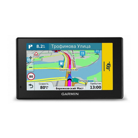
- Page 1 Garmin DriveAssist ™ Owner’s Manual February 2016 190-01923-00_0A...
- Page 2 All rights reserved. Under the copyright laws, this manual may not be copied, in whole or in part, without the written consent of Garmin. Garmin reserves the right to change or improve its products and to make changes in the content of this manual without obligation to notify any person or organization of such changes or improvements.
-
Page 3: Table Of Contents
Finding and Saving Locations........8 Support and Updates ..............1 Finding a Location Using the Search Bar ........9 Updating Maps and Software with Garmin Express ....1 Viewing Search Results on the Map ........... 9 Garmin DriveAssist Device Overview ......... 1 Changing the Search Area ............ - Page 4 The suction cup will not stay on my windshield ......21 Garmin Live Services ..............15 My device is not acquiring satellite signals ....... 21 Subscribing to Garmin Live Services ........15 The device does not charge in my vehicle ....... 21 Smart Notifications ..............16 My battery does not stay charged for very long ......
-
Page 5: Getting Started
• Vehicles, voices, and other extras Updating Maps and Software with Garmin Express You can use Garmin Express software to download and install the latest map and software updates for your device. Map updates provide the latest available mapping data to ensure... -
Page 6: Installing The Dash Camera Memory Card
Installing the Dash Camera Memory Card TIP: You can charge your device faster by putting it in power saving mode while charging the battery. Before the device can record video from the integrated dash • To turn off the device completely, hold the power key until a camera, you must install a camera memory card. -
Page 7: Enabling Automatic Volume
While recording, the LED is solid speed limit signs and to use safe driving judgment at all times. red. Garmin is not responsible for any traffic fines or citations you receive for failing to follow all applicable traffic laws and signs. Saving a Video Recording... -
Page 8: Enabling Or Disabling Audible Driver Alerts
Select or clear the check box next to each alert. Red Light and Speed Cameras NOTICE Garmin is not responsible for the accuracy of or the consequences of using a red light or speed camera database. NOTE: This feature is not available for all regions or product Forward Collision Warning System Performance Tips models. -
Page 9: Navigating To Your Destination
markers and, as a result, may have limited functionality in low • If there are specific roads you need to use or avoid, you can visibility conditions. customize the route (Shaping Your Route, page • You can add multiple destinations to a route (Adding a The LDWS feature alerts you when the device detects you may Location to Your Route, page... -
Page 10: Active Lane Guidance
Assistance or detour around specific roads. This is useful if you encounter construction zones, closed roads, or poor road conditions. The Garmin Real Vision feature automatically displays a camera view when approaching some destinations, including addresses From the map, select >... -
Page 11: Stopping The Route
Select an option: Select a saved trip. • To detour your route for a specific distance, select Detour Select a location. by Distance. Select an option: • To detour around a specific road on the route, select • To move the location up or down, select , and drag the Detour by Road. -
Page 12: Avoiding Delays, Tolls, And Areas
Select the navigation bar to view a suggested route to the Select Save. location. Custom Avoidances Custom avoidances allow you select specific areas or sections Avoiding Delays, Tolls, and Areas of road to avoid. When the device calculates a route, it avoids these areas and roads unless no other reasonable route is Avoiding Traffic Delays on Your Route available. -
Page 13: Finding A Location Using The Search Bar
• Search near a different city or area (Changing the Search If necessary, select a subcategory. Area, page Select a location. • Save your favorite locations to find them quickly in the future Searching Within a Category (Saving Locations, page 10). -
Page 14: Search Tools
Open the Smartphone Link app settings, and select Viewing Recently Found Locations Foursquare® > Login. Your device stores a history of the last 50 locations you have Enter your Foursquare login information. found. Select Where To? > Recent. Viewing Foursquare Location Details Before you can view Foursquare location details, you must Clearing the List of Recently Found Locations connect to a supported phone running Smartphone Link and log... -
Page 15: Saving Your Current Location
Select Save. Map Tools If necessary, enter a name, and select Done. Map tools provide quick access to information and device functions while you view the map. When you activate a map Saving Your Current Location tool, it appears in a panel at the edge of the map. From the map, select the vehicle icon. -
Page 16: Customizing The Up Ahead Categories
NOTICE Your device keeps a trip log, which is a record of the path you have traveled. Garmin is not responsible for the accuracy or timeliness of the traffic information. Select Settings > Map & Vehicle > Map Layers. Select the Trip Log check box. -
Page 17: Receiving Traffic Data Using A Traffic Receiver
About Traffic Subscriptions You can purchase additional subscriptions or a renewal if your Starting a Route Using Voice Command subscription expires. Go to http://www.garmin.com/traffic. You can say the names of popular, well-known locations. Viewing Traffic Subscriptions Say your wakeup phrase (Setting the Wakeup Phrase, Select Settings >... -
Page 18: Configuring Voice Control
A security code appears on the Garmin DriveAssist device Smartphone Link screen. You must pair your Garmin DriveAssist device with your phone On your phone, enter the code. to use Bluetooth features. After the devices are paired, they connect automatically when they are turned on and within range. -
Page 19: Disabling Smartphone Link Data And Smart Notifications For Your Apple Device
If you did not connect to the Smartphone Link app during the Garmin Live Services pairing process, you can connect to it for additional Bluetooth Before you can use Garmin Live Services, your device must be features. connected to a supported phone running Smartphone Link... -
Page 20: Smart Notifications
While your device is connected to the Smartphone Link app, you generating the notification. can view notifications from your smartphone on your Garmin DriveAssist device, such as text messages, incoming calls, and Viewing the List of Notifications calendar appointments. -
Page 21: Saving A Home Phone Number
You can temporarily disconnect a Bluetooth device without Select Apps > Weather. deleting it from the paired devices list. The Bluetooth device can If necessary, select a city. connect to your Garmin DriveAssist device automatically in the Select > Road Conditions. future. -
Page 22: Enabling Maps
The route calculation is based on road speeds and vehicle babyCam Settings acceleration data for a given route. The babyCam settings allow you to manage paired Garmin Faster Time: Calculates routes that are faster to drive but can babyCam cameras and camera settings. This menu appears ™... -
Page 23: Disabling Bluetooth
Position Reporting: Shares your position information with power. Garmin to improve content. Screenshot: Allows you to take a picture of the device screen. Travel History: Allows the device to record information for the Screenshots are saved in the Screenshot folder of the device myTrends, Where I’ve Been, and Trip Log features. -
Page 24: Device Maintenance
You can purchase an approved Garmin AC-DC adapter Apply pressure until the socket on the mount releases the suitable for home or office use from a Garmin dealer or ball on the suction cup. www.garmin.com. Removing the Suction Cup from the Windshield Flip the lever on the suction cup toward you. -
Page 25: The Suction Cup Will Not Stay On My Windshield
Garmin mapping software • Do not leave your device in direct sunlight. (www.garmin.com). In addition to map and data storage, the memory card can be used to store files such as maps, images, My device does not appear as a removable geocaches, routes, waypoints, and custom POIs. -
Page 26: Transferring Data From Your Computer
• For Mac computers, drag the volume icon to the trash. Disconnect the cable from your computer. Viewing GPS Signal Status Hold for three seconds. Purchasing Additional Maps Go to your device product page at garmin.com. Click the Maps tab. Follow the on-screen instructions. Purchasing Accessories Go to garmin.com/accessories. Appendix... -
Page 27: Index
Garmin Connect 14 battery Garmin Express pairing charging 2, 19, 21 registering the device 1 disconnecting 17 maximizing 21 updating software 1 phone 14, 21 problems 21 Garmin Live Services 15 parking, last spot 10 Bluetooth technology 14, 16, 21 subscribing to 15... - Page 28 Smartphone Link 14, 15 connecting 14, 15 disabling calls 14, 15 Garmin Live Services 15 software updating 1 version 19 specifications 19 speech recognition 13 speed cameras 4 subscriptions, Garmin Live Services 15 suction cup 20 theft, avoiding 20 time settings 19 tolls, avoiding 8 tools, maps 11 traffic 12, 13, 19 adding subscriptions 13 alternate route 8...
- Page 30 +34 93 275 44 97 +27 (0)11 251 9800 + 46 7744 52020 +886 2 2642-9199 ext 2 +49 (0) 89 858364880 0808 238 0000 zum Ortstarif - Mobilfunk +44 870 850 1242 kann abweichen 913-397-8200 1-800-800-1020 © 2015 Garmin Ltd. or its subsidiaries...
Need help?
Do you have a question about the DriveAssist 50 and is the answer not in the manual?
Questions and answers