
Related Manuals for RoyalTek RGM-3800


Summary of Contents for RoyalTek RGM-3800
-
Page 1: User Manual
RoyalTek Data Log GPS Receiver RGM-3800 User Manual Version 1.2 Published on June 2008 by RoyalTek Company Ltd. Design and specification are subject to change without notice. -
Page 2: Table Of Contents
3.4 Transfer data to your PC or Notebook ..........24 3.4.1 Connect RGM-3800..............24 3.4.2 Download Data ...............26 3.4.3 Get and Set RGM-3800 Device Status ........27 3.4.4 Get the Data Logger Data Downloader revision information...29 3.4.5 How to connect the Photo Match Tool -locr......29... -
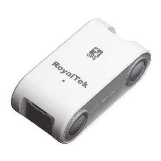
Page 3: Overview
1.1 Overview RoyalTek Data log GPS receiver, RGM-3800, is the successor of well-known Data log GPS receiver in 2007. RGM-3800 can receive and record time, date, position and altitude information. It uses SIRF Star III extreme fast TTFF GPS engine and provide accurate position tracking solution. -
Page 4: Specification
2. Specification 2.1 Specification Specification GPS Chipset Sirf GSC3f/LP Frequency L1, 1,575.42 MHz Channel 20 parallel C/A Code 1,023 MHz Fix time@Chipset Reacquisition: less than 1s (Open Hot start: less than 1s SKY,typical) Warm start: less than 35s Cold start: less than 35s Accuracy Position: within 10m for 90% Velocity: 0.1m/s... - Page 5 Mechanical Dimension Dimension: 70mm x 36.6mm x 24mm <=50g (without battery) Weight Location Log Log data UTC Time, Longitude, Latitude, Altitude, Velocity Log Interval 1secs ~ 60secs, user configurable (Default 15secs) Stored Data Type There are three types setting for intervals. (User configurable) For the data type, there are 3 options data logger format that can be used.
-
Page 6: Check The Package Content
2.2 Check the Package Content Before using RGM-3800, please make sure the package includes the items listed below. Please contact reseller immediately missing/damaged items. ● RGM-3800 Data log GPS receiver (batteries not included) ● CD (user manual, SW utility) ● USB Cable... -
Page 7: Hardware Overview
2.3 Hardware Overview Mini USB Connector Antenna Location LED for GPS Status, Battery Status And Memory Status Memory Clear Button Power Button... -
Page 8: Detailed Hardware Function
2.4 Detailed Hardware Function 2.4.1. Power Switch Power ON / Power OFF 2.4.2. USB Jack Using the supplied USB cable to connect with the GPS receiver ‘s USB connector for data transfer. USB Cable is without the charging function. 2.4.3. Memory Clear button While the power turn on, you can push the clear button for 3 seconds to erase the GPS log files from the recording memory if the GPS Receiver battery is ok. -
Page 9: Gps Status Led (Green)
When the remaining power become even lower (Approx. lower than 1%), the Battery LED flashes more frequently and please replace the batteries. If Battery low, The RGM-3800 will stop to log GPS position data. 2.5. Usage Tips 2.5.1. Inserting the Battery Insert the batteries with the correct polarity +/- 2.5.2. -
Page 10: Connect To Pc Or Notebook
With Alkaline batteries used, duration time can last over 10 hours in continuous operation mode (when used at 25ºC). Cautions: Remove the batteries when you do not use the RGM-3800 for a long time. Otherwise, it may result in leakage of the batteries. -
Page 11: Software Installation And Usage
The Main Menu of Installation CD shows as above. Click the Install USB Driver to install the USB Driver, which is needed when you connect the RGM-3800 to your PC or Notebook. Click the PC Software to install the software application. -
Page 12: Install Usb Driver
3.1 Install USB Driver Install the USB Driver from CD. When screen shows the installation window as follows: Click “Next> to next page”, or click”<Back” to back last stage or “Cancel” to give up installation. Please click “Finish” to finish the Installation. -
Page 14: Install Data Download Utility
3.2 Install Data download Utility Click “Next> to next page”, or click”<Back” to back last stage or “Cancel” to give up installation. To the License Agreement page: Click “ I accept the terms in the license agreement” then click “Next>” to next page, or click”<Back” to back last stage or “Cancel”... - Page 15 Click “Install” to start installation. Or click”<Back” to back last stage or “Cancel” to give up installation.
- Page 16 Start installation. Please click “Finish” to finish the Installation.
-
Page 17: Install Locr Gps Photo Utility
Finally you will see the icon on windows desk. 3.3 Install locr GPS Photo Utility *Before you install the Utility, please check the Internet connection is To the License Agreement page: Click “Accept” to start installation, or click ”Don’t Accept” to give up installation. Then... - Page 18 Start installation. Click “Next> to next page”, or click”<Back” to back last stage or “Cancel” to give up installation.
- Page 19 Click “Next> to next page”, or click”<Back” to Select Installation folder and back last stage or “Cancel” to next step. Click “Next> to start installation”, or click”<Back” to back last stage or “Cancel” to give up installation.
- Page 20 locr GPS Photo is being installed Installation Complete...
- Page 21 Finally you will see the icon on the windows desk.
-
Page 22: Transfer Data To Your Pc Or Notebook
(3) When download or erase data form RGM-3800, Receiver still continues record and save the position data. (4) The time of the log data of RGM-3800 is UTC Time. User doesn’t need to adjust the Clock setting of a camera. - Page 23 Set Folder or set a new folder for the photo Tool. Step 3: Change page to “Connection” menu bar Step 4:Select the COM Port and Model: “RGM-3800” System can search the USB com port and let user to connect. Step 5: Push the “Connect” Button Step 6: Wait the “Get All Datalogger Head”...
-
Page 24: Download Data
If you don’t want to download the logger data, please choose the “Dis-Connect” button 3.4.2 Download Data Step 1: Change page to “Data Download” menu bar Step 2: Select the download data items, which you want to load from RGM-3800... -
Page 25: Get And Set Rgm-3800 Device Status
Step 3: Wait the get Data action Finish. Data from RGM-3800 was success transferred to NMEA sentence. 3.4.3 Get and Set RGM-3800 Device Status Step1: Change to “Device Status” menu bar Step 2: You can review the RGM-3800 default setting configuration. - Page 26 You also can use RGM-3800 as the GPS Mouse. RGM-3800 will not output any NMEA message after power ON. You can use G_Mouse “Enable” button to let the RGM-3800 output the NMEA sentence. If you need to use RGM-3800 as a G-Mouse, just enable the G_mouse function then close the “Data Downloader Utility”.
-
Page 27: Get The Data Logger Data Downloader Revision Information
3.4.4 Get the Data Logger Data Downloader revision information Step1: Change to “About” menu bar User can get the Royaltek Data Logger Data Downloader version. 3.4.5 How to connect the Photo Match Tool -locr Step1: Change to “Data download” menu bar and Press the Photo Match... -
Page 29: Photo Match Tool -Locr Gps Photo Introduction
4. Photo match Tool -locr GPS Photo introduction GPS Photo – Automatic Geotagging Made Easy – locr GPS Photo Quick Installation Guide © locr GmbH 2007 All rights reserved. No part of this manual may be reproduced or transferred to other media without explicit written permission from locr GmbH, Braunschweig, Germany. -
Page 30: First Steps
First steps … How to sign up at locr Signing up at locr is easy. • To sign up for the first time open the locr web site: http://www.locr.com. • Click on “Sign up”. • On the next page, please fill the compulsory fields (with *). •... - Page 31 How to install the locr GPS Photo software If you want to download, install, and use the locr GPS Photo software you need an account and a password, so sign up (“How to sign up at locr”). To install the locr GPS Photo software, you can download and open the installation program from the locr web site.
- Page 32 How to use manual geotagging Geotagging using the address Geotagging using the address is an easy way to find out the position where a photo was taken. • Start the locr GPS Photo software: “Start” > “Programs” > “locr” > “locr GPS Photo”. On the left you see the “Photos”...
- Page 33 • Clicking the “Show Photos on Map” button, shows your photos in combination with their position on the map. Note: To show the position on the map, locr uses Google Maps, which means you need a fast internet connection. • The “Clear EXIF location tags…” button allows you to delete the latitude and longitude information.
- Page 34 • To open a photo, click “Add...” and select a photo/photos. Photos, which already contain GPS information will be flagged by an “x”, already uploaded photos by a “u”. • In the list choose the photo/s you’d like to geotag. You will see the photo in the “Photo Preview”.
- Page 35 • Now select the photo/s you want to upload and click the “Upload Photos” button. • At least determine the privacy status, click “OK”, and then have a look at the locr web site. Double-clicking left mouse button (zoom in), Tip: double-clicking the right mouse button (zoom out) makes zooming much faster.
- Page 36 Then click “Automatic Geotagging”. • The locr software now automatically completes the given photo data with the GPS information. The information will be written into the EXIF header, the “()” in the “Latitude” and “Longitude” columns will disappear. • Clicking the “Show Photos on Map” button, shows your photos in combination with their position on the map.
- Page 37 Further Settings The “Settings” tab Show large map control If you select the “Show large map control” option, all zoom & pan controls will be displayed: the complete zoom buttons ( ) as well as all pan buttons ( Note: A change of the map control option will only take effect after a map’s reload.
- Page 38 • Start the locr GPS Photo software. • Open the respective photos and the associated GPS file/files. • If your photos already contain GPS information in the EXIF header (Flag = “x”), that seem to be “wrong”, use the “Clear EXIF location tags…”...
- Page 39 Zoom in, zoom out, move map - the easiest Basically you can use either the buttons of GoogleMaps or the mouse solely. Zooming and panning using the mouse or the buttons can be used on the locr website as well as with locr GPS Photo. Zooming and panning with the mouse Zooming in/magnifying the map •...
- Page 40 Great: So you don´t have to geotag your photos manually again! The information will be read automatically when uploading the photo via the locr GPS Photo software. Your photo will be displayed with the exact more about position on the map. If you want to know the place where the photo was taken, just have a look at the Wikipedia articles which are also automatically assigned to the picture on the locr...
-
Page 41: Gps Receivers
I have a question … What does “Geotagging” actually mean? The term “geotagging” is sometimes also referred to as “geocoding”. Using “geotagging” e.g. photos, or videos, can be complemented with geographical coordinates (latitude and longitude, or physical address). This geographical identification data is saved together with the photos. - Page 42 Datalog GPS receivers Contrary to a “pure” GPS receiver the datalog GPS receivers store the received data to an internal memory. Being switched on, datalog GPS receivers start writing the position, date, and time into a log file. This logged data can be read and saved on e.g. a PC. So the data is also available for other applications like the locr PGS Photo software.
-
Page 43: Fcc Notices
FCC Notices This device complies with Part 15 of the FCC Rules. Operation is subject to the following two conditions: (1) This device may not cause harmful interference, and (2) This device must accept any interference received, including interference that may cause undesired operation. -
Page 44: Revision History
Revision History Data Revision Note V1.1 Final Release May 31 , 2007 V1.25 Modification the Utility June 12 , 2008 Contact information Headquarters Http://www.royaltek.com Sales: Http://www.royaltek.com/contact FAE: fae@royaltek.com...
Need help?
Do you have a question about the RGM-3800 and is the answer not in the manual?
Questions and answers